Gary Lewis trained as a geologist and then became a teacher by trade. He has taught in the classroom and has a great understanding of what motivates students (and their teachers). He is the author of over 30 Earth science related resources covering a plethora of topics from volcanoes to gold and has been running field trips for teachers since 1985 to Iceland, Hawaii and his native Australia. Gary is the president of GEOetc, a company that provides education, outreach and communication services and resources to the Earth science education community around the globe. You can read more about GEOetc and the fabulous field trips they run here.
A journey to the Big Island of Hawaii is one full of surreal landscapes, atypical geology and scenes and processes that make you rethink your classical geoscience training. I have been going to Hawaii now since the early 1990’s and have led trips for school teachers, college students, geocachers and enthusiastic geoscientists to show them the absolute wonders of this amazing place.
Most people arrive on the island by flying from Honolulu. This short flight has to be one of the highlights of flying anywhere in the USA, as you fly over the turquoise waters of the tropical Pacific over the eroding remnants of massive shield volcanoes. Even on cloudy days the tallest of the Hawaiian volcanoes, Mauna Kea and Mauna Loa rise above the clouds and beckon explorers down to the island. First stop for me is always Hilo.
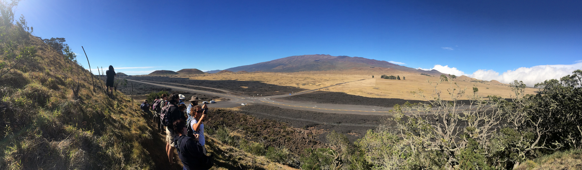
Mauna Kea – Hawaii’s tallest volcano from Pu’u Huluhulu. In the mid ground are flows from Mauna Loa.
Hilo itself is a strange mix of native Hawaii culture and failed sugar plantation all washed down by some of the heaviest rainfall anywhere in the USA. It is a funky town with some hidden gems in food, waterfalls and turtle strewn beaches. But it is often forgotten as the tourists all head out of the rain to the sunny side of the island. For us geologists, Hilo is a pilgrimage to the town that is hit by tsunamis the most in the USA. A local palm tree has markers showing the highest os the waves, and a clock that stopped as the waves hit in 1946 is a reminder of the danger of living in the centre of the pacific ring of fire.
But for me, my pilgrimage is always up the slope of Mauna Loa, then onto Kilauea to stay in the quaint town of Volcano, just a few miles from the summit caldera of Kilauea. Hidden in tree fern forests the village becomes my home for a brief time as I guide teachers and students around the island for a week of volcano discovery. Often as I lie quiet in bed at night I feel the activity below me – anything from a small quakes to full on volcanic tremor where the whole building rattles as magma moves down the plumbing system from the summit to the active vent on the east rift zone.
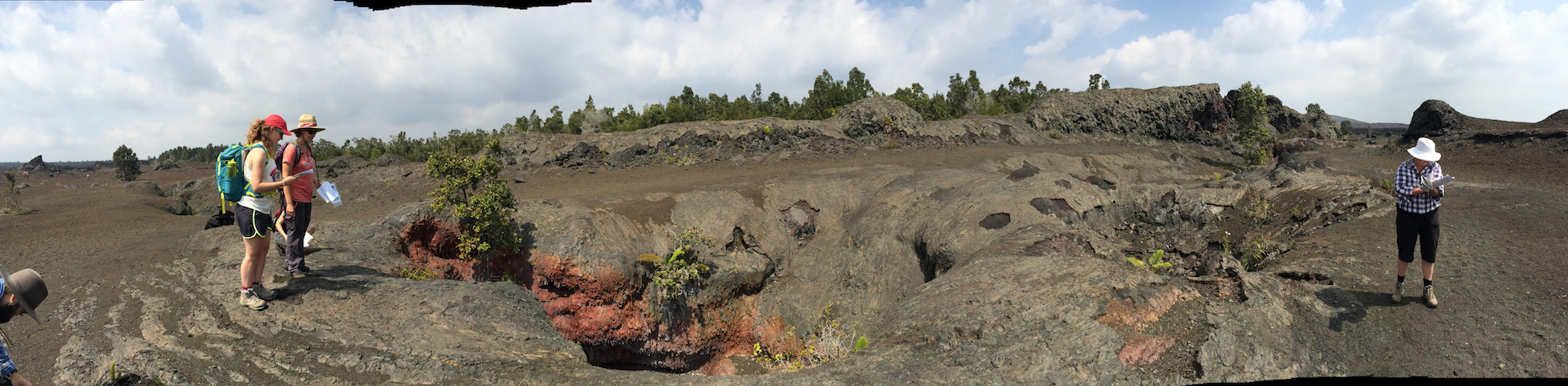
Group mapping the fissure eruption site from the 1969 eruption of Kilauea.
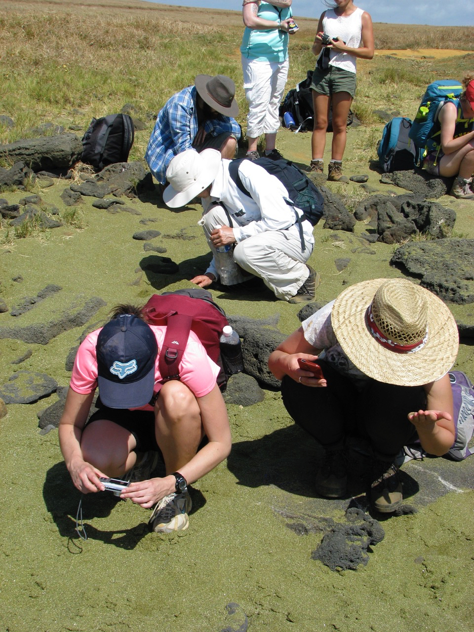
Examine some green sand that is eroding from the picrite a’a flows of Mauna Loa.
Driving to the summit caldera of Kilauea for the first time is a surreal experience. You expect to climb a hill and peer into a crater. Instead you drive down a small slope, through some mist and steam then walk a few hundred feet to a railing. In front of you is another world. The caldera below and beyond belief stretches infant of you almost to the horizon. It is filled with black and grey rock surfaces with puffs of steam and smoke rising from a pit deep within the caldera floor. It is just massive. It is unlike any landscape you have ever seen. A vegetationless moonscape that makes you wonder what terrible battle of the underworld smote the Earth’s surface here. This is the world of Hawaiian volcanoes and from here we travel to learn about processes and features of these majestic icons of the geoscience world.
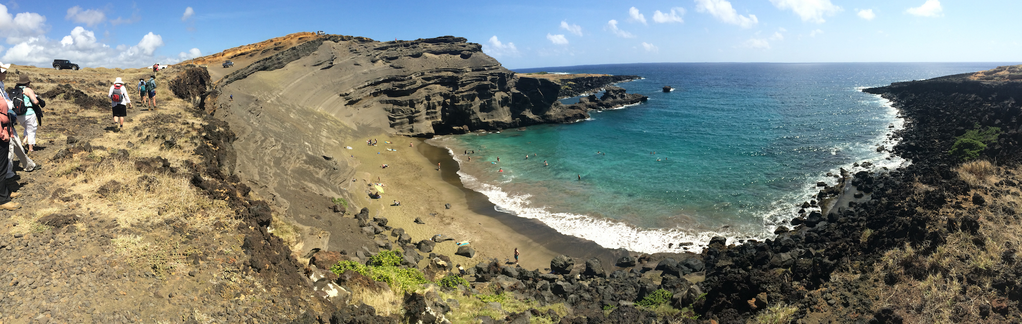
The famous Green Sand Beach – a breached cinder cone.
While the ultimate experience is to sit next to a glowing lava flow, the island provides so many other experiences that make even a brief trip truly amazing. Black, green and white sand beaches start off the extraordinary scenery followed by pit craters, spatter ramparts and massive calderas. The sights, sounds and smells of an active volcano change with every turn of the road. All that you learned from text books is thrown away as you try to fathom what processes formed some of the amazing landscapes.
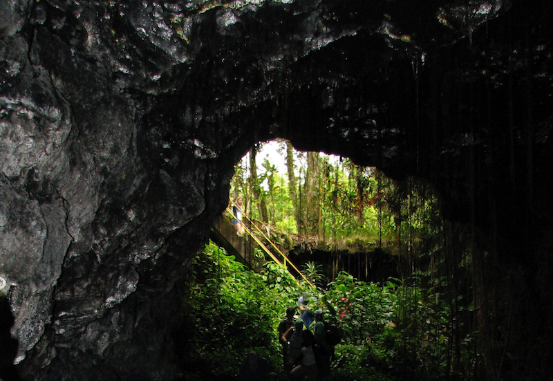
The collapsed entrance to a lava tube allows a group to enter and map inside.
And a trip to Hawaii’s Big Island is not complete without a swim over a reef or a relax in a geothermal heated pool, or a time relaxing on a beach next to a turtle.
If there is no place yet on geological bucket list, then start your list with the Big Island.
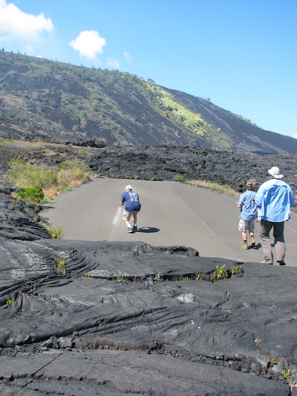
The remnants of the road to the coast that was cut by Kilauea lava flows in the early 1970’s.
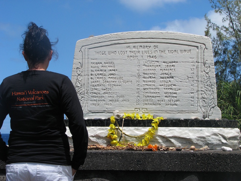
The memorial to the teachers, students and family members who lost their lives in the April 1, 1946 tsunami at Laupahoehoe Point.
![]() This work is licensed under a Creative Commons Attribution-NonCommercial-ShareAlike 4.0 International License.
This work is licensed under a Creative Commons Attribution-NonCommercial-ShareAlike 4.0 International License.