Josephine DiMaurizio grew up in St. Catharines, Ontario, Canada. As of September 2021, she will be completing her final year at Queens University with a BSc Honours and a Specialization in Geology. She will be working under Chris Spencer to complete her honours thesis in the characterization of metamorphic history and geochemical characteristics of what is thought to be the youngest blueschist in the world, found on the Indonesian island of Leti. Josephine plans to continue her education through a master’s degree.
Growing up in the Niagara region, everyone knows that visiting Niagara Falls and hiking through the Niagara Gorge is an essential experience. Its stunning natural beauty; unique and intense geological processes; rich history of formations and fossils, are things anyone who has an interest in geology or Earth processes would be excited about. The unique, up-close experience of the area is a once in a lifetime opportunity, unmatched anywhere in the world. Along with being geologically significant, these formations and processes have large impacts on economic and social aspects of the region.
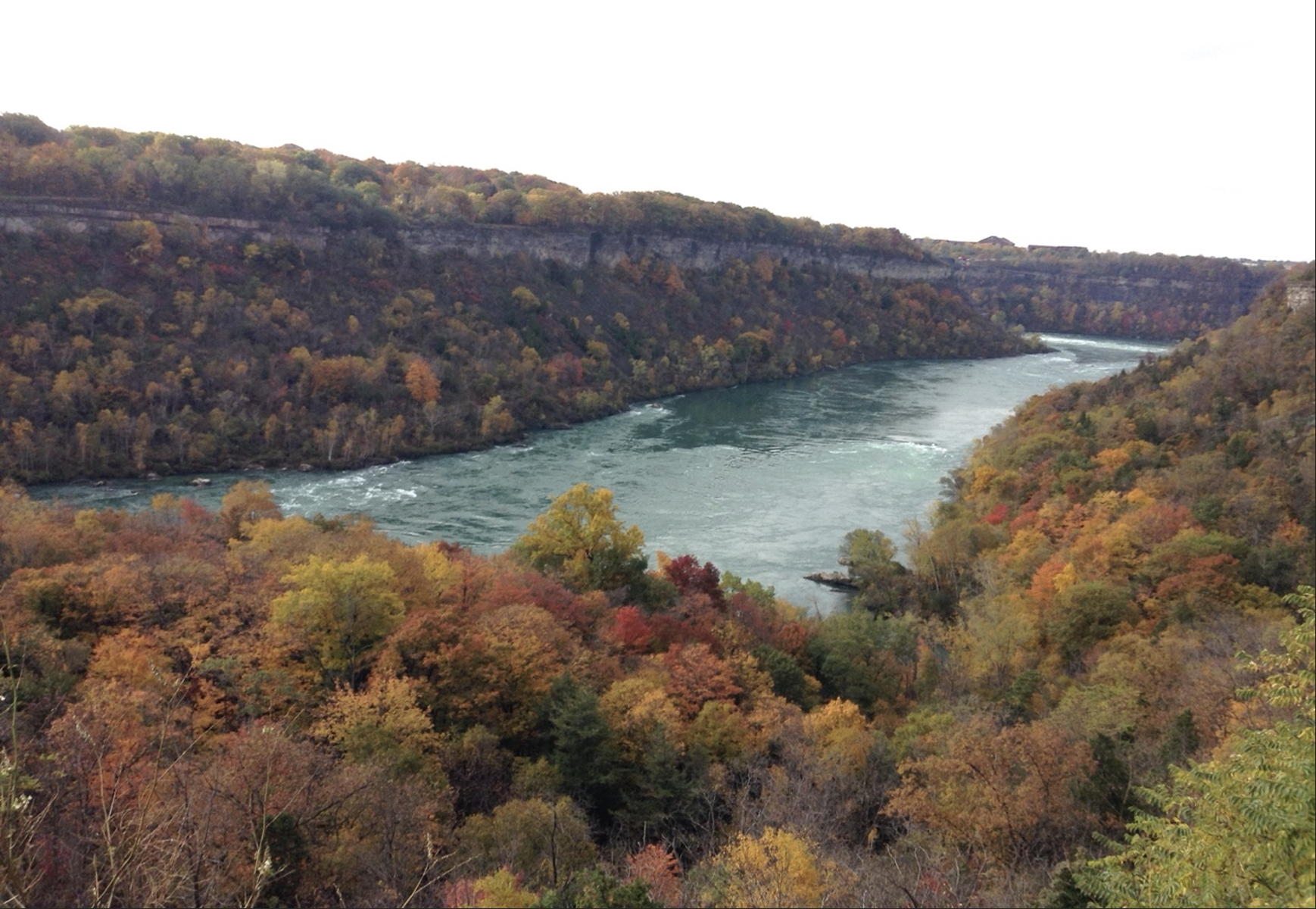
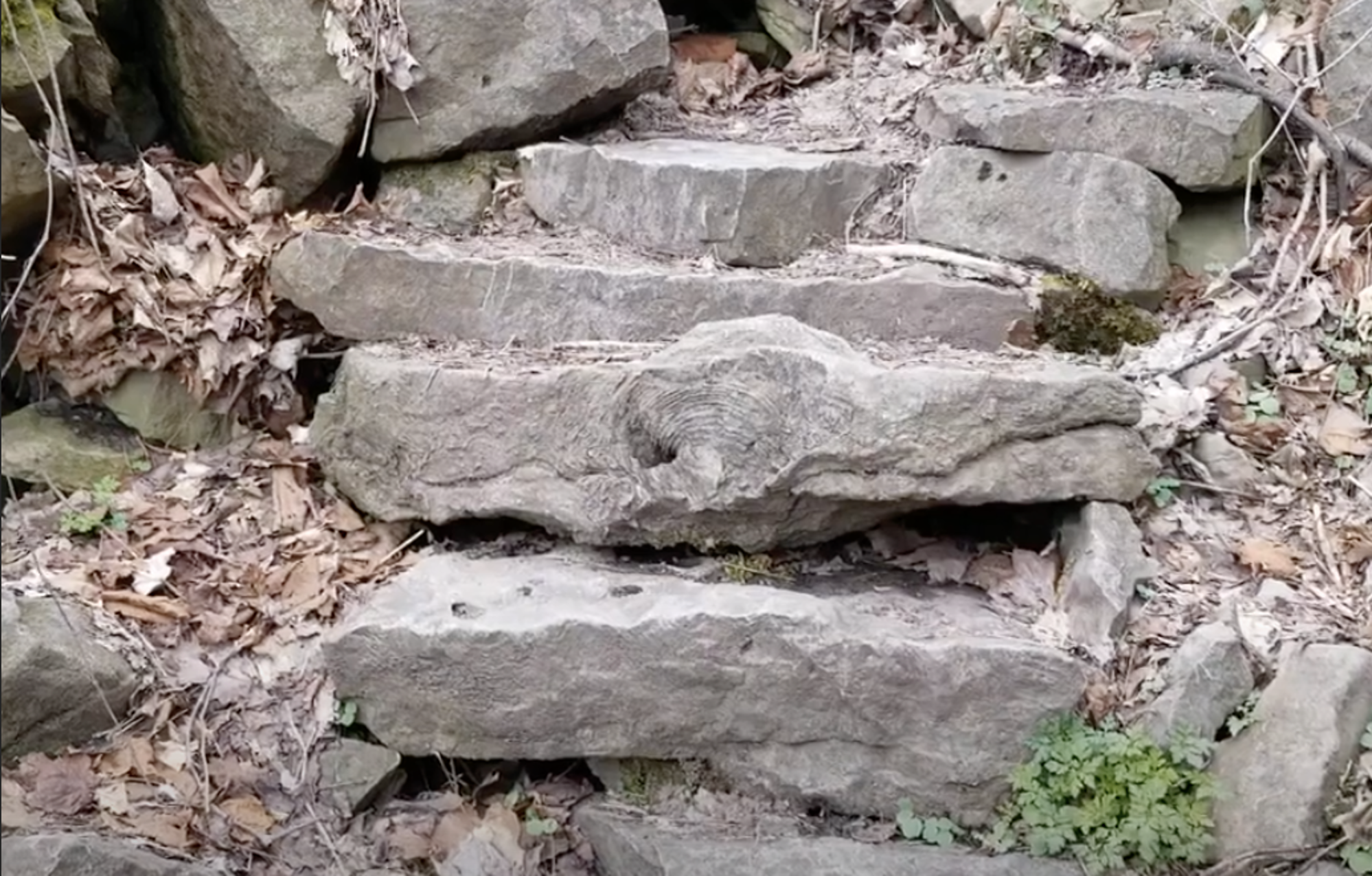
The story of Niagara Falls begins approximately 16000 years ago, during the peak of the last glaciation. At this time, the glaciers retreated which resulted in the Great Lakes being carved out. At 12000 years, the water from these lakes eventually found a pathway through the Niagara Escarpment for the water to flow through. This led to the formation of a channel known today as the Niagara River, this is where my trip began. The Niagara River was formed before Niagara Falls, the Niagara Gorge, and the Whirlpool. Witnessing the interaction between the Niagara River, and the surrounding features that are currently observable is a one-of-a-kind experience. The region marks some of the most exciting glacial impacts in the world, the aftermath of which continues to this day. The migration of Niagara Falls throughout the past 12000 years has led to the formation of the seven-mile-long Niagara Gorge. Hiking through this deep and geologically rich channel was invigorating, as there were numerous aspects that showed the unique history of the formations and their compositions. My hike through the gorge led me towards the Niagara Glen, also known as the Lower Great Gorge. This area is the home to a sight known as the Wintergreen Flats. These flats were formed approximately 400 Ma ago by glacial erosion. At the back of the flats, I had observed some hills where the glaciers had stopped eroding the land and began to retreat. This area is significant, along with the rest of the gorge, because it is composed of the rocks formed where a shallow salt sea had existed approximately 440 – 425 Ma ago (mid Silurian). The limestone that covers the area can be traced back to this ancient sea, in which the waters compacted carbonate sediments, resulting in the limestone and dolostone rocks that the area is composed of. Furthermore, through the compaction of sediments around a coral reef that had existed in the sea, I was able to find and identify coral that had been preserved in the rock on the walls of the gorge. Other fossils known to be in this area are brachiopods, trilobites, and crinoids.
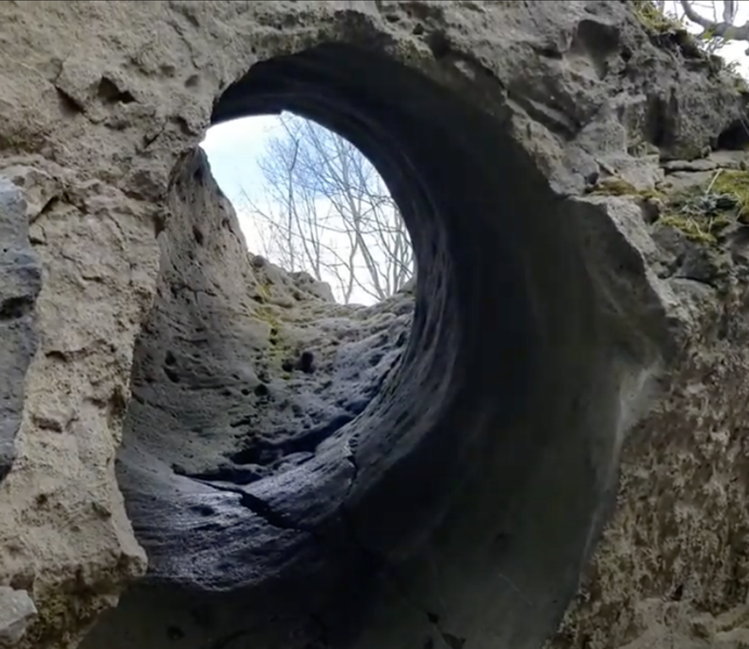
As I hiked deeper into the gorge along the Niagara River, I was lucky enough to find another unique and exciting rock feature, that had been created in an area called the plunge pool. In this area, when the plunge pool had existed there, there were many limestone boulders that sank to the bottom of the sea due to erosion. Some smaller rocks collided with larger ones and began spinning against them in a movement similar to that of a drill, due to the powerful rapids. Eventually, this resulted in the formation of a smooth tube-like hole that cut directly through the boulder. This formation is known as a Mammoth Pothole.
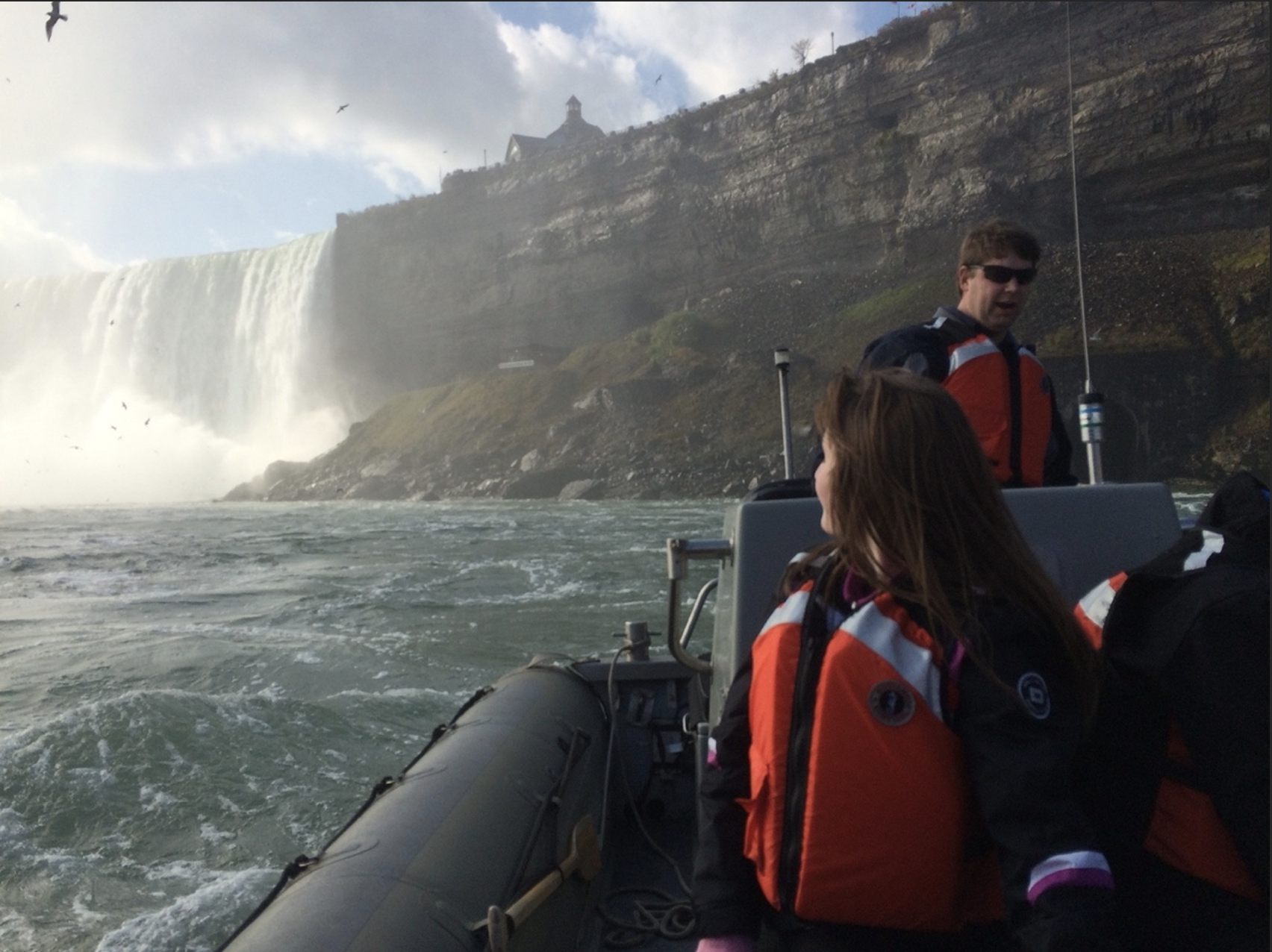
The final part of my trip involved venturing back up from the gorge and experiencing two separate and very different up-close attractions with Niagara Falls. Through an unforgettable voyage on Niagara City Cruises and walking behind the falls, I was able to observe the processes and composition of the falls in more detail. Niagara Falls is constantly eroding and migrating upstream, at approximately one foot per year; however, the hydroelectric generating plants in place have dramatically reduced the rate of flow. The type of erosion that takes place here is called sapping. Sapping results when rushing water goes over the edge of a waterfall and erodes the weaker rocks. In the Niagara region specifically, these rocks are primarily shale and sandstone. This water flow; however, does not erode the stronger rocks such as dolostone and limestone. I had previously observed these particular rock types as well in distinct layers in the walls of the gorge. Over time, enough of the weaker rocks erode which results in the stronger rocks protruding outwards. Eventually, these rocks break off in large pieces and fall into the plunge pool at the bottom of the falls.
![]() This work is licensed under a Creative Commons Attribution-NonCommercial-ShareAlike 4.0 International License.
This work is licensed under a Creative Commons Attribution-NonCommercial-ShareAlike 4.0 International License.