Viktor Bertrandsson Erlandsson is originally from Gothenburg, Sweden, where he did his bachelor’s and master’s degrees. He is currently a PhD student in economic geology at the Montanuniversität Leoben in Austria. His PhD project brought him to Namibia to collect samples from a sediment-hosted copper-cobalt deposit, which he now studies back in the labs. He primarily focuses on sulfide geochemistry by utilizing his method of choice, laser ablation inductively coupled plasma mass spectrometry (LA-ICP-MS).
During the first year of my Master’s degree, I was fortunate enough to join the yearly “big excursion course” which 2016 lead was going South Africa. Coming from a small island in Sweden, the land of gneisses and red granites, the savannahs of Africa was an exotic place, far out of my reach and I will admit I had a romanticized “Hollywood” view of it. However, once I got there for my three-week excursion, I fell in love with it for real. That excursion took us to the far north of South Africa, to the Orange River, the natural river border to Namibia. And standing there, I promised myself I would make sure that I’d return to Africa once more for its geology. And so I did.
After completing my Master’s degree in 2018, I applied for a PhD position at the Montanuniversität Leoben, Austria. Which I was lucky enough to get accepted to. The twist was that there was no set research topic for my dissertation, this being borderline a blessing and a curse. I had several topics to choose from. Although, the second my supervisor mentioned a copper-cobalt deposit in Namibia, currently being under exploration, my mind was made up.
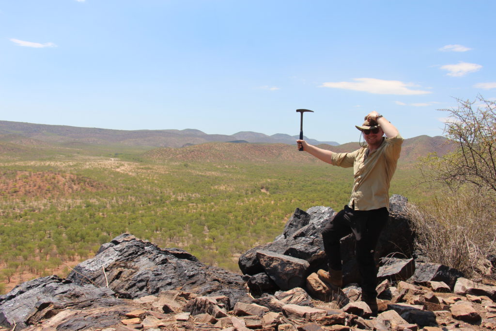
In March of 2019, we set off for Windhoek for a three-week fieldwork campaign in the Kunene region of northwestern Namibia. With me were a PhD student colleague of mine and our two supervisors. During these three weeks, we would have to familiarize ourselves with the regional geology, make field observations along with logging and sampling drill core from the exploration.
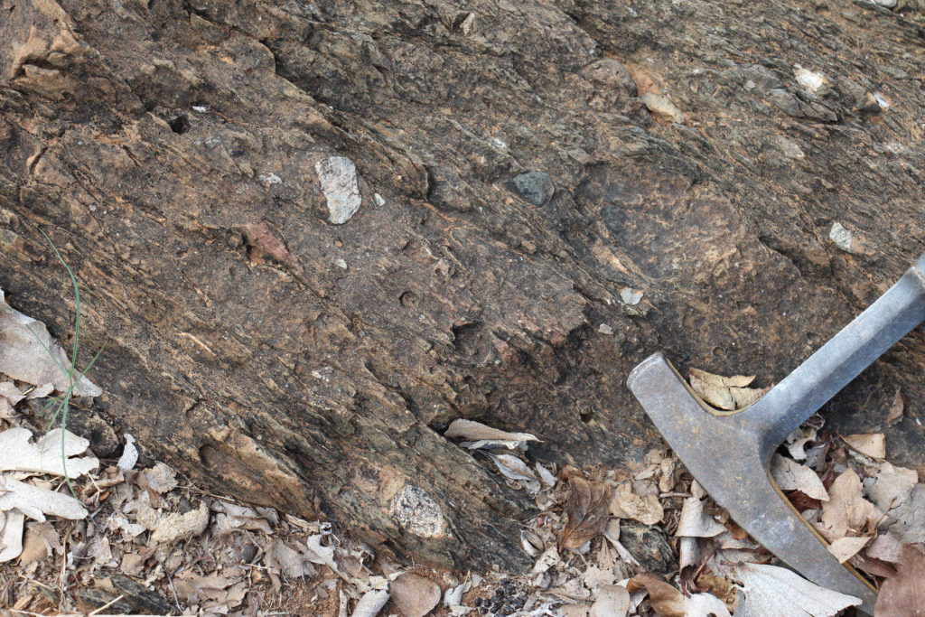
The geology of Namibia can be described, in simple terms, as two Precambrian cratons (the Kalahari and Congo cratons) in a framework of orogenic belts formed during the Pan-African Damara Orogen (around 550 Ma). Our field area is located in the eastern rim of the northernmost orogenic belts, the Kaoko Belt, which trends N-S in the northwestern part of Namibia. The eastern Kaoko Belt comprises dominantly sedimentary rocks of the Damara Supergroup, reflecting the filling of grabens formed during extensional rifting associated with the break-up of the supercontinent Rodinia (approximately 900 – 757 Ma). The basement rocks are overlain by rift-related siliciclastic sandstones and conglomerates, followed by phyllites and carbonates as the basin was flooded. The sedimentary succession of the Kaoko Belt is analogous and more or less coeval to the stratigraphy hosting the world-class sediment-hosted cobalt deposits of the Central African Copperbelt. Which we can then use as a reference to compare our own data to.
What makes this succession particularly interesting is the presence of two diamictites, both associated with “Snowball Earth” events (the Chuos and Ghaub diamictites). These units are telltale remnants of when the earth was covered by extensive glaciers. Some researchers even claiming a more or less completely covered Earth. The Chous diamictite (or tillite) formed around 746 Ma and is poorly sorted with a matrix-supported groundmass, in the Kunene region. This all indicating that the locality was relatively far away from the glacier front and that the larger stones and pebbles may be dropstones.
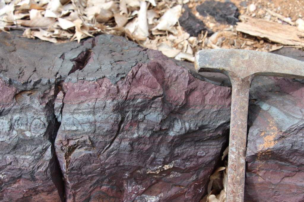
Commonly associated with “Snowball Earth” events and their diamictites are banded iron formations or BIFs. These types of BIFs, closely associated with glacial events, are referred to as glaciogenic BIFs and are believed to have formed in shallow, cold-water environments. These BIFs consist dominantly of chert and hematite which results in their characteristic banded texture. The famous great BIFs, e.g. Lake Superior and Transvaal, formed during the Archean (2.8 – 1.5 Ga) when there was no oxygen, and thus the seawaters were reductive. Mid-ocean ridges were active during this time, pumping out iron (along with other metals) into the water, but due to the lack of oxygen the metals did not precipitate. Then the “Great Oxidation Event” occurred and caused the iron to precipitate as oceans were oxidized.
During “Snowball Earth” glaciation events, the limitless ice sheets, would at least locally, separated the ocean waters from the atmosphere, causing a reduction of the ocean waters. Just like in the Archean, metals were introduced into the water but unable to precipitate. When the ice sheets melted, the waters were reoxidized and the metals precipitated in the form of e.g. glaciogenic BIFs.
We eventually left the local field area to see some of the exotic localities of northwestern Namibia. The “roads” to these localities are no asphalt roads but drives over dried-up riverbeds and through the shrubbery of the plains. Eventually, we reach a jagged hill, a jagged green hill. This was referred to as “Malachite Mountain” by the local geologist. The prominent malachite cover is the result of supergene alteration of primary chalcopyrite which can now only be found at depth. The copper is hosted in a strongly foliated metapelitic phyllite with parts of less deformed metasandstone, it is probable but uncertain if the deformation is also the ore-forming process behind the copper mineralization.
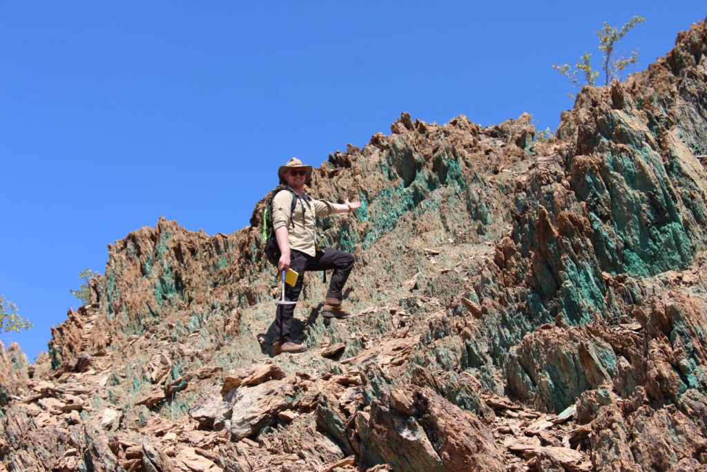
Me eagerly presenting the jagged “Malachite Mountain”. 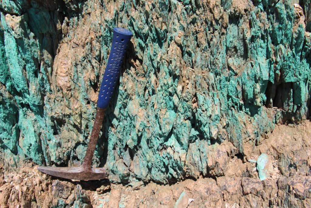
Close-up of secondary malachite forming a thin cover over the phyllite host rock.
Three different types of barite deposits were visited during our geo-round trip. The first barite locality comprised of banded barite-hematite-chert and is proposed to be the result of chemical precipitation. Somewhat like the BIFs. The presence of hematite is indicative of precipitation in an oxidizing environment. But it was suggested that it could be a barite-hematite-chert halo belonging to an, yet, undiscovered sulfide SEDEX deposit. Folding of the banded layers indicates that the deposit has experienced ductile deformation, syn-sedimentary or epigenetic deformation is not known.
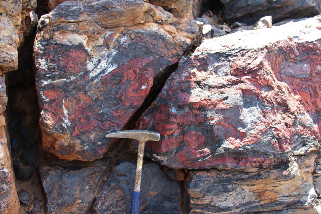
Ductile deformation of the banded barite-hematite horizon. 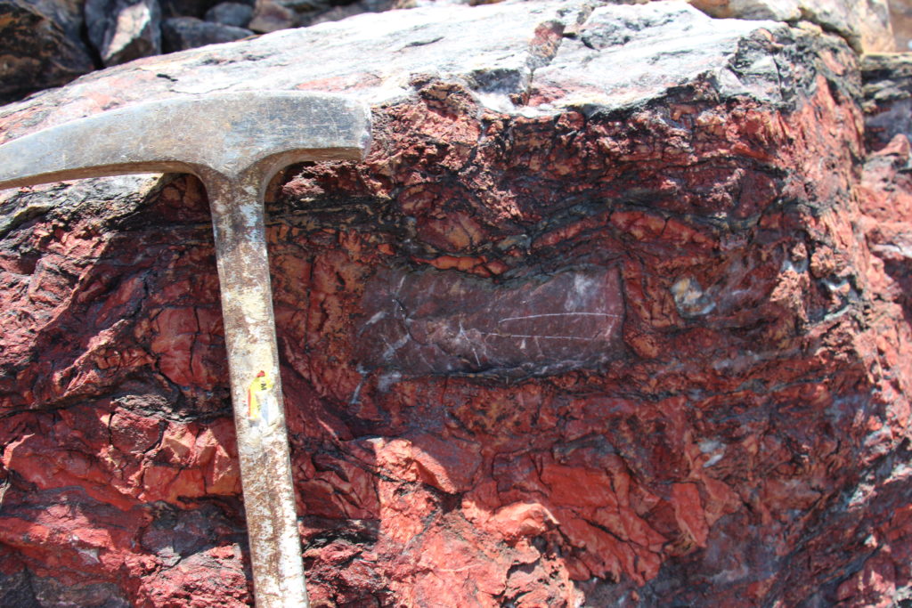
Sandstone clast within the banded barite-hematite-chert deposit. How did it end up there?
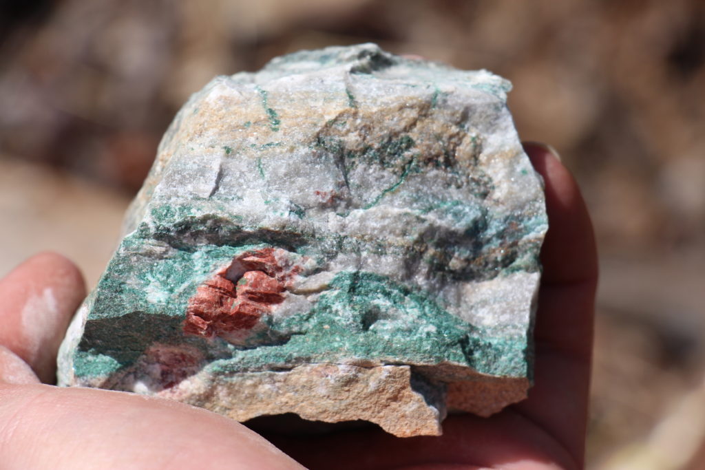
The second barite locality consisted of a banded barite-malachite deposit is located a few tens of meters from the barite-hematite-chert deposit, situated stratigraphically below the banded barite-hematite-chert deposit. The barite here was much more clear and pale. This deposit is interesting due to the fact that the barite and malachite seem to be paragenic and primary, due to the fact that there are no pieces of evidence for primary sulfides, the malachite seems not to be a second phase as seen in “Malachite Mountain”. The malachite bands are suggestively even folded with the barite, once again hinting to the effect of a regional deformational event on most of these deposits. The unit also contains a rare earth element (REE) anomaly which is interesting but not yet understood well.
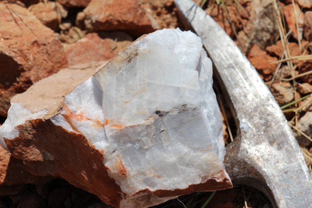
Whereas the barite-hematite and barite-malachite localities were both banded, sediment-like, the final barite deposit is a vein-type deposit, cross-cutting the sandstone host rock. The barite here is pure white (high quality) and massive, with other minerals only in accessory amounts, mostly white micas. The barium is speculated to have been sourced from surrounding pelites and/or seawater.
The Swartbooisdrift sodalite quarries were one of the most impressive localities I have ever visited, and probably ever will visit. From afar it looks nothing more like a tan-colored quarry, but once the dust was washed away it was as if someone had taken a paintbrush and swept the walls and floor of the quarry with blue paint. The sodalite occurs in several different textures and seems to replace the marble host rock and could perhaps have been introduced during metamorphism as the sodalite forms porphyroblast-like clumps and is found as bands interbedded with marble. But the exact formation of the sodalite is unknown. There were several hues of clue with some spots of sodalite being an extraordinary, deep, gem-quality blue.
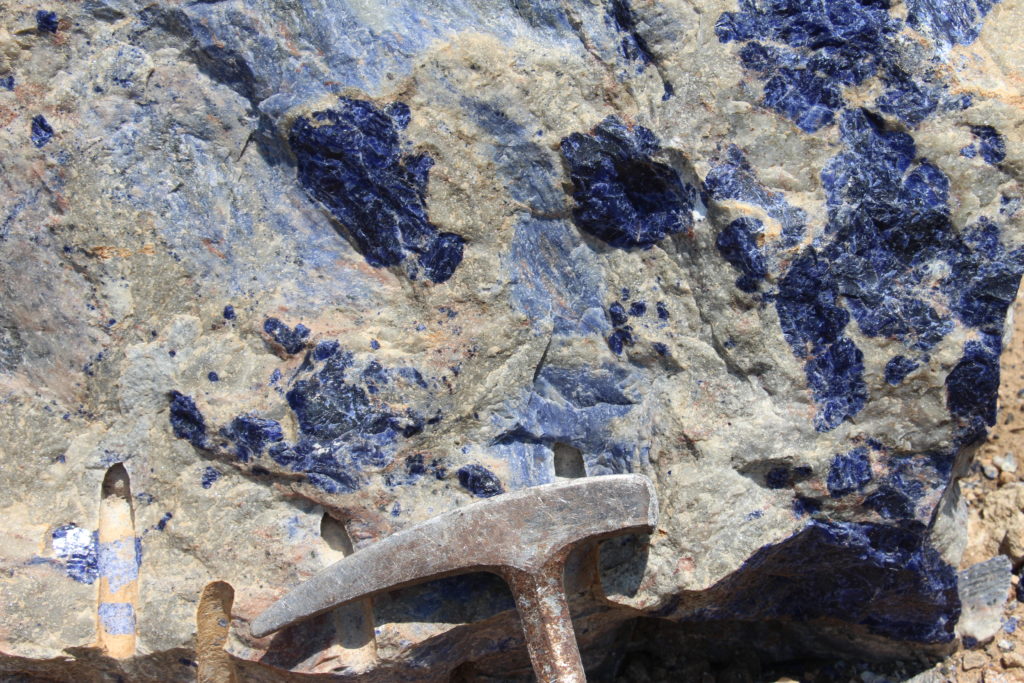
Swartbooisdrift sodalite. Note the deep blue spots of sodalite in a lighter shade of blue sodalite. 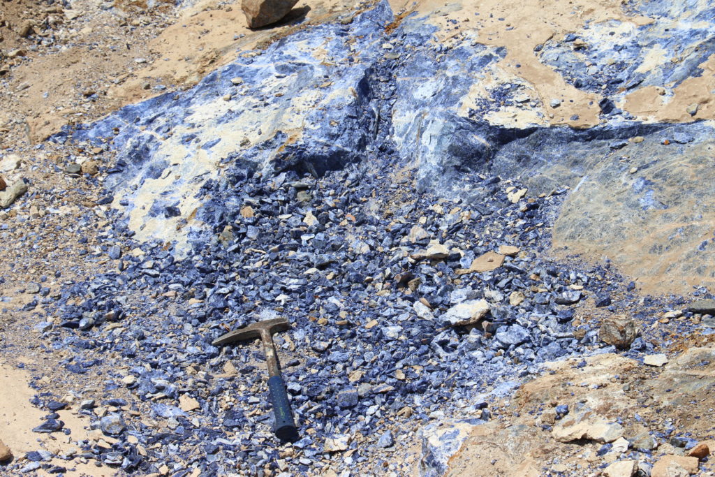
Sodalite exposure in the quarry.
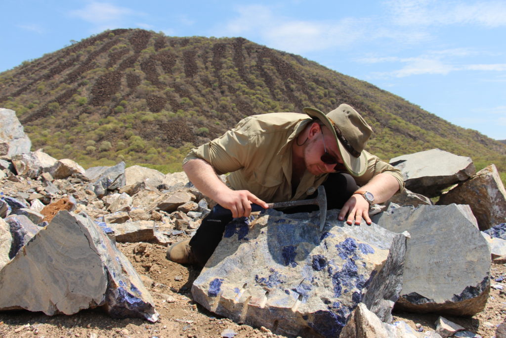
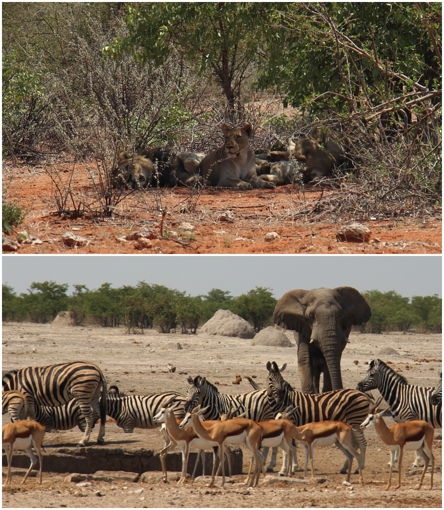
Most of the time spend in Namibia was spent logging and sampling the drill core, but just during a few days, I got to see so many different deposit types and breathtaking geology. We did manage to get one night in Etosha National Park on our way back to Windhoek for our return flight. Where we got to see the wildlife side of Namibia. And one thing is for sure, it is rich in animals. A night fulfilling this three-week experience. It’s important to enjoy other things besides the rocks when one is visiting a place like this(although one thing is unquestionably more interesting than the other)!
For me, the opportunities to travel and see the world, in a way other people do not get to, has always been one of the most attractive aspects of being a geologist. Not only does it make work more interesting, but for me, it works as a motivator.
As I hope the reader can notice, there is a treasury of geology in Namibia, do keep in mind I only visited a fraction of the country but still so much is unknown. There is so much left for geologists to research about this place and to really understand how it all fits together. I am more than happy to have gotten the chance to be part of this process and hope others will join me in unveiling the geological history of Namibia.
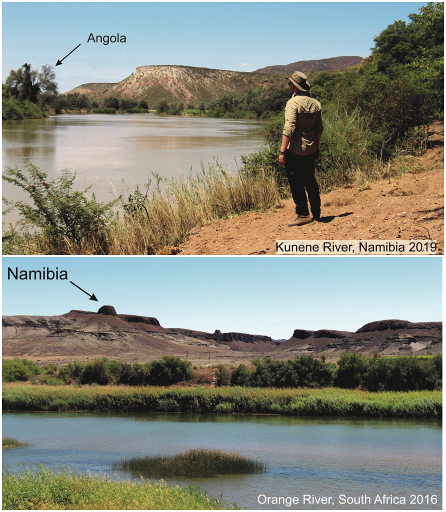
Bottom: Me in Namibia (2019), looking over the Kunene River at Angola. My next geo-destination?
![]() This work is licensed under a Creative Commons Attribution-NonCommercial-ShareAlike 4.0 International License.
This work is licensed under a Creative Commons Attribution-NonCommercial-ShareAlike 4.0 International License.