Sarah Falkowski did her Geosciences BSc studies at the University of Bremen, Germany, and her MSc studies at the universities of Bremen, Germany, and Waikato, New Zealand. Since her masters thesis, she focuses her research on the influences of tectonics and climate-driven surface processes on active orogens. She quantifies those processes through thermo- and geochronologic analyses and thermal models in combination with geologic and geophysical constraints. Her PhD studies specifically focused on the glaciated St. Elias Mountains and the spatial and temporal evolution of rock exhumation at the St. Elias syntaxis. Sarah’s current research as a postdoc at the University of Tuebingen continues to focus on syntaxial regions (as part of the EXTREME project), interactions between tectonics, surface processes, and climate, e.g., glacial erosion in active mountain belts like the Patagonian Andes, and detrital thermochronology. More information can be found here or here.
It was during the first year of my PhD studies on the Cenozoic evolution of the Yakutat-North American collision zone, when we got the permit to collect samples in the northern St. Elias Mountains. As my field area covered the border region of Alaska and Canada and I did not attend a previous field trip to the Alaskan side, I was more than excited to be able to go to the St. Elias Mountains and actually see what I would spend the next years thinking about.
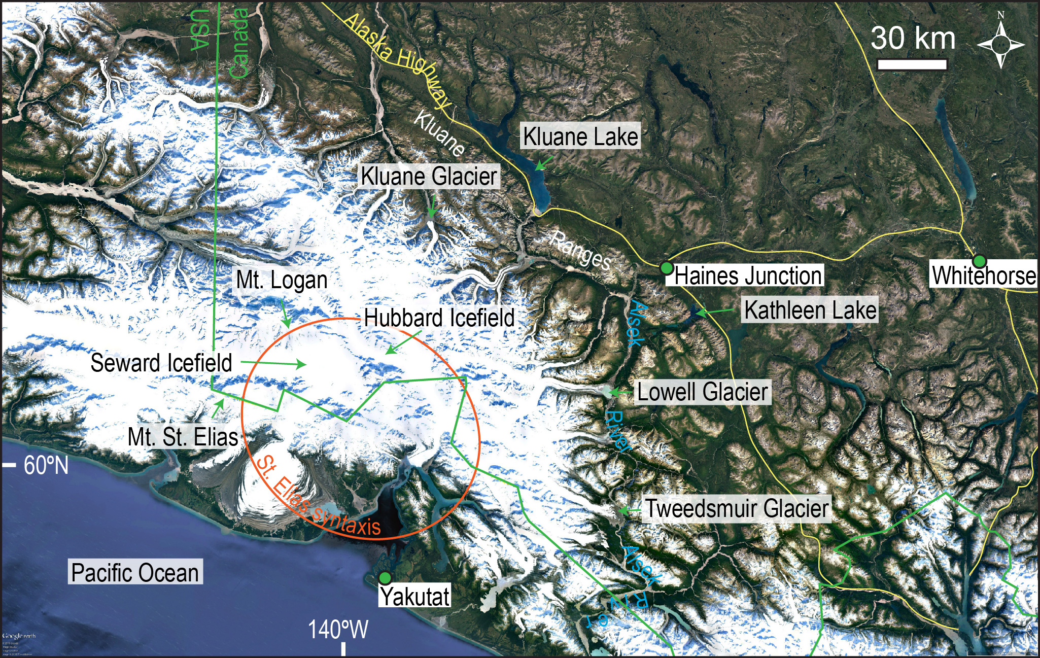
Google Earth image of the St. Elias Mountains with location names mentioned in the text.
Our team from the University of Tuebingen, Germany, led by Prof. Eva Enkelmann (now at the University of Cincinnati, USA), aimed to investigate the long-term history of building and eroding the St. Elias Mountains, which formed due to the indentation of the Yakutat microplate into the North American Plate. This area shows high seismic activity, high topographic relief (>5000 m), high erosion rates, and is almost completely covered by ice. My research project focused specifically on the center of the mountain range that stretches between the villages of Yakutat (Alaska) and Haines Junction (Yukon) and includes the St. Elias syntaxis, which has been compared with the eastern and western Himalayan syntaxes. All these areas are foci of studies on the interactions between tectonics and climate-driven surface processes. The combination of surface uplift and erosion results in the exhumation of rocks from several kilometers below the surface over 106 years timescales. Because exhumation results in cooling of rocks, these processes can be quantified using low-temperature thermochronology such as fission-track dating.
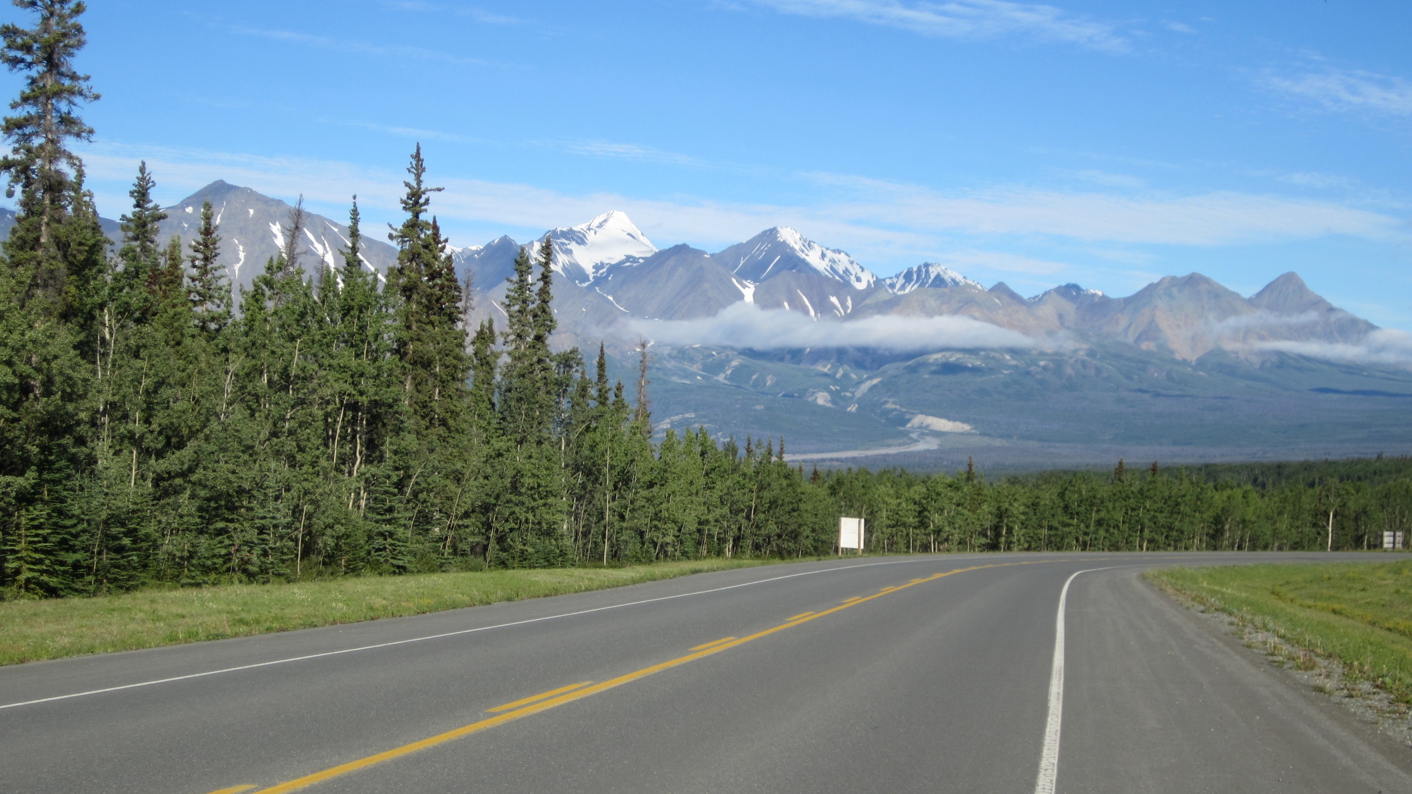
Taking the Alaska Highway west out of Haines Junction with view of the Kluane Ranges.
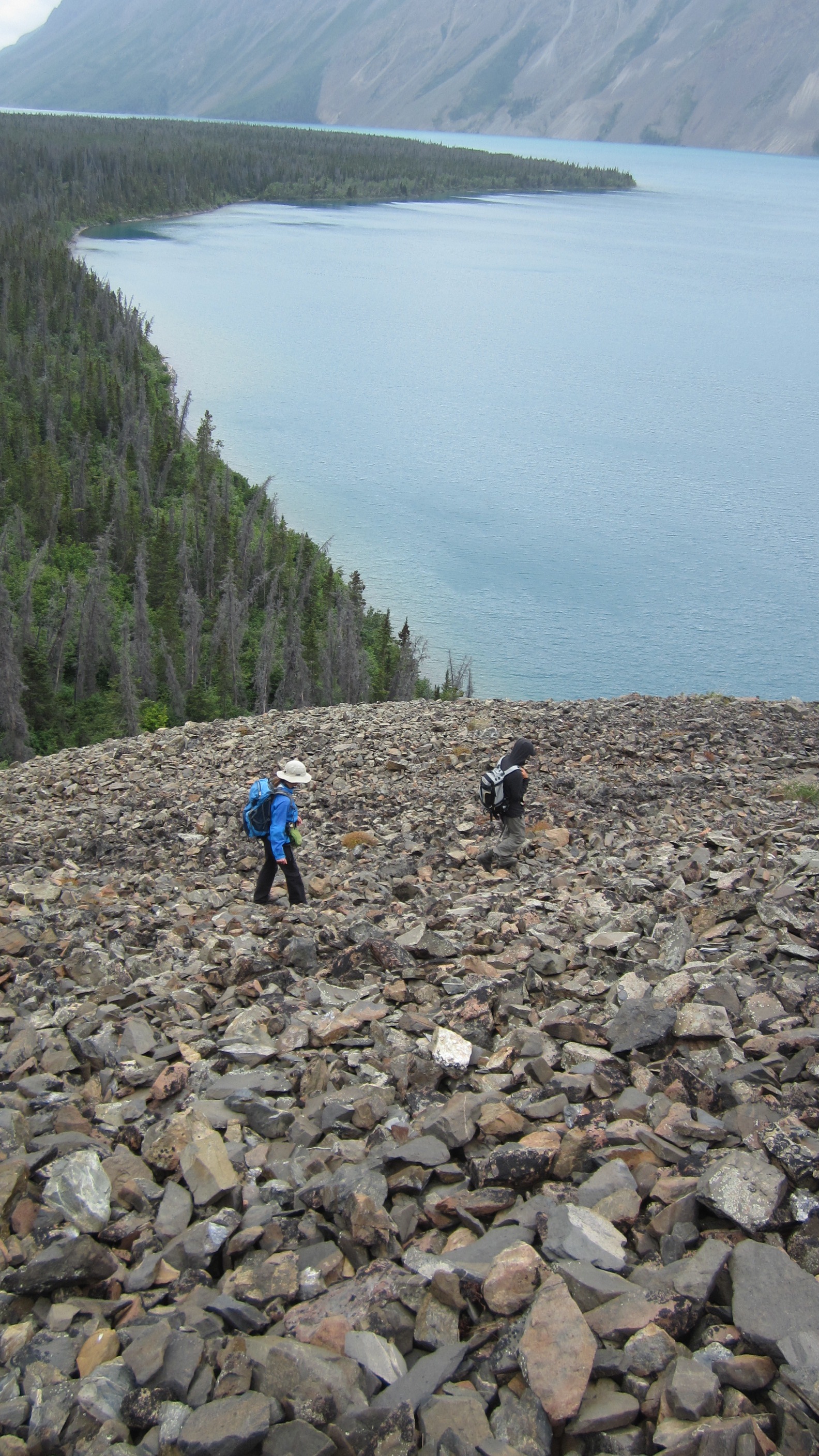
Eva and Philipp traversing moraine material at Kathleen Lake.
Our goal was to understand the spatial and temporal changes in rock exhumation in the St. Elias Mountains. To achieve that goal my first task was to map out the exhumation pattern. Not an easy job when you face 100s of meters of ice that overlie the rocks you are interested in for thermochronologic analyses (which yield the time of rock cooling below a certain closure temperature, e.g., ~250°C for zircon fission-track). Luckily, Eva had already been successful in sampling sand from modern rivers draining the large glaciers and icefields on the Alaskan side, and we continued with letting the glaciers do the work of rock sampling and sediment mixing from otherwise inaccessible glacier valleys. From first results from the southern St. Elias Mountains, we knew that this approach was successful and that we had found what we were looking for: young (<5 Ma) zircon fission-track cooling ages, which indicate recent and deep exhumation. That was exciting, but the sampling coverage has not been wide enough to confine the spatial extent of rapid syntaxis exhumation to the north and east. However, with first promising results at hand, we were in quite a good position for planning fieldwork on the Canadian side of the mountains. At the end of July 2012, our team, consisting of Eva, MSc student Philipp Widmann (now University of Geneva), and myself, took off from Frankfurt, Germany, directly to Whitehorse, Yukon, and then on to our base camp in Haines Junction. The name kept its promise, a junction with a couple of houses in the woods, motels, a bar, a gas station, and a stunning view of the Kluane Ranges, just concealing our view of the St. Elias Mountains to the south.
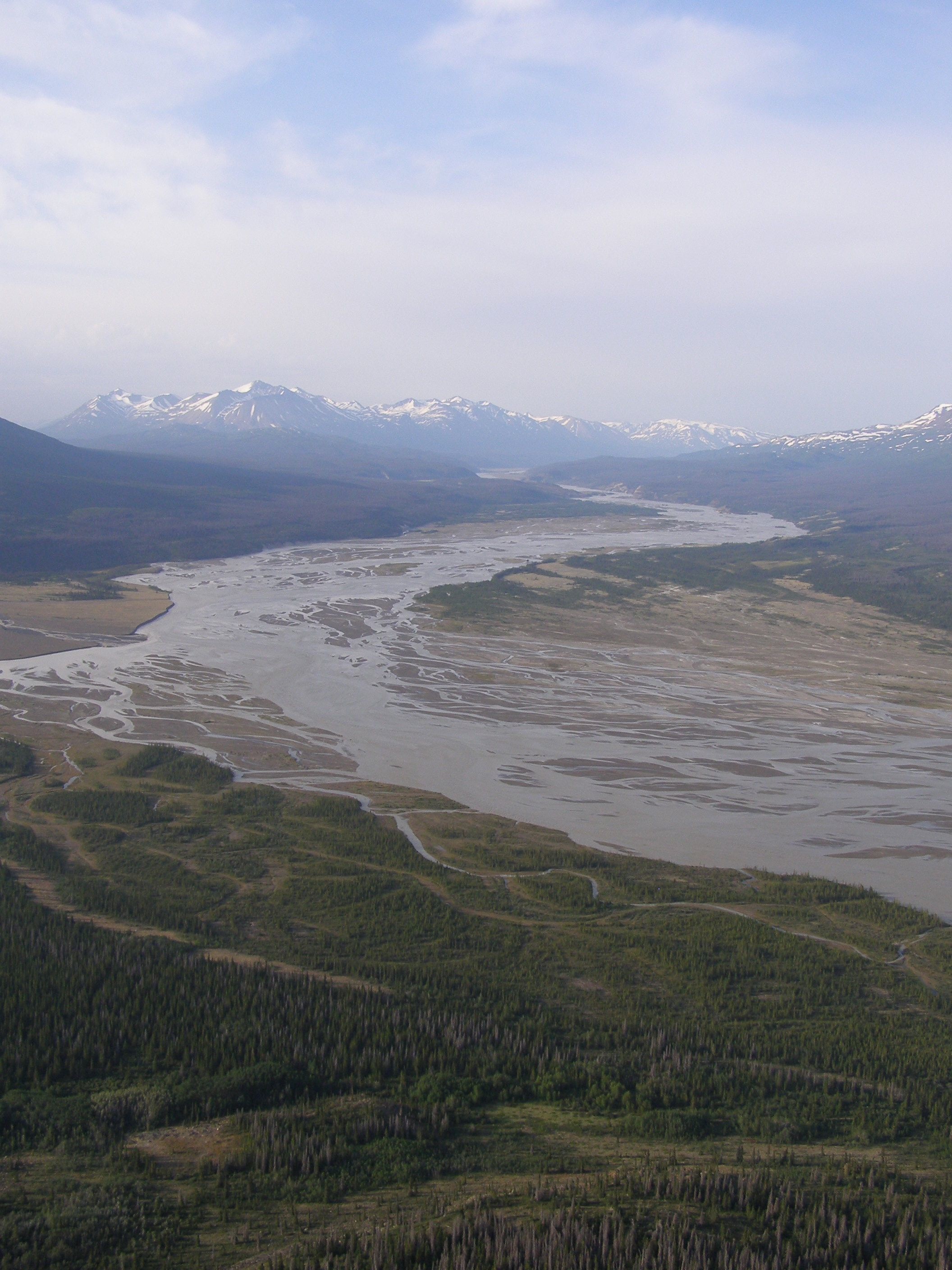
Alsek River sandbanks have been sampling targets.
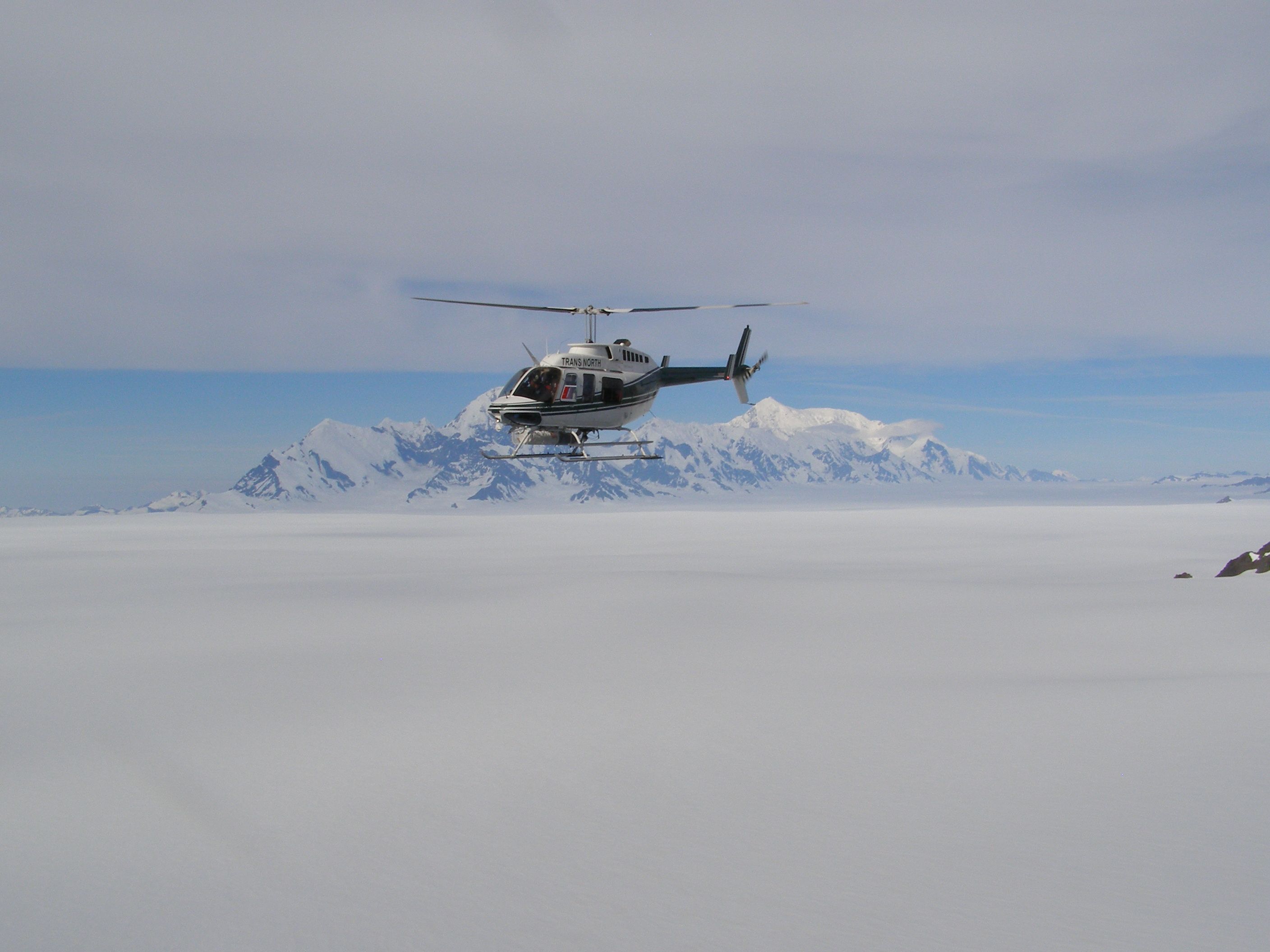
The mountains seemed close to our motel at the Alaska Highway, but there was no chance to get far into the mountains, not to mention the high icefield region, without a helicopter. We wanted to sample catchments that included the large glaciers, which drain the Icefield Ranges of the syntaxis area (the highest part of the St. Elias Mountains with Mount Logan as the highest peak (5959 m)) to the north and east, and also smaller catchments to better confine the cooling age signals. Additionally, we aimed to collect bedrock samples from high-elevation, ice-free ridges. While we took some samples along the Alaska Highway and the largest rivers that still had coarse enough material close to the highway, the majority of the 110 samples we took were collected within 2 days by helicopter. It had to be a rather large helicopter to be able to cover the long distance from Haines Junction to the Seward Icefield at the southern flank of Mount Logan and transport the additional baggage (river sands and bedrock). We were lucky to encounter good weather conditions in the high mountains and an experienced pilot (Doug Makkonen from Trans North), who knew the area in his sleep and had fuel barrels here and there distributed in the wilderness.
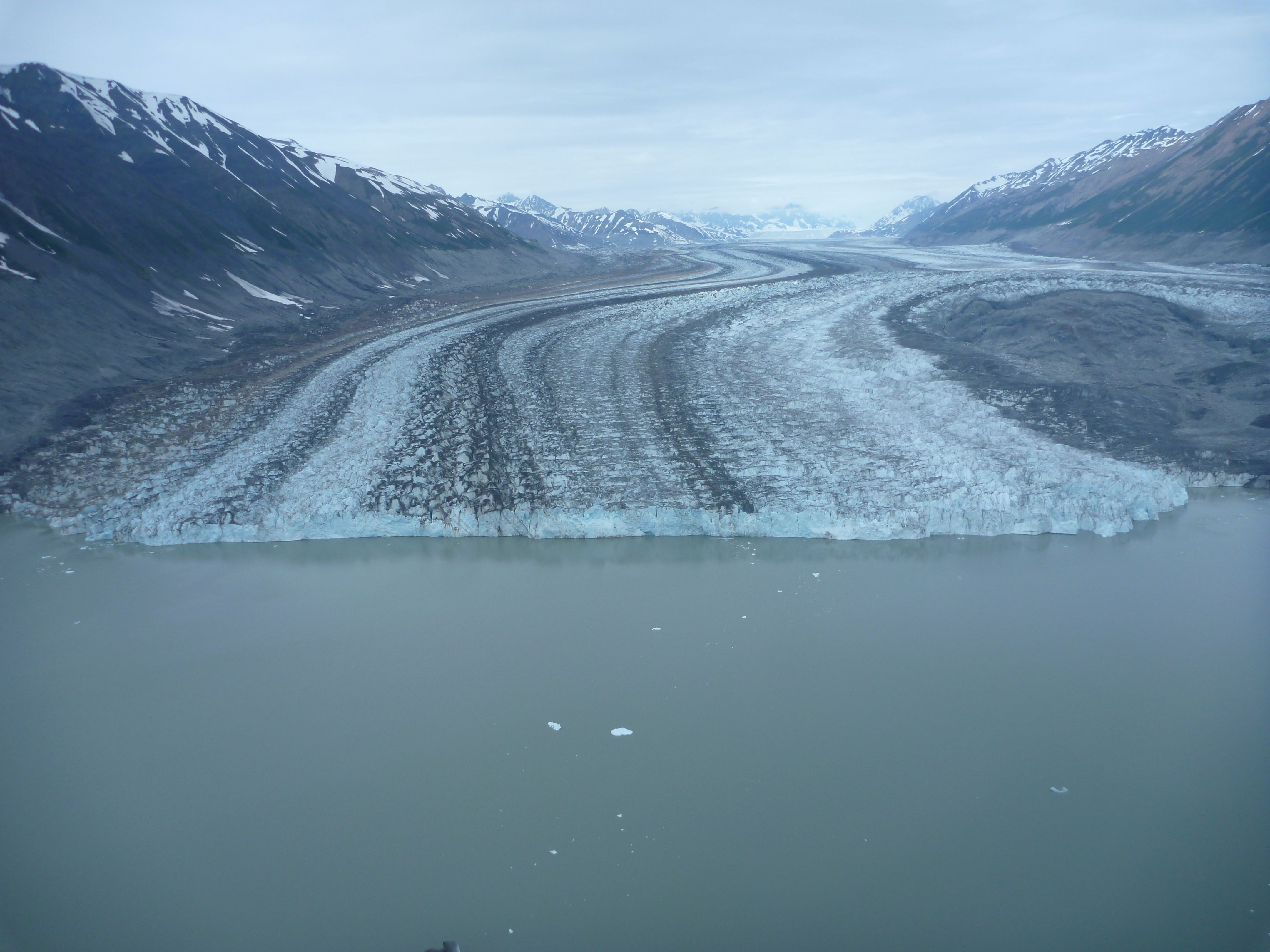
Lowell Glacier terminus at an ice-dammed lake draining into Alsek River. Glacier surges blocked the Alsek River several times in the historical past (the last time ca. 1850) creating Neoglacial Lake Alsek and causing catastrophic outburst floods.
After waiting for just one day because of rainy and foggy weather, we started with the sampling of glacio-fluvial sands from the Alsek River and its tributary glaciers and rivers. A strong stomach is advantageous with all the circling for the best sampling and landing spot, then just hopping out, grabbing a bag of sand (ca. 2–3 kg), and hopping back in to find the next spot. Time is of the essence, you never know if the weather is stable and helicopter time is expensive. On the second day, we had perfect weather conditions to conquer the high icefield region and get the bedrock samples. Mountain ridges sticking out above the Hubbard and Seward icefields and other large glaciers were the sampling targets. The flanks are steep and there usually is deep gap between ice and rock face so that you neither can land on the rocks nor on the ice to walk to the rock face. Fortunately, one of us (Eva) was an expert in jumping out of the helicopter, getting a rock sample, and then, when the helicopter comes back and balances on one skid, climbing back in. Who knew this skill would come in handy as a geologist?! Those were very intense 2 days, as the procedure requires a high degree of concentration the whole time to keep an overview of where you are flying, to find optimal sampling spots for your scientific goals and for logistic reasons, to properly label and document the samples and geographic coordinates, to be careful with your head while getting in and out of the helicopter, to be quick, and to possibly still enjoy the scenery.
View of the Tweedsmuir Glacier flowing east before it drains into Alsek River.
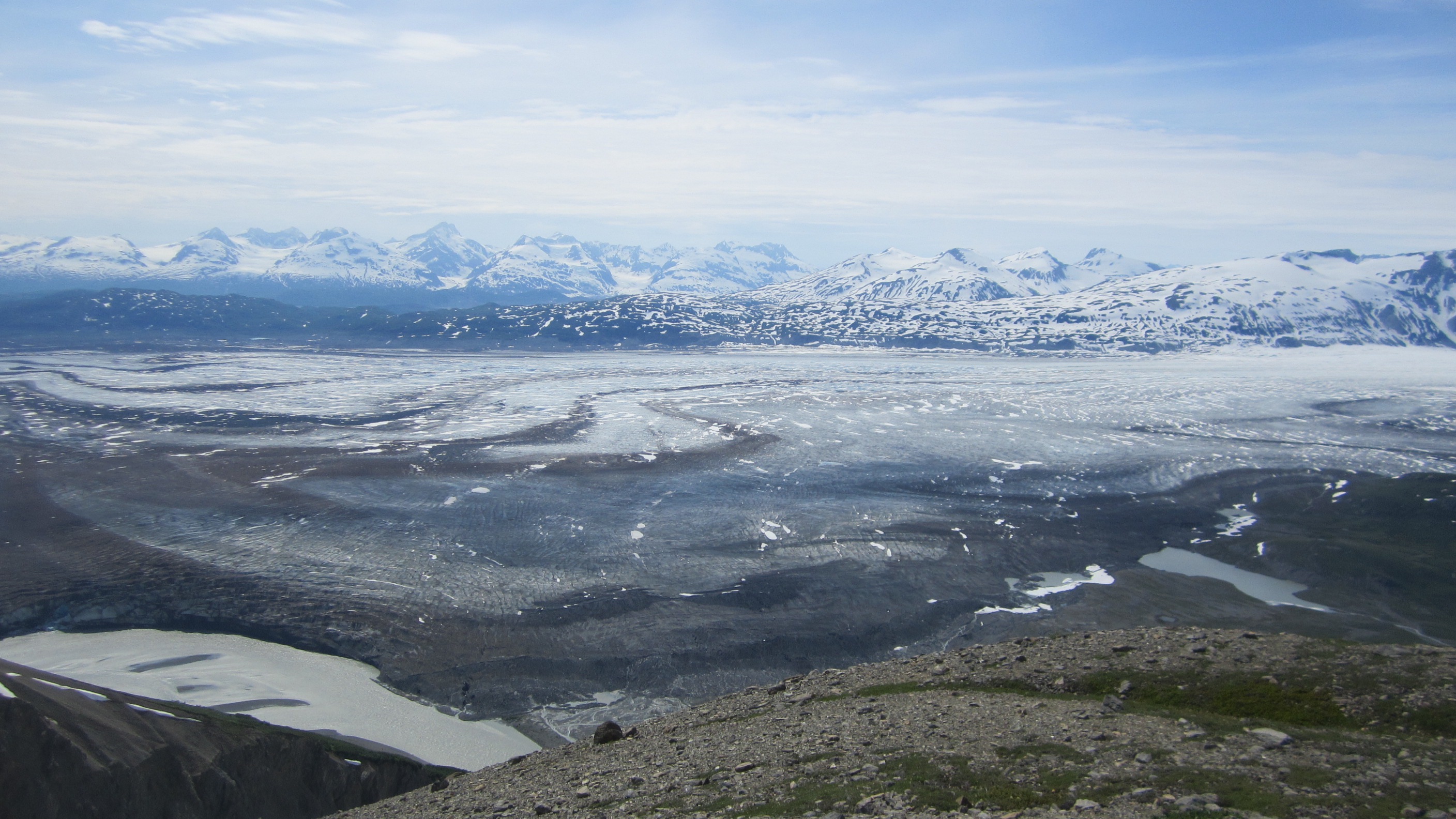
Hubbard Icefield with only the highest peaks towering above the ice.
The fieldwork has also been fascinating for the landscape contrasts. On one side there were the pine forests, lakes, moraines, and partly swampy, mosquito-infested lowlands. We hiked there equipped with our gold pan (to sieve out the heavy apatites and zircons; but you also cannot not look for gold in that area – nothing found, though), mosquito spray, and, as required by the park rangers, bear spray, making noise to alert the bears of our coming. On the other side there were the seemingly endless, peaceful, and pristine icefields and glaciers, with their beautiful medial moraines, and blue meltwater, which you usually do not get to see in all their length and beauty. But this also makes you painfully think about climate change and the sensitivity of these systems.
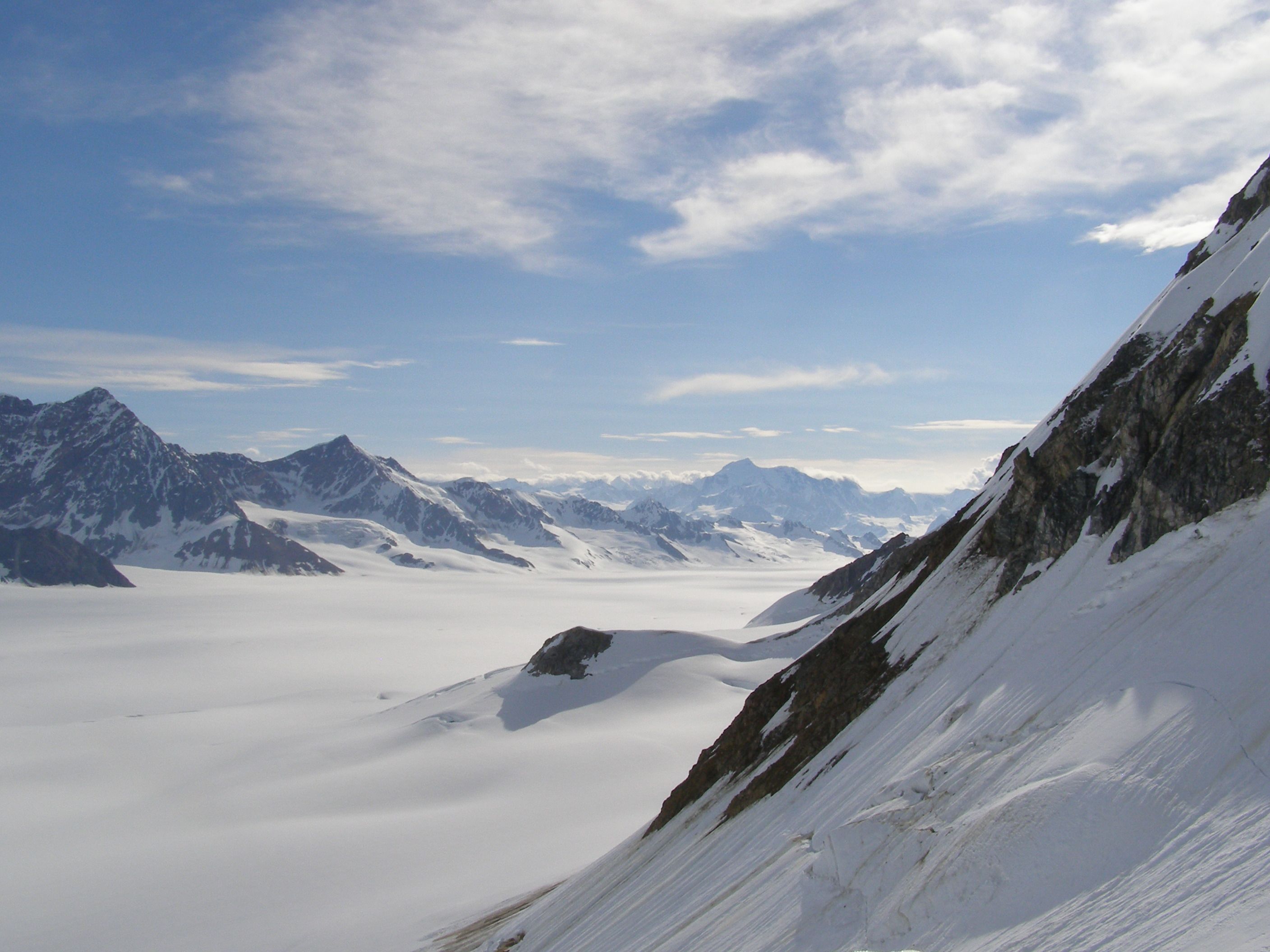
Helicopter flying above Seward Icefield in front of Mount St. Elias in the southwest.
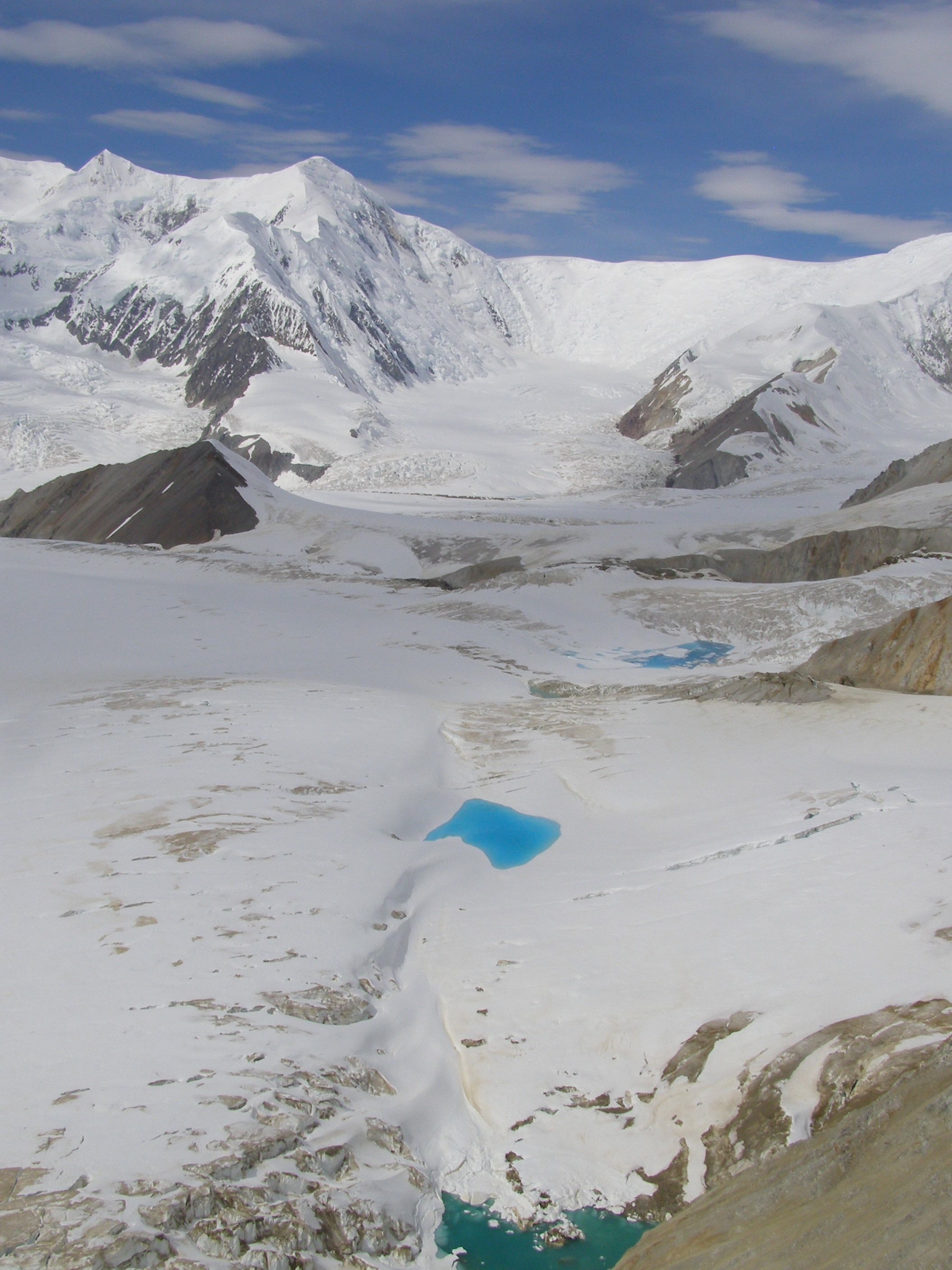
Three shades of blue in supraglacial lakes.
Even in the most remote areas, as you might think, you will find other scientists investigating. We met a few seismologist, geologists, and glaciologists with base camp in Haines Junction or at the Kluane Lake Research Station operated by the Arctic Institute of North America hosting scientists from diverse disciplines. A wonderful site for your studies.
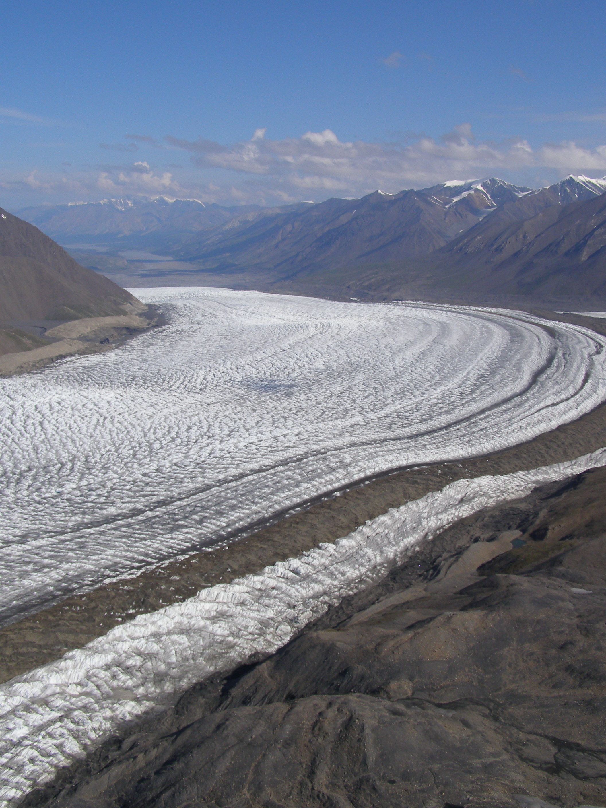
Kluane Glacier draining the St. Elias Mountains toward the north.
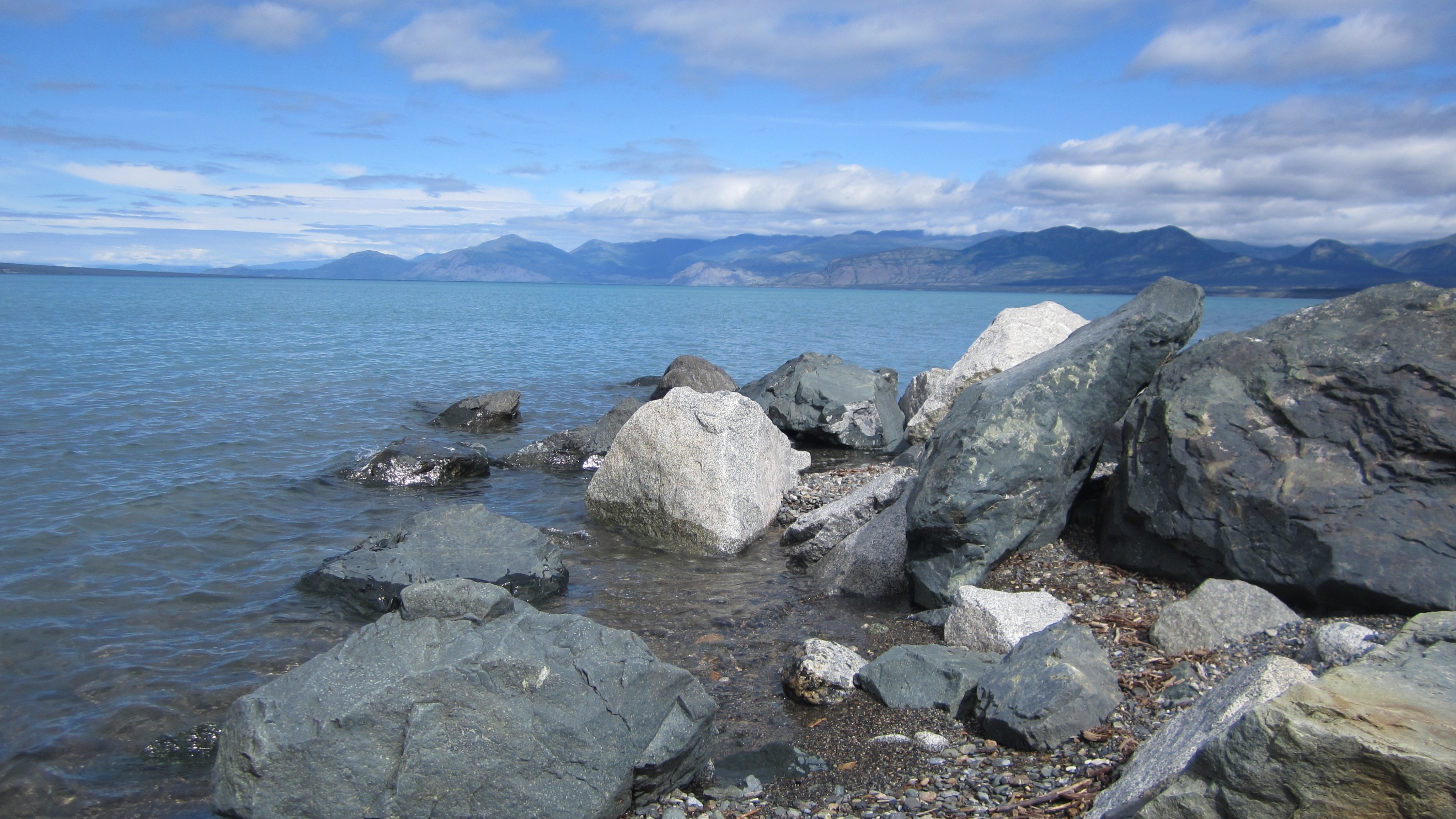
Kluane Lake.
All of our buckets with samples arrived safely in Germany and it turned out we had been quite successful. With our detrital and bedrock samples from the Alaskan and Canadian sides of the mountains we could not only confine the spatial pattern of rapid exhumation at the St. Elias syntaxis, but also show the change of the pattern through time. My future research as a postdoc at the University of Tuebingen continues to focus on syntaxial regions (as part of the EXTREME project), interactions between tectonics, surface processes, and climate, e.g., glacial erosion in active mountain belts like the Patagonian Andes, and detrital thermochronology.
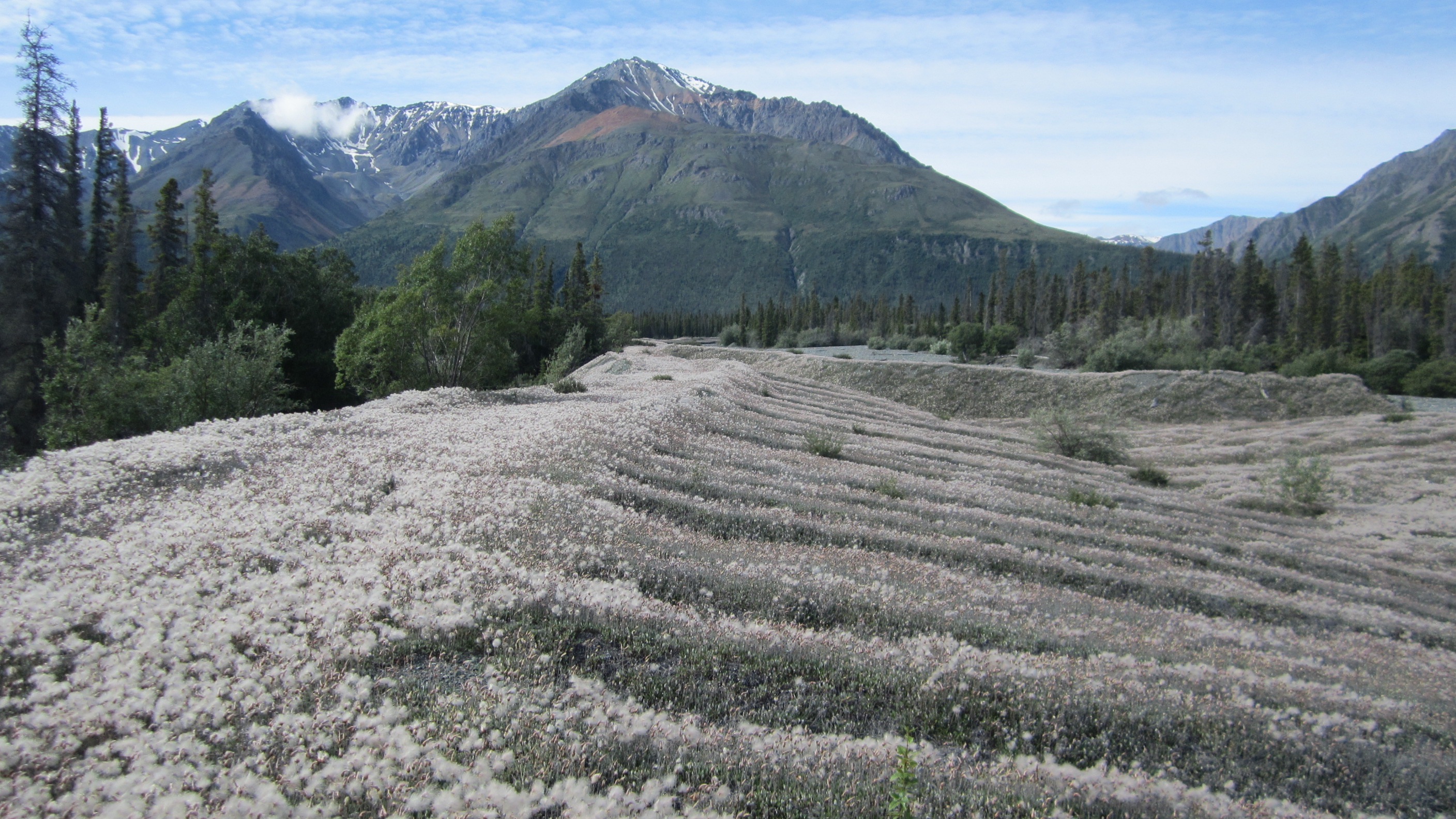
Moraine vegetated with cottongrass west of Kluane Lake.
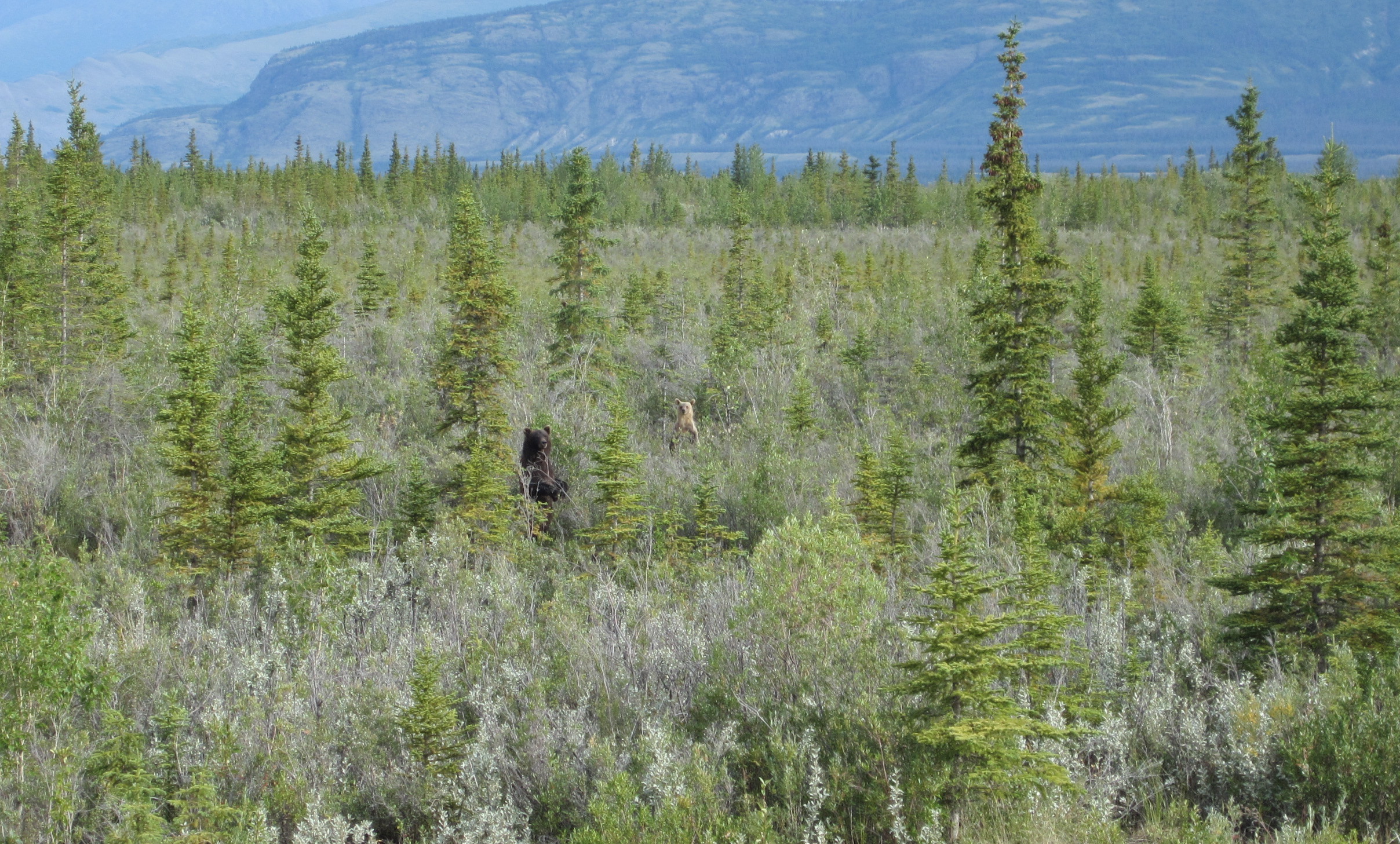
Spot the bears along the Alaska Highway.
![]() This work is licensed under a Creative Commons Attribution-NonCommercial-ShareAlike 4.0 International License.
This work is licensed under a Creative Commons Attribution-NonCommercial-ShareAlike 4.0 International License.