 |
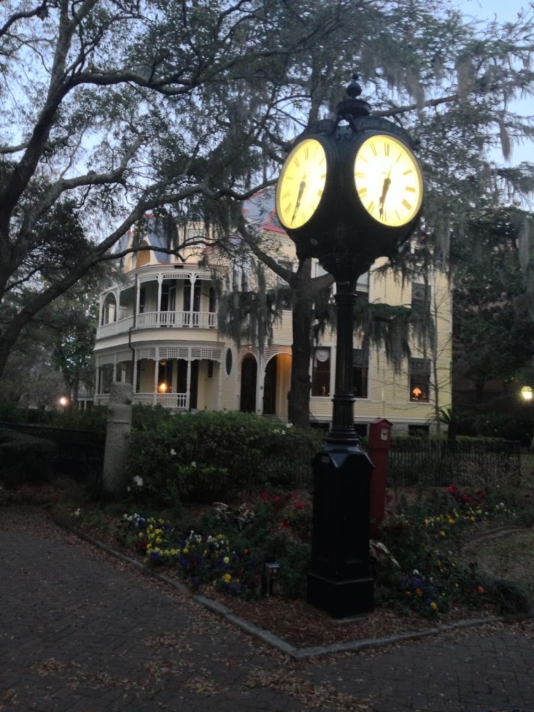
| Charleston College |
I recently returned from Charleston, South Carolina. Although the purpose of my visit was geologic in nature, it was a workshop rather than a field trip. Charleston is a charming city with many historical buildings still standing. In the major cities of the Southern United States it is rare to find any buildings older than the civil war as General Sherman laid waste to much of the region during his “March to the Sea.”
In my perusing of the historic downtown I was surprised to learn that Charleston has a seismically active past. On August 31st, 1886 an estimated magnitude 7.3 earthquake struck the capitol city of Charleston. This was the most damaging earthquake to occur in the Southeast United States. This earthquake was most likely associated with the reactivation of preexisting weaknesses left over from the rifting of the Atlantic. These remnant faults can reactivate for a number of reasons; e.g. over-loading of the hanging wall or changes in far-field stresses.
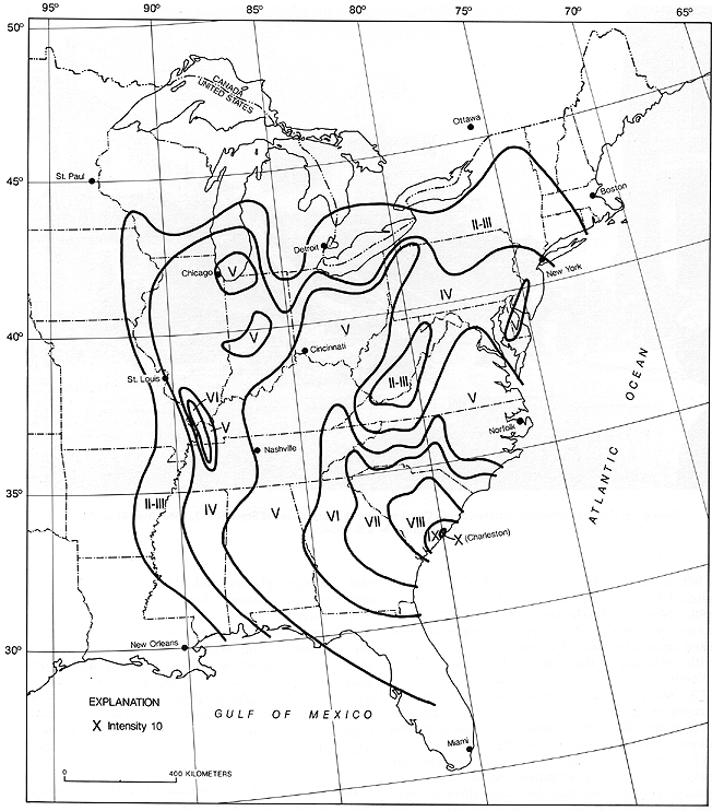 |
| Map of the Mercalli Intensity of the 1886 EQ |
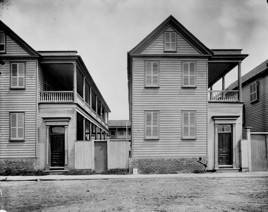 |
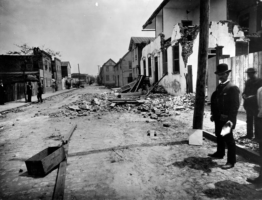
| The Charleston Lean (from the USGS) |
This earthquake damaged and destroyed many buildings in the old city of Charleston and killed 124 people. The spectacular thing about this earthquake is that structural damage was reported several hundred kilometers from Charleston (including Alabama, Ohio, Kentucky, Virginia, and Illinois), and it was felt over 1,500 kilometers away. Many of the wooden buildings in Charleston still have what is known as the “Charleston lean” where foundations sank causing the buildings to list. In some of the more dramatic cases, new floors were built on top of the original floors at an angle to restore horizontality.
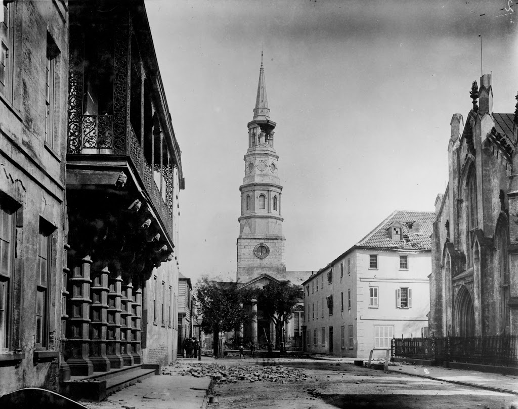
Within Charleston, liquifaction features were present throughout the area and sand volcanoes erupted and covered many acres of ground were overflowed with sand. Many of the liquifaction cones were nearly 6.5 meters across. In a few locations, water from the craterlets spouted to heights of about 4.5 to 6 meters.
The intraplate epicenter of this major earthquake is not unique in the Eastern and Central United States. Other major intraplate earthquakes include those at Cape Ann, Massachusetts (1755), and New Madrid, Missouri (1811-1812).
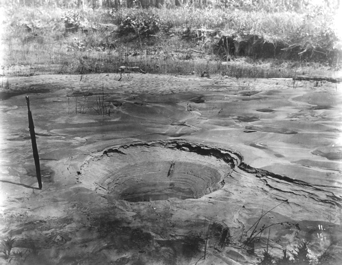 |
| Liquifaction cone |
Since the 1886 earthquake South Carolina has taken earthquake preparedness very seriously. A recent report (seen here) predicts at least 900 fatalities, 8000 serious injuries and approximately 45,000 total casualties (dead and injured). They believe over 200,000 people displaced and at least $200 billion in total economic losses from damage to buildings, interruption of businesses, and damage to transportation and utility systems. Furthermore, because of insufficient building code standards and average age of the majority of buildings, important government buildings, schools, fire stations and hospitals are especially vulnerable to damage. The catastrophic failure or partial collapse of government and school buildings during a work/school day would greatly increase casualties.
They also estimate about 800 bridges will be rendered unsafe, preventing first responders who try to reach victims. For coastal South Carolina, this will be a major problem as a number of sea island communities whose only connection to the mainland is a bridge, would be cut off from all transportation except by boats or helicopters if bridges fail. Even the new eight lane wide Arthur Ravenel Jr. Bridge is at risk. Although the bridge itself was built to sustain a magnitude 7 earthquake the elevated road leading to the bridge would likely fail leaving the bridge useless following an earthquake.
Although the chances a large earthquake will strike South Carolina in the near future are slim it would definitely be an event for which the South Carolinians should be prepared.
![]() This work is licensed under a Creative Commons Attribution-NonCommercial-ShareAlike 4.0 International License.
This work is licensed under a Creative Commons Attribution-NonCommercial-ShareAlike 4.0 International License.