Naomi is a PhD student at the University of Adelaide specialising in metamorphic geology and isotope geochemistry working with Professor Martin Hand.
Antarctica is an entrancing place. Her remoteness, elusiveness, natural beauty and unpredictability of the elements is both awe-inspiring and addictive. Visiting the most isolated regions of this continent – the rarest of Antarctic landscapes, is most certainly an unrivalled experience.
Between December 2014 and February 2015, I had the immense privilege to undertake fieldwork in east Antarctica, in the Bunger Hills, as part of my Ph.D. The Bunger Hills are a secluded, coastal, and uniquely ice-free region of undulating hills and deeply-carved freshwater glacial lakes (the deepest being almost 140 m). Since their discovery by U.S. Naval Operation ‘Highjump’ in the late 1940’s, the region has endured a limited human footprint, with few sporadic expeditions by the Soviet Union, later Poland and then Australia.

Twin Otter shortly after landing
I form one of 4 – our team consists of myself, geologists Martin and Chris, and our New Zealand field expert, Billy. We journey to the Bunger Hills to sample rocks formed at depth from the convergence of the Australian and Antarctic cratons during formation of the supercontinent Rodinia (between approximately 1.3–1.1 billion years ago). Specifically, these rocks form part of the Albany–Fraser Orogen that spans southwestern and central Australia. The Bunger Hills occupy a pivotal location at the very western extent of this system. Later, we will analyse the geochemistry, isotope composition and age of the igneous rocks we collect to unravel the crustal growth history of the Bunger Hills. We also collect samples of metapelite to discern the pressure and temperature conditions that these metamorphic rocks formed under, and ultimately to provide some insight into the likely tectonic environment during metamorphism. For 5 weeks, we roam the Bunger Hills landscape in search of answers.
Ourselves, our gear, food, fuel and two quad bikes are dropped into the Bunger Hills by Twin Otter light aircraft. The journey from the Australian station ‘Casey’ takes nearly 2 hours and covers close to 450 km. On the fourth attempt to descend, the plane lands on the 3 m-thick year-round sea ice, and after briefly refuelling, departs from us, leaving a deafening silence and (if we didn’t already know it) the final confirmation of just how isolated we really were going to be. Both a trepid and exciting feeling! Apart from a daily scheduled call-in with Casey, the four of us are now left entirely to our own devices.
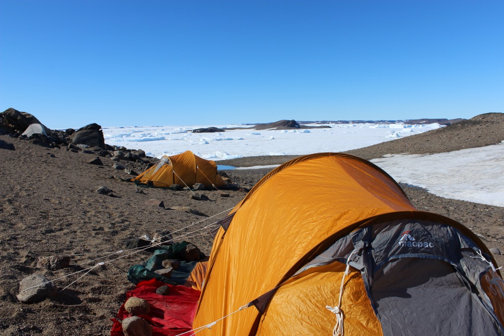
Our camp overlooking Paz Cove
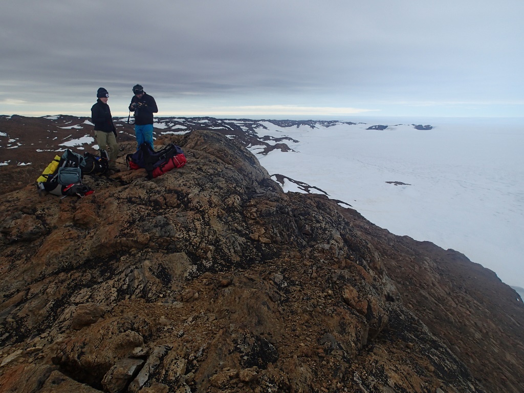
Upon their discovery, Richard E. Byrd of the U.S. Navy once described the Bunger Hills as being ‘one of the most remarkable regions on Earth. An island suitable for life had been found in a universe of death’. While the Bunger Hills provides refuge for only the hardiest mosses and birdlife, the landscape truly is beautiful in all its moods and diversity—lunar-like and desolate, sun-kissed peaks overlooking grounded icebergs in the coves, rugged terranes bisected by flowing estuaries with the progression into summer, and spectacular views southwards of snow-scapes stretching to infinity. This made for some extraordinary traverses.
View along the southern Bungers
We plan our days in advance so we can explore most of the landscape and geology. But ultimately, Mother Nature dictates and so, our course is often adapted on the fly. Our main camp is Edgeworth David – an Australian summer-only site; a rudimentary setup of 4 red fiberglass huts (‘apples’ and ‘melons’), providing us with some respite from the wind. But mostly, we set up sub-camps at different vantage points and sleep in tents for several days at a time, having carried only the bare essentials to minimise our load. Particularly memorable were our camps overlooking Paz Cove and at the historical, although now abandoned and run-down, ‘Oasis’ (Soviet Union) turned ‘Dobrowolski’ (Polish) station adjacent to Algae River (which is the third longest river in Antarctica!). Our camping stints are just long enough for ample rock sampling before needing to recharge our satellite phone batteries and radios, top-up our fuel supplies for the primus stoves and replenish our food. Highlights include American-army issue ration packs, tinned cheese, vegemite and Spam—the lunch staples, the apparently endless supply of laksa and chocolate bars well bygone their expiry date.
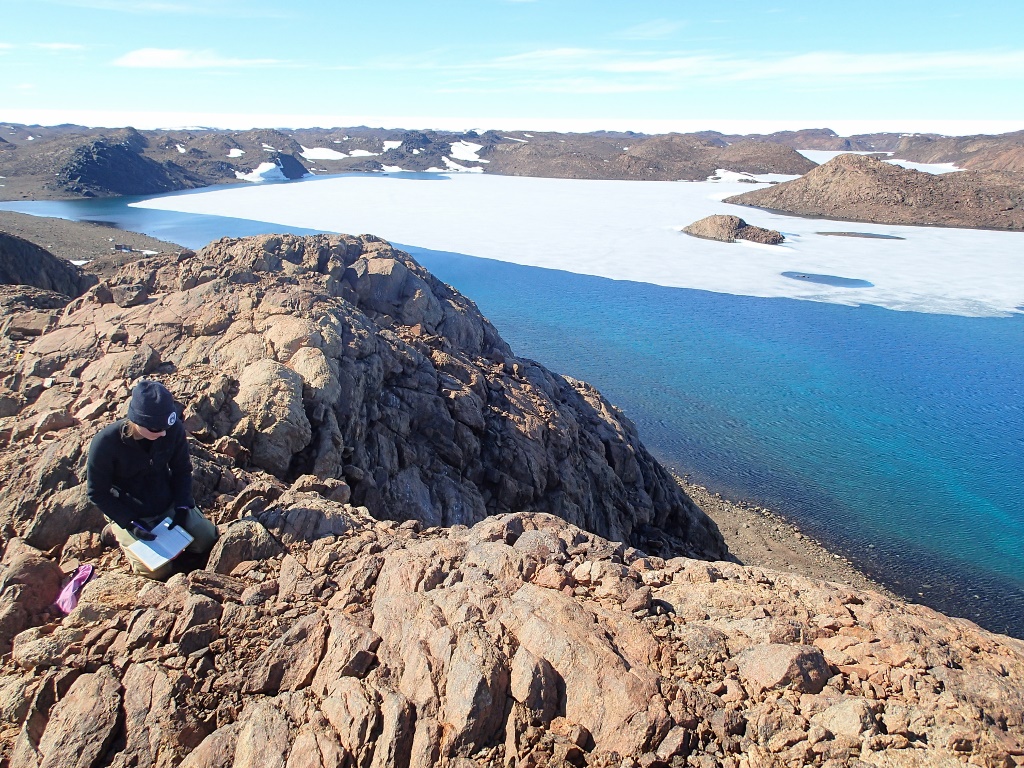
Geology near Algae River
Christmas is celebrated with a day-off, pudding and custard and a surprisingly successful (and creative) attempt to ‘baste and roast’ a Christmas Spam in our gas oven.
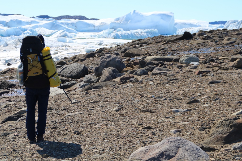
Sometimes we are navigating the moraine up to 25 km a day with heavy packs, inevitably made even heavier by the multitude of rocks we collect on the way, and the temptation to collect even more. The rapidly deteriorating sea ice each day into December and January unfortunately restricts our passage further north to the surrounding islands. Though on a particularly warm day (surely close to 10 °C and with hardly a breath of wind!) we do manage to find access onto Geologov Island. Yet this does not come without challenge—after a slow 12 km across the sea ice, we arrive to find the ice fragmented just meters from the land and few safe crossings. After considering our options over a long lunch, we eventually (and thankfully!) find a safe and intact route before making the return trip. Although physically demanding, exploring on foot is rewarding as it allows us to reach and appreciate the far corners of the Bunger Hills mainland, literally leaving no stone unturned.
Hiking Krylatti Peninsula to setup camp
There is a small window of opportunity for our extraction from the Bunger Hills – one day in which the weather looks favourably upon Davis, the Bunger Hills and Casey, enabling the plane to make the complete trip. The Twin Otter is loaded with several hundred kilograms of our carefully-selected rock samples, and all our waste for disposal back on station—these are our priority. The quad bikes and boxed items are left strapped to the ice for collection later that week. In reality, this happens almost 8 months later—the next good weather day!
![]() This work is licensed under a Creative Commons Attribution-NonCommercial-ShareAlike 4.0 International License.
This work is licensed under a Creative Commons Attribution-NonCommercial-ShareAlike 4.0 International License.