Jonathan Dean is a postdoc at the British Geological Survey. In this post, he travels through the land east of the Sierra Nevada to discover some incredible geology. You can read more of his adventures here.
I’d just spent a week in Reno at a conference, and was ready to move on from the so-called “Biggest Little City in the World”, which is in fact a collection of smoky casinos built somewhere that is really far too hot for human habitation. I hired a car and headed south on US Highway 395 towards Mono Lake, an area rich in geological delights. The area is bounded by the Sierra Nevada mountains to the west and smaller ranges to the east. First stop, north of Mono Lake, was Bodie. This is a ghost town set up following the discovery of gold in 1859. By the end of the 1870s, there were several thousand people living in this isolated spot – and at 2,554 metres above sea level they had to endure cold winters. In all, over $30M was probably produced from Bodie’s mines. But as the mines became less and less profitable, and more mines opened up elsewhere in the West, the town went into decline and by the 1940s there were fewer than a hundred people remaining. The town is now preserved as a National Historic Landmark, with about 100 of the original buildings left in a state of arrested decay.
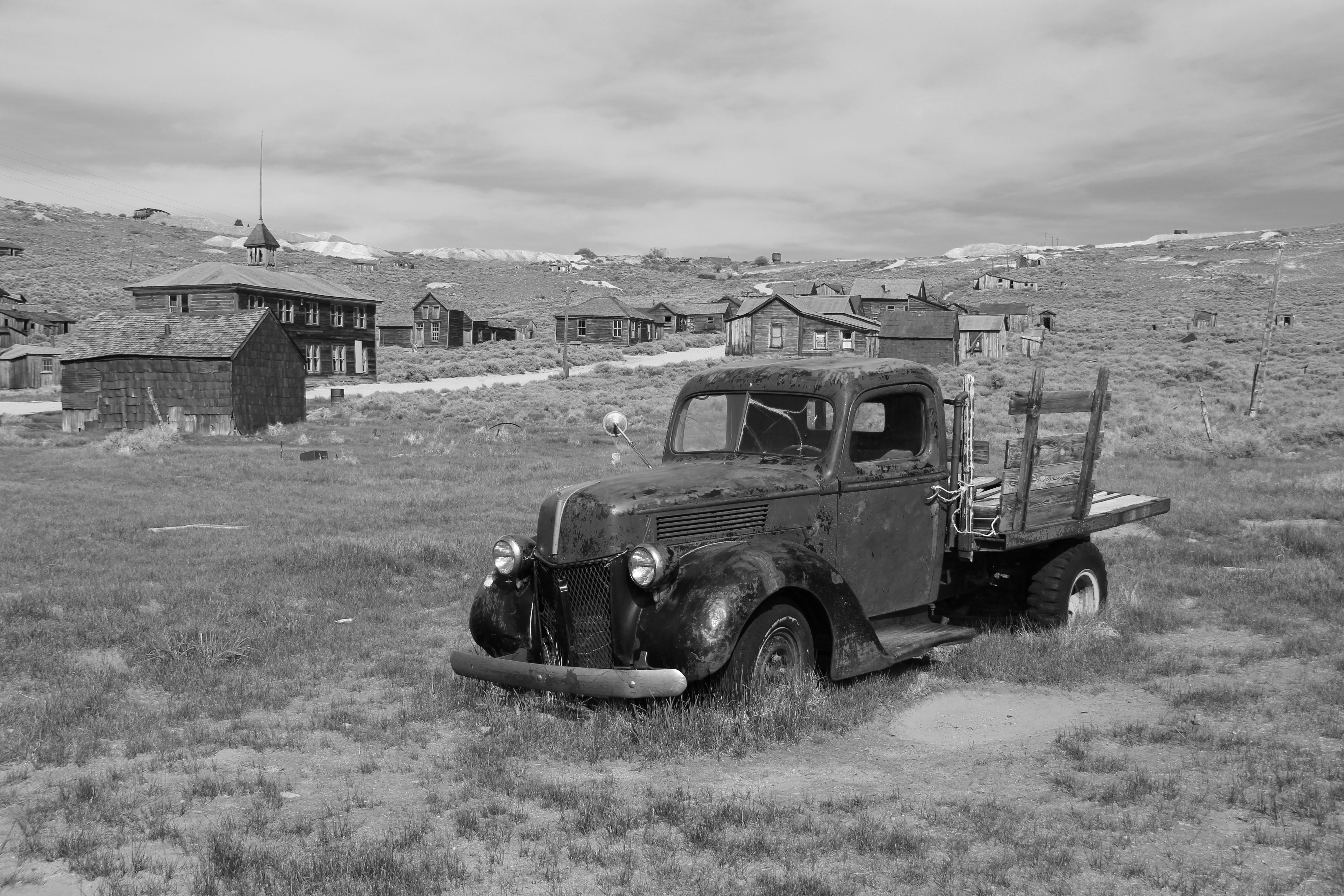
Bodie ghost town
From there, it was onto Mono Lake itself. The basin is part of the Walker Line, the place where a lot of the deformation between the North American Plate and Pacific Plate is seen. Because it is a terminal lake in an area with high levels of evaporation, and since it has existed for hundreds of thousands of years, the waters are incredibly concentrated in salts – the lake is actually saltier that the ocean. Tufa towers can be seen in the lake – these form from the precipitation of carbonate from the lake waters. Specially-adapted flies swarm around the edges.
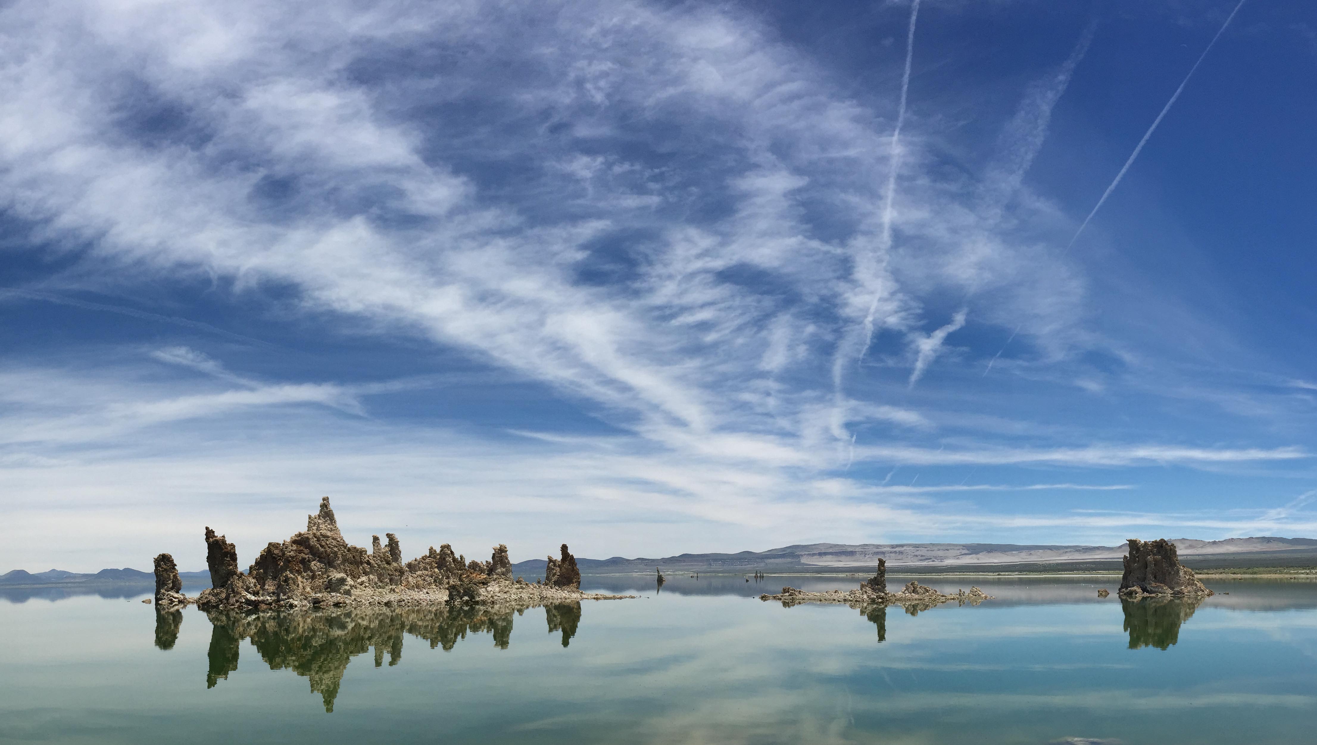
Tufa Towers in Mono Lake
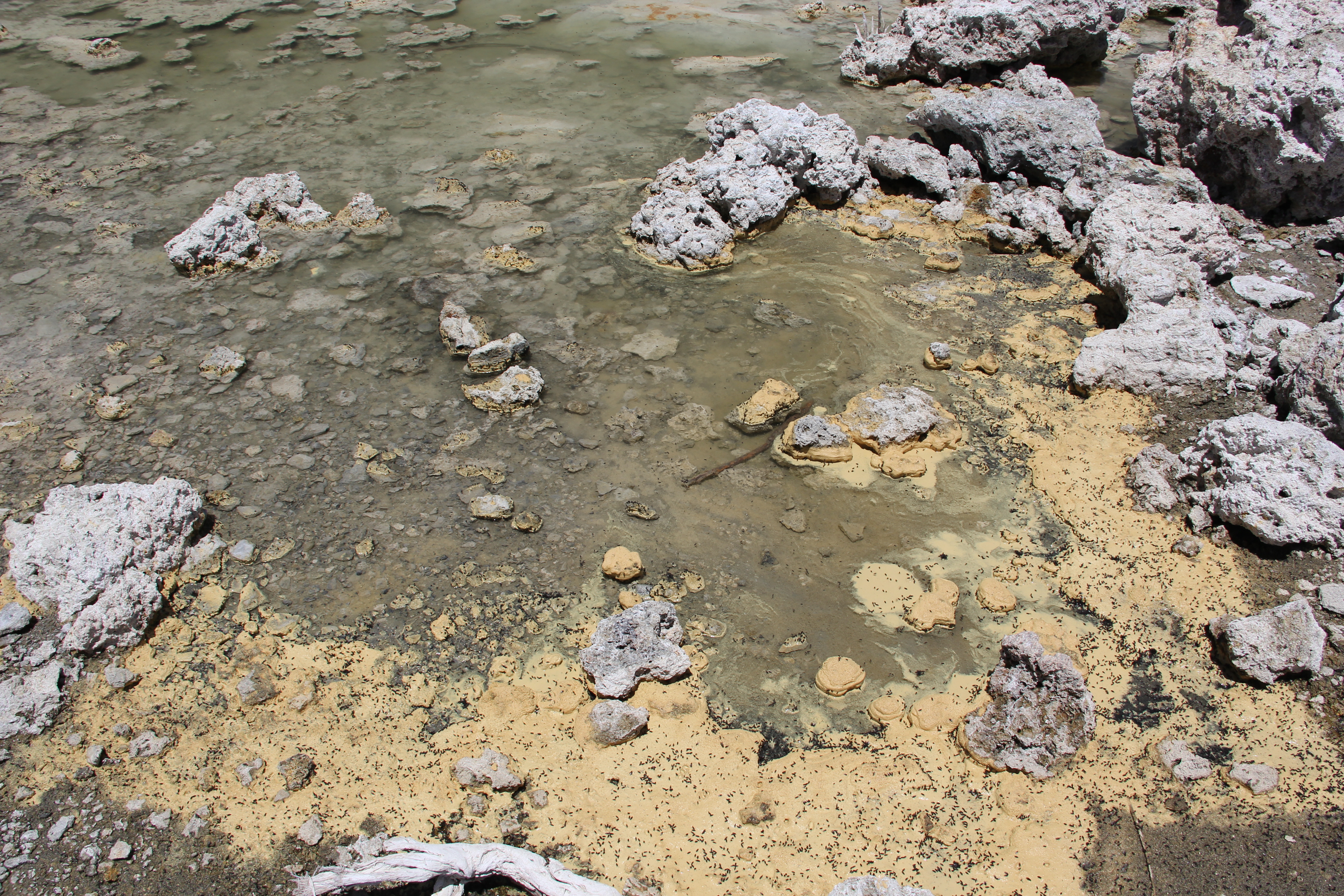
Mono Lake alkali flies
A bit further south and down another punishing dirt track is the Hot Creek Geologic Site, where groundwater fed by snowmelt from the mountains is heated by hot rocks in the Long Valley Caldera. The Devil’s Postpile National Monument is nearby and is also worth a visit, to see the basalt columns that are thought to have formed in the last 80,000 years or so.
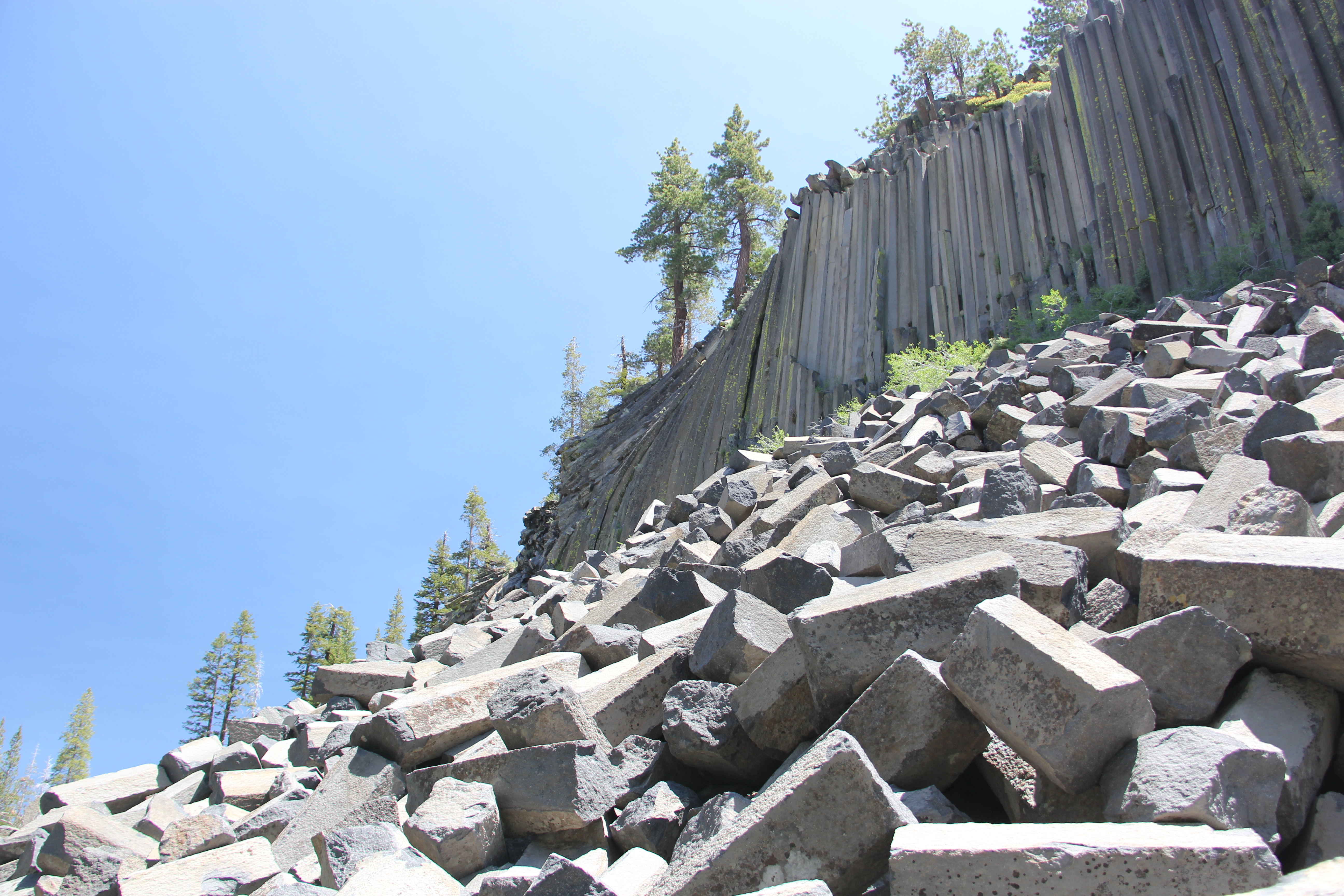
Basalt columns at Devil’s Postpile
Hot Creek Geologic Site
The next day, I decided to head down to Death Valley. The journey first went through Owens Valley, with the Sierra Nevada to the west all the way down, and the White and Inyo Mountains to the east. It is from Owens Valley, as well as from the rivers that feed Mono Lake, that Los Angeles took most of its water in the twentieth century. The first diversion of the Owens River by an aqueduct began in 1913, and through the century they continued to take the water. Legal efforts have recently helped to return water to the valley, although Owens Lake can still barely be described as a lake and the erosion of its exposed sediments mean it is one of the largest single sources of dust pollution in the US.
Mt Whitney, the highest point in the 48 states, seen from Owens Valley.
The route then took me through the desert round the southern end of the Inyo mountains, then over the Panamint range, with its stunning bends and drops of hundreds of metres from the road, unprotected by crash barriers, and finally over Towne pass. Death Valley contains the lowest point in the US at 85 metres below sea level and as a whole the National Park is the largest in the 48 states. The temperature of 56.7°C recorded at Furnace Creek in 1913 stands as the highest ambient air temperature ever recorded on Earth. It was a mild 46°C when I was there!
Hot!
The first stop – a very quick stop given that it’s not really possible to leave your air conditioned car for more than a few minutes – was to see the sand dunes just past Stovepipe Wells. Further down the road is Zabriskie Point, a badlands environment formed from the erosion of sediments from an lake that dried up millions of years ago, which was spoilt only by a group of loud tourists from England who were clearly on a day trip from their stag-do in Las Vegas.
Sand dunes south of Stovepipe Wells
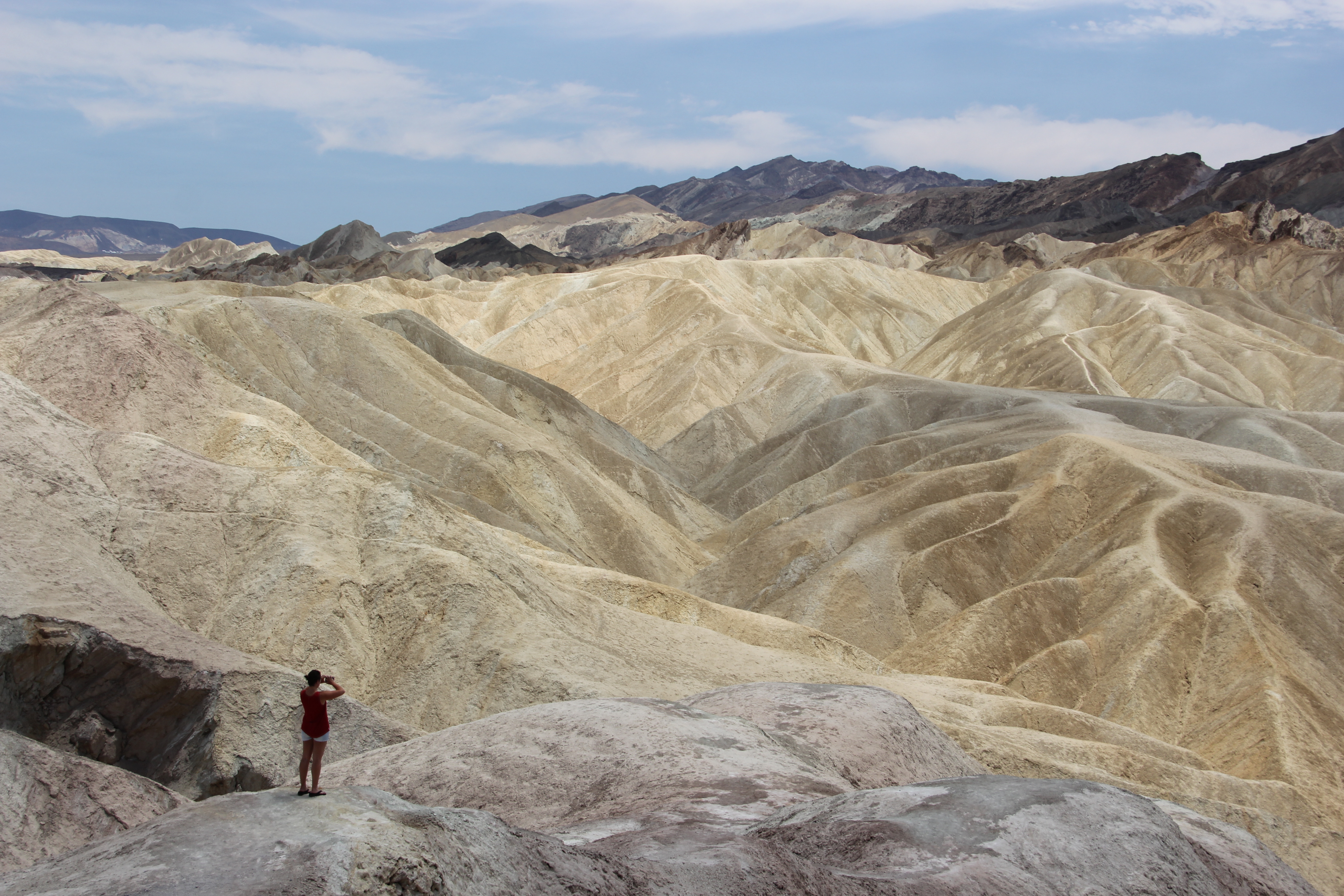
Zabriskie Point
But then I drove from below sea level up to over 1,500 metres above sea level at Dante’s View, from where you can get a great overview of Death Valley, and where I first understood how silence can be deafening. There were no sounds of birds, no wind, only the sounds of my camera shutter. It was about 15°C cooler here than in the bottom of the valley. The salt deposits down below were clearly visible. They are a reminder that the climate of the area was wetter in the past than it is today – i.e. more precipitation and less evaporation – so wet that there was a lake in the basin. When it dried up, it left the vast salt deposits behind. Lake Manly, as it is known, was last around during the last glacial maximum, until around 10,000 years ago when the climate became drier. In some years after heavy rainfall, such as 2004, water can fill the basin again, but it is soon evaporated.
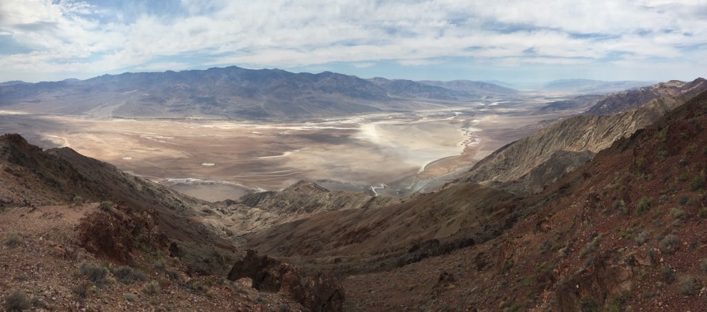
Looking down into Death Valley
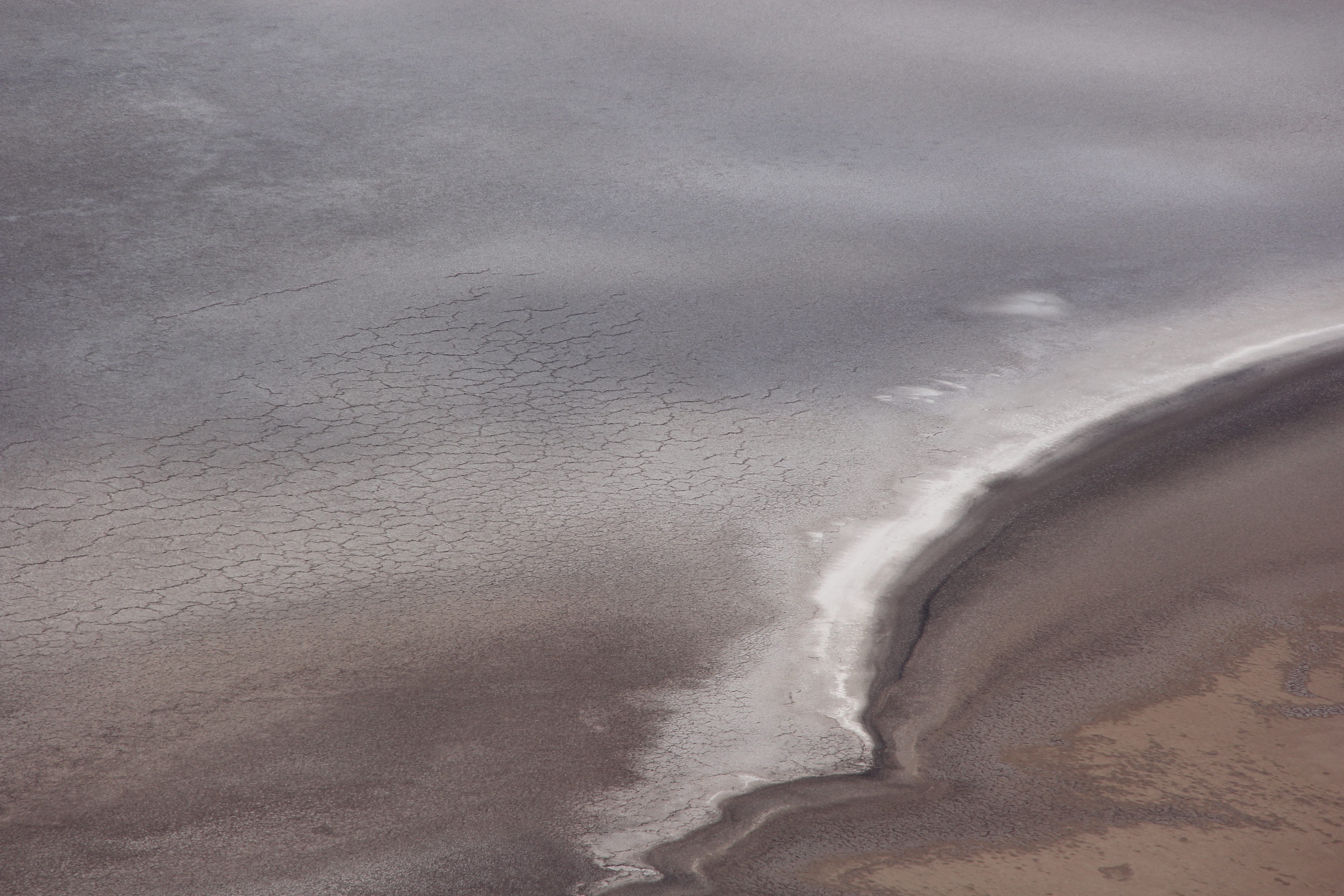
Close-up of the salt deposits and shorelines
![]() This work is licensed under a Creative Commons Attribution-NonCommercial-ShareAlike 4.0 International License.
This work is licensed under a Creative Commons Attribution-NonCommercial-ShareAlike 4.0 International License.