Derya Gürer is a PhD candidate at the University of Utrecht, The Netherlands. Together with Douwe van Hinsbergen she works on a tectonic reconstruction of Central and Eastern Anatolia. Read more about her ongoing research here. For her MSc. research she was at “Physics of Geological Processes” (PGP) in Oslo, where she, together with Olivier Galland and Fernando Corfu, examined the relationship between tectonics and magmatism in the Patagonian Andes.
The way magmas ascend in volcanic plumbing systems remains enigmatic. Especially, the detailed mechanisms that allow magma to reach the Earth’s surface in compressional tectonic settings remain unclear, as compression is intuitively assumed to impede magma ascent. To document the magma emplacement mechanisms in compressional settings, we undertook an extensive and detailed structural field study of a shallow, exhumed intrusion emplaced in a fold-and-thrust belt.
The journey starts on a dark November day in Oslo, Norway… Destination: Patagonia.
After flying Oslo – Paris – Buenos Aires – Neuquén and then finally a 5 hour car trip, past oil pumps, dinosaur sites, and smooth hills, we arrive in the foothills of the Andes.
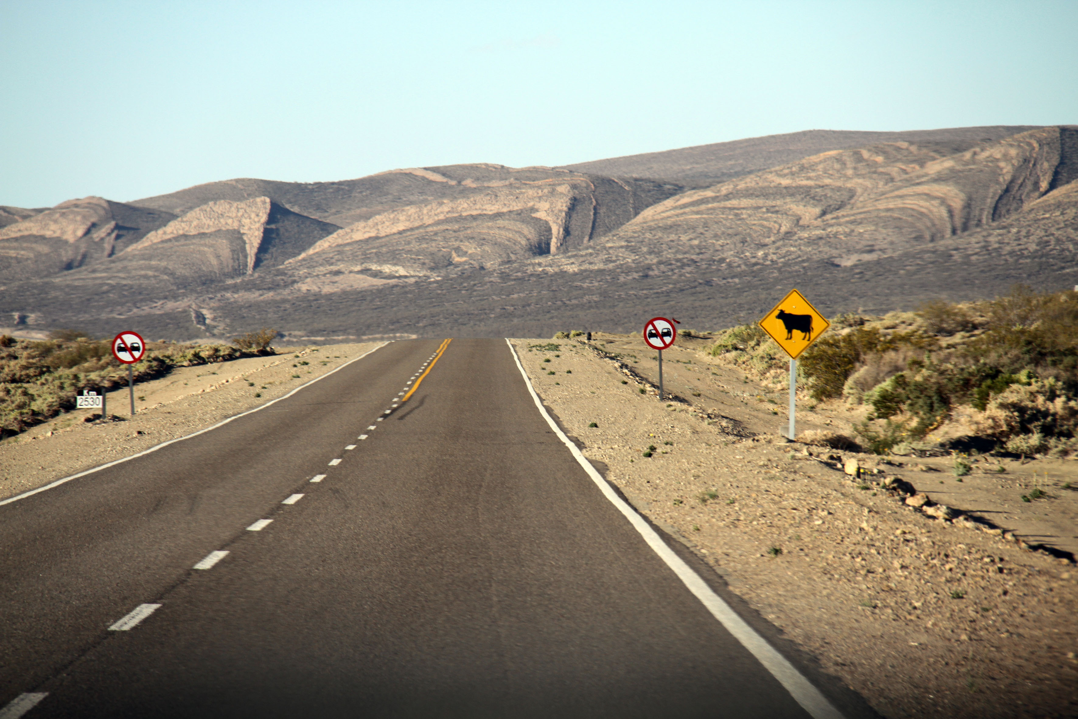
Photo 1: The scenic landscape of the foothills of the Neuquén Andes along the ruta 40.
Chos Malal, set at the convergence of Río Neuquén and Río Curi Leuvú, is the closest town to the mapping area and home for the coming four weeks. The small town is located around 30 off the scenic ruta 40, the country’s longest road, which stretches for 5224 km along the Andes Mountain Belt in western Argentina – a popular route with backpackers. Despite the beautiful landscapes of the region; especially Laguna de Tromen and Tromen volcano, only occasionally “gringos” (foreigners) make it into town. During our one-month stay, we enjoy the occasional company of locals during the traditional Argentinian “asado” (BBQ).
We’re here to document the interaction of shallow magmatic conduits with the surrounding sediments incorporated in the Chos Malal fold-and-thrust belt. Often the relations between magma conduits and tectonic structures are rarely exposed. But in the case of Cerro Negro de Tricao Malal (one of many shallow intrusions in this part of the Andes), well-exposed outcrops allow us to map this relationship in detail. The contacts between intrusion and surrounding sediments of the fold-and-thrust belt are often marked by chilled margins. Bedsides mapping the region, we also sample the different conduits in order to resolve the temporal relationship between sills and dike emplacement by absolute age dating.
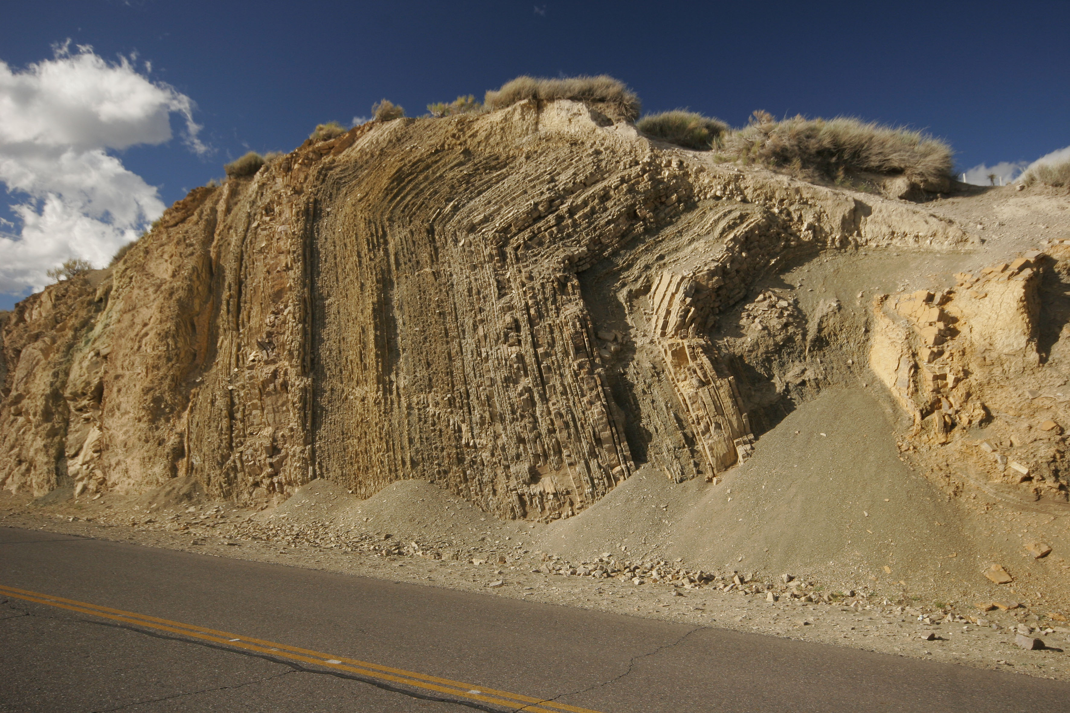
Photo 2: Road section of a thrust ramp anticline in the deformed sediments of the Chos Malal fold-and-thrust belt.

Photo 3: Derya mapping the relationship between magmatic conduits and sediments, always with a nice view of the Patagonian landscape.
Being located in a rather remote area, access to the intrusion is limited, and we rely on our legs. The area is scarcely inhabited; only in the occasional “puesto” we meet farmers and gauchos (equivalent to the North American “cowboys”), who are always happy to share their mate (herbal tea) over a small chat.
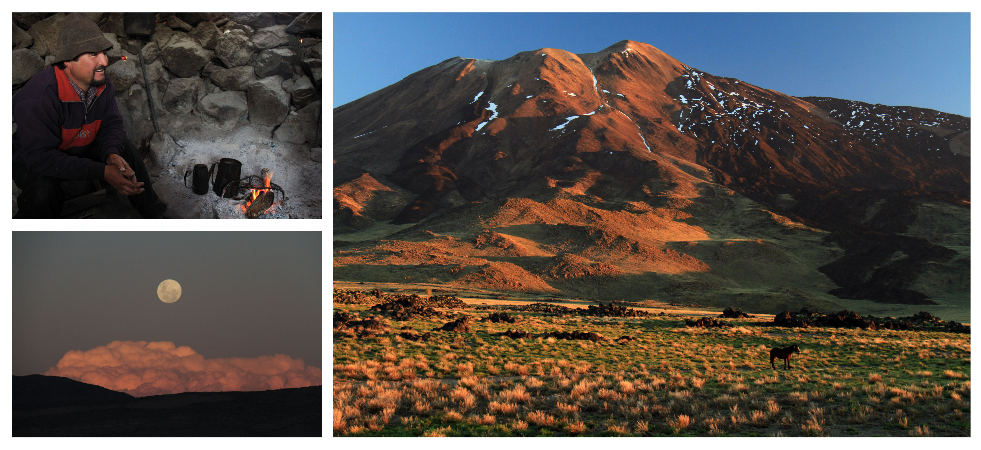
Photo 4: Gaucho José spends the spring with his livestock at Laguna del Tromen (2100 m), at the foot of Tromen volcano (4114 m). He tells us about the regions gaucho tradition over cup of a mate.
Only vast areas along the western flank of the complex are covered by slope thalus and therefore not accessible by foot. Also, Olivier has fractured his shinbone during sampling. But we’re lucky enough to run into a German-Argentinian gaucho, who has two horses that come in handy on our quest to cover as much area as possible and set camp on the western flanks of the intrusion.
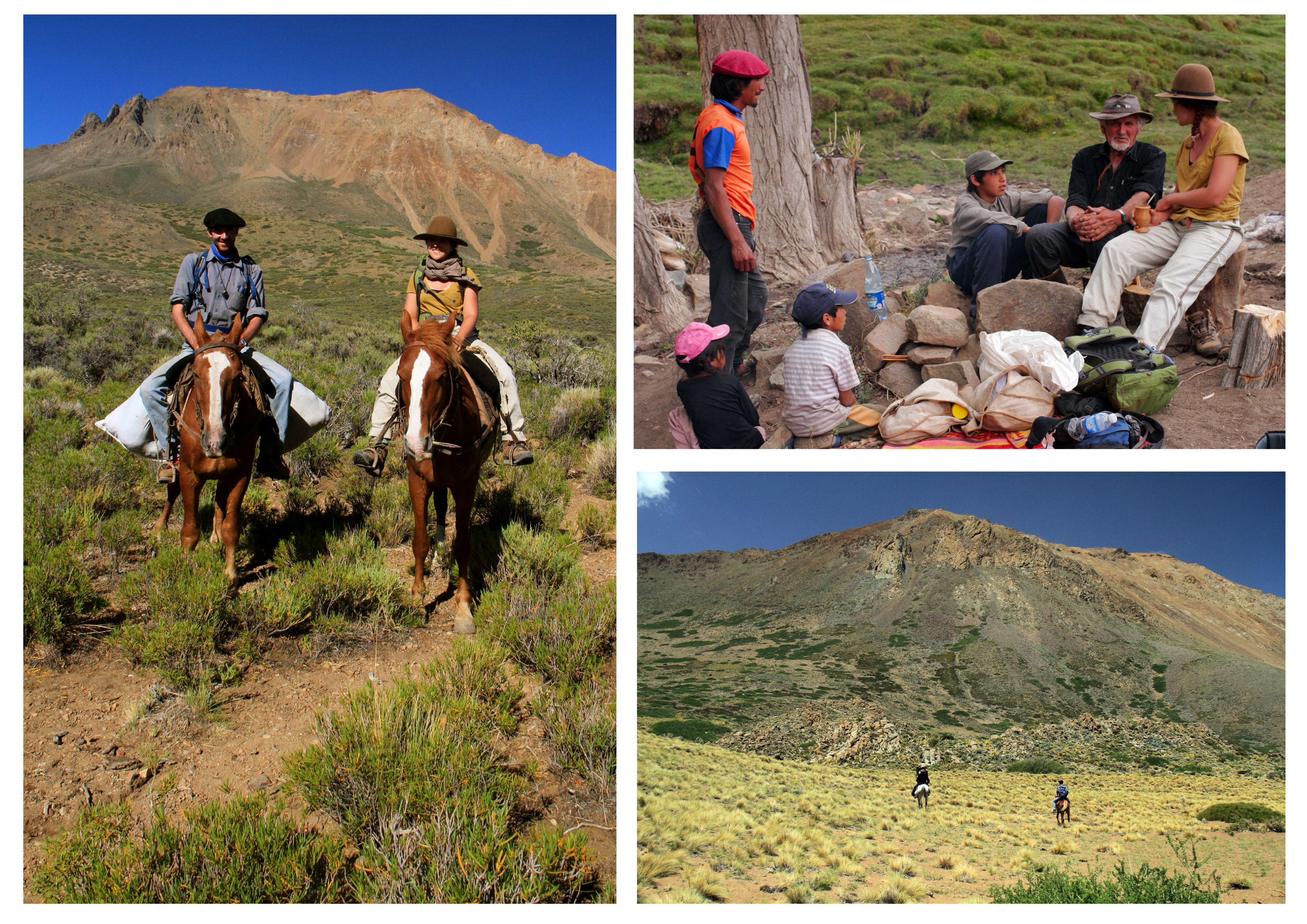
Photo 5: Horse riding and asado with the locals on the western flank of the Cerro Negro.
The summit, however, we can only reach by foot. The views from the top, overlooking the fold-and thrust-belt, the intrusions and the smoking volcanoes in the distance, are rewarding. Some days, especially when the wind blows from a westerly direction, we notice the volcanic dust of the smoking volcanoes nearby. The Puyehue-Cordón Caulle Volcanic Complex, just across the border with Chile was is in eruption.
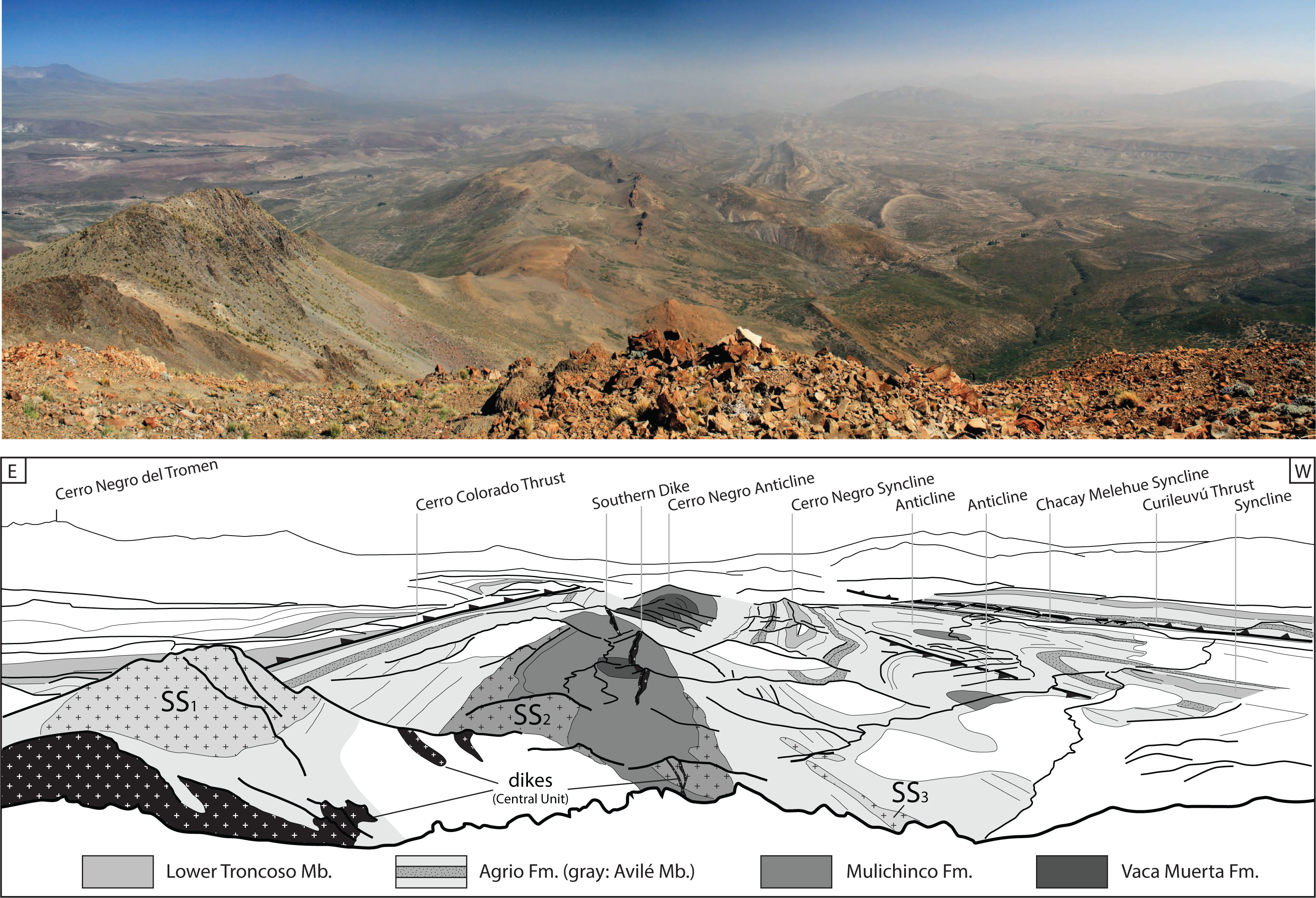
Photo 6: Overview of the southern part of the Cerro Negro intrusive complex and associated tectonic structures of the Chos Malal fold-and-thrust belt, looking S from the summit of Cerro Negro. The field of view is around 10 km in the central part of the image. Interpretation of the structures and magmatic conduits seen in the landscape (below).
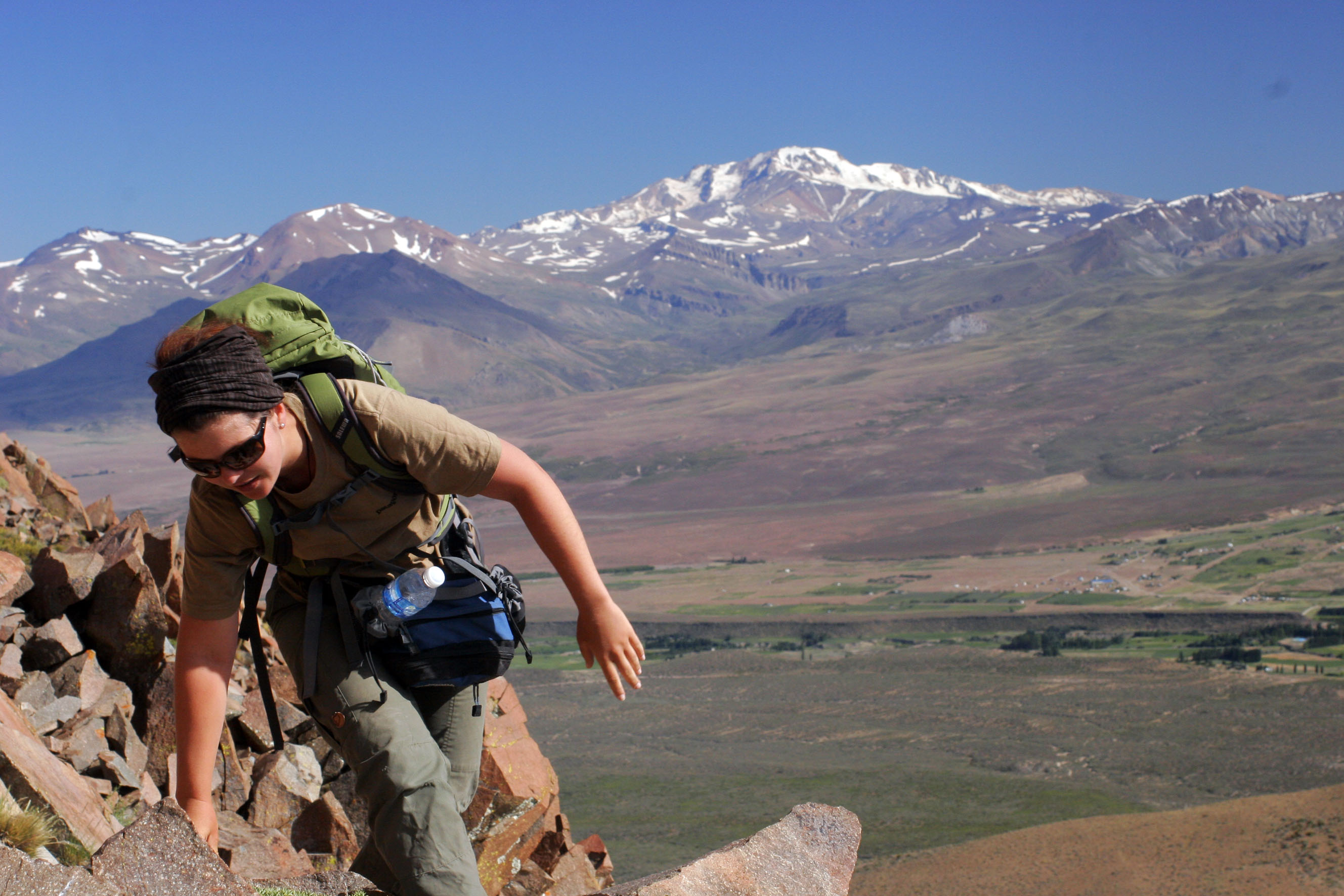
Photo 7: Derya on the way to the summit, with volcan Domuyo in the background. With a height of 4,709 m, it is the highest mountain in Patagonia and therefore often called the “Roof of Patagonia”.
Mapping is accompanied by the ever-blowing and whistling Patagonian wind, and the associated lenticular clouds (Altocumulus lenticularis) crowing the tops of the high mountains around us. The compulsory mate tea break during lunchtime soon becomes a habit, while gigantic condors (the national animal of Argentina) circle above our heads.
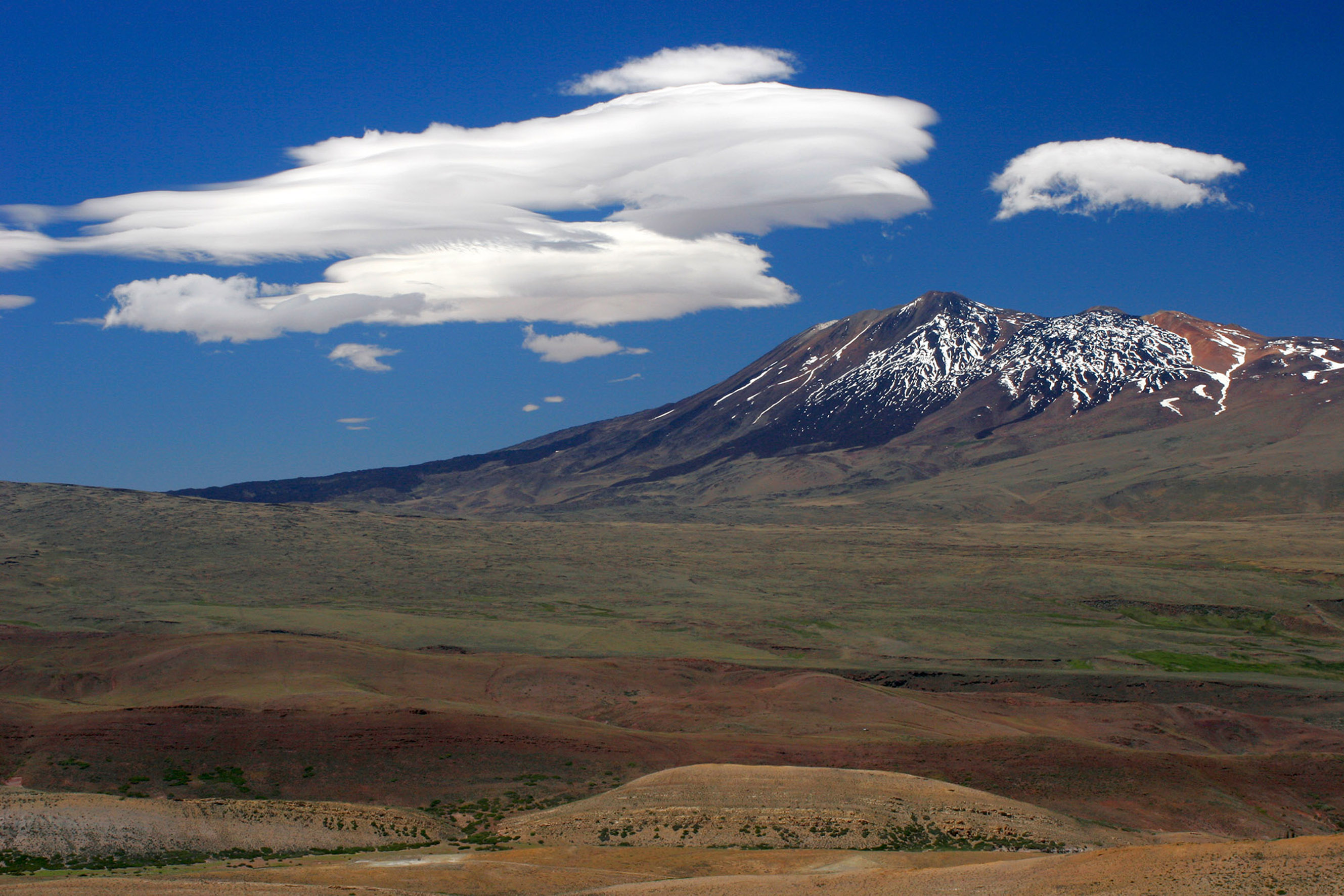
Photo 8: Tromen volcano (seen from Cerro Negro) with its typical lenticular hat
Springtime (“veranada”) is in full swing; the snow on the peaks has melted; the livestock is moving further up the mountains – which means our around 1 hour-drive in and out of the field area is regularly accompanied by livestock traffic jams. It also means that our time is coming to an end. The 90 kilograms of andesitic material sampled from dikes and sills are about to go on a long trip – destination: the geochronology laboratory in Oslo.
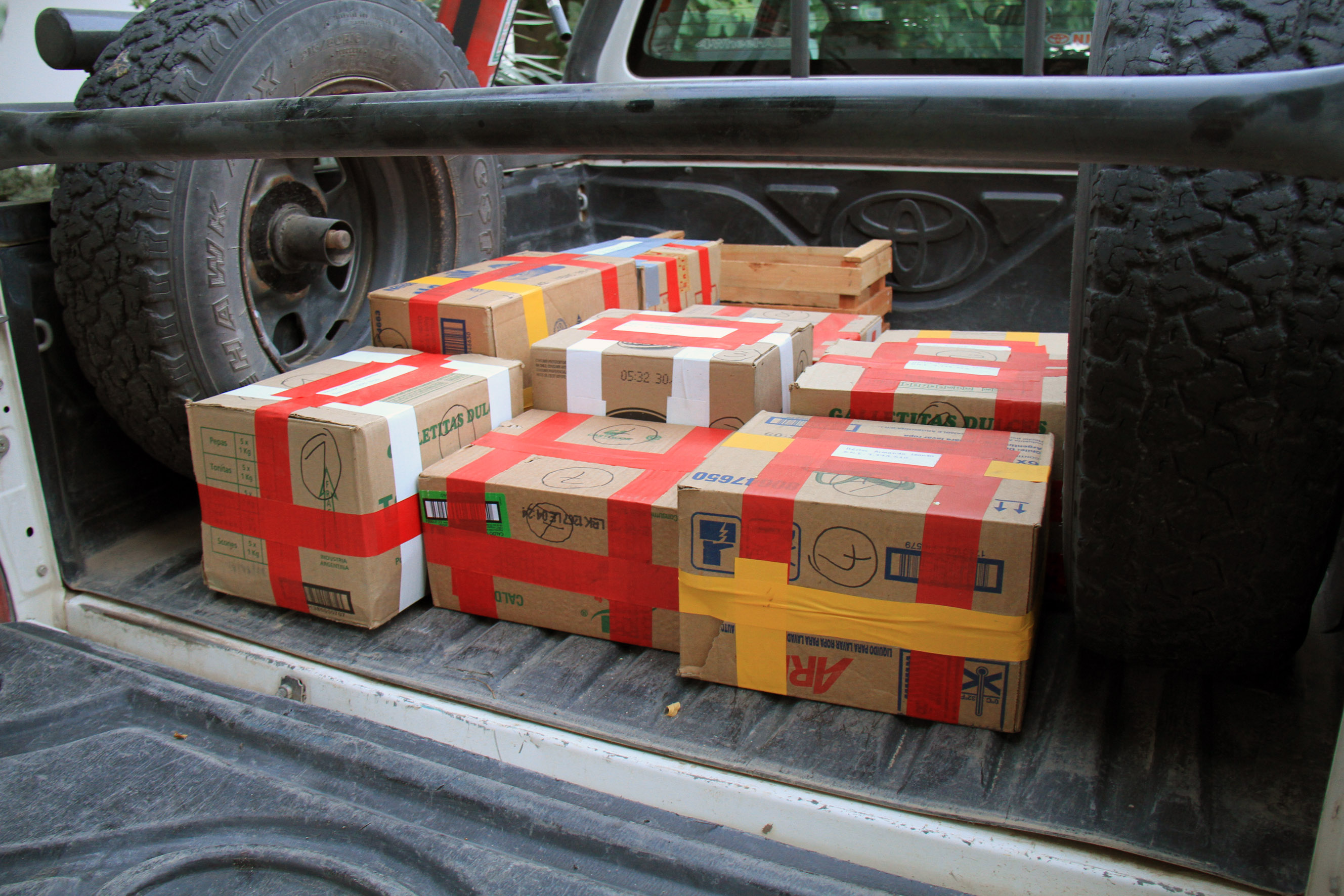
Photo 9: Andesitic souvenirs ready to be shipped to the laboratory in Norway.
This is where the nitty-gritty work on zircons will give us the key to the sequence of events that took place in the Chos Malal area in the Miocene. And finally we will use these to show how local stresses, such as outer-arc stretching at fold hinges, may be more effective for magma transport and emplacement than regional compressional stresses.
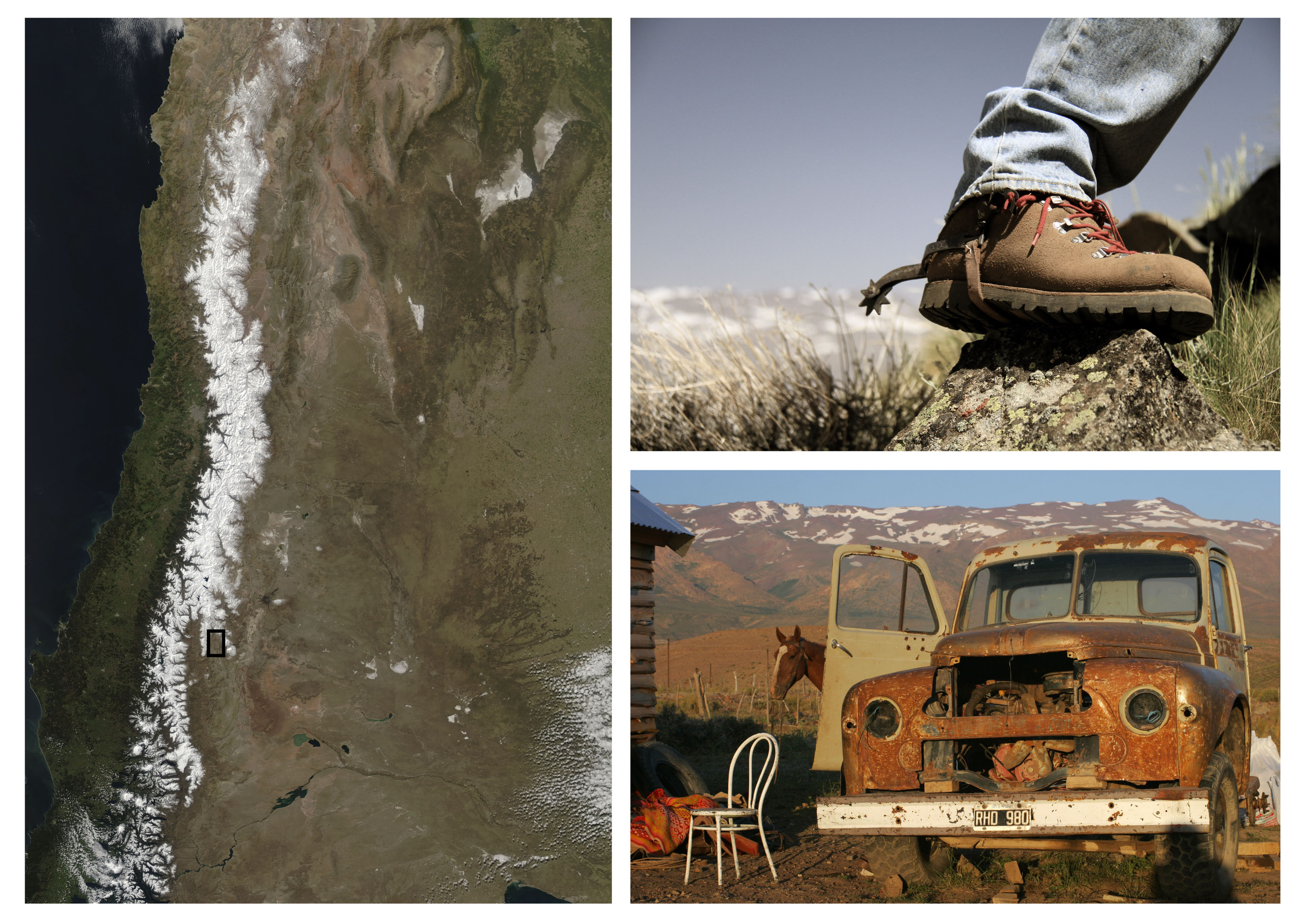
Photo 10 (credit for satellite image: The Moderate Resolution Imaging Spectroradiometer (MODIS) on NASA’s Aqua satellite acquired this image of the snowy Andes Mountains on September 12, 2015.)
The results of this project have resulted in the following publication:
- Gürer, O. Galland, Corfu F., H. A. Leanza, C. Sassier, 2015, Structure and evolution of volcanic plumbing systems in fold-and-thrust belts: A case study of the Cerro Negro de Tricao Malal, Neuquén Province, Argentina
![]() This work is licensed under a Creative Commons Attribution-NonCommercial-ShareAlike 4.0 International License.
This work is licensed under a Creative Commons Attribution-NonCommercial-ShareAlike 4.0 International License.