Scott Hassler works for the common good at The Wilderness Society, focusing renewable energy, climate adaptation, and wild land protection and restoration, primarily in the Western United States. He continues to research the environmental effects of extremely large meteorite impacts and teaches a bit at UC Berkeley. Possibly too many of his travels, geologic and otherwise, are detailed here.
A little background
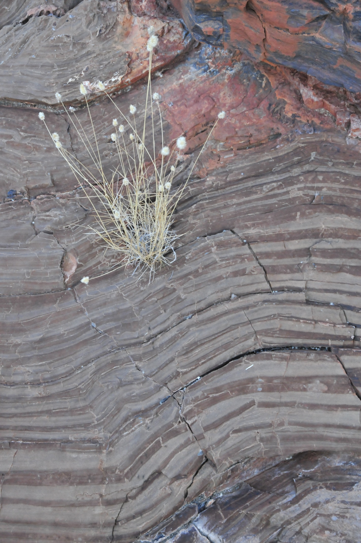
I’ve worked in the NeoArchean-Paleoproterozoic Hamersley Basin of Western Australia since 1985. On the first, exploratory trip to the Basin, we found a distinctive sedimentary layer in the upper Wittenoom Formation that contained lots of sand-sized spherical particles. Within a year, my colleague Bruce Simonson determined that the spherules were best interpreted as impact debris. When a km-scale asteroid hits the Earth, much of the impactor and the target area are vaporized. This material is ejected into the atmosphere, and probably into space around the earth. Somewhere in the process, the vapor condenses into spherical droplets that eventually rain back onto the Earth’ surface. This interpretation is well substantiated. There are numerous terrestrial processes that produce spherical particles, but the spherules don’t look like any of these. PGE and Cr isotope work also confirm an extraterrestrial component in the spherules.
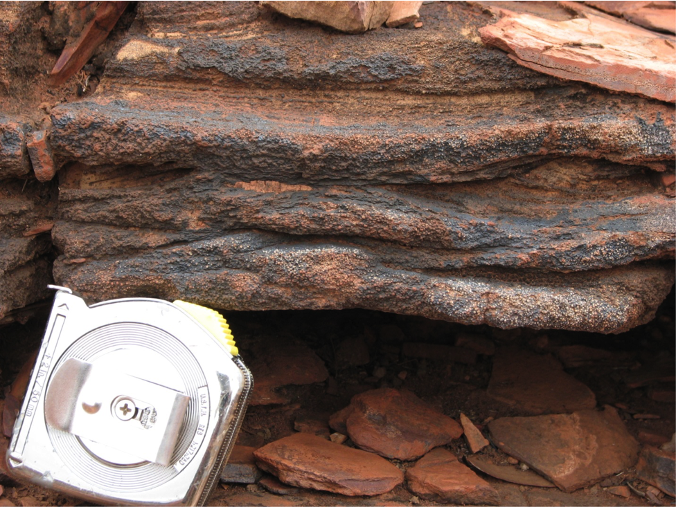
Close up of the base of the Wittenoom layer – the spherules are just above the tape measure.
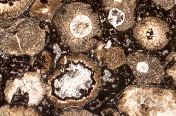
Photomicrograph of Wittenoom layer spherules
Since recognizing the Wittenoom layer, we’ve found three more spherule beds in the Hamersley Basin; a higher one in the Dales Gorge Member of the Brockman Iron Formation and a lower correlative pair in the Carawine Dolomite and Jeerinah Formation. Moreover, we’ve identified spherule layers correlative to all three impacts in the Griqualand West Basin of South Africa.
My focus in all of this work is sedimentology. Each impact hit an ocean target area which was likely thousands of km from Hamersley Basin and then deposited a fallout layer. Subsequently, tsunami generated by the impact arrived, eroded and then redeposited the fallout layers. The tsunami continued on, and struck relatively nearby land areas. Tsunami run-up and backwash triggered or contributed to subsequent turbidity currents, which again eroded the original layers and/or the tsunamigenic layers.
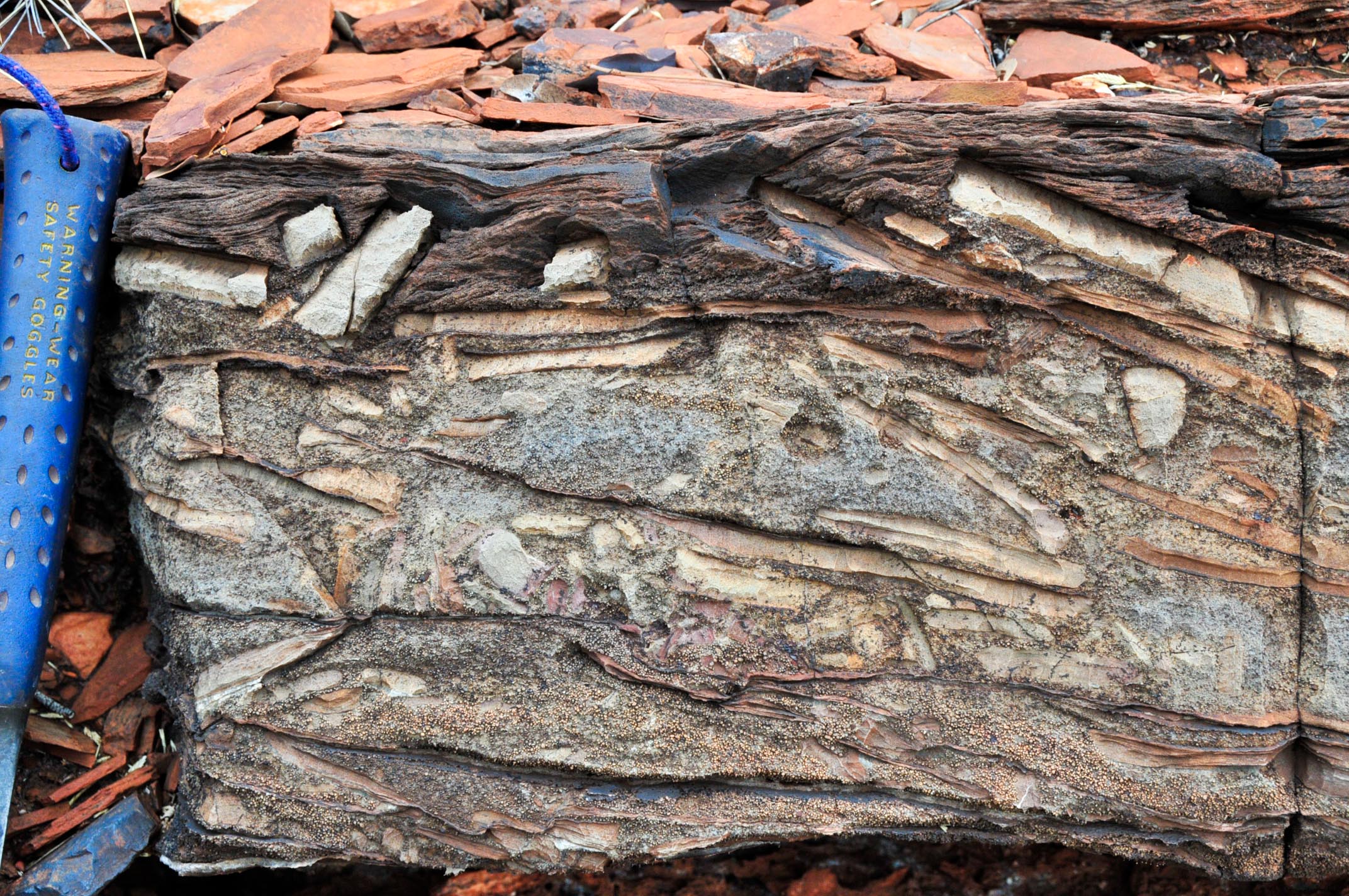
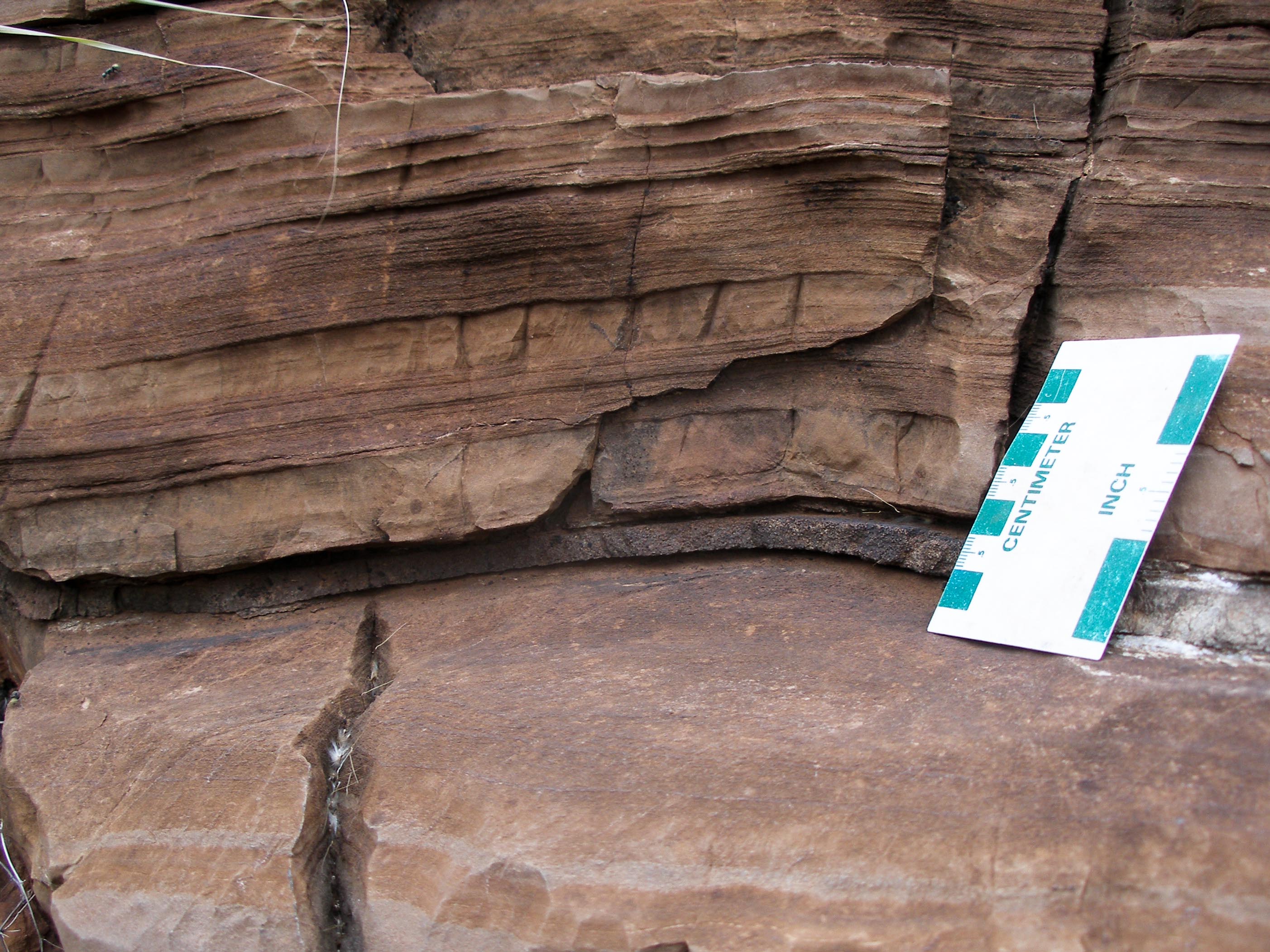
Outcrop of lower half of Wittenoom layer – note spherules at base, abundant intraclasts, and climbing ripples at top.
By the mid-2000s, we’d polished this work pretty well. However, for due to correlation issues and petrographic data, we’d begun to suspect that a fourth impact layer lurked in the lower Paraburdoo Member of the Wittenoom Formation. By 2009, I had time to search for this hypothetical layer.
June 26th, 2009
After a day of hiking and photography in Karijini National Park, my assistant Louis and I camped in an overflow area. This was tourist season; a nearby pair of banal late night conversations kept me awake. I woke up severely crabby and tired.
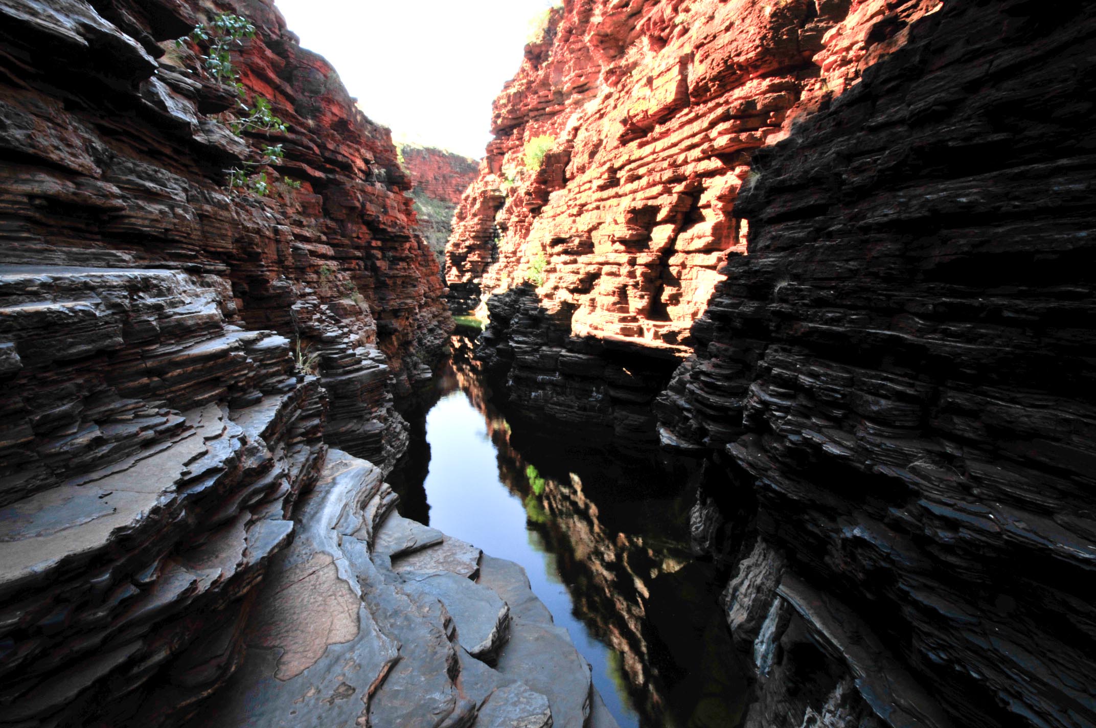
Karjini National Park, hiking amid the Brockman Iron Formation
However, it was time to go back to work. We drove south from Karijini, and reached the turnoff to the next target area, several kilometers down a bumpy dirt track. We parked. I had to sit in the truck for a minute to collect myself and try to focus. I figured the odds of finding the Pararburdoo layer were low. Moreover, the weather had degraded; rain clouds to the west. Anticipating a quick look and disappointment, I took just my field vest and hammer. To heck with the camera, water, and hat.
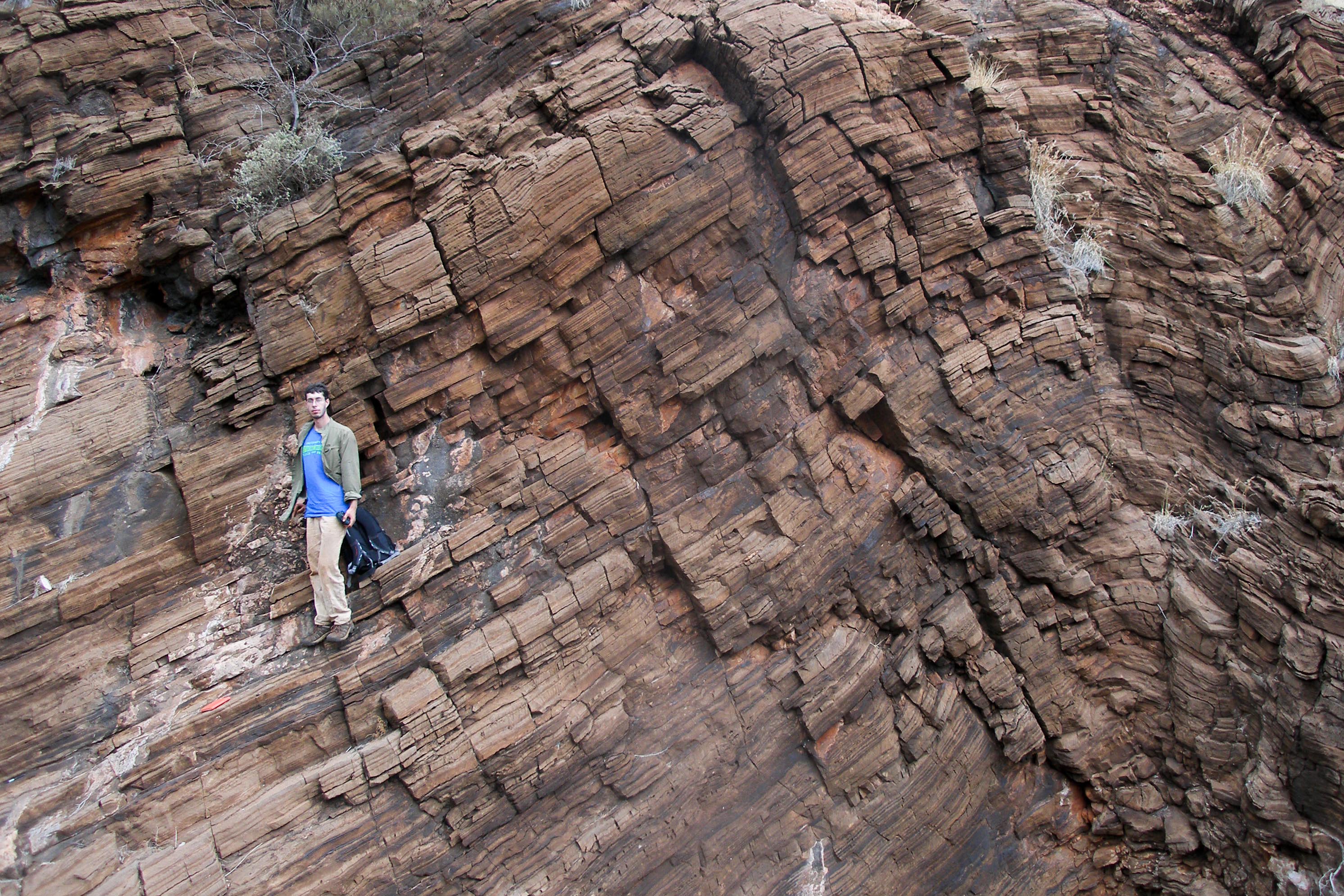
It’s hard to search in the Paraburdoo Member; lots and lots of thinly bedded dolomite. It often looks monotonous, especially when I lack motivation. This section was badly faulted and folded. I picked a drainage that looked like it had maximum depth of exposure. I dispatched Louis up the east side. I took the west.
Typical Paraburdoo Member outcrop
I wanted to sit and zone out. I was tired of spinifex and loose rocks. My back hurt. The outcrop was chopped by folds. I hammered on suspicious looking layers. They were all carbonate. This was annoying. I kicked a rock down the hill. I thought, I should keep going, at minimum I’m a role model. Another two meters of ribbon beds. I grabbed a dead cordwood tree and pulled myself up on a ledge. I looked down.
There was a thin gray layer at my feet. I thought to myself, no, it can’t be this easy. I pried a piece off of the outcrop. There they were. The little bed was pure spherules. Unbelievably, I’d found the *** thing. It began to rain.
The Paraburdoo spherule layer
Fatigue, what fatigue? I yelled for Louis. I traced the bed laterally. It ran about six meters before disappearing under debris and travertine. The rain let up a bit. What to do? It would be dusk in one hour. More rain was imminent and we did not want to be stuck down a potentially boggy track. Louis arrived. Crap, I didn’t bring my camera: we used his. So much for being a role model. Where the hell were we in the section? We measured a quick stratigraphic column up to a known marker layer. That took thirty minutes.
Back to the layer. We traced it laterally – no change in thickness or composition – a characterized the immediate stratigraphy. We needed spherule samples, and lots of them, quickly. I sent Louis to trace the bed around the hill to look for good outcrop. I found a good spot, and went at the outcrop with my hammer. The wind picked up; it looked very wet to the west. Dolomite is tough. I spent twenty minutes quarrying away the beds above and below the layer. In the end, I got about a fist-sized amount of sample.
Louis on the layer
Time to scoot. I stuffed samples, pens, notebook and camera in the pockets of my vest. I almost ran down the hill to the truck. Louis arrived a couple minutes later. I couldn’t see the hills to the west: too much rain. Driving a shade too fast, we made it back to the bitumen.
It was dusk and hard to see tracks that might lead to camping spots. I kept driving. I was tiring, makings it harder to stop. Finally, a decent turn off and an acceptable spot off the road. I could see rain bands all around us. We rigged to the side of the truck as a cooking shelter. It was great, except for the small termite mound that shared the space with us while we made dinner. The wind picked up. It blew an empty pot into my nose. Nice bruise.
Ten minutes later, the rain stopped. What a day. Another spherule layer! I slept under broken clouds. I was happy to see Venus at 5 am.
![]() This work is licensed under a Creative Commons Attribution-NonCommercial-ShareAlike 4.0 International License.
This work is licensed under a Creative Commons Attribution-NonCommercial-ShareAlike 4.0 International License.