Jake Lowenstern is currently the Project Chief for the Volcano Disaster Assistance Program. From 2002-2017, he served as Scientist-in-Charge of the Yellowstone Volcano Observatory. To study the interaction of magmas and their overlying hydrothermal systems, he applies techniques ranging from gas and and isotope geochemistry to igneous petrology to U-Th-Pb geochronology. A 1986 graduate of Dartmouth College, he spent the following year on a Fulbright fellowship to Catania Sicily (Italy). He later earned an M.S. and Ph.D. at Stanford University, finishing in 1992. He spent a year as a researcher at the Geological Survey of Japan (Tsukuba) in 1993. Since then, he has worked for the USGS in Menlo Park, CA. In 2000, he received the Lindgren Award from the Society of Economic Geologists and in 2006 was an AAPG Distinguished Lecturer. He was elected a fellow of the Geological Society of America in 2011.
Until last Fall, I served as the Scientist-in-Charge of the Yellowstone Volcano Observatory, which involved lots of coordination between my organization, the USGS, and observatory partners at universities, state geological surveys, and other organizations. My job required interaction with scientists covering multi-disciplinary topics including seismology, geology, and hydrology. Anyone familiar with the topic of the “Yellowstone Volcano,” knows that the job requires considerable public outreach to provide a summary of geologic/volcanic activity at Yellowstone. This is especially challenging at Yellowstone because an army of Yellowstone followers creates volumes of daily blogs and vlogs interpreting the latest wiggles of the seismic records. Much of their interpretations are inaccurate, misguided, or even intentionally misleading, creating additional complications for those whose job is to provide official warnings and updates to the public and local officials.
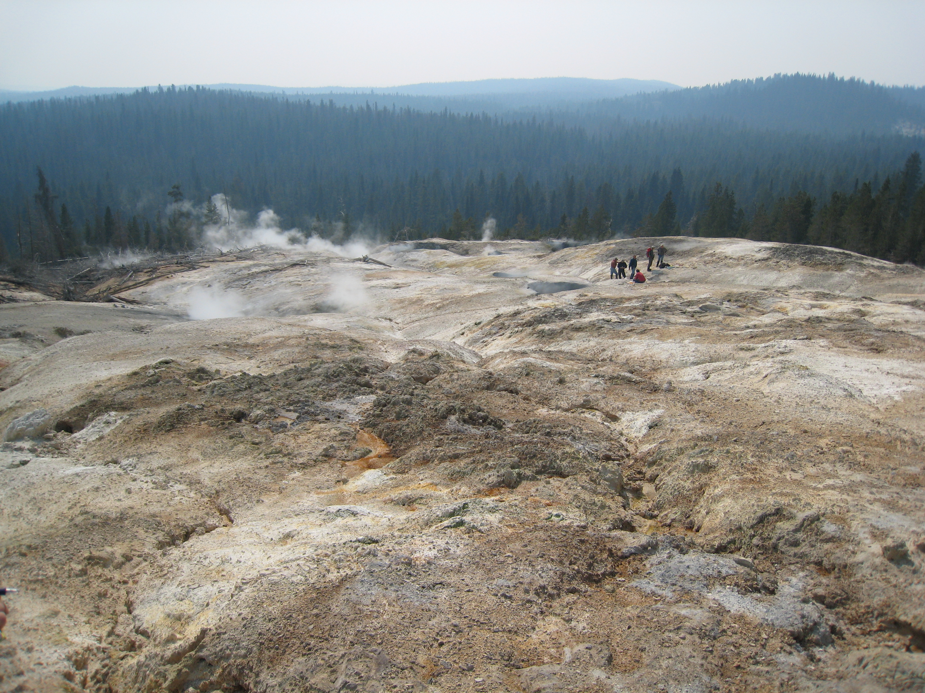
Geochemists explore Washburn Hot Springs. Photo by Cindy Werner, USGS.
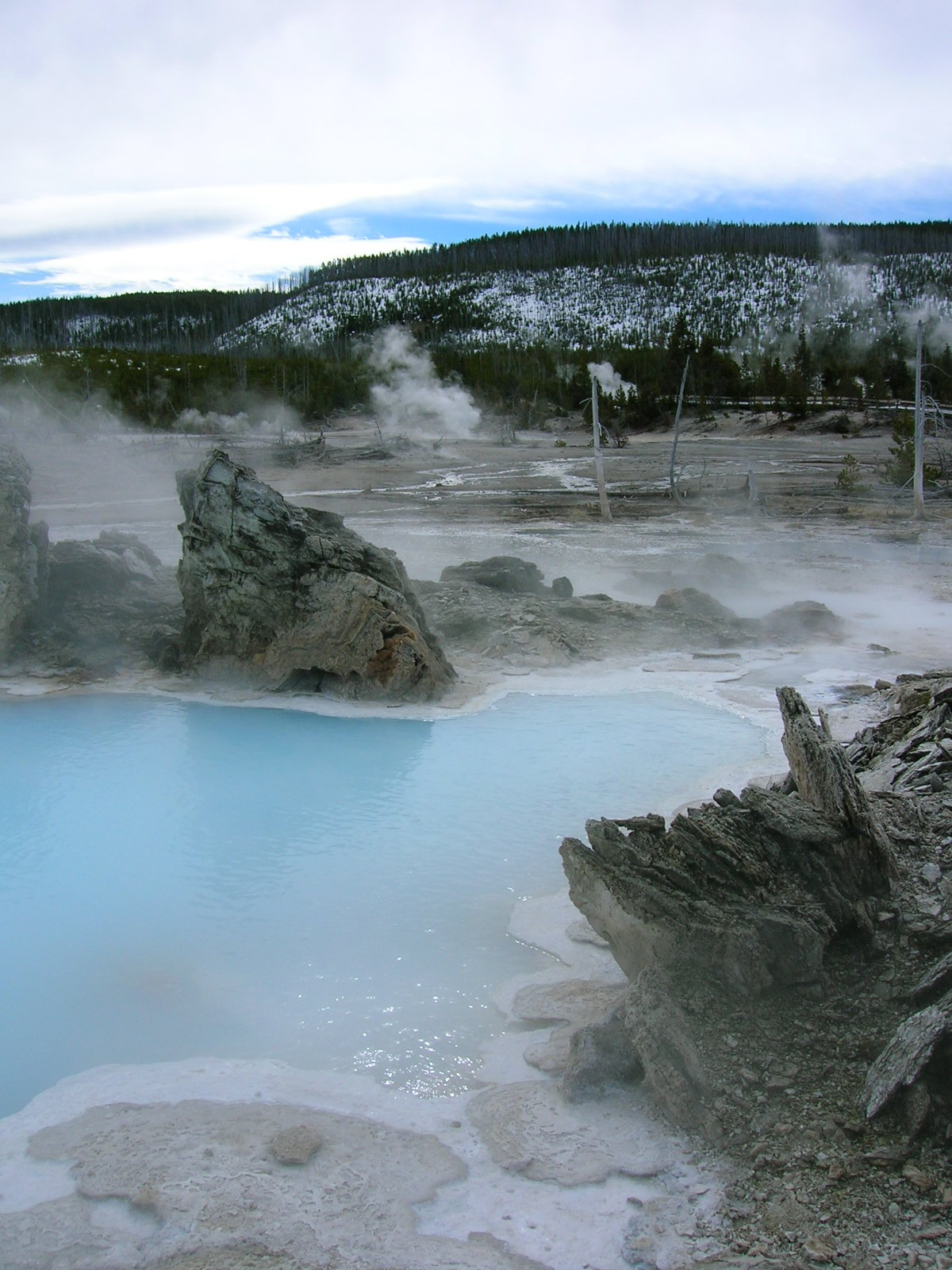
Porkchop Geyser, Norris Geyser Basin. Photo by Jake Lowenstern, USGS.
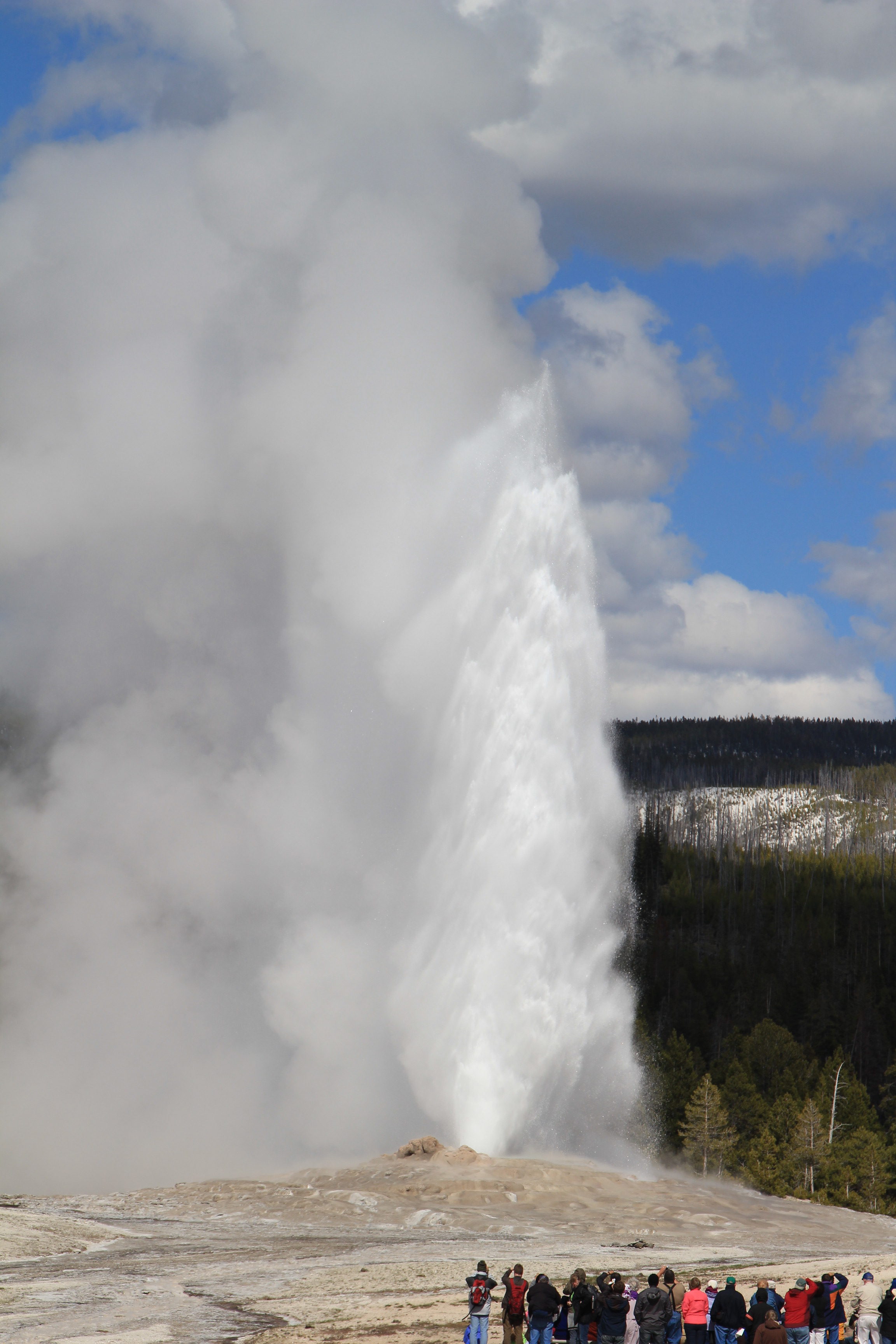
Old Faithful, in Yellowstone’s Upper Geyser Basin. Photo by Jake Lowenstern, USGS.
Geochemistry research: Another part of my job at Yellowstone was as a research scientist, to study the gases and waters that emerge from the world-famous geothermal system. Those gases reflect a range of fluid sources and processes that take place between the surface and underlying magmatic system: magma rising from the mantle, heat driving metamorphism of crustal rocks, sediments reacting with migrating fluids, and infiltration of surface water with its atmosphere-derived gases. Our task as scientists is to interpret how these gases and waters reflect what’s happening beneath the surface, to provide a record of “background” fluxes and chemistry of the geothermal system, and to tease out information about the magma system through study of the geothermal volatiles.
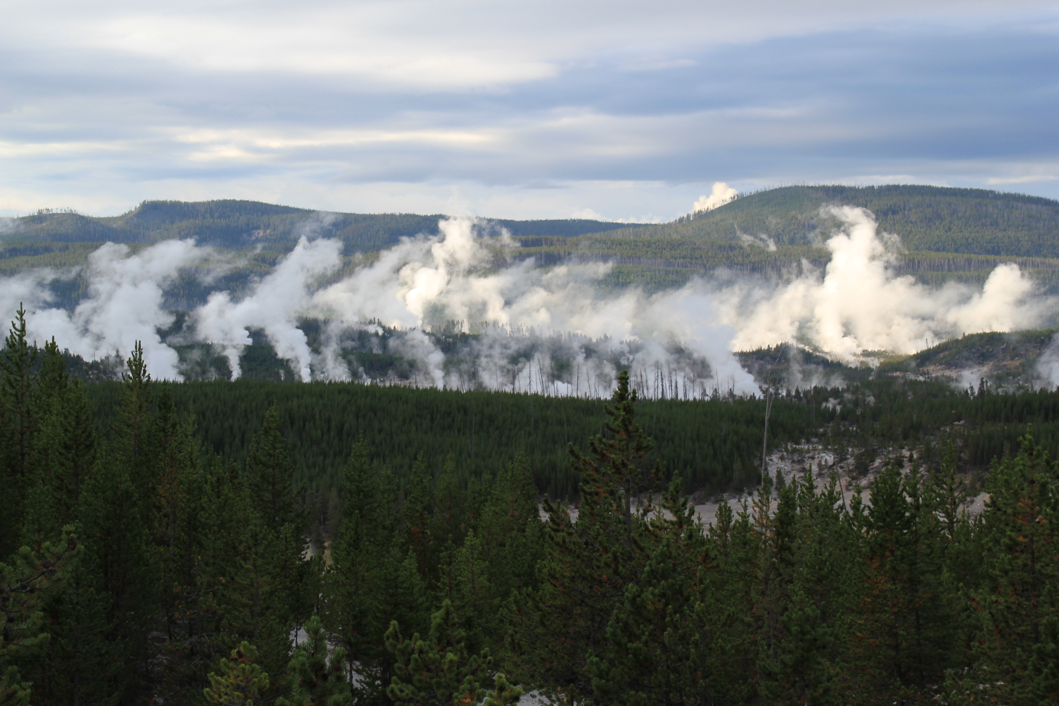
Yellowstone has an estimated 10,000 thermal features spread out over about 85 distinct thermal areas, some of which are over 25 km from the nearest road. The park is enormous, with ~9000 km2 of terrain— only about 0.6% of which is defined as geothermal— so it’s not a simple task to get a representative sampling of the park’s geothermal features.
To undertake this research, my colleague Deb Bergfeld and I explored a considerable fraction of the Yellowstone backcountry, as well as dozens of thermal areas that line the park’s roads. We worked out of the USGS office in Menlo Park, California, so each year we’d pack the truck for the 1000-mile drive out to northwest Wyoming. Between 2003 and 2015, we planned an annual fall excursion to visit a series of thermal features around the park. Occasionally we’d revisit old favorites to provide an understanding of temporal variability of gas compositions at springs and fumaroles (steam vents). More often, we’d seek out new areas to explore. Usually, we’d plan our work with other USGS researchers, with student assistants, or with university colleagues who collaborated on some aspect of our work. Some years we organized expeditions with as many as eight people, and other years we’d be slimmed down to two or three.
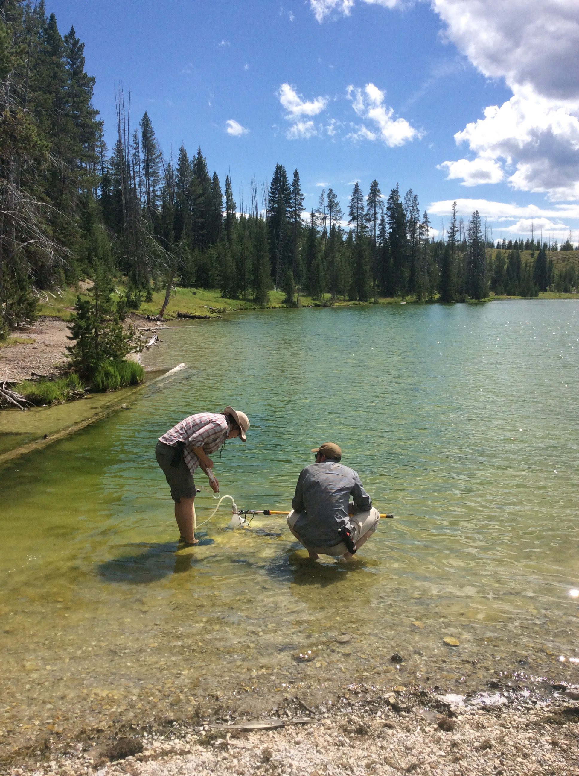
Laura Clor and Jonathan King sample gas bubbles at Fern Lake. Photo by Jake Lowenstern, USGS.
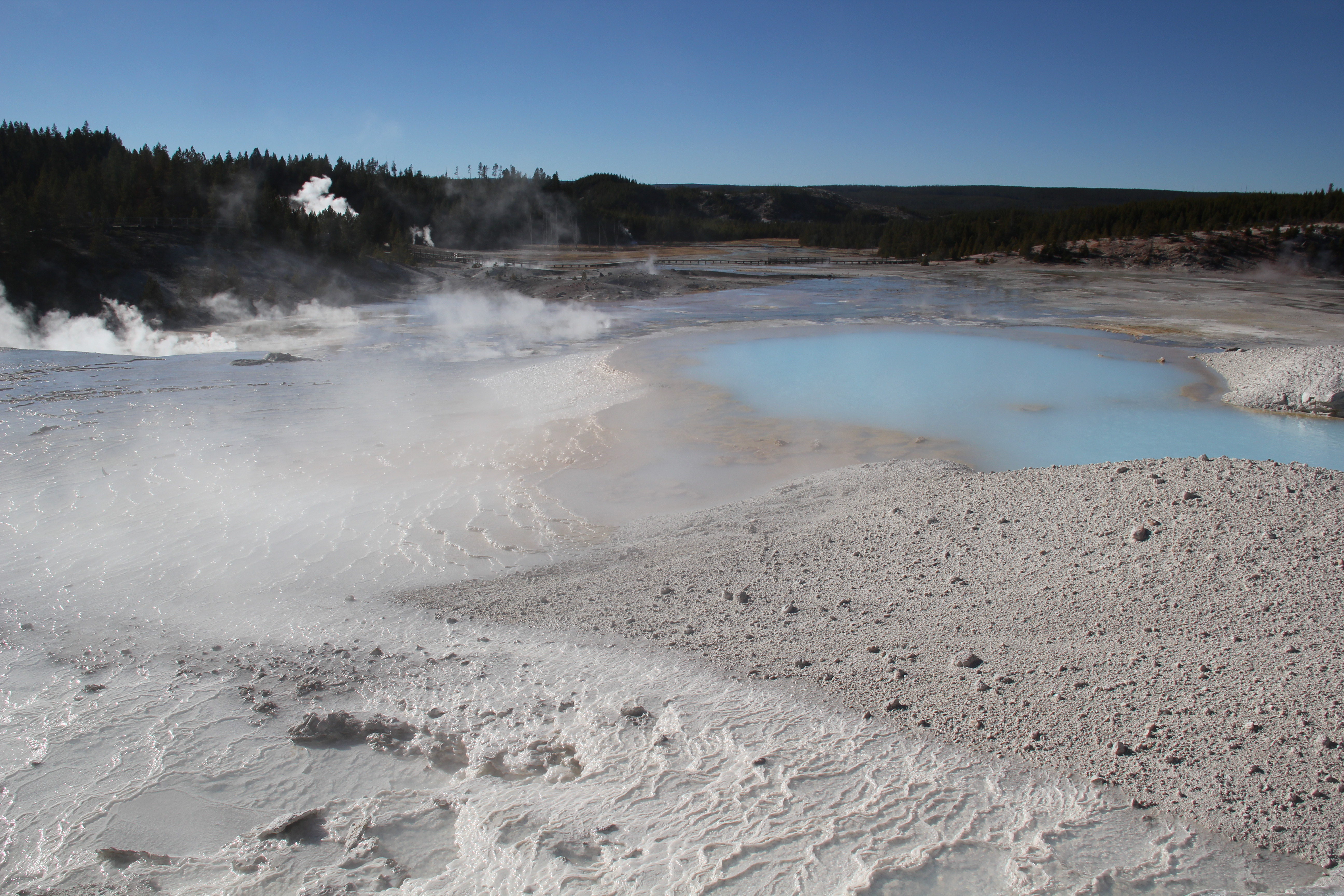
Fresh silica terraces form in the outflow of a pool on Porcelain Terrace at the Norris Geyser Basin. Photo by Jake Lowenstern, USGS.
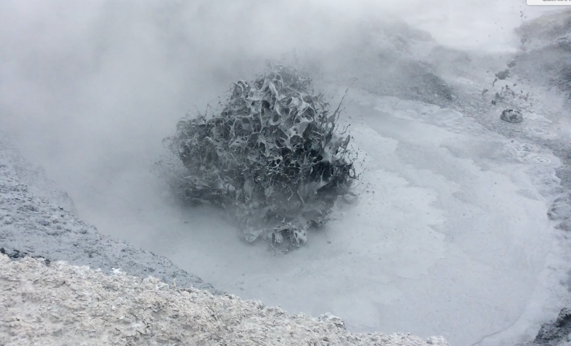
Mudpot near Pelican Creek. Photo by Jake Lowenstern, USGS.
Camping: On a typical trip, we’d arrange for a “drop camp,” where horses and mules (and on one occasion, a boat) would transport our gear into a backcountry campsite that we’d use as a base of operations. We’d arrange for 6 to 10 mules to carry our 300-400 kg of gear. Besides our food and camping equipment, the outfitters would transport sampling equipment (gas bottles, tubing, meters, and solutions), a gaging rod, and flux meters and accumulation chambers used to estimate gas emissions from the ground. We needed batteries, computers, solar panels, and other materials to keep us productive for up to six days. The outfitters would meet us on the first day and would migrate all our equipment into panniers, Pelican cases, Action Packers, and other creative means for strapping gear onto a mule. Typically, we’d walk to the site, anywhere from 7 to 16 miles from the trailhead, and find our gear waiting for us at the backcountry campsite. A typical Yellowstone campsite contains a fire ring, an outhouse, and one or more horizontal “bear” poles for hanging food. Each day we’d wake at dawn, eat a quick breakfast, and hike for up to two hours to reach our worksite. If we were lucky, we’d be back to camp in time to cook dinner, and re-hang the food before it got too dark to see. When we collected waters during the day, we’d usually have to do a “campsite titration” to determine alkalinity (dissolved bicarbonate). Almost always this wouldn’t happen until after dark, requiring us to use headlamps to read our notebooks and operate the equipment. Finally, at the end of the trip, the pack train would return to transport our gear back to the trailhead and our vehicles.
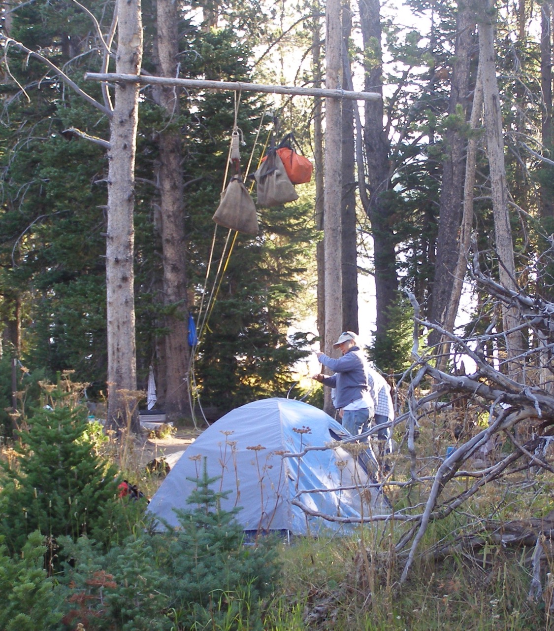
Campsite at Heart Lake. Photo by Shaul Hurwitz, USGS.
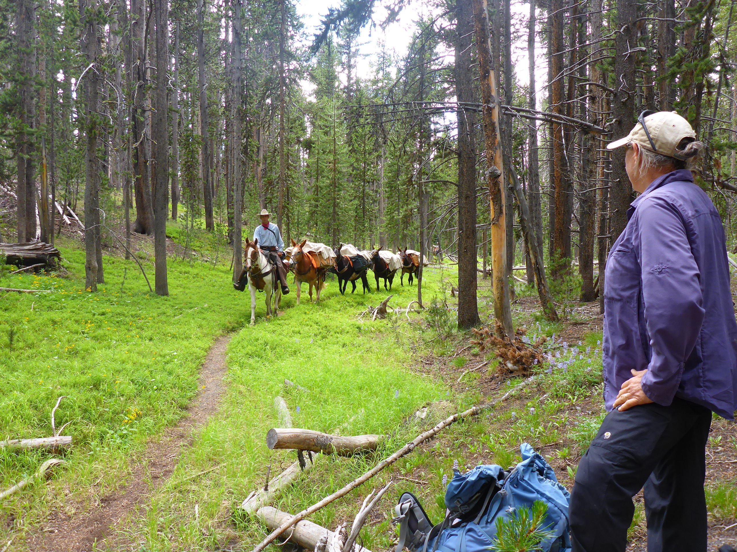
The pack train passes us on the Wapiti Lake Trail on our way to the campsite. Photo by Jake Lowenstern, USGS.
Nature: What can I say about Yellowstone that hasn’t been already said? Yellowstone is different in so many ways. It’s a high plateau full of broad meadows, swamps, forested glens, acid barrens, and sweetly flowing streams. There are animals everywhere. It’s hard to spend a day on the trail without spotting an elk, a bison, or a coyote. Less frequent but still common are bears, wolves, moose, pronghorn, badger, skunk, porcupine, snakes, and many others. Every day provides an interesting insect, frog, or bird to observe. Of course, there is also an incredible diversity of thermal features to visit, with ranges of temperatures, acidity, chemistry, and local geology that create infinite variations.
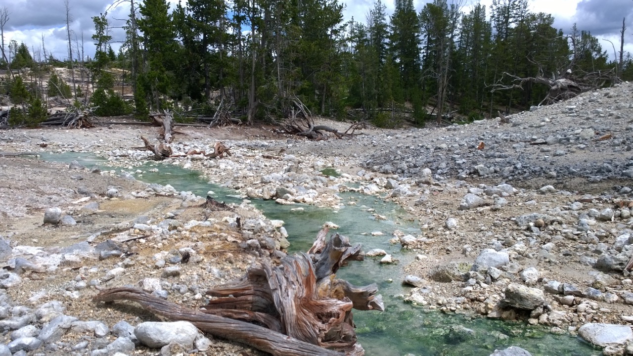
Photosynthetic thermophile lifeforms impart a green shade to this streambed at the West Astringent Creek thermal area. Photo by Jake Lowenstern, USGS.
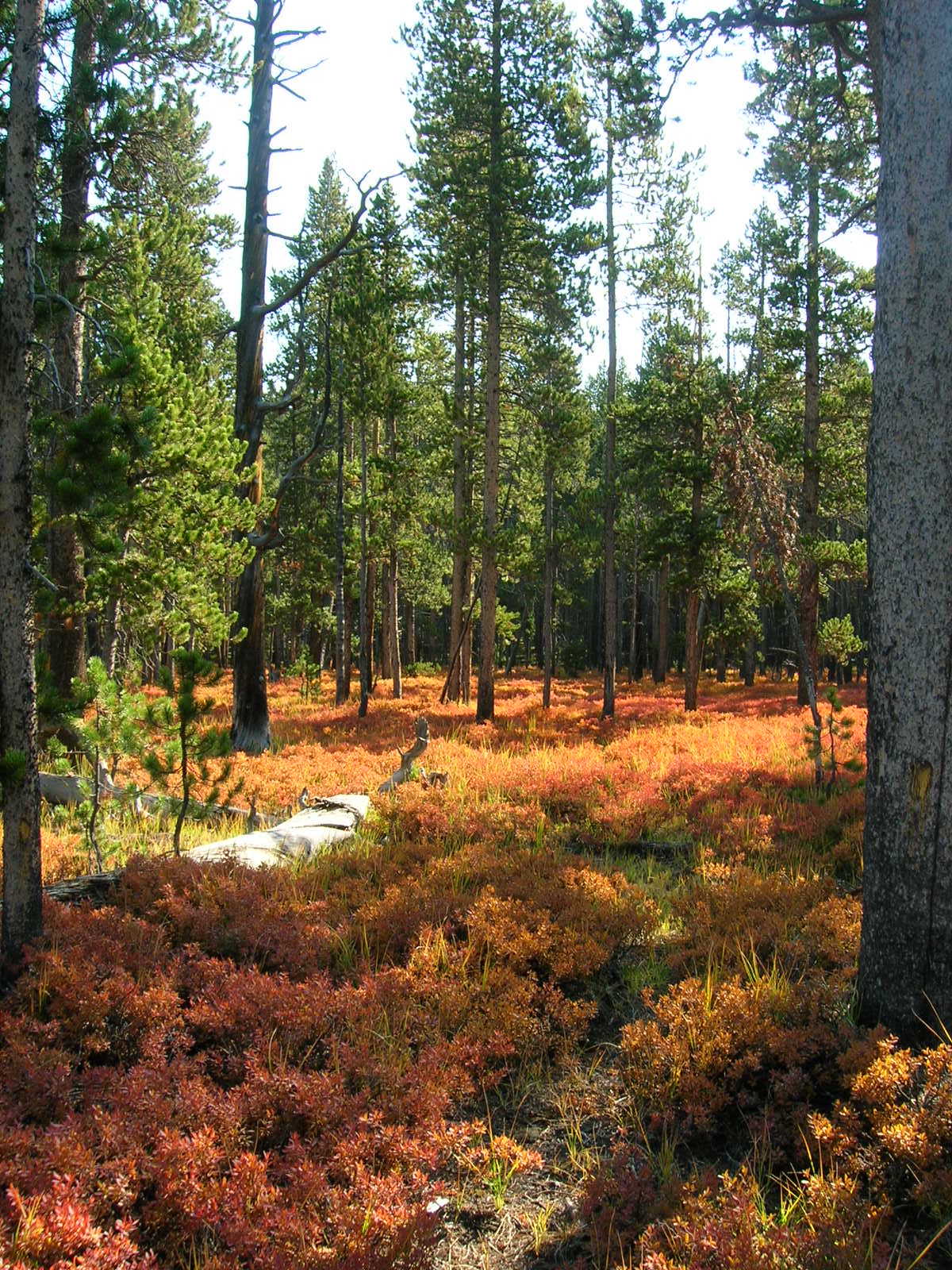
The ground cover at Forest Springs turns color in early fall. Photo by Jake Lowenstern, USGS.
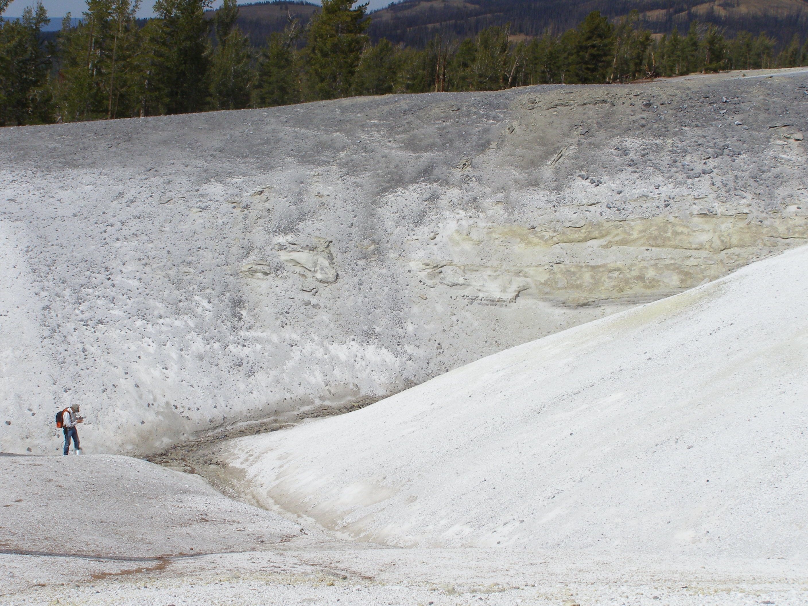
Favorite Places: Each trip was so distinct. Shoshone Geyser Basin is reminiscent of the Upper and Lower Geyser Basins (where Old Faithful resides), with numerous geysers and castles of silica sinter. Hot Springs Basin is an enormous, remote wasteland of acid soils and muddy flats. Glen Africa Basin is an unexpected garden of flower-lined hot springs rushing out of the base of the Central Plateau lavas. Brimstone Basin is a broad expanse of cold, gassy soil; the remnants of hot ground in earlier times. The eastern part of Yellowstone hosts a whole series of remote locations with fun surprises: West Astringent Creek, Mushpots, Broad Creek, Pelican Creek, and Josephs Coats. Turbid Lake is a relatively accessible site and the location of a giant hydrothermal crater formed by a steam explosion around 10,000 years ago. Washburn Hot Springs looks like many other acid sulfate regions at Yellowstone but is rich in gases like ammonia and methane from the breakdown of organic material in buried sedimentary rocks.
Hot pools along Shoshone Creek in the Shoshone Geyser Basin. Photo by Jake Lowenstern, USGS.

Flowers carpet the ground along Upper Alum Creek, Glen Africa Basin. Photo by William Snow.
Dried sulfur flows (black) cover the acid-altered terrain of the Brimstone Basin. Photo by Jake Lowenstern, USGS.
Safety: Although backcountry trips have the potential of being interrupted by accidents, fortunately, I can state that no one in our group ever suffered anything worse than a twisted ankle. In thermal areas, we exercise extreme caution and require that members of our group always wear long pants, leather hiking boots, and knee-high waterproof gaiters. The latter prevent infiltration of boiling water down into the sock if you break through the surface and sink into searing mud and water. People can end up with serious burns if they don’t take this simple precaution. A safety plan is part of the normal process to obtain a research permit from the National Park Service. Anyone seeking to collect samples or do science at Yellowstone submits a proposal that undergoes peer-review and oversight from the park research committee. It’s an important step to protect fragile park resources and to ensure the safety of visitors to the Yellowstone backcountry.
One continuing frustration was that despite our careful planning, sometimes nature wasn’t obliging. Forest fires and aggressive bears interfered with our plans on multiple occasions. Twice we had to cancel trips to Highland Hot Springs due to aggressive bears frequenting the trails in that region. In 2012 we reached our goal but had to approach the area from the west, which required many more miles of driving (and cost) to get the mules to the trailhead.
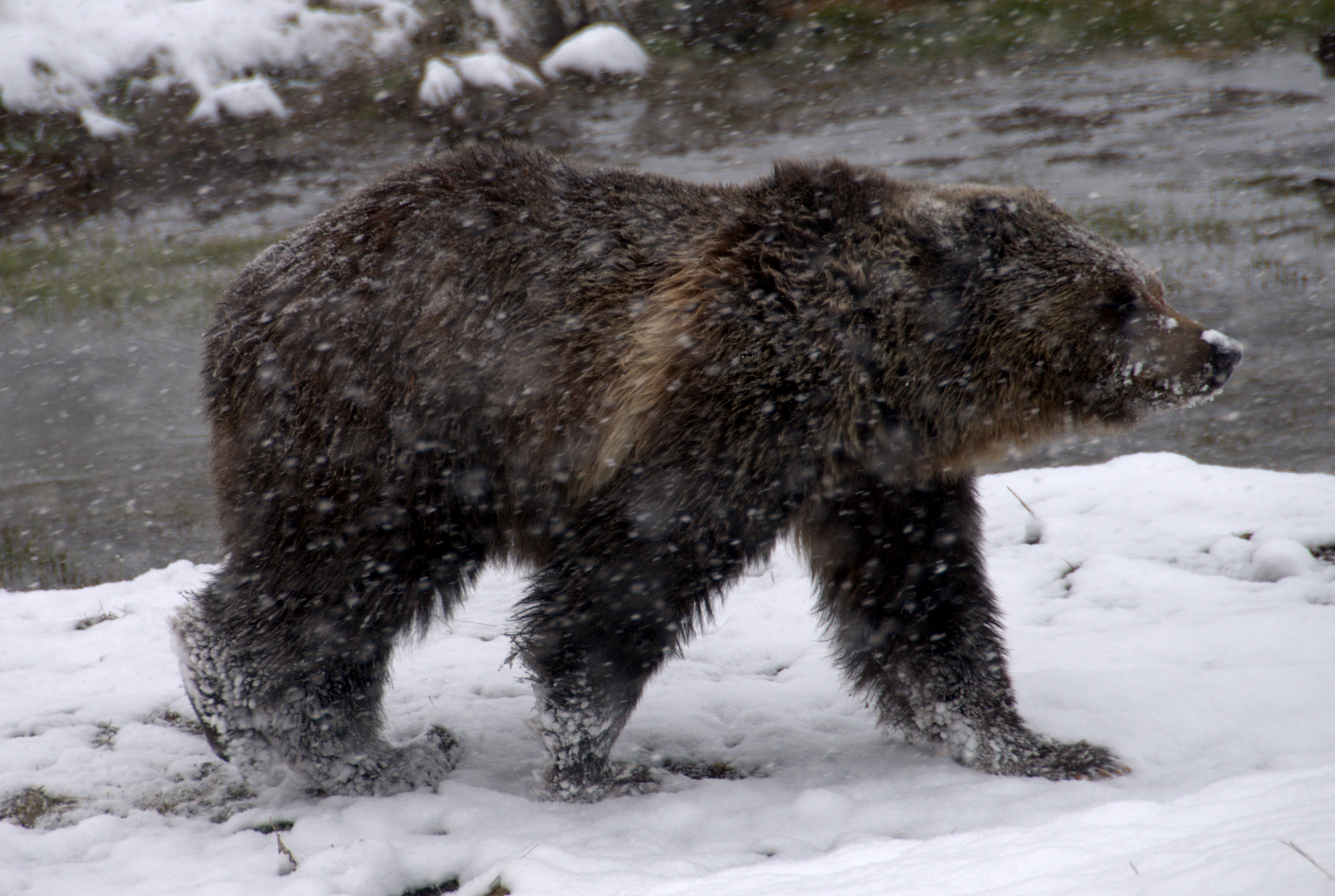
A grizzly bear strolls through a spring snow flurry. Photo by Heather Bleick, USGS.
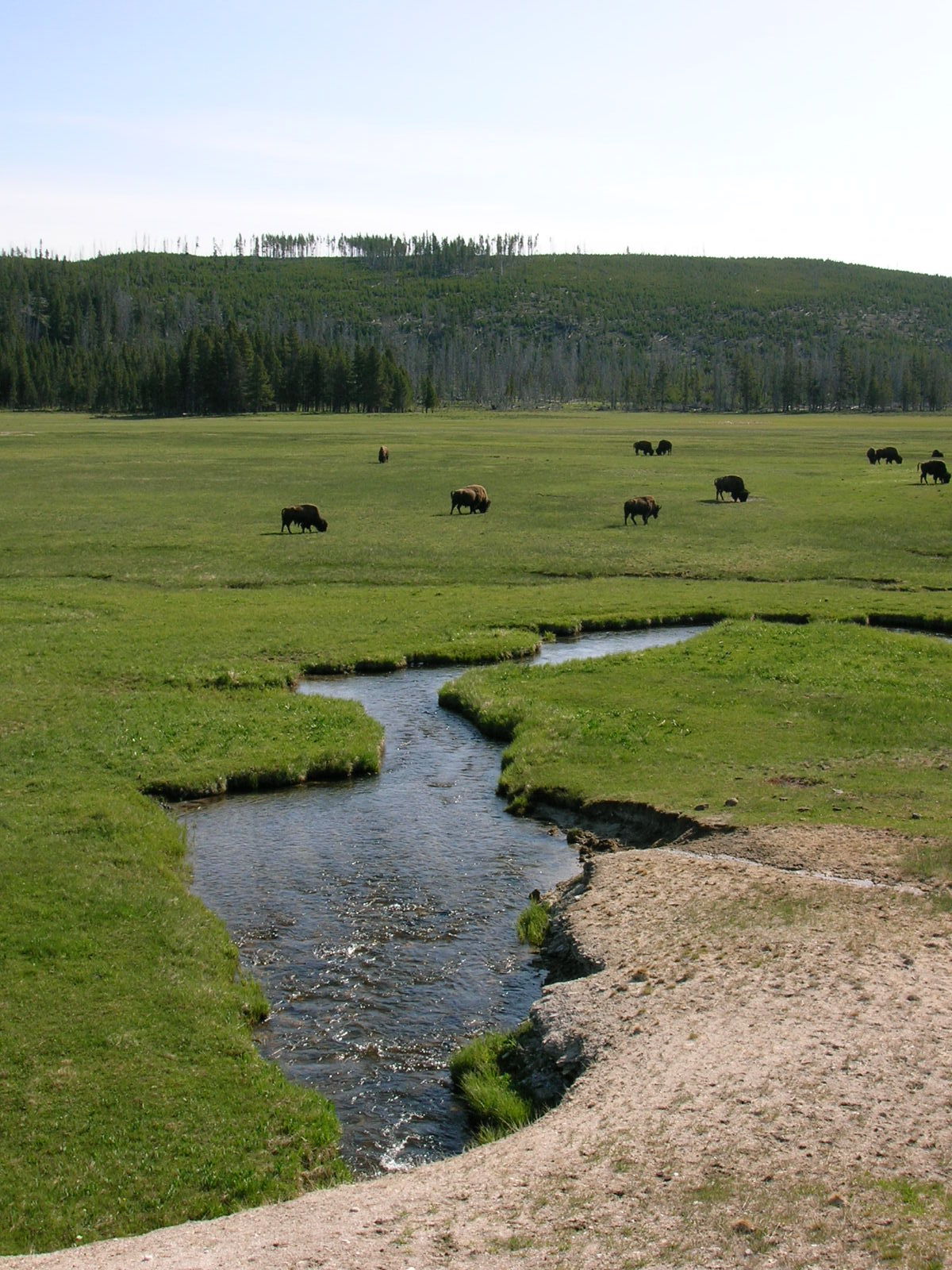
Bison graze in Yellowstone’s Lower Geyser Basin. Photo by Jake Lowenstern, USGS.
Weather: For the most part, August and September provide plenty of warm, clear weather that is outstanding for exploration and enlightenment. Nevertheless, we probably experienced every kind of weather possible during our trips across the park. We camped in the snow at Smokejumper Hot Springs, hiked through a hail storm at Amphitheater Springs, baked in the hot sun at Hot Springs Basin, and walked hours in the rain at… well, a lot of places. One year we hiked into Yellowstone Lake’s Southeast Arm, but our gear carried in by boat, couldn’t reach the campsite due to windy weather, whitecaps, and resulting perilous conditions on the lake. Park hydrologist Dan Mahony waited out the weather in a nearby cove until the weather cleared enough for him to bring us our gear. For a few hours, we were wondering if we’d have to sleep without our tents and sleeping bags!
Fresh snow in northern Yellowstone. Photo by Jake Lowenstern, USGS.
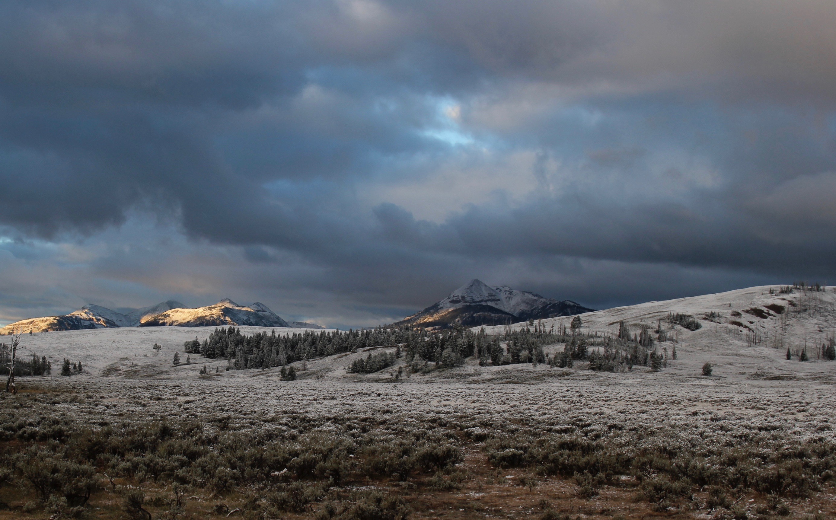
The Gallatin Range towers above Norris Geyser Basin. Photo by Jake Lowenstern, USGS.
Lessons learned: So, what have we learned? Over the past 15 years, we’ve published about 15 journal articles on our findings. We’ve estimated the heat output from Yellowstone with our colleagues Greg Vaughan and Shaul Hurwitz. We’ve written about the river chemistry with Blaine McCleskey. Bill Evans and John King explored the geologic record as recorded in tree rings, and Jen Lewicki and Peter Kelly are now using new technologies to look at variations in gas output and chemistry as a function of time. Deb and I focused mostly on the chemistry and isotopic characteristic of the gases. We’ve observed that all gases at Yellowstone reflect mixing of magmatic, crustal and atmospheric sources, and that each gas species may be derived from a different source. That is, most argon and nitrogen are coming from atmosphere dissolved in recharging groundwater. Carbon dioxide is dominantly coming from the mantle, and methane is created as sediments are heated and metamorphosed. Helium can be sourced from the mantle, as at Mud Volcano, which reflects a hotspot signature. Or radiogenic helium can form by the long-term breakdown of uranium and thorium in the earth’s crust, creating alpha particles (essentially, a helium atom). Because Yellowstone is underlain by old Archean basement rocks, and because the region has been geologically inactive for almost three billion years, a tremendous amount of radiogenic helium built up over time, and was stored in the cold ancient rocks. When Yellowstone volcanism started up two million years ago, the rocks were fractured, metamorphosed, and melted, releasing long-stored helium and other gases, a process that continues today.
Early morning steam at the Norris Geyser Basin. Photo by Jake Lowenstern, USGS.
Bill Evans takes notes. Brimstone Basin. Photo by Deb Bergfeld, USGS.
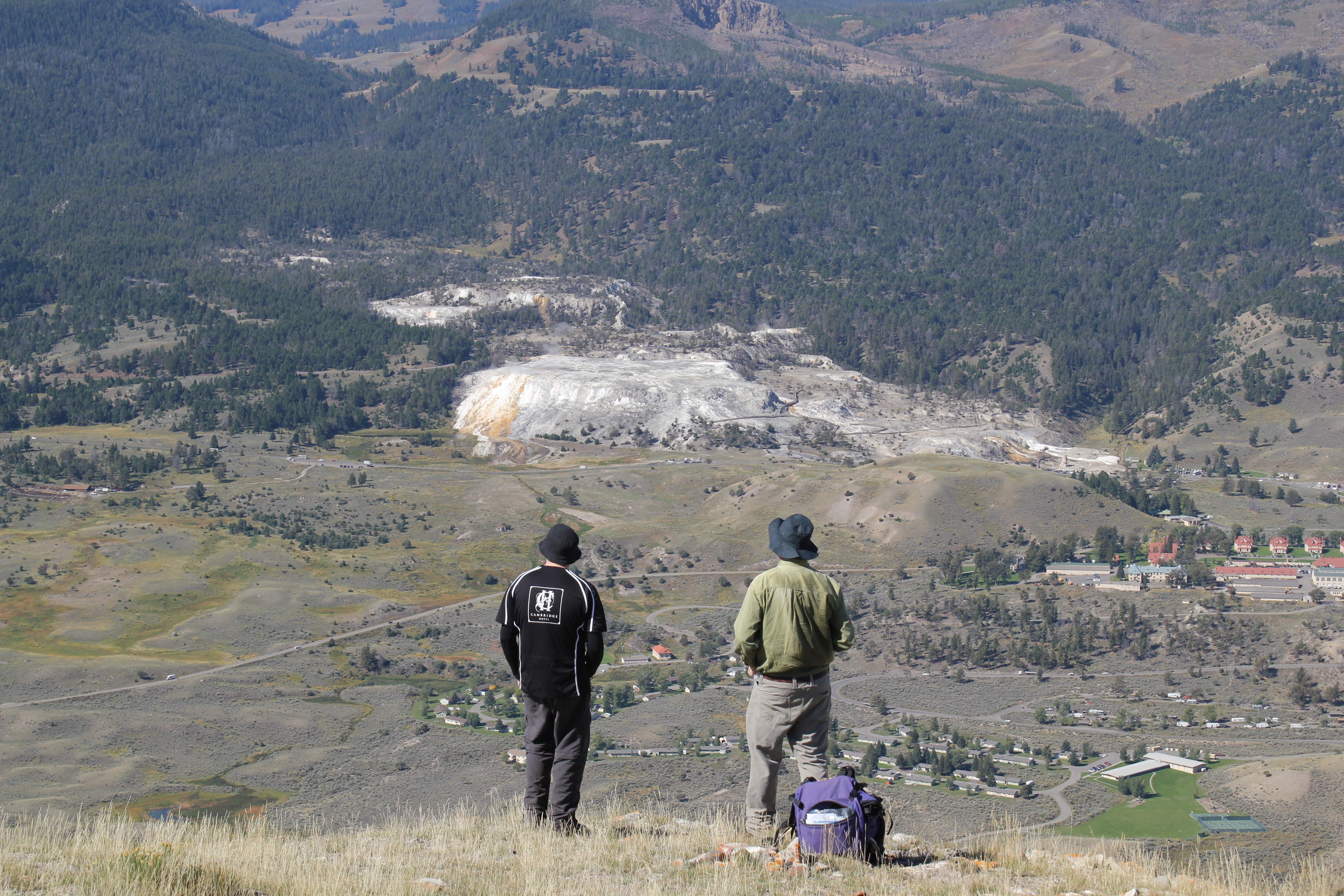
Eliot Swallow and Colin Wilson contemplate Mammoth Hot Springs from the top of Mount Everts. Photo by Jake Lowenstern, USGS.
All in all, we’ve learned a lot, and it’s been tremendously rewarding. Yellowstone is one of the world’s most charismatic terrains, and we feel fortunate to have been able to work there and shed a little light on its fascinating history, and dynamic current activity.
Note: All our work was conducted under Yellowstone National Park Research Permit YELL-05406.
Further Reading:
Articles and videos about the Yellowstone Volcano
http://www.geotimes.org/june05/feature_supervolcano.html
https://www.youtube.com/watch?v=gNdMZ6CGKm8
https://www.youtube.com/watch?v=-GRJK0k1sBw&t=300s
Non-technical articles and videos about our Research
https://volcanoes.usgs.gov/volcanoes/yellowstone/yellowstone_monitoring_96.html
https://volcanoes.usgs.gov/volcanoes/yellowstone/yellowstone_monitoring_110.html
https://volcanoes.usgs.gov/volcanoes/yellowstone/monitoring_gas_quakes.html
https://www.youtube.com/watch?v=6i781sNV5DY
https://www.smithsonianmag.com/science-nature/yellowstone-belches-ancient-helium-180949799/
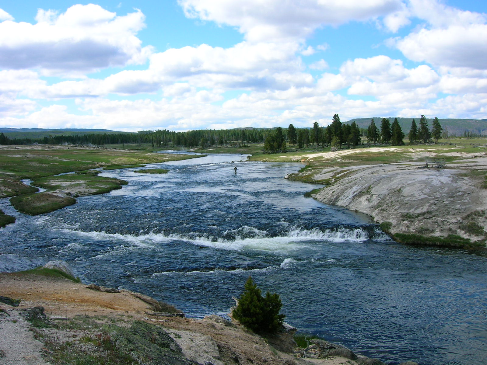
The Firehole River in Yellowstone’s Lower Geyser Basin. Photo by Jake Lowenstern, USGS.
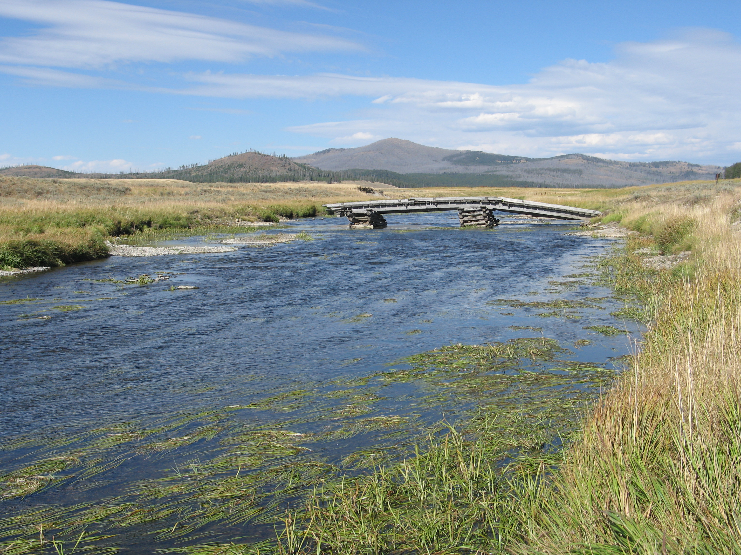
A deteriorating bridge that once crossed Pelican Creek. Photo by Cindy Werner, USGS.
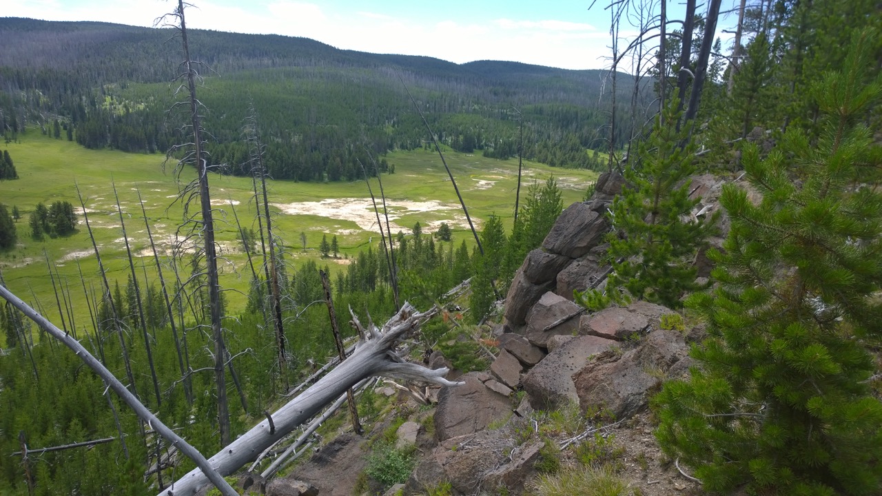
Looking south toward the Ponuntpa Springs in eastern Yellowstone. Photo by John Barefoot, USGS.
![]() This work is licensed under a Creative Commons Attribution-NonCommercial-ShareAlike 4.0 International License.
This work is licensed under a Creative Commons Attribution-NonCommercial-ShareAlike 4.0 International License.