Kellie Wall is a second-year graduate student at Oregon State University working toward her PhD in geology. The daughter of a rock collector and a master rock wall stacker, Kellie has the rock gene in her blood—though it took a college science class to activate it! Abandoning initial career plans, she pursued an undergraduate geology degree at Washington State University, and continued to OSU to study volcanism in the Cascades. Kellie’s current research focuses on the petrologic evolution of Goat Rocks Volcano, a Pliocene-Pleistocene composite volcano in central Washington State.
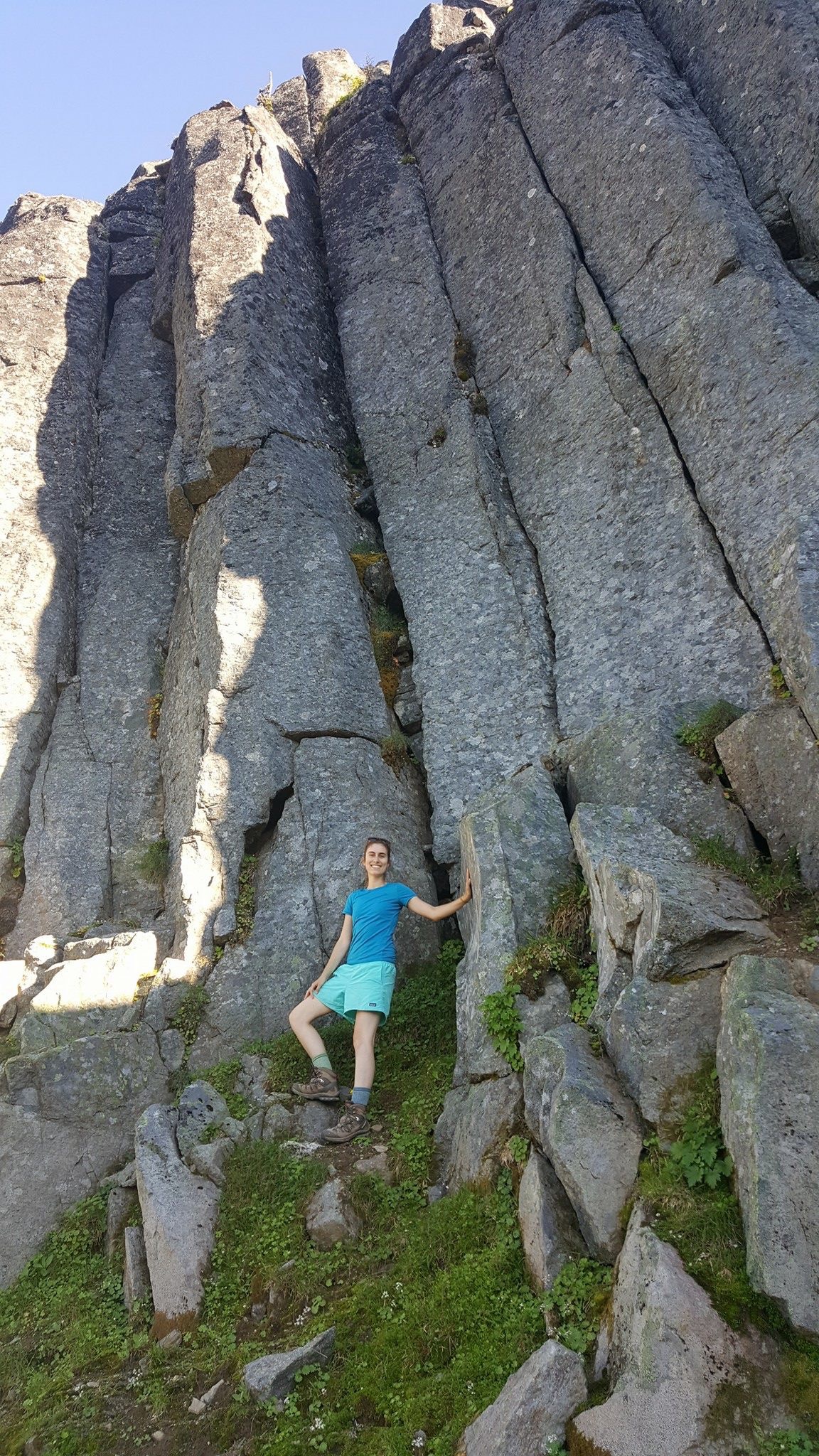
Making friends with the massive “plagiotastic” andesite columns capping the ridge above Lost Lake.
When you gaze upon the imposing stature and destructive path of a composite volcano like Mt. St. Helens, can you fathom how actually tiny it is on the spectrum of geologic time? Even the major stratovolcanoes of the Cascades are practically transient features, building and weathering away in a matter of a few million years. Mt. St. Helens, Mt. Rainier, and Mt. Adams in Washington State are only the youngest centers (less than 1 Ma) on an arc that has been regenerating itself since about 40 million years ago. I am fascinated by this life cycle of volcanism at arcs like the Cascades—which is why I set out last summer on a field campaign to Goat Rocks Volcano, the eroded older sibling of these prominent young peaks in Washington.
Goat Rocks Volcano lies about 30 km north of Mt. Adams in the Goat Rocks Wilderness, a popular hiking and backpacking area near Packwood, Washington. Although it doesn’t stand so tall today, Goat Rocks was once a composite volcano approximately the size of Mt. Hood. The andesitic-dacitic edifice began building about 3 million years ago after an explosive caldera-forming rhyolite eruption and appears to have been active in four major “pulses,” dying out sometime close to 0.25 Ma. During and after its lifetime, the volcano was deeply dissected by glaciers to expose a thick sequence of eruptive deposits. This exposure makes Goat Rocks a very special study site: while younger, more active volcanoes have buried most of their early lavas and tephras, Goat Rocks is practically laid open in cross-section. By studying the rocks here, I aim to reconstruct this volcano’s life story—what events characterized its birth and death, how frequently it erupted, how the magmatic sources and subvolcanic structure evolved through time—providing clues about the past and potential future behavior of similar, younger volcanoes, and strengthening understanding of the Cascade arc as a whole.
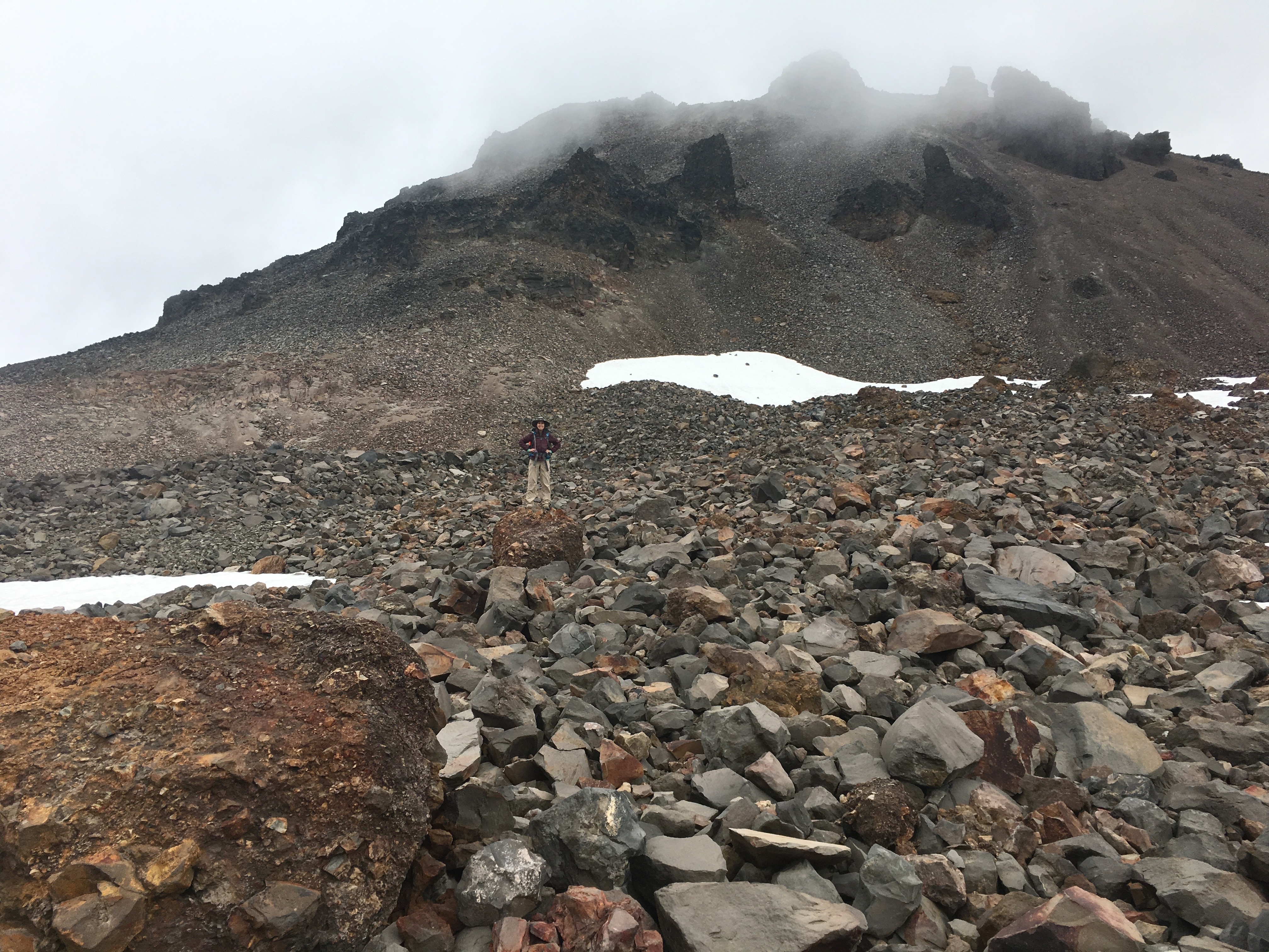
My journey began last August with some trusty assistants, the biggest backpack I’d ever owned, and a shiny new sledge hammer (essential for breaking super hard, dense lava rock). This would be my first major backpacking experience, and I didn’t want to crash and burn, so my partner Tommy (a nuclear engineer and excellent helper) joined me for a short trial run to some distal outcrops north of Packwood Lake. The steep climb from Packwood Lake to Mosquito Lake was tough for my little legs, but worth it when we descended to the banks of Lost Lake—a serene alpine oasis secluded in the bowl of an old glacial cirque. High above the crystal clear water, a ridge-capping columnar outcrop gleamed like a crown in the last orange sun rays of the day as we refueled on camp burritos and dark chocolate.
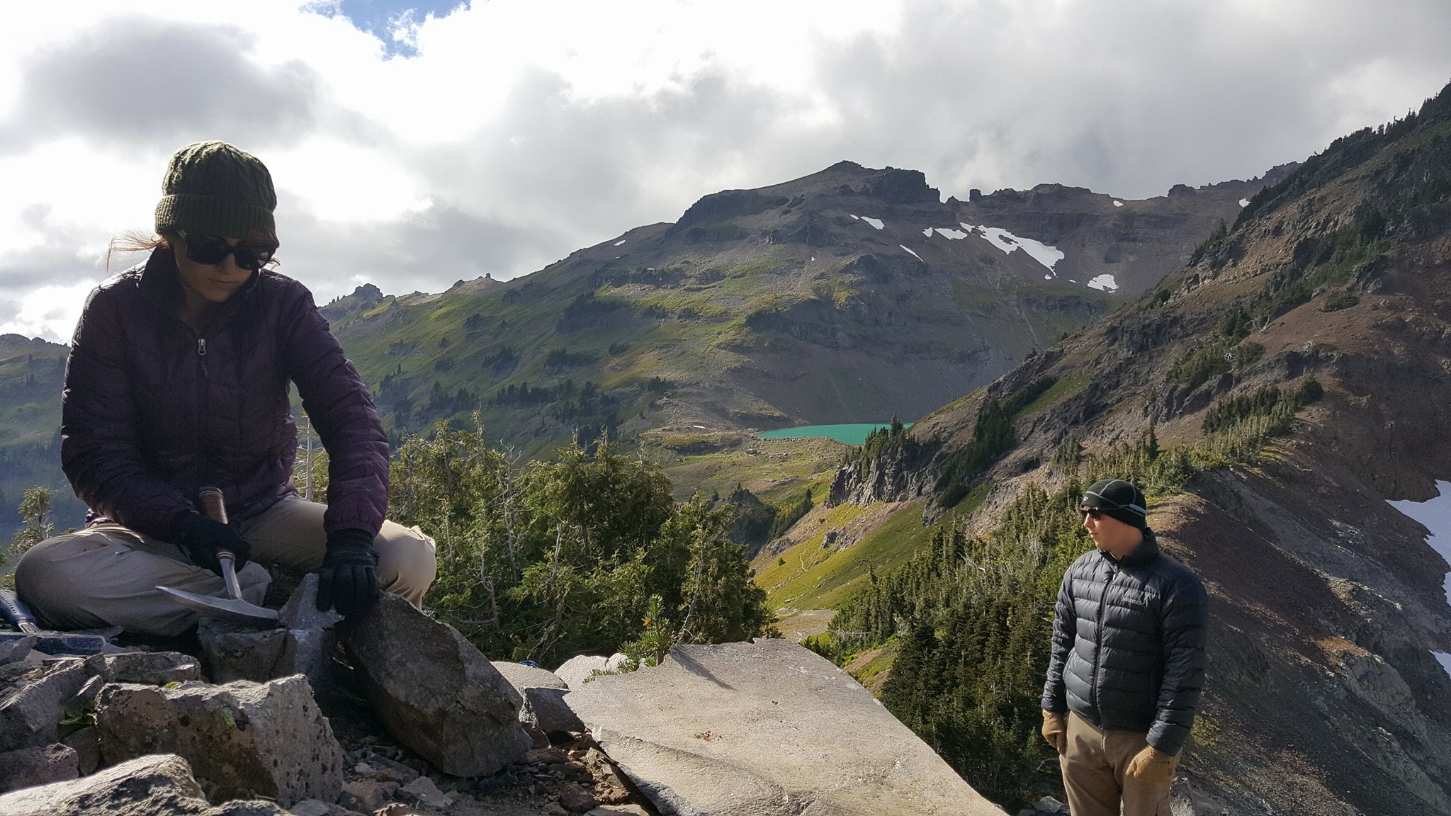
In the morning, Tom and I trekked uphill through dense underbrush to investigate the crown of columns, highlighted on an old geologic map as a remnant from a long Goat Rocks lava flow. We encountered a few outcrops from at least one, but probably two, major flows, with abundant plagioclase phenocrysts in shiny black glass (Tom coined the very scientific term “plagiotastic”). I was in awe of the size of those hilltop columns—some as wide as I am tall! After a somewhat precarious scramble to the top, we had an amazing near-360 degree view from Mt. Rainier to Johnson Peak (central Goat Rocks) to a peek of Mt. Adams. And after spending an hour beating on rocks that left my hands embedded with glass shards, I made a mental note: BUY LEATHER GLOVES! This time a few splinters were worth a bag of sparkly fresh samples, but there would be much more rock-smashing to come…

William up at first light to get the coffee brewing at Snowgrass Flats; Hawkeye Point greeting us from afar.
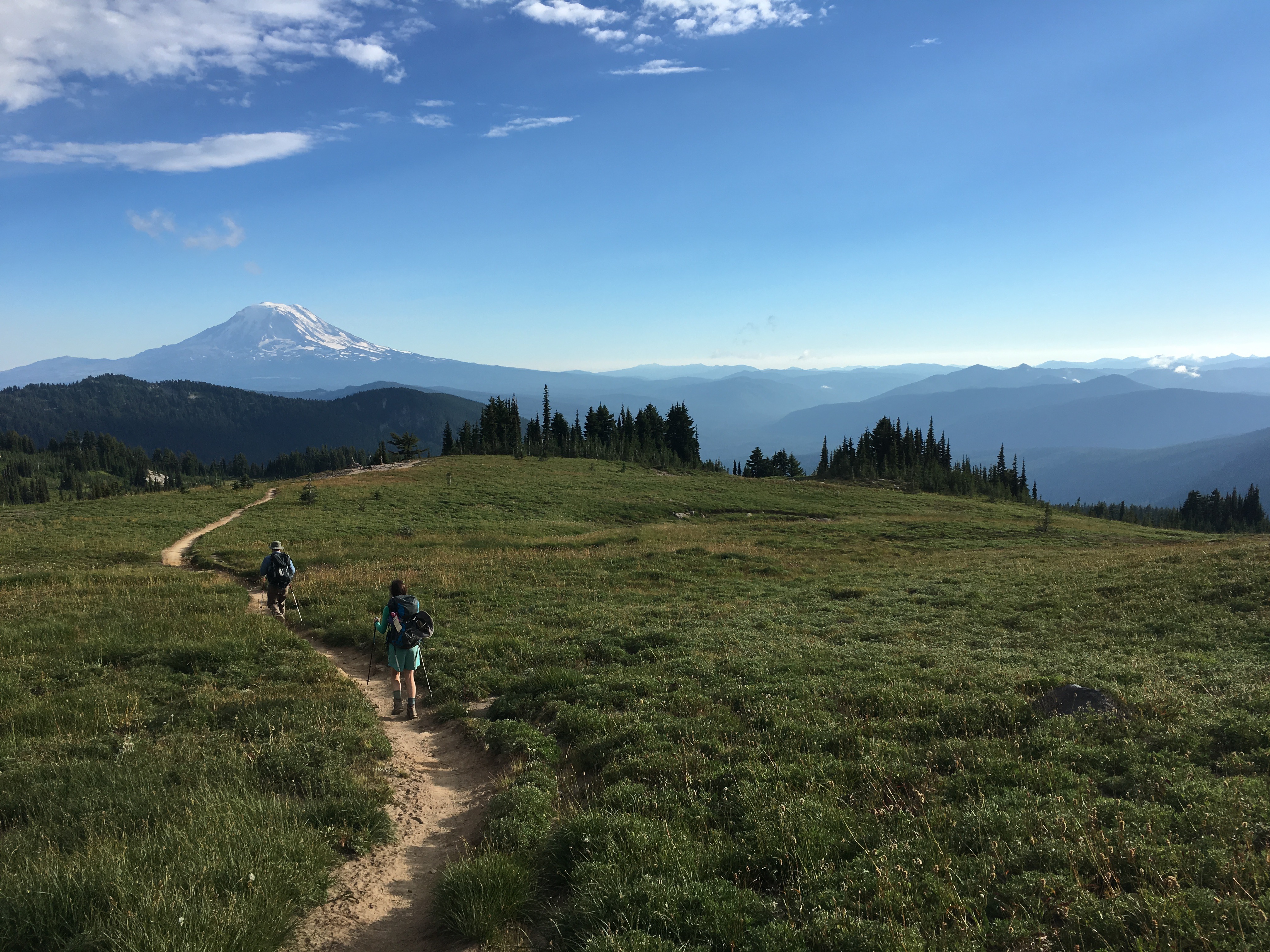
A few weeks later, with new gloves and a week’s worth of food in tow, I returned to Goat Rocks in the good company of William and Nathan, two former students of mine who were keen for adventure. From the Berry Patch trailhead, we hiked up to Snowgrass Flats (man, a week of food is heavy!) to set up base camp for exploring around Old Snowy Mountain, the youngest vent area of this composite volcano. At our campsite near the junction of the Lilly Basin and Pacific Crest trails, we had a meadow and a Hawkeye Point view for our front yard, with a short walk to an ice-cold stream that cut narrow and deep into lush banks peppered with sprightly Indian Paintbrush. I’d never seen this flower in any color besides bright red-orange, but here it was accompanied by a hot pink variety. New and beautiful things to discover every day!
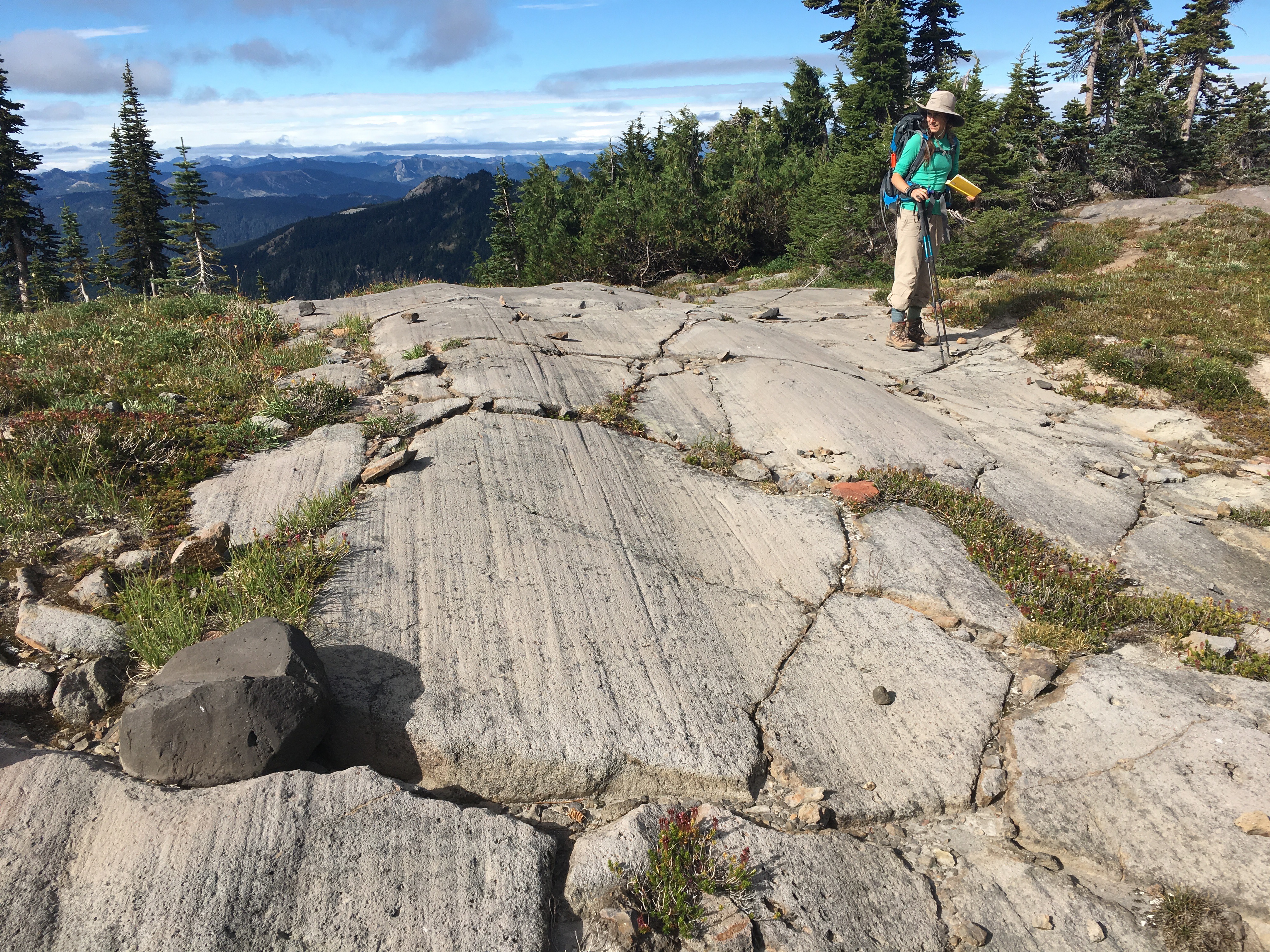
Evidence that ice has the power to tear down a mountain—crossing the striated bed of a glacier on our way to Old Snowy Mountain. (photo by Nathan Van Cleave)
The Old Snowy area was bountiful—tons of exposed rock ripe for the picking. We saw a number of distinctive lithologies, which I assigned working names: “Marble Cake” (gorgeous flow-banded lavas), “Black Licorice” (a dark, glassy rock), “Fruitcake” (oxidized lava chock full of crystalline enclaves) and “Funfetti” (snowflake-textured aphyric rock) being the main ones (notice a theme?). I think we could have spent a month here and still had new rocks and relationships to discover—there was so much to see in a day, and what felt like a large area in person was only a tiny piece of the map. But every 50 yards was an exciting discovery. We came upon a large boulder of what looked like vent breccia—angular blocks of lava, shattered in an explosion (probably by contact of lava with groundwater or ice), re-welded together in the vent—and traced its path upslope to what I think was its source: a garden of these rusty breccia-pipes punching up through loose talus. Perhaps a major vent, south of the summit of Old Snowy!
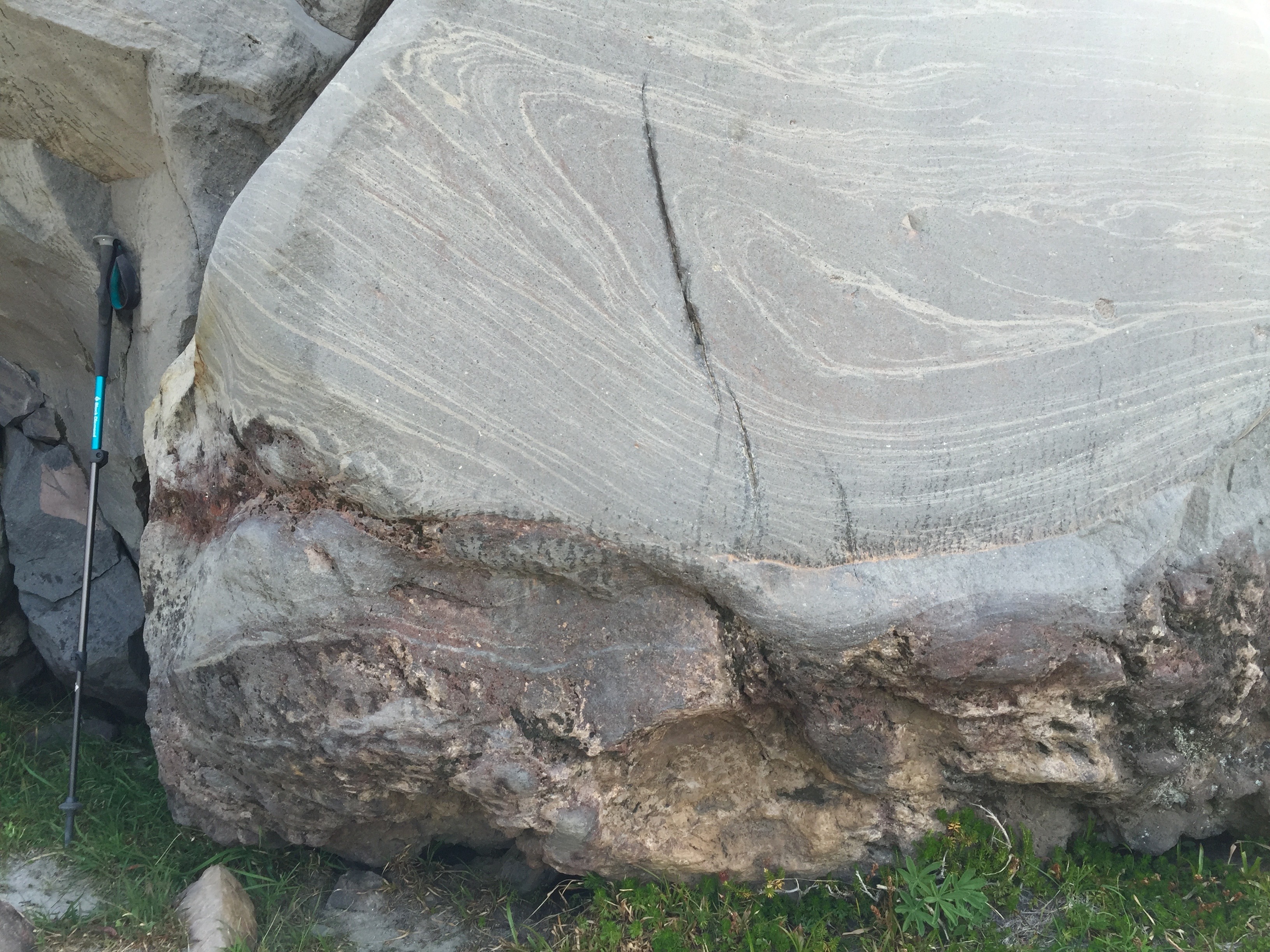
Our “marble cake” unit displaying spectacular flow-banding.
Mt. Adams leads the way home after a great day of sampling and exploring. (photo by Nathan Van Cleave)
After a few days of getting to know these young rocks, we packed up our little home and took the Lilly Basin trail around the bend to Goat Lake. The clouds were rolling in… and unfortunately they would bring more than just greyness. But being an optimist and maybe a little naïve, I was overjoyed to find that we had the entire Goat Lake basin to ourselves. Not a soul in sight; our choice of any campsite we wanted! On this first day, we attempted to hike up to Hawkeye Point, but by the time we reached a false summit we were in the clouds and lost the way. The rain and a few snowflakes hit us on the way down, and it stopped long enough for us to huddle around the camp stove with our freeze dried beef stroganoffs, but came back as soon as we finished eating and didn’t let up again. By next day one of our tents had sprung a leak… and as our stuff got progressively soaked, we made the call to roll out and return with better weather. With rock-loaded packs we made haste to cross the 11 km to the car before dark—then stopped for a much-needed hot meal at the Huff-n-Puff burger joint on our way back to civilization.
Kellie stands on some vent-y looking rock (reddish oxidized breccia, also in foreground) below the summit of Old Snowy Mountain.
Scrambling up a huge talus pile to collect samples before the clouds roll in! (photo by Nathan Van Cleave)
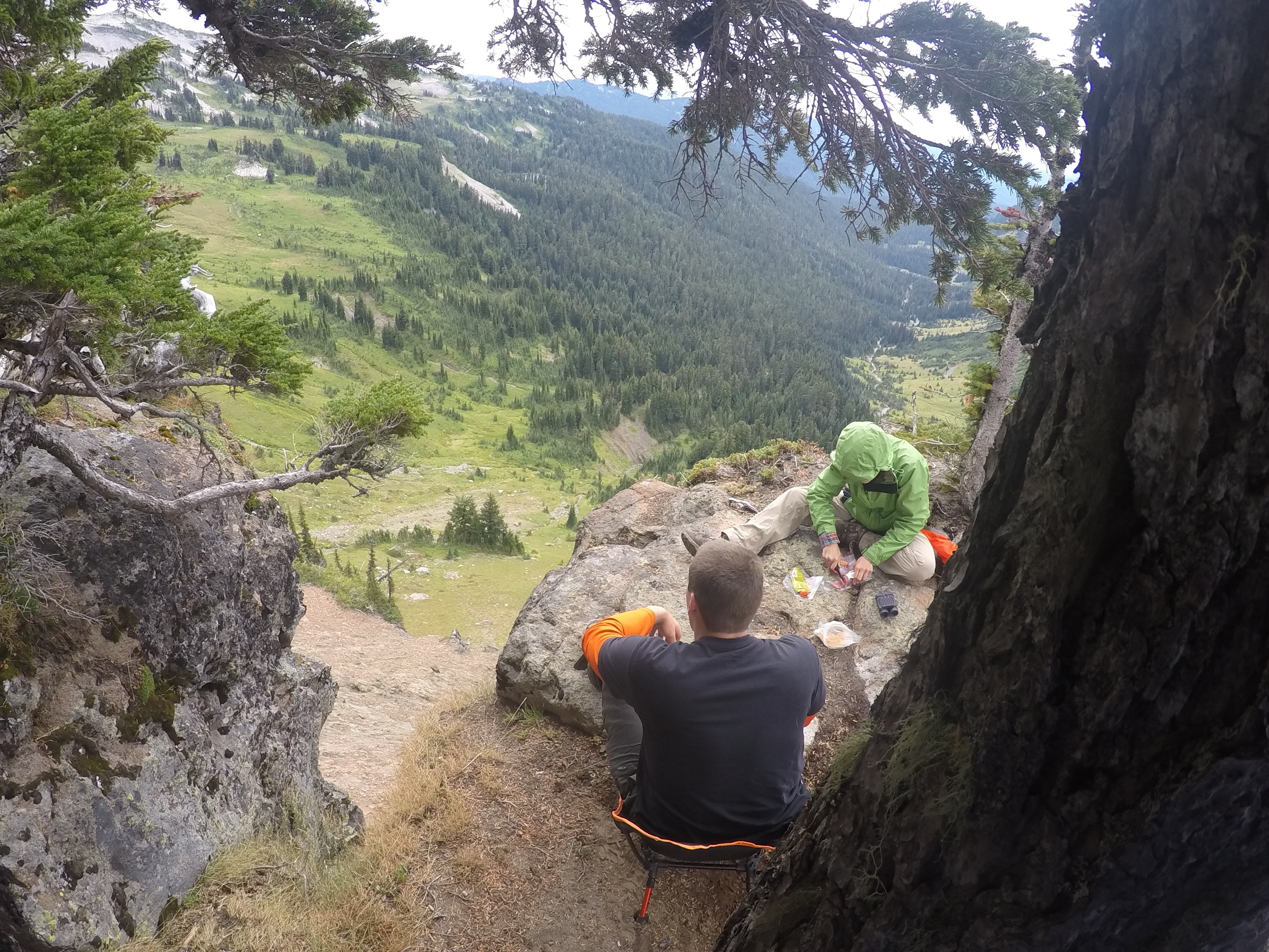
Lunch break at our cliffside campsite (another feast of salami, cheese, crackers, nuts, and dried fruit). We would hear marmots whistle and watch them barrel straight down steep hillsides like the one below—like it was nothing! (photo by William Otto)
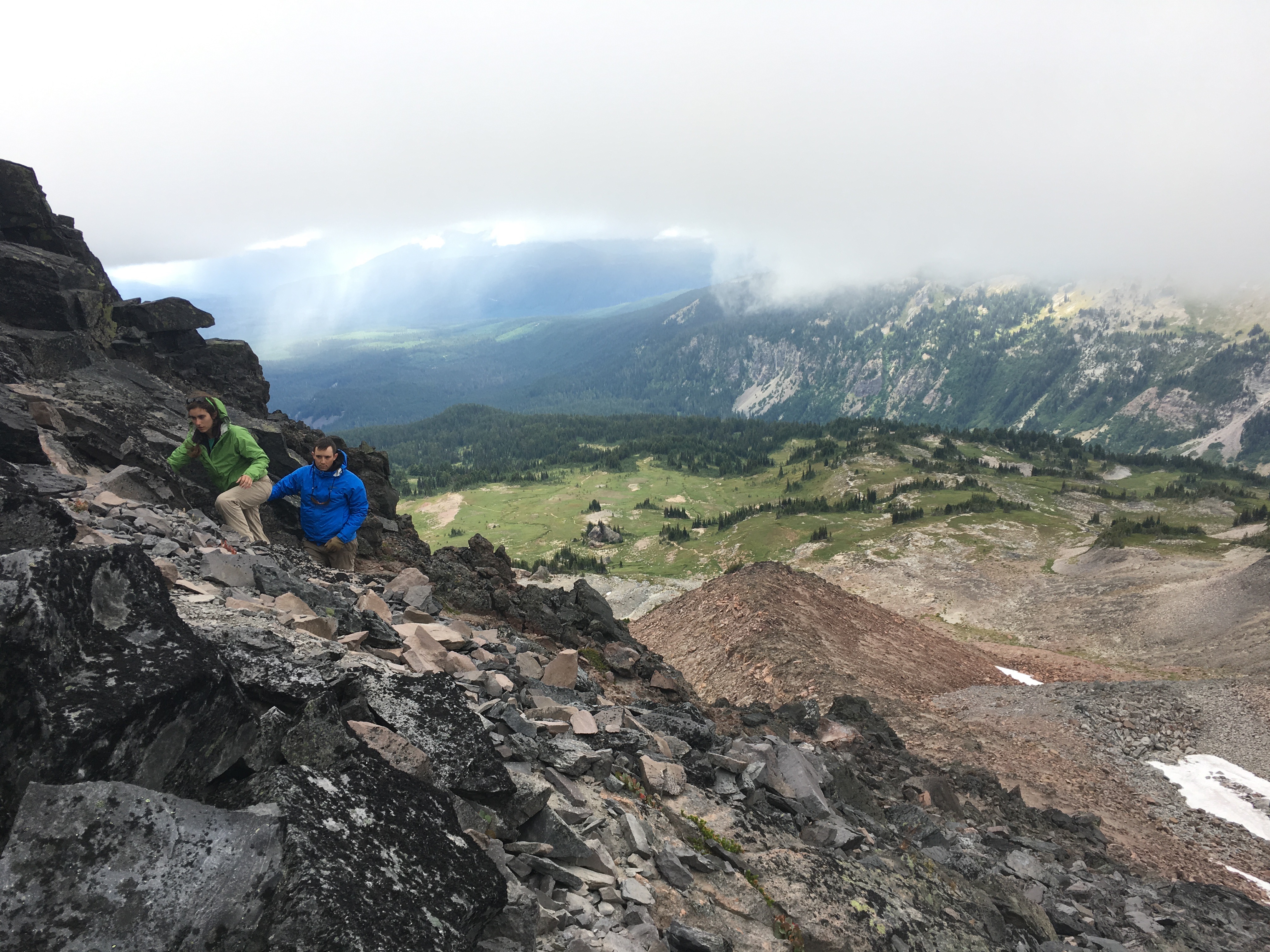
Nathan and William take in the view after our unsuccessful attempt at Hawkeye Point.
A week later, the forecast was 10 days of pure sunshine. We would return to Goat Lake for 4 days, then drive to the eastern side of the Wilderness to explore Tieton Peak and the Devils Horns. Nathan couldn’t join until part two of the trip, so I asked Tommy to fill in for him (and was glad I did—William and I would really need the help).
With perfect weather we finally had easy access to the amazing suite of rocks near Goat Lake. Along the trail to Hawkeye Point, we walked through an erosional unconformity separating the first two “pulses” of the volcanic system. With a short walk east of the lake, we stood at the contact between Tertiary volcaniclastic basement and infant Goat Rocks lava—the base of the volcanic pile! Within a kilometer of this little cirque basin we could explore and sample a million years of volcanic activity, from some of the first outpourings of this center, across a mysterious gap in time, to a second of four generations of eruptions. I’m hoping the rocks can tell me what the volcano was doing during these “gaps”—did the system completely shut down? Was a cooling, crystallizing magma chamber periodically rejuvenated by small mafic injections—enough to shake up the crystal mush, but not enough to erupt? As I write this, a first set of samples—tiny aluminum packets filled with mineral and groundmass separates—is “cooling” down after irradiation in our campus reactor, soon to be analyzed for 40Ar/39Ar dates; and bags of powdered rock lie on my office shelves waiting to be panned for zircons. 40Ar/39Ar dates will help me constrain the eruptive timeline of the volcano, and U-Pb dates and trace element compositions of zircons sampled during those eruptions will provide clues about the unseen processes at depth.
Kellie hoards all of the rock hammers to extract the perfect chunk of fresh andesite. The stack of lavas in which Goat Lake is nestled (background) records potentially a million years’ worth (or more) of eruptive activity—as long as Mt. Rainier and Mt. Adams have been active. (photo by Tommy Moore)
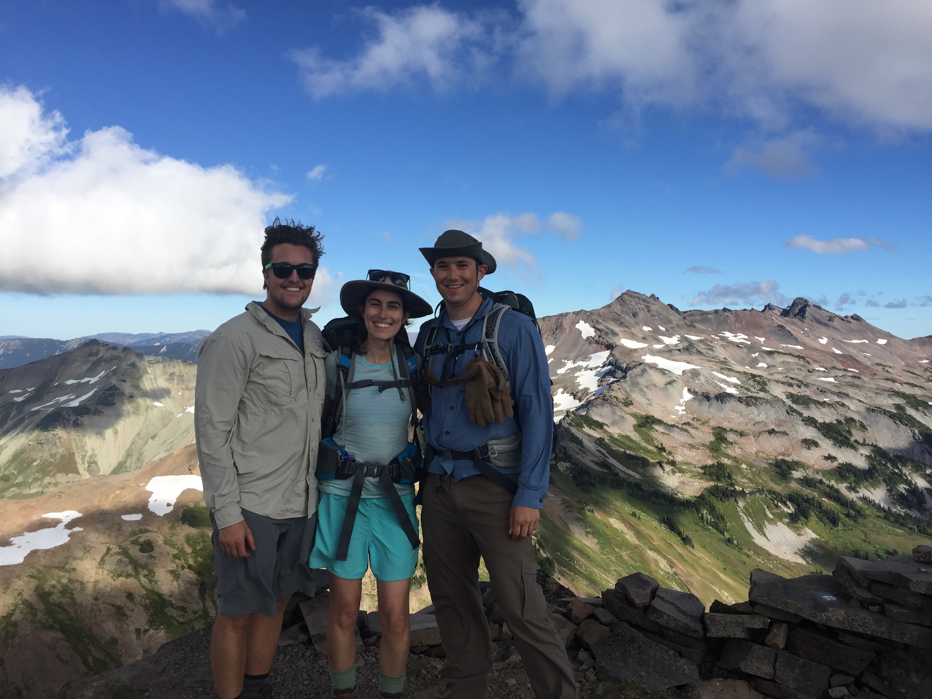
Tommy, Kellie, and William take in fantastic views of Mt. Rainier, Mt. Adams, and Old Snowy Mountain (background, right of center) after finally making it to Hawkeye Point.
But Goat Rocks wasn’t keen to give away too much too soon… misfortune struck again when I came down with a bad fever, and a windstorm blew in on the same day! Even with all of my clothes on and a Nalgene full of hot water, I shivered uncontrollably through the night while the wind howled through our exposed campsite. In the morning, feeling like a frail zombie as the nylon tent flapped about me, I really thought I might blow away! With every gust the un-staked corners lifted higher and I swore the next one would carry me off, like a plastic bag on the breeze, over the cliff and the deep glacial valley and the huddled goats waiting for a spectacular crash-landing. Outside, William and Tom yelled over the gale to coordinate our disassembly. It took all six frozen hands to break down camp without losing a tent to the wind… but we managed to make it down the mountain in one piece. I’m sure the alpine critters were all laughing while we fought the invisible storm. “Perfect weather,” hah!
I was bedridden through the last days of summer, so we never made it to the east side of the mountain—but when the snow melts again I’ll be back for more rocks, suffering, and amazing adventure. I can’t wait.
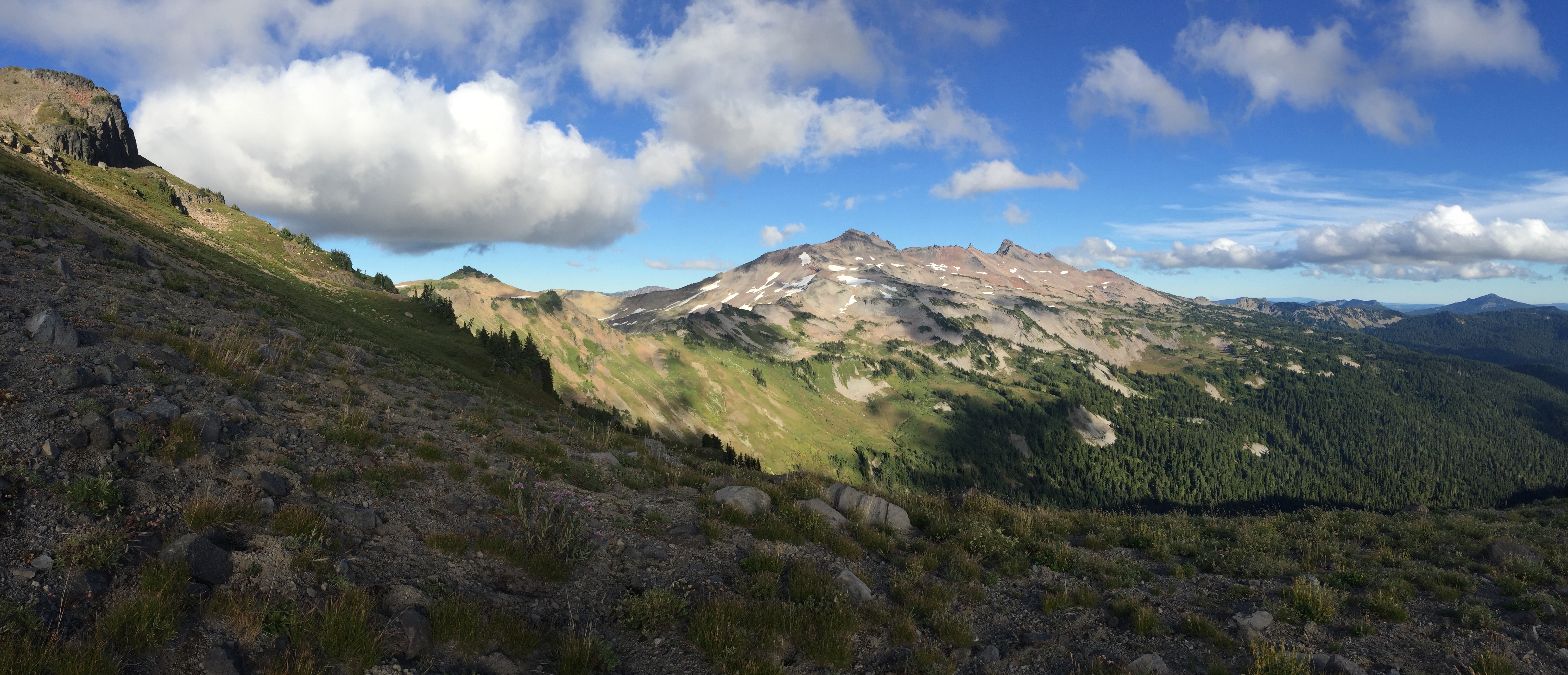
Another view of Old Snowy Mountain on the way down from Hawkeye Point. A herd of mountain goats, from which the wilderness area takes its name, munches on greenery (white specks on the hillside at left). The goats are hard to spot most of the time—but stray wisps of their soft white wool abound to mark their vast territory.
…
I’d like to thank a few people—my field team, William, Nathan, Tom, I couldn’t have done this without your strong legs and bright spirits. Thanks to Don Swanson, who guided my every step through maps and notes from his many summers of impressive field work in the 80s and 90s. To my advisor Anita, thanks so much for the opportunity to work on this exciting project in such a beautiful area!
![]() This work is licensed under a Creative Commons Attribution-NonCommercial-ShareAlike 4.0 International License.
This work is licensed under a Creative Commons Attribution-NonCommercial-ShareAlike 4.0 International License.