Brandon Alessio is a PhD student at the University of Adelaide. His project utilities an array of methods to better understand the tectonic geography of central Africa during the Neoproterozoic. His favorite mineral is Yoderite.
Zambia is a beautiful country located in south-central Africa, where it is landlocked by several nations, most notably including the Congo, Mozambique, and Zimbabwe. It is a nation of unique and unparalleled beauty, being home to many well-known species of African wildlife including lions and elephants. However, it is also home to incredible landscapes including spectacular rivers and waterfalls, the most notable of which being Victoria Falls, also referred to Mosi-oa-Tunya (The Smoke That Thunders).
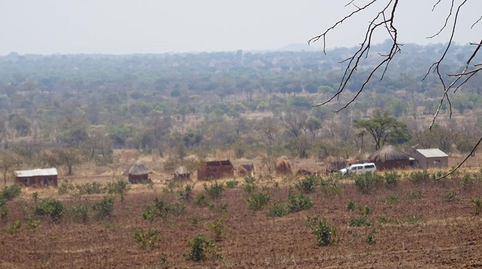
A small group of houses in Zambia’s Chipata district
In terms of its geology, Zambia is well known for containing significant copper deposits in the country’s northwest (the Copperbelt Province), with the export of copper forming the backbone of Zambia’s economy. However, my purpose for travelling to Zambia was not to investigate the geology of this region but rather that in the country’s southeast. The rocks within this region belong to a geological feature referred to as the Southern Irumide Belt, which forms the basis of my PhD project.
My research is focused on the Neoproterozoic Era, which occurred 1000–541 million years ago. The Neoproterozoic is particularly interesting, as it relates to the period that saw the demise of the supercontinent Rodinia and subsequent formation of the supercontinent Gondwana. I specifically investigate the tectonic evolution of discrete areas of the world that formed part of the Gondwana supercontinent, with the evolution of the Southern Irumide Belt in Zambia being the research focus of my PhD. This belt formed during the Mesoproterozoic Era (1600–1000 million years ago), though was later deformed throughout the Neoproterozoic. This deformation is still observable in the rocks exposed today in Zambia, which provides us with a record of how this belt (and by extension central Africa) developed during the Neoproterozoic.
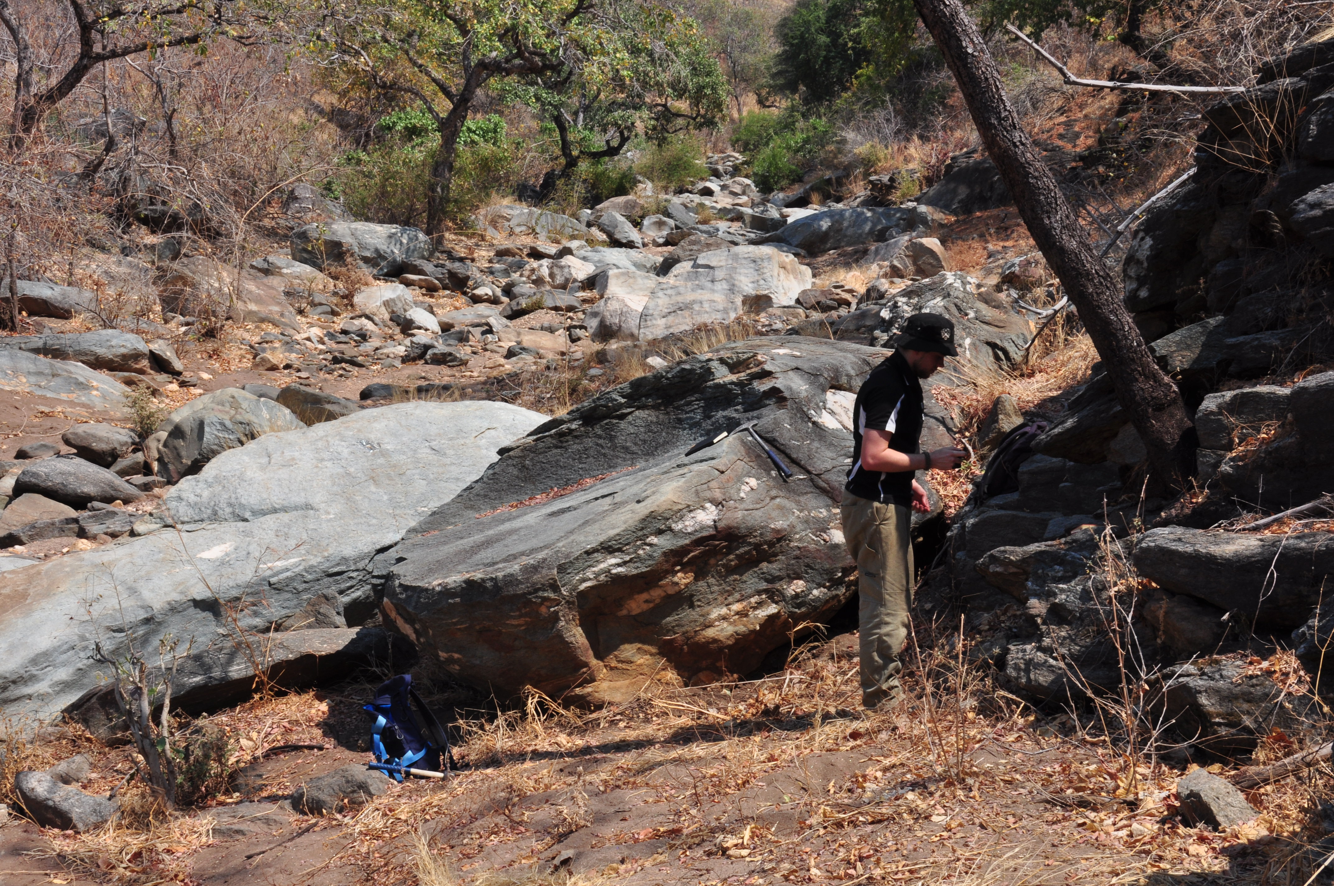
Investigating the geology exposed in the Lower Zambezi National Park
In September 2016, after spending a couple of weeks in Cape Town attending the International Geological Congress (and enjoying the many attractions in Cape Town), academic supervisor Alan Collins and me flew into the Zambian capital city of Lusaka to begin a transect through the Southern Irumide belt. This transect would not only enable me to understand the physical relationships between different rock types in the Southern Irumide Belt, but also allow for the collection of samples that will later be used for geochronological, geochemical, and isotopic analysis, as well as pressure–temperature (P–T) modelling. We arrived in the late evening and had organized a shuttle bus to our accommodation in Lusaka. It had been less than an hour in the country before I would have my first experience of the Zambian way of life. While driving to our accommodation we turned off onto a dirt road, this road ran near many houses and the locals didn’t appreciate dust being kicked up by people driving past at night. To combat this, many large rocks had been placed on the road to slow vehicles down. Unfortunately, the locals were somewhat overzealous in placing rocks this time around, turning a five-minute drive into a significantly bumpier half hour drive. We eventually made it to our accommodation (albeit slightly shaken) and were finally able to get some rest. In the morning we were greeted by Reuben, who was hired to be our driver for the duration of our stay in Zambia and proved to be an invaluable help. After packing our belongings we were both ready and excited to hit the road and get stuck into the Zambian geology.
Crustal thickening and clay : controls on O isotope variation in global
My fieldwork consisted of long days of driving that constantly involved stopping whenever we saw rocks outcropping, which occurred less often as we drove further east towards the Zambia–Malawi border. These days were accompanied by long nights, as we were camping and constantly on the move, our tents and belongings had to be set up and packed away almost every day. Setting up camp at night was usually followed by a beer and dinner, followed by more beer. Even at night, the temperature was relatively hot, making sleep uncomfortable for much of the night. None the less, the work was very much enjoyable, the scenery was constantly beautiful and this was particularly true along the Zambezi and Luangwa rivers, where one could look across and see Zimbabwe and Mozambique, respectively. The African wildlife also made the trip very exciting. A portion of my trip involved traversing the Lower Zambezi National Park, during which I encountered several different animals including springboks, elephants, baboons, zebras and warthogs, Alan even managed to spot a hippo. However, it is worth mentioning that the wildlife did manage to cause some issues, particularly when we were surrounded by elephants in the national park. Reuben had to do some intense four wheel driving that day to get us out of the park before nightfall! Unfortunately, upon leaving the park the road was again blocked by elephants, this time we were unable to get around these ones and had to turn around and stay at a nearby campground, where we were unable to set up our tents due to even more elephants on the campgrounds.
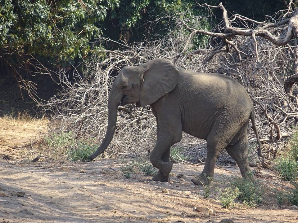
Elephant in the Lower Zambezi National Park
Fieldwork lasted for two weeks, after which I returned to Lusaka to organize the shipment of my collected samples back to Australia, which is nothing short of a time-consuming process in Zambia (but gave me time to visit Victoria Falls!). My samples had just arrived as of writing this, and will soon be used in conjunction with the observations and measurements obtained during my trip to piece together the tectonic evolution of this fascinating part of the world.
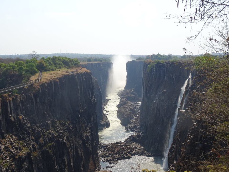
Victoria Falls, although quite dry at this time of year it’s still an impressive sight to behold
![]() This work is licensed under a Creative Commons Attribution-NonCommercial-ShareAlike 4.0 International License.
This work is licensed under a Creative Commons Attribution-NonCommercial-ShareAlike 4.0 International License.