Dr. Thomas Ronge is a Marine Geologist currently working for the Alfred Wegener Institute in Bremerhaven, Germany. You can read more about his research here.
The Drake Passage and the Antarctic Peninsula are key regions for our climate as well as for it’s past evolution.
Propelled by strong, perpetual Southern Westerly Winds, the dominant force in the circum-Antarctic Southern Ocean is the Antarctic Circumpolar Current, or ACC. With ~24.000 km in length, the ACC is the globes largest current system. As it connects the Pacific, Atlantic and Indian Oceans, the current is of exceptional importance for the oceans and the global climate, as it transports heat, salt and gases from one ocean basin to another. The most dominant constraint in the flow path of the ACC is the Drake Passage, located between South America and Antarctica.
Despite its importance for the past, current and future climate, little is known about the climatic and oceanographic evolution of this oceanic gateway.
In order to shed new light onto this climatic key area, we planned to retrieve high- and low-resolution sediment cores from southernmost Patagonia, the Drake Passage and the Antarctic Peninsula. Another objective of our work was to analyze high-resolution sediment cores from the Antarctic South Shetland Islands for the impact of the most recent climate change as well as to reconstruct the climate fluctuations themselves.
Not unlike the pages of well written history books, the layers of sediment cores (basically mud from the ocean floor) can tell us about the evolution of different oceanic and climatic parameters like temperatures, current-speed, sea-ice extent, CO2-storage within the ocean, terrestrial dust-input and much MUCH more. Particles (shells of microorganisms, organic compounds, mineral grains etc.) recording these parameters sink to the seafloor and accumulate over time. The oldest layers are thereby found at the bottom, the youngest at the top of our sediment cores.
However, to retrieve these sediment cores under the harsh conditions of this often-forbidding region, we had to rely on the support of a large research vessel, in our case the German research icebreaker R/V Polarstern. A two month-long expedition was planned for the Austral summer/fall of 2016.
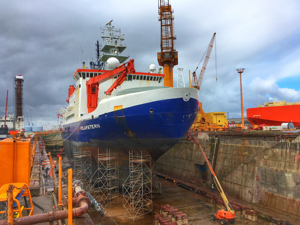
R/V Polarstern in the drydock in Bremerhaven, Germany (©Thomas Ronge)
For most of us “onboard scientists” the preparation for the expedition began about 9 months before the actual port call. Lab equipment, polar clothing, working material and all of the huge oceangoing devices had to be packed in boxes and containers. While the ship was in Bremerhaven for its biannual refit at the End of October 2015 we had to stow everything on board, before Polarstern left port again.
While the vessel steamed south, our preparations were far from over. Those of us, who never attended it before, had to complete the Seminar for Antarctic Environmental Protection. As our working area was far from civilization and therefore from any hospitals, all of us hat to endure a rigorous medical examination before we were allowed to book our flights.
Finally in February this year, we boarded the plane bound for Punta Arenas in southernmost Chile. With stopovers in Frankfurt, Madrid and Santiago de Chile, we reached the lovely Patagonian city and our vessel after strenuous 30 hours of travelling! As with most cruises our first days on board were dominated by setting up our labs and the equipment on the working deck.
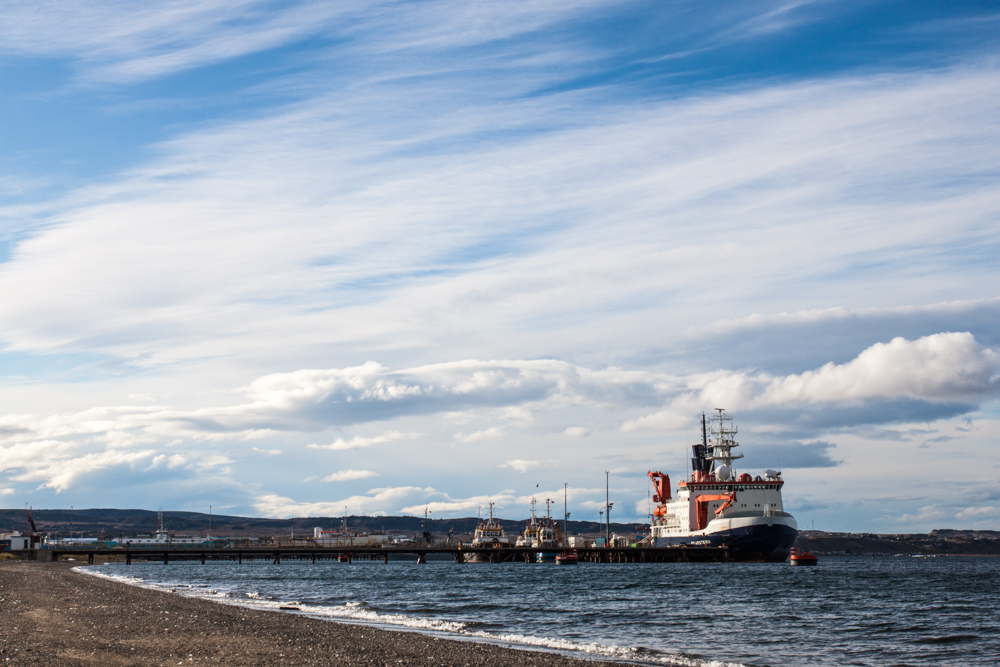
R/V Polarstern at the pier in Punta Arenas, Chile (©Thomas Ronge).
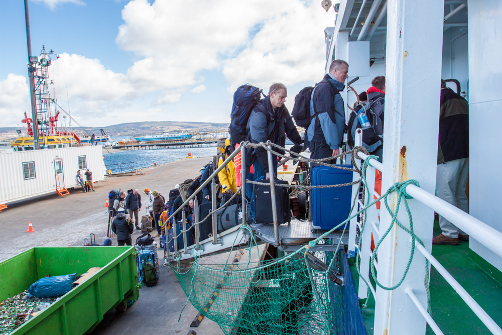
Scientist waiting to board R/V Polarstern (©Thomas Ronge).
Our plan was to go west through the Strait of Magellan and then turn south towards our main working area. However, Patagonia and the infamous Southern Westerlies lived up to their reputation, battering the western cost with waves of up to 14 m. Therefore the captain and our chief scientists made the sensible decision to alter the original plan for the first time, even before we left the pier. Our new route led us via the eastern entrance of the Strait and further south towards the first working area off the Argentinian Isla de los Estados. Despite being protected by the island, our station work was aggravated by gale force winds, dragging on our equipment and us.
The box grab is hauled back on board off the Isla de los Estados (@ Thomas Ronge).
Following the first stations in Argentinian waters, we continued working off the Cape Horn archipelago and the western side of Tierra del Fuego. While most of us worked on board, a small scientific party used one of the two ship based BO-105 helicopters to conduct some geological work on Cape Horn Island as well as Isla Noir and Isla Londonderry. The objective of the shore parties was to drill lake sediment records, conduct geodetic GPS measurements and to collect rock samples for cosmogenic dating.
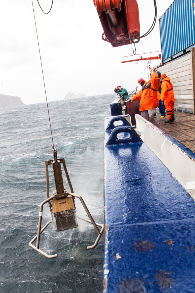
Considering the stormy history of the Drake Passage, we left our South American working area a few days later and set sail for Antarctica. In spite of our misgivings about the transit through the passage, the weather proved to be so calm (Drake Passage calm, meaning waves not higher than 6 m) that we were able to conduct several stations on our way south, using our gravity and piston coring systems.
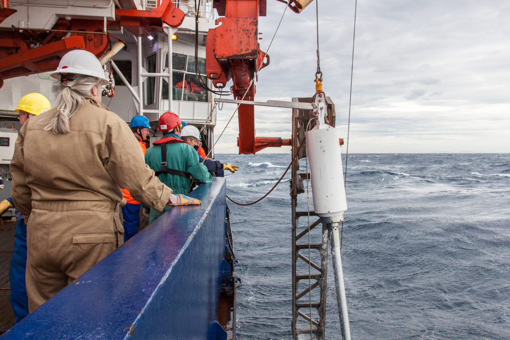
Deployment of the piston corer, somewhere in the Drake Passage (© Thomas Ronge).
Pressure can be an interesting thing. Deep inside the Earth’s interior, pressure transforms ordinary carbon into glittering diamonds (45-60 kilobar). Or, in combination with hot water it turns roasted Kona coffee (~9 bar) into the perfect espresso. Besides this, pressure is one of the dominant parameters within the ocean. Every 10 m it increases by about 1 bar. This means a pressure of ~100 bar in a depth of about 1000 m.
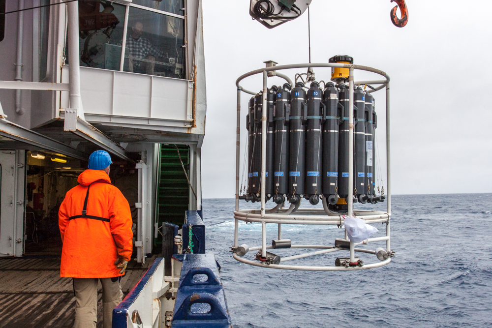
For us, water pressure is a force that we need to protect our instruments against. Our coring devices or net-systems are quite insensitive to pressure. However, more complicated systems like our CTD-probe (measuring conductivity, temperature and depth) need reinforced casings to withstand the waters’ crushing force.
Despite all these dangers for our research, water pressure can be a lot of fun! A favourite pastime for many marine scientists is to paint styrofoam cups in their spare time, attach them to their equipment and to send everything to the bottom of the sea. At the surface, these cups comprise of about 90% air-bubbles. Kilometres below, the cups are squeezed from all sides, in a way that forces the air to leave the cup and ultimately shrink them. Back on board the cups remain their new size and are a welcome souvenir.
Styrofoam cups in a bag attached to the CTD-rosette (©Thomas Ronge).
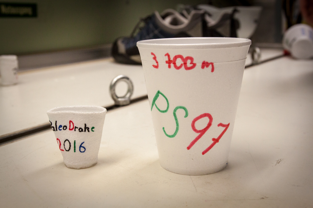
Cups before (right) and after (left) being send down to 3700 m water depth (©Thomas Ronge).
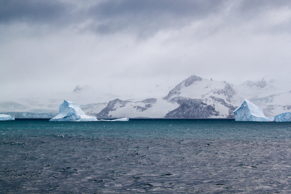
Not far from Trinity Island, Antarctica welcomed us with a day, nobody of us dared to hope for. Temperatures were just shy of zero, the sky was spotted only occasionally with white clouds, the ocean was teeming with life (penguins, seals, humpback and southern right whales) and glittering white glaciers alternating with black rocks of the peninsula and the surrounding islands marked the backdrop of this awe-inspiring scenery.
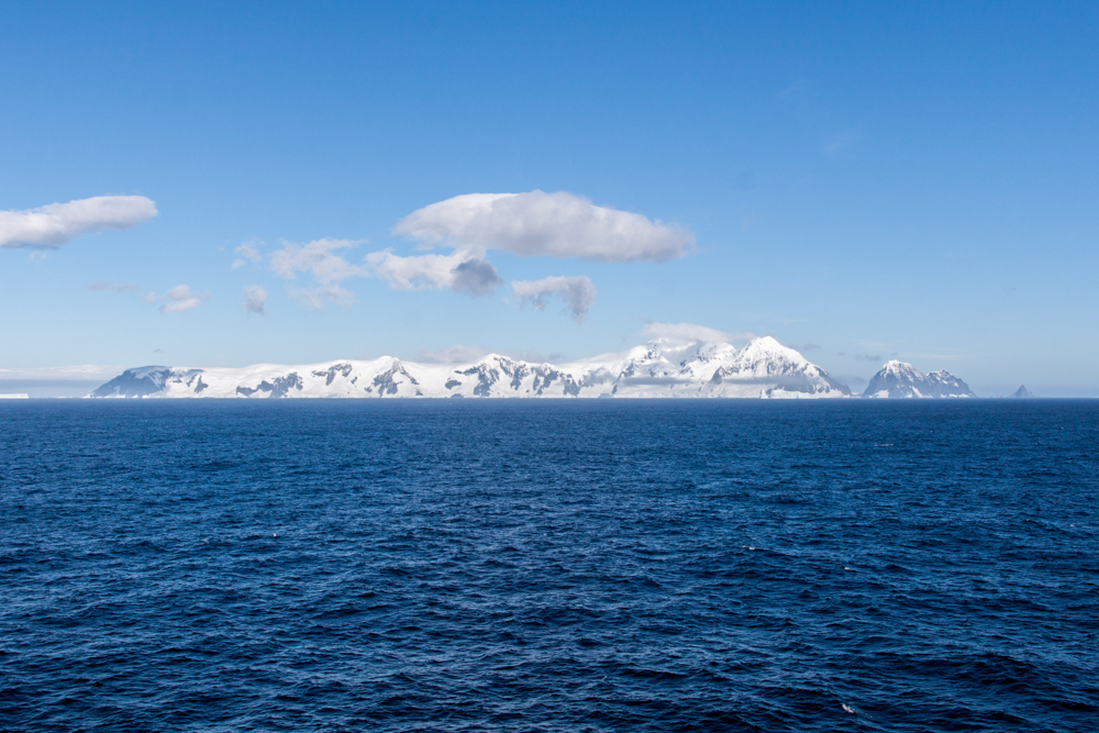
Trinity Island off Antarctica (©Thomas Ronge).
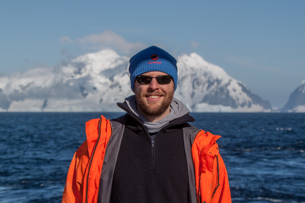
Me in front of Trinity Island (©Thomas Ronge).
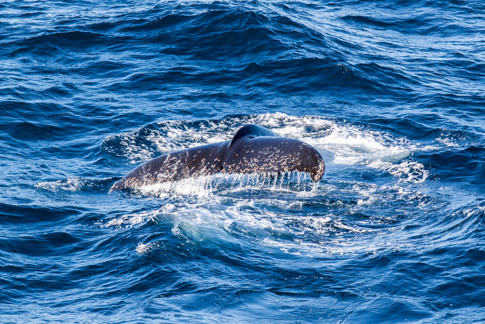
Diving humpback whale (©Thomas Ronge).
Sorry, I’m deviating a bit… Anyway the work in this pristine area is subject to different rules than the work north of 60°S, outside of the realm of the Antarctic Treaty. Every work, every working area and every used system had to be approved (in our case) by the German Umweltbundesamt, before our cruise began. Furthermore, we had to establish a Marine Mammal Observer (MMO) watch-keeping system. During our work an MMO had to man the bridge permanently, while being south of 60°S. In case of approaching whales or seals (and there are dozens of them!) we had to turn off our sediment echo sounders, only to reboot them once the animals have cleared our area. In this region as well, the extensive coring at sea was accompanied by shore parties, using the helicopters to collect rock samples on the islands and the continent.
Board-helicopter shuttling a shore party to the continent (©Thomas Ronge).
Sheltered by the South Shetland Islands, the geological work was particularly flawless and so we were able to use the calm conditions to celebrate our well-deserved mid-cruise BBQ on the working deck of Polarstern.

R/V Polarstern off King George Island (©Lars Lehnert).
Facing the second crossing of the Drake Passage, we left the Shetland Islands and steamed towards Elephant Island. This island became famous, as it was shelter to the legendary failed-but-not-failed expedition of Sir Ernest Shackleton and his men in 1916. During our cruise, we almost made it to the centenary of their epic landfall in April 1916, being in the very same spot just 99 years and 11 months later.
Elephant Island (©Thomas Ronge).
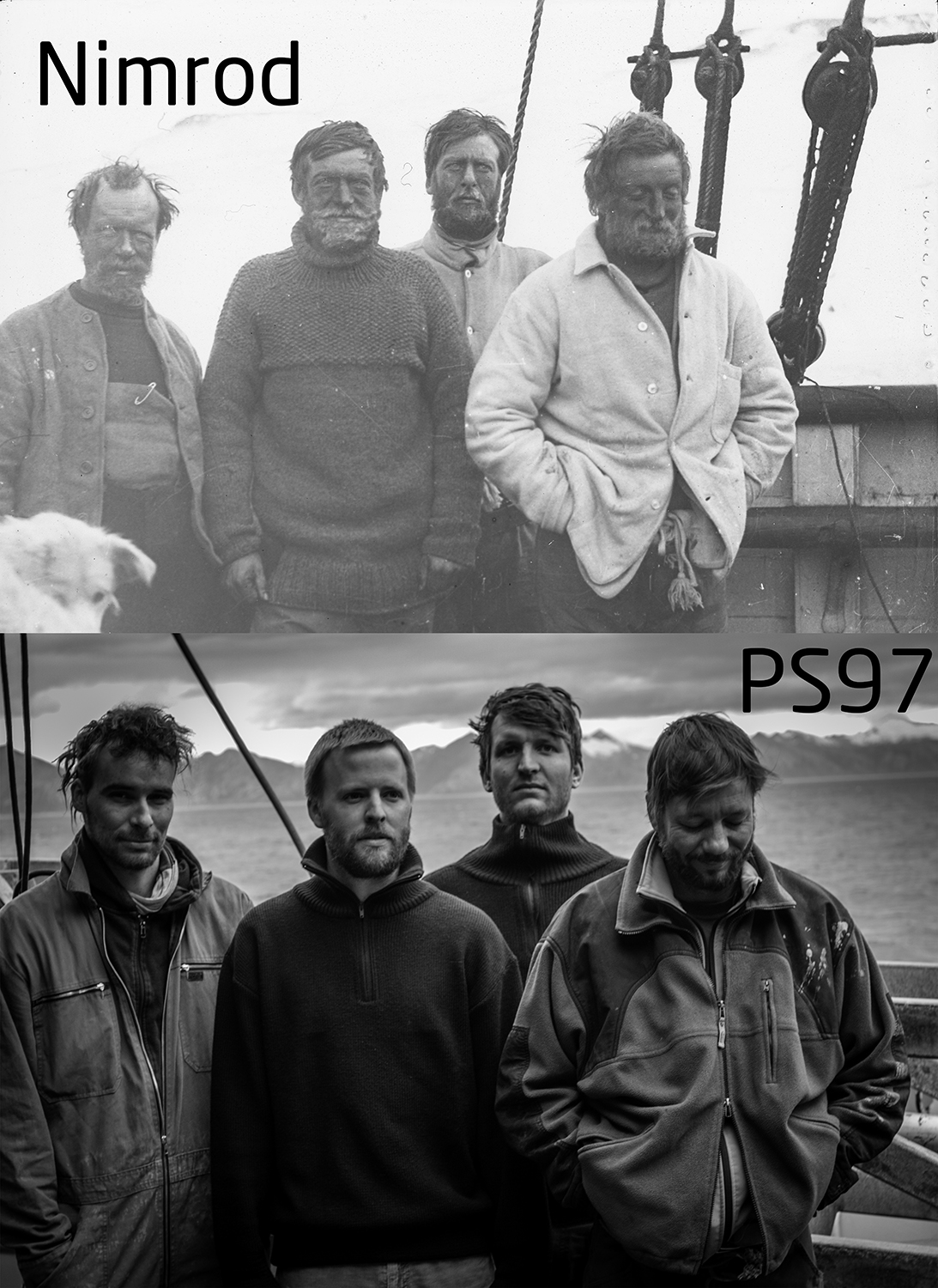
Commemorating the epic journey of Shackleton and his men, we staged a picture from one of his earlier expeditions. Top: Shackleton (2nd to the left) and his men aboard the Nimrod (© Archive for German Polar Research; S4F No. 49). Bottom: Simon Schröder (AWI), Thomas Ronge (AWI), Marc Wengler (AWI) and Sascha Plewe (IOW) (©Thomas Ronge).
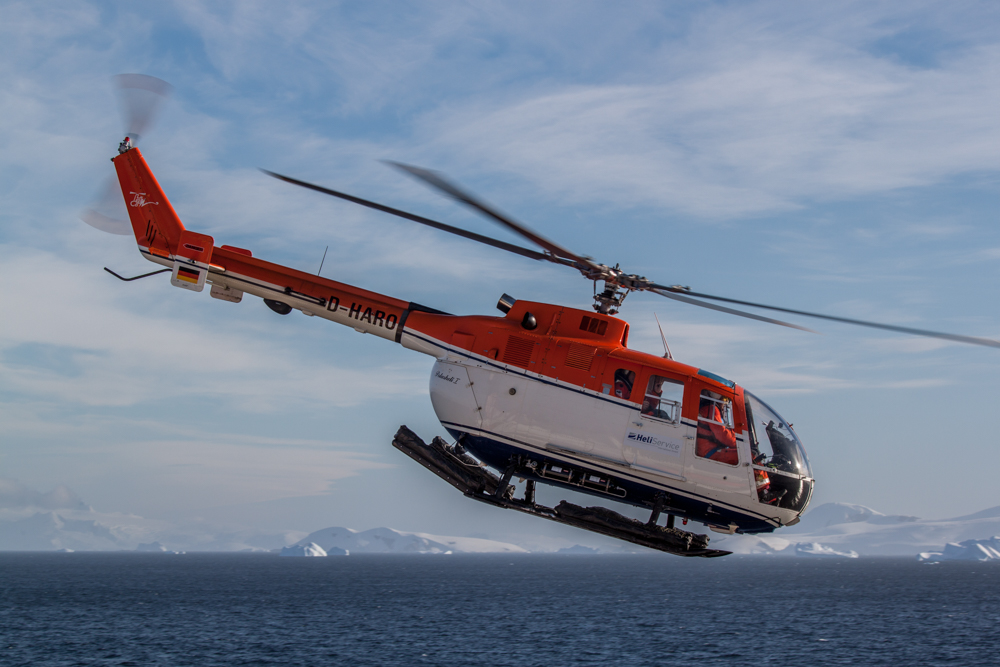
While our work was supported by all the technology and comfort of Polarstern, it was kind of surreal to imagine the burdensome time Shacklton’s men had, while hoisting sediment cores on board a century later (o.k. almost). The last geodetic GPS measuring point was brought out via helicopter on a small ridge ~300 m above sea level. Helicopter work is always a difficult task under the Antarctic conditions. Wave height must not surpass ~4 m, visibility must be good and the wind should not exceed a certain level. Therefore it requires a lot of preparation and planning before the captain approves land work. Usually the land parties meet with the meteorologists as well as the pilots on the day prior the planned flight as well as again in the very morning of the day of departure. If weather and sea state are favorable for heli-operations, we have to don bright orange survival suits, live jackets, boots and helmets. The BO-105 helicopters accommodate one pilot as well as four scientists and their equipment. Apart from the working equipment, every “passenger” needs a personal survival bag, containing food, sleeping bag, tent etc. for several days, just in case.
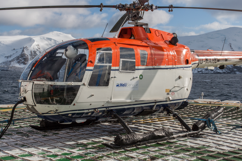
A BO-105 helicopter on Polarstern’s helipad with Elephant Island in the background (©Thomas Ronge).
Helicopter over some large glacier (@Lars Lehnert).
Our home for two months (@Thomas Ronge).
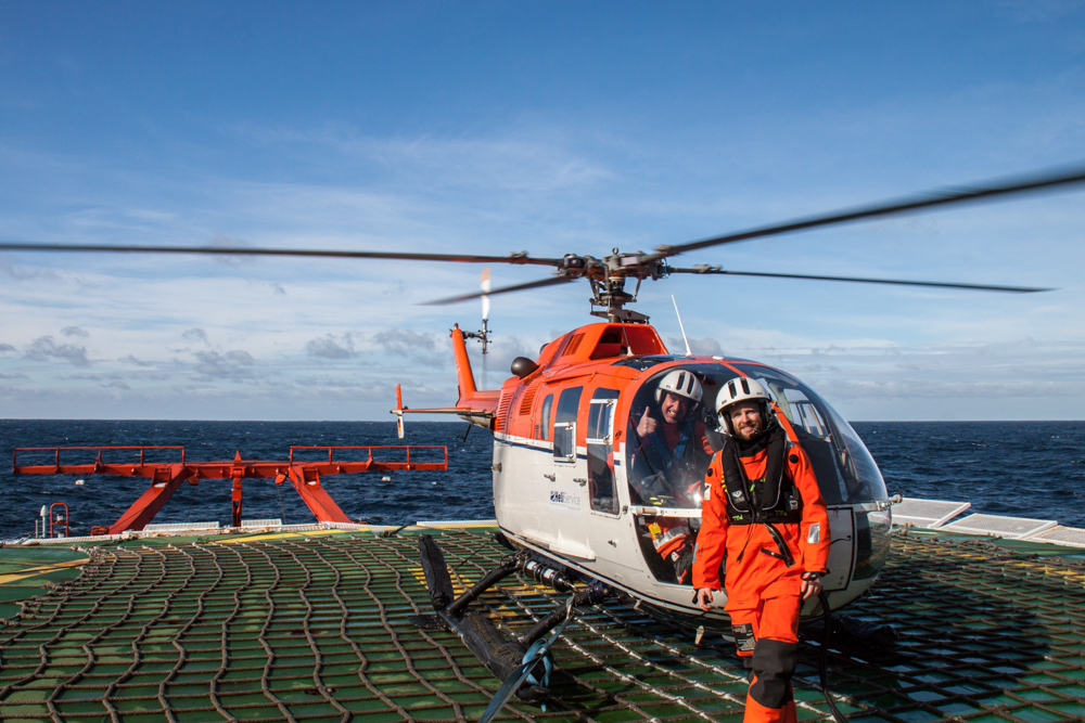
Pilot Harold de Jager (cockpit) and me in my “pumpkin” survival suite (@Thomas Ronge).
Passing 60°S again, we continued our coring work in the Drake Passage, while heading again for the Cape Horn archipelago, where a land group of three spend two days of taking sediment records from a small lake.
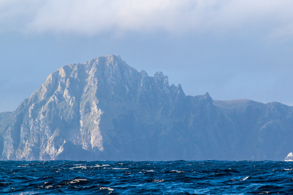
The towering silhouette of Cape Horn Island. The sampled lake is right behind the cliff (©Thomas Ronge).
After traversing the Drake Passage without any “real” storm for the second time, we were eventually hit by a major storm system, west of Tierra del Fuego during the Easter days. Waves, up to 10 m height forced us to abandon our work, seeking shelter in Bahía Cook and then again in the western entrance of the Strait of Magellan.
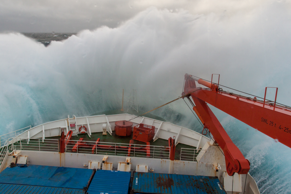
Furious Fifties living up to their name as the Polarstern fights its way through up to 10 m waves (©Thomas Ronge).
Nevertheless, these interruptions did not stop us from retrieving our last samples before we ultimately sailed for Punta Arenas via the breathtaking scenery of the Strait after two months at sea.
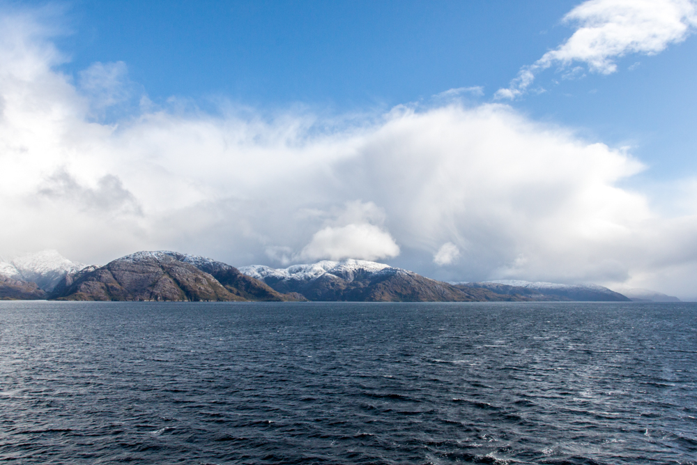
The Strait of Magellan (©Thomas Ronge).
In Punta Arenas, our long journey home began with two tiny pilot-boats, which shuttled us from Polarstern to the jetty of the city.
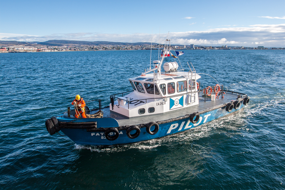
Pilot-boat waiting to shuttle us back to Punta Arenas in the background (©Thomas Ronge).
Now, back at our institutes (for me it’s the Alfred-Wegener-Institute in Bremerhaven, Germany) we are busy working on our samples and can’t wait to see the first results of this most successful cruise.
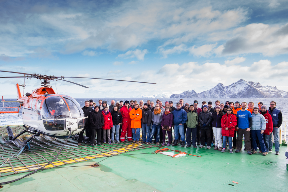
Scientists of PaleoDrake expedition PS97 off Gibbs Island (@Lars Lehnert).
![]() This work is licensed under a Creative Commons Attribution-NonCommercial-ShareAlike 4.0 International License.
This work is licensed under a Creative Commons Attribution-NonCommercial-ShareAlike 4.0 International License.