Simon Pendleton is a PhD student at the Institute of Arctic and Alpine Research at the University of Colorado Boulder. You can read more about his research here.
I’m not sure I’ve ever been this cold. Ever. Our research team (Drs. Gifford Miller, Nicolas Young, Jason Briner and PhD students Sarah Crump and myself) is huddled in the open cockpit of a Northwestern Canoe as it bounces through the waves, our local Inuit guide Gordie Audlakiak deftly weaving it between bergs and pack ice. We are traveling from the local community of Qikiqtarjuaq on the southeast coast of Baffin Island to one of our base camps for the 2015 field season. As I sit there, wearing every piece of clothing I brought with me, it is difficult to grasp the reality of the modern Arctic: one of ever increasing temperatures, rapidly retreating ice and a changing climate we are only just realizing, let alone understanding its consequences. The irony is not lost on me…or my frozen toes.
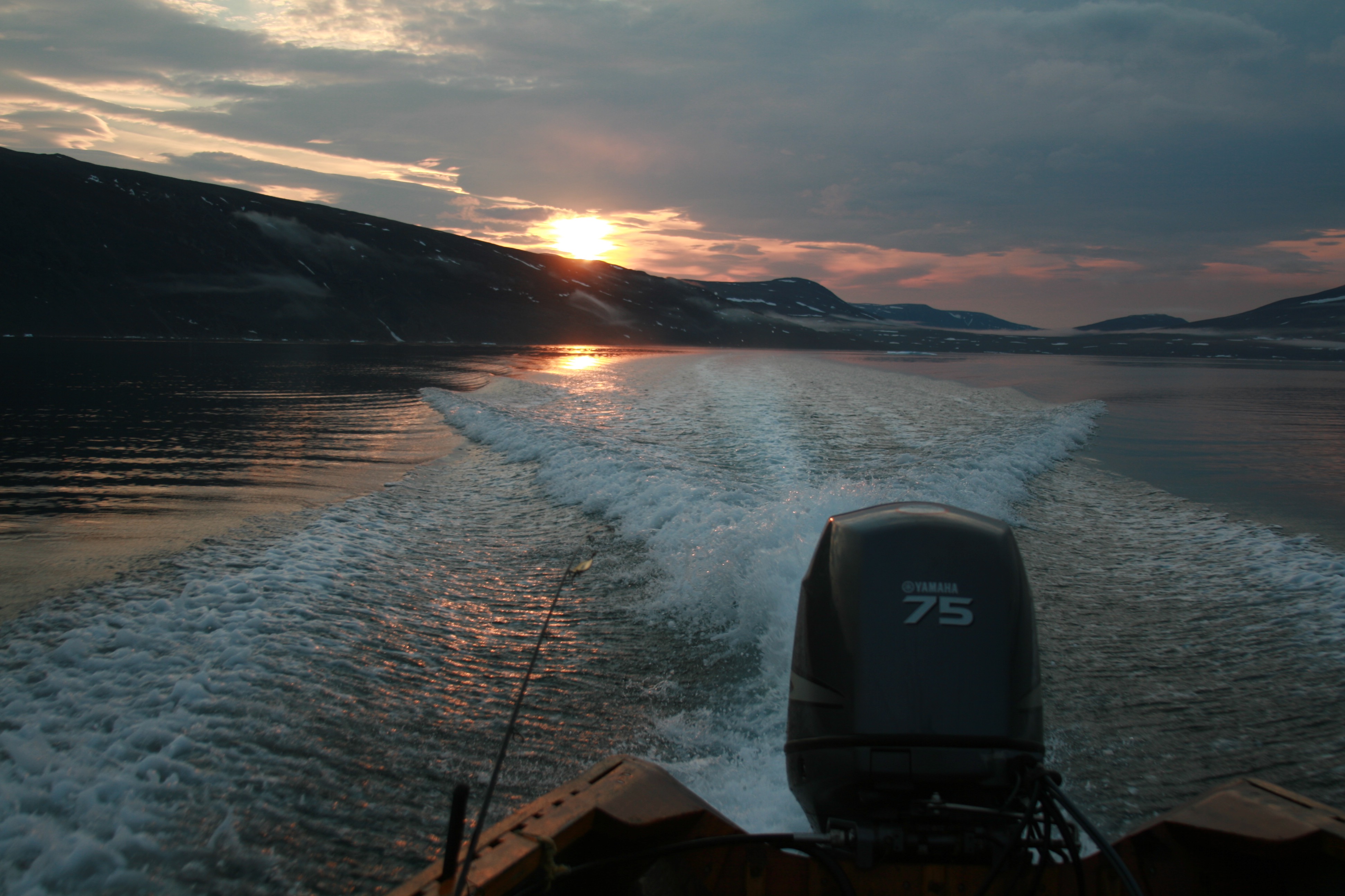
An Arctic sunset from the open ocean canoe as we make our way to basecamp.
Those warming temperatures are a large part of why we are here. I am part of a multi-year NSF supported research project to investigate the Quaternary history of cryosphere activity (ice sheets, ice caps, and glaciers) and evolution of the landscape on Cumberland Peninsula, Southern Baffin Island. The amount work that has been done in this region could fill several volumes, but we are lucky enough that the conditions on Baffin Island allow us to apply relatively new techniques to get at some old questions. 1) Cumberland Peninsula has a large number of low-relief, high elevation upland surfaces, which, in combination with thin cold-based ice, allows for the preservation of the landscape beneath to a very high degree. 2) Although recent glacier retreat rates are alarming, they are exposing these ancient preserved landscapes, complete with bedrock free from glacier scour and even dead plants still rooted in same spot they were when they were killed by advancing ice margins. Given these conditions, we are able to apply two different surface dating techniques: radiocarbon dating of in situ plants on preserved land surfaces and Cosmogenic Radionuclide exposure dating of intact bedrock outcrops.
On good weather days my advisor, Dr. Gifford Miller (who has been coming to this part of the world almost annually since 1970), and I hop in a chartered helicopter to fly around the margins of the Penny Ice Cap in search of these preserved ice caps. Now, I know what you’re thinking, ‘A helicopter? Seems a little luxurious…’. Perhaps it is, but over the past three field seasons, we have been able to visit ~200 unique locations on Cumberland Peninsula, collecting over 300 samples. If we were to attempt this campaign on foot (the only other reliable method of travel across these lands in the summer), it would take several lifetimes to get to every location, not to mention several times more costly. Plus, with the ever increasing polar bear presence inland (as summer sea ice continues to diminish, bears venture farther and farther from the coast), I for one am thankful for the mechanical assistance.
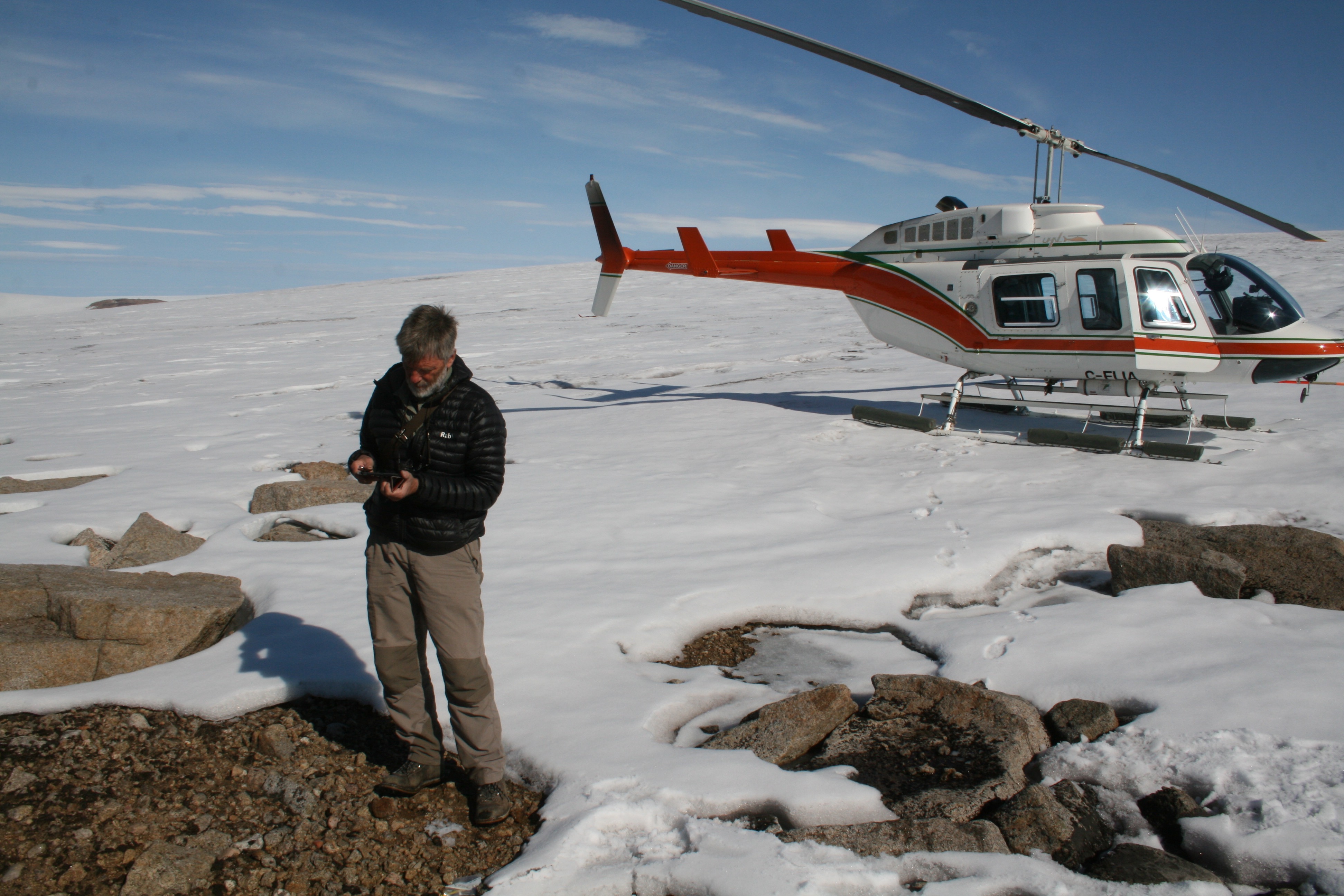
Dr. Gifford Miller making the long trek from the helicopter to the ice edge sampling dead moss emerging from the retreating ice edge.
I digress. Once landed at a likely ice cap, it usually only takes a few moments of traversing the ice edge to locate dead mosses or lichens still in growth position coming out from underneath the ice edge. Although innocuous, those dead plants represent an impressive archive of ice activity over the last >10,000 years. It goes something like this: plants require sunlight for photosynthesis, so when they lose that light, say, by being covered by the advancing margin of a nearby ice cap, they die. Under temperate glacier conditions, where basal ice grinds away at the surface below, these plants would be stripped from the surface almost immediately. However, on Baffin Island, much of the ice is cold based, or frozen to the ground, so anything covered by the glacier can be preserved to a very high degree. During the next warm internval, when ice retreats and uncovers these plants, the radiocarbon age from the plant is the age of it’s demise, which corresponds to the time when ice last advanced over that particular location. Now imagine you date a few hundred such locations across Baffin, and you will begin to build something we’ve never had before: the most continuous chronology of regional ice activity over the last 10,000 years. Pretty neat!
Unexpectedly however, we began to find locations where the plants were radiocarbon dead, or contained no detectable radiocarbon. At first we blamed measurement error, but when we began finding one after another, after another, we knew something else was at play. A radiocarbon dead sample would mean that a plant would have had to die at least 40,000 years ago in order for all radiocarbon to decay away by present day. This meant that some locations may have gone under the ice more than 40,000 years ago and have been buried ever since. Thinking about long term Artic climate, the last time it was as warm as present (or warmer) was during the last interglacial period, or ~125,000 years ago. Was it possible that some landscapes that are being exposed by retreating ice caps today have been covered with ice for the last 125,000 years?
To further investigate this, we look to another isotopic dating method: Cosmogenic Radionuclide dating. Here’s how it works: the earth is being bombarded with with a constant flux of high energy cosmic rays, which produce specific isotopes (10Be, 26Al, 14C, etc.) in surface rocks at steady rates. However, in polar locations, ice is a great absorber of cosmic rays, and isotope production in rocks covered by ice is often extremely low. In a place like Baffin Island where landscapes have survived multiple glacial advances, the isotopic inventory of surface rocks hold a record of the burial and exposure of a land surface by ice, over thousands to millions of years. In the case of our radiocarbon dead plants, if the surfaces they come from are indeed 125,000 years old, then any radiocarbon (14C) produced cosmogenically in the rocks should also have decayed away. At the time of this posting, we are waiting with baited breath to hear the result of the cosmogenic 14C.
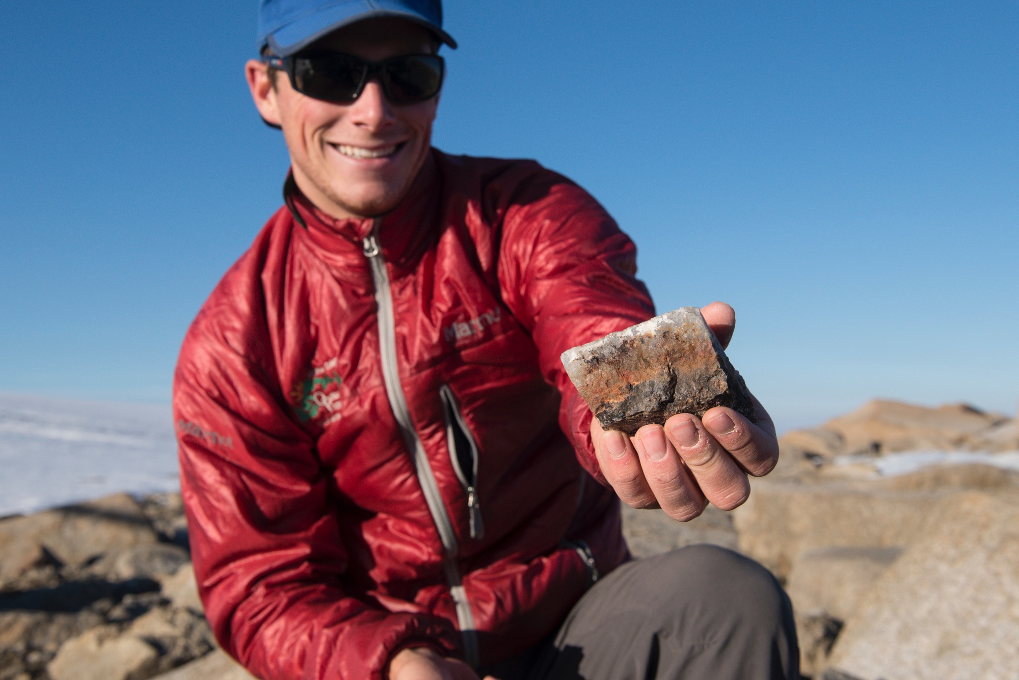
The author with a sampled piece of pure quartz from exposed bedrock, which he hopes contains all the answers to his PhD.
While we wait, it is also possible to used cosmogenic isotopes with much longer half-lives than 14C to investigate the evolution of the cryosphere on Baffin Island over the Quaternary. While in itself, a whole other story, the results from the last few years of work are exciting to say the least. First, some of the landscape being exposed today are old, very old; on the order of two million years old or even greater, meaning that Baffin Island has been host to cold-based ice capable of landscape preservation for most, if not all of the Quaternary. We are also noting that the histories of burial and exposure of landscapes by ice vary dramatically both spatially and temporally across Baffin Island. We are only just now beginning to contemplate the reasons for this variability, be it climate, topography or how the ice and landscape have co-evolved throughout the multiple glacial-interglacial cycles that dominated the last 2 million years.
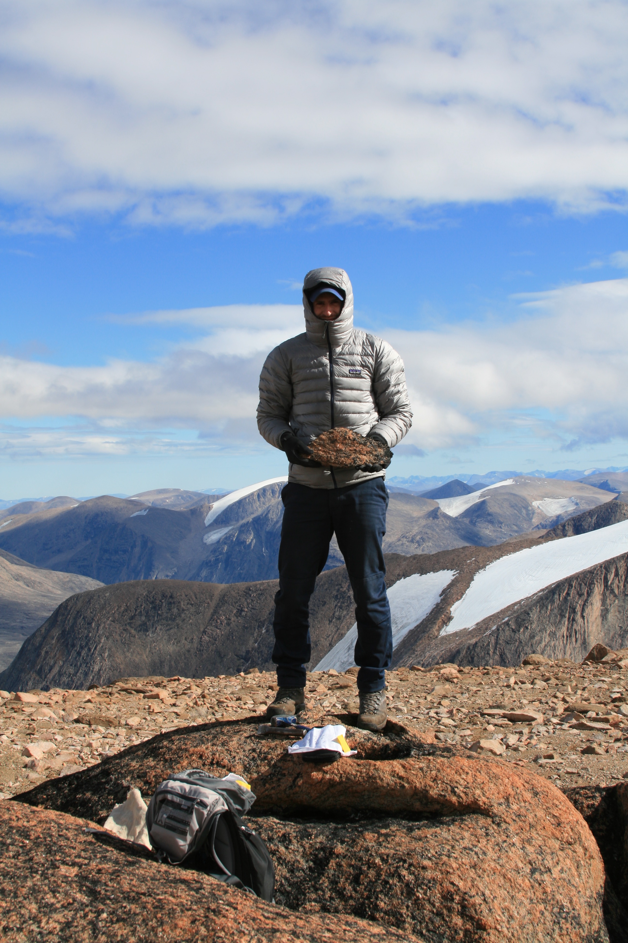
Dr. Nicolás Young with his latest catch; weathered bedrock from a small ice cap on eastern Cumberland Peninsula.
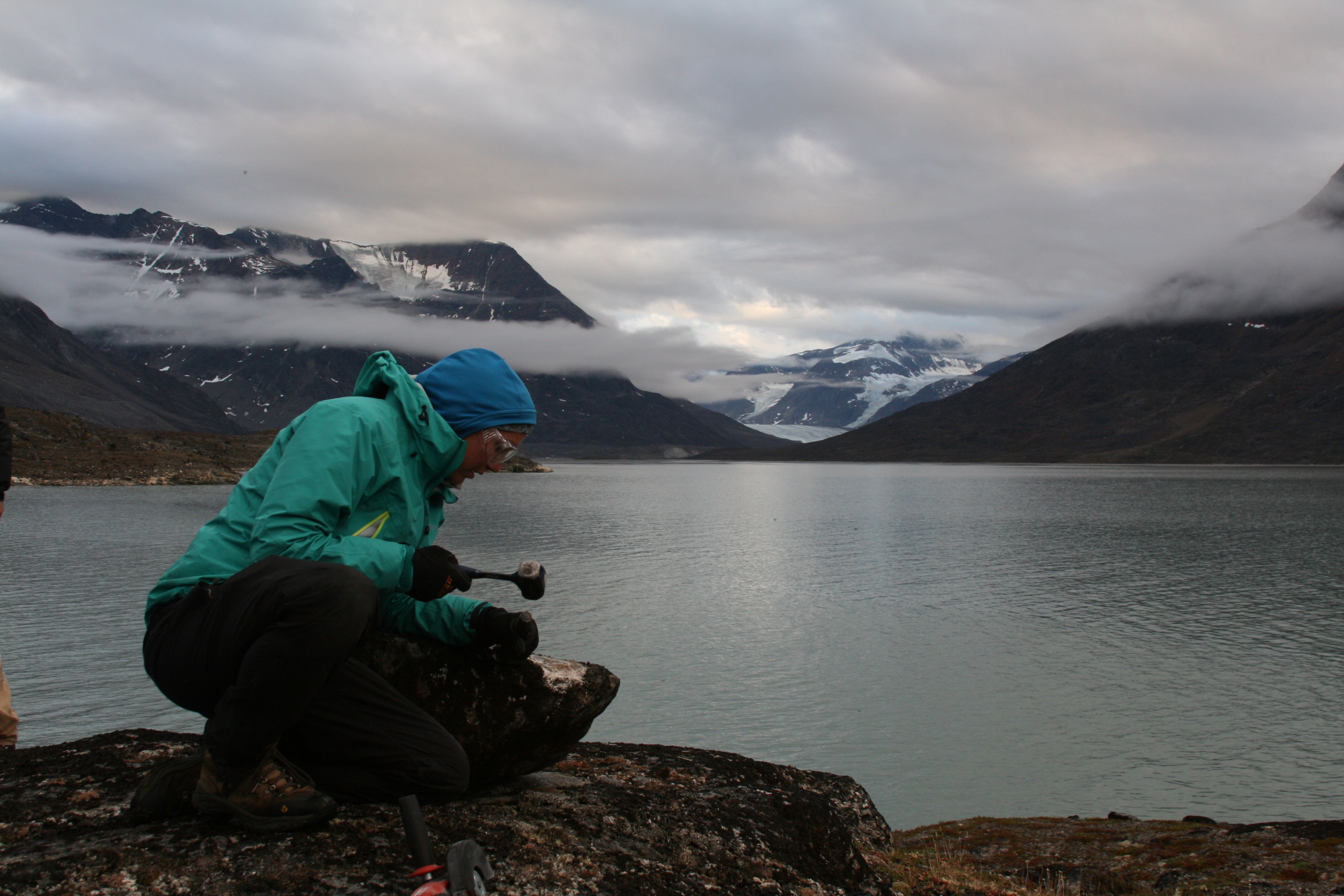
Sarah Crump tackling her latest rock sample the old fashioned way; hammer and chisel.
It is these questions that drive our work, and also drive us to venture far out into the wilds of the Arctic. So here we are, camped just about as far from civilization as one can get, with only soaring fiord walls and wandering polar bears for company. Perhaps it was the alarm of a rapidly melting arctic that brought us here in the first place, but now, the melting ice is what keeps us coming back, knowing that every inch of melt reveals a trove of knowledge, sitting there, waiting.
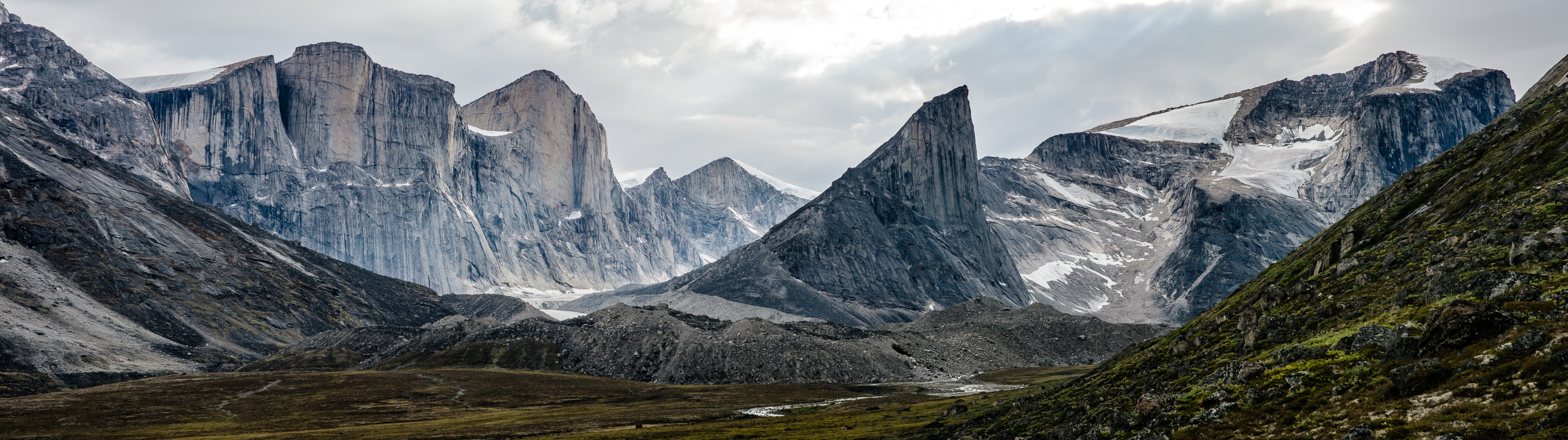
The view from camp of the soaring granite walls that make up most of Baffin Island. Photo Credit: Dan Sperduto
![]() This work is licensed under a Creative Commons Attribution-NonCommercial-ShareAlike 4.0 International License.
This work is licensed under a Creative Commons Attribution-NonCommercial-ShareAlike 4.0 International License.