Pieter is a geochronologist at University College London with interests in thermochronology, cosmogenic nuclides, provenance studies and aeolian geomorphology. You can read more about his research here.
When four hydrogen nuclei (protons) fuse to form one helium nucleus in the solar core, two of them convert into neutrons, releasing two neutrinos in the process. One of the definitive tests of the so-called Standard Solar Model is to measure the flux of those neutrinos. In 1976, Melvin Freedman proposed that the reaction 205Tl (ν,e-) 205Pb could form the basis of a geological neutrino detector. The world’s largest accumulation of thallium-bearing minerals, and the only one suitable as a neutrino detector, is found in the Majdanska River catchment in the Former Yugoslavian Republic of Macedonia, where a number of small mines contain an estimated 500 tonnes of Tl, mostly in the form of lorandite (TlAsS2) with a geologic age of 4.3 Myr.
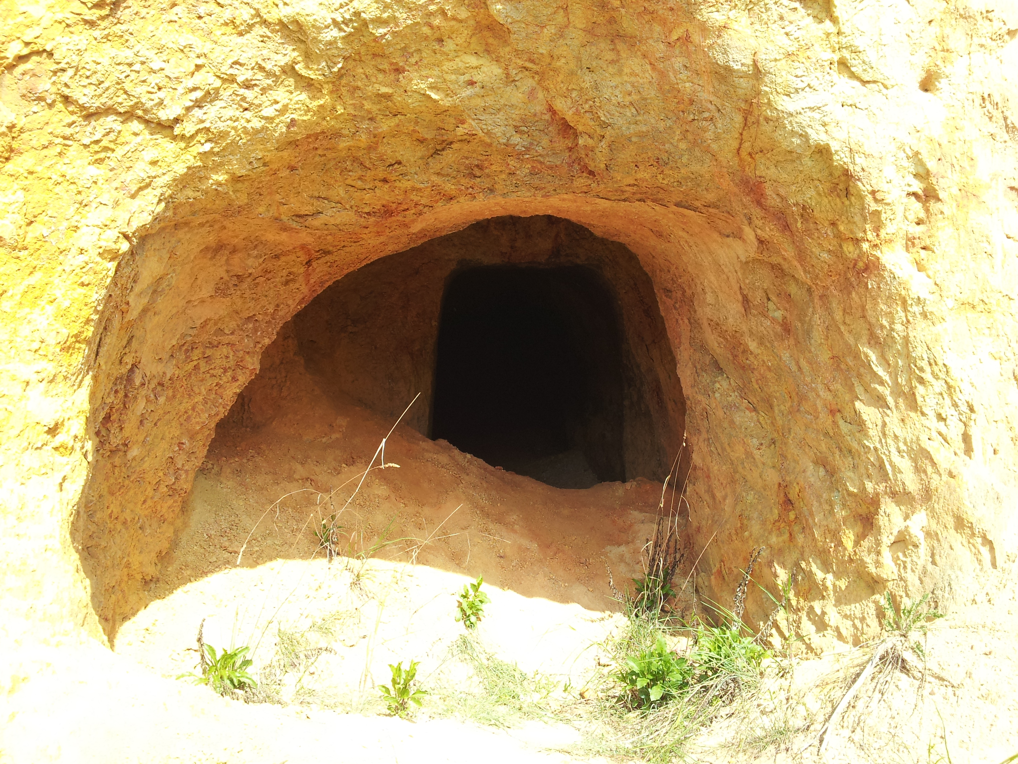
The entrance to one of the lorandite mines near Majden, FYR Macedonia.
The Achilles’ heel of Freedman’s proposal is the relatively shallow depth (120m) of the deposits. Besides neutrino reactions, a second production mechanism for 205Pb is by cosmic ray muons. Whereas 205Pb production by neutrinos is effectively independent of depth, the muon flux decreases exponentially with depth. But at 120 m, it is still enough to produce a significant background signal of 205Pb. However, the burial depth of the lorandite may have been significantly greater in the past, because 4.3 Myr worth of erosion may have removed a significant amount of overburden. The erosion rate, and hence the magnitude of the muogenic 205Pb contribution, may be estimated by analysing other cosmogenic nuclides such as 36Cl (half life: 301 kyr) and 10Be (half life: 1.387 Myr) in surface rocks surrounding the lorandite mines. And so we (Pieter Vermeesch and Martin Rittner) travelled to southern Macedonia to collect some samples for a cosmogenic nuclide study, in a research project funded by the Leverhulme Trust.
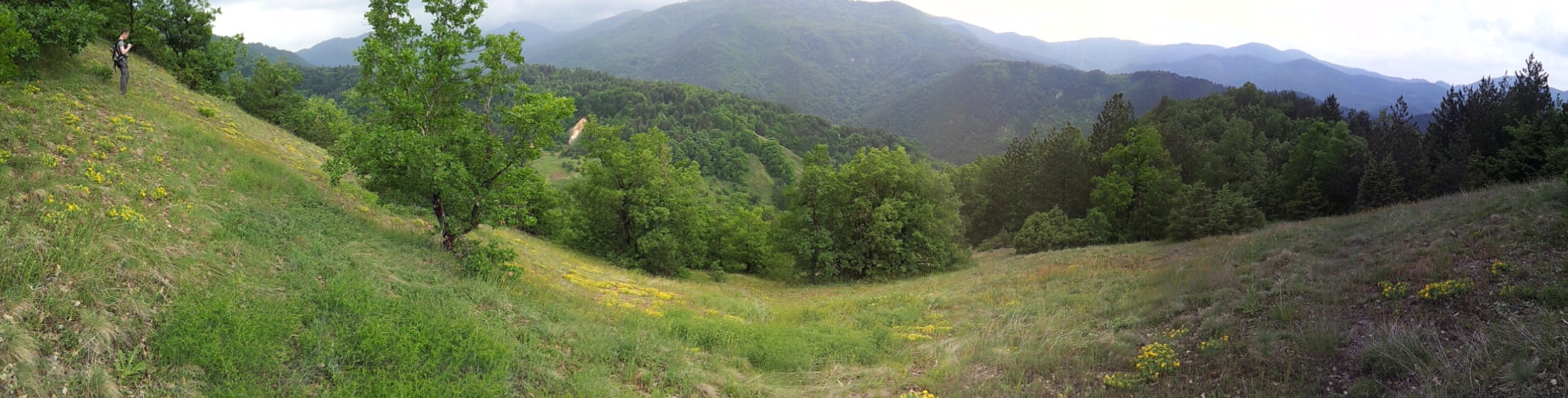
Panoramic view of the Majdanska River valley, which is heavily forested except for some patches underlain by sulfur- and arsenic-bearing deposits.
Majden is a beautiful place. Tucked away high in the Macedonian mountains, just 5 km from the Greek border, it is about as remote a location as you will find in continental Europe. We spent four days here, combing out two square kilometres in search of suitable samples for cosmogenic nuclide analysis. Our sampling strategy included four different kinds of sites:
- The summits of the highest hills, covered by andesitic volcanics, should yield the lowest erosion rates.
- Rare bedrock exposures in the canyons of tributaries to the Majdanska River, carved out in dolomite and marble, are expected to yield the highest erosion rates.
- Bedrock exposures on the steep slopes in between the above two settings consist of andesite, tuffs, marble and every conceivable reaction product of these end members.
- Modern sand and gravel from the Majdanska River containing wide range of lithologies including many quartz bearing phases (gneiss, granite) are expected to yield intermediate erosion rates, representative for the catchment-wide average of the area upstream of Majden.
Finding suitable samples for cosmogenic nuclide analysis is a tricky business, and we took great care to explore the entire field area in order to select the best possible locations, as you can verify from the GPS tracks (yellow lines) on the location map shown below.
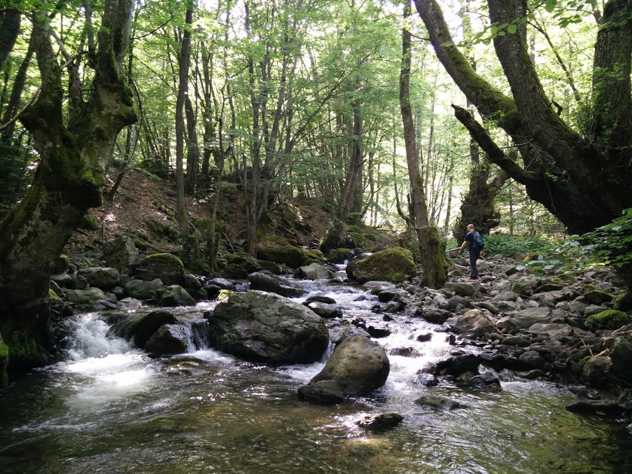
The Majdanska River near sample location 1517
![]() This work is licensed under a Creative Commons Attribution-NonCommercial-ShareAlike 4.0 International License.
This work is licensed under a Creative Commons Attribution-NonCommercial-ShareAlike 4.0 International License.