A lot of people, including many non-geologists (even Beyoncé), are aware of the famous detrital Hadean zircons from the Jack Hills of Western Australia, which represent the oldest terrestrial minerals yet found (up to 4.37 Ga). The oldest crystalline basement rocks are arguably an equally important source of information regarding Earth’s earliest history. During my PhD with Sam Bowringat MIT, I have had the rare opportunity to work with rocks from the Acasta Gneiss Complex (AGC) of the Slave Province of northern Canada, home to the oldest known zircon-bearing evolved crust on Earth (>4.03 Ga).
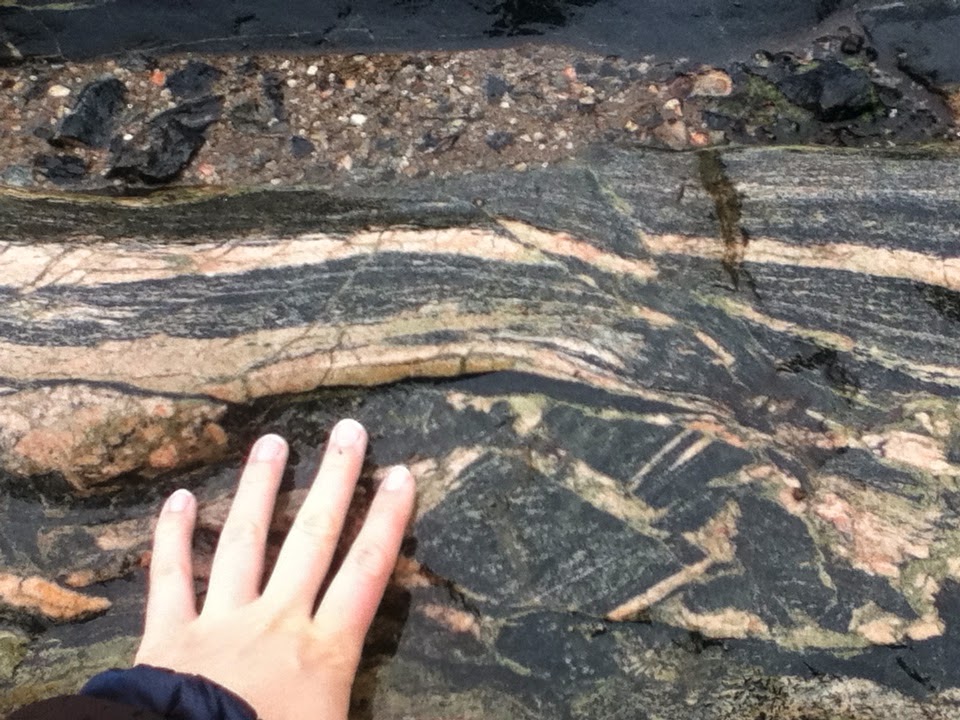 |
| Touching a cleaned outcrop of Acasta Gneiss near camp. |
The rocks of the Acasta Gneiss Complex are exposed along the western margin of the Slave craton in the core of a north-trending fold associated with the Proterozoic Wopmay orogen. The rocks are compositionally diverse, ranging from quartz diorite to tonalite. U–Pb zircon dates indicate that the oldest igneous crystallization ages are 4.03–3.96 Ga. Older zircon cores and published zircon Hf and whole rock Nd isotopic datasets are consistent with the involvement of even older crust in their generation. The rocks of the AGC have undergone a complex history of metamorphism and deformation, and, as a consequence, the zircons often retain a complex history of inheritance, magmatic and metamorphic overgrowths, recrystallization, and multi-stage Pb loss.
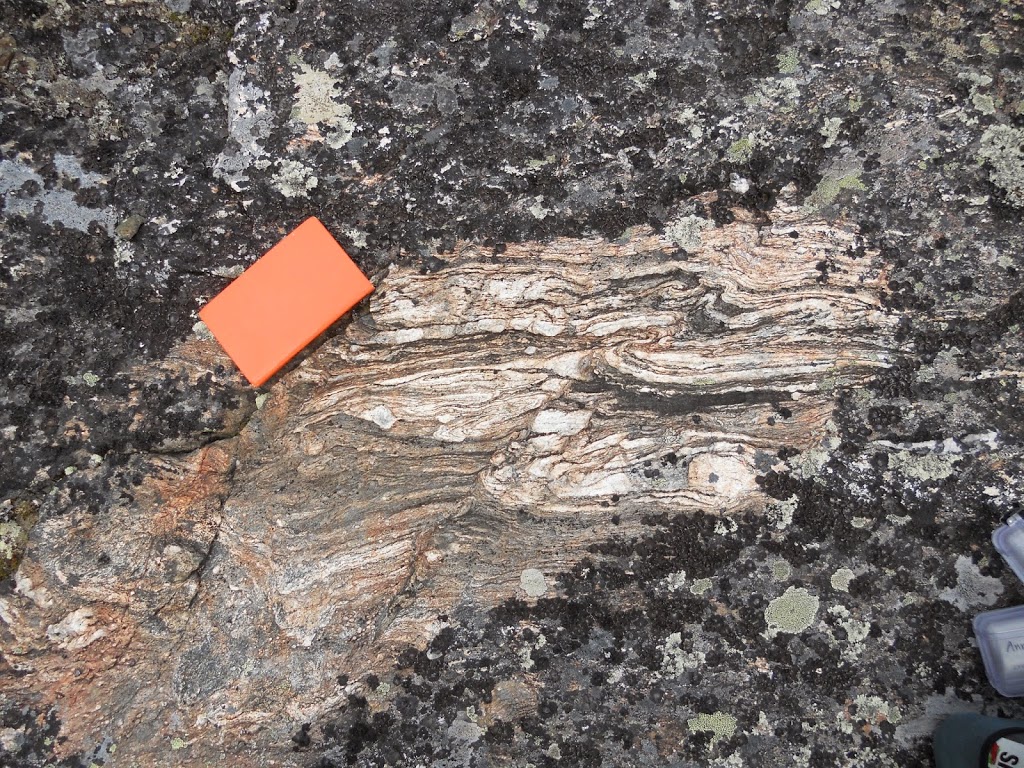 |
| A small, lichen-free window into an outcrop. ~15 cm orange notebook for scale. |
One of the major challenges inherent to working in old gneiss terrains is finding suitable samples. The rocks are multiply metamorphosed mixtures of multiple lithologies, which means that it is difficult to find samples representing just one lithology. On top of that, outcrops are sparse. Most outcrops are glacially polished and have no rough edges that you can break into. The rocks are also completely covered in lichen, except in places that have experienced recent forest fires.
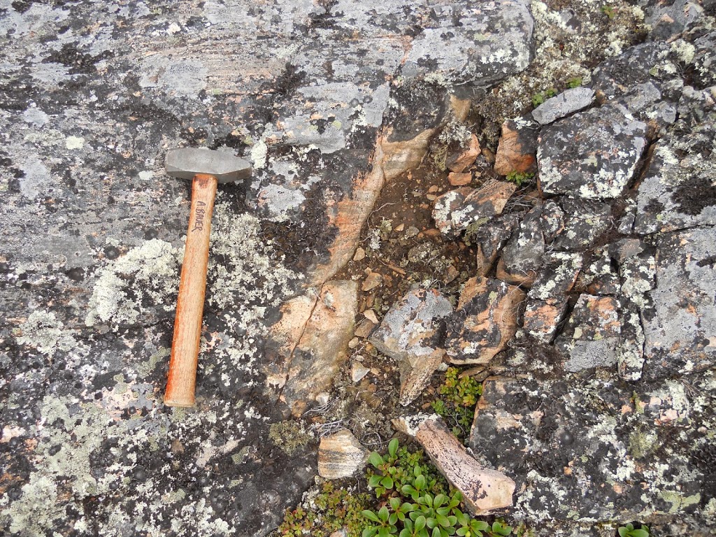 |
| Sometimes the edges of outcrops are crumbly, making it tough to get a fresh sample in spots like this. I chose not to take a sample here. |
I am not alone in my focus on these rocks. I was lucky enough to accompany University of Alberta graduate student Jesse Reimink and his advisor, Tom Chacko, for a portion of their summer fieldwork in the Acasta Gneiss Complex and environs. To see some of their work, check out this recent paper. They had already conducted a couple of prior field seasons, but this season they had the rare treat of helicopter time funded by the Northwest Territories Geoscience Office (NWTGO), which is in the province capital, Yellowknife. Geologist John Ketchum of the NWTGO and Jesse’s dad, Ron, a high school biology teacher from Michigan, came along as well.
 |
|
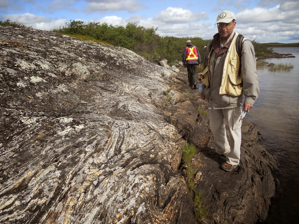
Some gorgeous tight folds with Tom Chacko for scale. Apparently it is vogue among field geologists working in the Canadian shield to wear fishing vests.
|
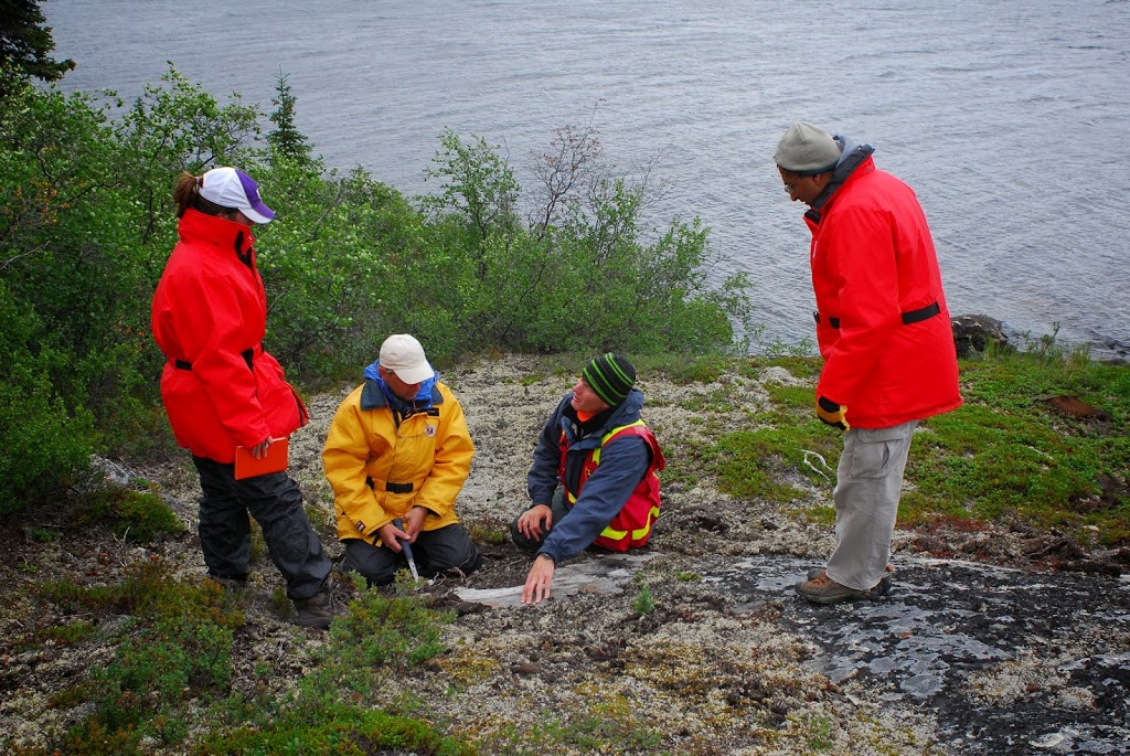 |
| Looking at the Idiwhaa unit described in Reimink et al (2014). L-R: Ann Bauer (MIT), John Ketchum (NWTGO), Jesse Reimink (UA), Tom Chacko (UA). Photo credit: Ron Reimink. |
Before heading to the field, we took a day to organize our supplies and pass the required NWTGO field and bear safety training. The following morning, we packed up the floatplane and headed out. When we arrived at the small island in the Acasta River that serves as home base, we unloaded the plane, waved goodbye to the pilots, and then learned how to shoot a gun before setting up camp. As a native Seattleite, I had never even held a gun before. We also practiced using bear spray and bear flares, both of which are used to scare away bears in the event of a bear encounter.
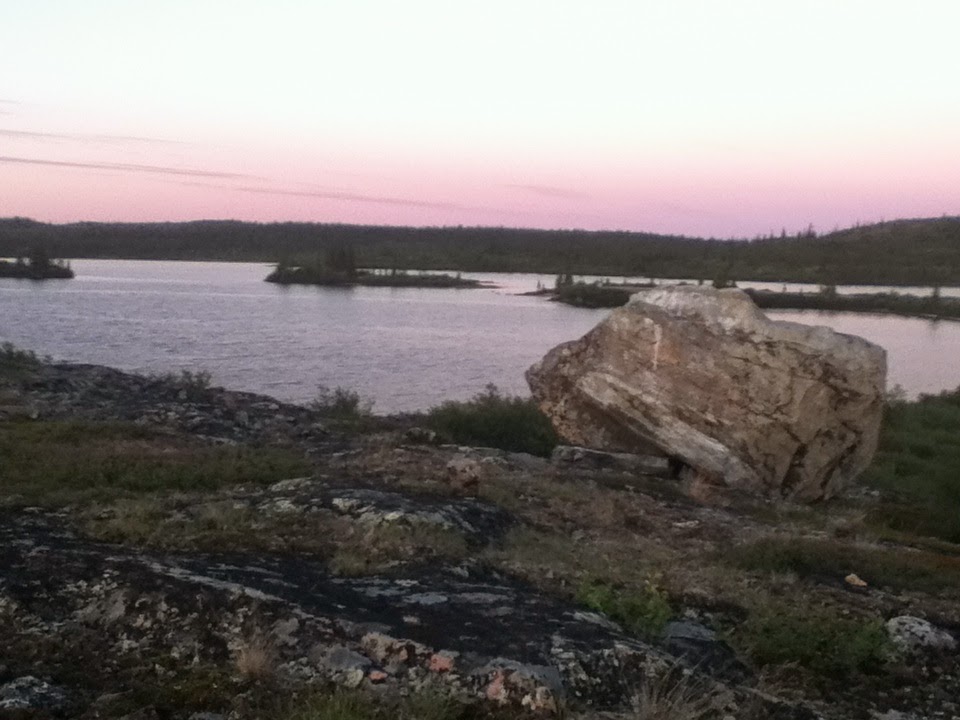
Acasta is a hauntingly beautiful place. Our field site straddled the boundary between tundra and boreal forest. Camp was situated near the tree line, such that if we looked north, we saw few trees, and if we looked south, the trees were much denser. It was tough ground to move through; much of it was swampy and uneven. That far north, it stays moderately light through the night—the picture below was taken close to midnight.
 |
| Looking east across the Acasta River from camp. This picture was taken at 11:50PM. |
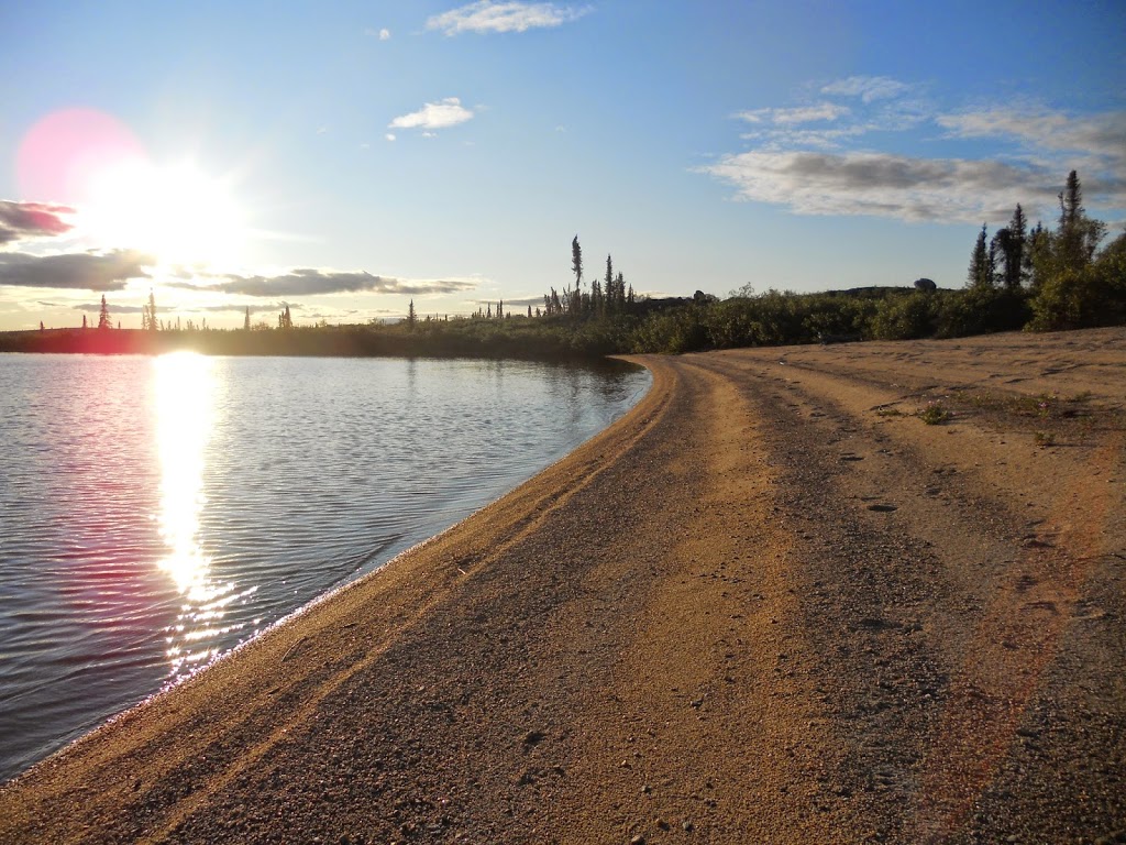 |
| The beaches are gorgeous, but the mosquitoes, the infamous black flies, and the cold kept swimming and bathing activities to a minimum. |
A question that I am particularly interested in answering is, ‘Has the volume of continental crust remained constant, or has it grown with time?’ The project that I am working on attempts to address this question through an integrated isotopic, geochronologic, and petrologic approach. It’s a critical question to answer because an understanding of the development and growth of continental crust over the course of Earth history is essential for deciphering the geochemical, geophysical, and geobiological evolution of our planet. The Acasta Gneiss is one of our earliest terrestrial repositories of chemical, age, and isotopic information and therefore has significant potential to contribute to our understanding of tectonic processes on the early Earth.
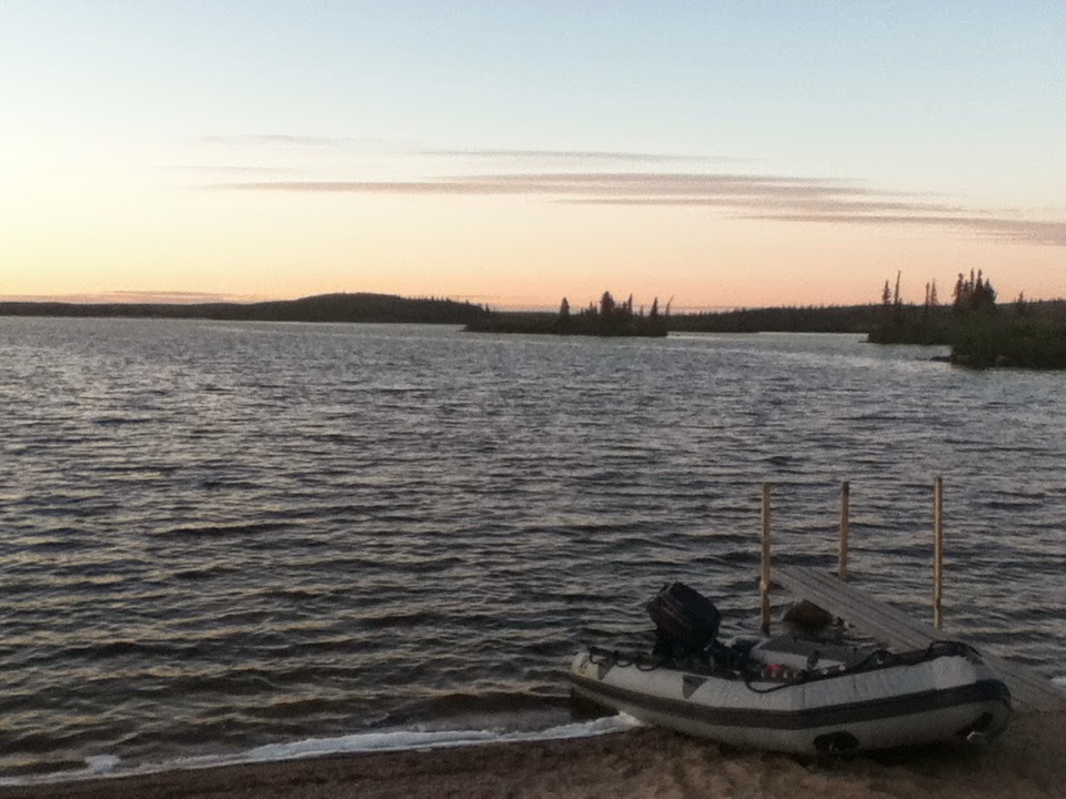 |
| Looking east from camp. We used the pictured Zodiak to reach mapping transects that abutted the Acasta River and also for some world-class fishing. |
![]() This work is licensed under a Creative Commons Attribution-NonCommercial-ShareAlike 4.0 International License.
This work is licensed under a Creative Commons Attribution-NonCommercial-ShareAlike 4.0 International License.