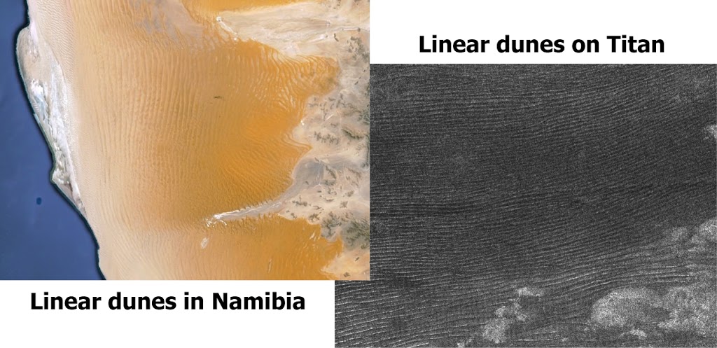
During my undergraduate at Brigham Young University, I had the opportunity to work with Dr. Jani Radebaugh in conjunction with the Jet Propulsion Laboratory (NASA/Cal Tech) and Lunar and Planetary Laboratory (U of Arizona). We were researching the linear dunes on Saturn’s largest moon Titan seen by the Cassini spacecraft. Titan is unique because it is the only planetary body in the outer solar system that has similar surface processes as found on Earth (i.e. erosion of a solid “crust”, eolian and fluvial transport, and deposition). The dunes on Titan are thought to have forms as hydrocabron compounds (tholins) form in its dense atmosphere and fall as “snow” on Titan’s icy surface. Winds that circulate the equatorial regions sweep these particles into dunes. The dominant dune form on Titan is linear. Linear dunes were originally thought to have formed from bi-directional winds, however recent modeling and observations have shown that linear dunes are elongate parallel to the prevailing wind.
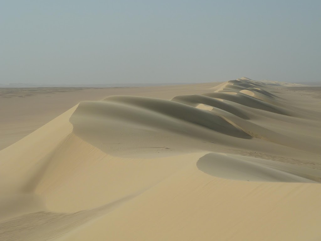 |
| Linear dune in Egypt (photo by Jani Radebaugh: here) |
My work was focused on finding terrestrial analogues to the dunes on Titan. There are several places on Earth when linear dunes are found (e.g. Namib, Taklamakan, Rub’ al Khali, and Grand Erg Oriental Deserts to name a few) and of which are strikingly similar to those found on Titan. Results of the project were published in Icarus and Geomorphology. Later in my undergraduate program, I was lured away from Titan and its dunes by zircons and the Himalaya.
The students that continued working on the dunes of Titan were invited to accompany a group of planetary scientists/geologists (Jani, Ralph Lorenz, Tim Farr and others) and students to Egypt to study this terrestrial analogues of the “sand” dunes on Saturn’s moon Titan. Unfortunately sending a geologist to Titan would be a bit too lengthy (it took Cassini 6 years, 8 months, and 16 days to get to Saturn). Stephen Phillips and Chris Savage were among those lucky enough to attend this incredible expedition. Stephen is currently finishing a MSc at Brigham Young University and will subsequently begin work for Anadarko Petroleum. Chris is currently working for Chevron. Thanks to Stephen for sharing this adventure.
Titan’s Dunes in Egypt
Stephen Phillips
The original plan was to spend the majority of three weeks in the Sahara of western and southern Egypt. This plan was greatly modified when we arrived and found that the Egyptian government would not allow us to go to the Sahara … they thought we were spies.
Instead we spent a lot of time being tourists in Cairo waiting for permission to enter the desert. During our time as tourists Chris and I never really got over our jet lag and as a result, we spent our nights walking the streets of Cairo. That might be semi-dangerous in major cities in the US, but in Cairo, people were just getting away from long days at work. We met some amazing people who showed us around the area. We spent time in Tahrir Square every night. It was surreal watching the protests only months later.
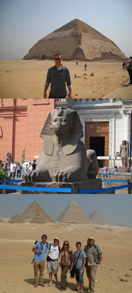
We were also able to see some of the classic sights in and around Cairo including the Bent Pyramid of Dahshur (left top), pyramids of Giza (left bottom), and the Khan el Khalili.
Eventually we got sick of waiting and (against orders and probably at the risk of arrest) travelled to the nearest linear dunes we could find, the Quattaneya Dunes just west of Cairo.
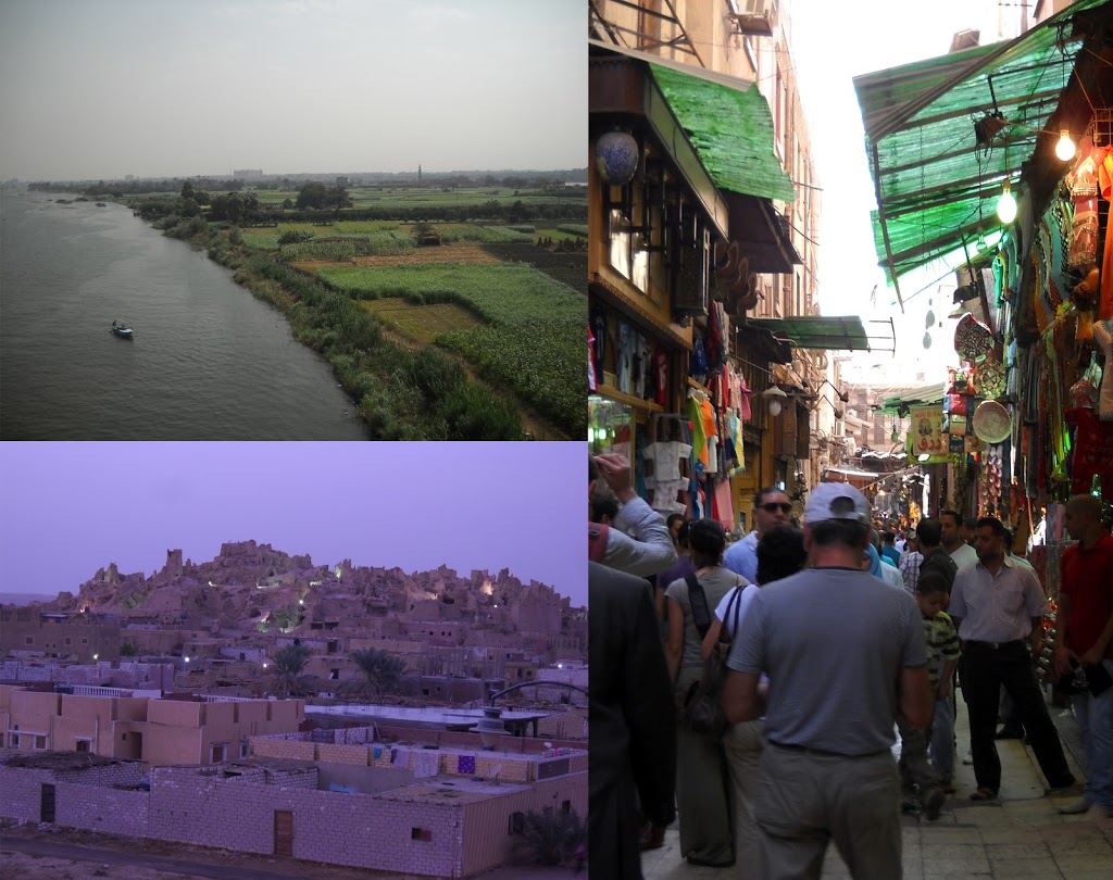 |
| Nile river (above), the old part of Siwa Oasis (below), and Khan el Khalili (right) |
Once out among the dunes, we ran ground penetrating radar (GPR) surveys over the dunes to image the interior surfaces. GPR uses sound waves to “see” the internal structure of the dunes and potentially see reactivation surfaces which represent changes in wind direction through time. We were also able to image the extension of the interdunal deflation surfaces under the plinth of the dune. This suggests that the dunes move laterally as well as lengthwise. Chris Savage and I were the workhorses who did the dragging in the heat of the day. Hey, we had to pay or way somehow!
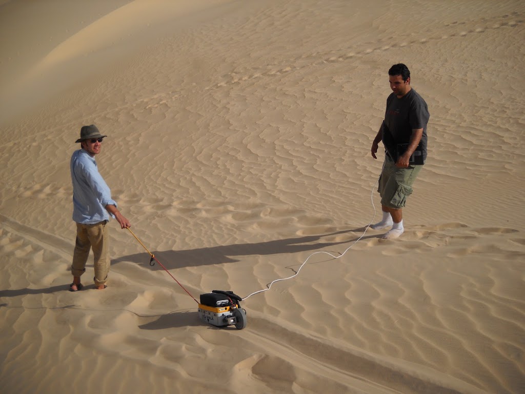 |
| Chris Savage pulling the GPR across a dune |
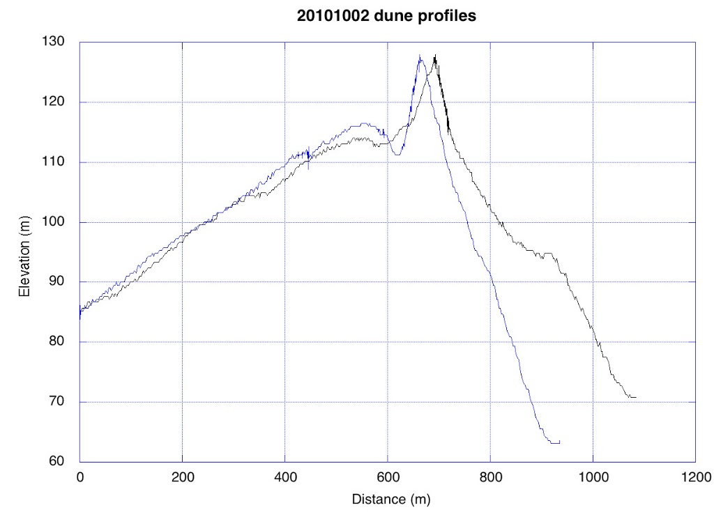
Tom Farr took GPS surveys perpendicular to the dunes to get their profiles. The lee side (right) is the steep avalanche face of the dune and the stoss is the shallower slope. The top of the dune is most active and thus displays the greatest degree of variation. It’s hard to get that kind of view from aerial photos or views from the ground. A linear dune is, indeed, an active and ever-changing surface feature.
Our last stop was in the Grand Erg Oriental (after receiving permission). This limestone yardang has experienced significant sandblasting. You can see that the top part is more resistant than the chalky white bottom part. Differing resistance to weathering was evident within these layers as well as evidenced by the fossils that stick out of the rock.
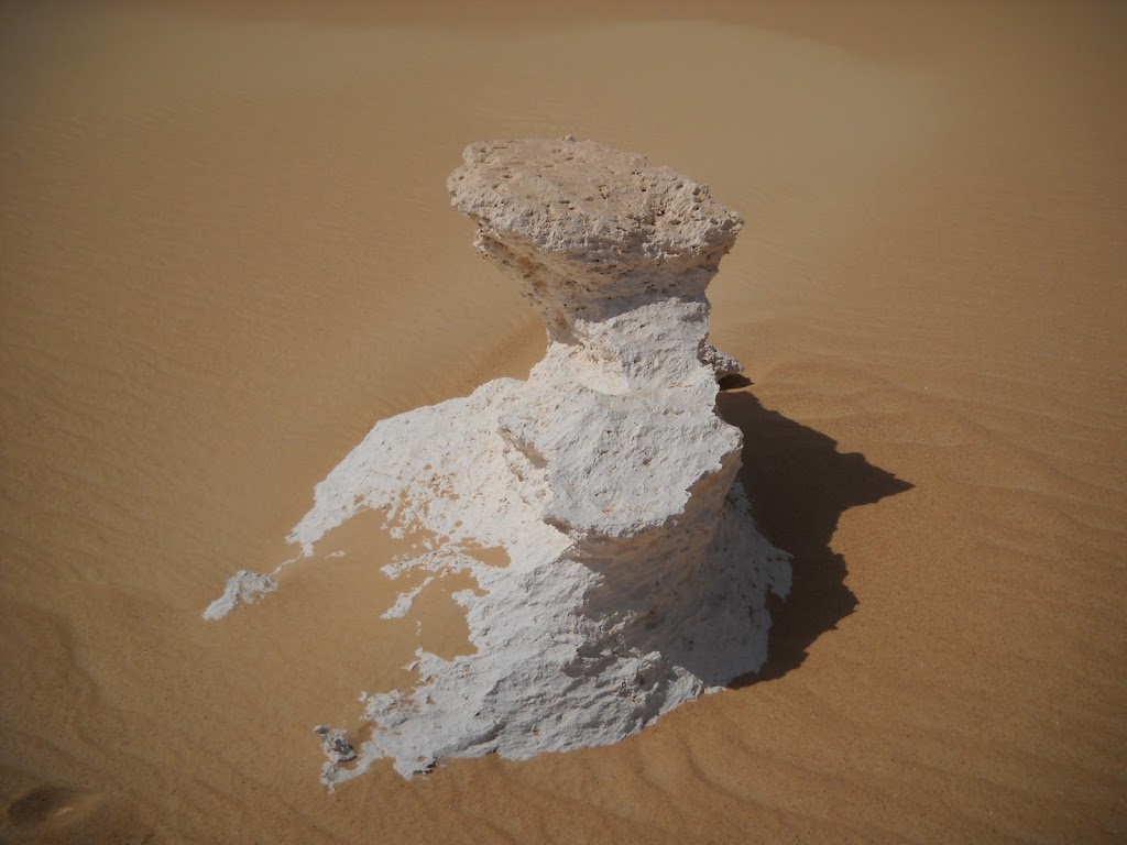 |
| Limestone Yardang |
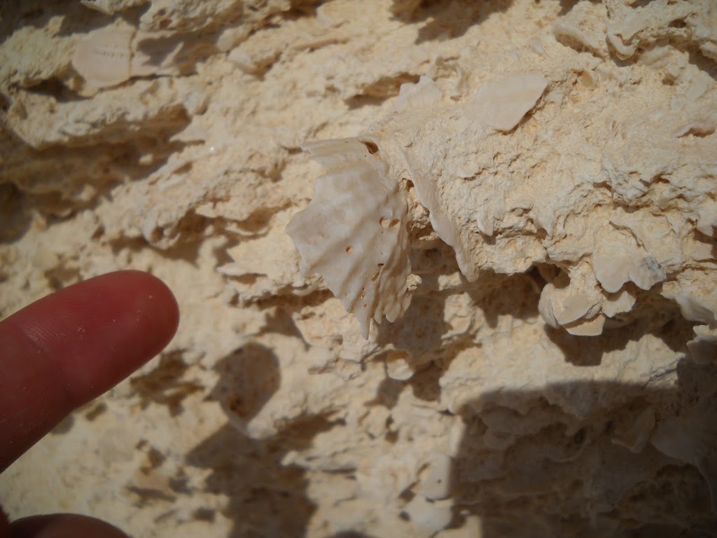 |
| Mollusk Fossil |
![]() This work is licensed under a Creative Commons Attribution-NonCommercial-ShareAlike 4.0 International License.
This work is licensed under a Creative Commons Attribution-NonCommercial-ShareAlike 4.0 International License.