History of Destruction
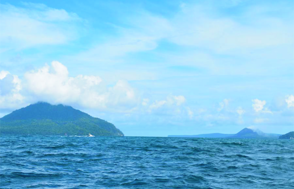
The infamous Krakatoa (Fig. 1) continues to live up to its legacy as one of the most volatile volcanoes on the planet. Its 1883 eruption is legendary for producing the largest explosion in historic times. The sound it made was heard 5000 km (3000 miles) away. Imagine hearing an explosion in Boston from San Francisco! The pressure wave of the explosion circled the globe 7 times and was registered on barographs worldwide over the course of 5 days.
The blast was sparked by the instant flashing to steam of megatons of seawater that poured into the magma chamber feeding the eruption as the volcano collapsed into the sea. The event generated a series of tsunamis with run-up heights > 35 m, which claimed most of > 36,000 deaths locally resulting from the eruption. Hundreds of settlements were swept away. Even more casualties globally are attributed to the eruption due to sulfur contamination of Earth’s upper atmosphere from the violence of the explosion. The increase in sulfur dioxide blocked enough sunlight to cool Earth by an estimated 1.5 degrees C.
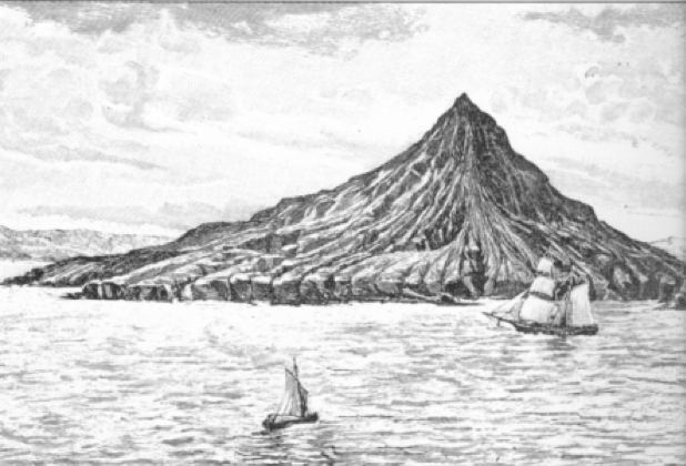
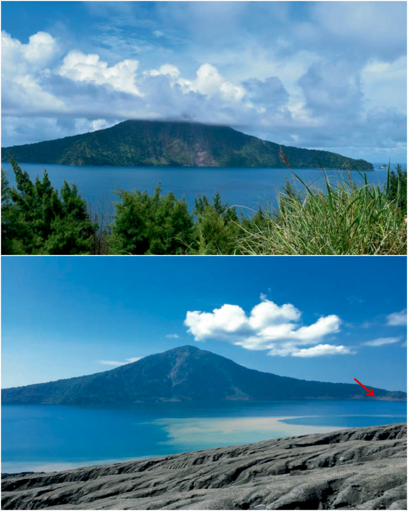
Near the eruption, darkness continued for 3 days. When it cleared the survivors witnessed that most of Krakatoa was gone. Only a few remnants of its ~918-meter summit was visible, the most prominent of which is Rakata Island (Fig. 1).

Source: Wikipedia.
The Restless Child
Anak (child) Krakatoa was born 45 years after the cataclysmic 1883 eruption. Rumblings under the sea spit ash and poured lava flows that eventually grew into a new island in 1930. By 1960 Anak Krakatoa had grown to a height of 166 meters and was averaging an episodic growth rate of 5 meters per year. It has erupted 59 of the past 100 years.
The Collapse of Anak Krakatoa
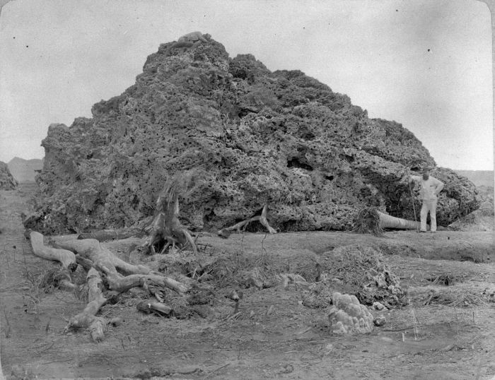
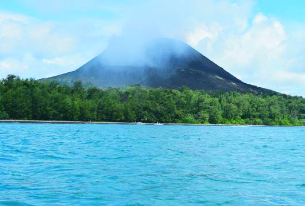
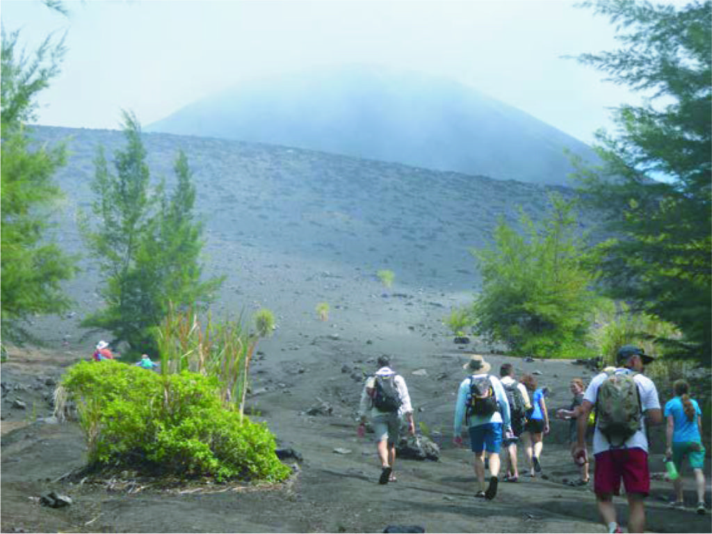
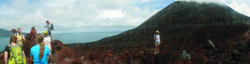
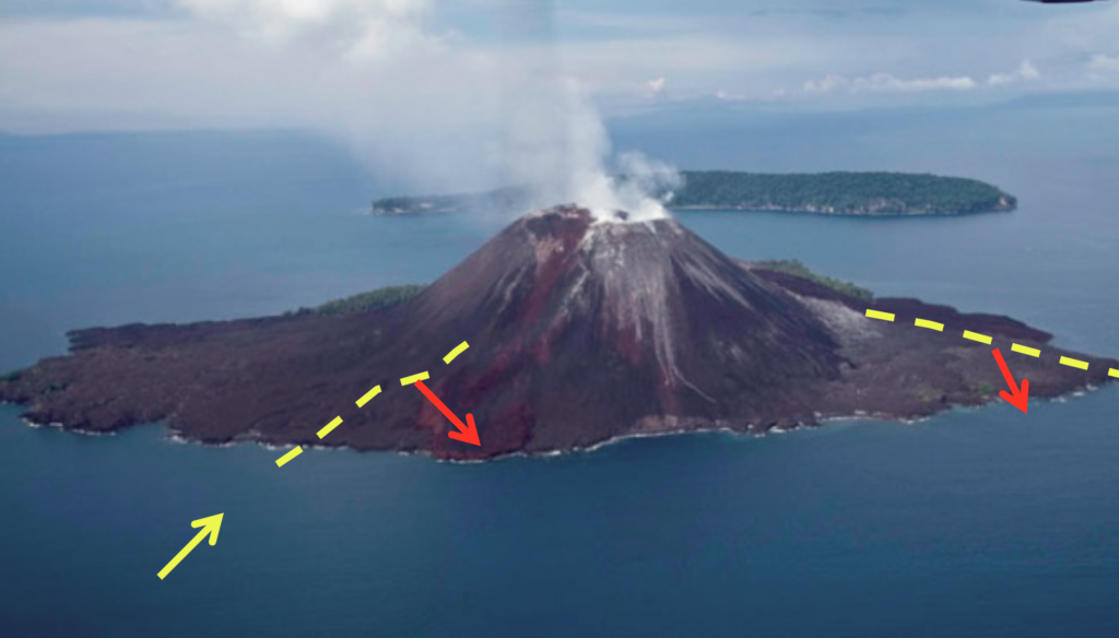
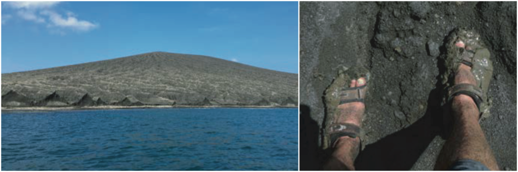
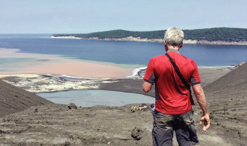
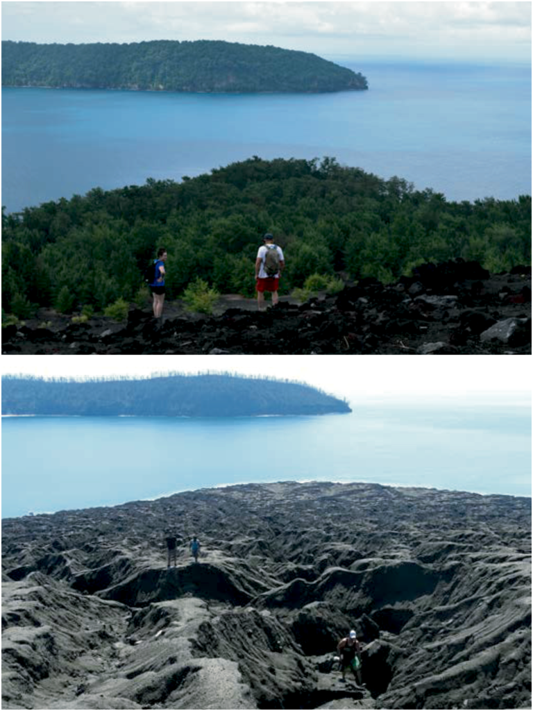
By 2016, when I first set foot on ‘the child’, her summit was around 400 meters above sea level (Fig. 3). The expedition to the island focused on searching for evidence of instabilities in the volcanic edifice. Several students and faculty from the WAVES project joined the expedition. We landed on the east side of the smoking volcano, which is perched on older deposits from the 1883 eruption (Figs. 2 and 3). Vegetation had established itself there and sheltered some huge monitor lizards that scurried through bushes.
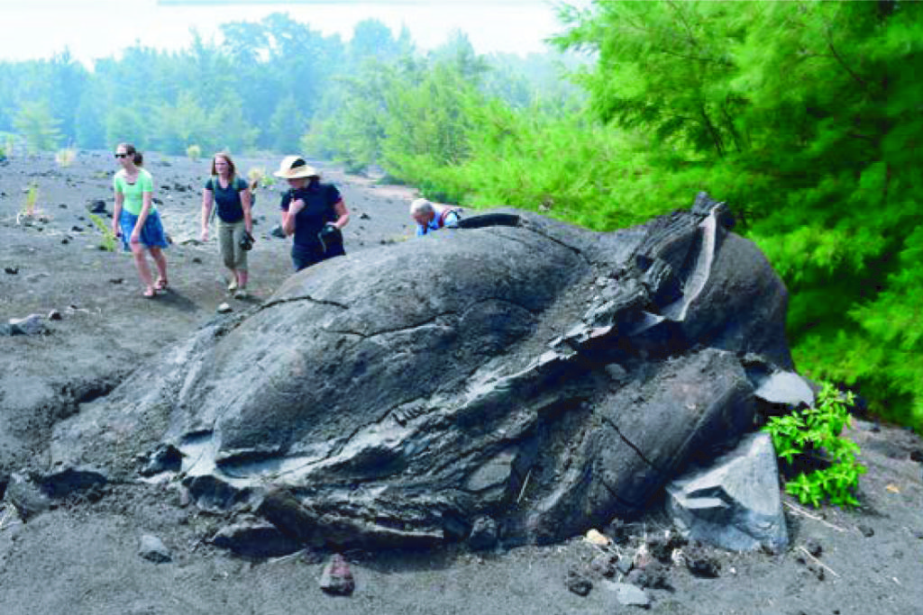
The volcanic edifice was perched on the rim of the caldera formed during the 1883 eruption. The SW slope was steeply inclined (~30 degrees) directly into the sea and toward the deep hole left by previous explosions. The part of the volcano we climbed in 2016 had been built during the early emergence of the island and was much less steep. It was littered with fine pyroclastic material cratered by huge volcanic bombs (Fig. 5).
A paper published in 2012 warned that renewed activity of Anak Krakatoa could result in collapse of the SW slope of volcano into the sea (Giachetti et al., 2012). From numerical models these authors simulated the collapse and concluded:
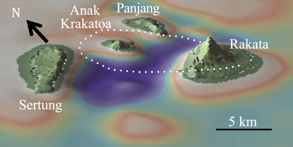
A hypothetical 0.280 km3 flank collapse directed southwestwards would trigger an initial wave 43 m in height that would reach the islands of Sertung, Panjang and Rakata in less than 1 min, with amplitudes from 15 to 30 m. These waves would be potentially dangerous for the many small tourist boats circulating in, and around, the Krakatoa Archipelago. The waves would then propagate in a radial manner from the impact region and across the Sunda Strait, at an average speed of 80–110 km h−1. The tsunami would reach the cities located on the western coast of Java (e.g. Merak, Anyer and Carita.) 35–45 min after the onset of collapse, with a maximum amplitude from 1.5 (Merak and Panimbang) to 3.4 m (Labuhan).”
Giachetti T, Paris R, Kelfoun K, Ontowirjo B. 2016. Tsunami hazard related to a flank collapse of Anak Krakatau Volcano, Sunda Strait, Indonesia. Geological Society, London, Special Publications, 361: 79-90, https://doi.org/10.1144/SP361.7
The Beginning of the End
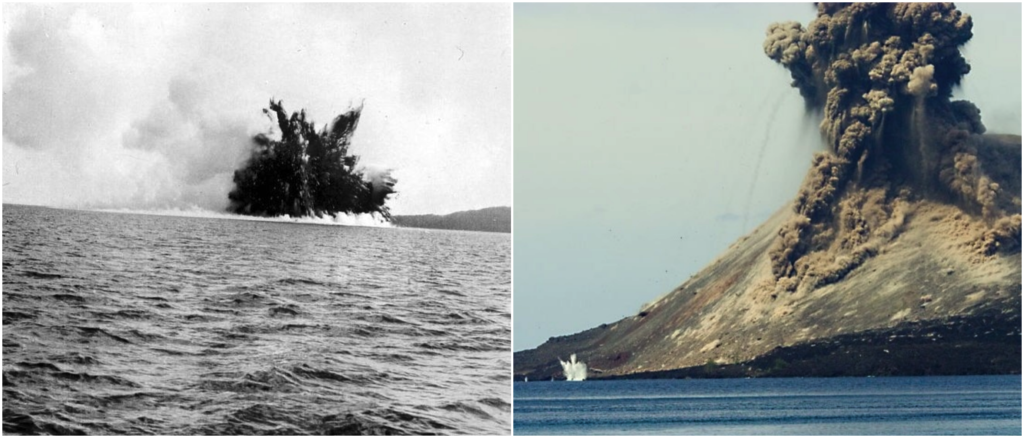
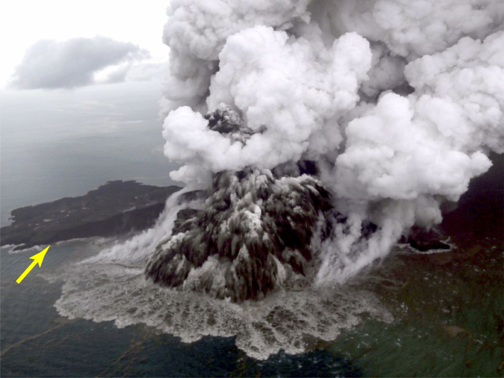
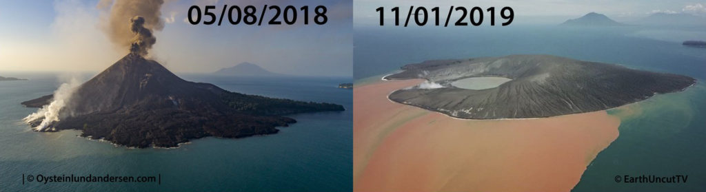
Violent eruptions shook Anak Krakatoa from October to December 2018, eventually engulfing the entire island (Figs. 11-12). These eruptions destabilized the volcanic construct as forecast by Giachetti et al. (2012).
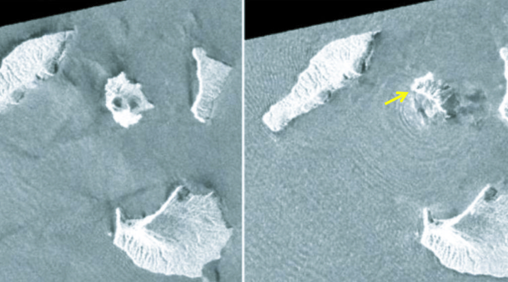
On the night of 22 December it happened – the steep SW slope of Anak Krakatoa collapsed into the deep sea of the former crater of the 1883 eruption (Fig. 5). Two catastrophic events followed: first, mega-tons of seawater were displaced by the landslide to send a tsunami outward from the site (see waves radiating away from the collapsed island in Fig. 14); and second, the water rushed back into the new opening of the volcano furnace, flashed into steam and exploded (Fig. 12). This event blew what was left of Anak Krakatoa apart.
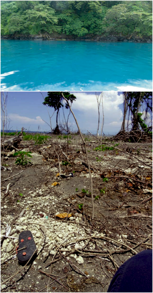
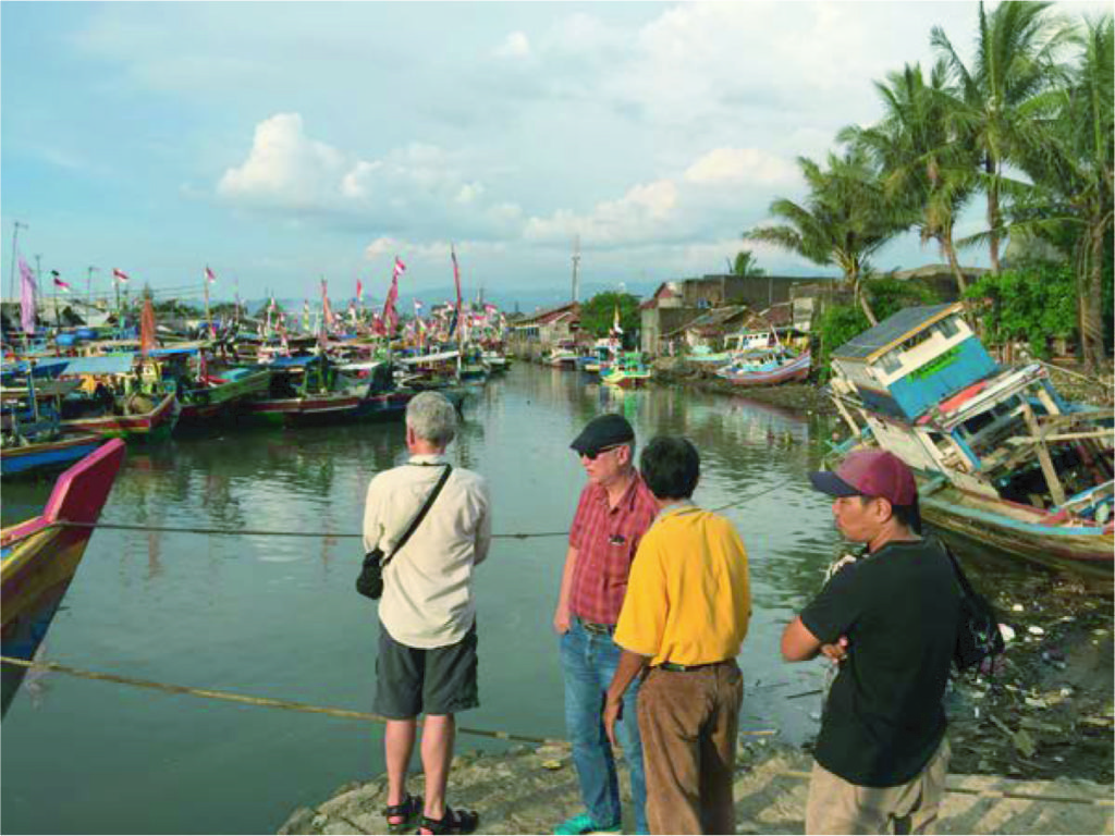
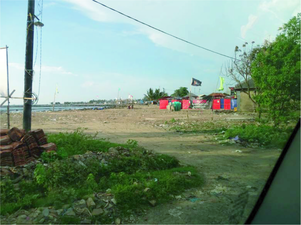
In February of 2019 I was able to gain access to the Cucu Krakatoa to compare it with what we observed in 2016 and document damage on the nearby coastlines of the tsunami (Figs. 14-18).
Silent Tsunami
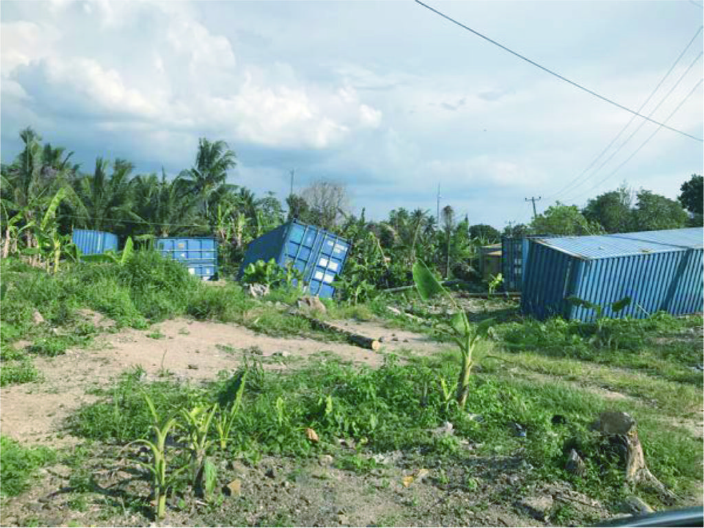
The tsunami generated by the collapse of Anak Krakatoa is known as a ‘silent wave’ because it was not caused by an earthquake (no ground shake warning). Also, the landslide happened at night, which made it difficult for anyone to see it was approaching. Over 1000 persons were killed by the tsunami. A YouTube video of a concert on the beach in West Java captured the tsunami crashing into the stage and shoving it and the band over the crowd.
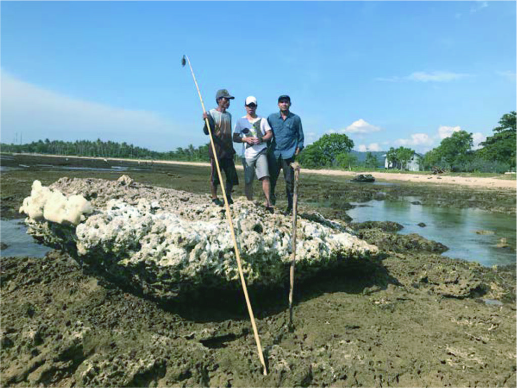
The largest waves were those that struck the islands surrounding Anak Krakatoa. A ‘trim line’ where the tsunami ripped the vegetation from the shorelines of these islands is over 20 meters high in places (Figs. 17-20).
What Can We Do?
The catastrophic collapse and explosion of Anak Krakatoa, and the tsunami it spawned, was not as formidable as the 1883 eruption, but it claimed >1000 lives and injured and impacted thousands more. The only way to avoid such events is to maintain tidal gauges around Cucu Krakatoa. These gauges transmit real-time data about unusual wave activity (long wavelength tsunami waves) to a siren system. However, these types of technologies have been installed in Indonesia before and within a few years were in ill repair. Another problem is the sparcity of sirens compared to the number of coastal communities. In some places where sirens work no one knows what to do when they hear it due to lack of tsunami evacuation drills.
These issues are the focus of In Harm’s Way, which is a non-profit organization dedicated to natural disaster reduction through preparedness. We have saved thousands of lives by identifying local, community-based solutions to building resilience to natural hazards. Our motto is, “an ounce of disaster prevention is better than tons of disaster relief.” Have you given your ounce? Visit our website and see how: inharmswayhelp.org.
![]() This work is licensed under a Creative Commons Attribution-NonCommercial-ShareAlike 4.0 International License.
This work is licensed under a Creative Commons Attribution-NonCommercial-ShareAlike 4.0 International License.