Sheree is a PhD candidate at The University of Adelaide researching the plate tectonics of supercontinent Gondwana in Madagascar and India. She recently demonstrated for an undergraduate field trip to Arkaroola in the Flinders Ranges. You can stay up to date with her research here and follow her on twitter @geoSheree
The Flinders Ranges would have to be up there with the most spectacular regions in Australia to see from space. Huge, steeply plunging folds and distinct lithologies dominate the landscape. From the ground, it is no less impressive.
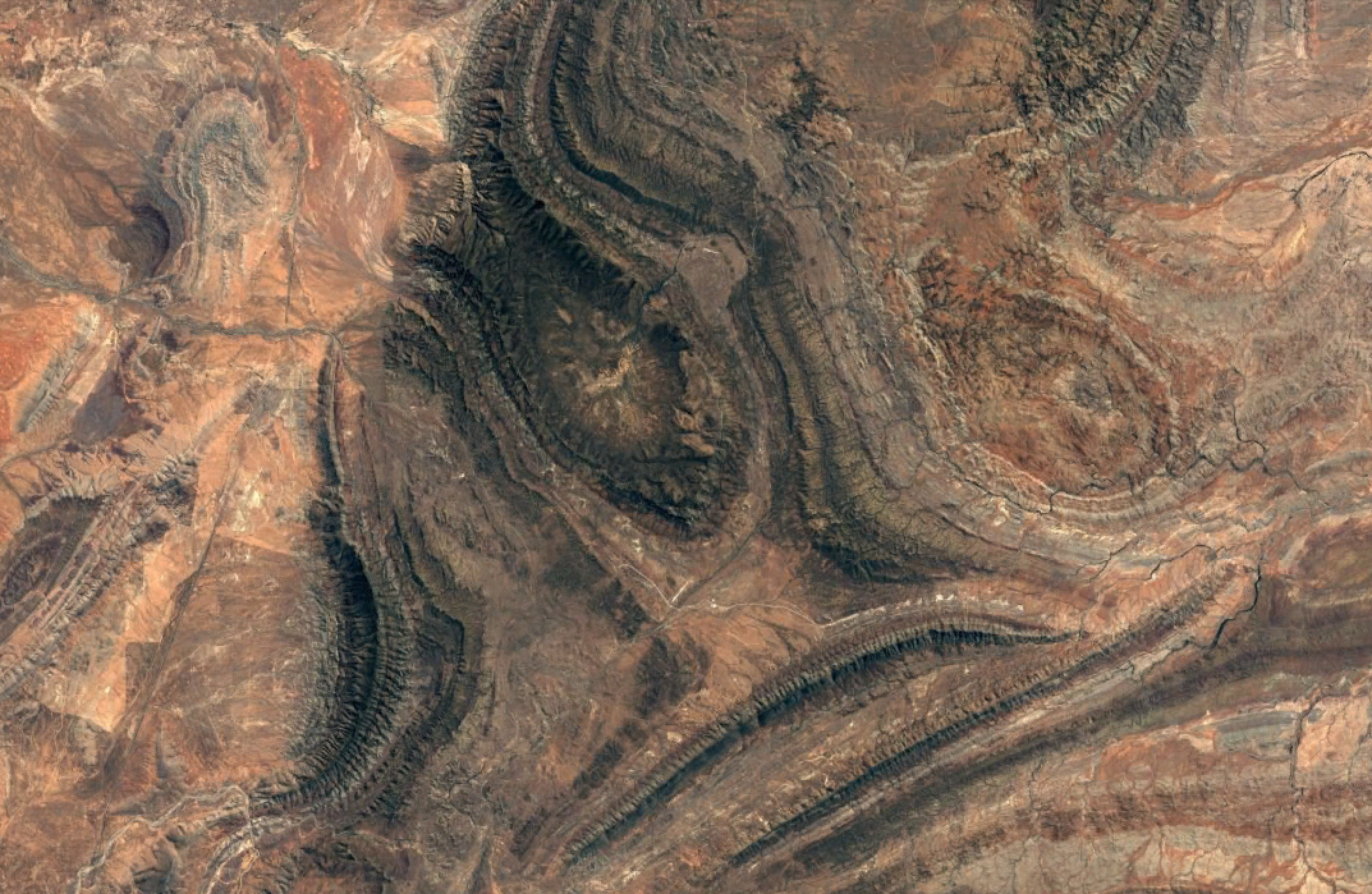
Landsat image of the area surrounding Arkaroola Village
Third-year students from The University of Adelaide had the opportunity to map part of this stunning region on a 10-day field trip to Arkaroola. Students were led by Professor Alan Collins, Dr Grant Cox, and demonstrators Morgan Blades, Drew Lubiniecki, Gilby Jepson, Renée Tamblyn, Jonathan Berthiaume and myself. We were fortunate to have geologist and regional expert Stephen Hore from the Geological Survey of South Australia join us for the field trip. Palaeontologist Dr Jim Gehling from the South Australian Museum also joined us for the first field day to share his expertise on Ediacaran fossils.
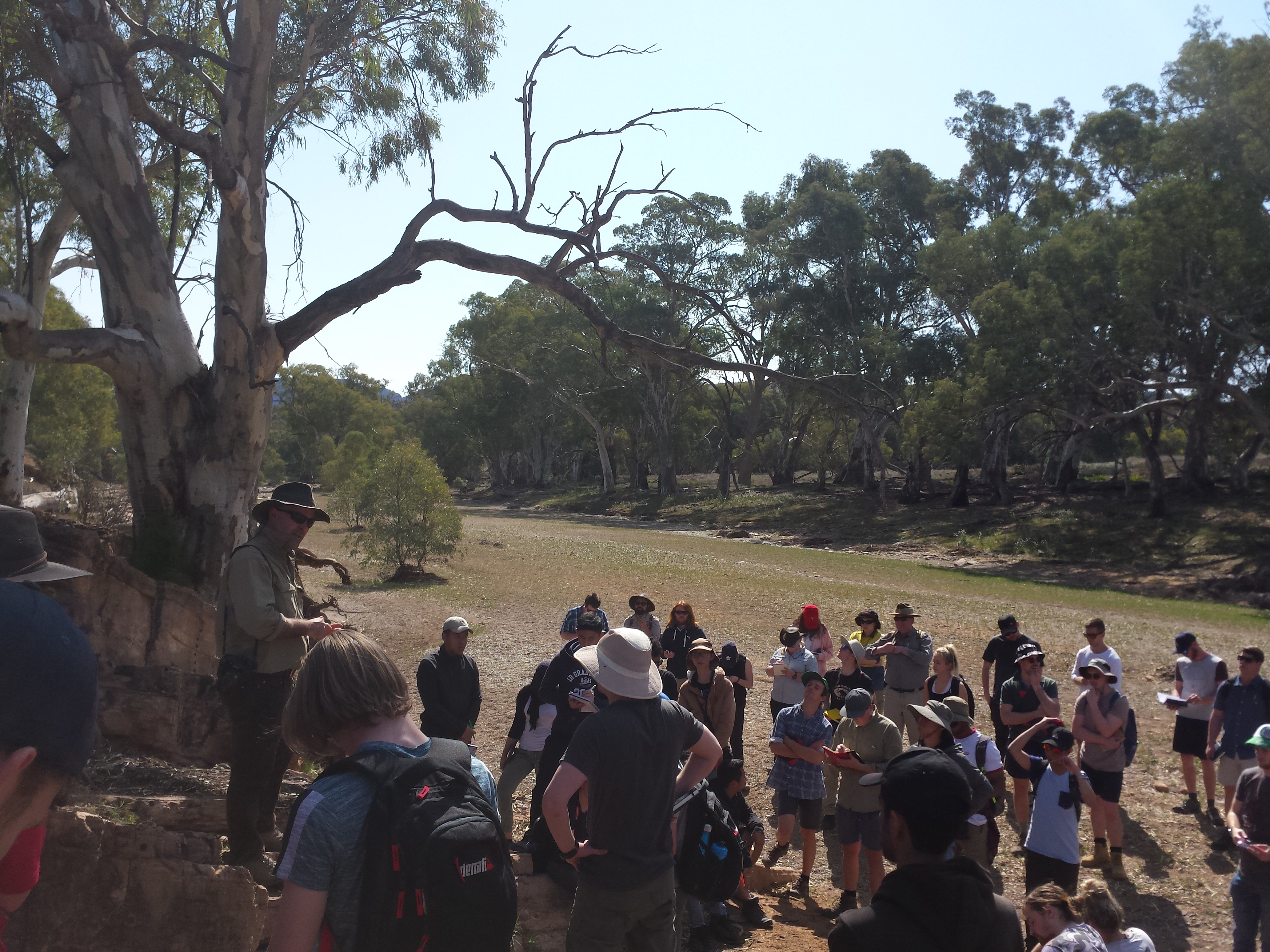
Alan Collins explain the geology of the Flinders to the students.
We left Adelaide in a convoy of minibuses on Monday and spent the day driving to Leigh Creek. The next day we visited Brachina Gorge and learnt about how the Earth was evolving rapidly at the time these rocks were being formed. Jim Gehling pointed out some fossilised algae mats and the famous Dickinsonia fossils – which represent some of the Earth’s earliest Animals. We visited the ‘Golden Spike’, which is the internationally recognised boundary between the older Cryogenian Period and younger Ediacaran Period. Our journey through the Earth-changing Ediacaran Period eventually came to an end and we made our way to Arkaroola Village, where we would spend the next week mapping.
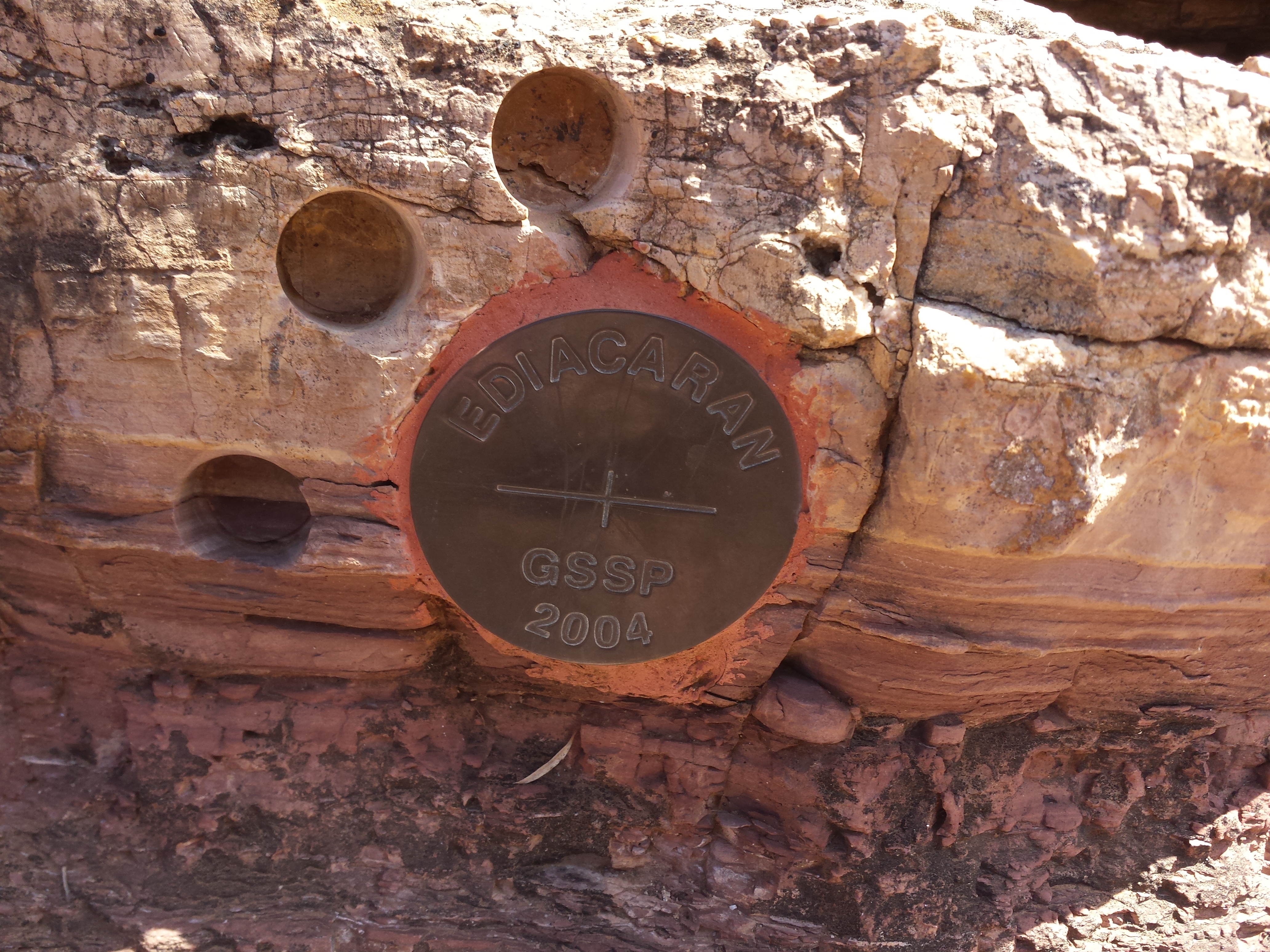
‘Golden Spike’ showing the base of the Ediacaran Period
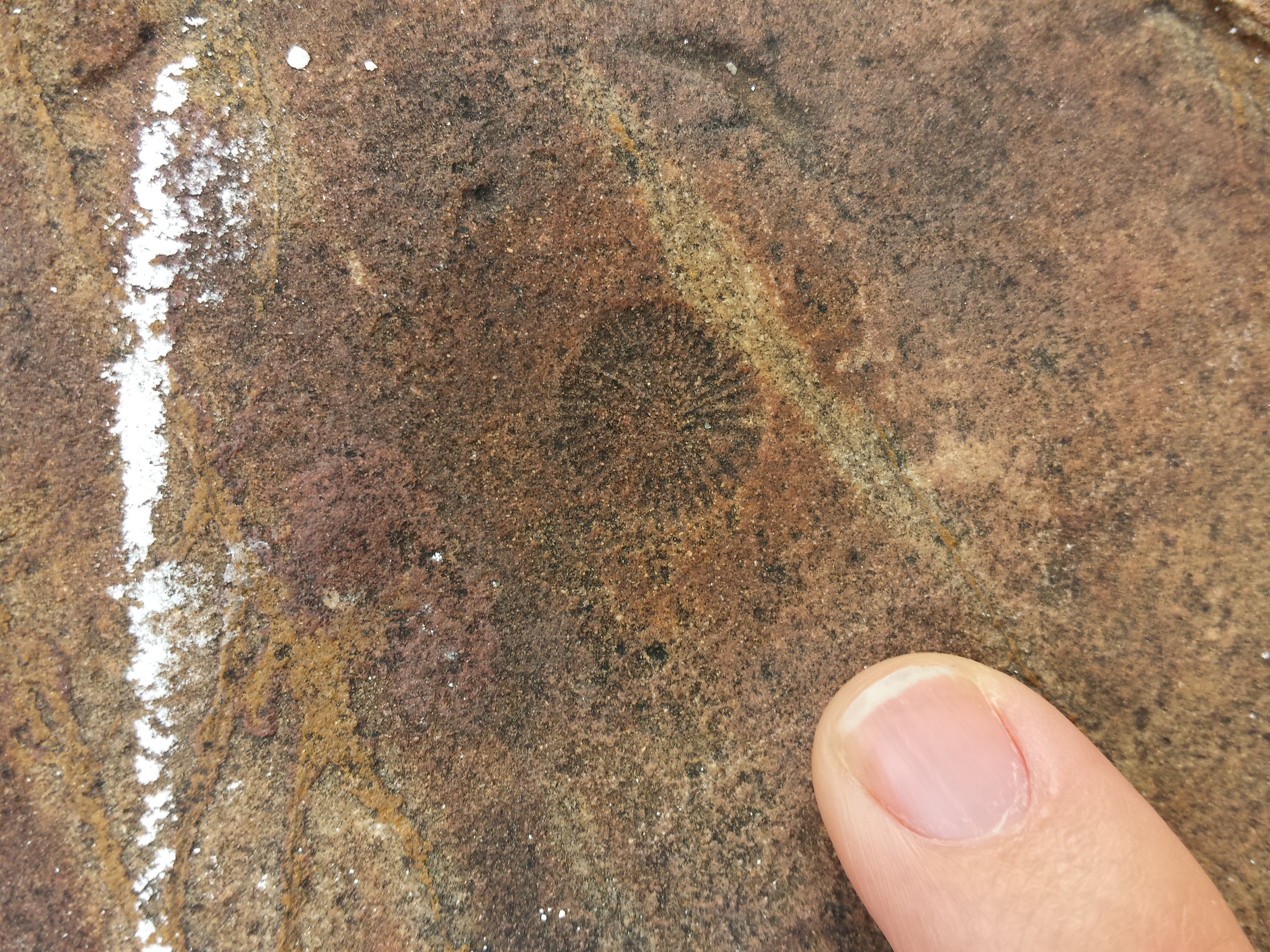
Dickinsonia fossil
The following day, students began the mapping part of the field trip at Arkaroola. Traditional mapping techniques involving a map board, satellite image, and tracing paper were used by students to map their interpretations of the geology surrounding Arkaroola. For the first few days, we took groups of students to key outcrops and helped them understand the geology. The conditions were challenging, with temperatures reaching 35 degrees Celsius most days.
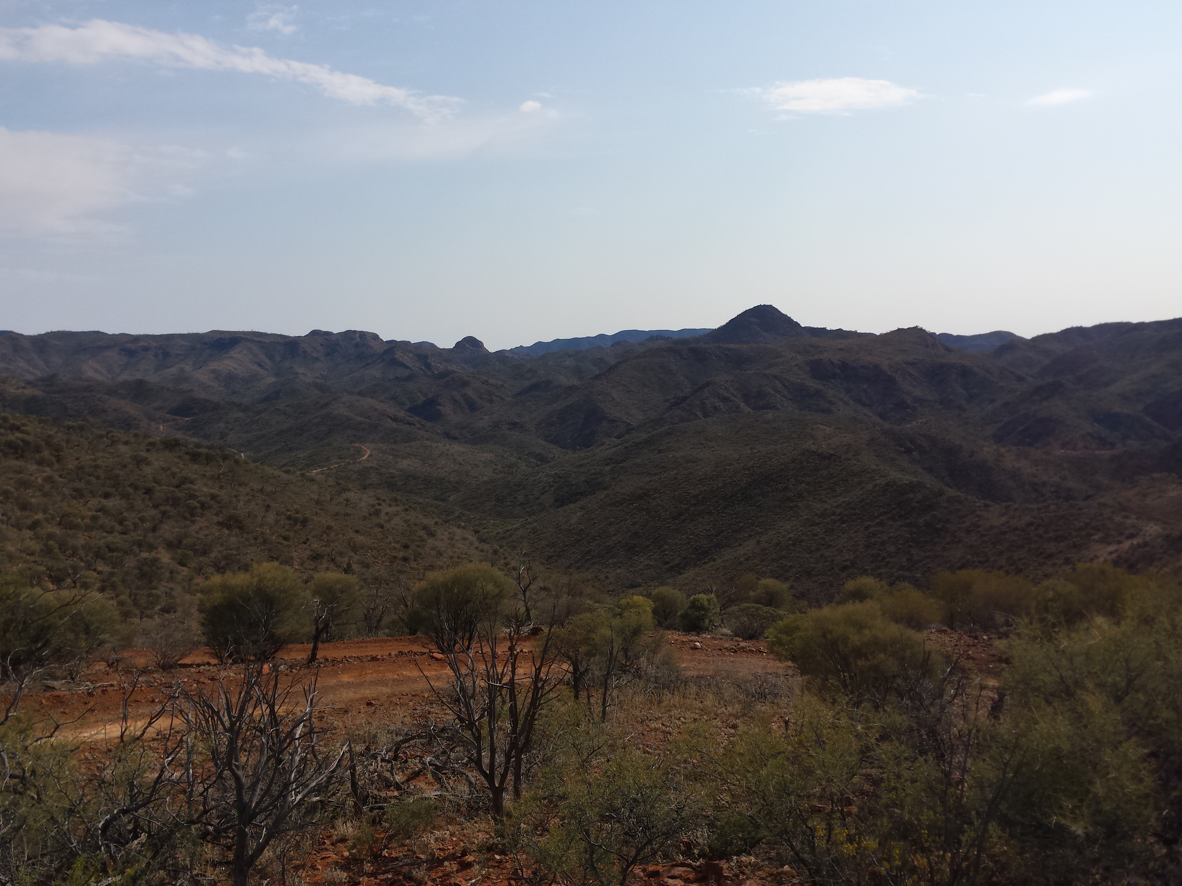
Typical landscape in the Flinders.
Stephen Hore from the Geological Survey of South Australia generously drove groups of students up the famous Ridge Top Track throughout the week. This exhilarating 4WD track winds its way through Neoproterozoic rocks and crosses the major unconformity with the Mesoproterozoic (~1580 Ma) Ninnerie Supersuite granite. Toward the top, the Palaeo-Mesoproterozoic Mount Painter Inlier can be seen. At the top, we can see how the major Paralana fault separates the high topography of the Flinders Range from the flat plains below. In the distance, we can see the Beverley Uranium Mine and Lake Frome (the whitest salt lake in the southern hemisphere).
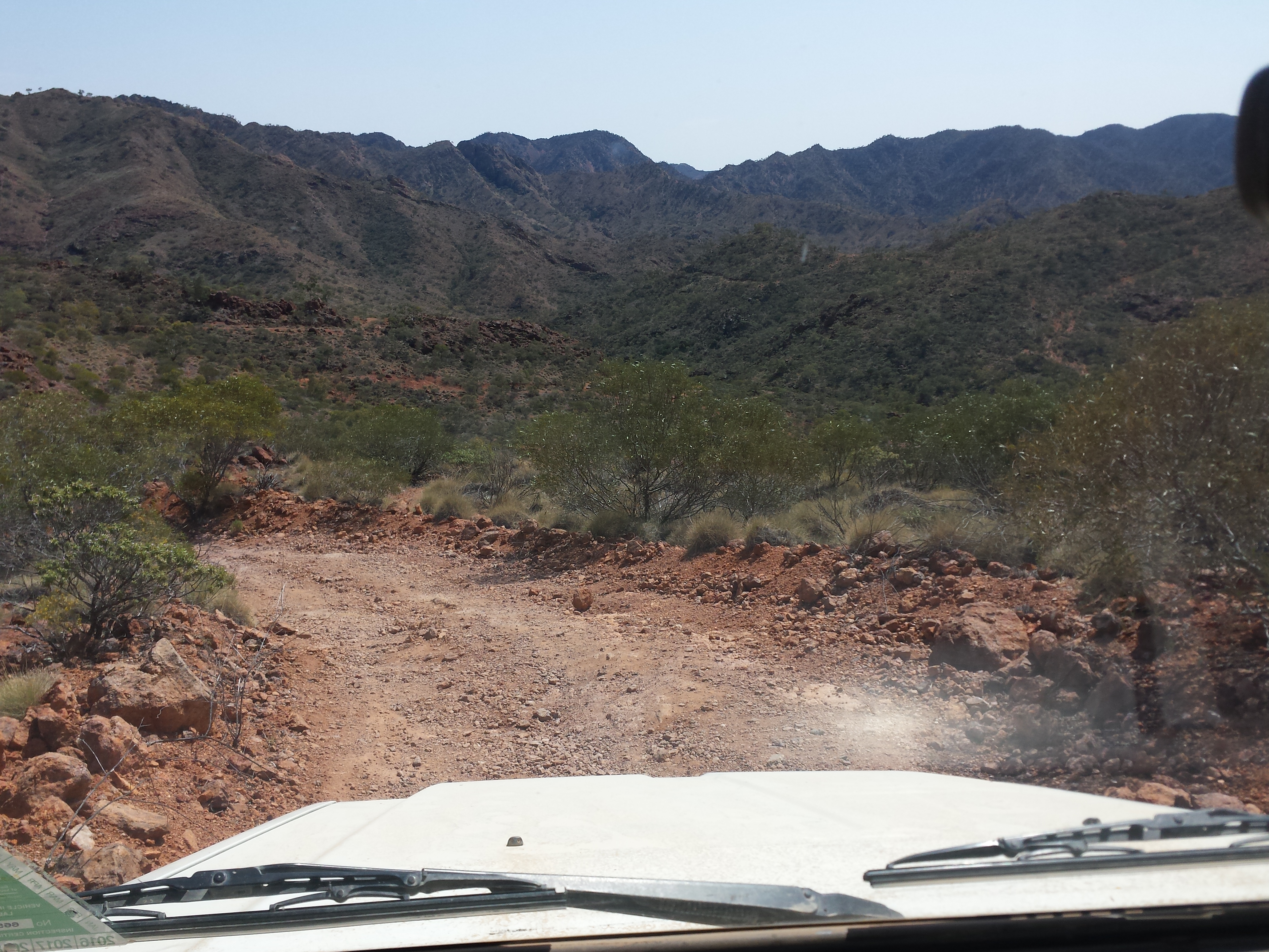
From the 4WD on the Ridge Top Track
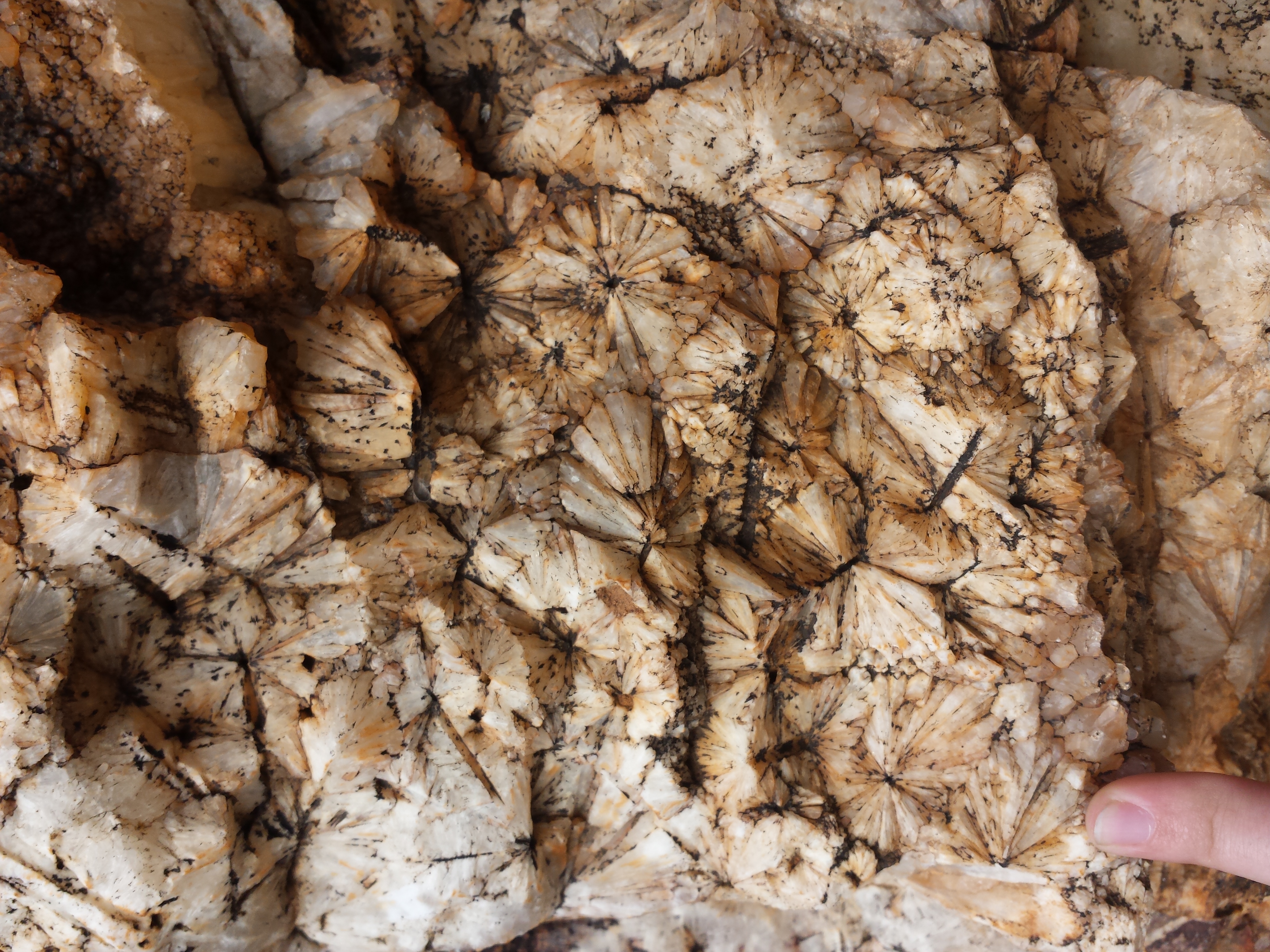
This outcrop of Nailhole quartz can be seen on the way up to the Ridge Top Track at Arkaroola. It forms radiated crystals around elongated laumontite (a type of zeolite)
For the last few days of the mapping camp, students were equipped with first aid kits and radios and had the task of mapping the area a bit more independently. Demonstrators checked in on the students throughout these days, but it was impressive to see how much the students’ confidence had grown throughout the week and how they were starting to come up with their own ideas about the geology.
Toward the end of the trip, a few of the academic staff took a scenic flight with Doug Sprigg, son of the famous Reg Sprigg who discovered a lot of the fossils and key sites in the Flinders Ranges. It was spectacular to see the geology from the sky. The huge relief in topography was even more apparent from this view.
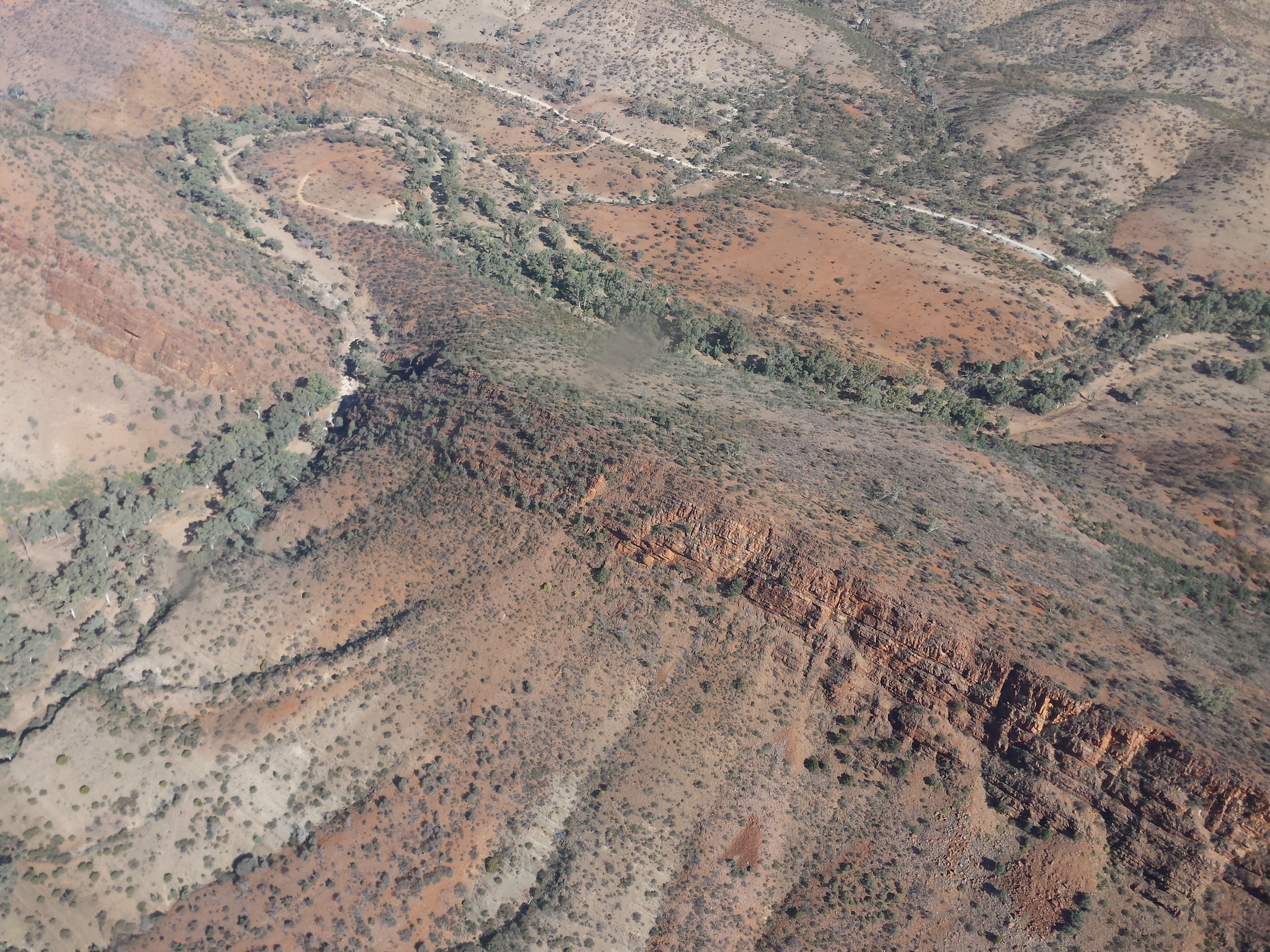
View from the air above the Flinders
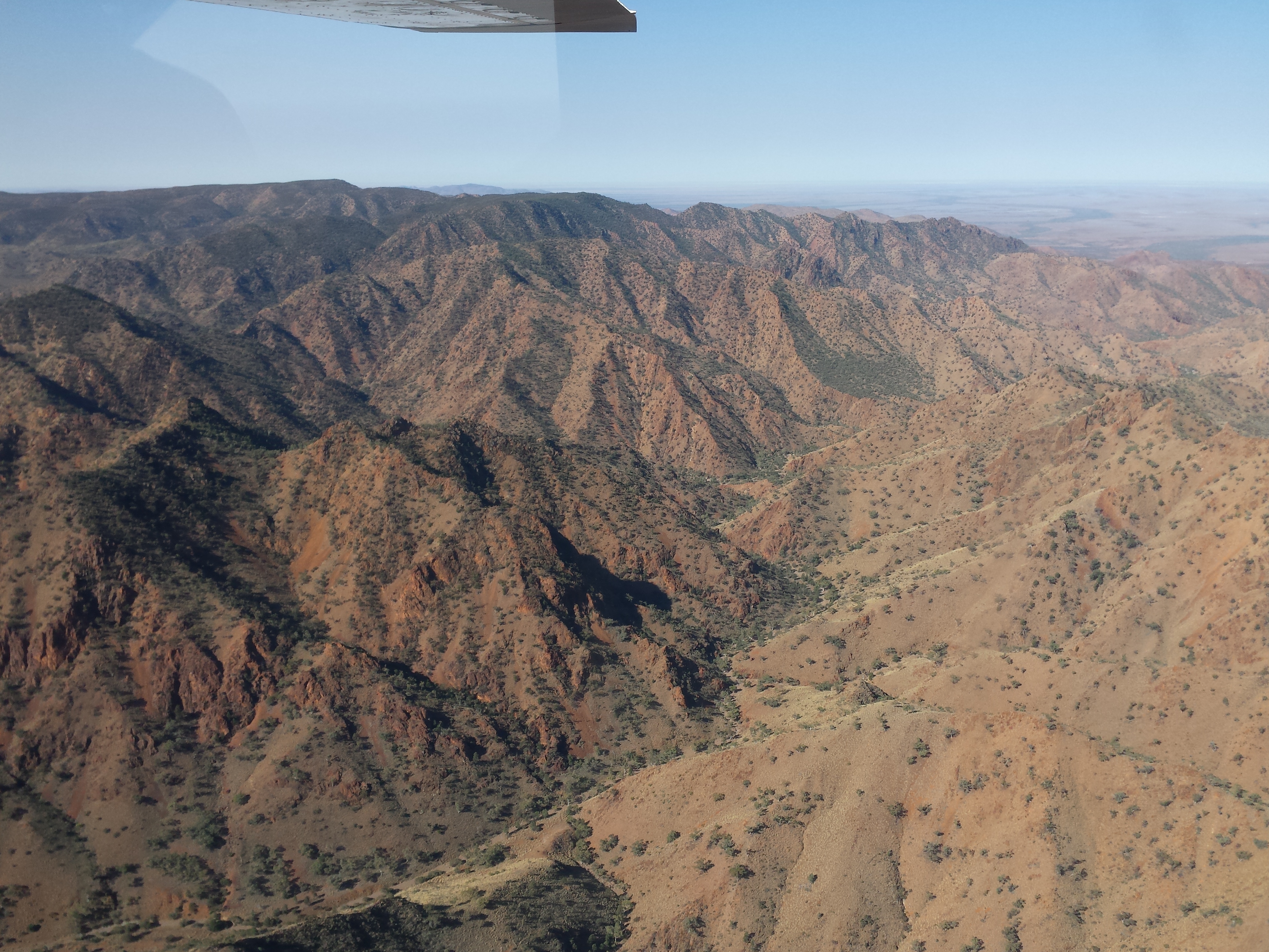
While the students were mapping, the staff were flying over their heads.
On the last night of fieldwork, students were treated to a BBQ prepared by the demonstrators. Early the next morning, students handed up their maps, and we began the long journey back to Adelaide. This is the last undergraduate field trip these students will participate in. The support of Doug and his sister Marg and the whole team at Arkaroola, as well as the SA Museum and the Geological Survey of South Australia make this an incredible learning experience. The skills students gained throughout this field trip – thinking critically, coming up with models based on data, working collaboratively – are important no matter what their future careers may be.
![]() This work is licensed under a Creative Commons Attribution-NonCommercial-ShareAlike 4.0 International License.
This work is licensed under a Creative Commons Attribution-NonCommercial-ShareAlike 4.0 International License.