Derya Gürer has recently finished her PhD research at Utrecht University, the Netherlands, where she worked on a tectonic reconstruction of Central and Eastern Anatolia (present day Turkey) – as part of the Alpine-Himalayan orogen. You can read more about Derya’s research here and see her other TravelingGeologist adventures here.
Back in the spring of 2013, I pitched a tent on the foothills of the Aladağlar (or Anti-Taurus) Mountain range for five weeks waking up with a view of the 8th and 9th highest mountains of Turkey covered in snow: Kızılkaya (3767 m) and Demirkazık (3757 m). I was set out to study the tectonic evolution of Central and Eastern Anatolia (present-day Turkey) starting in the Late Cretaceous. The task was to figure out what had happened to the Neotethys Ocean that once existed in Anatolia and was now found thrust into the Anatolian orogen. The target area for my first fieldwork became the Ulukışla Basin – and I recall finding myself in a mountain range with an average elevation of about 1500 m sprinkled with scraps of ancient oceanic lithosphere rather than what I had imagined being a basin. What had happened? Time to be an Earth detective an look for clues to explain what had happened in the past to form this spectacular landscape.
The Aladağlar mountain range with its highest peaks Kızılkaya (3767 m, back right) and Demirkazık (3757 m, second from left) in spring. Later in the year, the snow would have melted and the trees would be full of cherries.
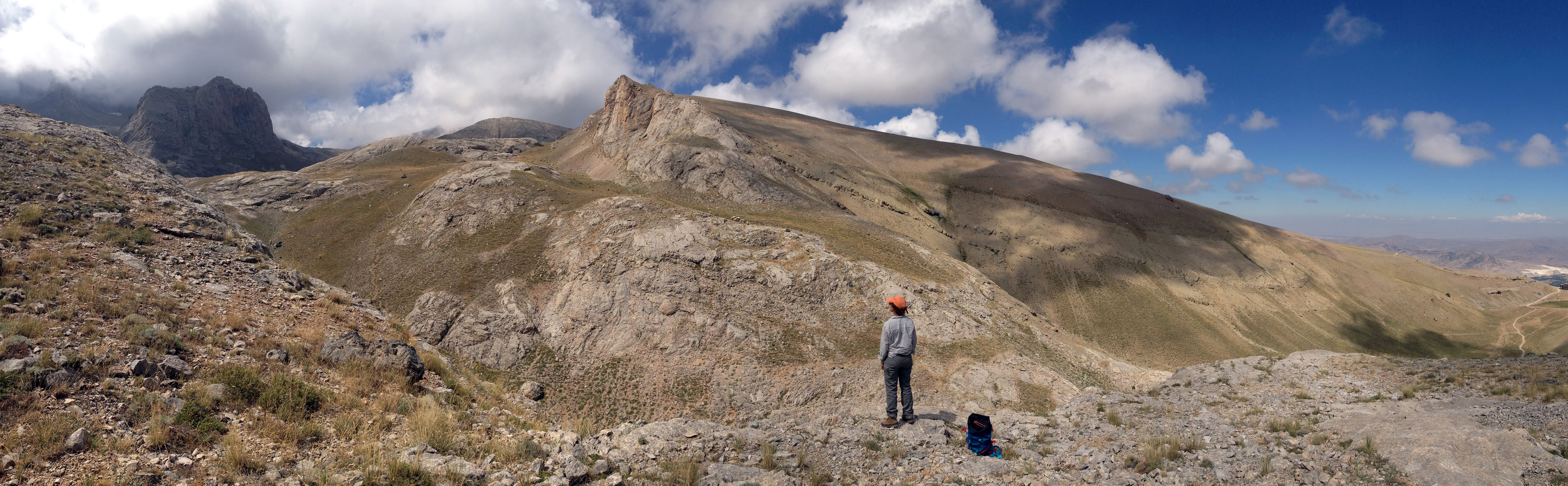
The Aladağlar mountain range set against the Ulukışla Basin along a major strike slip-fault.
.
With time and through many discussions with my advisor Douwe van Hinsbergen I began to understand that the widespread occurrence of ophiolites of Cretaceous age scattered across Anatolia called for a plate kinematic history that was more complex than the collision of two continental fragments upon the closure of an intervening Neotethys Ocean due to subduction. But it was the collision that was omnipresent. The strong deformation due to collision had left an impressive overprint and tilted the stratigraphy of the basin into vertical or even overturned.
The basal stratigraphy of the Ulukışla Basin titled upright or even overturned due to collisional processes. (Photo: Pete Lippert)
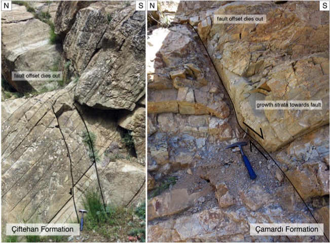
As a result, the Aladağlar region and surroundings have some world-class hiking and climbing. Not much time for climbing though – I was here to find out how everything around me looked like when it first formed in the Late Cretaceous. The detailed kinematic study of the tectonostratigraphy of the basin provided clues that it was formed in an extensional setting in the Late Cretaceous to Eocene time and became inverted since Eo-Oligocene time (Gürer et al., 2016).
But the record of extension contained in the stratigraphy of the basin was a rather minor offset normal faulting – but it was syn-kinematic, which allowed to date it with fossils and geochronology of minerals. Something bigger had to be there… and the key became the southern margin of the basin, where high-pressure metamorphic rocks of the so-called Afyon Zone are the surface along a contact that is in a thrust-fault geometry… Had that been always the case? Or was that also due to the strong deformation owing to continental collision? How did the high-pressure rocks come to the surface?
Syn-kinematic faulting recorded by the basin stratigraphy, hammer for scale.
One of the many spectacular views of the Bolkar mountains near Karagöl (the dark lake).
GO WEST! and find the same contact in its original orientation became the motto. Finding that critical contact between high-pressure metamorphic rocks on one side and non-metamorphic basin stratigraphy was not hard once I knew what I was looking for. It took me to the break in topography at the foot of the mighty Bolkar Mountains and to an archeological site with a Hittite rock relief next to the Ivriz spring. The relief dates back to the late 8th-century B.C.E. and depicts King Warpalawas (left) and the storm-god Tarhunzas (right) and is thought to be the only open-air water cult of the Iron age. No wonder the site is currently nominated to be listed in the UNESCO World Heritage… more so if one realizes that amazingly the relief was carved into a matrix-supported Eocene conglomerate which contains a lot of high-grade pebbles.
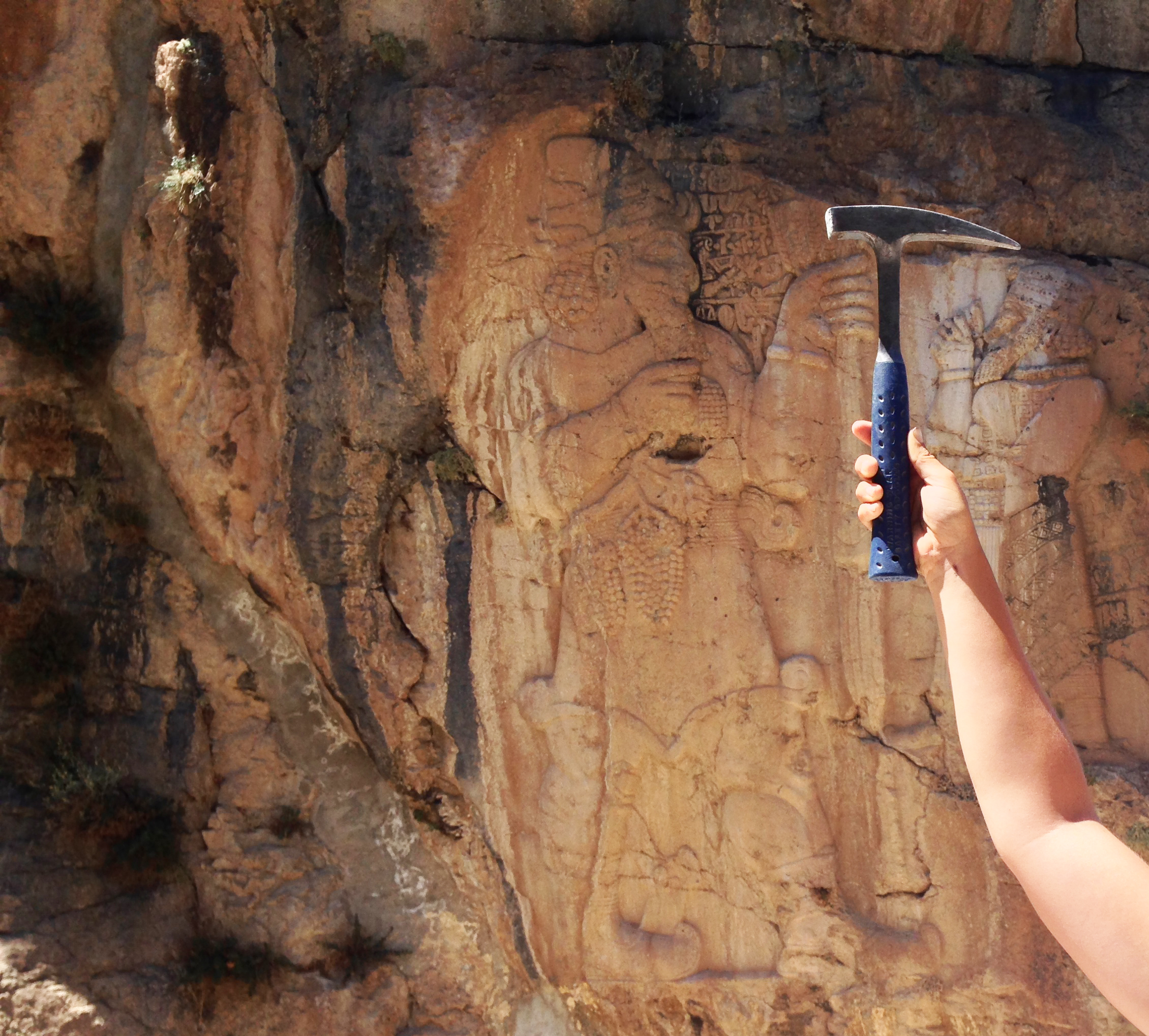
The Hittite Ivriz rock relief depicting King Warpalawas (left) and the storm-god Tarhunzas (right), hammer for scale.
The site also provides the best view of the very structure that I was after – the planar surface of a low-angle normal fault with high-pressure metamorphics in its footwall and non-metamorphic units in the hanging wall: the Ivriz Detachment.
However, the archeological site of Ivriz, despite being the best place to study the structure, was not the ideal place to sample the footwall rocks to constrain their kinematic history in thin section. Along the strike of the structure, there were plenty of other places and small variations in lithology to sample the footwall and to even find some syn-kinematic intrusions that could be used for geochronology. Most of the footwall was, however, made of marble-mylonites… an Earth detective’s nightmare when it comes to finding kinematic indicators.
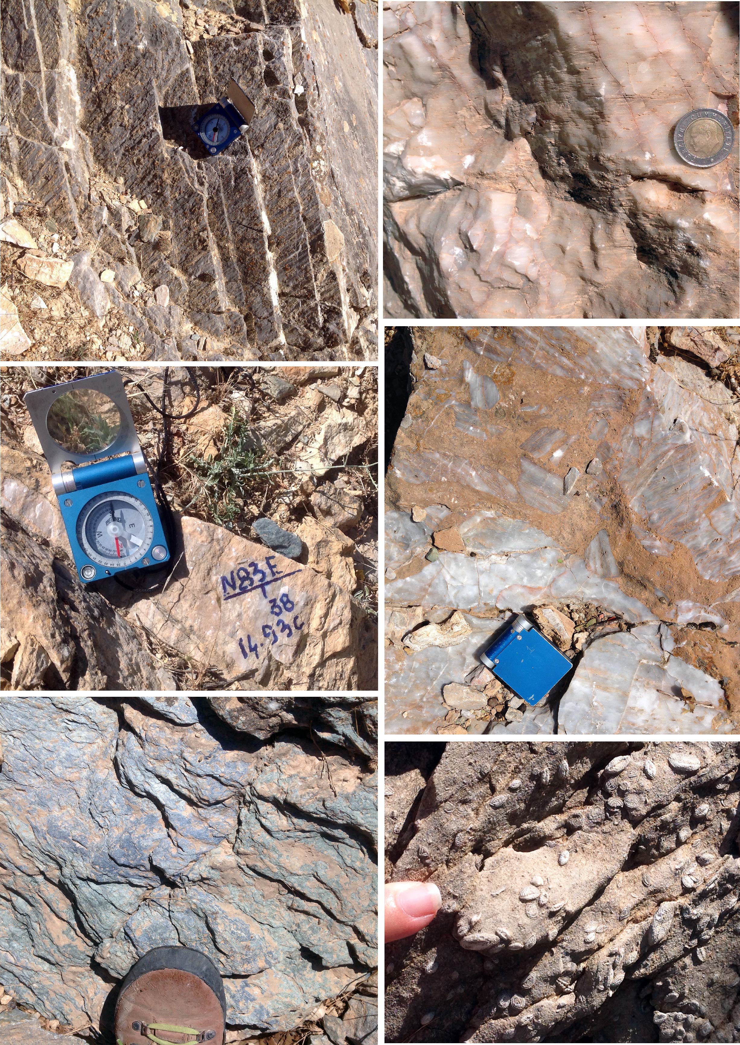
The many faces of rocks related to the Ivriz Detachment – from high-pressure metamorphic rocks of various kinds to non-metamorphic sediments containing nummulites.
This is where a geologist’s traveling ordeal and years of detective work to constrain kinematics and timing started. Those Anatolian rocks took me to collaborators in Zurich, Switzerland to work out their kinematic history in (ultra-)thin sections and to Oslo, Norway to date the syn-kinematic intrusions. In the summer of 2016, the Utrecht-based Subduction Initiation reconstructed from Neotethyan Kinematics (SINK)-group and international collaborators went on a field trip to Central Anatolia, which gave me the rare opportunity to show my collaborators the Ivriz Detachment and the associated rocks we had been working on and to discuss on the rocks.
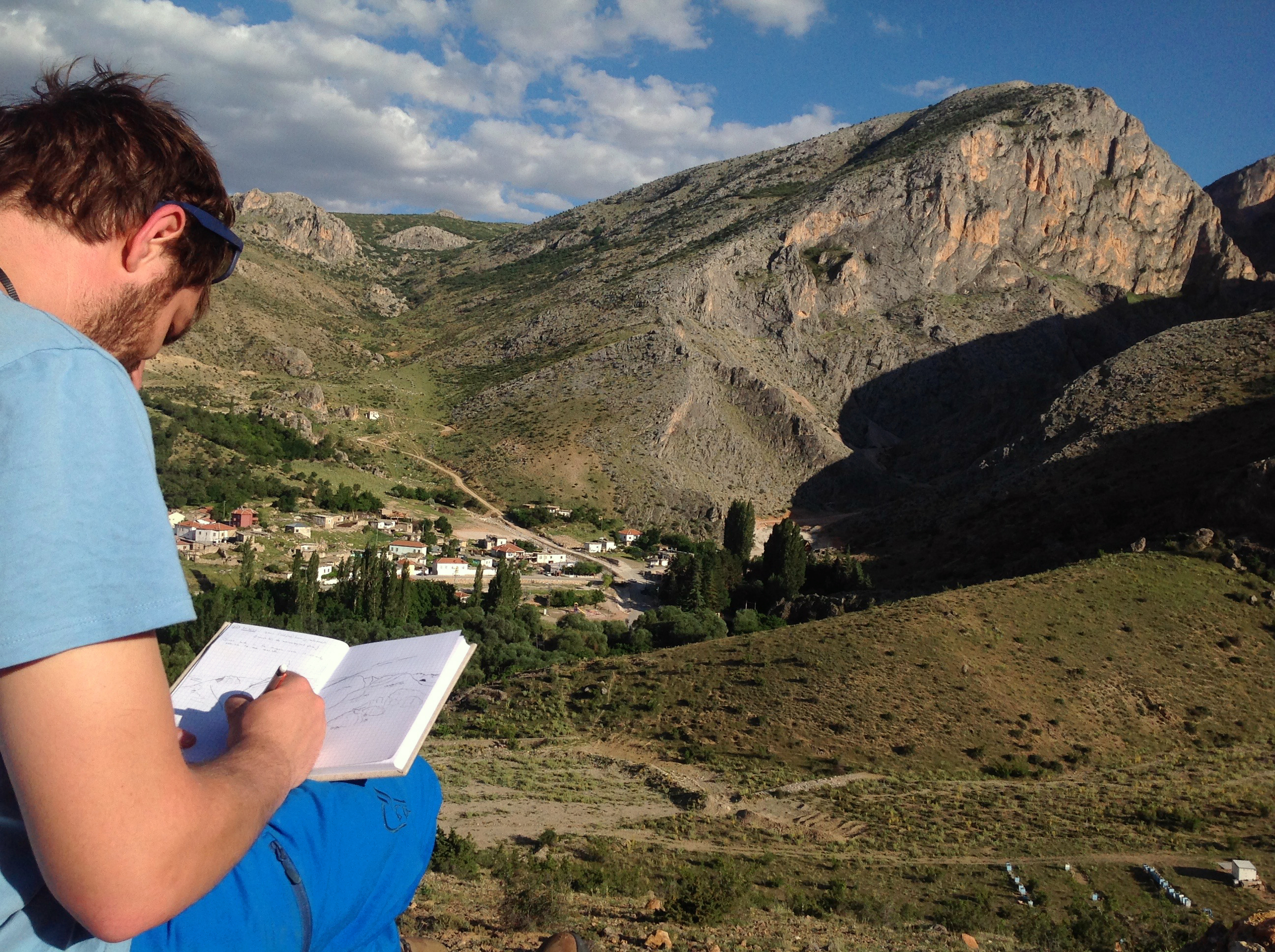
Mapping in the Ulukisla basin.
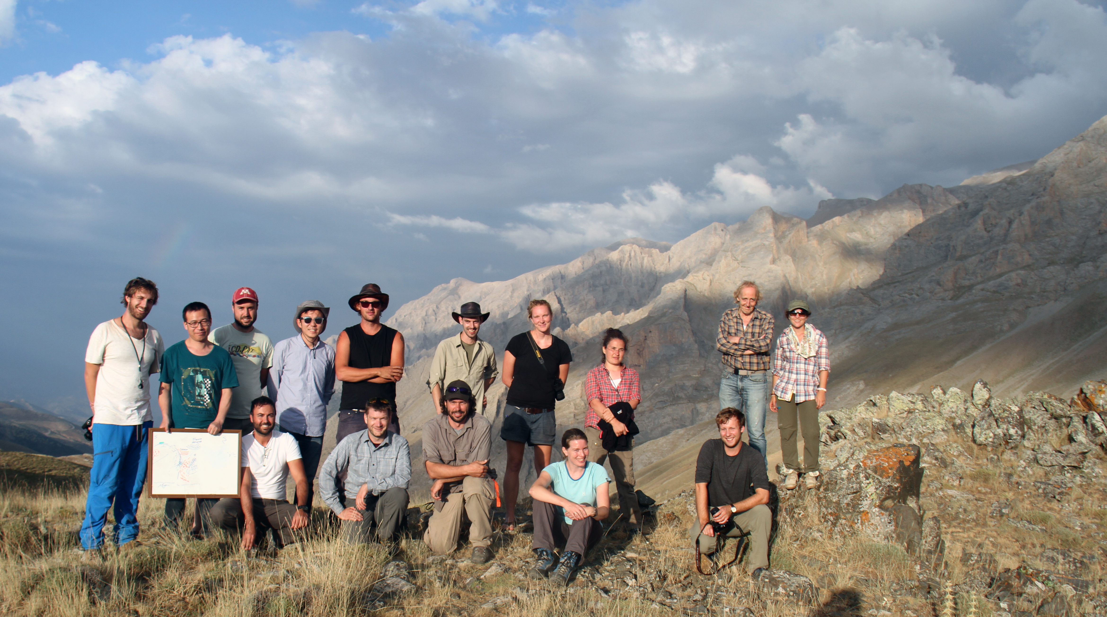
Visiting the Ulukışla Basin and its southern margin – the Bolkar mountains with a group of colleagues and collaborators.
An early bird of extension from Turkey? It turned out that combined with previously documented isolated extensional detachments found to the north, a major province governed by extensional exhumation was active throughout Central Anatolia between ~80 and ~48 Ma. In fact, the Central Anatolian extensional province is the oldest major extensional province above Mediterranean subduction zones and suggests that the African lithosphere that subducted below Anatolia must have rolled back relative to the Aegean region since at least the latest Cretaceous.
Sunrise over the Aladağlar mountain range – the best time to be heading to some of the canyons in the area for climbing.
The resulting publications and the wider scale implications of this find for the Eastern Mediterranean extension can be found in here:
![]() This work is licensed under a Creative Commons Attribution-NonCommercial-ShareAlike 4.0 International License.
This work is licensed under a Creative Commons Attribution-NonCommercial-ShareAlike 4.0 International License.