Dr. Thomas Ronge is a Marine Geologist currently working for the Alfred Wegener Institute in Bremerhaven, Germany. You can read more about his research here and follow him on Twitter @remotelongitude
In the light of the massive, 6000 km2 sized iceberg – A-68 – that broke off the Antarctic Peninsulas Larsen C ice shelf in July, should we worry about a small, 267 km2 iceberg that is just over four times the size of Manhattan Only two months after the A-68 calving event, the smaller B-44 calved off the Amundsen Sea’s Pine Island Glacier.
Today, the Pine Island Glacier is Antarctica’s fastest-melting glacier, loosing up to 46 billion tons of ice per year. 46,000,000,000 tons of ice…per year! That’s almost one-quarter of the total annual ice loss on our southernmost continent! Despite the decades-long thinning of the Pine Island Glacier’s ice shelf (the floating part of the glacier), the position of the calving front remained more or less stable. Over the last 70 years, the ice shelf experienced a pattern of advance and retreat that left the calving front roughly to the same position.
However, with ongoing thinning, it was clear that sooner or later, the calving front would change its location. This change came in 2015 when the position of the front retreated by almost 20 km and moved its orientation by up to 45°. Now in 2017, B-44 calved at almost the same location, confirming that the shift in the calving position observed in 2015 represents a long-term change and not just a freak event.
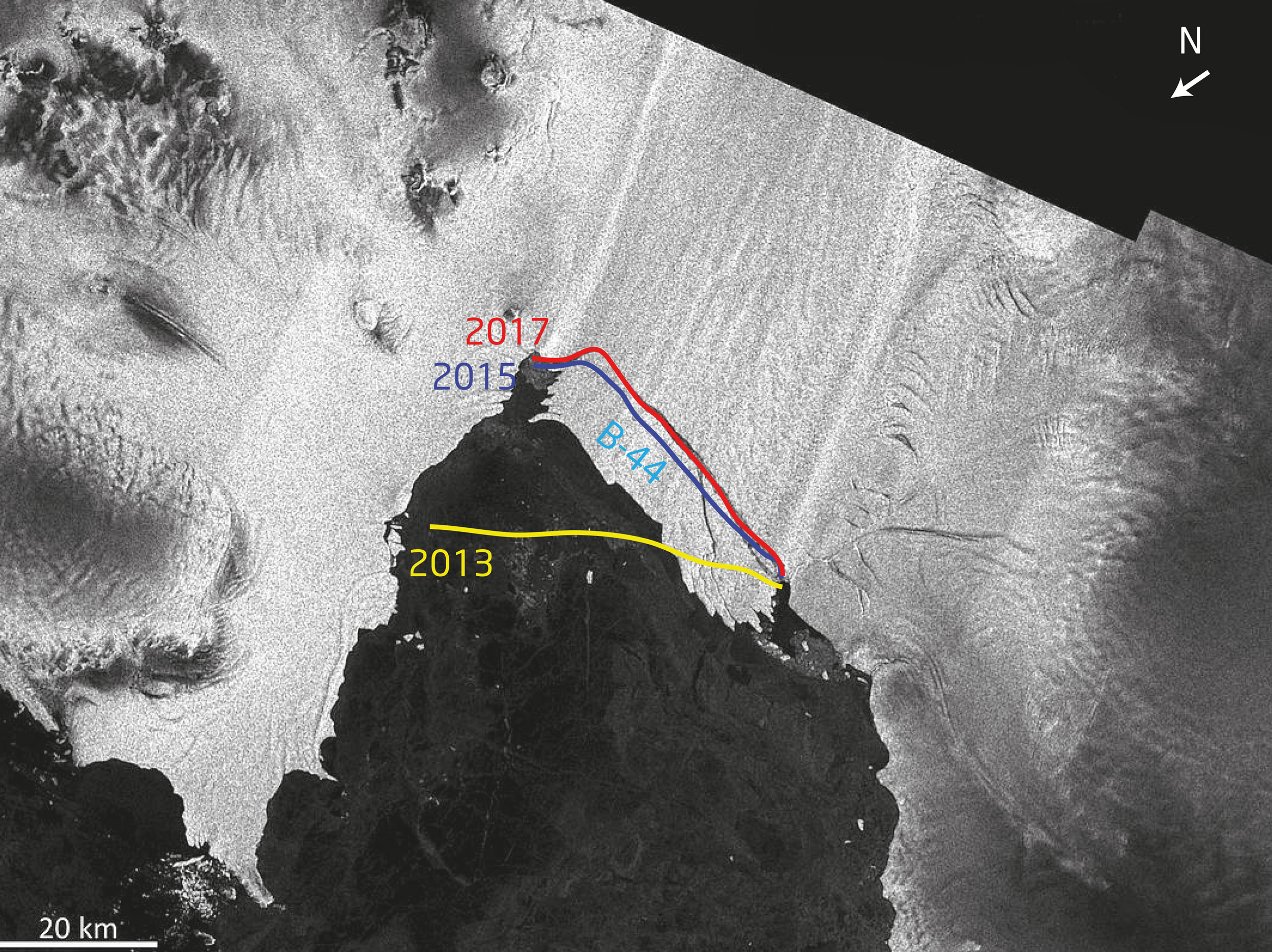
Satellite picture of the recently formed iceberg B-44 in the Pine Island Bay; September 2017 ~75°S. Calving fronts of 2013 (yellow), 2015 (blue) and 2017 (red). Picture produced from ESA remote sensing data.
If the process of thinning and retreat continues, the buttressing effect the ice shelf exerts on the massive Pine Island Glacier in the hinterland might diminish even further. Ice shelves can be compared to the cork in a bottle of Champagne, blocking the bottleneck the continental ice masses have to pass before reaching the ocean. Another alarming factor, pointing to the doomsday potential for the West Antarctic Ice Sheet (WAIS), is the fact that the depth of the bed, the glaciers rest on, increases upstream. This means the further the glaciers retreat, the deeper the water becomes they are grounded in and the thicker the ice becomes at the ‘grounding line’, the point where they start to float. As a consequence, at the same ice flow rate, more ice crosses the grounding line and is lost from the grounded ice sheet. This increases the imbalance between the input (snow accumulation on the surface) and output of the ice sheet, which drives further retreat. Amongst the scientific community, it is feared that this process might trigger a runaway retreat that might result in a collapse of the entire WAIS over the next centuries and might raise global sea level by 3.4 to 4.2 m.
The recent calving event of B-44 came as no surprise to us. Earlier this year, in February and March, I participated an expedition to the Amundsen Sea aboard the German research icebreaker Polarstern.
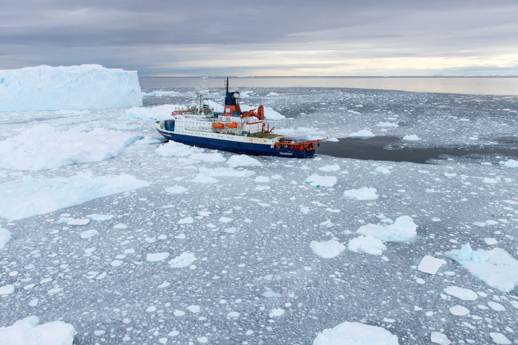
German R/V Polarstern off the part of Pine Island Glacier, which now became B-44. ©T. Ronge/AWI.
One aim of this expedition was to retrieve sediment samples from the Amundsen Sea in order to reconstruct the glacial history of the area. These reconstructions might help to shed new light on the potential of a complete collapse of the WAIS under current and future climate forcing. During the cruise, we already observed the rift that resulted in the September calving event. In order to investigate further, two colleagues (British Antarctic Survey and Alfred-Wegener Institute) and I took one of Polarstern’s helo’s and left for the rift. During the flight, we could spot several crevasses and even observed seawater seeping into the rift from below.
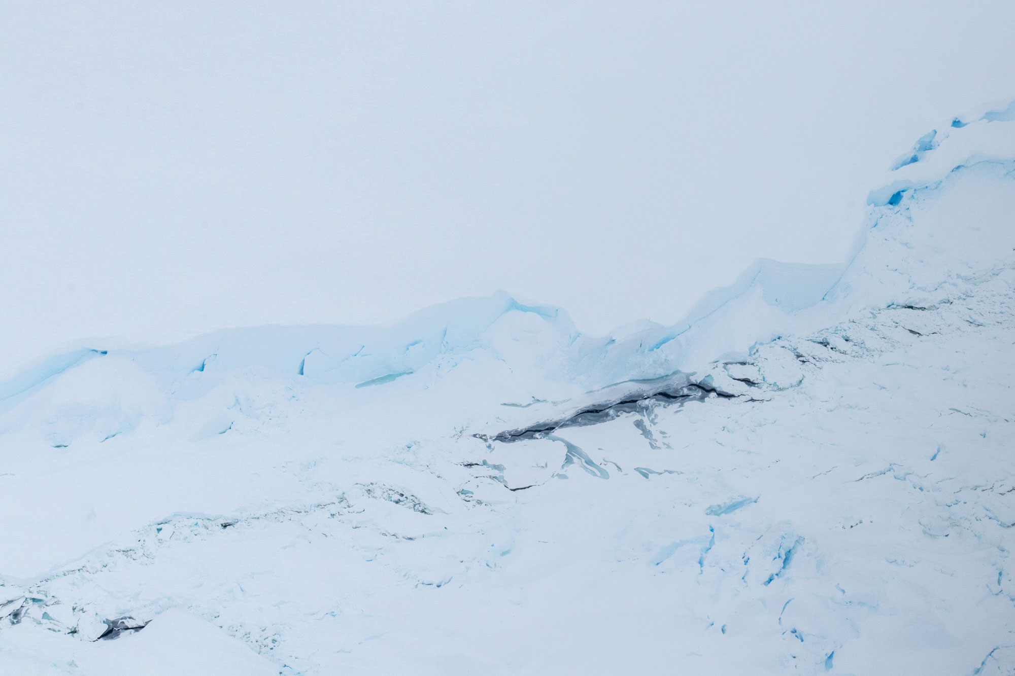
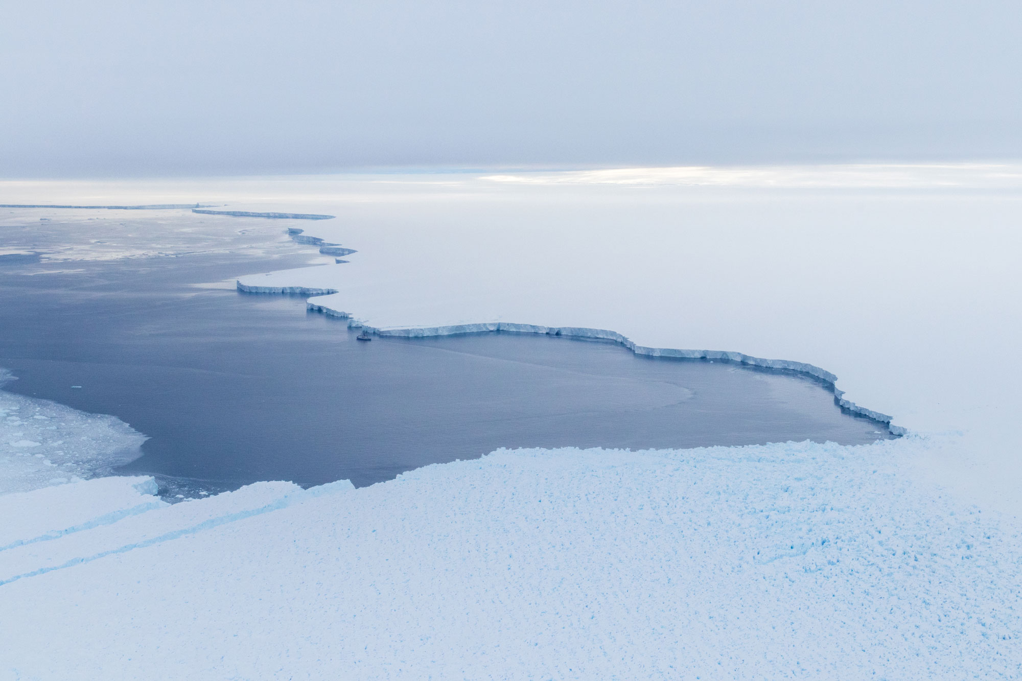
10 km in the hinterland, seawater (dark area) is already seeping into the rift. ©T. Ronge/AWI.
About 50 m wide, 20 to 40 m deep and more than 25 km long, the rift was quite impressive, reminding us of the iconic Star Wars scene, where Luke Skywalker dropped into the trench of the Empire’s Death Star.
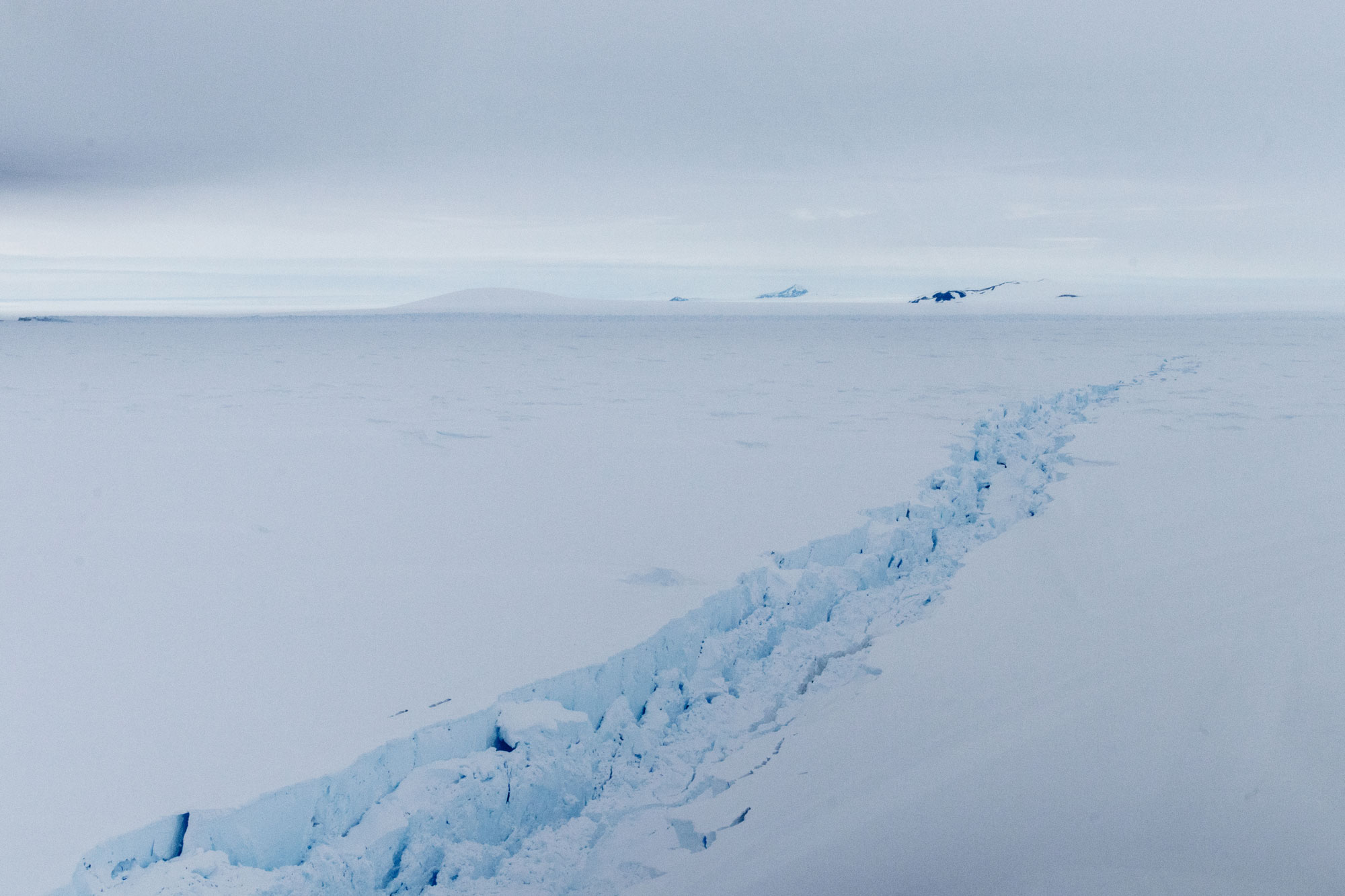
Rift in Pine Island Glacier. The open Amundsen Sea is just seen as the dark spot on the left side of the horizon. ©T. Ronge/AWI.
Landing on an iceberg next to the glacier, we could also observe the effect “warmer” summer surface water has on the ice front, resulting in numerous cave-like structures.
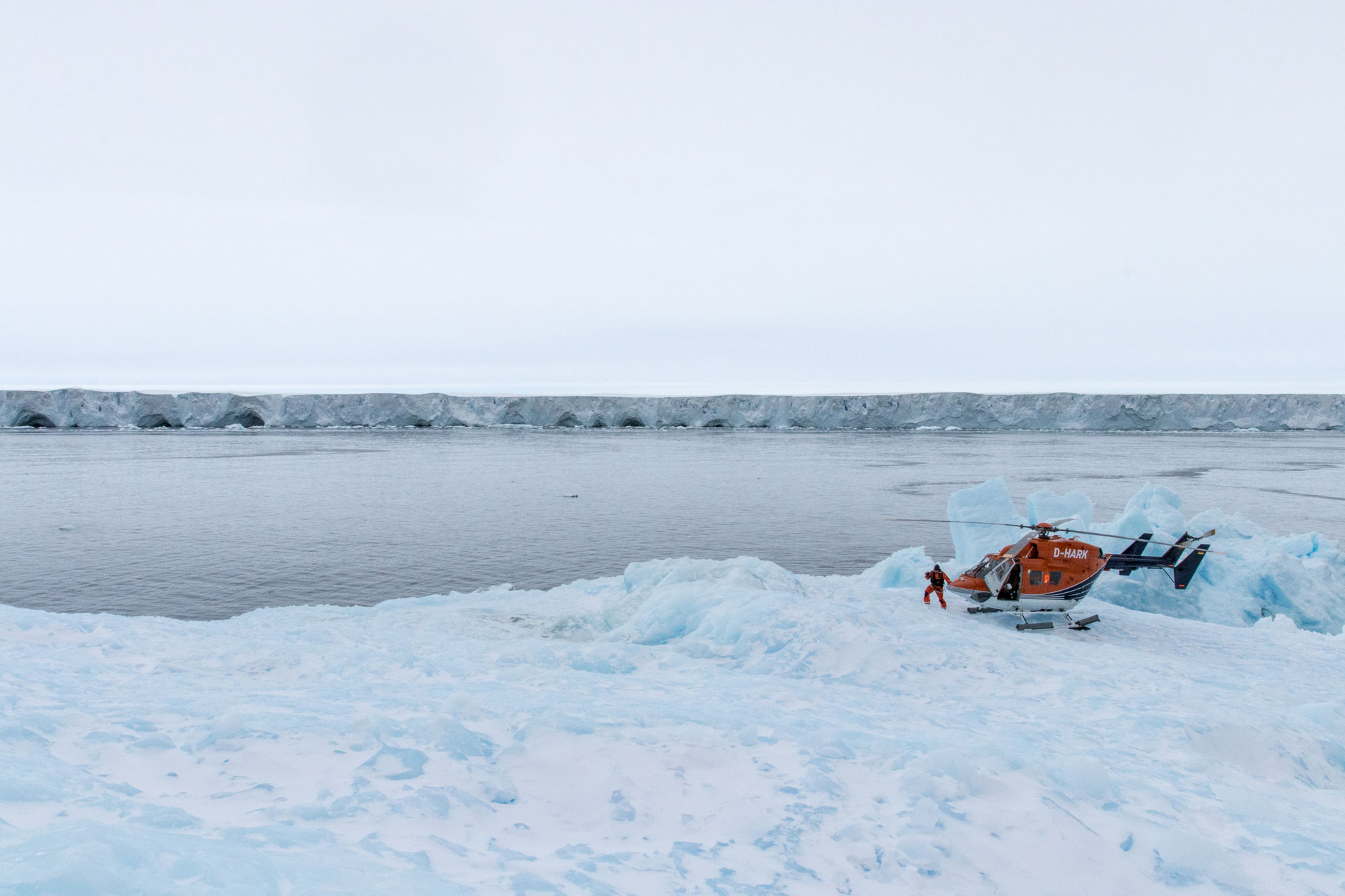
Helo-landing on an iceberg off Pine Island Glacier. ©T.Ronge/AWI.
Heading back home, I was stunned by the sheer size of the ice masses – dwarfing our 120 m long vessel – that are silently waiting to raise global sea level.
120 m long R/V Polarstern, surveying off Pine Island Glacier. ©T. Ronge/AWI.
Looking back at our flight leaves behind mixed feelings. It is strange to know that back in March, we were the last people to stand on an area of the mighty glacier close to the rift. But now, only a few months later the entire region next to it is gone, heading toward its fate as iceberg B-44.
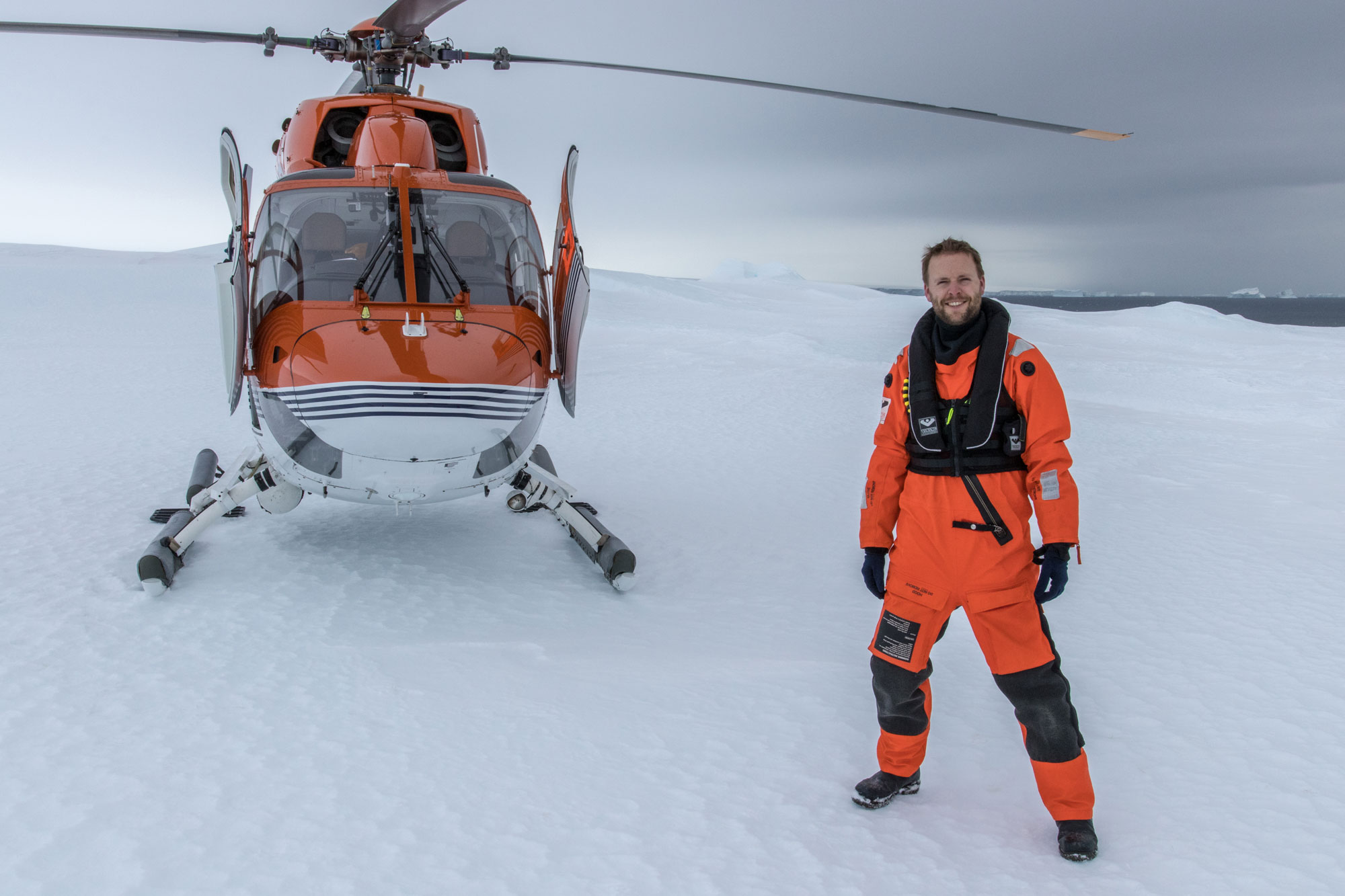
Me on Pine Island Glacier next to the area that is now floating as B-44. ©T. Ronge/AWI.
![]() This work is licensed under a Creative Commons Attribution-NonCommercial-ShareAlike 4.0 International License.
This work is licensed under a Creative Commons Attribution-NonCommercial-ShareAlike 4.0 International License.