Helen is a PhD student at Monash University in collaboration with University of Toulouse. Her PhD work is part of the West African Exploration Intiative (WAXI). You can read more about her work here.
It occurred whilst I was sweating away in a cocoa plantation on the hunt for outcrop, in the hope of furthering our understanding how the Earth was changing around two billion years ago, during its teenage years.
My research focuses on the geology of central SW Ghana, with the aim of furthering the understanding of crustal evolution and accretion of the West African Craton during the Palaeoproterozoic. The southern portion of West African Craton comprises the Archean Kénéma-Man Shield centered on Liberia, flanked to the east and northeast by the Palaeoproterozoic Baoulé-Mossi domain (~2.30 Ga – 2.00 Ga), assembled during the Eburnean Orogeny (2.15 – 2.00 Ga). The Palaeoproterozoic domain is unique in that it is dominated by vast, alternating granite-greenstone provinces bound by craton-scale shear zones, reminiscent of Archean domains. The craton, therefore, provides us with an opportunity to study how Earth processes evolved at the Archean-Palaeoproterozoic boundary, relative to the well-constrained processes occurring today. Furthermore, it represents the first orogenic event during a period of global orogenesis between 2.1 and 1.8 Ga, corresponding with the birth of the Palaeo-Mesoproterozoic supercontinent, Nuna (also known as Columbia).
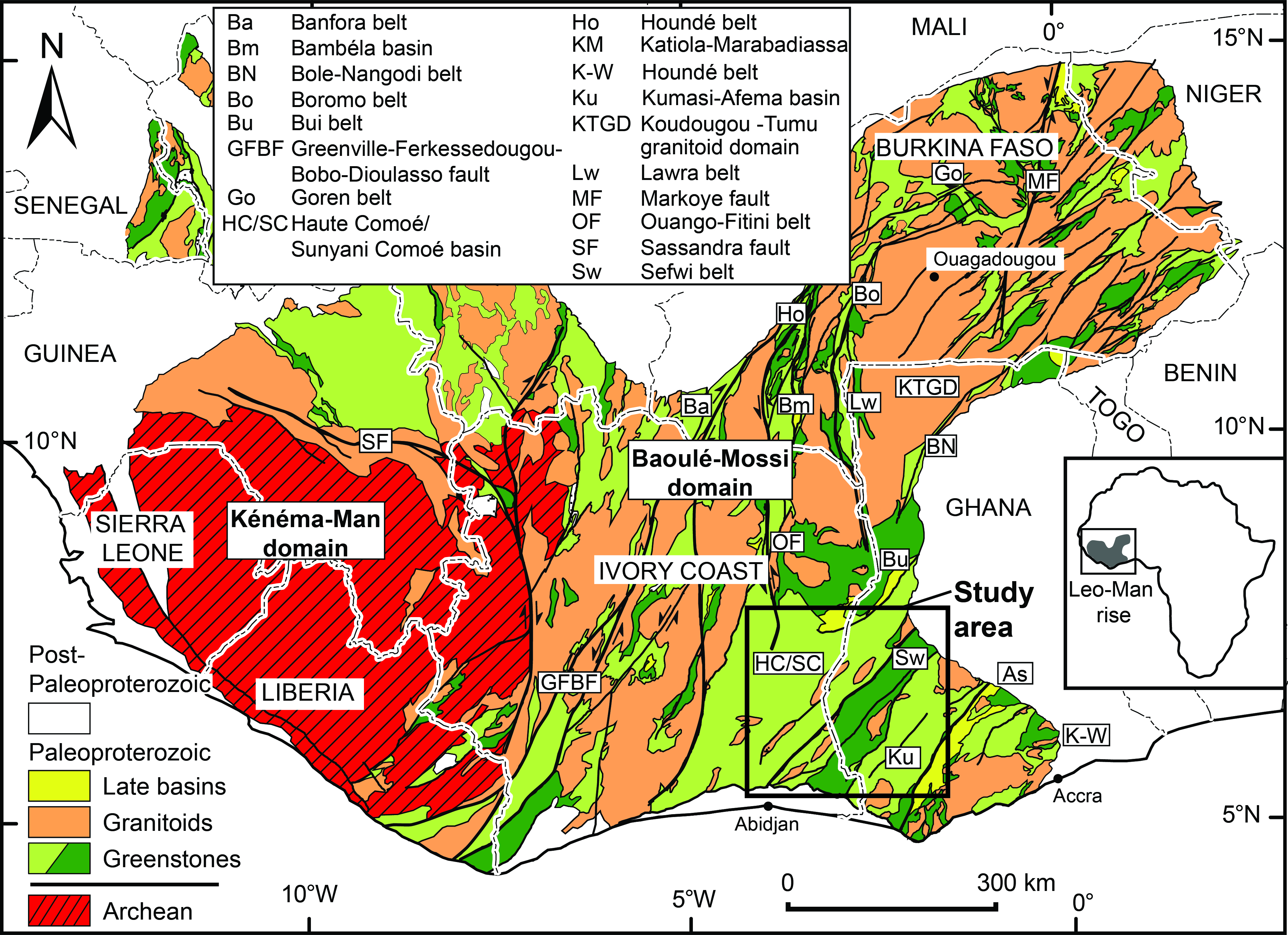
Figure 1. The southern portion of the West African Craton, illustrating the context of the study area (Modified after BRGM SIGAfrique, Milesi et al. 2004).
In total, I spent four and a half months in the field, split over two field seasons during the early months of 2014 and 2015. In January 2014, on my first visit to the Ghanaian capital, Accra, accompanied by two of my academic supervisors Laurent Ailleres and Mark Jessell, I paid a visit to the Geological Survey Department (GSD) of Ghana. GSD provided the bulk of our logistical support, much of which had been previously arranged by Kwame Boamah, Head of Geophysics. In Accra we also met fellow WAXI students Prince Amponsah and Abigail Ayikwei and our drivers, Kwasi Duah and Mr Brown. Before reconnainsance of my field area could begin, we had a meeting scheduled with another of my aceadmeic supervisors, Lenka Baratoux, and Sylvain Block, in Bole, 600 km to the northwest. The roads were bumpy and laden with traffic of all shapes and sizes, meaning the trip took us the better part of two days. The journey revealed glimpses of Ghana’s diverse landscapes, from the tropical and more highly populated parts of the south to the dry savanna-type vegetation and sparse villages of the north. Once assembled, our crew comprised geologists from Ghana, Australia, France, Ivory Coast and Senegal. During our first week, we explored the high grade terranes and vast granite provinces of NW Ghana, followed by a visit to the Bui Greenstone Belt in central west Ghana.
For me, the real work started when we arrived at my field area, covering the Sefwi Greenstone Belt and the adjacent Sunyani and Kumasi metasedimentary provinces. Here we confronted the biggest challenge of mapping in southwest Ghana: finding the rocks. The field area spans about 60 000 km2, and is largely covered by cocoa plantations, impenetrable forest reserves, and thick regolith cover, grading into drier, sparser vegetation in the far north of the field area. All of these features pose challenges when designing a field campaign. We utilised existing geological maps, old outcrop databases and regional geophysical datasets, including aeromagnetic and radiometric surveys, to target key localities for gathering lithological, petrophysical, metamorphic and structural data and collecting representative samples.
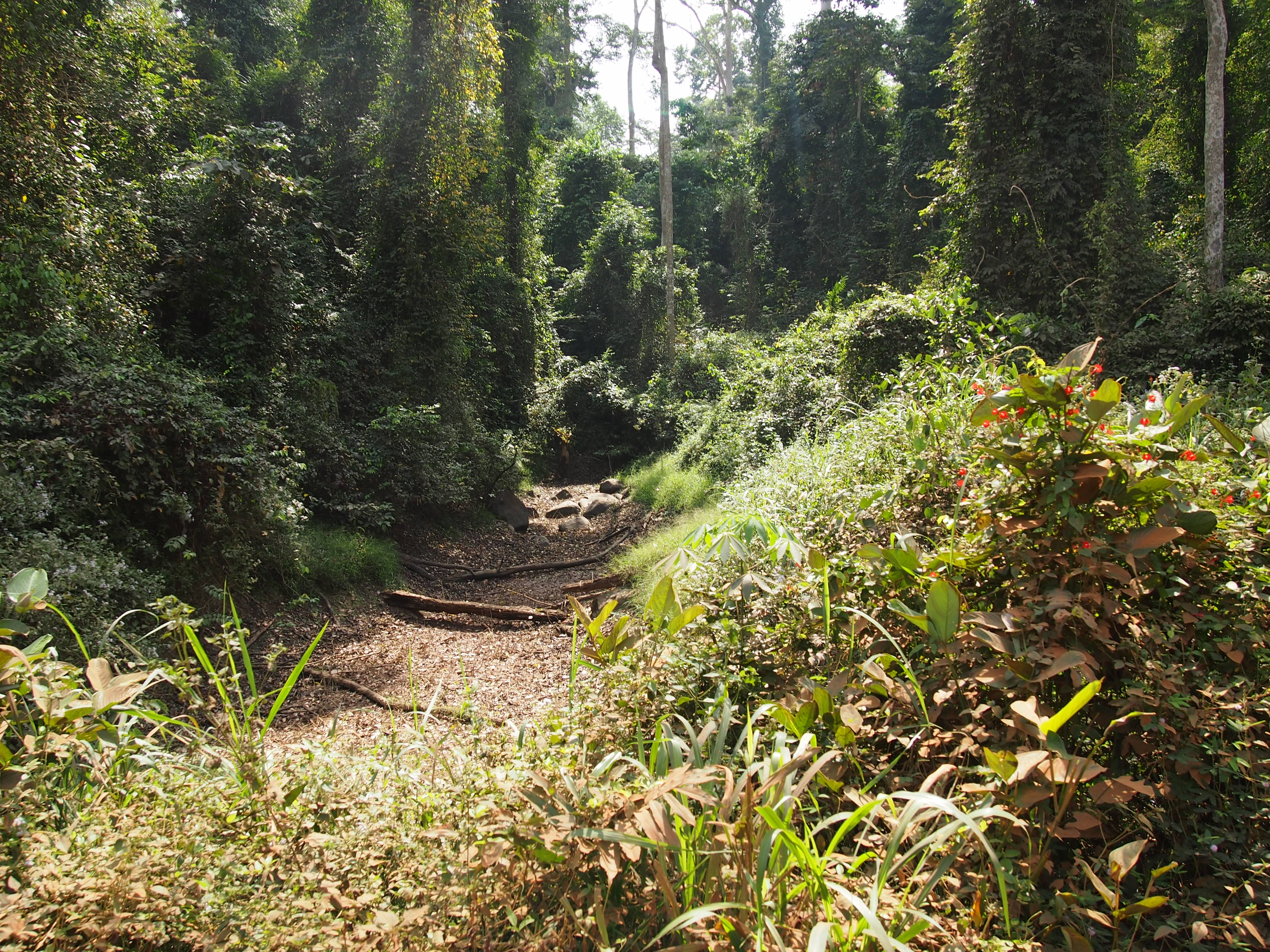
Figure 2. Like finding a needle in a haystack! An outcrop of tonalite exposed in an dry stream in the Ayum Forest Reserve.
The majority of my field work was spent in the company of my driver, Kwasi Duah, to whom I am heavily indebted. Kwasi had extensive field experience in Ghana and great familiarity with the geography of the field area, acting also as my translator and providing muscle power when I couldn’t manage the hardest of samples, even when wielding a sledge hammer.
Given the extensive vegetation cover, Kwasi and I, plus a rolling cast of field assistants and fellow geologists, targeted areas of “high” relief, road cuttings, and river banks in order to find outcrop. We utilised local knowledge, asking farmers if they knew of any nearby exposures. The most commonly spoken language in the field area is Akan (Twi), so I rapidly learned some key phrases including “ɛ te sɛn” (hi, how are you?) and “Me re ɛrehwehwɛ boba kɛse” (I am looking for a big stone), my pronunciation of which drew many smiles and often much laughter.
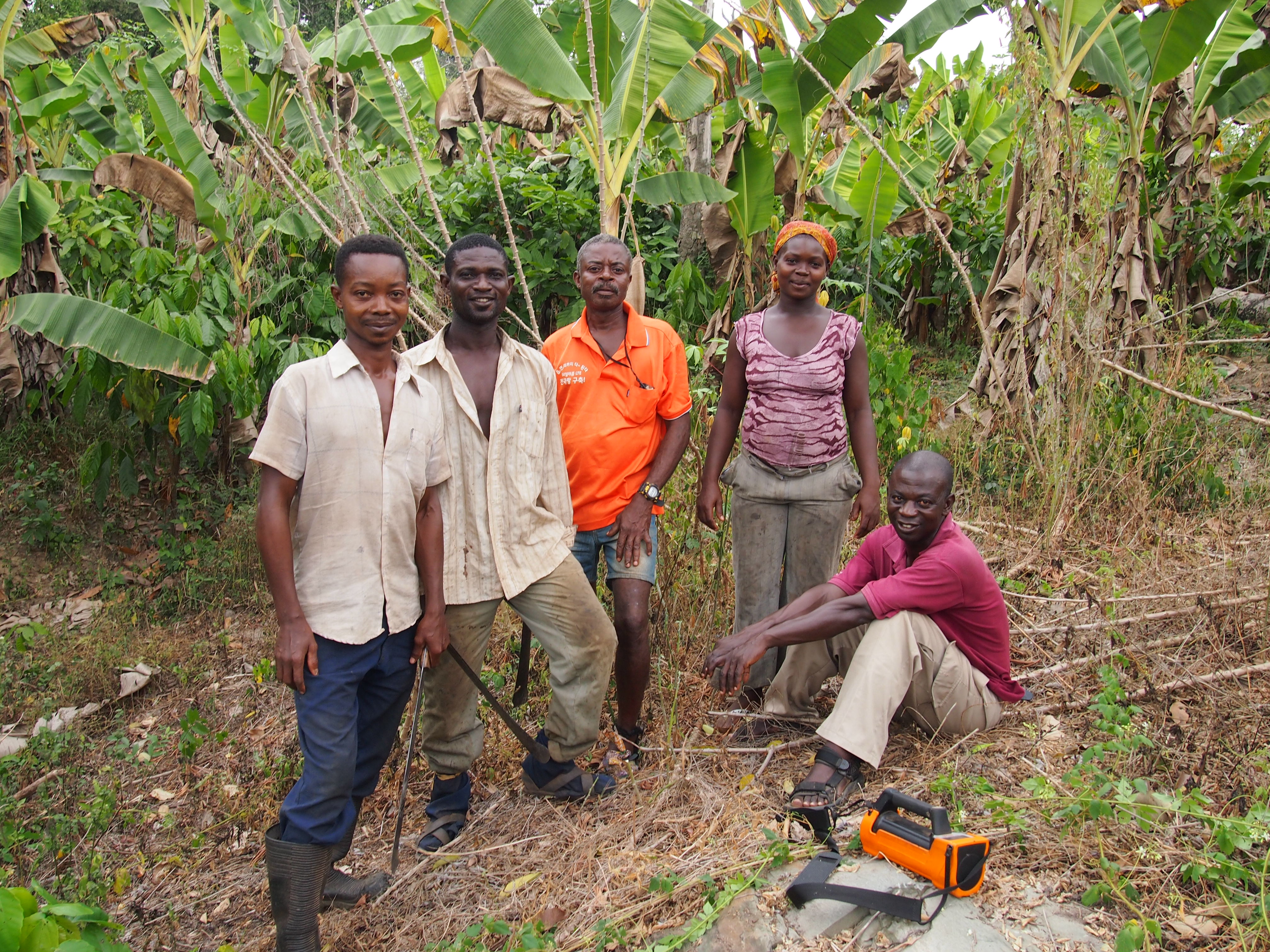
Figure 3. Kwasi (bottom right) and a group of farmers who lead us to an outcrop west of Kenyase.
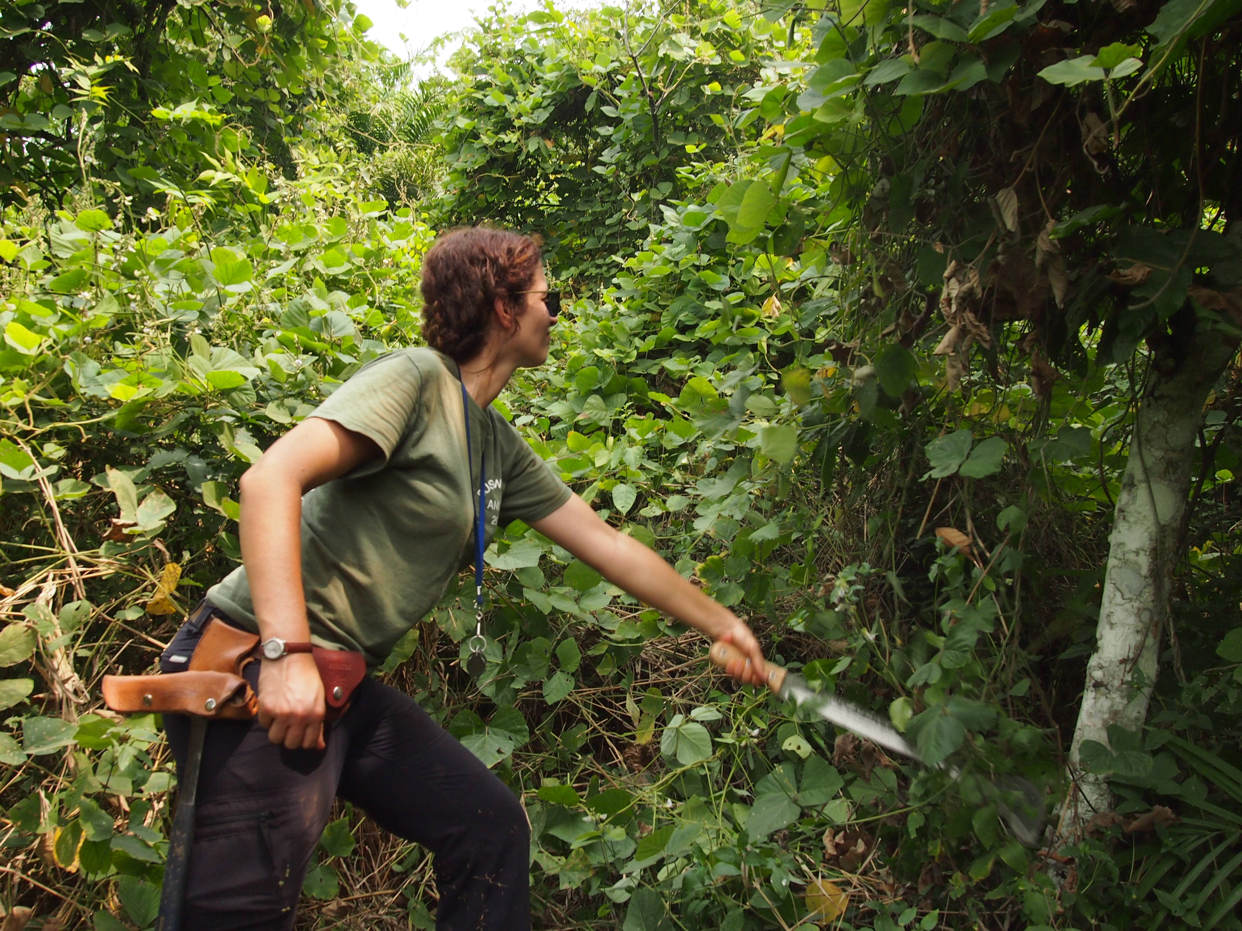
Figure 4. Field kit included the standard hammer, compass, hand lens, GPS and machete.
Some of the more unique challenges encountered during field work in Ghana led to a new appreciation for particular pieces of field equipment that I had rarely used before. I saw the true purpose of the waterproof pages in my notebook as the sweat streamed off my face in the heat and high humidity. And I was strangely comforted to be surrounded by people carrying machetes when we came across the wide, muddy trail of a python whilst hunting for outcrop in dense forest. Other exceptional experiences included sitting down with village chiefs to explain the purpose of our research and request permission for access to nearby outcrop.
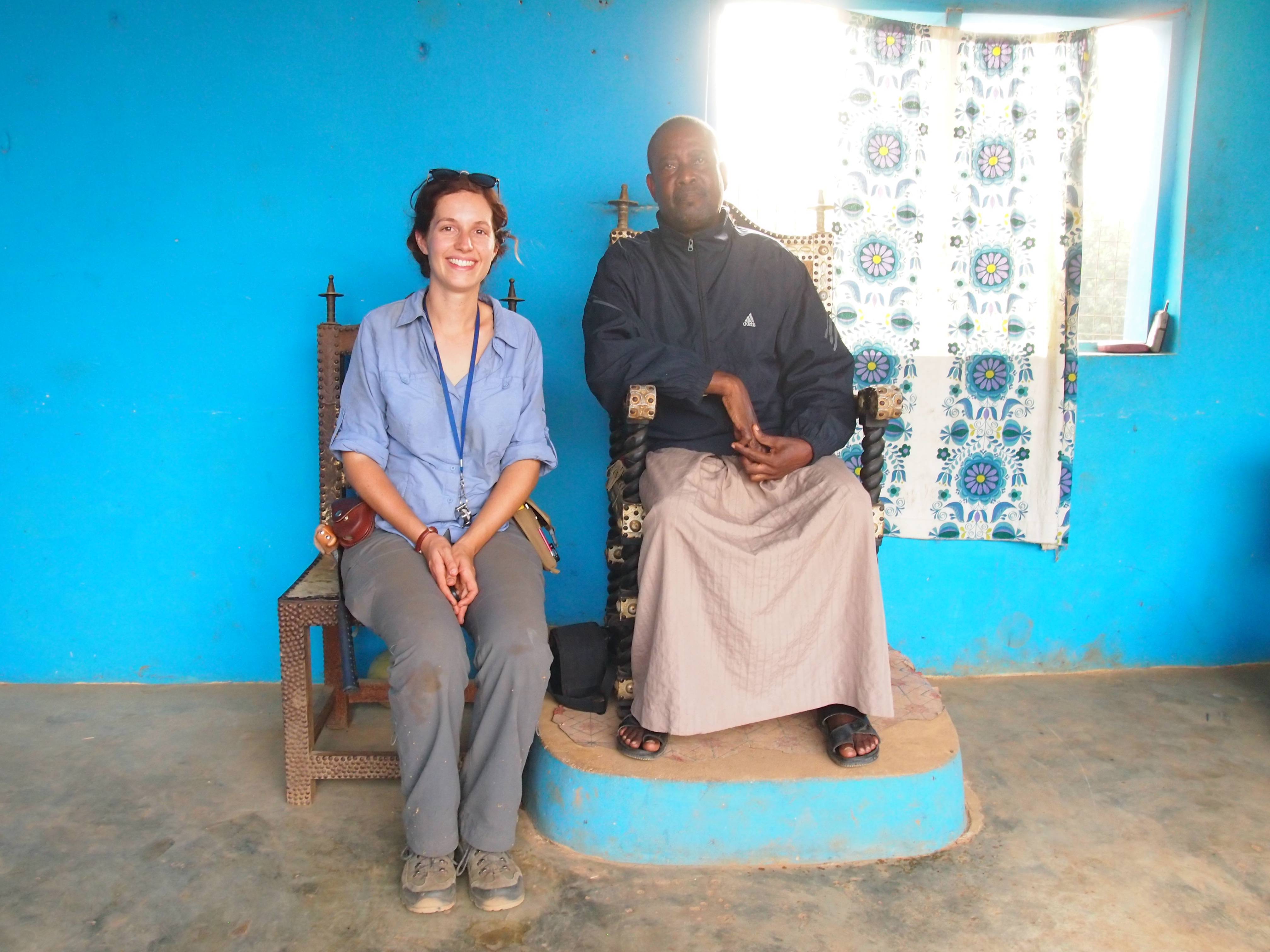
Figure 5. My meeting with the chief of Siana.
It’s a truly spectacular part of the world with high rainfall and luscious forest. Unfortunately for geologists, this also means increased weathering of rocks exposed at the surface. During the dry season ( late November – March), a dry, north-easterly trade wind, called the Harmattan, collects fine dust particles from the Sahara desert and blows them over West Africa resulting in a thick haze and reduced visibility.
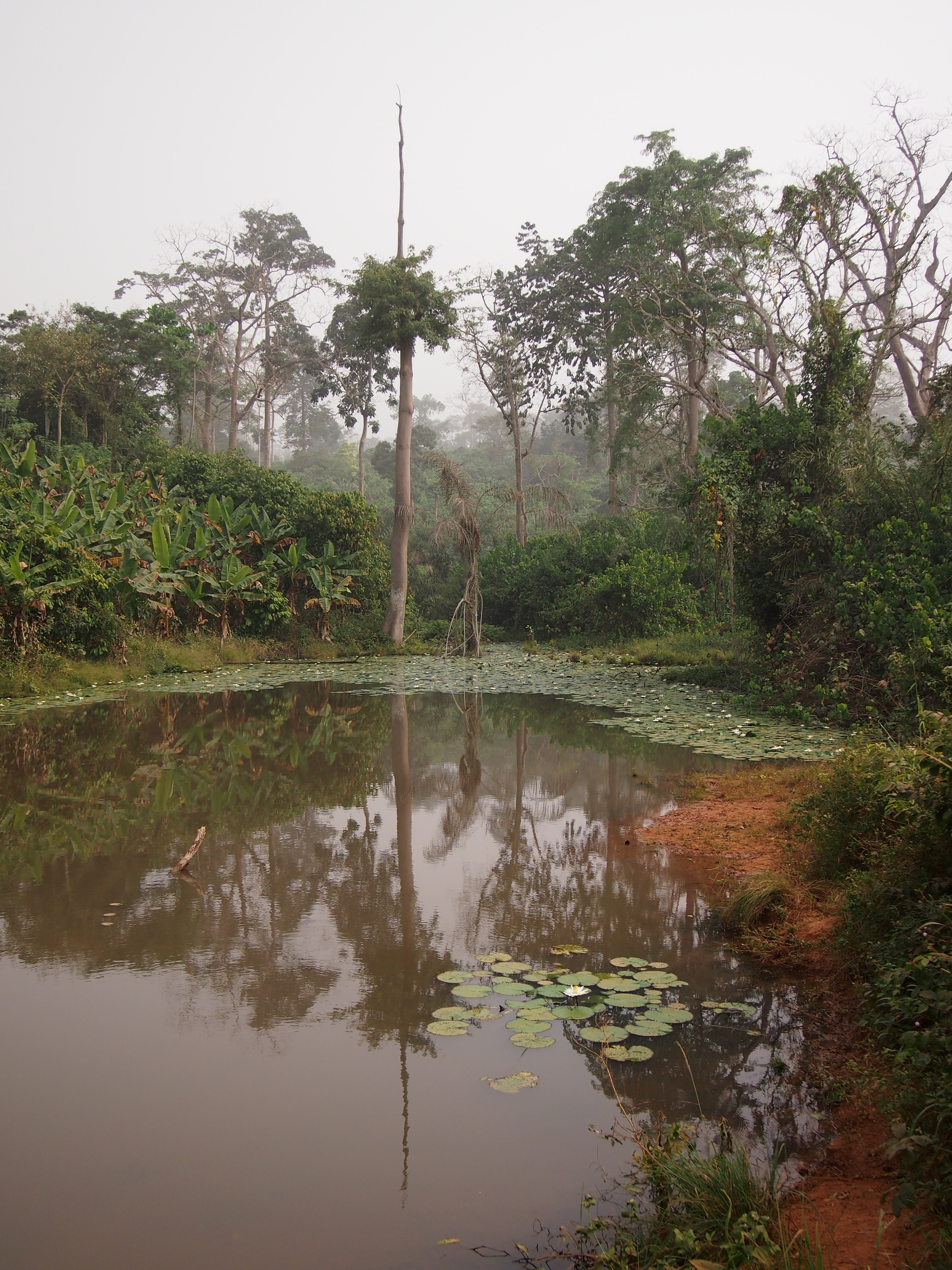
Figure 6. The Harmattan hanging over forest and banana plantations.
Our diet staples were fresh bread, sardines, avocado, and tomato, plus pawpaw, coconut and orange depending on what was being sold in the stalls we passed. For dinner, we feasted either on fufu (mashed cassava and plantain) or banku (corn and cassava dough), which you break off and roll into a ball with your right hand and dip in a hot groundnut or light soup. We also ate quite a lot of goat, dried fish, and chicken, and I was once honoured with the head of a bush rat, which, I can assure you has a particularly strong smell and flavour.
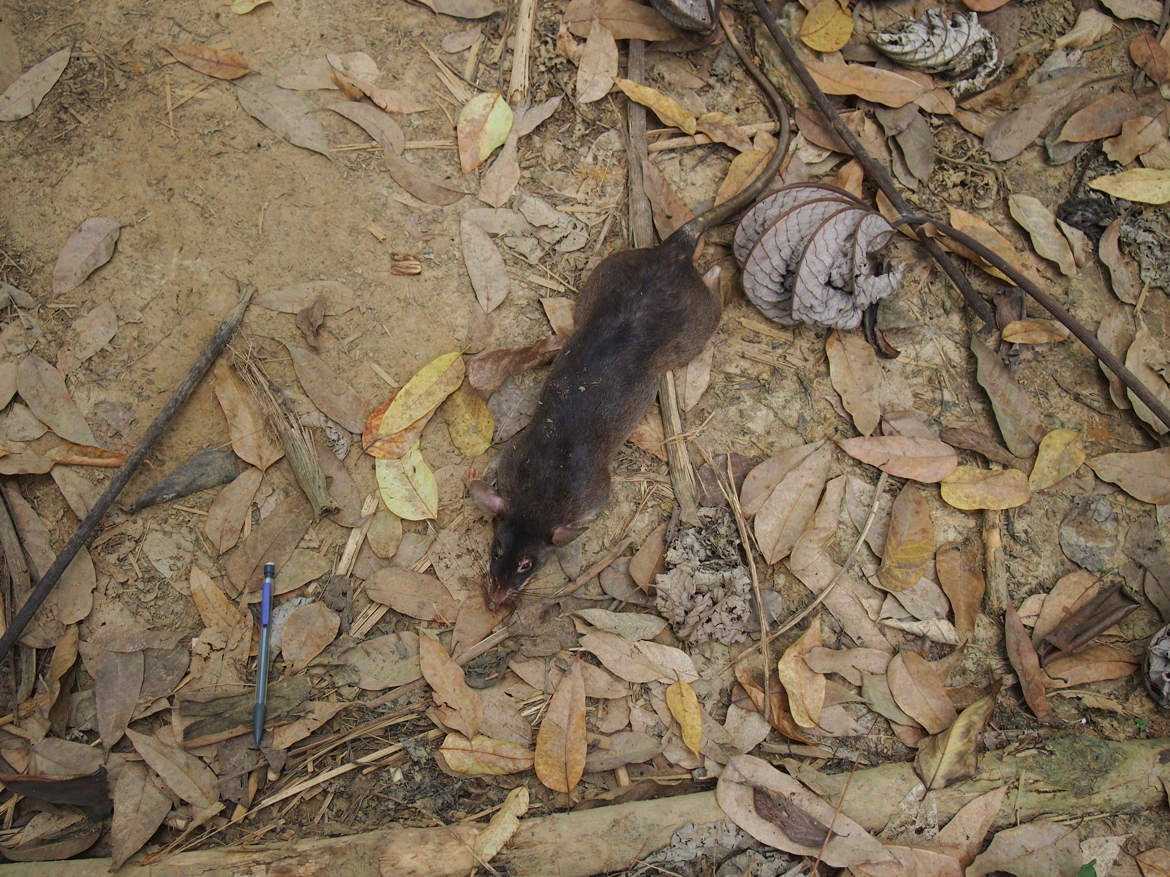
Figure 7: Bush meat caught by farmers who accompanied us through one of the forest reserves near Nkwanta.
The two field campaigns proved to be highly successful, with close to 500 outcrops documented, greatly bolstered by additional outcrop databases supplied by Newmont and Kinross. Samples gathered were used for microstructural constraints and metamorphic P–T modelling, as well as new geochemical and geochronological data to constrain the geodynamic setting and timing of magmatism, sedimentation, metamorphism and deformation.
Figure 8. Garnet bearing migmatitic paragneiss from Chiraa.
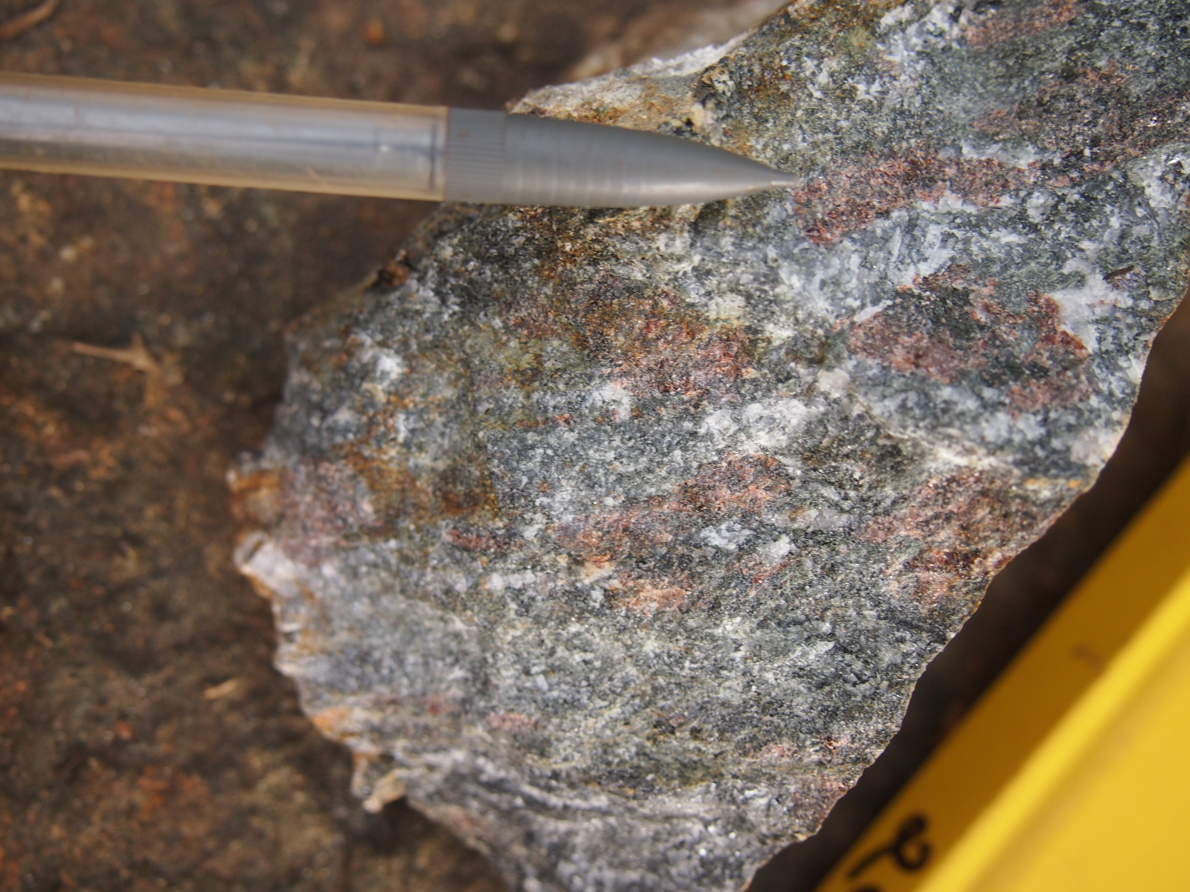
Figure 9. Hand sample of a deformed migmatitic garnet-clinopyroxene high-pressure amphibolite/granulite.

Figure 10. The crew perched atop the megacrystic leucogranitic Juju Mountains.
The greenstone belt threw up a few surprises, including outcrops of migmatitic garnet-kyanite-biotite paragneisses and amphibolites. From these samples, metamorphic modelling revealed previously undocumented high-pressure assemblages, with P-T-t-D paths indicating collisional orogenesis, high grade metamorphic and subsequent lower crustal exhumation occurred in the study area around 2.07 Ga, in the later stages of the Eburnean Orogeny. This combined with the limited number of regional studies in the Sefwi Greenstone Belt opened up a fascinating and untapped research avenue into Palaeoproterozoic geodynamics. All of the geologists who have previously worked on the Sefwi belt and the surrounding areas must have faced similar challenges of outcrop sparsity, pervasive weathering, and thick ground cover. But with perseverance, our field work provided a few little threads to help us unravel the history of the West African Craton.
Milési, J. P., Feybesse, J. L., Pinna, P., Deschamps, Y., Kampunzu, H., Muhongo, S., Lescuyer, J.-L., Le Goff, E., Delor, C., Billa, M., Ralay, F. & Heinry, C., 2004. Geological map of Africa 1: 10,000,000, SIGAfrique project. In: 20th Conference of African Geology, BRGM, http://www.sigafrique.net, Orléans, France, 2-7 June.
![]() This work is licensed under a Creative Commons Attribution-NonCommercial-ShareAlike 4.0 International License.
This work is licensed under a Creative Commons Attribution-NonCommercial-ShareAlike 4.0 International License.