Part of what is means to be a Traveling Geologist is that your curiosity and desire for discovery never stops, even when you are on holiday. For those brave souls who are coupled to us Traveling Geologists, this means that many of our family vacations are actually just well disguised geologic expeditions. This became apparent to my wife early on in our marriage when she noticed that my vacation packing list included a rock hammer, a roadside geology guidebook, and about half a dozen geologic maps. She might have felt bamboozled if not for the fact that she soon discovered that geologists tend to plan trips to remote and exotic locations that have charm beyond the outcrops. So while she now has come to enjoy the thinly disguised field trips we call vacations, she constantly has to answer the question to her friends, “Why did you go to (Iceland, Death Valley, insert other major geologic location here) on vacation?” Of course, the reply is always, “Because my husband is a geologist.”
Our family tradition continued this year as we used our vacation to escape to the desert around Big Bend National Park in Texas, United States. Big Bend National Park is in a remote corner of West Texas where the Rio Grande River that forms the border between the United States and Mexico takes a wide sweeping turn to the north. It is one of the least visited national parks in the lower 48 states and it’s not hard to imagine why. I don’t think I have been to a more remote place in all of the contiguous United States. It’s at least a 4-hour drive from El Paso, Texas, which is the closest major airport to the park. Big Bend is in the Trans-Pecos region of West Texas, a region of vast desert and mountains that are sparsely inhabited and little frequented by tourists. The remoteness of Big Bend is a big part of its allure. When you are at Big Bend, you get the sense that you are at the end of the world and you are instilled with a feeling that you are catching a glimpse of the earth thousands or millions of years ago before Homo sapiens left their indelible mark on this place. In the United States, this feeling is becoming increasingly rare unless you happen to find yourself in a place like Alaska. As beautiful and important as our national parks are, the most popular ones (Yellowstone, Yosemite, Smoky Mountains, Zion, etc.) are increasingly crowded and filled with congestion and development.
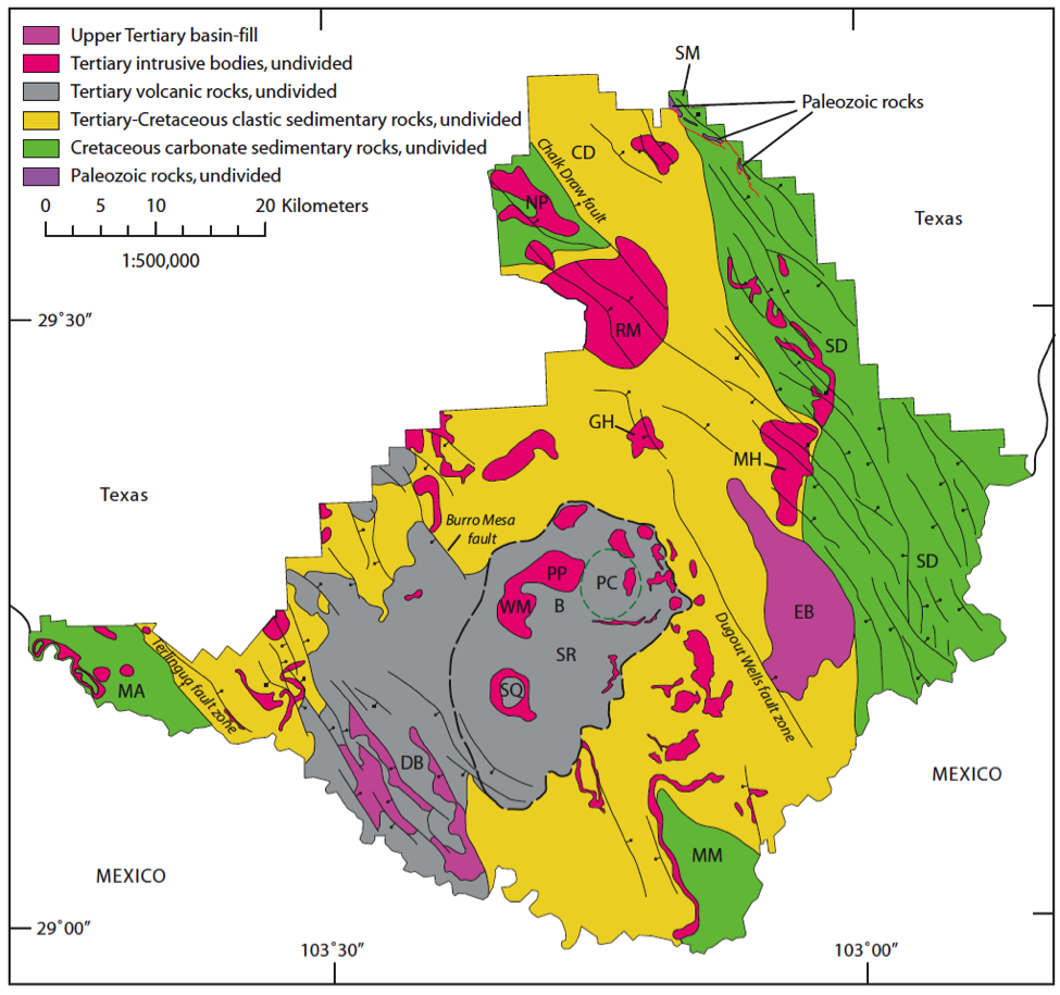
Geologic map of Big Bend National park showing the major rock units and structural elements. Map courtesy of the USGS.
The geologic history of Big Bend is complex, yet readily decipherable if you know where to look. In the park, there is a record of multiple mountain building events, violent volcanic eruptions, and quiet shallow seas filled with marine life (Figure 1). The oldest rocks in the park are Paleozoic sediments that were deformed in the Marathon orogeny during Pennsylvanian-Permian time. This ancient mountain belt is part of the greater Ouachita-Marathon-Sonoran orogenic event that occurred during the assembly of the supercontinent Pangea. Marathon age structures can be seen at the Northeast entrance of the park near the town of, you guessed it, Marathon.
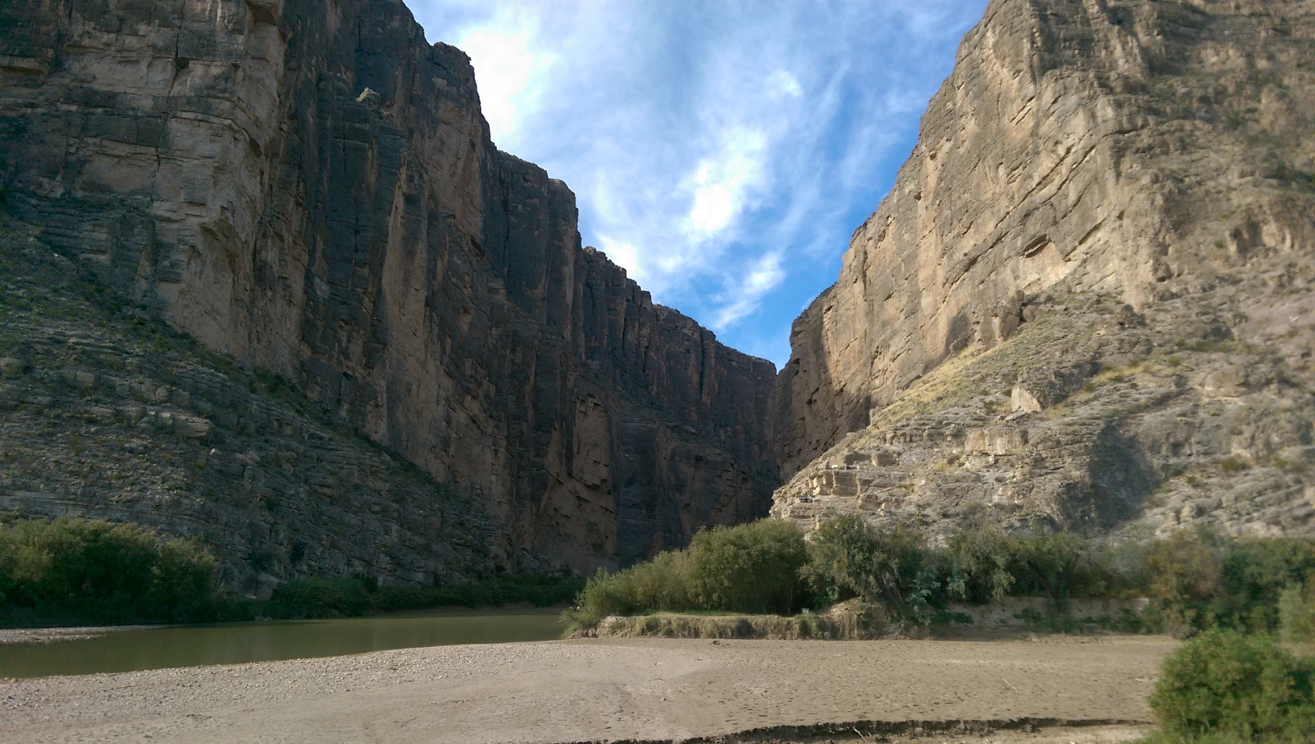
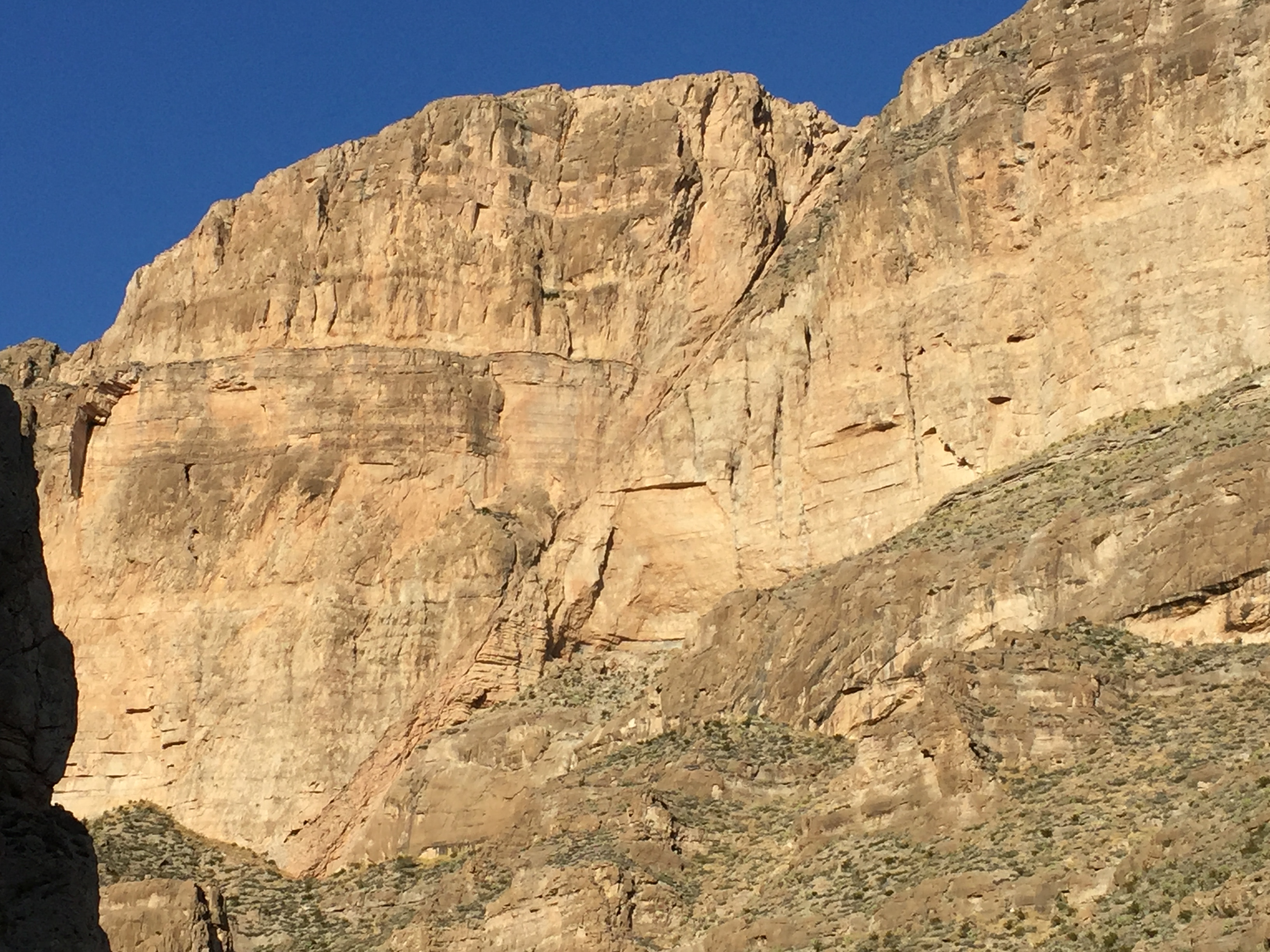
At the famous Santa Elena Canyon, the Rio Grande River has incised through large limestone cliffs that were deposited in the Cretaceous interior seaway. The limestones form a frontal monocline that was deformed during the Laramide Orogeny.
Most of the sedimentary rocks in the park are limestones deposited in the Cretaceous interior seaway that stretched all of the way from the Gulf of Mexico to the Arctic. These limestones make up the massive cliffs forming the Santa Elena, Mariscal, and Boquillas Canyons in Big Bend (Figure 2). Hiking along the mesas made up of these limestones is a treat, as fossil bivalves and ammonites are often spotted right in the middle of the trail (Figure 3).
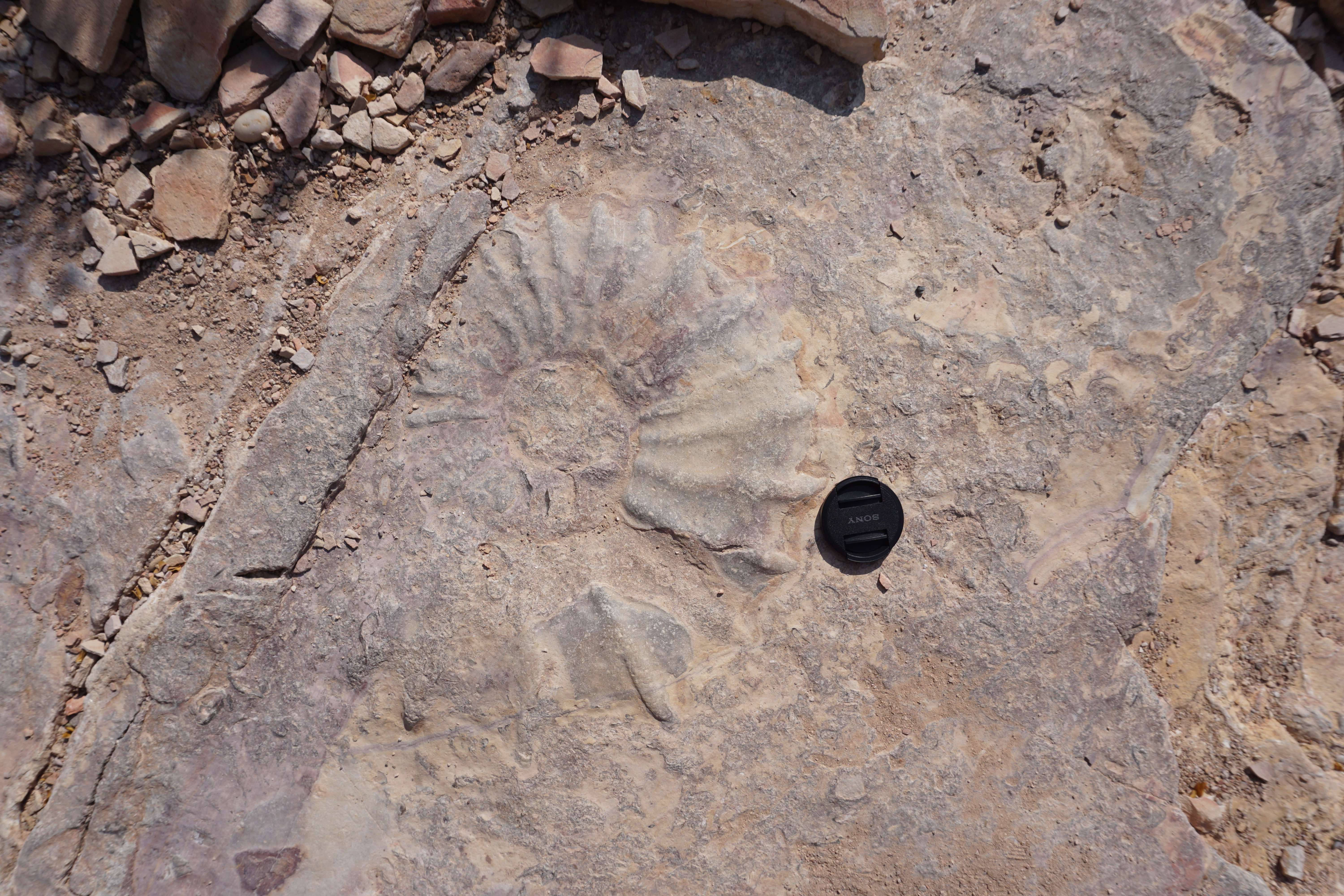
Large Ammonite fossil in the middle of a backcountry trail.
Not long after these Cretaceous limestones were deposited they were uplifted, folded, and faulted during the Laramide orogeny. The Laramide orogeny began during the Cretaceous Period and lasted until the Eocene; it is the mountain building event that uplifted much of the North American Rocky Mountains, including the front ranges in Colorado and Alberta, Canada. At Big Bend, the Laramide orogeny uplifted the Santa Elena Mountains in the west and the Sierra del Carmen Mountains in the east (Figure 4). These ranges have opposite senses of vergence, or movement, meaning that they were folded and thrust towards each other with the Boquillas Basin separating them.
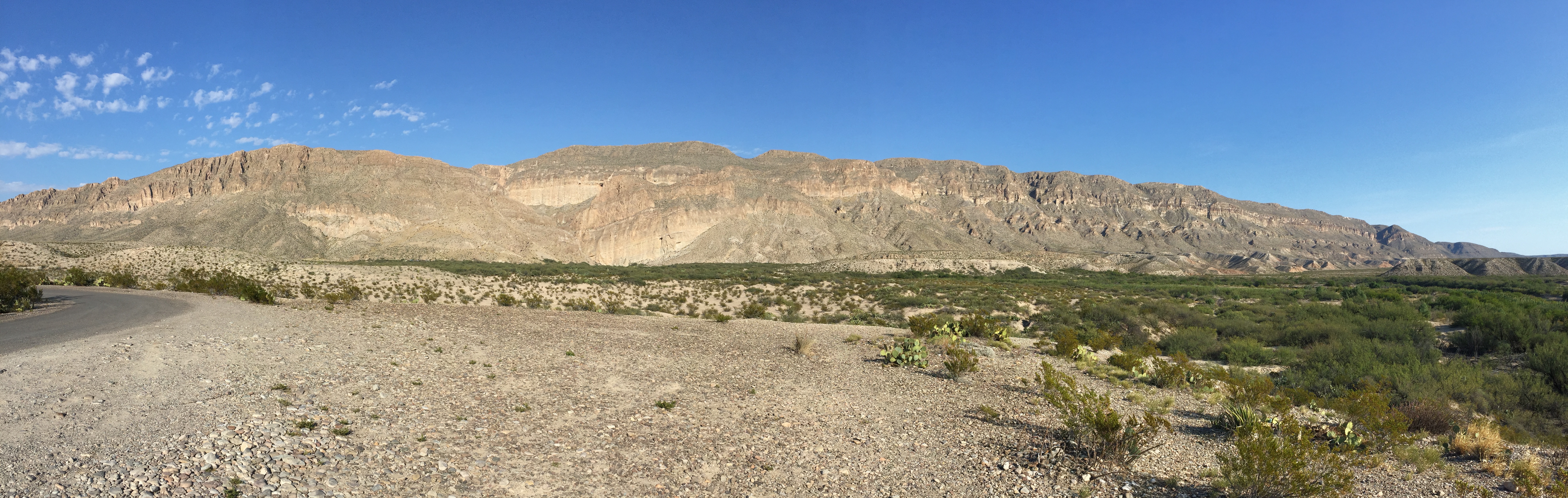
Laramide age thrust sheet in the Sierra del Carmen mountains.
The Boquillas Basin quietly collected sediments from the growing mountain ranges surrounding it until the late Eocene- Oligocene time when it became the focal point of volcanism in the area. The switch from folding and thrusting to volcanism at Big Bend during the Eocene is often attributed to the initiation of flat-slab subduction of the Farallon plate, which had the effect of pushing subduction-related volcanism eastward to where the park now stands. Volcanic rocks at Big Bend are spectacularly exposed in the Chisos mountains, the crown jewel of the park. The Chisos Mountains stand high above the surrounding desert floor and give the impression of a citadel fortress imagined in the mind of a writer like Tolkien. They are high enough (over 2300 m) that they create their own microclimate and eco-zone. While the surrounding desert is populated by sagebrush, road runners, and armadillos, in the Chisos Mountains there are a variety of conifer trees and large mammals such as black bears, mountain lions, and deer. The bear population has exploded in recent years with the number of animals in the park reported to be between 25-30 bears. This is pretty impressive for a small and isolated range. Evidence of Big Bend’s volcanic past can be seen everywhere in the Chisos. Andesites, rhyolites, and ash-flow tuffs can be seen on almost every hike (Figure 5). Because of the excellent exposures, it is possible to sit at several vantage points and visually work out the sequence of volcanic events that built the mountains.
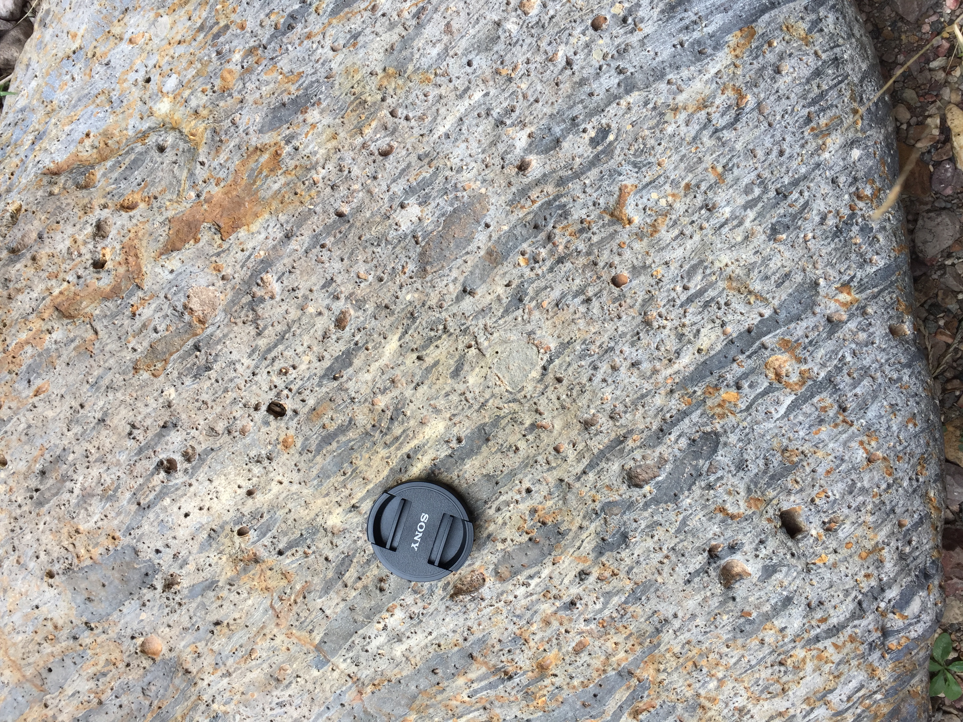
Ash-flow tuff found in the Chisos Basin
The last major tectonic event that shaped Big Bend National Park is the tectonic event that is still going on today, namely basin and range extension. A hike down the scenic Boquillas Canyon in the Sierra del Carmen Mountains exposes a spectacular normal fault in the canyon wall (Figure 6). This fault has approximately 100 meters of offset and is striking evidence that the surrounding landscape is not static, but is still subjected to immense tectonic forces.
Normal fault exposed in Boquillas Canyon resulting from basin and range extension
In 2016, the United States National Park Service celebrated its 100th anniversary. These parks are precious public jewels, not only to be preserved but also to be experienced. As Traveling Geologists we have an advantage over the everyday tourist since we have been trained to read the language of the rocks. That means we can visit these parks and read the story of deep time, violent continental collisions, and life that is long extinct. Even on vacations, our quest for geologic discovery doesn’t have to stop. All we need is a map, our hand lens and notebook, and the never-ending patience of our loved ones as we drag them across the desert to the next outcrop.
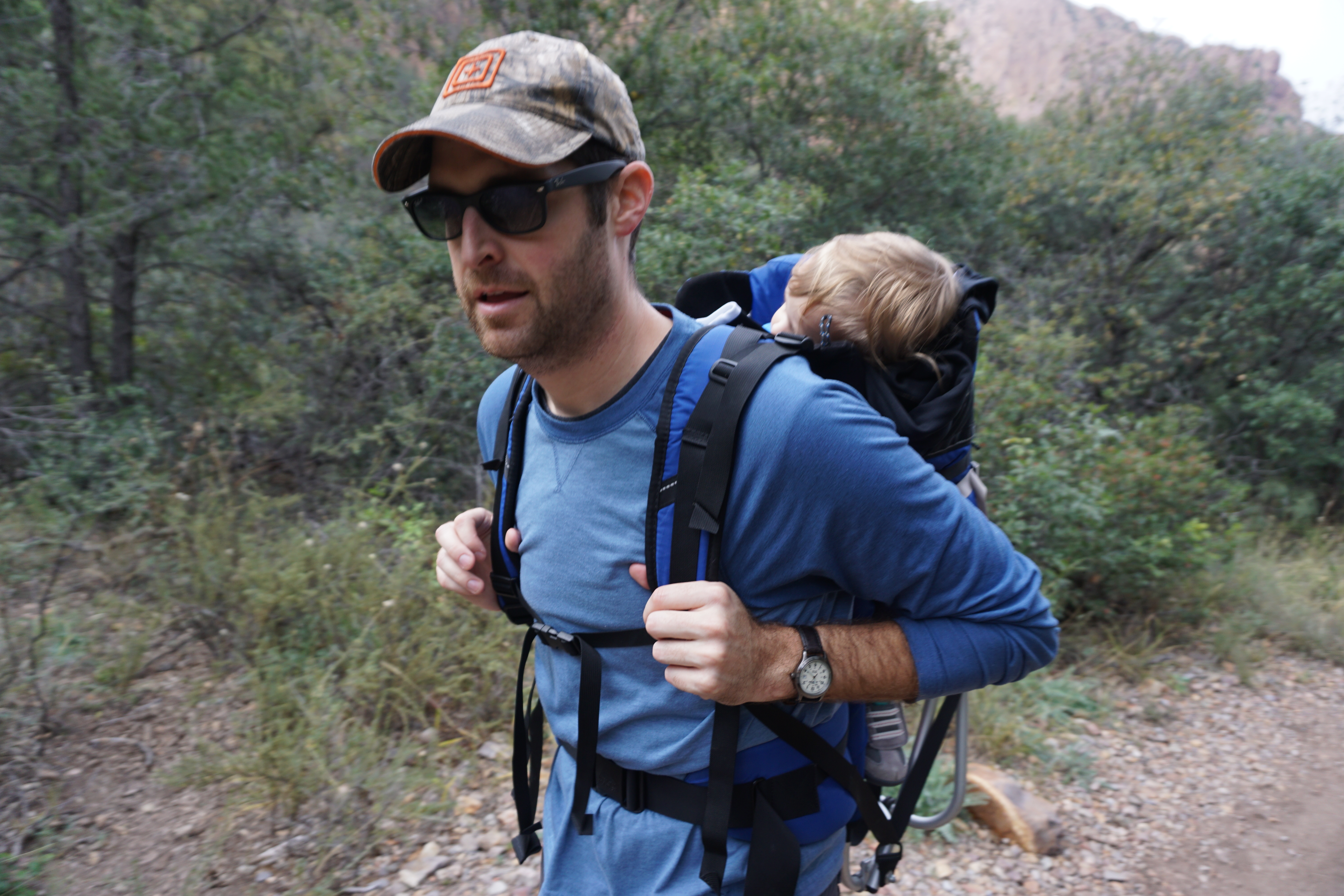
Geology dad: Trading in a backpack full of rocks for a backpack full of a sleeping toddler.
![]() This work is licensed under a Creative Commons Attribution-NonCommercial-ShareAlike 4.0 International License.
This work is licensed under a Creative Commons Attribution-NonCommercial-ShareAlike 4.0 International License.