Andreas Petersson recently finished his PhD at Lund University and is starting a joint fellowship between the University of Western Australia in Perth and the Swedish Museum of Natural History in Stockholm. You can follow his research here.
During the Fall of 2012, all the Ph.D students from the Geology Department (bedrock sub-dept.) at Lund University were fortunate to go across south-western US on a joint field trip.
Everything is bigger and better in the States they say. After this trip, I have a hard time disagreeing.
We flew out of Copenhagen airport and aimed for Denver. After arriving in Denver we picked up our rental cars. They too, a lot bigger than we are used to back in Scandinavia. Straight away, we headed for the first locality of our trip, the southern parts of the Green Mountains near Boulder, Colorado. The Flatirons!
The Flatirons
The Flatirons are a conglomeratic sandstone formation uplifted during the Laramie Orogeny (80–35 Ma) and a world famous rock-climbing area. Reaching 2484 metres above see level (8148 ft) they are a unique symbol for the area around Boulder and a perfect start to our time in North America.
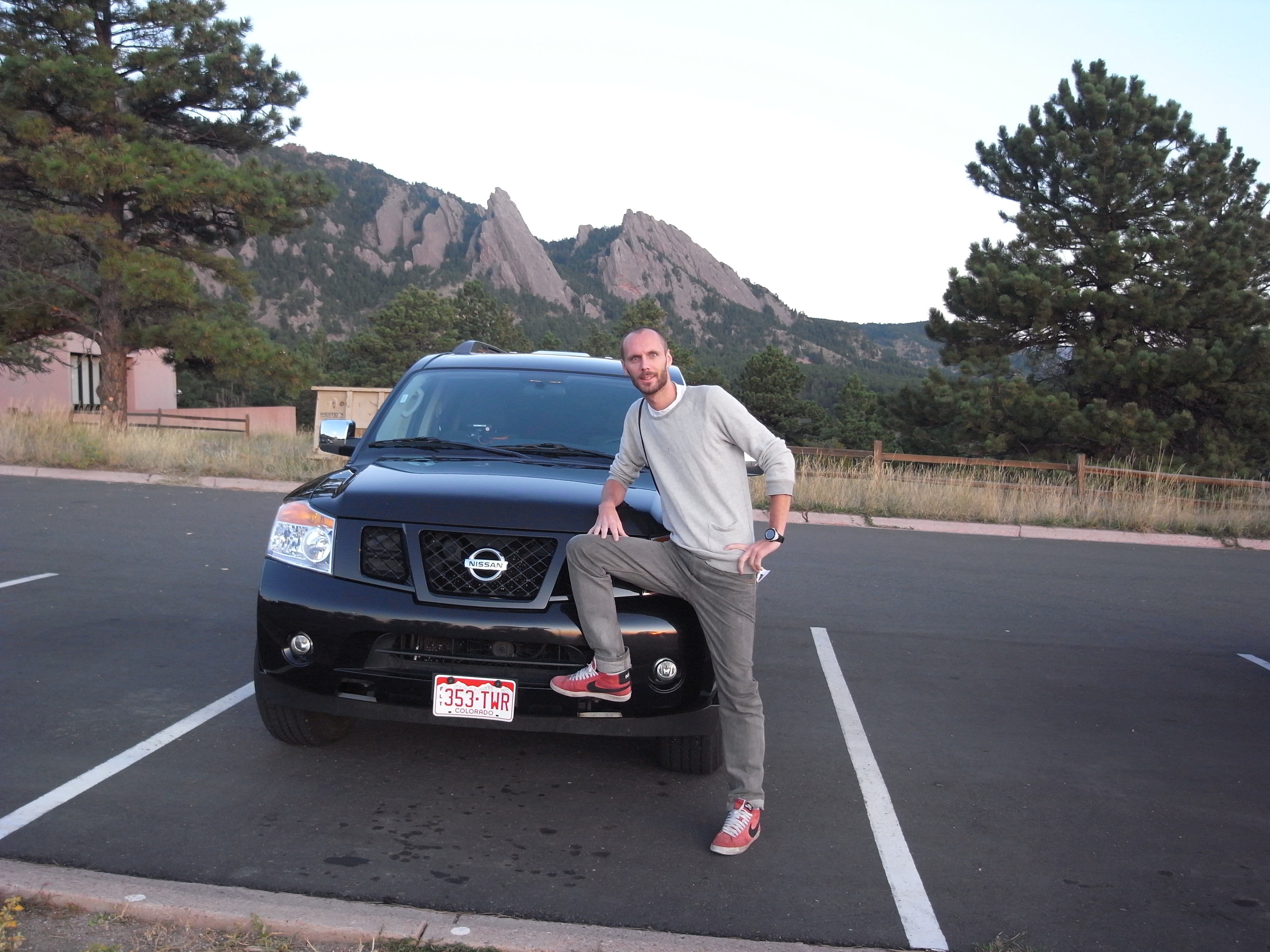
Me in front of our SUV and more importantly; the Flatirons!
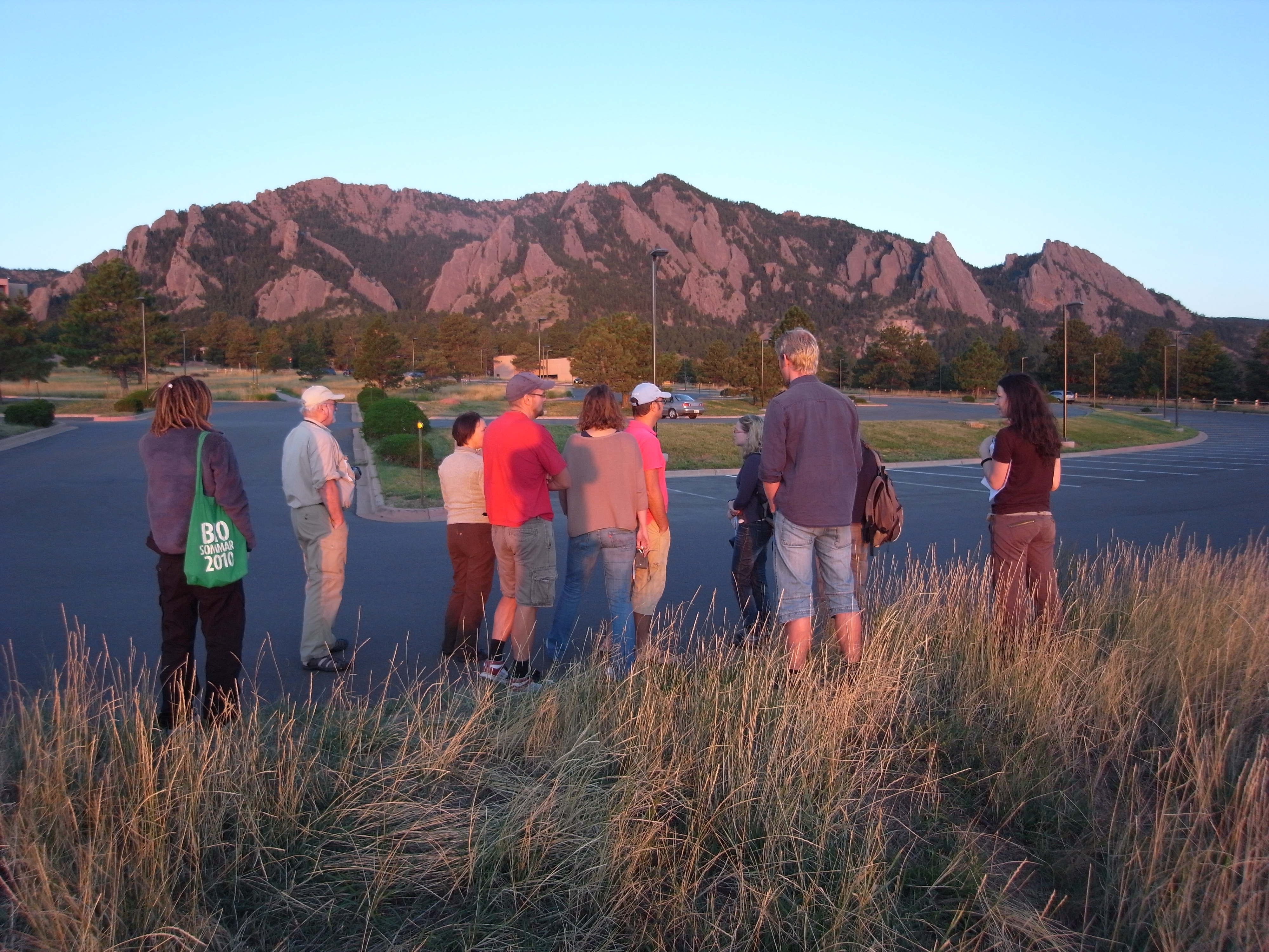
All of us enjoying the sunset at the Flatirons
The next couple of days we drove across the Rocky Mountains, from Boulder to Breckenridge to Aspen and off course stopping for coffee in the little town of Basalt, CO.
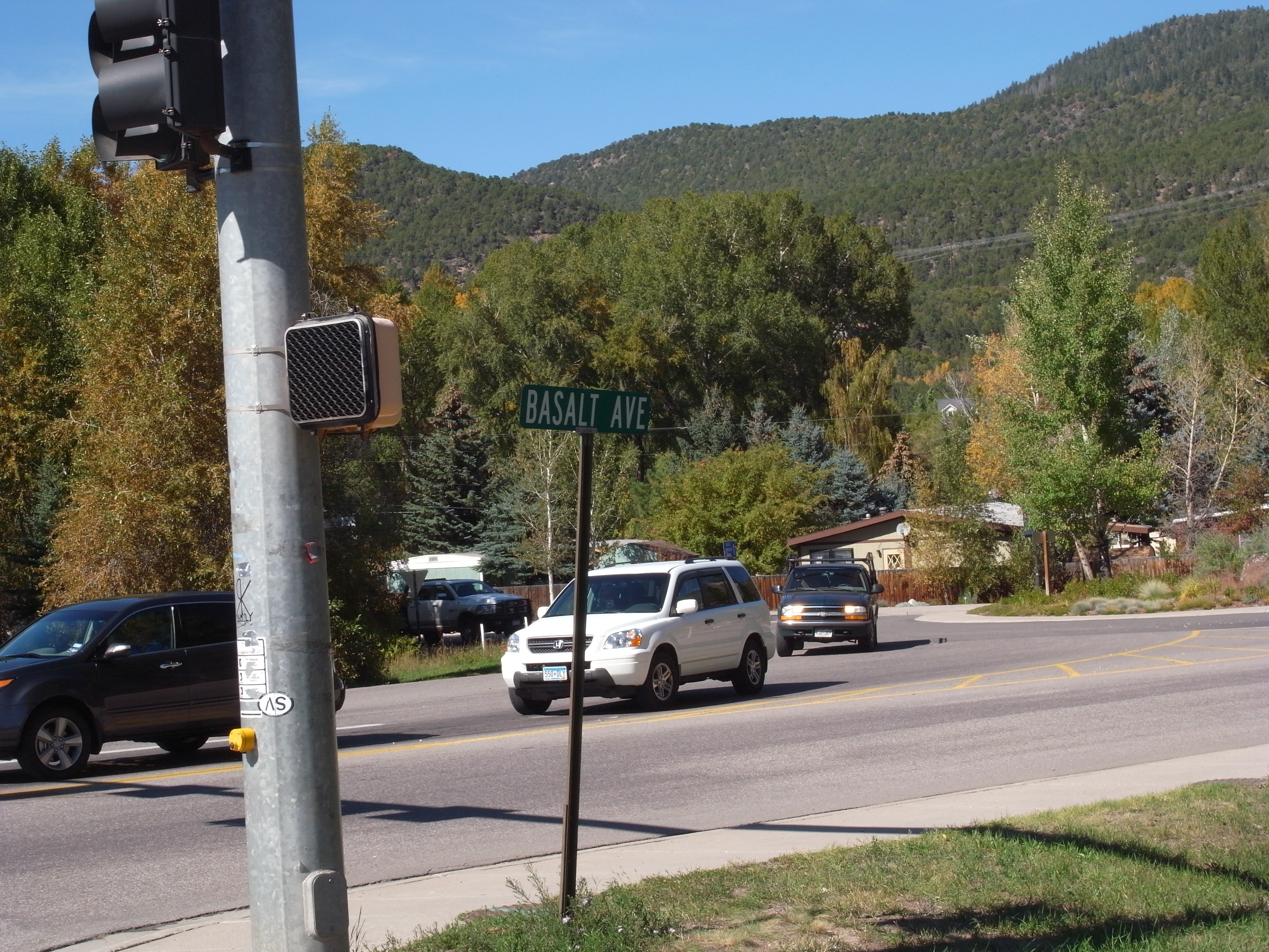
Basalt ave. in the town of Basalt
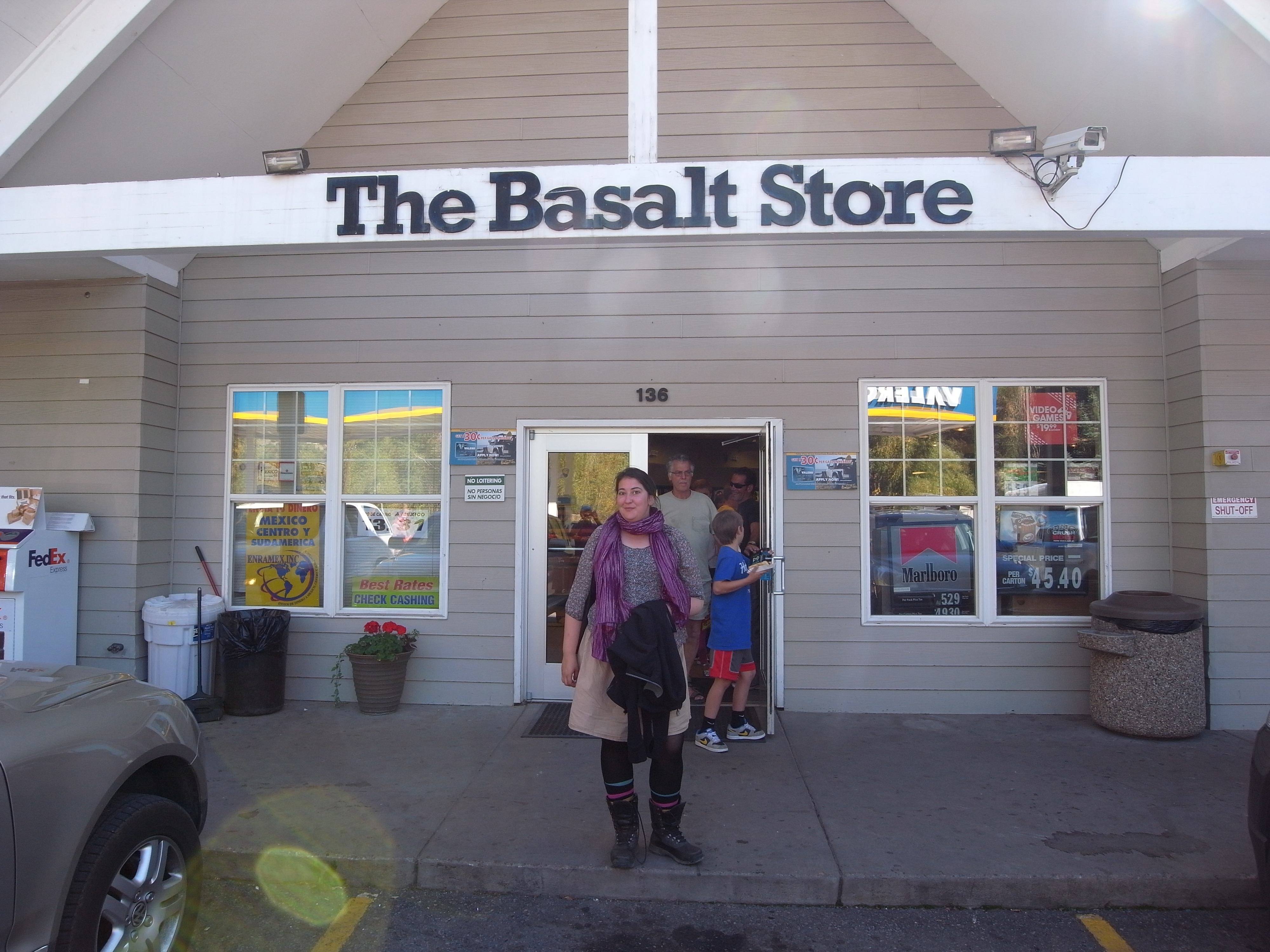
Mimmi Nilsson in front of the Basalt Store in the town of Basalt
Having spent several years, prior to picking up my geology studies, in the French Alps, visiting classic ground like Breckenridge and Aspen was exiting, but the real treat was to familiarise with the impressive geology of the Rockies.
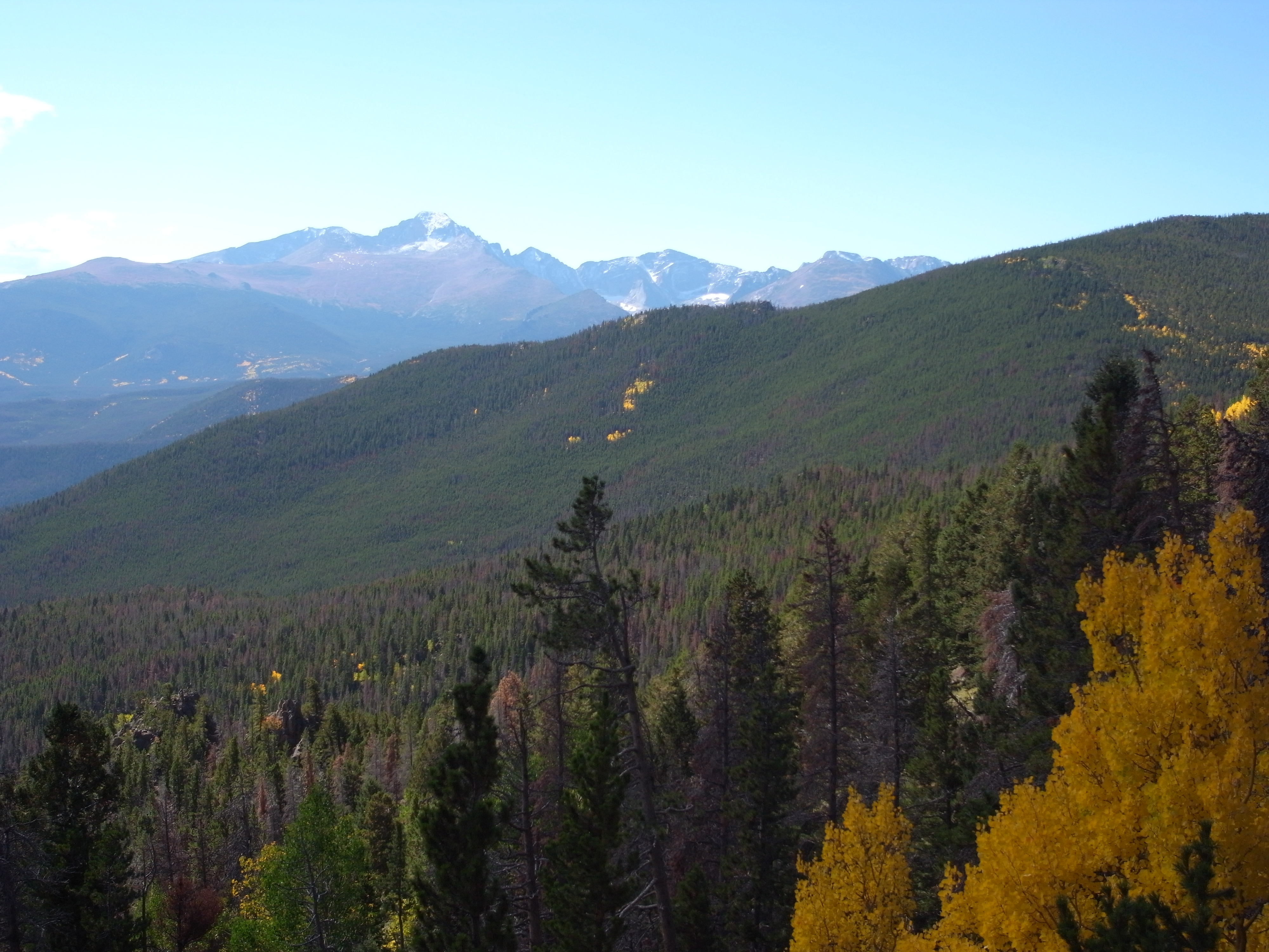
The Rocky Mountains
The Rocky Mountains took shape during a period of intense plate tectonic activity in response to the subduction of the Farallon Plate underneath the North American continent. These events shaped much of the rough landscape of the western United States. Three major mountain-building episodes reshaped the west from about 170 to 40 Ma. The last event, the Laramide orogeny, (70–40 Ma) is responsible for raising the Rocky Mountains.
During the last half of the Mesozoic, much of today’s California, Oregon, and Washington were added to North America. Western North America had repeated collisions from slabs of ocean crust that sank beneath the continental edge. Continental crusts, carried by subducting ocean plates, were scraped onto North America’s edge.
The Rocky Mountains
About 300–500 km inland, magmas generated above the slab erupted into the North American continental crust. Arc-shaped volcanic mountain ranges formed from numerous volcanoes, and large volumes of magma crystallised inside the lithosphere.
For 100 Million years the effects of plate collisions were focused near the edge of the North American plate boundary, west of the Rocky Mountain today. It was not until 70 My ago, during the Laramie Orogeny, that these effects began to reach the Rockies.
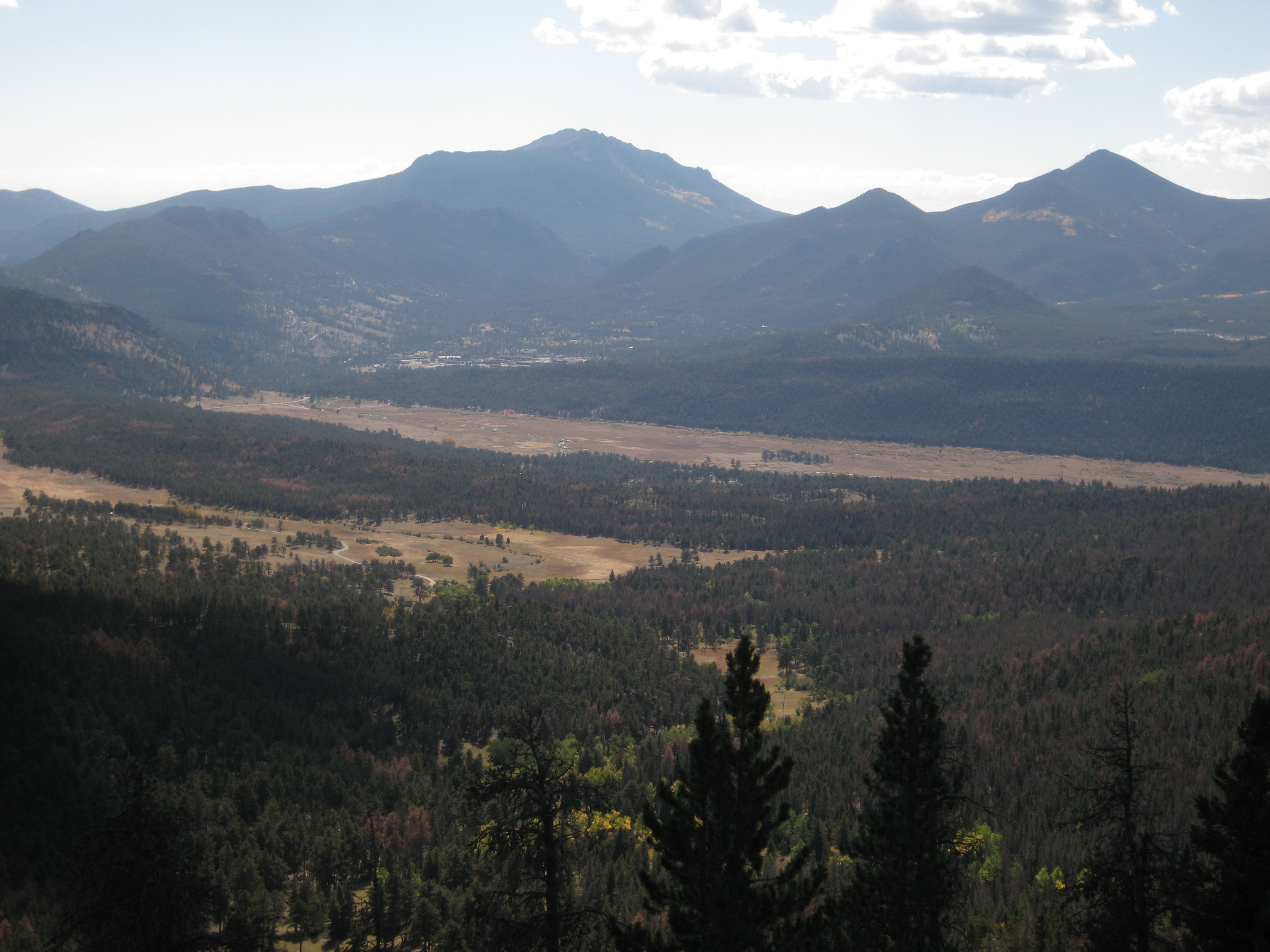
Another view of the Rockies
Seeing the impressive features, that are the remnants of these major orogenic events, during during a few hot, early autumn days in 2012 truly manifested my love for being in the mountains. Driving through this undulating landscape, clearly seeing and being able to follow the uplifted and tilted strata was a bit like stepping in to a schoolbook.
Leaving the Rockies a few days later, we headed for Utah’s red rock canyon country and more specifically the Buckhorn Wash in the San Rafael Swell where towering rock cathedrals form twisting and turning canyons. I must say, even though, or perhaps because it doesn’t get as much attention as places like Moab or Zion it was a great place to check out the red rocks of the canyon country and even squeeze in a bit of culture, in the form of the Buckhorn Wash Rock Art Site, an excellent example of >2000 years old Barrier Canyon style rock art.
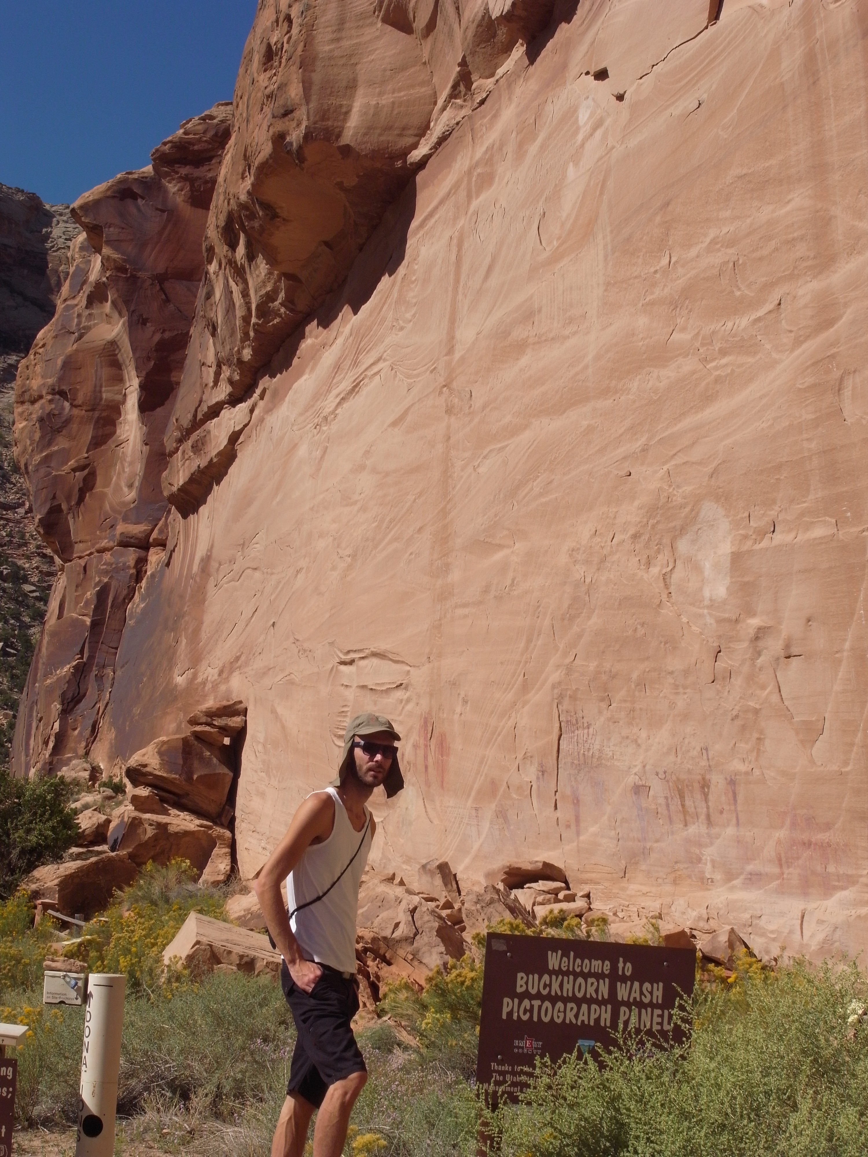
Me in front of some Native American art on the walls at Buckhorn Wash.
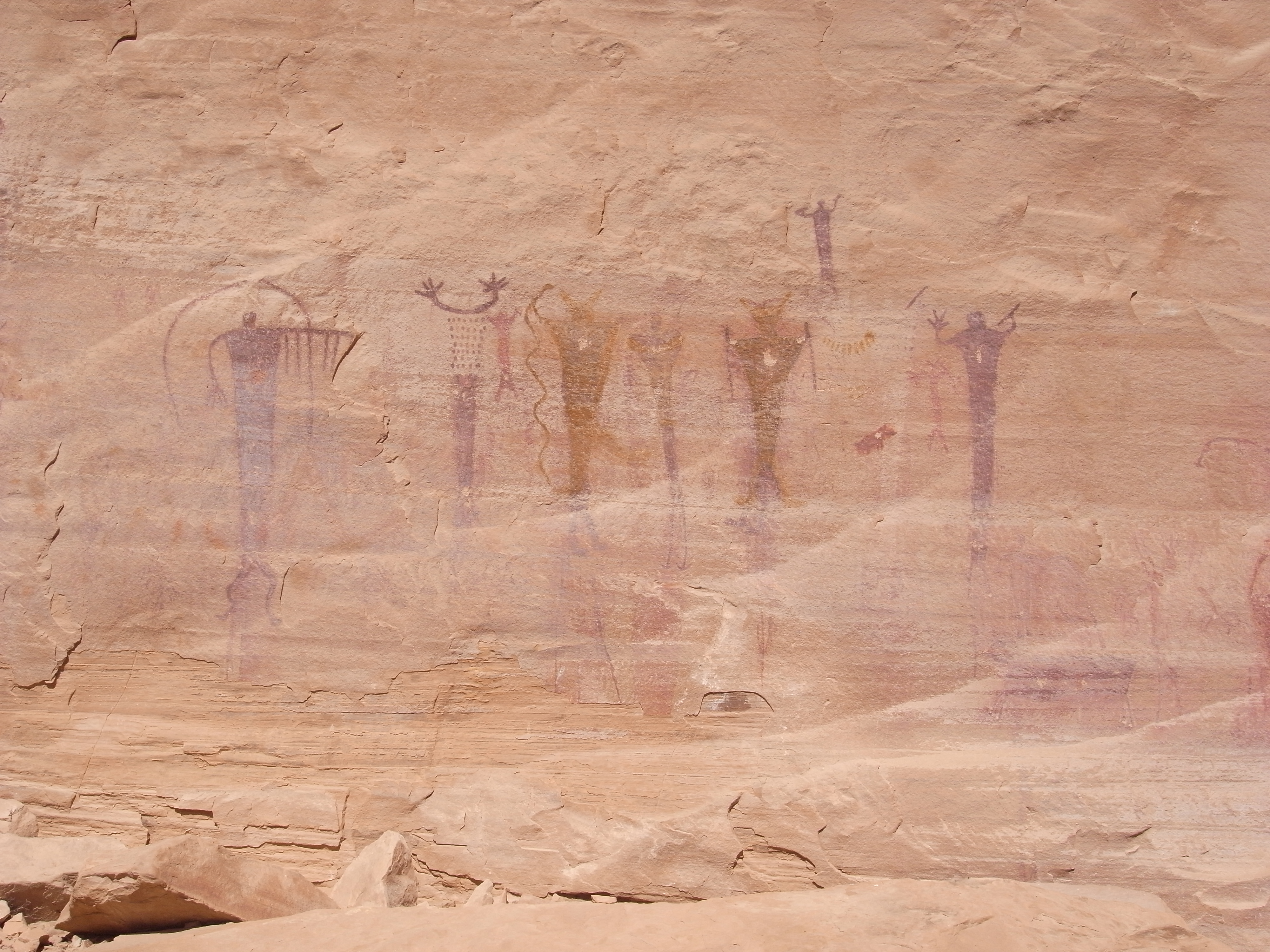
Buckhorn Wash wall-art.
This day we met up with a local guide/cowboy/ranger whose name I have sadly forgotten, that showed us around. We started of at the Buckhorn Wash doing a bit of site seeing, but fairly soon he showed us some “really cool stuff”. The surrounding area was packed with geological features such as sinkholes, the Black Dragon Canyon and of course lots of dino-tracks and dino-bones.
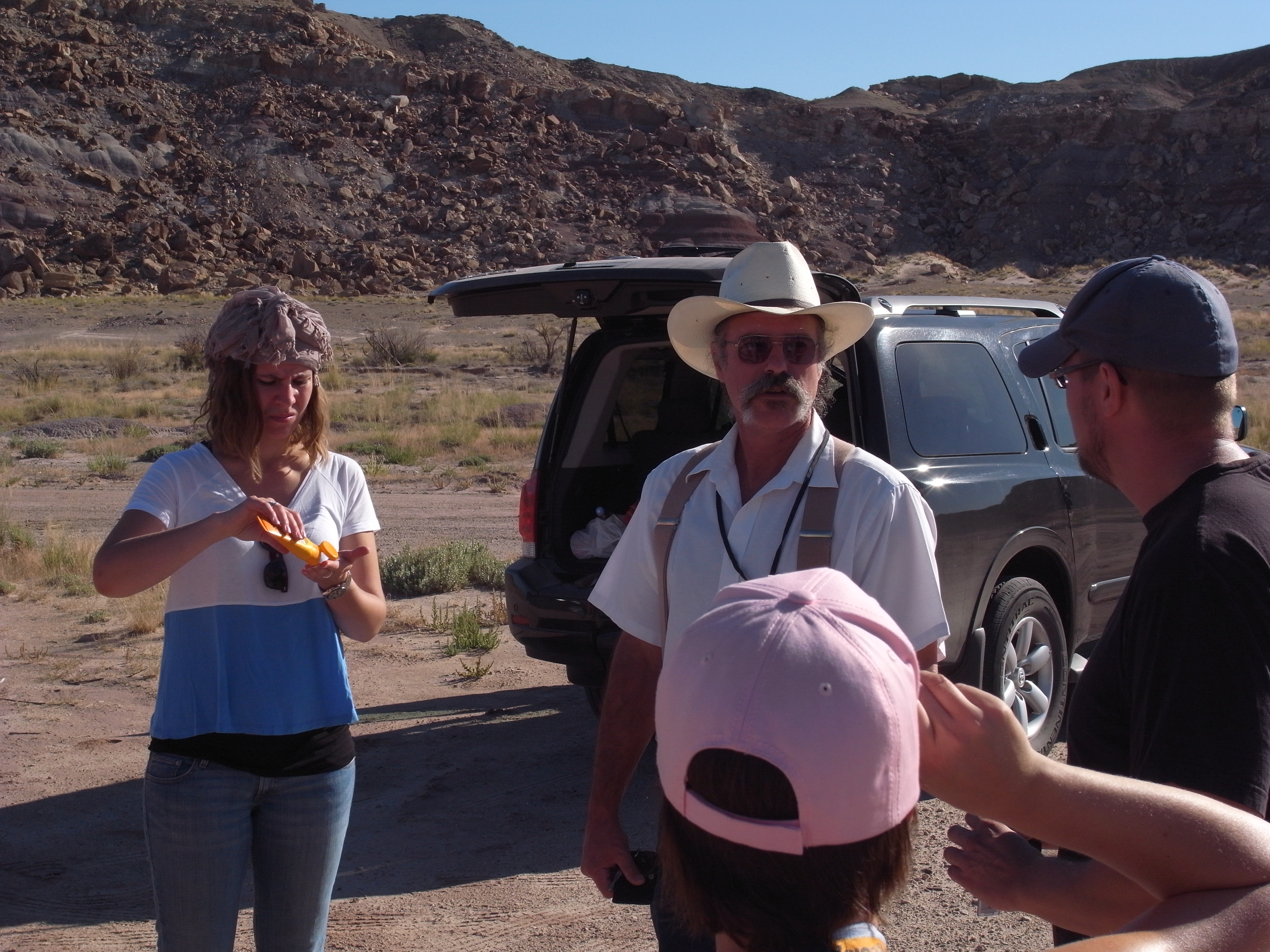
Our Guide/Ranger/Cowboy in Black Dragon Canyon together with Sanna Alwmark, Johan Lindgren, and Victoria Beckman.
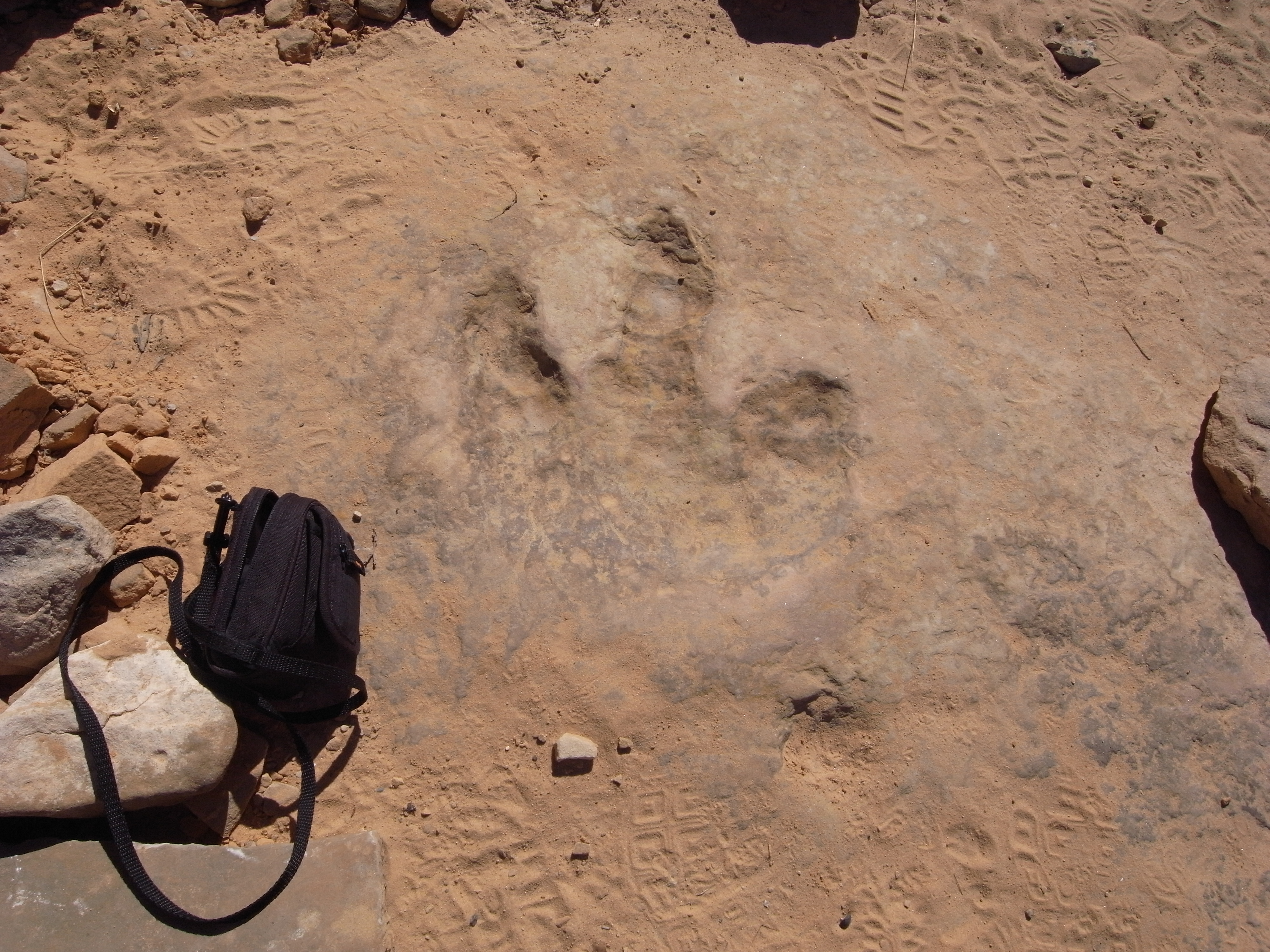
Dino-track!
A long day worth of walking around the super hot desert looking at different geological features and hunting down dinosaur fossils ended with a visit to the Dinosaur National Monument in Jensen, Utah where we could look at fossils of dinosaurs including Allosaurus, Abydosaurus and various long-neck, long-tail sauropods.
At the end of the day I personally wanted to thank our cowboy-guide for a great day.
He replied, with a slightly offended tone in his voice:
“This was not a great day! This was a f-ing AMAZING day!”
As a modest European I realised first hand that not only is geology bigger in the States.
The Dinosaur National Monument
The rock layers enclosing the fossils at and around Dinosaur National Monument is a sandstone and conglomerate bed of alluvial or river bed origin known as the Morrison Formation from the Jurassic Period, some 150 million years old. The dinosaurs and other ancient animals were washed into the area and buried presumably during flooding events. The pile of sediments were later buried and lithified into solid rock. The layers of rock were subsequently uplifted and tilted to their present angle by the mountain building forces that formed the Uinta Mountains. The relentless forces of erosion exposed the layers at the surface to be found by palaeontologists.
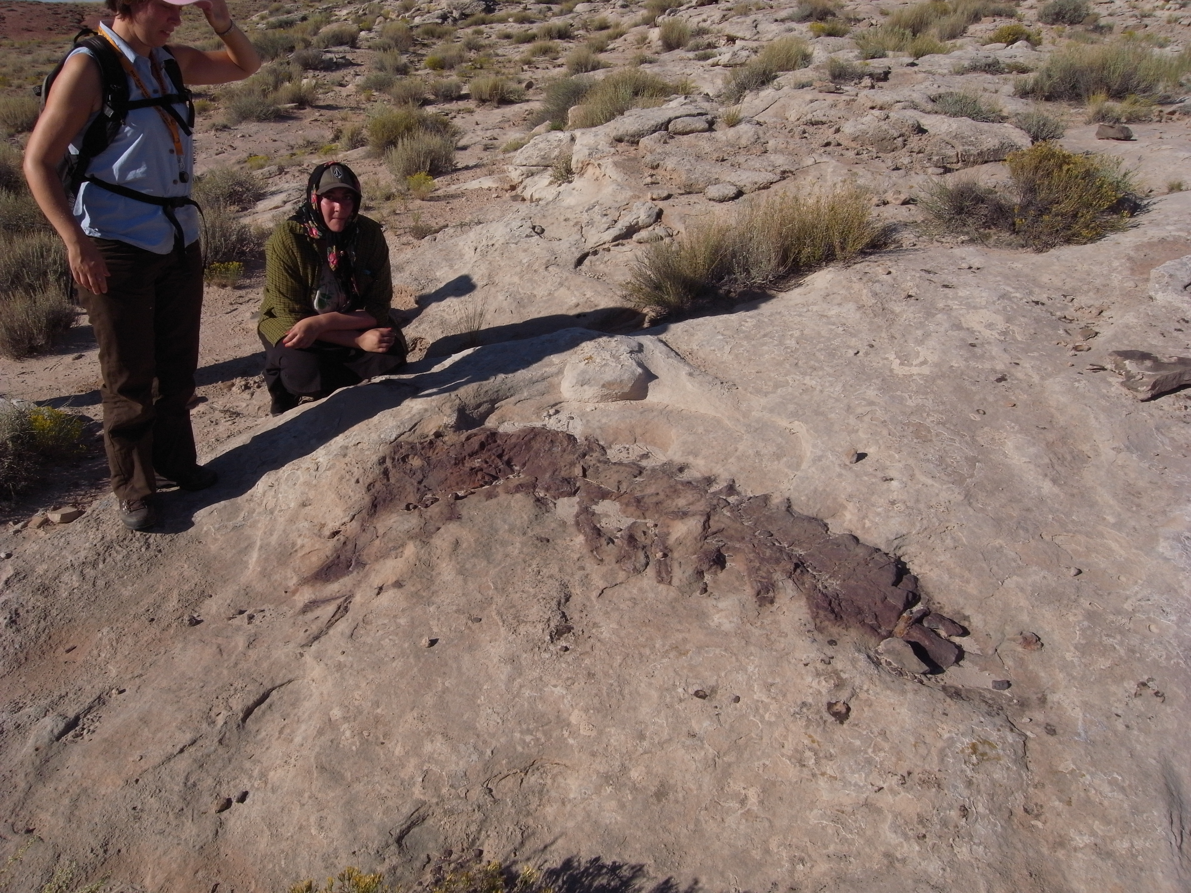
Dino fossil in the Black Dragon Canyon. Students, Mimmi Nilsson and Victoria Beckman
The dinosaur fossil beds (bone beds) were discovered in 1909 by Earl Douglass, a palaeontologist working and collecting for the Carnegie Museum. He and his crews excavated thousands of fossils and shipped them back to the museum in Pittsburgh, Pennsylvania for study and display. President Woodrow Wilson proclaimed the dinosaur beds as Dinosaur National Monument in 1915. The monument boundaries were expanded in 1938 from the original 80-acre (320,000 m2) tract surrounding the dinosaur quarry in Utah, to its present extent of over 200,000 acres (800 kmÇ) in Utah and Colorado, encompassing the spectacular river canyons of the Green and Yampa. Though lesser-known than the fossil beds, the petroglyphs in Dinosaur National Monument are another treasure the monument holds. Due to problems with vandals, many of the sites are not listed on area maps.
The Dinosaur wall located within the Dinosaur Quarry building in the park consists of a steeply tilted (67° from horizontal) rock layer, which contains hundreds of dinosaur fossils. The enclosing rock has been chipped away to reveal the fossil bones intact for public viewing. In July 2006, the Quarry Visitor Center was closed indefinitely due to structural problems that have plagued the building since 1957 as it was built on unstable clay. The current preferred plan is to rehabilitate the existing Quarry building, destroying the serpentine ramp, administrative, and museum facilities. A new facility to house the visitor centre and administrative functions would be constructed elsewhere in the monument. This plan would provide a safe structure while still retaining a portion of the historic Mission 66 era exhibit hall. It was announced in April 2009 that Dinosaur National Monument would receive $13.1 million to refurbish and reopen the gallery as part of President Obama’s administration $750 billion stimulus plan.
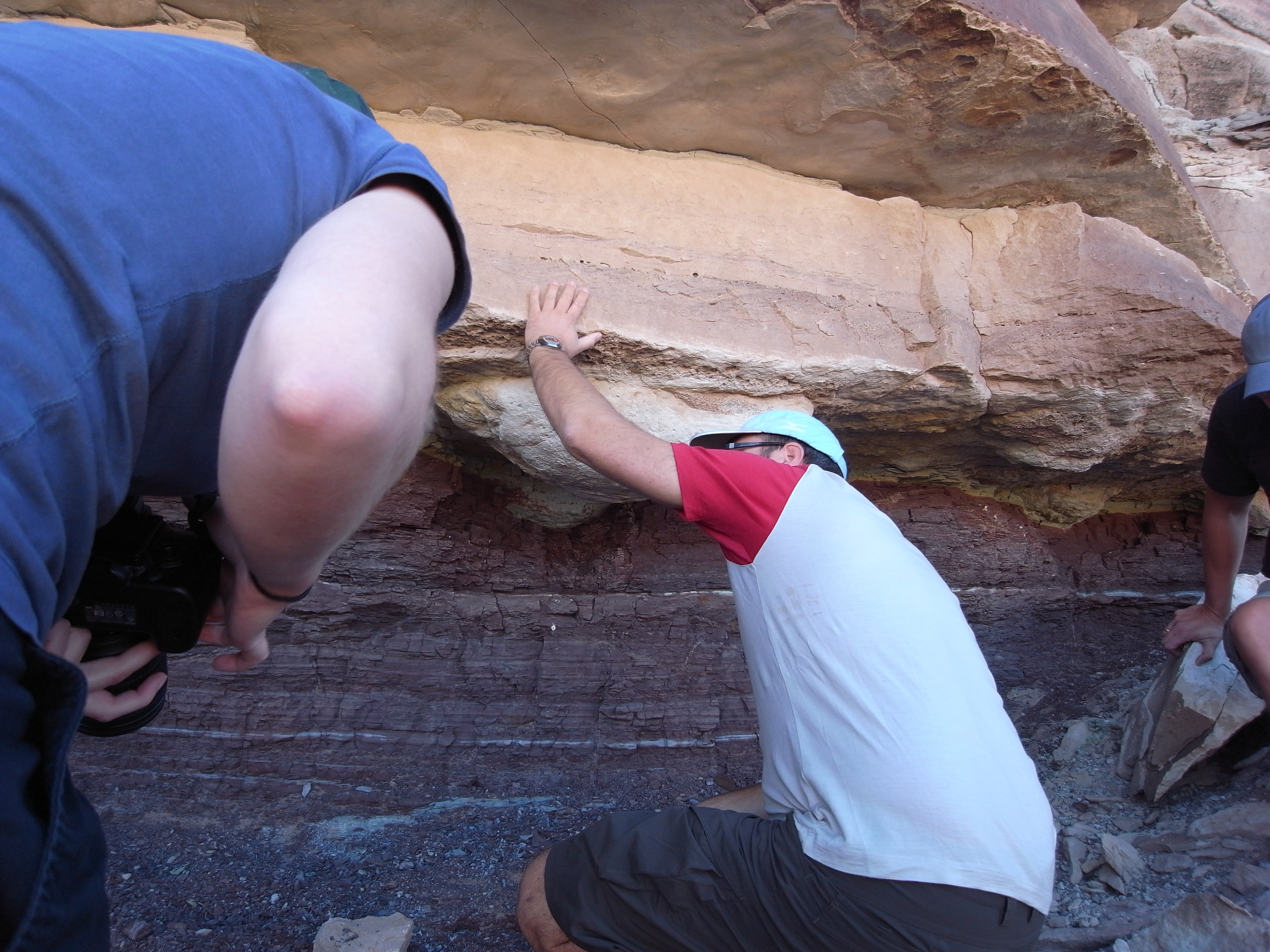
Anders Scherstén looking at a Dino-track.
The next days our trip continues towards, and into the Green River Basin stopping at various quarries and minor localities.
The Green River Basin
From north-eastern Utah, the Green River meanders through Dinosaur National Monument and then south to Canyonlands National Park, where it merges with the Colorado river. The river meanders through the landscape forming canyons. It has a large catchment area; south-western Wyoming, north-western and western Colorado and north-eastern Utah. The area consists bedrock mainly Palaeocene sedimentary rocks called the Green River Formation. This formation consists of fossil-rich strata deposited in lakes during the Eocene. It covers over 6 Million years and was deposited around 48 Ma. These deposits can be seen in all three states, the most famous venue being Fossil Lake, Wyoming. Fossils found here include vertebrates (such as fish, reptiles, birds and mammals), invertebrates (such as snails and insects) and plants (leaves, wood and reeds).
Schoolbook faults along the road.
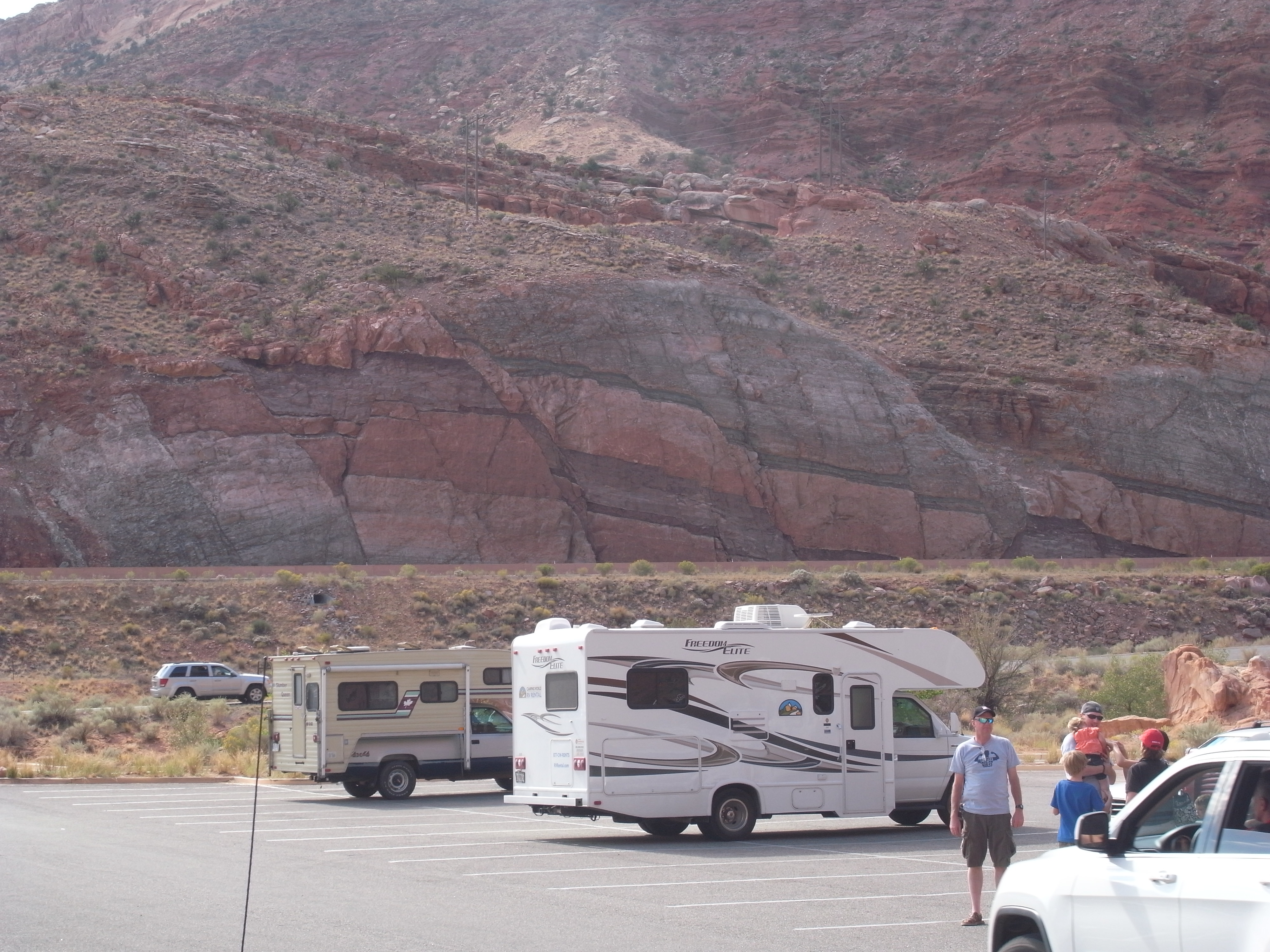
The main goal, however, was Arches National Park. You really do not need to be a geologist to appreciate the beauty of this amazing locality. First driving and then hiking up this park gives you a great view of both the surrounding plains and the incredible sandstone arches that named the park.
The hike up to the top was somewhat of a struggle for some of us as it was super hot that day. But, when regrouping at the top we could all agree it was well worth the effort. These red sandstone formations with its grand arches combined with an amazing view of the surrounding landscape is truly breath-taking and I would highly recommend a visit to anyone planning to go to south-western US.
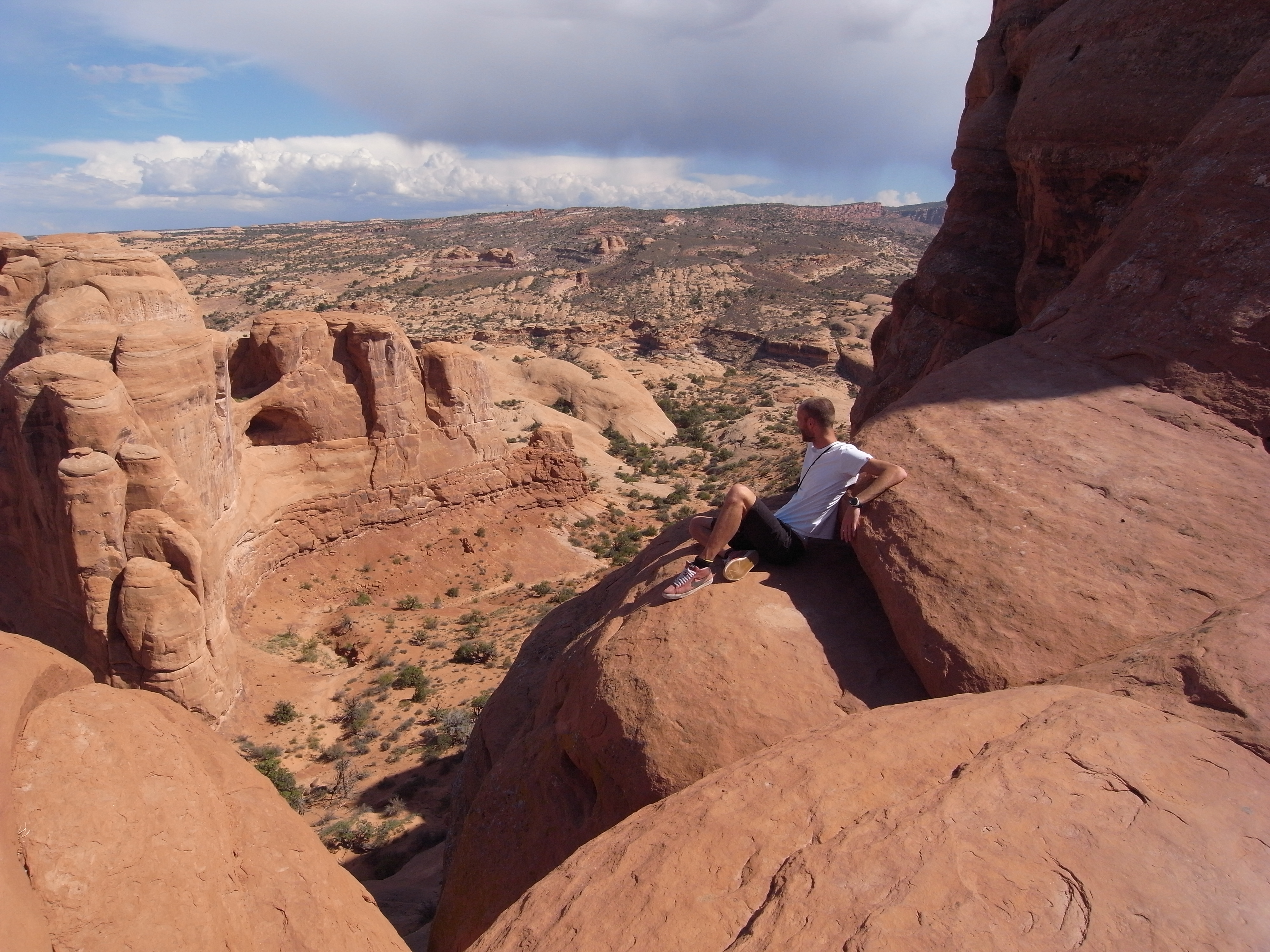
Me enjoying the view at Arches National Park.
Arches National Park
The Entrada Sandstone and the underlying Carmel Formation comprise the sandstone of Arches National Park. The Entrada Sandstone, once a desert full of dunes of fine-grained sand, is made up of spherical sand grains now lithified to a very porous rock. In contrast the Carmel layer has a much higher clay content making it denser and less porous.
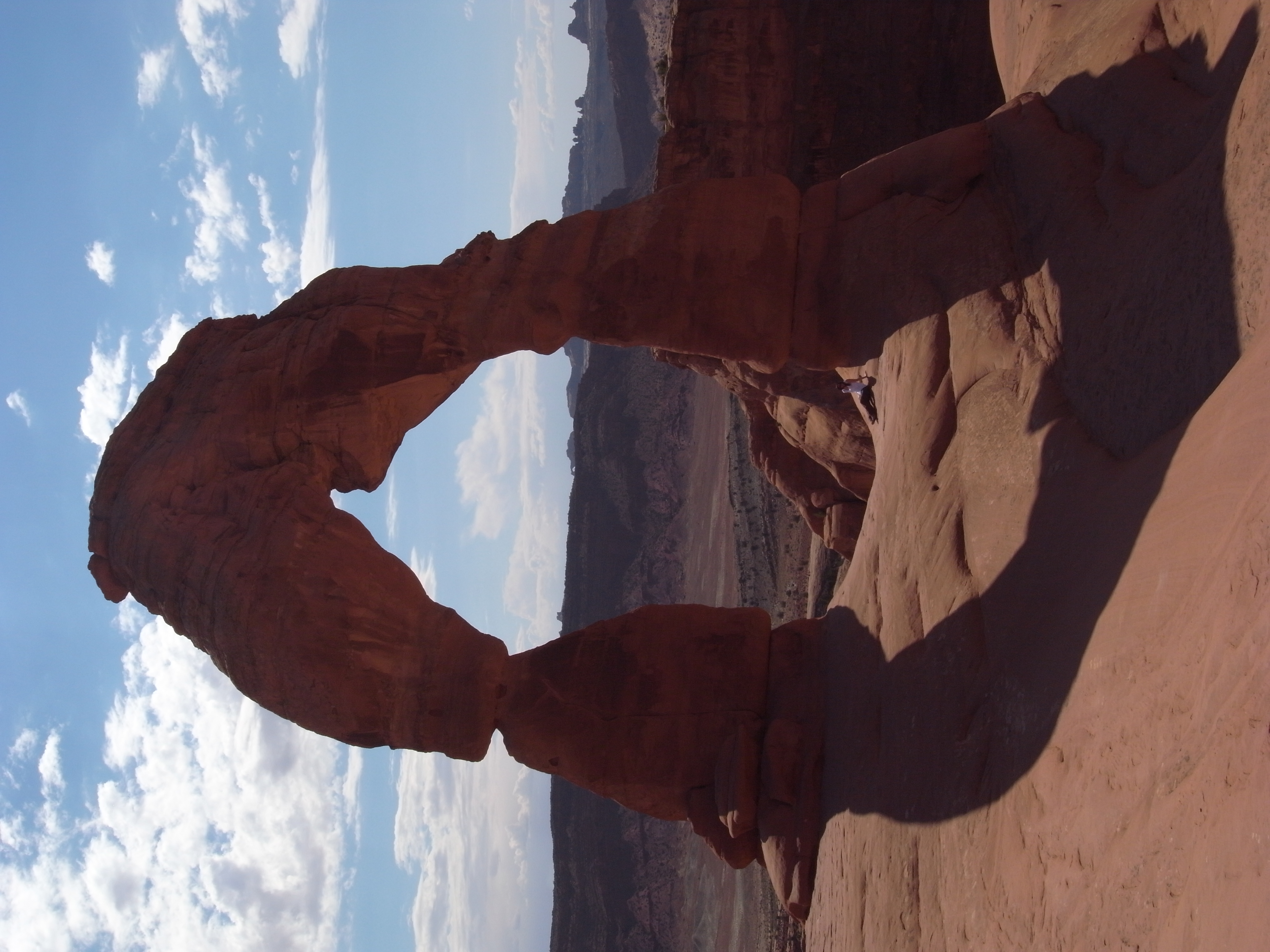
Loraine Lual relaxing in one of the arches.
Further down lies a thick layer of halite (salt). Due to the increasing pressure from the overlying rocks these halite layers started to flow and bulge creating long parallel domes forcing the overlaying strata to crack into long parallel walls of rock.
Precipitation infiltrates the porous Entrada sandstone and dissolves the calcite bonding the sand together. Furthermore, water accumulates on the denser Carmel layer eroding cavities in the overlying porous sandstone. This process, combined with frost shattering and a location luckily fairly free from major earthquakes has generated the jaw dropping formations that today comprise the Arches National Park.
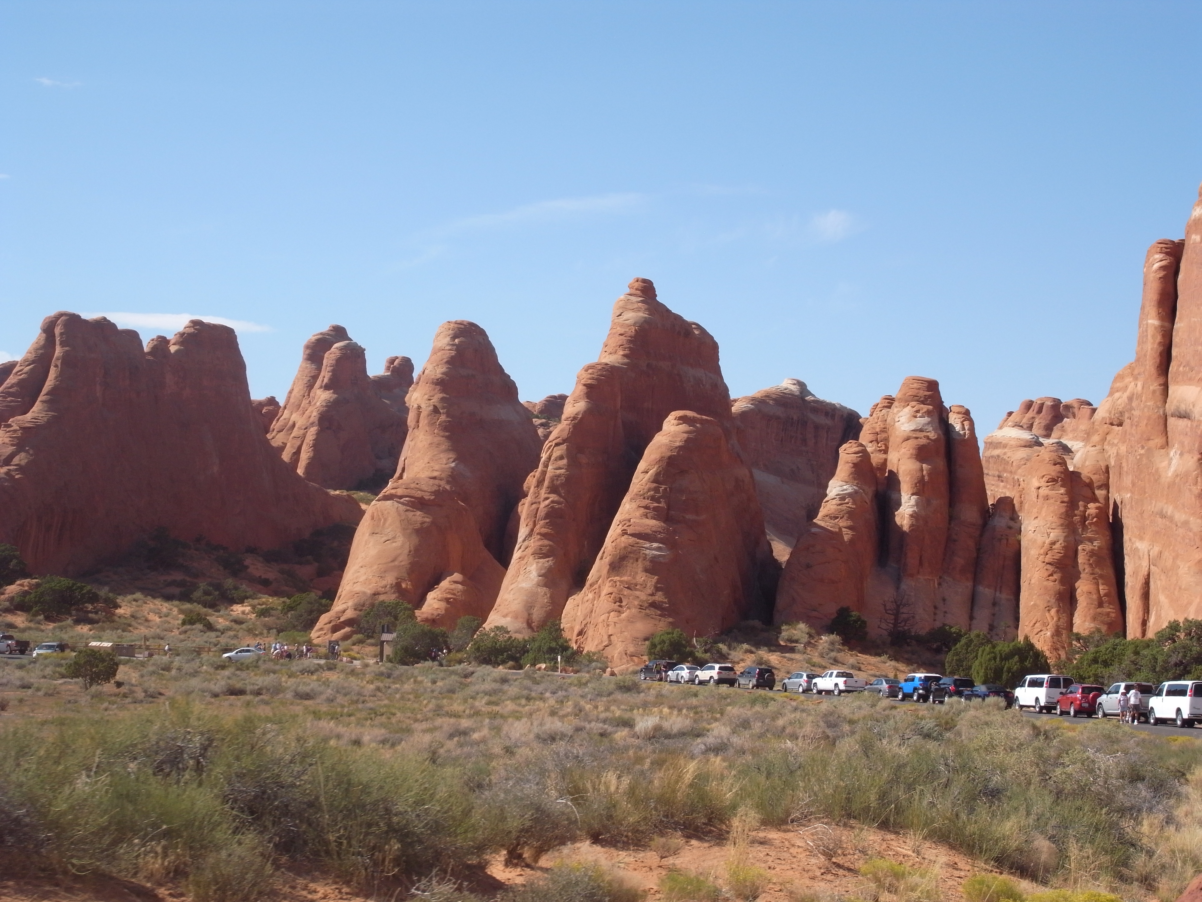
Amazing sandstone formations at Arches National Park
The next few days we did minor excursions from our base camp in the small town of Flagstaff.
From here we visited several exciting geological sites including the Barringer meteor crater, the San Juan volcanic field and the Petrified Forest.
First out was the impact structure, for many of us the first we’ve encountered. The guided tours at the site were very informative, and as the structure is very well preserved (as it is so young, 50,000 years) the whole area is very scenic. An exhibition and associated souvenir-shop came with the package.
Barringer meteor crater
Meteor Crater (or Barringer meteor crater) in Arizona represents the most common type of impact crater we know, the simple bowl‐shaped type (compare complex impact structures that consist of a central uplift/central peak/peak rings). The crater formed approximately 50,000 years ago by hypervelocity impact (collisional energy equivalent to approximately 20 million tons of TNT) of a type IAB iron asteroid. It presently has a diameter of 1.18 km. The Meteor crater homepage brags about the structure being the best preserved meteor crater on Earth. This is debatable; although there is no doubt that the structure is very well preserved. The target area is the Canyon Diablo region of the southern part of the Colorado Plateau. At the crater rim, the bedrock units are preserved, inverted.

The Barring Meteor Crater
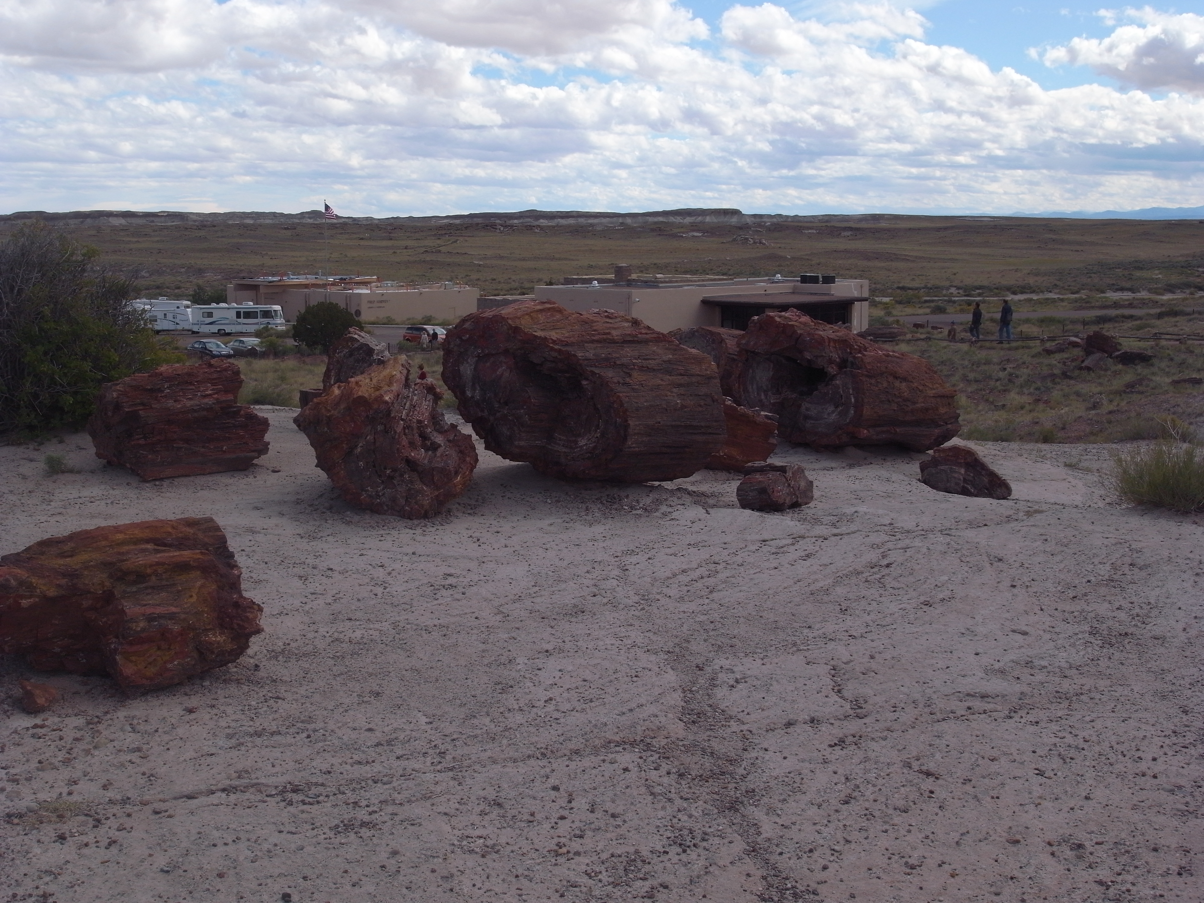
Next stop: The Petrified Forest.
Petrified Forest National Park
The late Triassic (225 Ma) Petrified Forest National Park is located in Navajo and Apache areas of the Northeast Arizona. The park is about 380 km2, and consists of semi-desert shrub steppe and eroded stone desert. The premises in the north, becoming the Painted Desert was declared a National Monument in 1906 and a national park 1962. The park is located at about 1.600 m altitude, and has a dry, windy climate that can reach temperatures of 38 °C in summer and below freezing in winter.
The Chinle Formation gave the name the Painted Desert due to it’s amazing colours made up of sedimentary rocks of silty mudstone, siltstone, bentonite, sandstone, conglomerate and limestone.
During the late Triassic a lake covered much of north-eastern Arizona. The older layers consists of fluvial and lacustrine deposits of silt, sand, and clay. The younger sediments containing ash and lava from volcanoes that erupted both nearby and further away. During the late Triassic dead trees accumulated in river channels and was subsequently buried by sediments full of volcanic ash. The groundwater dissolved the silica (silicon dioxide) from the ashes and brought it to the logs where they formed quartz crystals that gradually substituted the organic material. Traces of iron oxide and other substances combines with silicon create the various colours in the Petrified tree trunks. Many of the fossil logs come from an extinct conifers (Araucarioxylon arizonicum) which is Arizona’s state fossil. At least nine species of fossil trees have been identified, which are now extinct. Furthermore, ferns, cycads, conifers, gingko and clubmoss have been found on the premises along with fossil vertebrates, large crocodile-like reptiles (phytosaurs), large salamander-like amphibians and early dinosaurs.
Some petrified wood-logs at the Petrified forest.
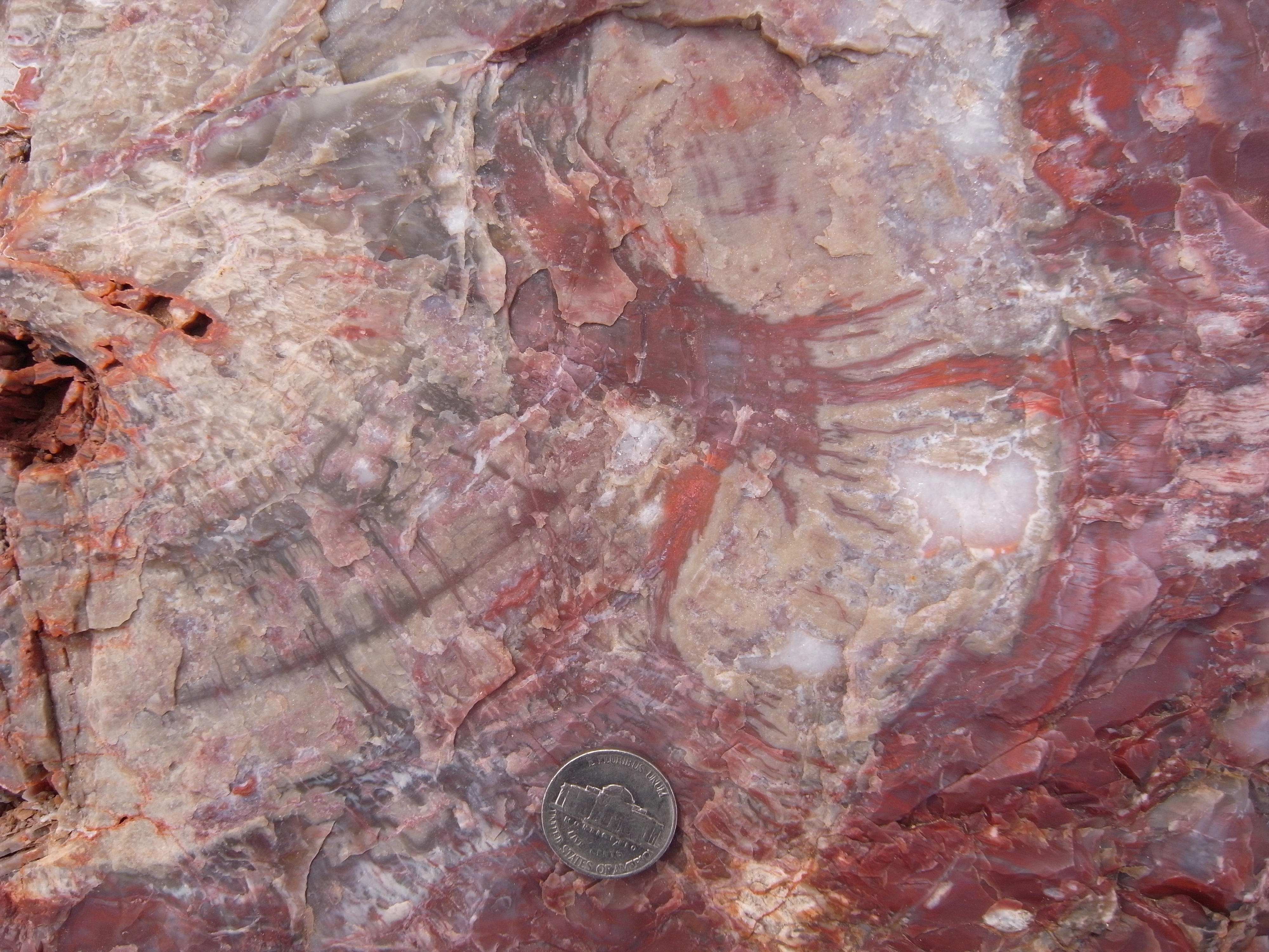
Close-up of petrified wood.
This was another extremely hot day, so we were all glad we had working A/Cs in our vans for the fairly long ride there.
However, when arriving (and getting a cold drink) the wonders of this park truly captivated us all. A few small museums where some of the best fossils are displayed together with the possibility to freely walk around in parts of the park made the whole trip worthwhile.
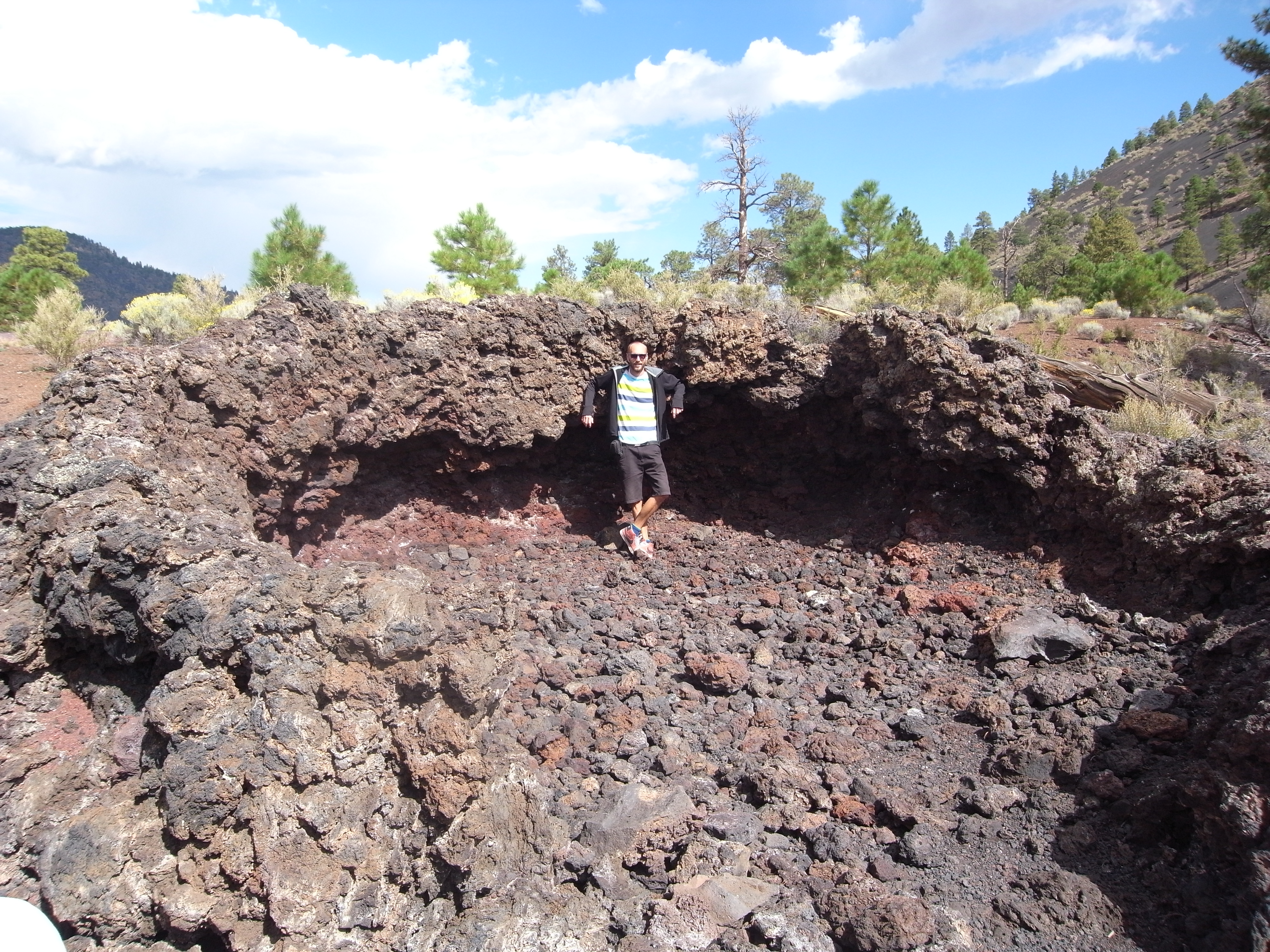
The last major stop before beginning our long journey back to Sweden was the San Juan volcanic field.
As a bedrock geologist this was a welcome return to “real rocks” even though most of it actually is better defined as glass. Erosion of these ash flows has produced spectacular pillar like outcrops, best seen from the Wheeler Geologic Monument. This is truly a “must-see” for any geologist visiting the area.
The San Juan volcanic field
The San Juan volcanic field, located on the eastern margin of the Colorado plateau in southwestern Colorado, is a large magmatic province covering nearly 25.000 km2. It consists of two distinct phases of volcanism separated in time, one in Oligocene with intermediate to silicic ash-flows and breccias and another phase during the Miocene–Pliocene that produced a bimodal suite of basaltic and rhyolitic lavas. The Oligocene phase of volcanism is believed to be related to low-angle subduction along the western margin of the American plate while the Miocene–Pliocene volcanic units are interpreted to have erupted in an extensional tectonic setting. The basalts are thought to have been derived from the upper mantle whereas the rhyolites may be partial melts of the lower crust.
In the middle of a large lava flow at the San Juan Volcanic Field.
The Oligocene volcanism produced vast quantities of ash tuff flows and 17 different ash layers have been recognised in the San Juan volcanic field. Perhaps the most famous of the preserved ash tuff flow units is the Fish Canyon Tuff, which is the product of the single largest volcanic eruption on Earth known to man. A total volume of 5.000 km3 was deposited during the eruption, which in turn has been related to the collapse of the large La Carita caldera (100 x 35 km). Zircon grains from the Fish Canyon Tuff have been dated by the U-Pb isotopic system to ca. 28 million years. A great locality to study the ash tuff flows of the San Juan volcanic field is the Wheeler Geologic Monument where erosion has exposed three different ash tuff units. These volcanic units have erupted from the San Luis caldera.
Heading back home
On our last day on the road we headed for The Grand Canyon. This was supposed to be the grand finale of our US road trip. I am however, personally torn regarding my own appreciation of the Grand Canyon. The place is so vast it is almost impossible to grasp it. Perhaps you need to take one of those expensive helicopter tours to reply get the full experience.
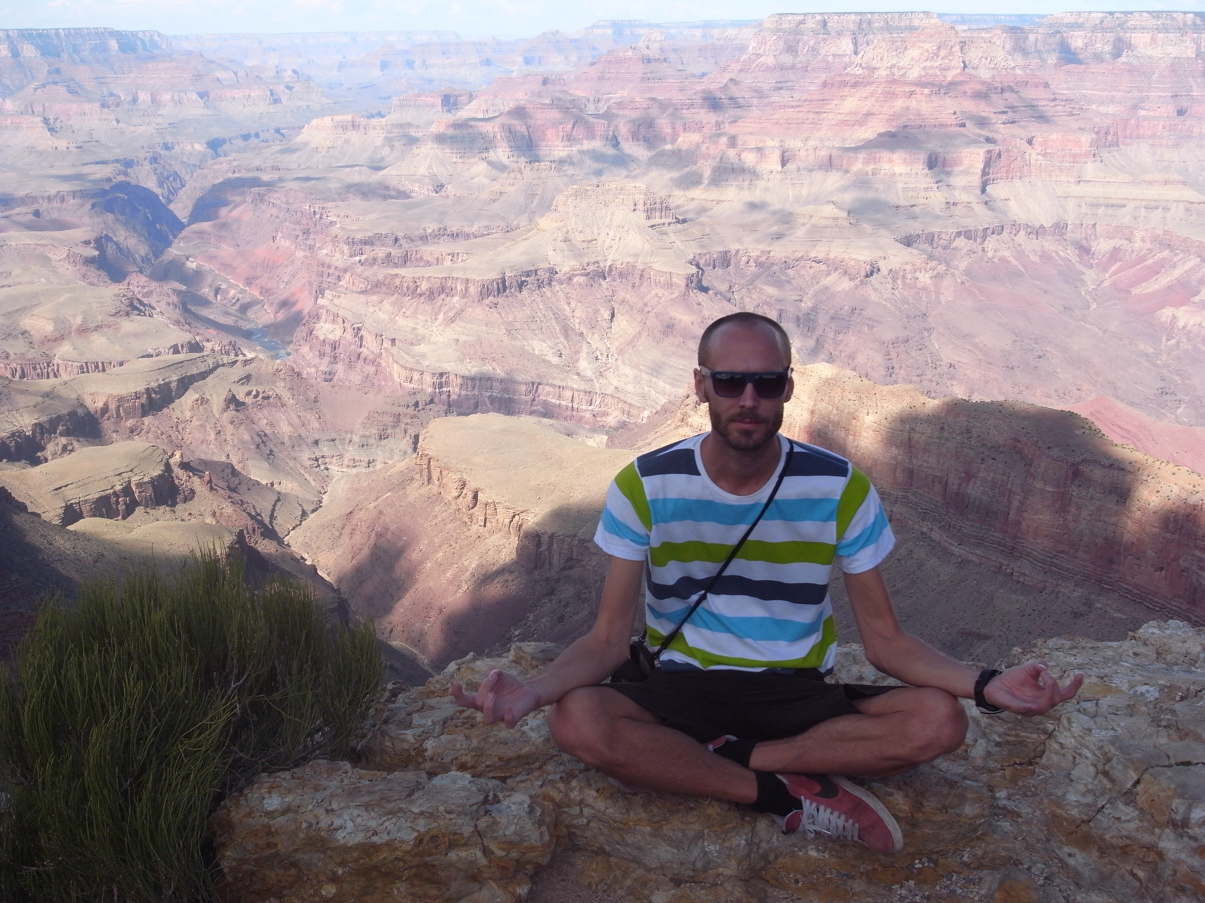
Finding inner peace at the Grand Canyon.
Even so. I am glad I have been there, and perhaps the recent memory of all the other amazing localities we visited during the trip clouded the beauty of this last stop.
After about a week in the US we were flying out of Las Vegas. If you ask me, a good choice…
I would love to tell you all about that last day spent in Vegas.
But…
As you probably know.
What happens in Vegas…

Driving in to Las Vegas.
![]() This work is licensed under a Creative Commons Attribution-NonCommercial-ShareAlike 4.0 International License.
This work is licensed under a Creative Commons Attribution-NonCommercial-ShareAlike 4.0 International License.