Andrew K Laskowski is a PhD Candidate, Department of Geosciences, University of Arizona working with Prof. Paul Kapp. You can read more about his research here.
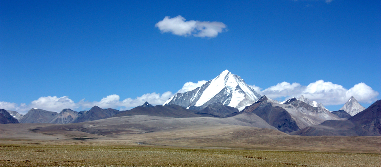
Lopu Kangri (7095 m), highest peak in the Lopu Range, and highest peak in the Gangdese Shan (Transhimalaya) of southern Tibet. View from near the Men Chu River, looking northeast. Location of Lopu Range: 29.63612°N / 84.80098°E
I moved to Tucson, AZ in fall, 2010 to begin my graduate study in Geology at the University of Arizona. I had always been fascinated with Himalayan-Tibetan tectonics, and I jumped at the opportunity to join a multi-institutional, interdisciplinary group of researchers working to unravel the history of India-Asia suturing in southern Tibet. The lead PI on the project, Dr. Paul Kapp, eventually became my PhD advisor. During the past four years, I was lucky enough to spend a total of ~20 weeks distributed between three field seasons conducting field work in southern Tibet. The most exciting finding of this research so far is the discovery of a new high-pressure, low-temperature metamorphic complex in the Lopu Range, which transects the Yarlung suture ~600 km west of Lhasa city. Keep an eye out for my paper on this locality, which will soon be submitted to Geology. For the remainder of this post, I’ll give the science a break and focus on the experience of conducting field work in southern Tibet.
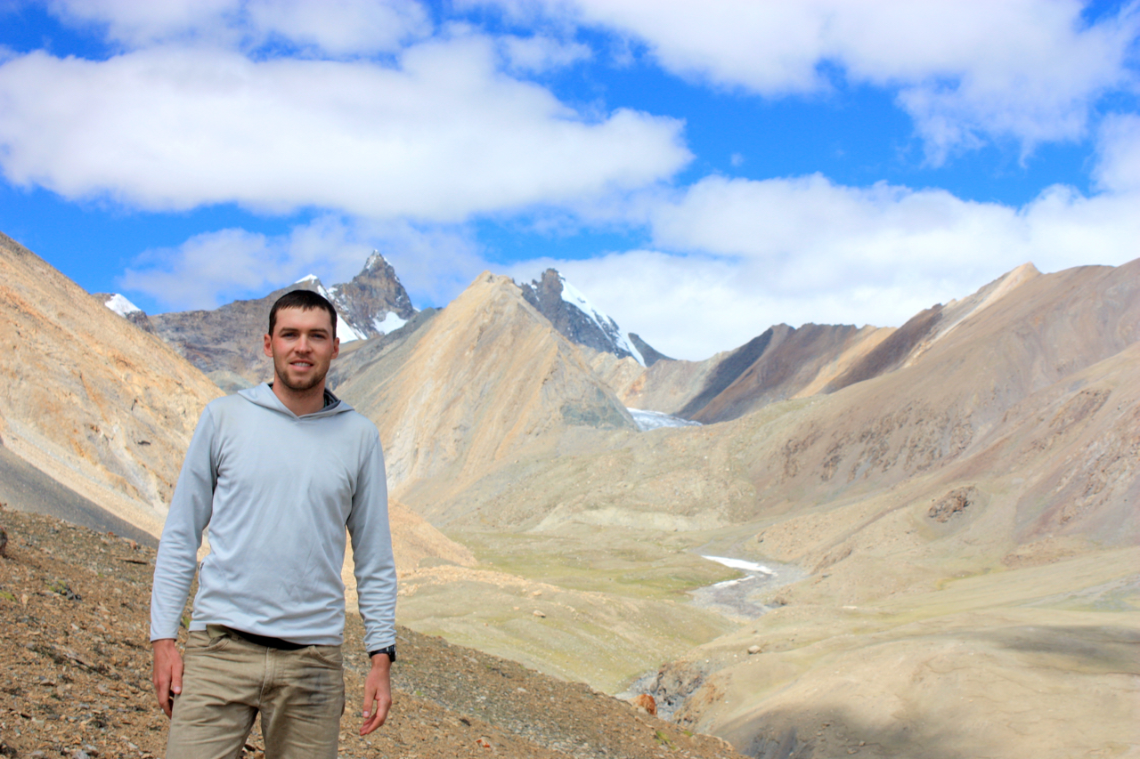
Andrew Laskowski striking a pose, with the help of field assistant Clay Campbell, high in the Lopu Range.
Travel to and in southern Tibet is much easier now than it was just ten years ago. The Chinese government has invested heavily in infrastructure along the Yarlung-Tsangpo river valley, which closely tracks the Yarlung suture between Mt. Kailas, in the west, and Lhasa, in the east. The cell phone coverage along this valley is better than most places in the western United States. That being said, traveling to southern Tibet is still a marathon. The journey begins in Tucson, where we hop on a flight to SFO, spend a few hours enjoying the last comforts of home for a couple months (for me, a nice cup of non-instant coffee), then we’re off to Beijing. Hours later, we begin the process of meeting with our colleagues at the Institute for Tibetan Plateau Research, squaring away our plans and finalizing our permits. The next morning, we catch two more flights that bring us to Lhasa. There, we spend two to three days gathering supplies, finalizing our permits, renting vehicles and adjusting to the altitude (~14,000 ft.). In Lhasa, I highly recommend grabbing a few beers at the Dunya Bar. When everything is in order, we head west from Lhasa, through an amazing gorge cut through Gangdese batholith rocks (which formed from arc magmatism during Neo-Tethyan ocean closure), and out into the wild. Time spent in transit is never wasted, however, as the route from Lhasa to Lopu Kangri, near Saga, Tibet, is filled with dramatic views, beautiful monasteries and “fine” local eateries. If you stray from the paved path, as we did during my first field season, a few hours drive south of the main highway rewards with amazing views of the high Himalayas. A few kilometers further and you’ll be enjoying the view of Qoomalangma (Everest) from the Rongbuk Monastery. Just make sure you trust your driver to keep you on the road.
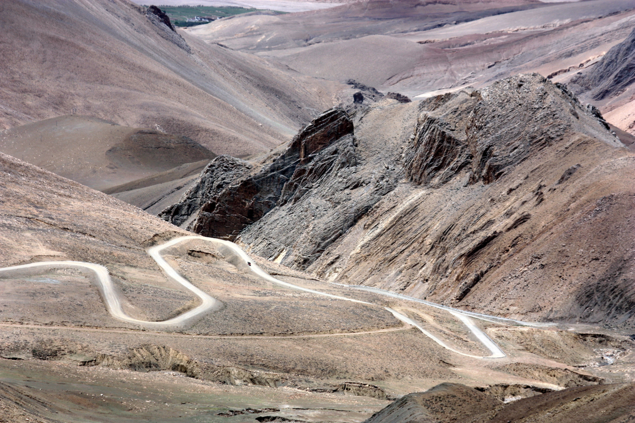
A pass in the Tethyan Himalaya on the way to Rongbuk Monastery. Photo captured by the author just north of Lao Tingri.
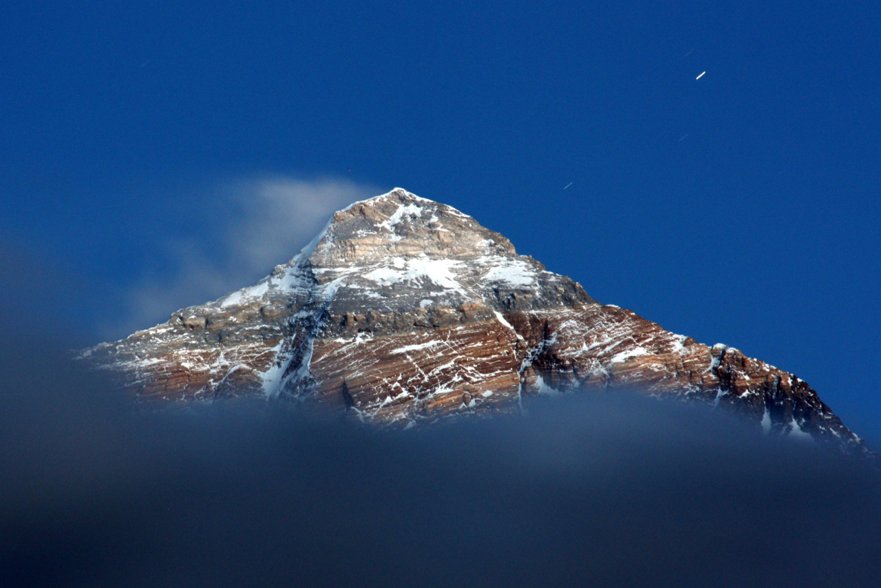
A photo of the summit of Qoomalangma (Everest) illuminated by moonlight taken by the author during field work in 2011.
Approaching the Lopu Range, I am excited and relieved. Any number of regulatory of physical obstacles could prevent access. Finally, I get to glance once more upon those rocks I spend most days thinking about in my office! My field work typically involves a 10-15 km round trip from base camp on foot. The mornings are always spend trudging uphill and attempting to catch my breath. Our camp sites are usually situated at ~4,800 m while the more subdued peaks in the Lopu Range are between 5,700-6500 m. Typically, I remain in the field for about a week at a time before refueling in the nearby town of Saga.
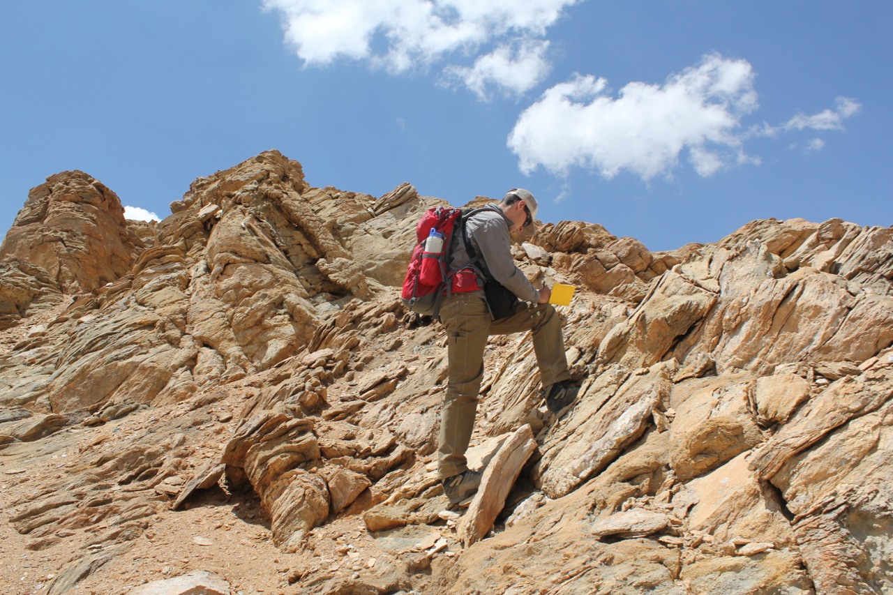
Andrew Laskowski conducting field work in the Lopu Range, photo by Dr. Paul Kapp.
Two field excursions stand out from my many traverses in the Lopu Range. In summer, 2012 I was camped out in the Lopu Range with Dr. Paul Kapp, two other Arizona graduate students, two Chinese field assistants, and three Tibetan drivers. The way our numbers worked out, I was conducting field traverses solo in relatively close proximity to the camp. That day, I set off to map and sample along the northeast flank of the southern Lopu Range. After a few hours of hiking, I crossed the range-bounding Rujiao fault and was enjoying ductile fabrics in footwall gneiss. By lunch time, I was only ~500 m below the summit of one of the smaller peaks. Since the weather was clear, I decided to push on. A few more hours of climbing and I was on top of a nearly 6,000 m peak. Looking to the south, I could see the impressive peaks of the Nepal Himalaya, near Mustang Valley. Looking north, I had a spectacular view of Lopu Kangri and the Gangdese Shan. Incredibly, I managed to send a picture message to my family in Colorado while I was sitting on a peak that likely had never been summited before by a “westerner”. Growing up in Colorado, I was thrilled to summit a 14,000 ft. peak. Now I was enjoying the view from ~20,000 ft. Towards the end of the field season, I decided to attempt an overnight trip into the northwestern Lopu Range alongside Devon Orme and Kate Metcalf, the two other graduate students working in the Lopu Range region. We spent two days trudging our gear into one of the spectacular glacial canyons that fan outwards from Lopu Kangri. The reward was great, we gathered a few very important samples and enjoyed incredible views of peaks seldom seen by anyone buy the local nomadic sheep herders. We even ran across a wild Tibetan yak, which was an intimidating experience. On the last day of the excursion, we fled an approaching monsoon thunder storm on our way down a vast glacial moraine. The opportunity to work in the Lopu Range provided me with an excellent field area ripe for new discoveries as well as an opportunity for life-changing field experiences.
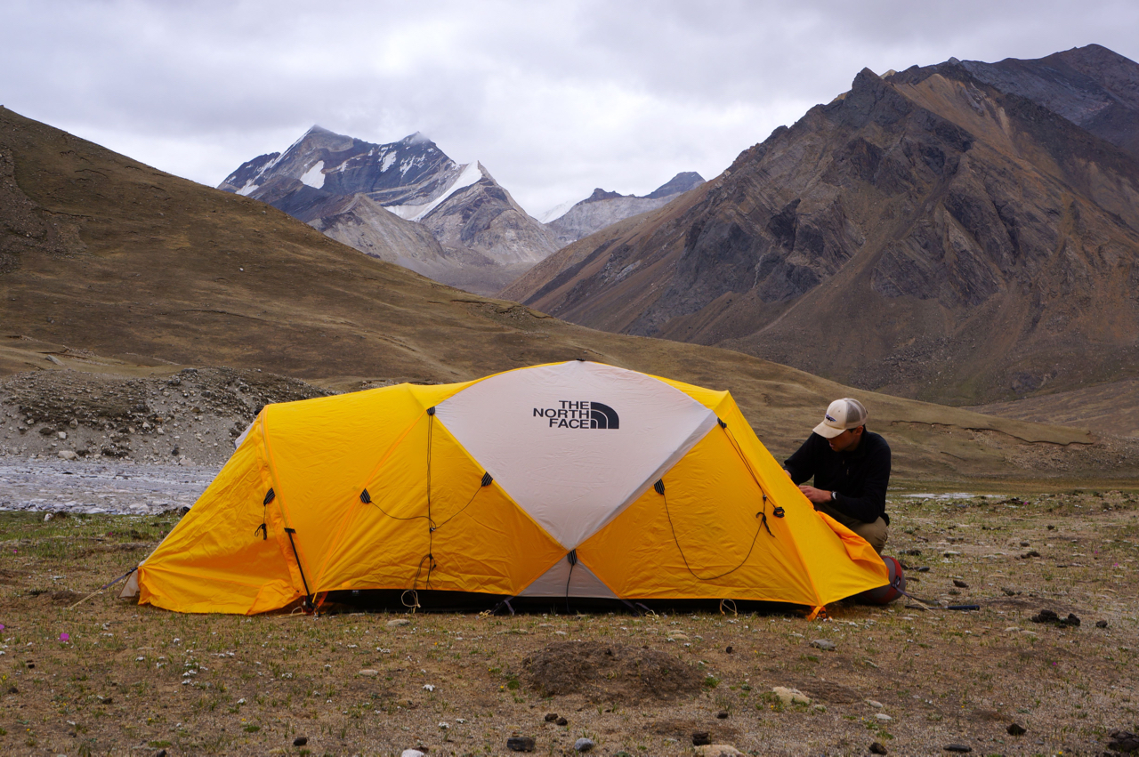
Andrew Laskowski preparing for a field traverse in the Lopu Range during a backpacking in summer, 2012. Photo by Devon Orme.
![]() This work is licensed under a Creative Commons Attribution-NonCommercial-ShareAlike 4.0 International License.
This work is licensed under a Creative Commons Attribution-NonCommercial-ShareAlike 4.0 International License.