Jens is a researcher at Karlsruhe Institute of Technology. His research has taken him from the Alps of Austria to the ultrahigh-pressure Qinling-Dabie orogen. He is currently continuing his work in the central Scandinavian Caledonides, central zone of the Variscan orogen, and the Sulu orogen as he explores the connections of structural geology and tectonics.
Seve nappes in the central Scandinavian Caledonides of Sweden of southern Västerbotten
The Scandian fold-thrust belt of the central Scandinavian Caledonides is composed of several major nappe complexes overlying the western edge of the Baltica terrane or Fennoscandian Shield. On top of a Lower Allochthon, the Middle Allochthon comprises the former Baltica passive margin to (Iapetus) ocean-continent transition with major pre-rift volcano-sedimentary successions. Its lower to upper greenschist-facies nappes are overlain by the Seve Nappe Complex (SNC) with amphibolite to eclogite facies metamorphism and local evidence for UHP metamorphic conditions. The roof of the SNC represents the suture between continental Baltica terranes and the oceanic Köli Nappe Complex (KNC, Upper Allochthon). The Uppermost Allochthon comprises parts of the former Laurentian margin with Silurian active margin magmatism as young as 430 Ma providing a maximum age for its emplacement onto the KNC. Metamorphism of the KNC and assembly of the KNC with the Middle Allochthon occurred before 425 Ma, predating post-Wenlock nappe stacking of the Lower Allochthon.
The SNC extends for more than 750 km along strike, thinning significantly toward the hinterland. In the Jämtland-Västerbotten segment, the SNC is subdivided into the Lower, Middle, and Upper Seve nappes (Fig. 1). The Lower Seve nappe basal thrust shows top-to-southeast kinematics. The Middle Seve nappe consists of garnet-kyanite-bearing rocks, minor pyroxene-garnet-bearing metabasites and migmatites with a basal shear zone of syn-metamorphic top-to-southeast kinematics. The boundary toward the Upper Seve nappe is transitional and the Middle and Upper Seve nappes may be treated here as a coherent structural unit.
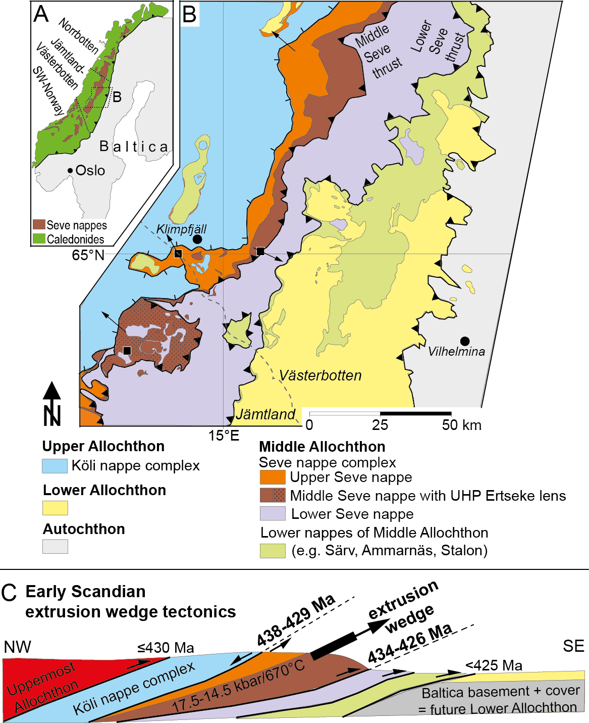
Fig. 1: A: Overview map of the Scandinavian Caledonides with Seve nappes and location of study area (B) and the segmentation as discussed in the text. B: Geologic overview map of major nappe units, their boundaries and sample locations in the study area. Minor thrusts, windows, and klippes are not highlighted by thrust signatures for clarity. Arrows indicate proven sense of shear. Broken line: Jämtland-Västerbotten boundary. C: Schematic cross section of study area (with supplemented parts of KNC and Uppermost Allochthon) with age constraints of nappe bounding shear zones and pressure-temperature data.
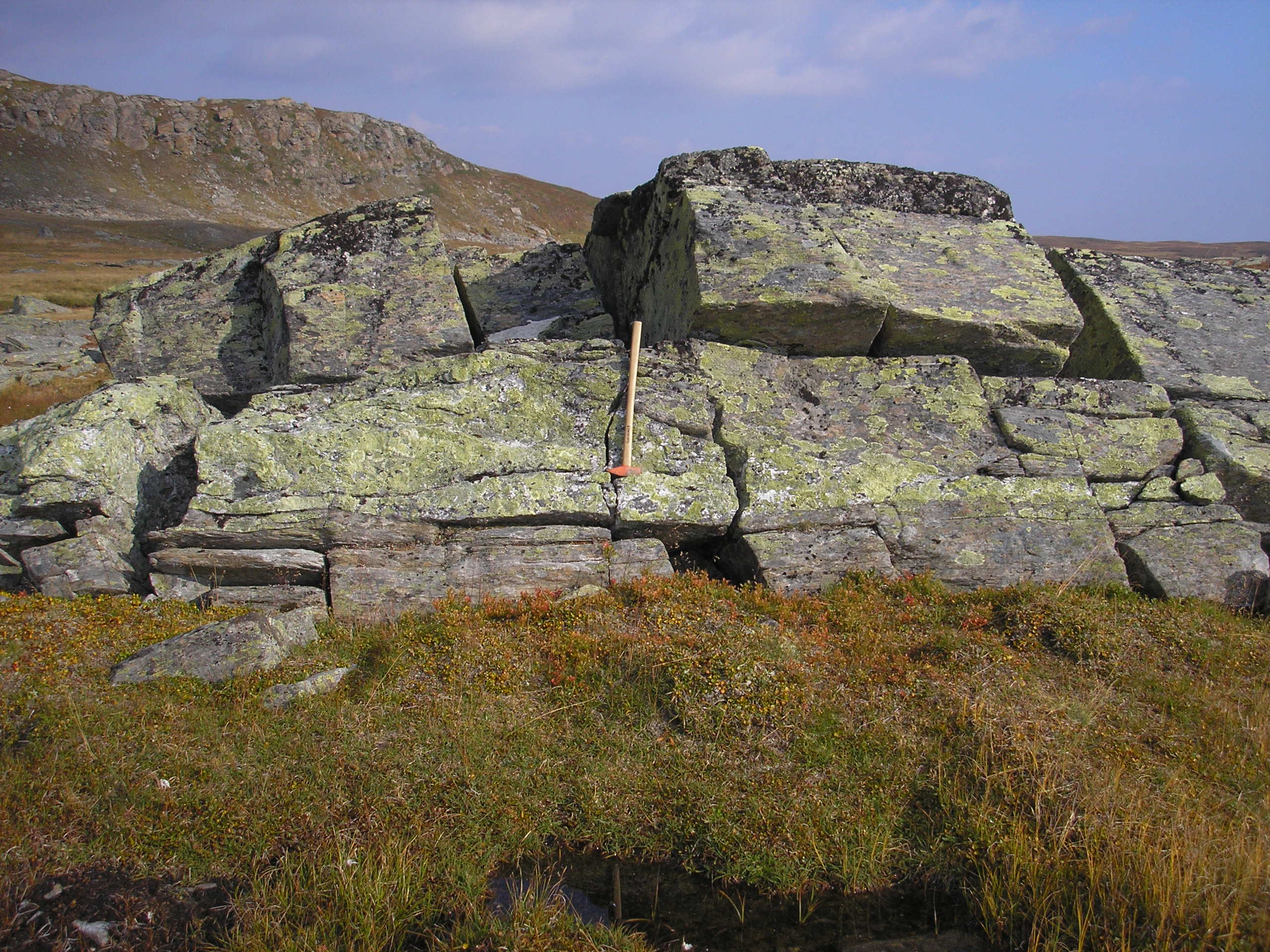
Fig. 2: Synkinematically intruded and deformed pegmatite vein in mylonitic high pressure garnet-micaschists of the continental Upper Seve nappe. Steep slope to the left is formed by massive and detrital serpentinites of the hangingwall oceanic Lower Köli nappe. Picture was taken close to the top of a 434-429 Ma extrusion wedge that exhumed high-pressure Seve nappes from mantle depths to mid-crustal levels.
The Upper Seve nappe of garnet-micaschists and amphibolites with minor gneisses and ultramafic rocks has a top-to-northwest roof shear zone. Together with Reinhard Greiling I studied the Seve nappes in southern Västerbotten in the area of Klimpfjäll / Kultsjön valley. The rocks, particularly amphibolites and ultramafites, of the Seve nappe complex are morphologically well figured out by westward-directed glacial transport that formed characteristic, east-facing scarps with heights of several hundred meters providing morphologically and geologically spectacular rock exposures. On the lee-sides of these scarps the glaciers dropped their loads and outcrop conditions become very poor. Westward glacial transport is the reason why you find in the mountains undeformed granite blocks and boulders derived from the autochthonous foreland. Parallel with research related fieldwork we carried out student´s mapping courses. I once supervised a student´s group that was mapping around the SNC-KNC boundary close to the Jämtland-Västerbotten boundary nearby the old path from Klimpfjäll to Stekenjokk, and realized that the garnet-micaschists of the Upper Seve nappe constitute a several hundred meters thick mylonitic shear zone with consistent top-to NW (i.e. hinterland-directed) sense of shear. Wow! This was the starting point for a very rewarding and exciting multidisciplinary research project involving colleagues specialized in rock magnetism, structural geology, petrology, and geochronology. PT-pseudosection calculation yielded lower eclogite facies conditions for the mylonitic garnet-micaschists. Rb-Sr-multimineral geochronology shows that the hinterland-directed shear zone operated simultaneously with the foreland-directed shear zone at the base of the Middle Seve nappe for at least 5 Ma – i.e. from 434 to 429 Ma. Therefore we suggest that the Middle Seve nappe was exhumed by extrusion wedge tectonics – as similarly documented in the Alps and the Himalayas.
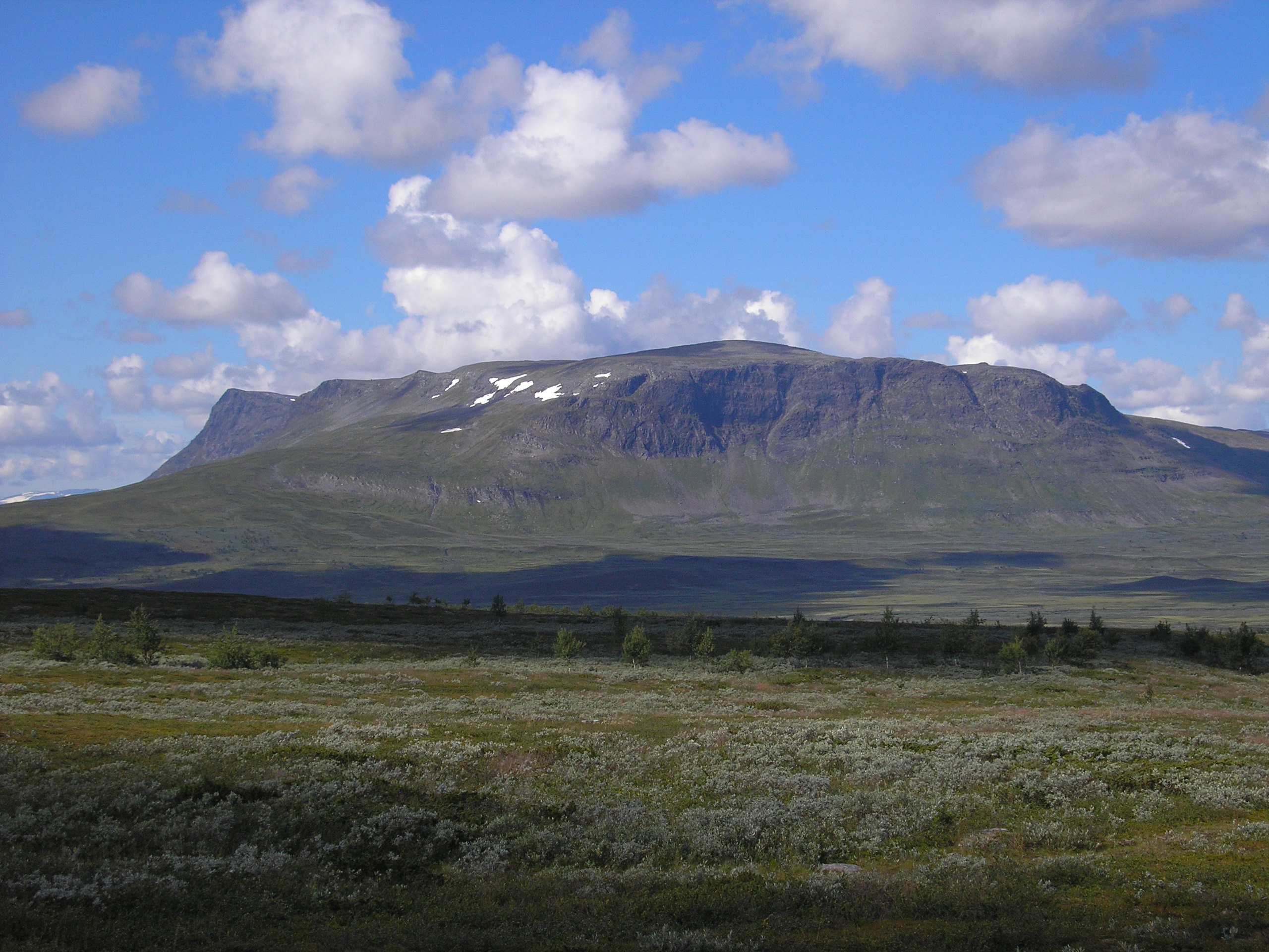
Fig. 3: E-facing scarp made of garnet-micaschists and amphibolites of the Seve nappe complex overlie metagreywackes of the Ammarnäs complex. View is to the W across the wetland of the Karsbäcken valley, which is a bird protection area. Mountain peaks are between 1250 to 1350 m above sea level.
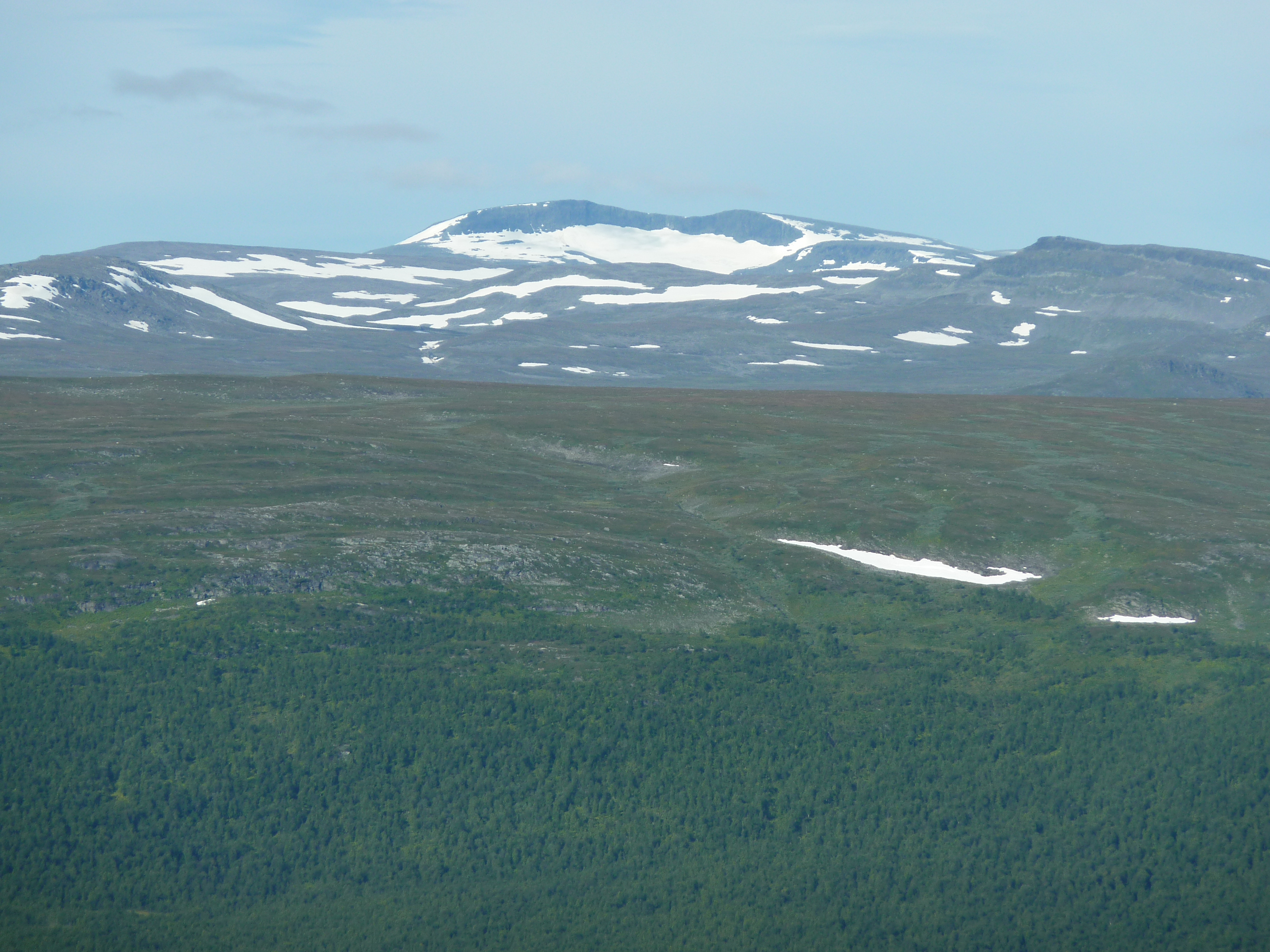
Fig. 4: View to west onto the Ammarfjället, essentially constituted by rocks of the Seve Nappe Complex, with the remote, 1611 m high Rerrogaisse mountain massiv and its characteristic relic kettle glacier. The foreground shows the western flank of the Vindelälven valley exposing metagreywackes of the Ammarnäs Nappe Complex.
The vastness of nature and landscape above the timber line is very impressive. The timber line is located at about 750±50 m above sea-level. Hiking paths and forest roads suitable to enter fieldwork areas are rather limited and some areas can be only accessed efficiently by a helicopter or a boat, optionally with putting up a tent in the mountains. The ideal frame conditions for putting up a tent in the mountains are: i) a little stream for drinking water supply, ii) a place close to the timber line offering to collect firewood easily, and iii) a place that shields the tent from the winds. The lack of comforts spending nights in a tent may be rewarded by fantastic experiences if the northern lights start with a show. Profound knowledge about edibility of berries and mushrooms are an asset and `learning by doing´ is not really an option. During fieldwork you may get rewarded by watching wild animals such as the very rare arctic foxes, eagles, falcons, capercailzies, grouses, snow owls, and – of course – lemmings. In particular years, one must really have to take care not to tread them down. Wolves, lynxes, wolverines, and bears commonly recognize you first and thus – fortunately – remain unseen species. Though, by coincidence, it is always possible to meet them in the field particularly if you work along noisy streams. The numerous reindeers may approach you to ca. 30-50 m and are reliable weather trend indicators as they prefer to stay below the timber line when it is getting cold and rainy.
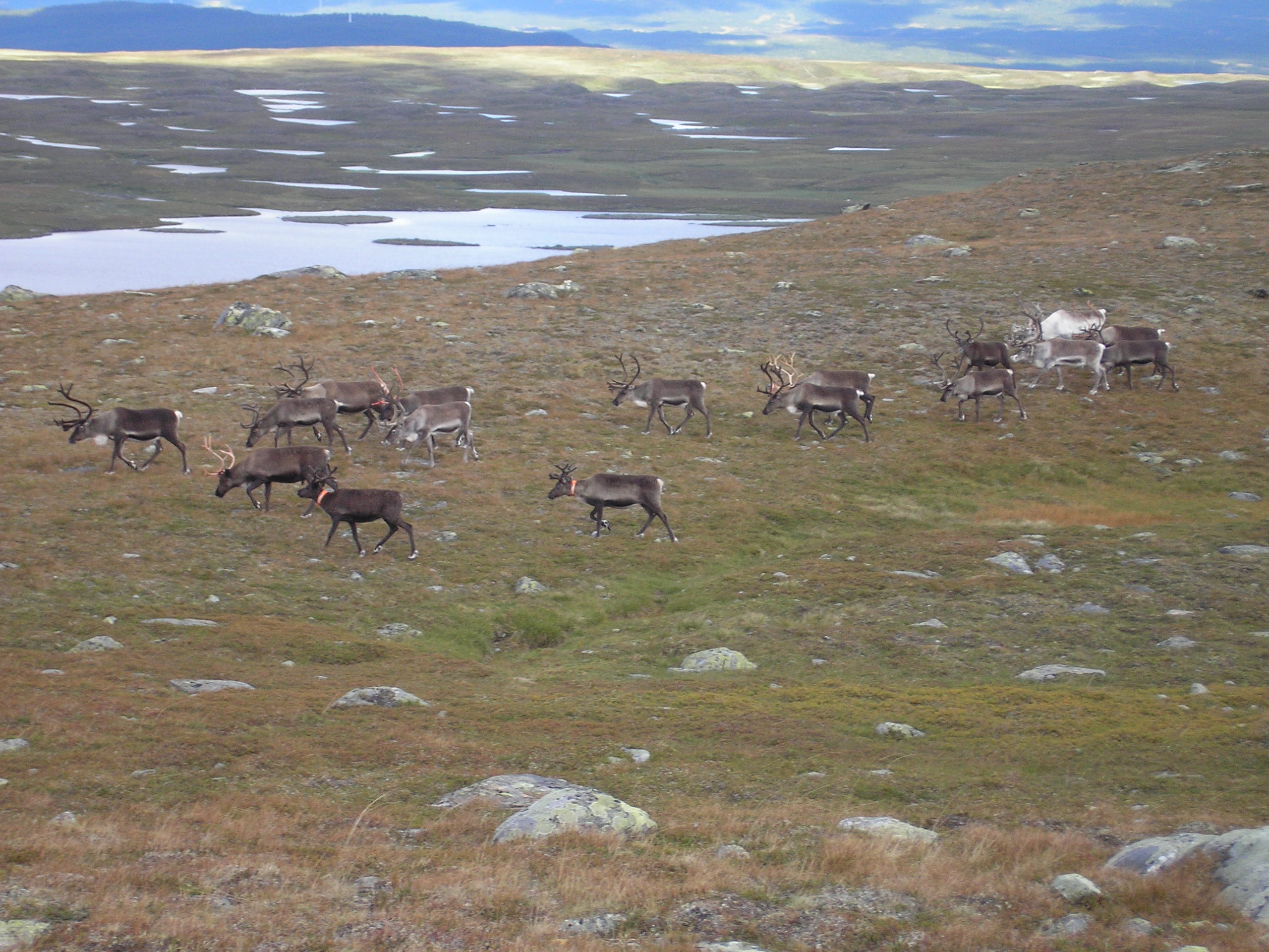
Fig. 5: Little reindeer herd walking on rocks of the Seve Nappe Complex in the Lake Slipsiken area.
Elks commonly do not cross the timber line and are difficult to recognize in the forest. I have seen most elks along the roads after dawn and in the early evenings. Best fieldwork time is mid-August to mid-September since i) snow-fields, unless not completely molten, are at their minimum extent, ii) water levels are commonly low, which may become important if you want to or have to cross the numerous little streams and swampy areas, iii) the weather is relatively stable with comfortable fieldwork temperatures commonly at 10±5°C during the day, and – last but not least – iv) most mosquitos faded away after first frosty nights have appeared. Bird hunters from southern and northern Europe are major rivals for accommodation during August, but in general it is easy to find a vacant cabin at campsites along the major mountain roads. Swedish people are always very friendly, patient and helpful, but can become very angry if you disturb them during elk hunting season starting at the first Monday in September.
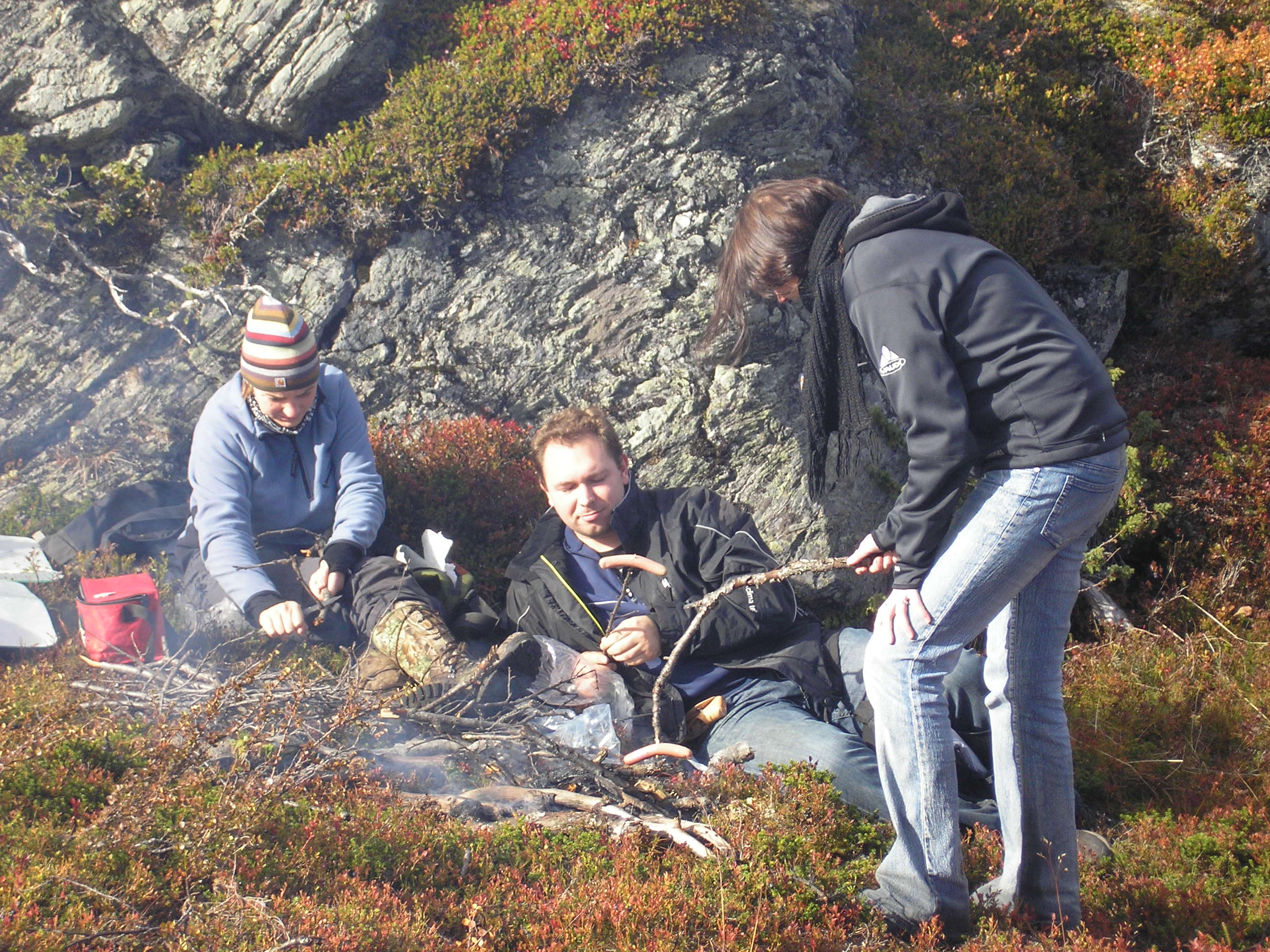
Fig. 6: Lunch break in the field with student´s group during geological mapping.

Fig. 7: Basecamp of a student´s mapping course in the mountains (Ammarfjäll). Valley floor is covered by moraine material, but locally exhibits exposures of meta-greywackes of the Ammarnäs complex. Valley flanks exhibit good exposures of the Seve nappe complex. View is to the WSW. Mountain top in the background is at ca. 1300 m above sea level.
![]() This work is licensed under a Creative Commons Attribution-NonCommercial-ShareAlike 4.0 International License.
This work is licensed under a Creative Commons Attribution-NonCommercial-ShareAlike 4.0 International License.