Background
As a 4th year undergraduate geologist at Oxford University, I really relish the opportunity to work abroad and gain the experience of working as an exploration geologist. It’s fantastic that there are opportunities for me and my peers that send us half way across the world for 3 months in the summer. We are not just reading about things that other people are doing, we are involved in the processes that make the world tick. This summer I am working as an exploration geologist in the Peruvian Andes looking for porphyry copper deposits.
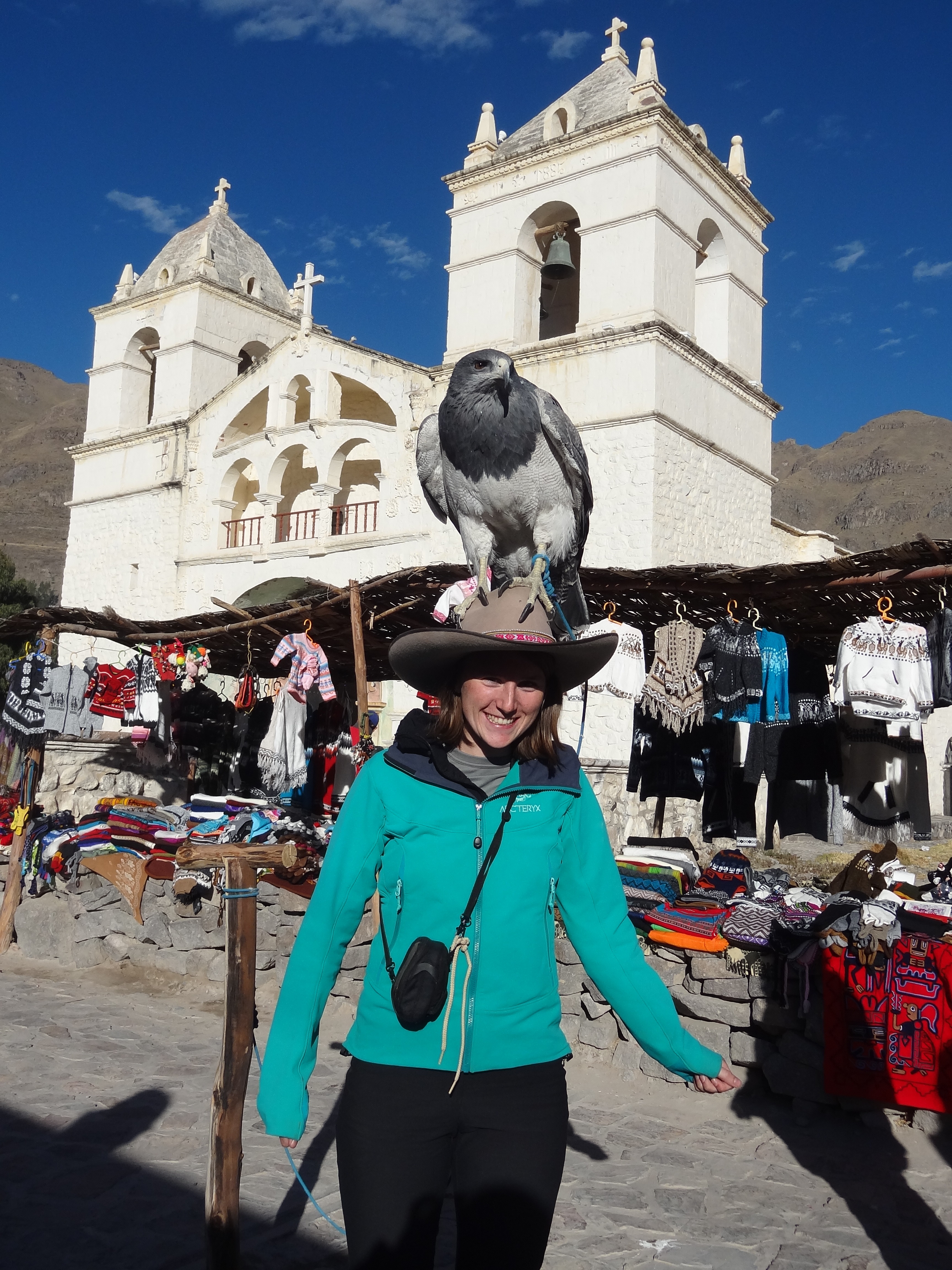
Andean eagle in the Colca Canyon.
Arriving in Lima
I arrived in Lima in June tired from the 21 hours of travelling and jet lagged from the 6 hours time difference. I was to spend the first 4 days in Lima completing my inductions, having medical tests and reading up on copper porphyry deposits in South America. Lima is the metropolis of Peru, buzzing with life and, most noticeably, traffic. There is very limited public transport in Peru, so as a consequence there are a large number of cars. This is not unusual in a city but the chaos of Lima is quite unique. However, there are well defined walkways for pedestrians and the taxi service is cheap and easy (you just have to choose the least battered looking ones).
Almost as soon as I’d arrived and slept off the jet lag, I was back at the airport for an early morning flight to Tacna in the south. I was extremely excited about seeing Peru. Although Lima was an interesting place, I wanted to get out of the city, after all, that is why I am doing exploration geology. When I got off the plane, all I could see was white! A dense mist sat in the valley and there was no sun like I had been promised. As soon as the taxi left Tacna to take me to Moquegua, we rose above the mist and I finally had an amazing view of the Andes.
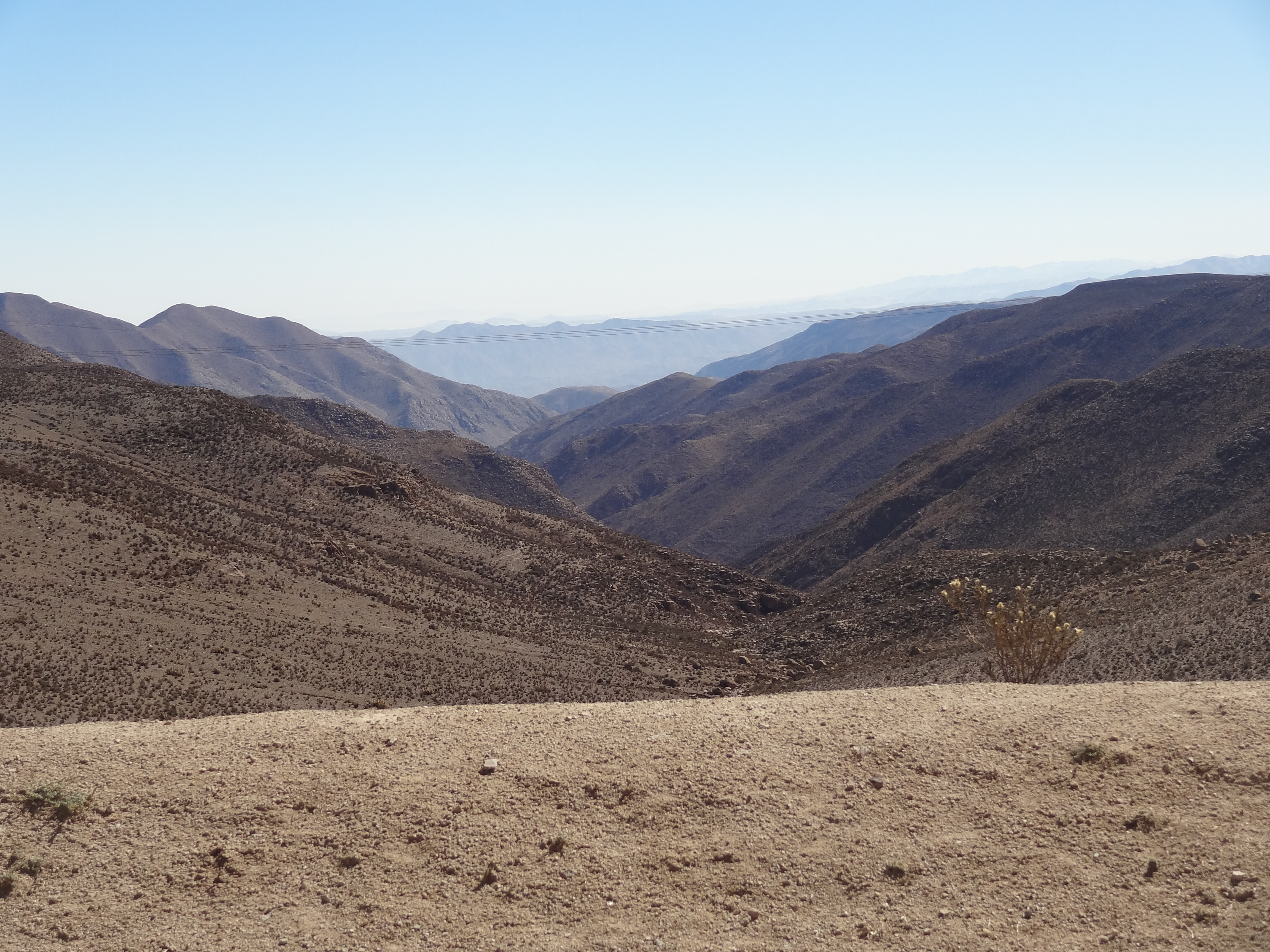
View of the desert environment of the Andes.
Despite being mountainous and fairly close to the sea, this area of the Andes is a desert. There are no trees and no fauna that I could see and the mountains look like large sand dunes. Peru is known for its plethora of natural environments which can change over very short distances; The North is typically rainy and warm, there are rainforests a short distance away from the highest peaks, the south is hot and dry and the coast is humid. The main difference I have found is that in Lima it is overcast and grey, whereas in Moquegua it is clear and sunny all of the time!
Exploration Geology in Peru
There is a lot of exploration geology in Peru and it is currently at its height. Chile contains some of the world’s largest copper porphyry reserves, however these have been explored and exploited for a long time. This has shifted the frontier for copper porphyry exploration to Peru. I arrived just as the group of geologists I was to be working with were finishing the preliminary stages of exploration of a project. This means that they have mapped the area, undergone the geophysical surveys and the geochemical analysis of soil samples across the area. A combination of the magnetic and gravity surveys, concentration of elements like Mo, Au, Pb and Cu in the soil along with the outcrop maps and cross sections all provide information for the geologist on the location, depth and potential size and quality of the copper porphyry deposit. This then allows them to make educated guesses on where to drill; taking the project to more advanced stages in the exploration process. Drilling is an expensive business so you really would like to get it right first time. The geologists propose a 1st, 2nd and 3rd choice location to drill and an optimal angle to drill at, then with their limited budget they have to decide what is feasible in terms of drilling equipment etc. This is the bit that takes time. The drilling process provides them with more information on the quality and size of the deposit and whether or not it is economic to mine. Many projects never go on to become mines.
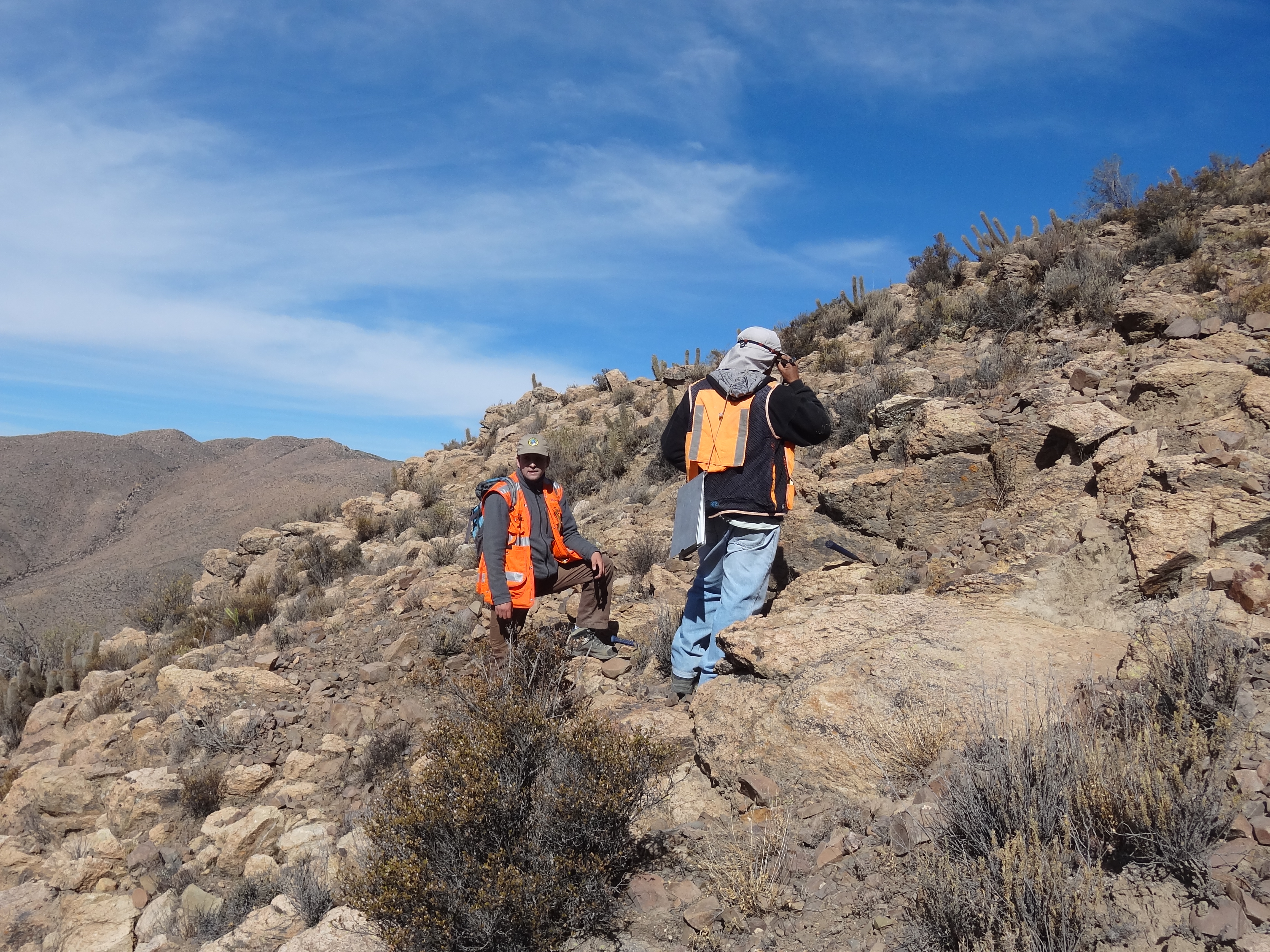
Working on a steep slope covered in cactuses.
Social Problems
An exploration geologist is not simply a rock lover who spends their time in isolated places making maps. There is a lot more to it than that. For instance these isolated places may have been the home to communities of people for thousands of years and to begin exploring on their land, you need to ask permission. If you walked into someone’s back garden, would you ask permission? Very often it is the geologists who first come into contact with these communities and it is the geologists who are there at all times during the exploration. This requires the geologists to be able to communicate well with the communities, provide a friendly face and answer their questions.
In Peru there are a lot of social issues making exploration very difficult. The first thing the companies will do when they want to work in an area is to set up meeting with the leaders, authorities and the local community to explain what exploration geology involves. It is a common view for people to assume that exploration means that eventually there will be a mine and chaos and disruption will ensue. The aim of this meeting is to benefit both the companies and the community. An exploration company wants to cooperate with the community. They know the land better than anyone, they know the best way to get around and in Peru’s case are accustomed to the altitude. By working together, jobs are provided for the local community and a system is put in place to maintain contact with the community. Suggestion boxes are present in the village, allowing the community as a whole to decide what they would benefit from; for example better water facilities. The mining company would then help the community to accomplish this, making an effort to make a positive difference and not just arrive, look for copper and leave.
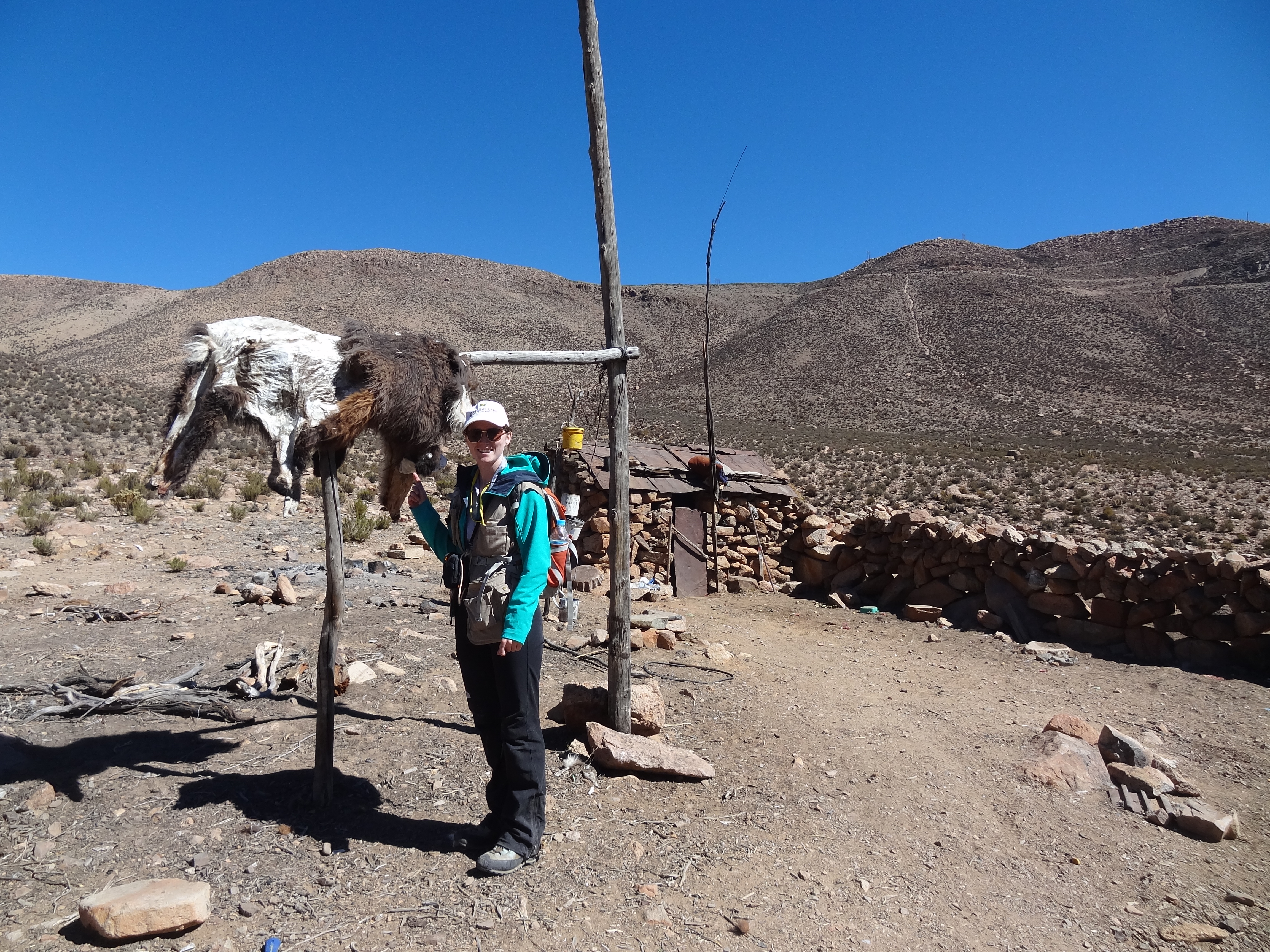
Home of a llama farmer at 4200m.
Many mining companies have stopped working in Northern Peru due to the social issues. The local communities are not happy with the mining companies using their water supply for drilling and until they can be reassured that the water supply is sustainable and this can be proven, exploration in the area has stopped. In order for drilling programs to start, exploration companies must get permission from the authorities to use the water source in the area.
Arequipa and trekking in the Colca canyon
During my days off I visited Arequipa, Peru’s second largest town, 1/10th the size Lima. Surrounding the town are three looming stratovolcanoes. One of which is El Misti, around 5800m. I didn’t stay long before I’d booked myself on a trekking tour to the Colca canyon. The Colca canyon is the second deepest canyon in the world, measuring around 4200m from top to bottom, twice as deep as the Grand canyon!
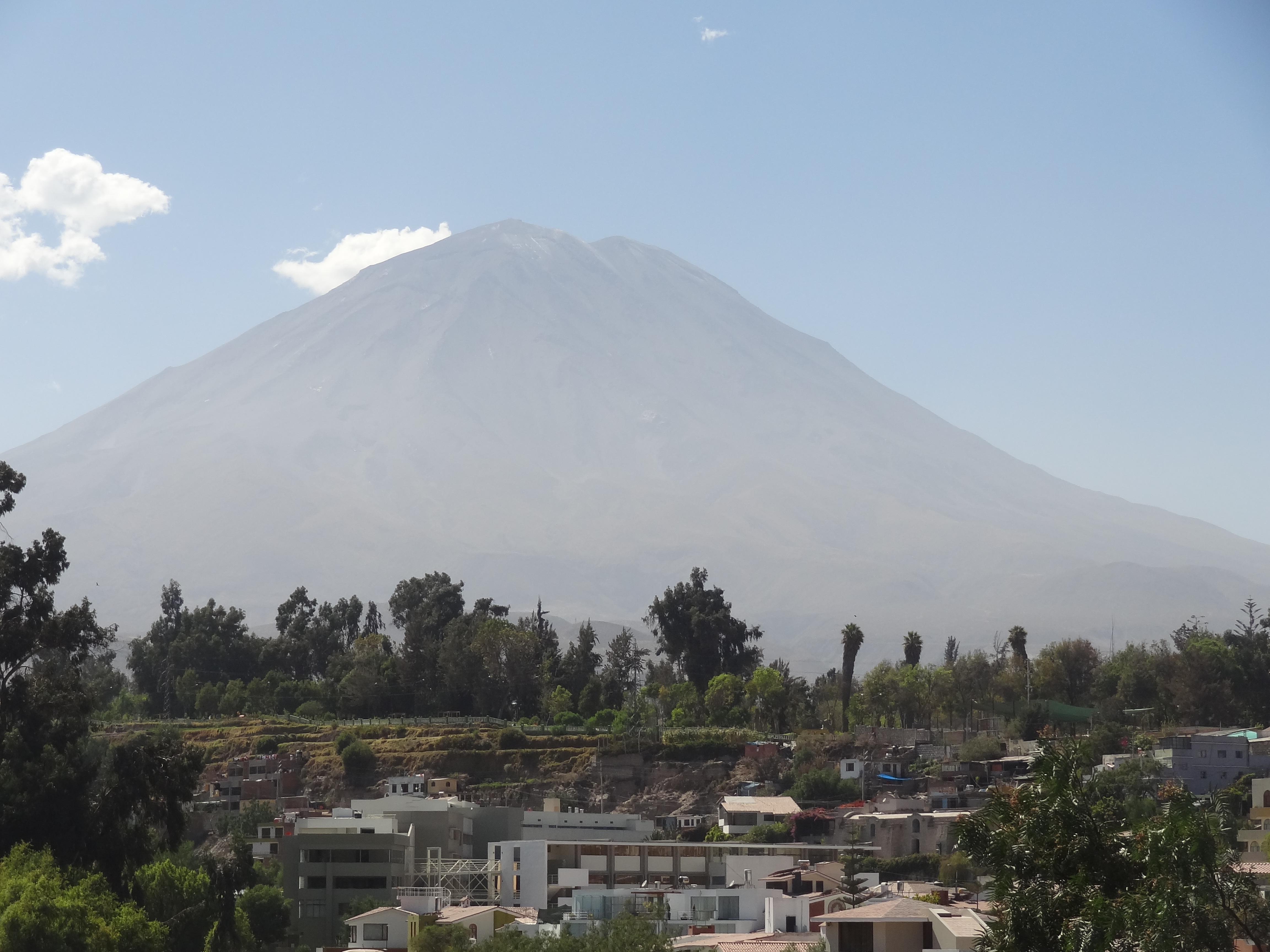
El Misti volcano towering above Arequipa
The canyon is quite spectacular, and so is the V-shaped valley connected to the canyon, carved by the river running along its length. The canyon and the valley are quite different places; firstly they are inhabited by different tribes. These tribes used to shape the heads of young children by strapping sticks to the skull until the age of 5. This identified them as belonging to a certain tribe. Nowadays this is not a current practise; instead they wear distinctive hats to identify which tribe they are from. The tribes were prohibited from interacting, marrying, trading or any form of communication. Over the years this has gradually lessened as trading became a necessity. In the valley, they farm crops on the terraces, particularly corn, barley, wheat and quinoa. At higher altitudes where crops don’t grow, you find the llama and alpaca farms. Alpaca are farmed for their meat which is extremely low in fat and for their wool which is extremely soft. Softer than alpaca wool is the vicuna which is closely related to the llama. However vicuna are wild animals and are protected so are not eaten.
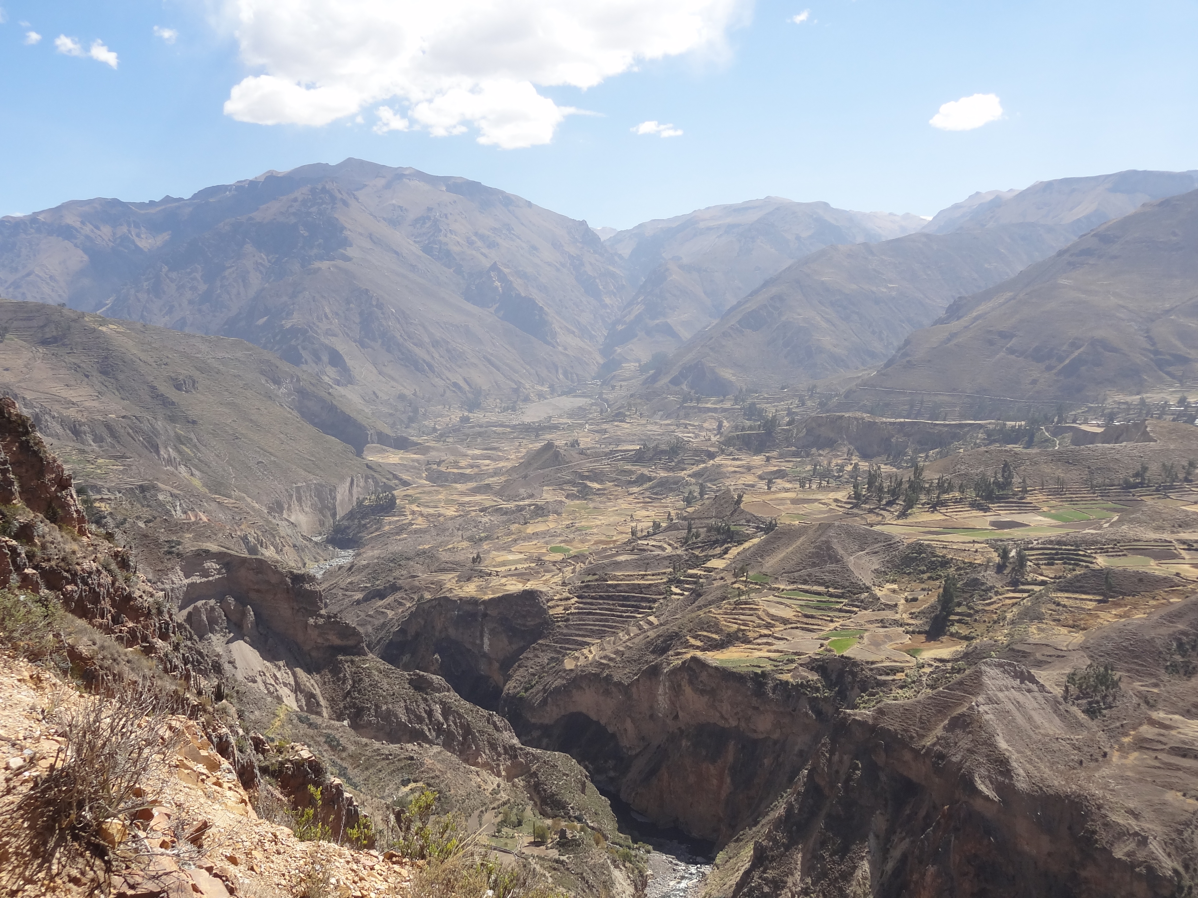
Terraces above the river and the entrance to the Colca Canyon at the top of the valley.
As you move into the canyon, the slopes get steeper and warmer allowing fruit trees to grow rather than corn. This is what motivated the interaction of the two tribes to start trading. avocado trees naturally litter the slopes close to the river. Cactus fruits are also farmed and are used to create the valley’s traditional drink known as colca sour. Similar to pisco sour but made with a cactus fruits that looks like a kiwi and tastes like lemon. Many of the plants have medicinal properties and are gargled to treat the cough. Cactuses are also farmed for the parasite found on its flesh which is used to produce a red dye.
Inside the canyon
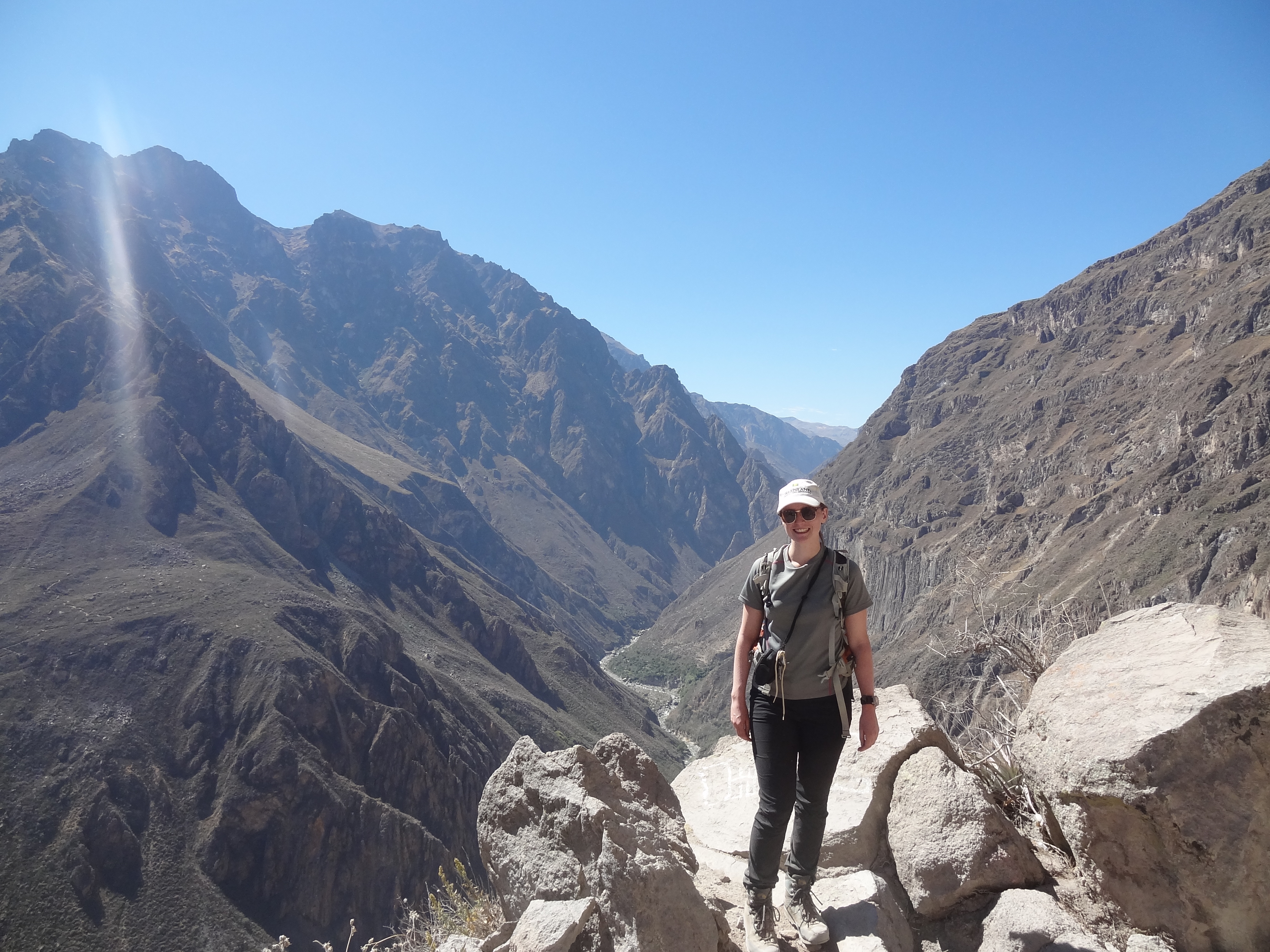
We trekked down into the canyon from around 3500m altitude and descended 1050m. There are no roads for cars down the sides of the valleys as it is too steep so instead mules are used to transport produce and people. At the bottom of the canyon we stayed in bamboo lodges and swam in the pool which was a blessing after the heat of the sun! Climbing back up the side of the canyon was tough! 1050m of zigzagging up a steep dry track for 2 hours. That’s around the height of Scafell Pike before breakfast. The canyon sides were spectacular for a geologist! They were made of hundreds of metres of basaltic columnar joints, which the path wound above and below, formed from the cooling and contraction of a thick lava flow.
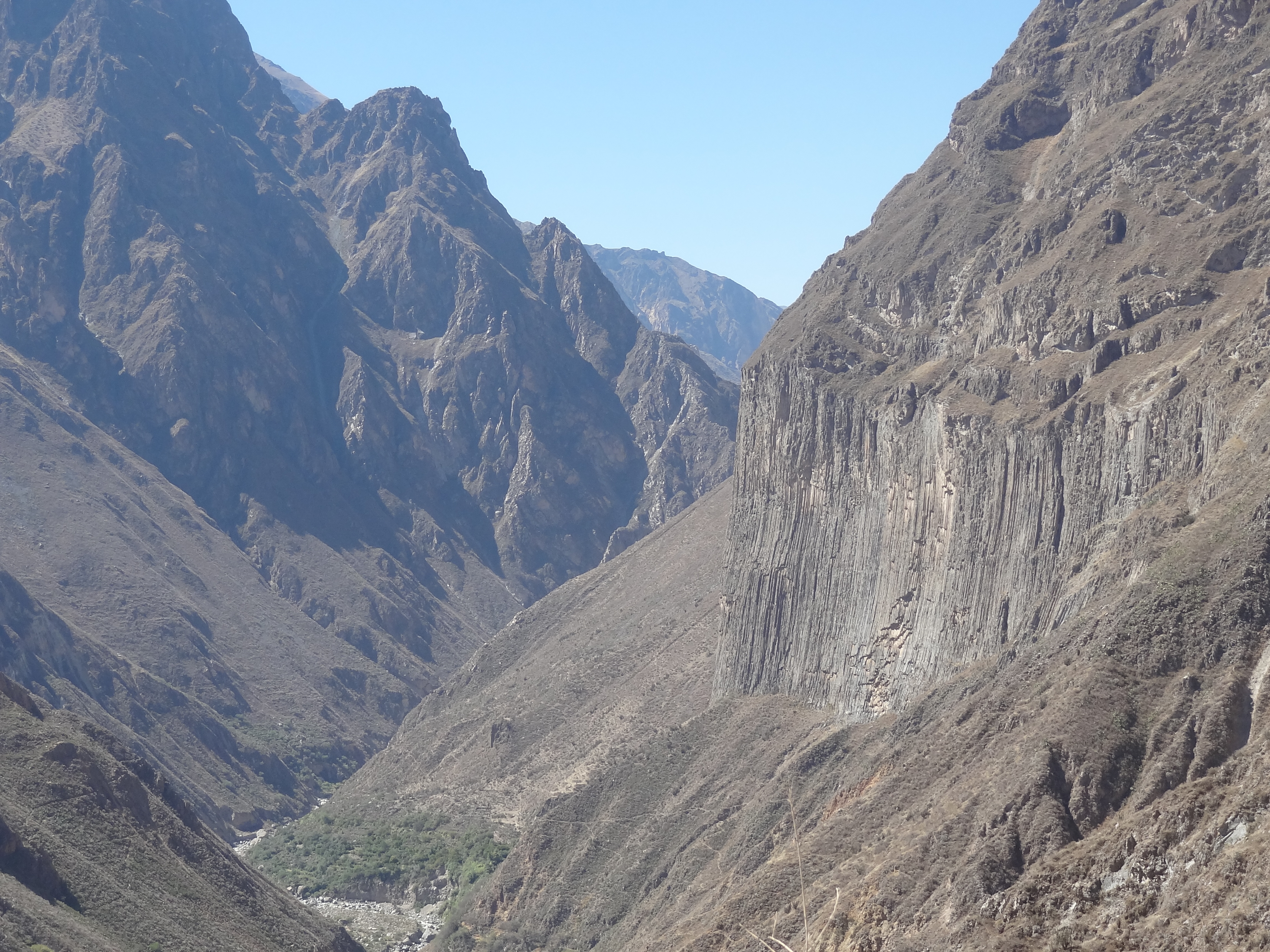
Columnar jointing
On route to and from the canyon we stopped off in some of the local villages and viewpoints. In the first village, I ended up with a full grown Andean Eagle on my head! Soon after we arrived at the ‘Cruz del Condor’, a fantastic view point and the place where the condors ride on the thermals to gain height. Condors are a type of vulture measuring 1m in height with a wing span of 3m! They are enormous! In this valley there are only around 50 individuals left and are now a protected species. The locals used to kill the condors as they thought that they were killing their livestock. However, condors are scavengers so only eat dead animals. They are not able to grasp or kill with their talons. They are thought to be the fox’s best friend as they often eat the remains of a fox’s kill. Condors have been known to live for up to 70 years and only lay one egg every 2 years.
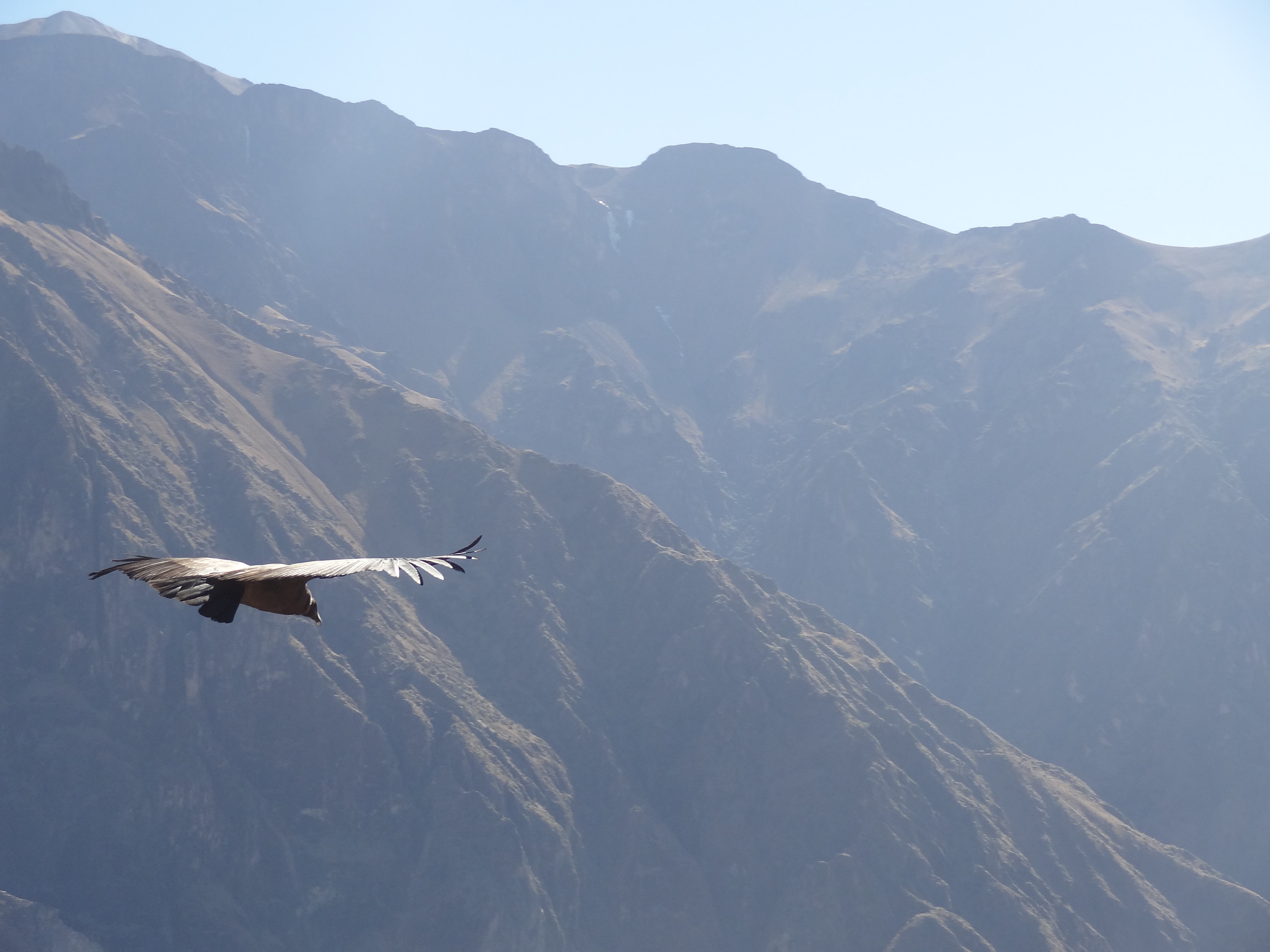
Condor flying in the Colca Canyon.
![]() This work is licensed under a Creative Commons Attribution-NonCommercial-ShareAlike 4.0 International License.
This work is licensed under a Creative Commons Attribution-NonCommercial-ShareAlike 4.0 International License.