This is part 2 of Anna Bidgood‘s adventure in the Gardar Province. You can read part 1 here.
NARSAQ AND A BREAK!
After 3 weeks of mapping we took a boat to Narsaq where we planned to spend 3 days relaxing in the hostel and restocking our food supplies. Narsaq is a town of 1800 people so has 2 supermarkets sufficiently larger than Igaliko and yes, they even have chocolate. The boat that arrives in Narsaq from Denmark to restock the shop comes at least once a week rather than every fortnight like in Igaliko and is therefore slightly cheaper. As we were staying in the youth hostel we didn’t need to bring our tents or cookers and could fill our large rucksacks with tins and meals for the next few weeks although we accidentally bought cornflower instead of custard.
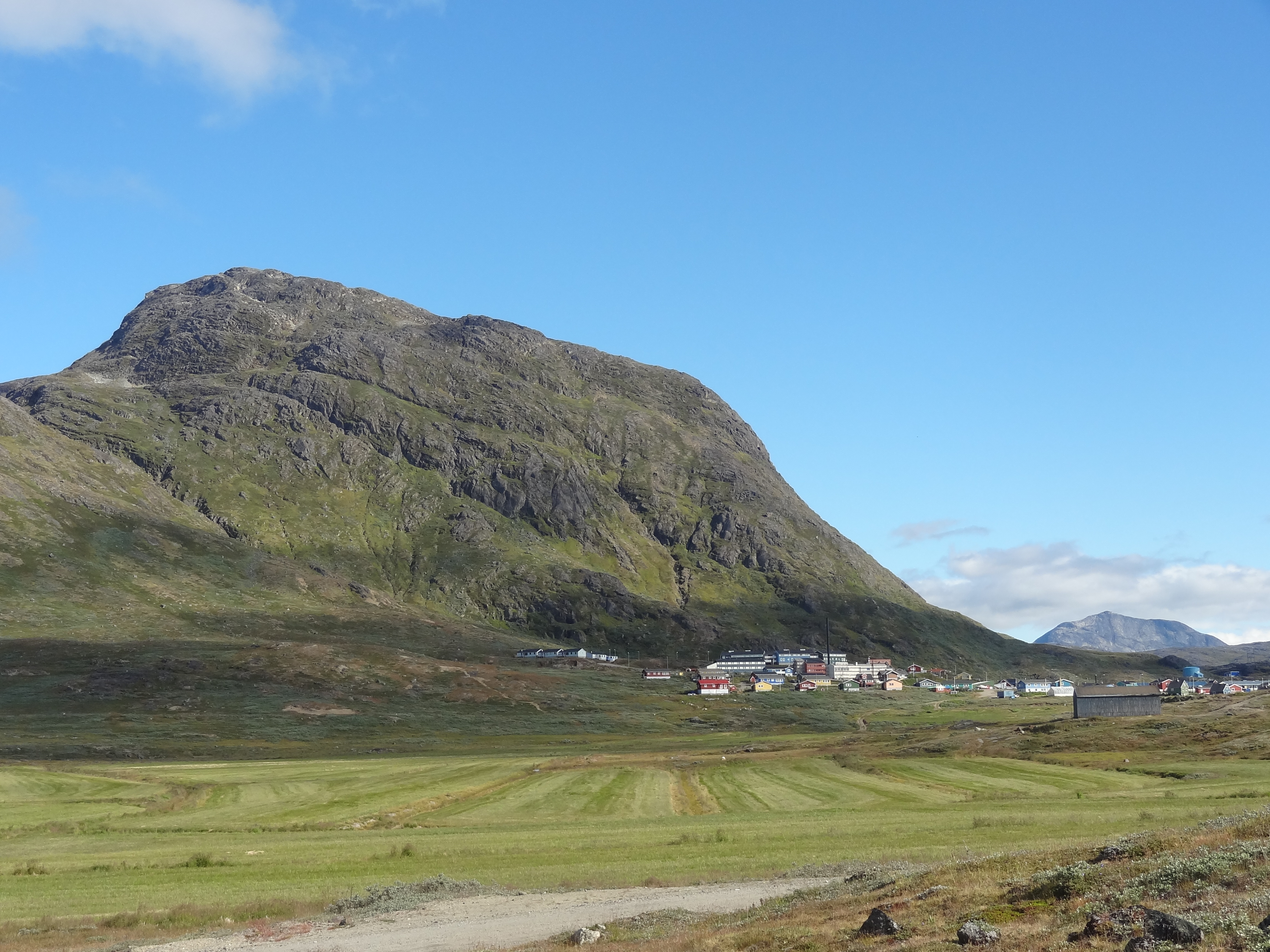
Ilimaussaq intrusion towering over Narsaq
We spent our first evening in the restaurant in Narsaq eating burgers and chips, much to our stomach’s delight and complaint after eating dehydrated and tinned food for 3 weeks. Unfortunately the famous Narsaq fish market wasn’t open but we did manage to buy fish to cook in the hostel.
We have yet to visit the Narsaq museum which is supposedly the best museum in south Greenland, with Greenlandic winter houses, traditional clothing and bone carvings. We have managed to visit the workshop where they make all of the souvenirs. Particularly popular is tugtupit, a bright pink mineral, rich in beryllium which makes great jewellery. You can also buy carvings made of antler and bone as well as seal skin bags.
Written by Anna Bidgood
AURORA BOREALIS AND SHOOTING STARS!
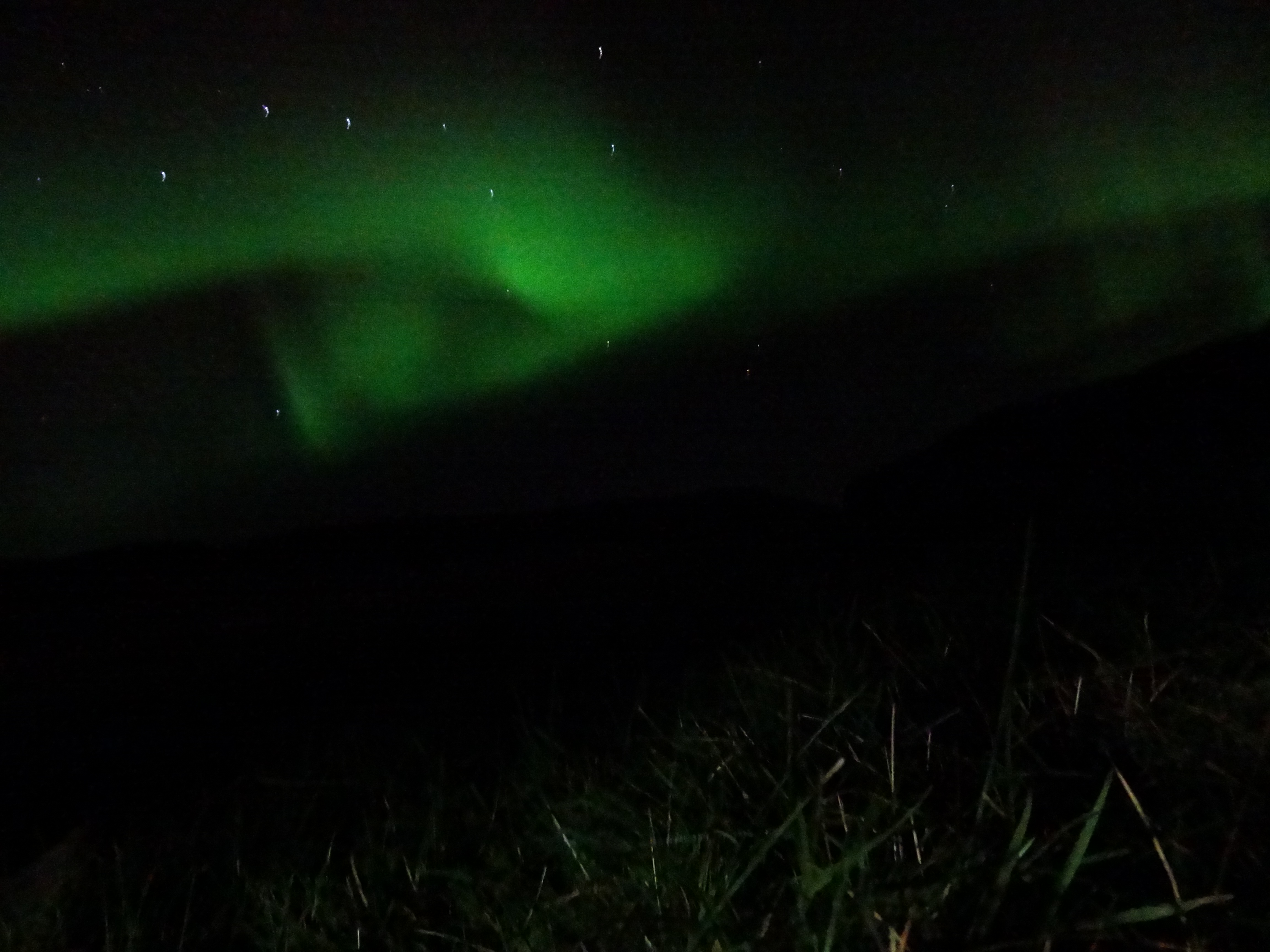
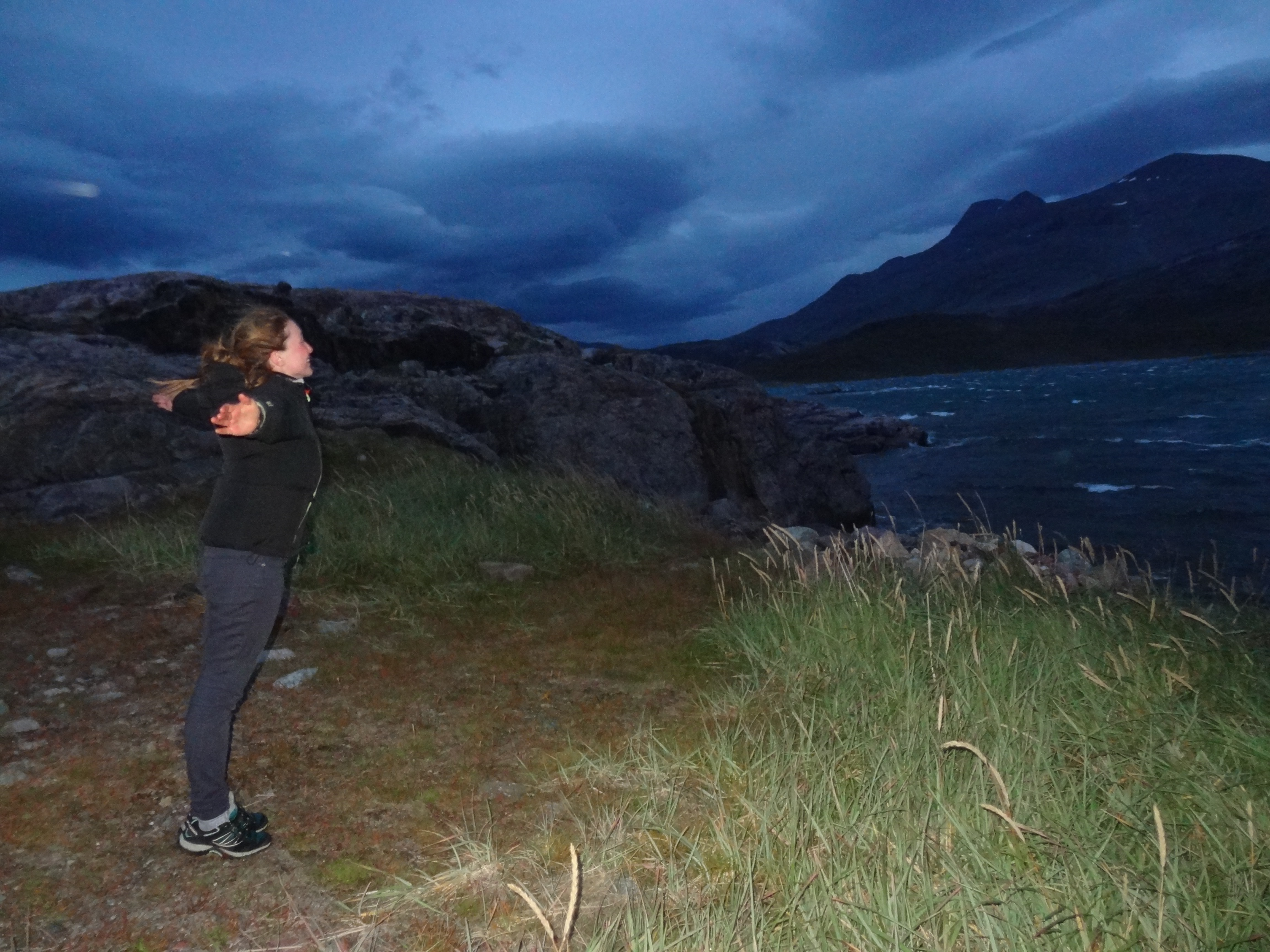
One clear sky night at 11pm, we were wearily making our way into the community centre to brush our teeth, when Rob suddenly spotted the Northern Lights! It was stunning, it was the first time Eleni and Chantelle had ever seen them and we weren’t expecting to see them so early in the year.
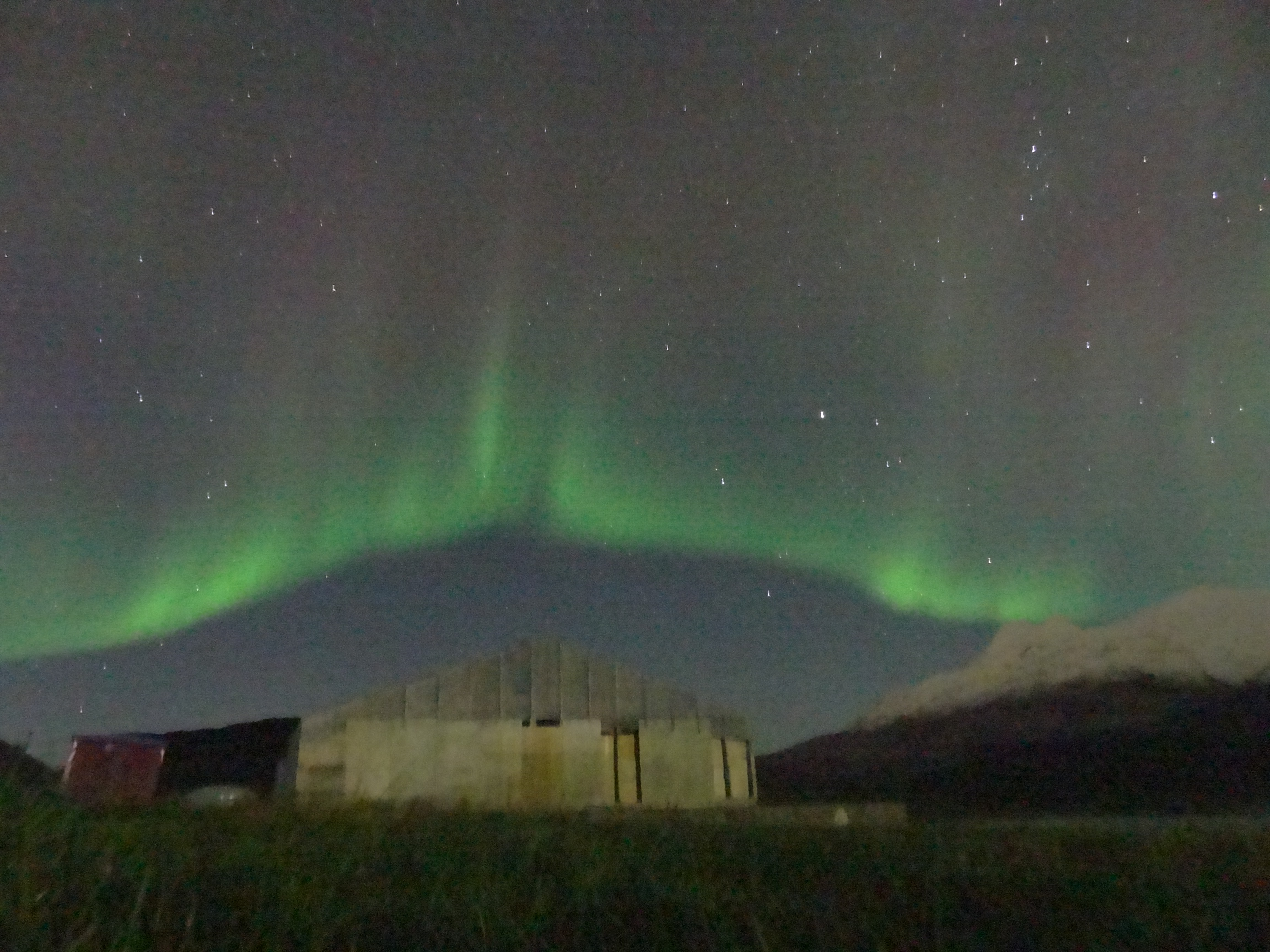
Aurora Borealis
The northern lights are the result of cosmic rays reaching the earth’s atmosphere which is protected for the most part by the earth’s magnetosphere. Near the poles the magnetic fields are nearly perpendicular to the earth’s surface and the cosmic rays can be caught between flux lines and spiral towards the earth. These cosmic rays reach the upper atmosphere and collide with particles. The scintillations are the result of the excited particles emitting energy in the form of light to drop down to their stable groundstate. Different particles in the atmosphere emit different wavelengths of light leading to the range of colours. For example, nitrogen particles emit a light green colour and oxygen a red/orange colour.
During the summer time in the polar regions there is 24 hour daylight, so the well known phenomenon the ‘Aurora Borealis’ is not visible. It is approaching the end of August and it now is almost dark by 11pm. The presence of a full moon made it even more surprising to catch a glimpse of ghostly green above the mountains. As the nights get longer and darker we can only hope to see them again, hopefully even stronger and more vivid colours.
Shooting stars
On a clear night in late August, chantelle and eleni spotted some shooting stars whilst looking at the milky way which is very bright in the absence of light pollution. Shooting stars are in fact meteors burning up on the edge of the atmosphere due to the friction of the meteor traveling through the atmosphere, this is proportional to the speed that it is travelling. Meteors usually come from the asteroid belt between Mars and Jupiter. Jupiter is so large that it’s gravitational field often deflects the asteroids from their orbit, causing them to approach earth. If the meteor reaches the surface of the earth, it is known as a meteorite.
Top 3 Cravings:
Anna – a proper cup of tea, fish and chips, a bath
Eleni – mature cheddar, slippers, my mum’s cooking
Chantelle – dad’s braai (BBQ), films, a hair dryer
Rob – MEAT, a lie in, pubs
– written by Robert Fox and Anna Bidgood
CAMPING LIFE AND THE COMMUNITY
When you are part of any expedition, you may have to learn to live with other people, in close proximity, for extended periods of time. So far, we have been learning each others habits and traits, and importantly – how to respect each other. For example, Anna wakes up early and needs tea before she functions properly, whilst Rob and Eleni both need half an hour just to get out of bed. Meanwhile Chantelle needs food as soon as she wakes up! Everyone is used to different routines and these should be respected, but at the same time you need to be flexible to suit the team’s needs and learn to compromise.
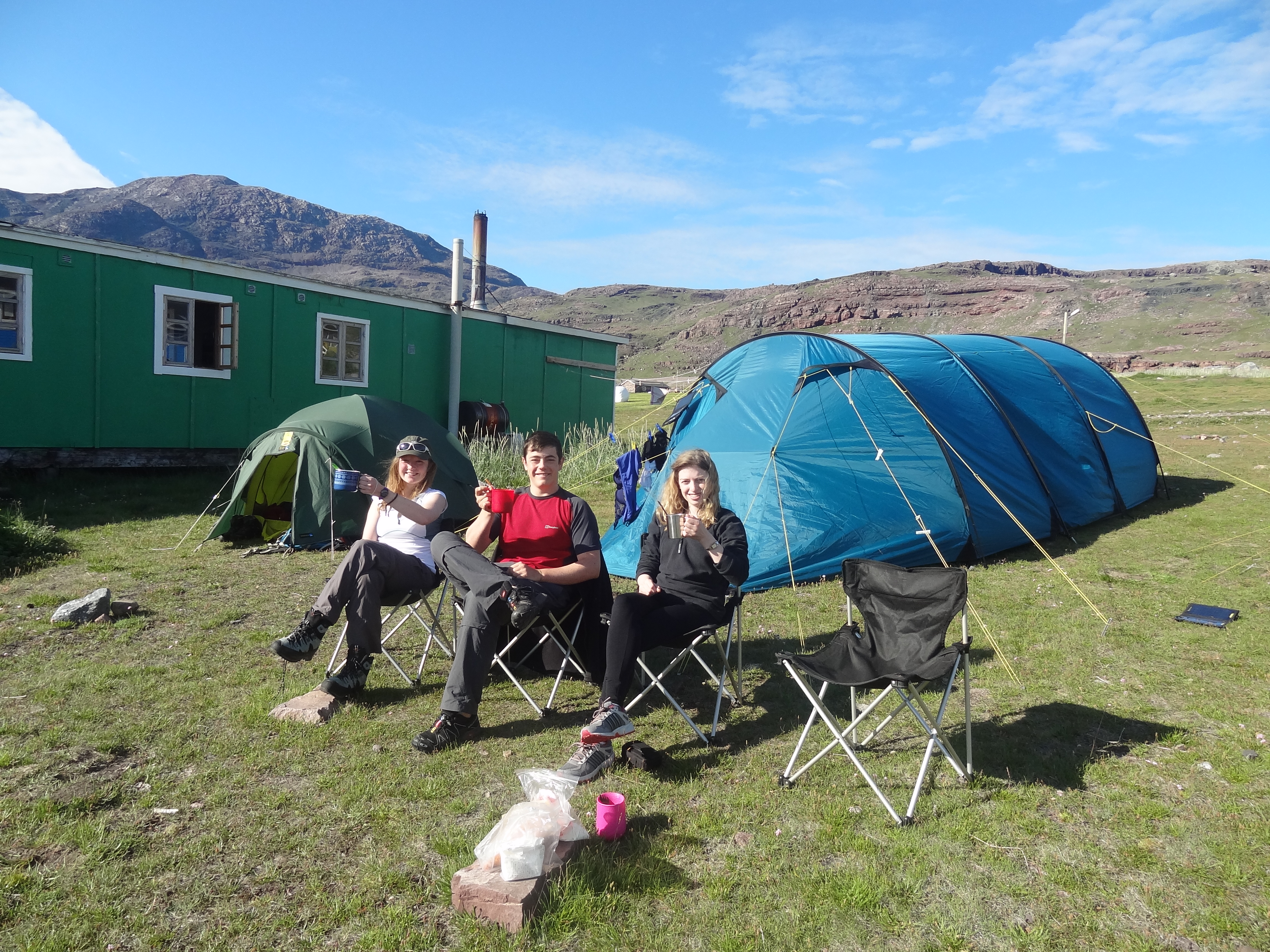
Basecamp in Igaliko
As for camping, 6 weeks may seem like a long time to be in a tent ( or in Anna’s case 10!), but it’s not as uncomfortable as it may sound. It may seem like a lot of effort to get up and fetch water very routinely and juggle your cooking on a trangia stove, especially when there’s no dishwasher. But hot food on a cold night after a long day in the field, your sleeping bag or a square of chocolate are luxuries that have never been so good! A top tip for camping: you’d be amazed how comfortable you can be with the right gear and an open mind.
The local community is an important part of any expedition that is passing through or using the community as a base, especially if you make friends with the hotel cook! The shop in igaliko is rather limited in what it sells and although we have managed to scrape together our meals, there are certain ingredients that are lacking or craved. We have a great relationship with the ladies in the country hotel; we go there on our days off/when the weather is unpleasant, chat to them and have Igaliko cake and proper coffee. They are kind enough to bake us a loaf of bread every once in a while which to us seems like a miracle; the shop surprisingly does not sell bread as everybody bakes their own which is quite difficult to do on a trangia.
– written by Chantelle Roelofse
WHAT AND WHY!
What we did
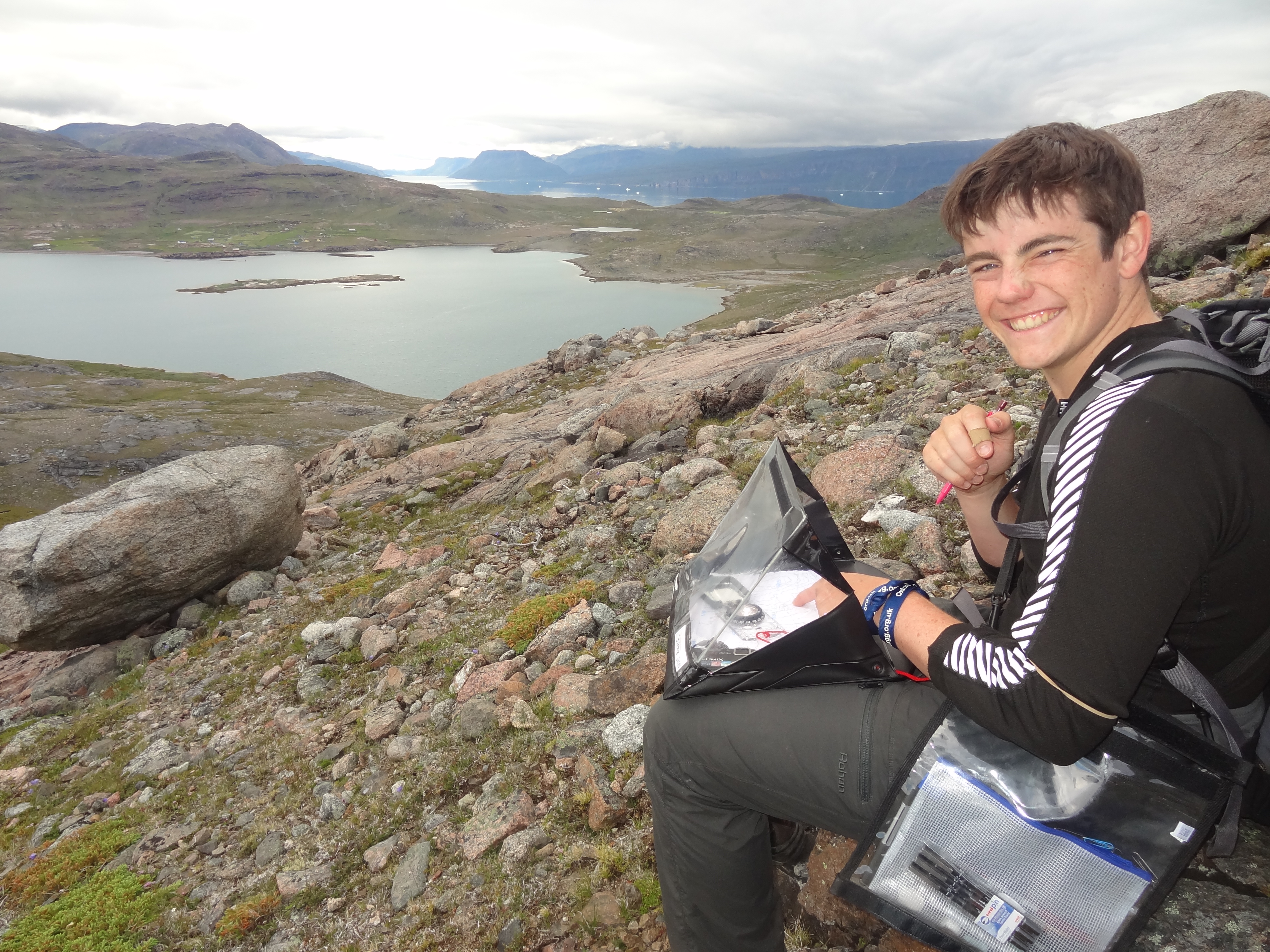
Writing in our notebooks in a slope covered in boulders, looking down towards Igaliko
When conducting a geological mapping project you are armed with a notebook, maps, hand lens and a compass clinometer. Day by day you visit outcrops of bed rock, describe the types of rock that you found and sketch any features that you find, from these you can infer the type of environment that the rock formed in.
For example, a large portion of our area is made of a quartz rich rock comprised of grains in an iron rich matrix, we call this quartzite. Within this unit we found red beds, ripple marks, cross bedding, and desiccation cracks infilled with mud; all remnants of a palaeoenvironment. From this we can build up a picture of a potentially fluvial environment on land, where the oxygen has oxidised iron to Fe³+, making up the red colour we saw. This terrestrial, fluvial environment may also be quite hot and arid, drying up occasionally to form mud dessication cracks. We also found evidence of mass deposits of large boulders within the beds, deposits like these are snapshots into a palaeoenvironment when something like a flash flood may have occurred.
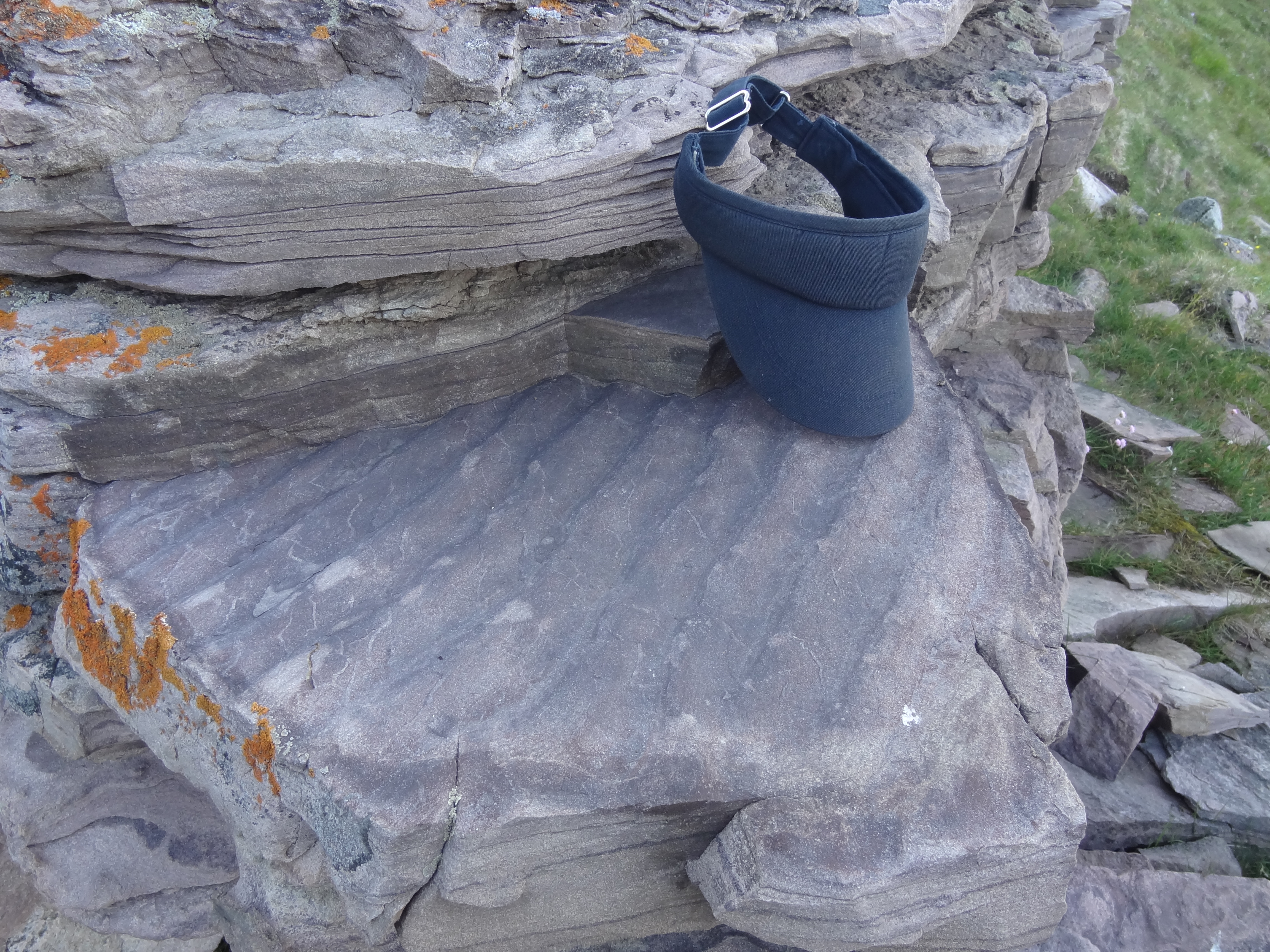
Ripple marks in a stone wall
So when you look at a sedimentary rock and just see a rock, look again and see if you can figure out what kind of environment they may have been deposited in and from this you could even make a guess as to the latitude that continent was at when it was deposited.
After describing all of the features you see, next you need to look at the relationship between the different rock types known as lithologies. Is the contact gradual or sharp? Does it cut across the bed or is it concordant? Is it laterally continuous? All of these observations go into your precious notebook so that when you have gathered all of this evidence you can begin to make your interpretations.
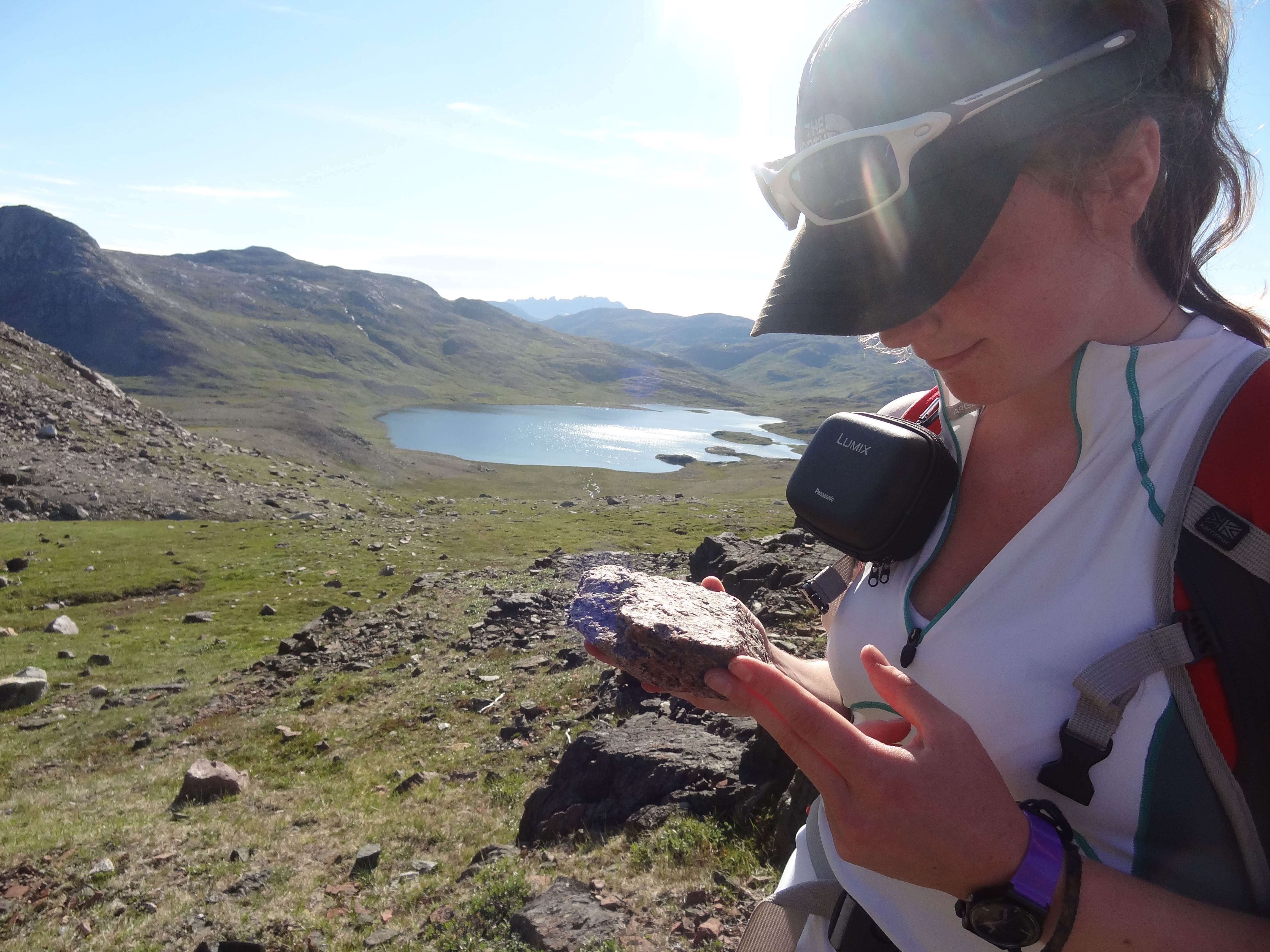
Eleni and the Julianehaab granite
But, you may ask, is this not a mapping project? What about the maps?
The map and your field notebook work together to help you describe the lithological relationships that you encounter. The contacts and features that you sketch and describe in your notebook become boundaries and annotations on your map and larger scale relationships become more obvious.
Then comes the fun part: colouring in.
What we found
A bit about the geology of south Greenland, the Gardar province: Gardar, besides being the Viking settlement, was once a centre for igneous activity with large magma chambers intruding into the crust. This particular type of magmatism is known as alkaline magmatism due to it’s relative enrichment in elements such as sodium and potassium. There are not many areas of alkaline magmatism in the world, the current active zone being the afar region in Ethiopia. It is because of this that the minerals that form in these settings are considered rare and unusual and of particular interest to geologists.
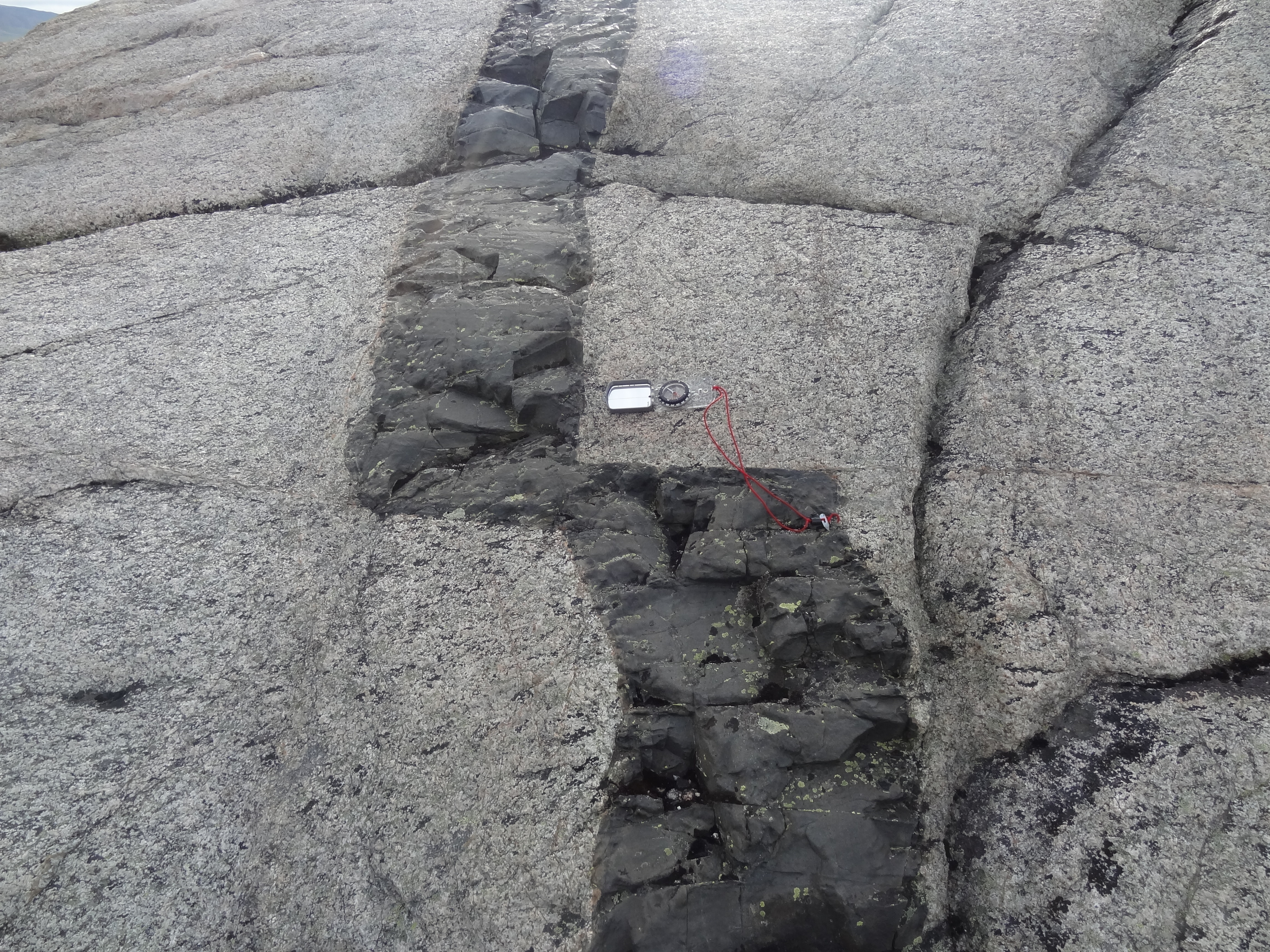
Dyke cut by a fault
We are currently mapping the edge of one of the large igneous centres in the gardar province where layers have formed in the magma chambers as minerals started to crystallise and accumulate around the edges. Surrounding this exposed but now fully crystalline intrusion are many smaller intrusions which makes up what is known as the Gardar Dyke swarm; a large concentration of narrow conduits from 30cm to a km wide, cutting through the surrounding rocks. Some of these dykes are younger than the intrusion and are cut by it, others intrude throughout; this tells us the dykes were intruded for a long period of time as the magma chamber was emplaced, and their similar composition could even suggest a similar origin.
– Written by Anna
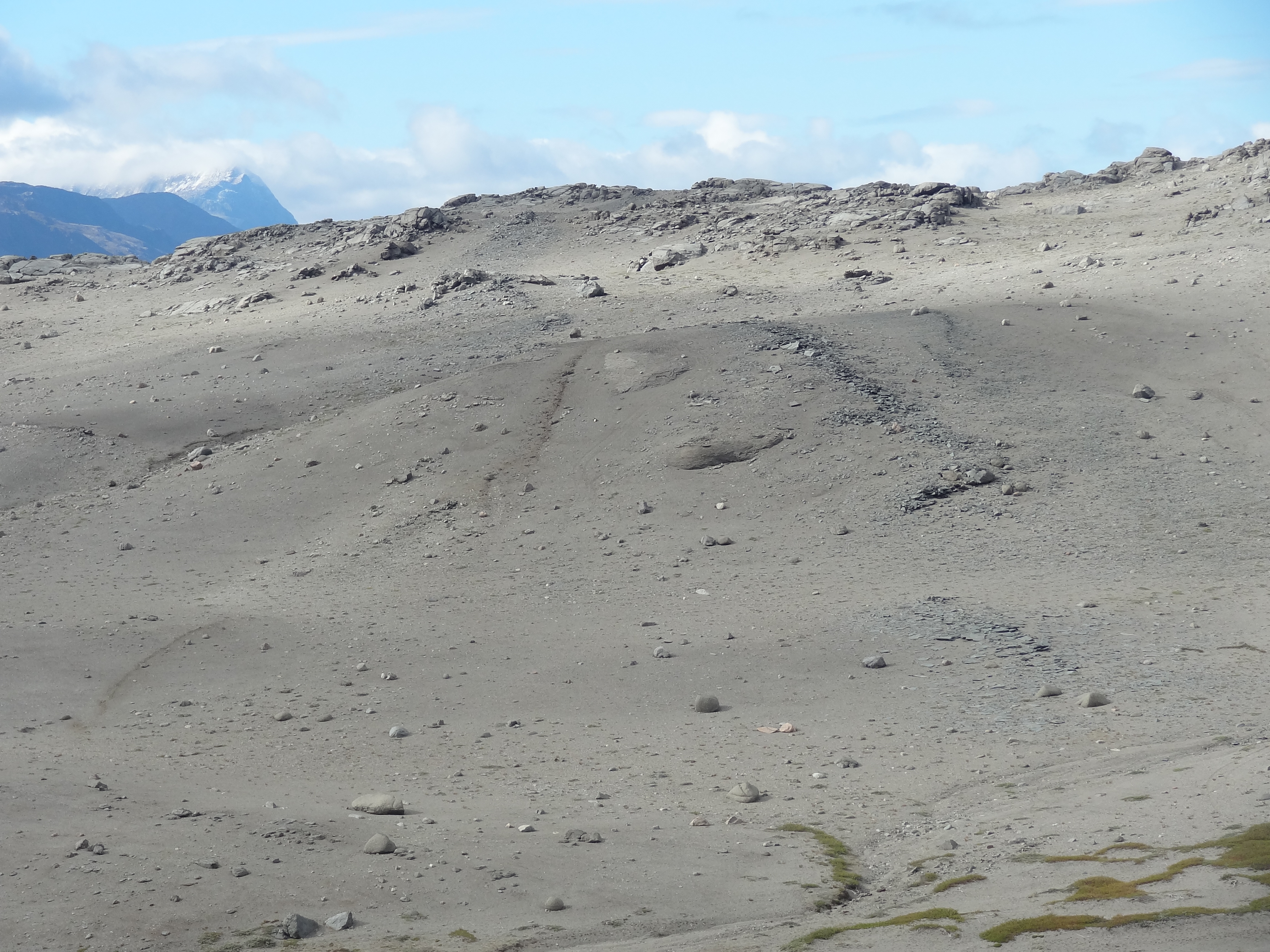
Barren landscape that makes up the nepheline syenite intrusion. Weathered dykes can still be seen as piles of rubble
OVERVIEW AND WINDING DOWN!
An overview of the Project
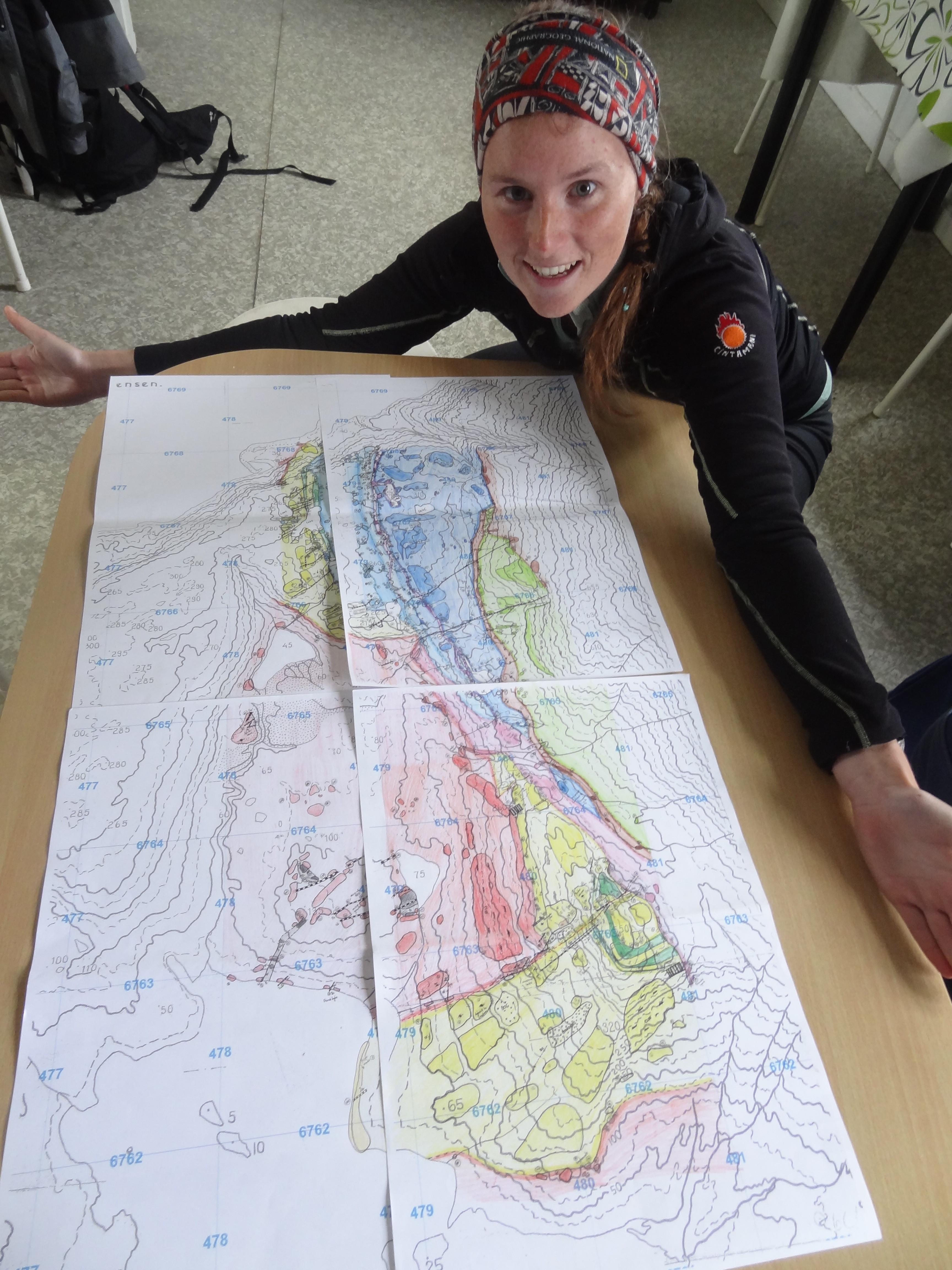
Anna and her final map
In the last 28 days in the field, each team of two has mapped around 15km², collected up to 20 samples, and completed almost 3 notebooks each and made a sedimentary log. Our neat maps are looking fantastic and shear number of dykes make them look impressive. A successful mapping project almost complete.
For the last two days we sorted out our samples, finished copying and colouring our maps and to save time we quad bike around our areas to collect the last few samples and for a bit of fun.
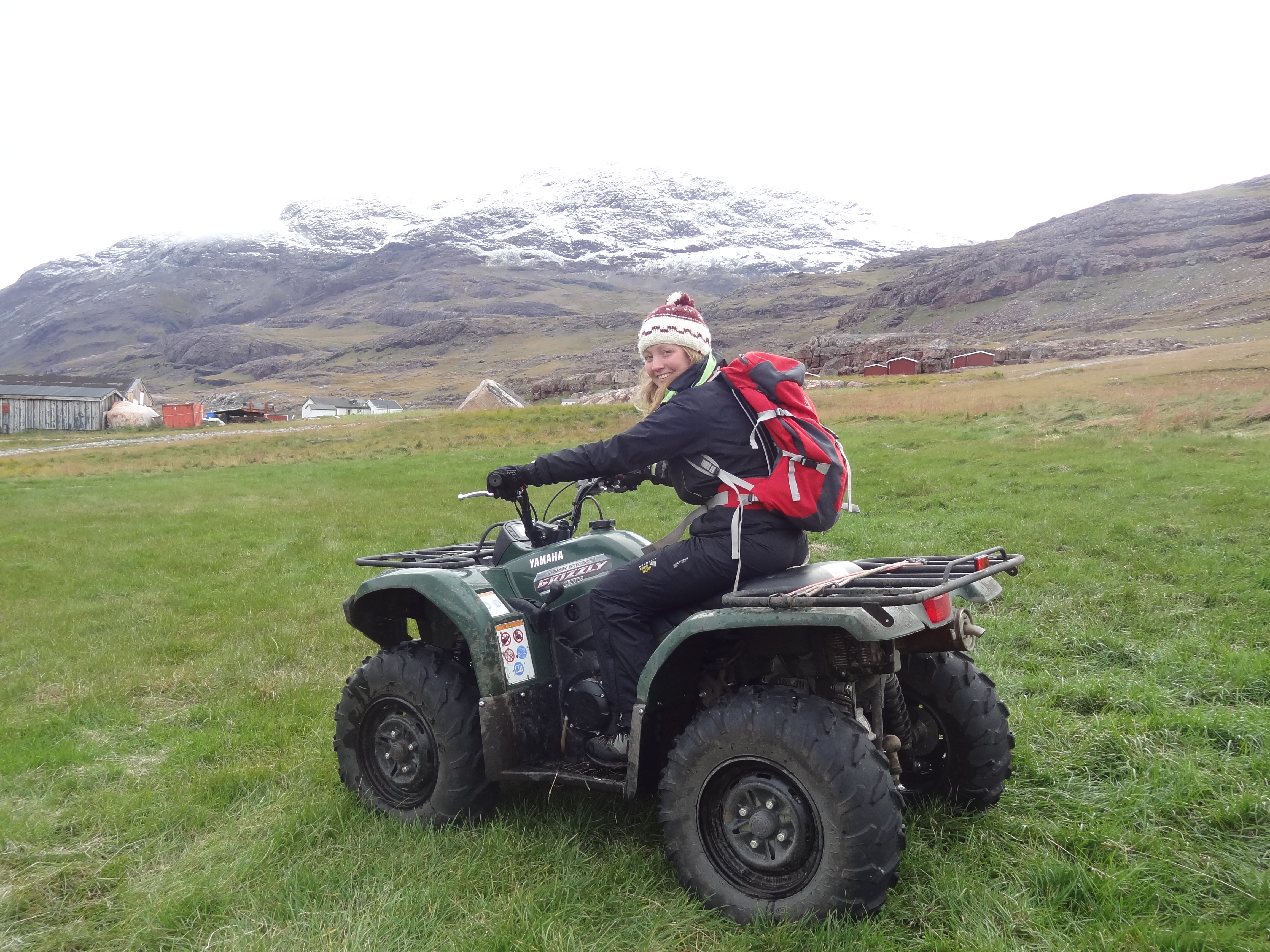
Eleni taking the quad bike for a spin to collect samples
Down time
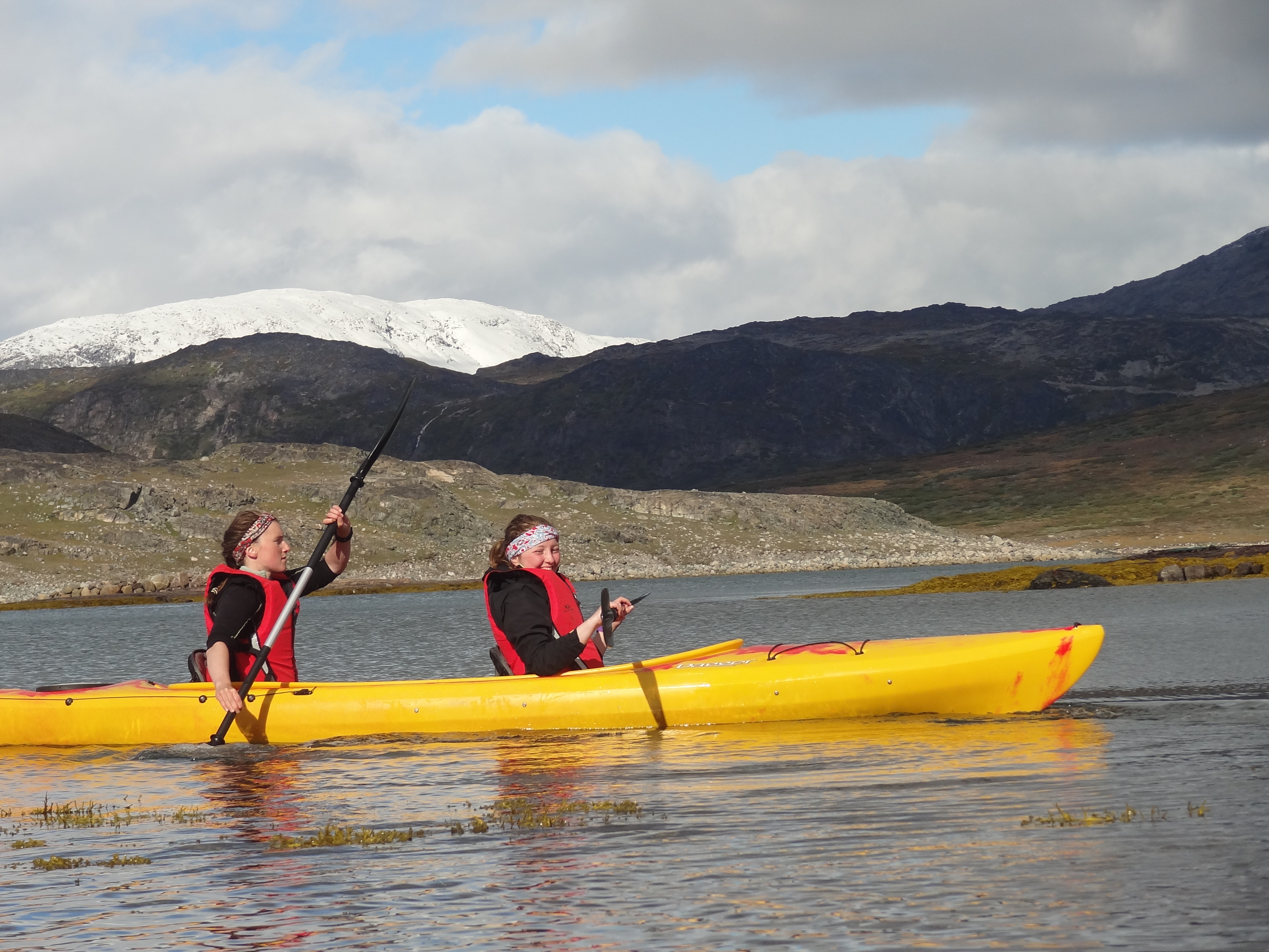
Anna and Eleni paddling in the fjord
Before we left for Iceland, Eleni and Anna found a new view of our mapping areas, this time from a kayak in the fjord. The water is icy cold so we didn’t want to be going in, but armed with paddles and our waterproof video camera we set of for a few hours in the sun on the water.
As long as the weather stays good enough for our flight to take off, on Saturday we’ll be in Reykjavik city youth hostel with a few days to explore the city, visit the geothermal baths where the water is naturally hated by volcanic activity below the surface and maybe even visit the rift valley where the continents are moving apart!
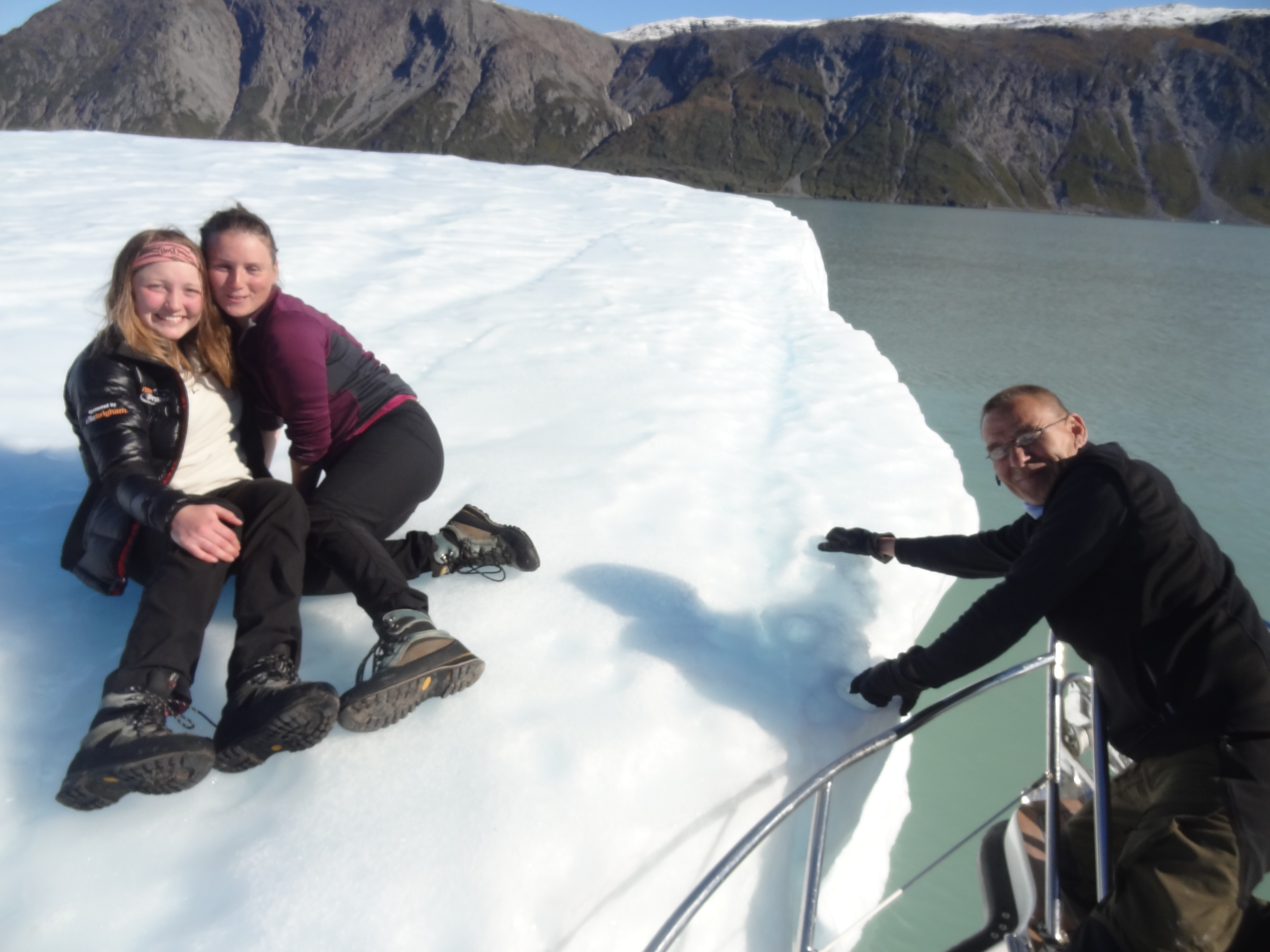
Anna and Eleni sat on an iceberg in the middle of the fjord!
On the journey back to Narsarsuaq we stopped off at a nearby iceberg, hopped off the boat and sat on it to take pictures! A truly magical experience.
The weather in September
As September arrived the weather very quickly began to turn. On the last few nights of mapping our water began to freeze overnight and there was constantly snow on the tops of the mountains and by 10th September, on top of Igannaq (550m) as well. We’re expecting temperatures of around -10°C overnight from now on.
The beginning of a storm
Greenlandic storms – fohn winds
We experienced about 14 hours of fohn winds whilst confined to our tent from 7pm until 9 am. We got very little sleep but it only lasted one night, they have been known to last around 3 days. We’d been warned in advance that these winds were coming by the locals who then proceeded to pull all of their boats out of the water, they even had shutters on all of their windows and chains on their chimneys, well prepared for such a storm!
Fohn wind are a type of catabatic wind which comes off the glacier and have been known to reach 200km/hr. They are extremely destructive and can cause full tanks of fuel to fly through the air. They were in fact one of the reasons we brought such good tents and piled rocks on the sides. We took down or big mess tent in advance as we knew it would not withstand the wind and stored or equipment underneath the barn. The winds themselves are very warm! A strange concept I know but they are formed when warm air is forced down wards onto and of the ice. As we all know warm air rises so the forces required to push this huge body of air down a glacier to these speeds must be quite impressive.

The team saying goodbye to Greenland
Winding down for winter
As soon as the weather turned and September arrived the tourist industry started to close down, the hotel had a sign on the door saying ‘closing down for winter’! Yet here we were still camping, much to the locals’ amazement. The gates which had been left open all summer around the fields were now shut as the sheep were rounded up. The farmers had to round up lambs from the surrounding mountains and were gone for as long as a month bringing them in, quite a job! Especially with the turning weather.
Thank you very much to all those who have followed our Blog – Please feel free to ask us any questions you may have about the project via the ETE Discussion Boards!
Anna and the Team
![]() This work is licensed under a Creative Commons Attribution-NonCommercial-ShareAlike 4.0 International License.
This work is licensed under a Creative Commons Attribution-NonCommercial-ShareAlike 4.0 International License.