Helen is working on a PhD at the University of Glasgow with a focus on geothermal energy in the East African Rift. Read more about Helen here.
So why is the development of geothermal energy so important for the East African nations? It is estimated that 84% of Kenyans do not have access to electricity. For those that do, lighting their homes is very expensive and hugely unreliable. However, Kenya is developing its vast geothermal resources faster than any other country in the world and has a geothermal power potential estimated to be 7,000 MW; its current supply is 1,400 MW. As demand for electrification in the region grows, geothermal offers the greatest opportunity for cheap, clean and sustainable base-load power. There are three geothermal fields already developed/part developed in Kenya, these are Ol Karia, Eburru and Menengai. My field location is based in Menengai.
Menengai Caldera
Menengai is a large shield volcano that occupies the floor of the East African Rift Valley in the Gregory Rift. The 30km3 volcano is young at only 200,000 years. There has been the eruption of two voluminous ash-flow tuffs, each preceded by major pumice falls. Both eruptions have been linked to the formation of the present day 12 x 8km summit caldera. The first occurred 29,000 years ago with the second about 16,000 years ago which produced approximately 30km3 of compositionally zoned peralkaline trachytes. There are more than 70 post caldera lavas covering the caldera floor. The meaning of Menengai in the Masaai tribal language is “mass death”, named because of fatal eruptions and war in the area, it is possible that some of the flows are only a few hundred years old.
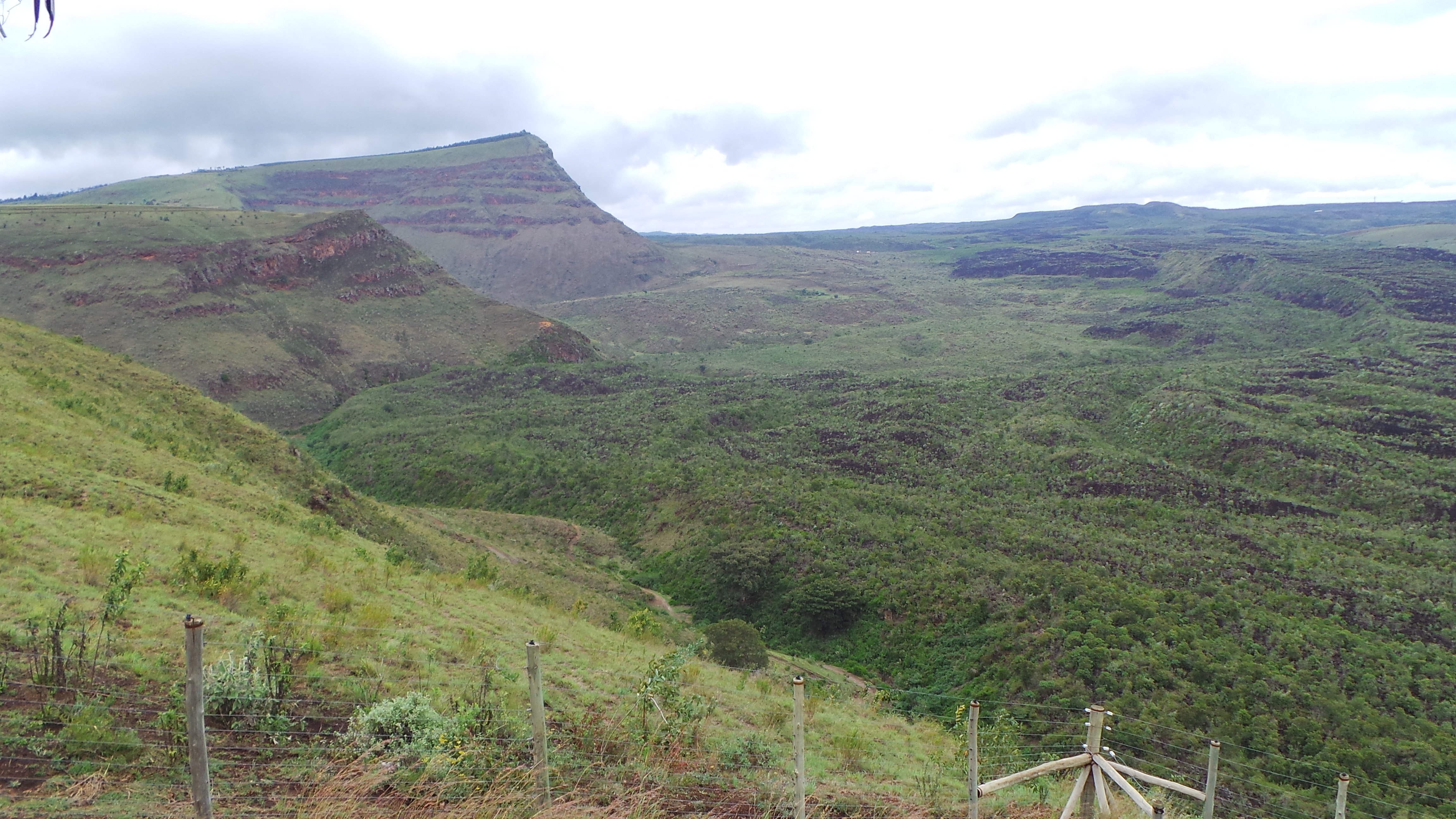
Image of the caldera taken from the eastern rim looking west. Image covers about a quarter of the caldera, the slightly higher area on the horizon in the centre of the image is an area of rejuvenated uplift with young a’a flows in a easterly direction. Flows move westerly also but cannot be seen from this location.
Fieldwork
As this was my first time in the caldera, the three weeks in September 2014, were spent mainly familiarising myself with the location and establishing contacts. A large task for the trip was also to develop a geological map of the caldera, as there are no detailed maps currently available.
Key to understanding the subsurface fluid flow are structures. Unfortunately fault surface traces within the caldera have been buried by the young lavas. So a visit to Sleeping Warrior (aka Split Crater) in the Elementeita Badlands to observe rift fault interactions with the regions volcanoes.

Sleeping Warrior, the depression in the crater rim clearly seen in the centre of the image, is part of a fault trace that can also be seen on the other side of the volcano.
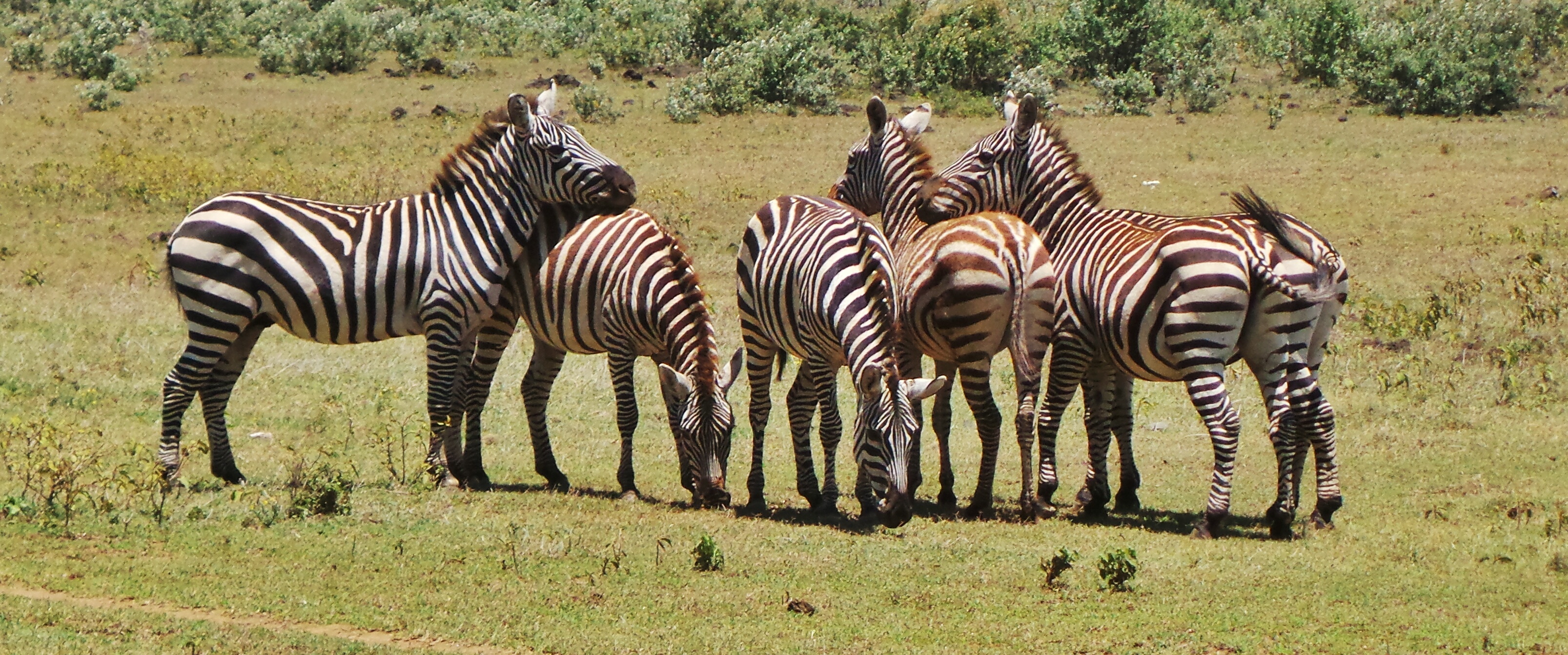
Badland Zebras.
Even with the absence of fault traces with in the caldera, there are open extensional fractures covering wide areas of the caldera, some of which are venting steam at temperatures ranging from tepid to extremely hot, not surprising as despite the average global geothermal gradient being around 25°C per 1km depth, the temperatures 1m down have been recorded up to 88°C in the calderas centre (Mungania et al,. 2004). Some of these surface manifestations were hot enough to cook eggs, though forget the 5 minute boiled egg, it was more like an hour!
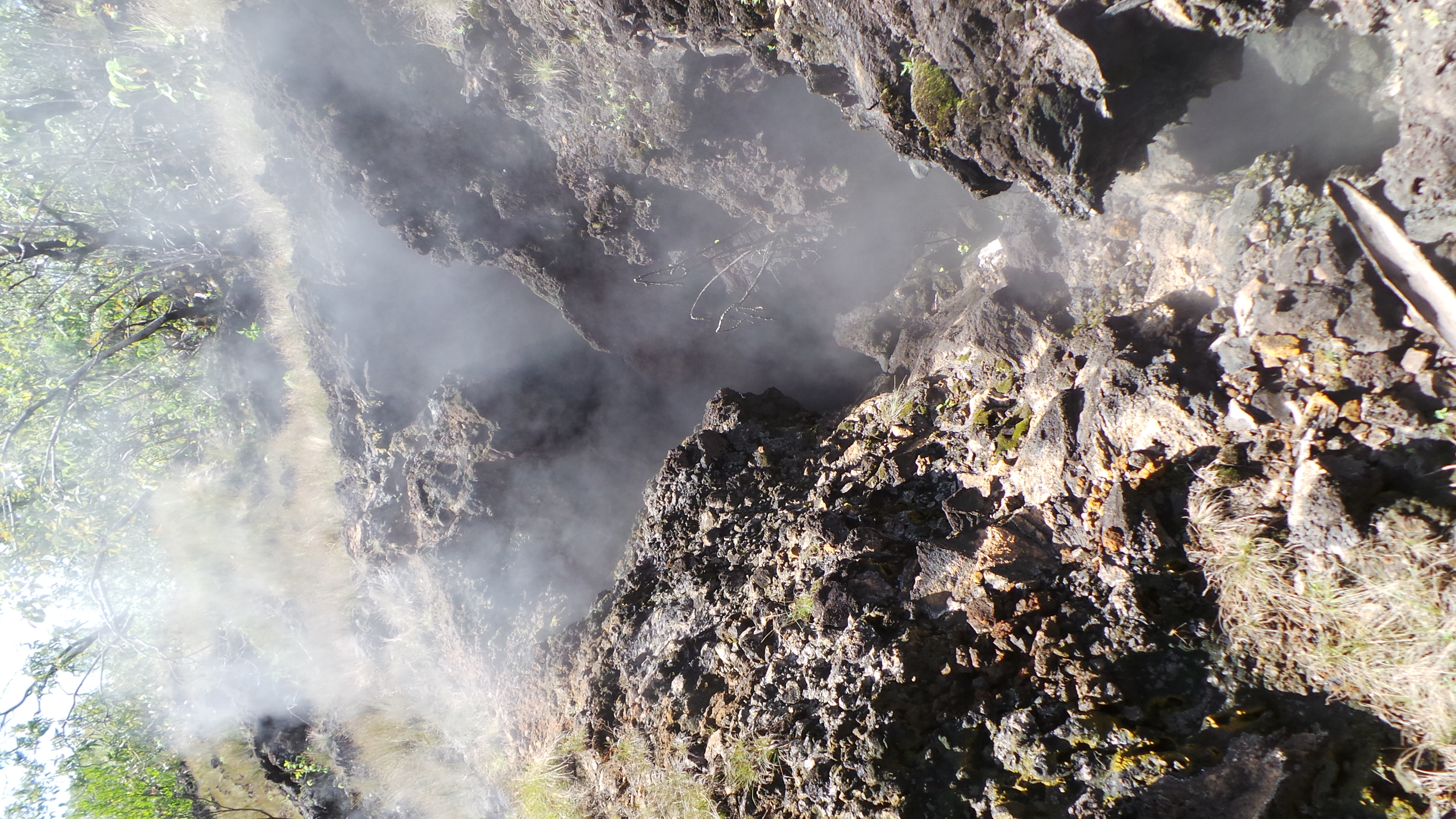
Venting open extensional fracture.
Also important for this trip was gaining an understanding of some of the engineering and the reasons why things are done. For example boreholes are vented through mufflers to reduce sound pollution, for 4 months. This allows for the geologists to test the temperatures. If the boreholes venting temperature remains above 165°C for the duration of venting, then it is likely that borehole will be used as a production well. Those that do not remain above the required temperature will be used as injection wells.
Visits were also made to the rigs within the caldera. There are many wells being drilled, but there are only two different rig set ups in use. Geothermal Development Company (GDC) are responsible for the caldera and most of the drilling. The GDC rigs are rotary drills that can get to depths of 7,000m and case to the full depth. The hydraulic drill used in the caldera is owned by Cluff Geothermal/Hotspur Drilling, a UK company working in the caldera. These rigs drill to 3,000m and case to 2,000m. In the caldera, drilling to these depths are all that is needed to access temperatures needed to generate electricity.
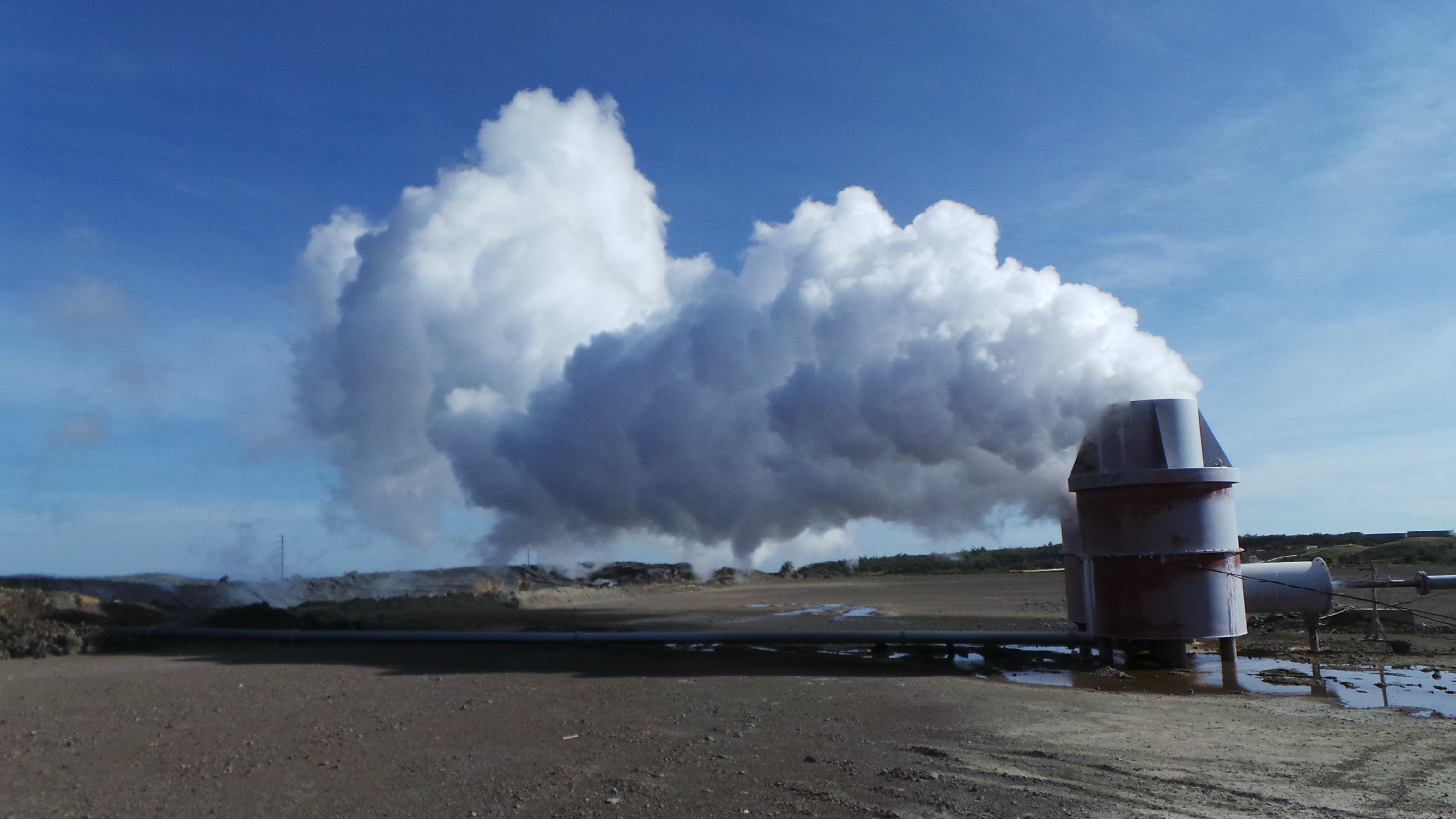
Venting MW-10

GDC Rig
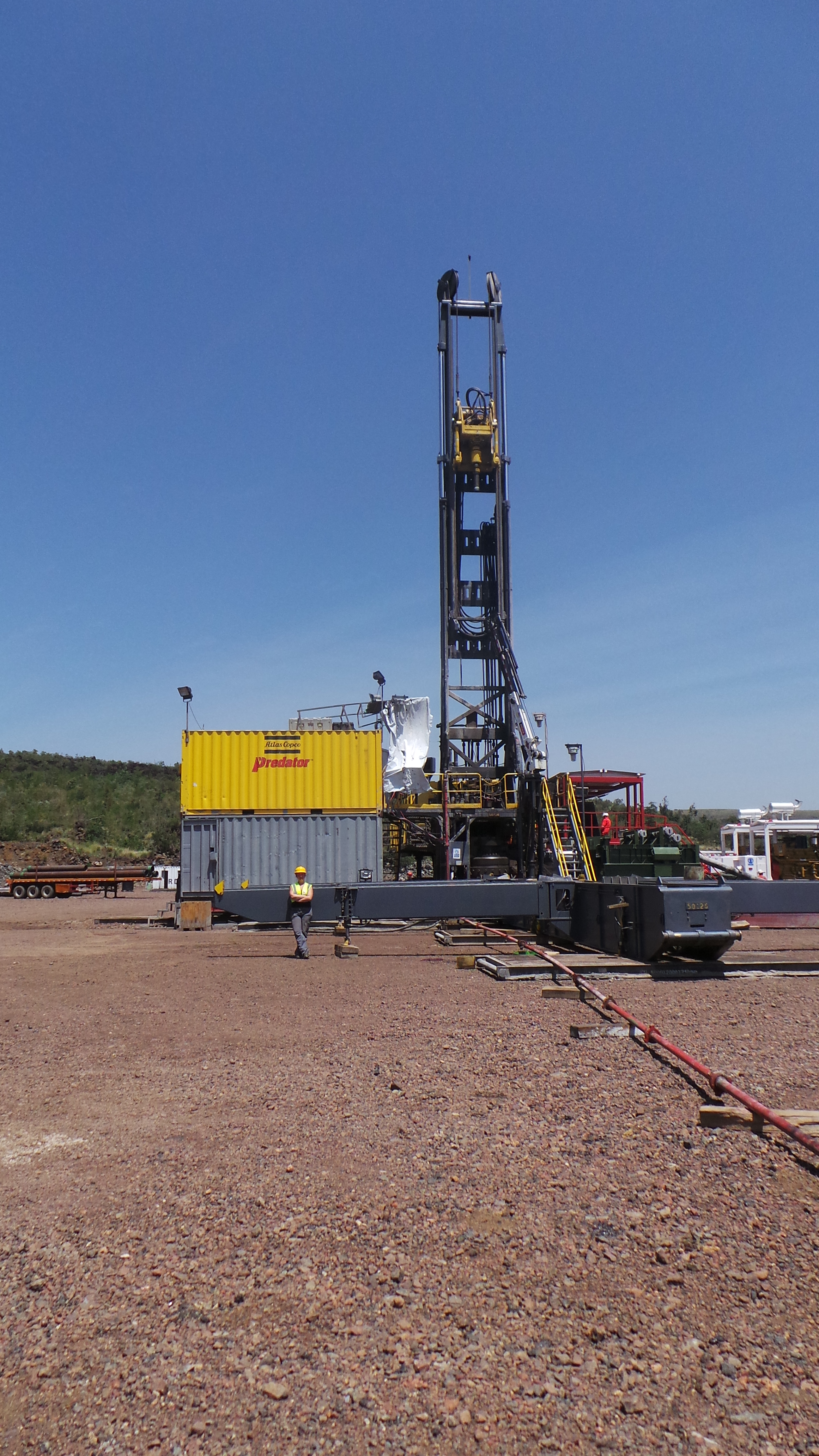
Cluff Geothermal/Hotspur Drilling Rig
The collapse mechanisms of this caldera have been identified as piecemeal by Leat et al., (1984). A disruptive collapse such as piecemeal would certainly provide an extensive fracture network for sub-surface fluid flow, though evidence that would confirm this has been extensively covered by young lavas, observations of post-collapse deposits within syn-collapse (un-welded) tuffs would support different phases of multiple disruptive collapses occurring concurrently. What has also become apparent is the presence of collapse shoulders to the south confirming the diameter we see today is a topographic diameter; the structural diameter of the caldera is therefore smaller; collapse shoulders are absent in the north. The absence of welded tuffs within the caldera along with the hummocky topography to the south of the caldera suggest the collapse of over steepened caldera walls occurred during the late stages of collapse eruptions. The shoulder breccia debris forms the core of the hummocks and the tuffs have been deposited over and interleaved with the cool collapse breccia, preventing welding of the tuffs.
Direct Use Projects at Menengai
The high temperatures at Menengai (260°C-340°C), coupled with the poor electricity supplies in Kenya, means that there is a large emphasis on electricity generation. However there is more going on. A trial direct use project with in Menengai currently in the experiment phase uses the heat from the geothermal system to warm two greenhouses. In one there is a large tank with 3000 catfish. Catfish waste is rich in ammonia that is regularly filtered out of the water and diluted for the purpose of watering bean plants. The beans are very rich in nitrogen which is extracted and diluted with water to feed strawberry plants. Using this method for strawberry harvesting has resulted in 2kg of strawberries from 1 plant!
In the other greenhouse, there are tomato and kale plants that have been separated in to 5 sections. Each section is watered with the brine waters from the wells under different diluted values (100% water, 30% water/70% brine, 50% water/50% brine, 70% water/30% brine, 100% brine). The fruit are collected and sampled and tested for the brine water contamination. It is hoped that the fruit will absorb low enough levels of the brine that the water can be given to the local community and used for watering the crops. This means less water is wasted in the caldera and the communities around the caldera will not need to worry during dry seasons.
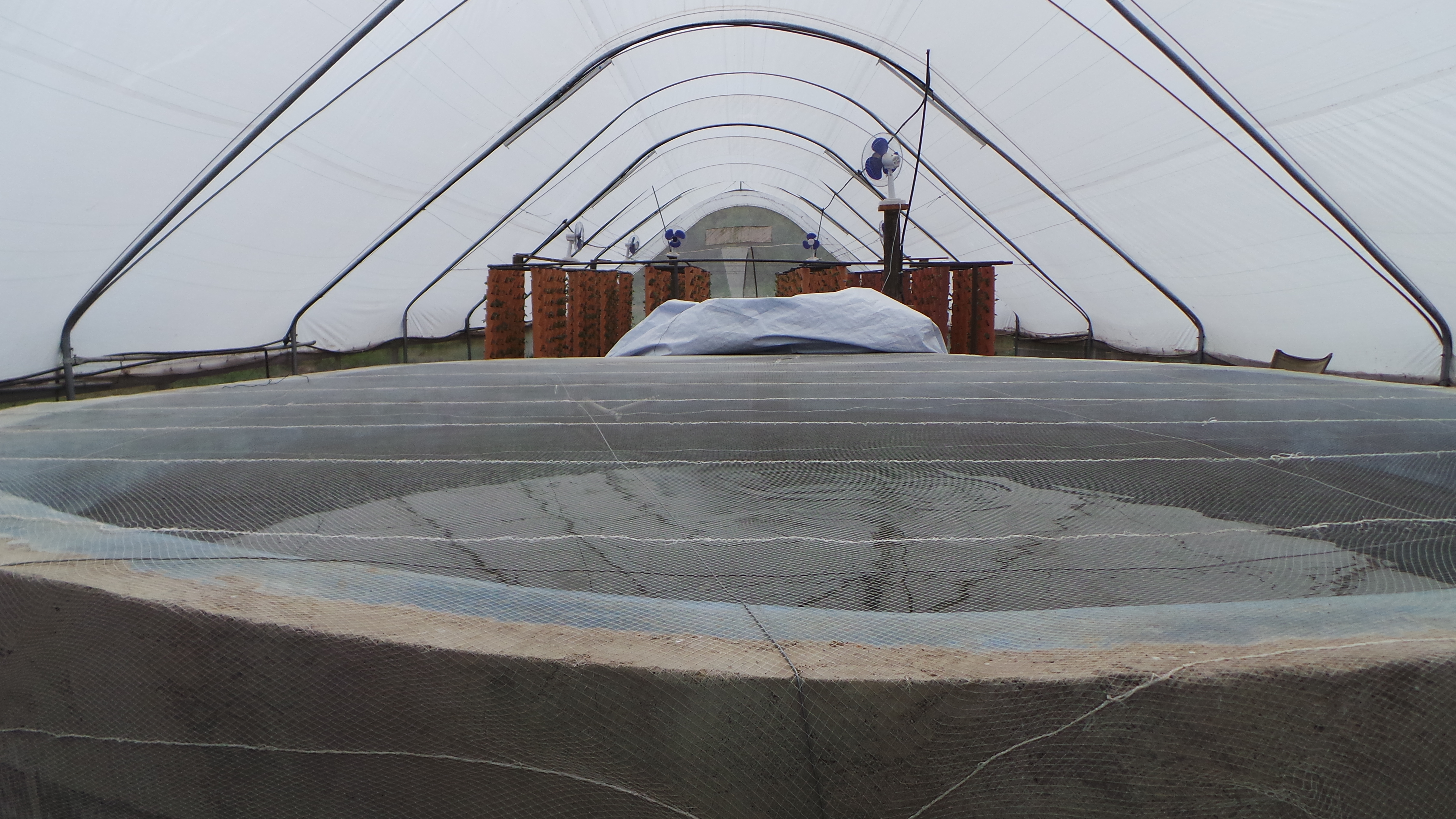
Fish tank in the foreground with the new bean plants in the background.
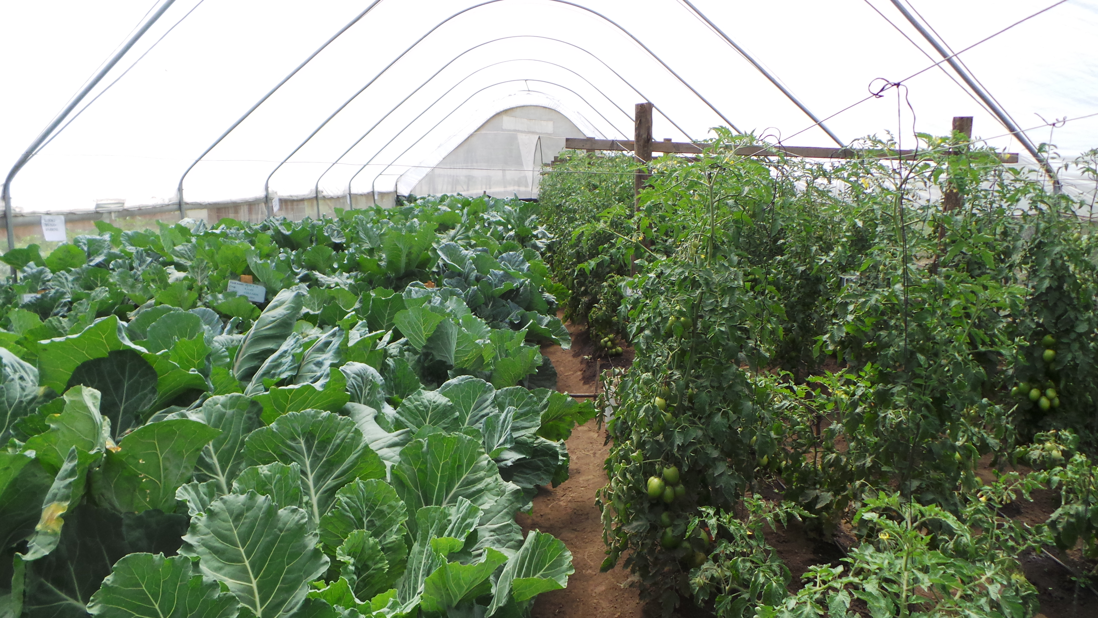
Greenhouse with kale on the left and tomatoes on the right.
A second trip is planned for September 2015, where soil gas sampling, borehole sampling and grid mapping will be completed. Samples will look at δ13C-CO2, δ13C-CH4, 3He/4He, δ18O- and DH-H2O. The grid mapping will be concentrating on thermal changes at the surface due to circulation in the aquifers and the structures assisting with the circulation. There are also plans for a visit to Ol Karia and the GDC labs and outreach work with the Kenya Museum Society.
![]() This work is licensed under a Creative Commons Attribution-NonCommercial-ShareAlike 4.0 International License.
This work is licensed under a Creative Commons Attribution-NonCommercial-ShareAlike 4.0 International License.