Abi is a Quaternary Scientist, Dryland Geomorphologist and Hydrogeologist, based at the Geography department in SEED at the University of Manchester as a lecturer in Physical Geography.
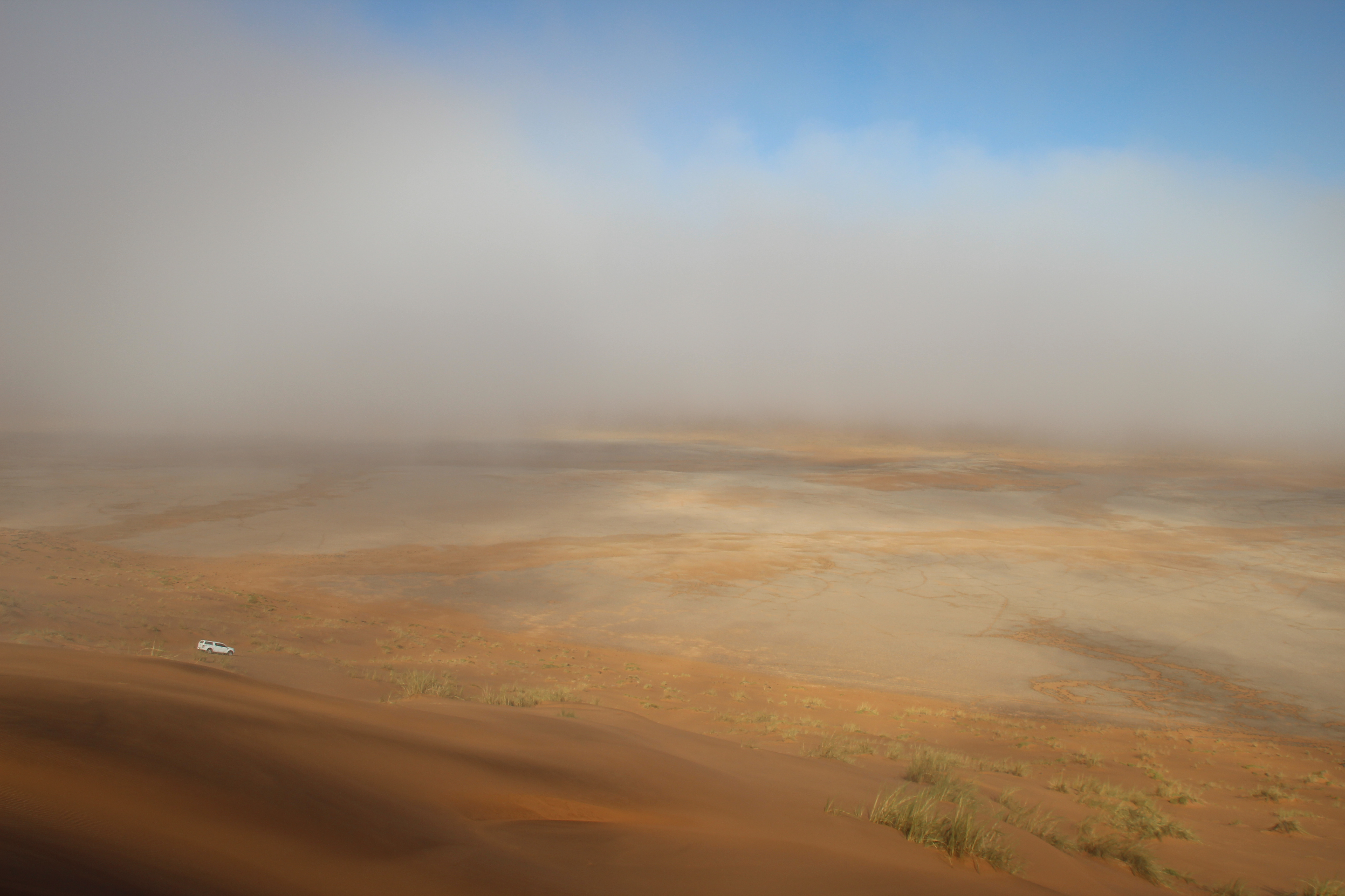
Can you spot the former river courses on this foggy morning in the Namib Sand Sea?
As January mornings in Manchester stubbornly refuse to get lighter and the days lack warmth, I think fondly of sliding my head underneath the Toyota Hilux to find some shelter on a trip into the Namib Sand Sea a few (gosh, quite a few) years ago…
The Namib Sand Sea is a spectacular series of piles of sand on the west coast of Namibia, covering 34,000 km2 (this amounts to more than one and half times the size of Wales), and quite likely one of the oldest desert regions on earth. In fact, it’s array of dune types are so outstandingly good that, combined with the influence of fog from the cold coastal Benguela current in the South Atlantic Ocean, it is now recognised and protected as a World Heritage site by UNESCO. It’s outstanding universal value (UNESCO terminology) is listed as a ‘unique coastal fog desert’, and with the status granted on June 21, 2013, I now fortuitously share some sort of birthday with the Sand Sea. If you want to see the mosaic of dune types for yourself, you can download the .kml files to open in Google Earth. The map is so lovely that some of my colleagues who helped to assemble it got a t-shirt made.
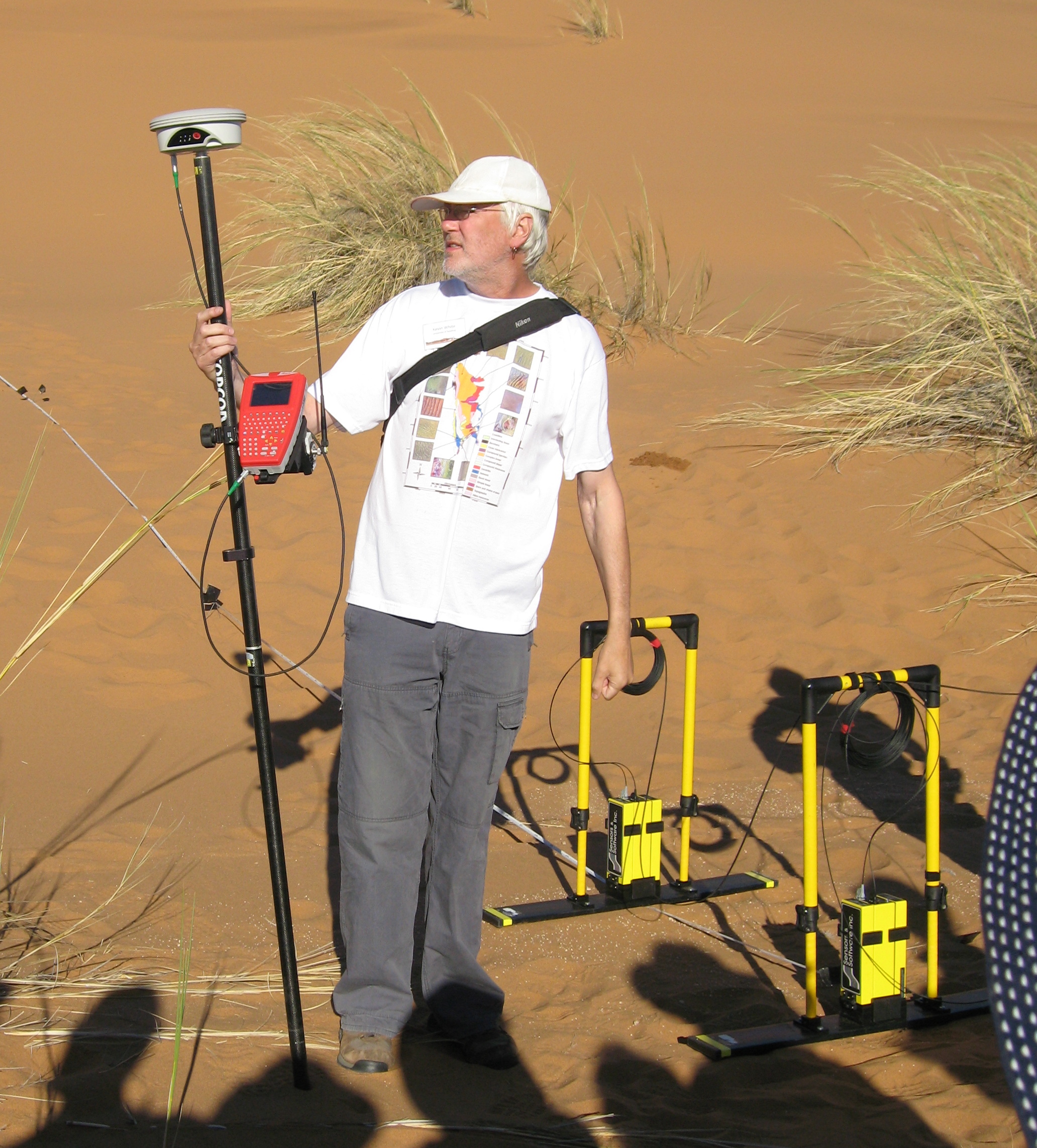
Photo 1: Kevin models the Namib Sand Sea dune mosaic map.
So, back in time to April 2007. I was sitting inside, looking out of the window of a bungalow at the Gobabeb Research and Training Centre (a unique and beautiful hub of dryland research for over 50 years at the top of the Namib Sand Sea) where a beautiful green ribbon of trees marks the course of the ephemeral Kuiseb River that separates the Sand Sea from the gravel plains to the north. In the bunaglow I am checking over the packing list which includes: tins of food; cool box with fresh food, which we will miss after the first few days; 100 litres plus of water for drinking, washing and cooking with; a few dozen segments of sawn-down black drain pipe; parcel tape, pens and a toilet brush (?); sun cream…
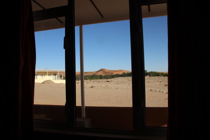
Photo 2: Room with a view of the last line of trees before an almost 400 km stretch of sand dunes.
The aim of our trip was chasing former river courses out in the northern Sand Sea. Well, in truth, the activity only really required some tracing on a map and didn’t require any chasing as the water is long gone from these former river valleys, and are now filled-in with sands in this hyper-arid region. Indeed a hyper-arid Sand Sea is not the obvious place to be thinking about water courses, but if you look at the outline of the Sand Sea on Google Earth you will see that the expanse of sand is punctuated and interrupted in a number of places by narrow lines. One of these lineaments now houses a tarmac road, along which thousands of tourists a year ‘stream down’ to the Sossuss Vlei to climb up dunes and see the ghostly skeletons of Acacia trees in Dead Vlei. The death of these trees is a clue in the story, indicating a reduction in water flowing west from the Great Escarpment hills into the Vleis (or pans) out in the sand sea over the recent Quaternary past.
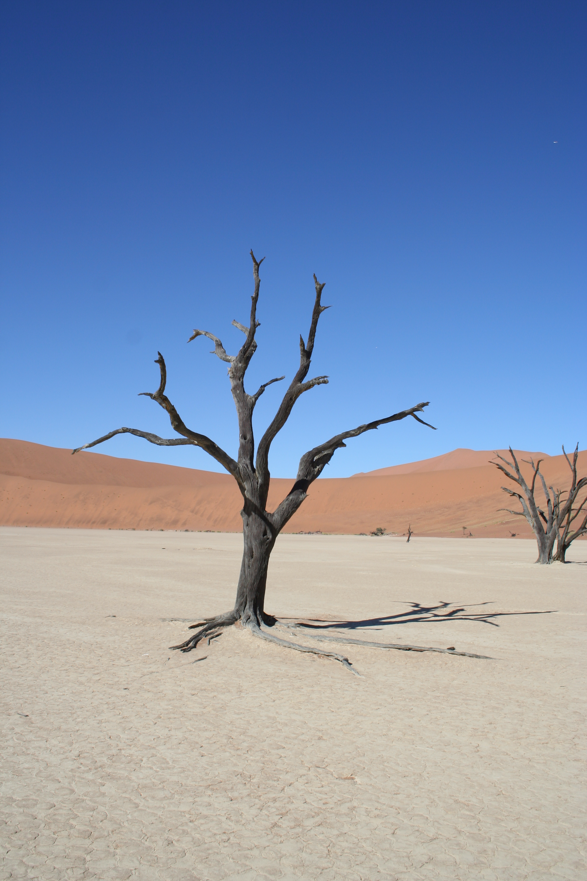
Photo 3: Colours of a photographers dream in the pan of dead trees ‘DeadVlei’.
To the north the lesser-travelled Tsondab Vlei-expressway (in reality the only passable way in to it is from the north, and not the east, not least because this is a protected area and in a national park) has left a marked area of disturbed dune patterning indicating that the Tsondab River, which in modern times occasionally ponds up at the Tsondab Vlei (see maps below), was once a much mightier river that housed flows of water large enough to prevent dunes from migrating across the surface of the Tsondab Flats. At this point I should mention that the Namib Sand Sea is a layer-cake of a desert. Underneath the unconsolidated sands of the most recent geological period, the ‘Quaternary Period’ spanning the last 2.58 million years, there is a fossilised sand sea, known as the Tsondab Sandstone, perhaps as much as 65 million years old. The full appearance of the Tsondab Flats therefore is therefore likely to be inherited from this much older period. However, researchers before us in the 1970s and 1980s had found geologically relatively ‘fresh’ water-lain material amongst these disturbed dunes that must relate to the Quaternary period and the uppermost ‘layer’ of the sand sea. And the Quaternary flows of the river continued to keep the Tsondab Flats relatively sand-free. As for how old this material was, it had been difficult to establish the age of this material accurately, owing to the techniques available at the time.
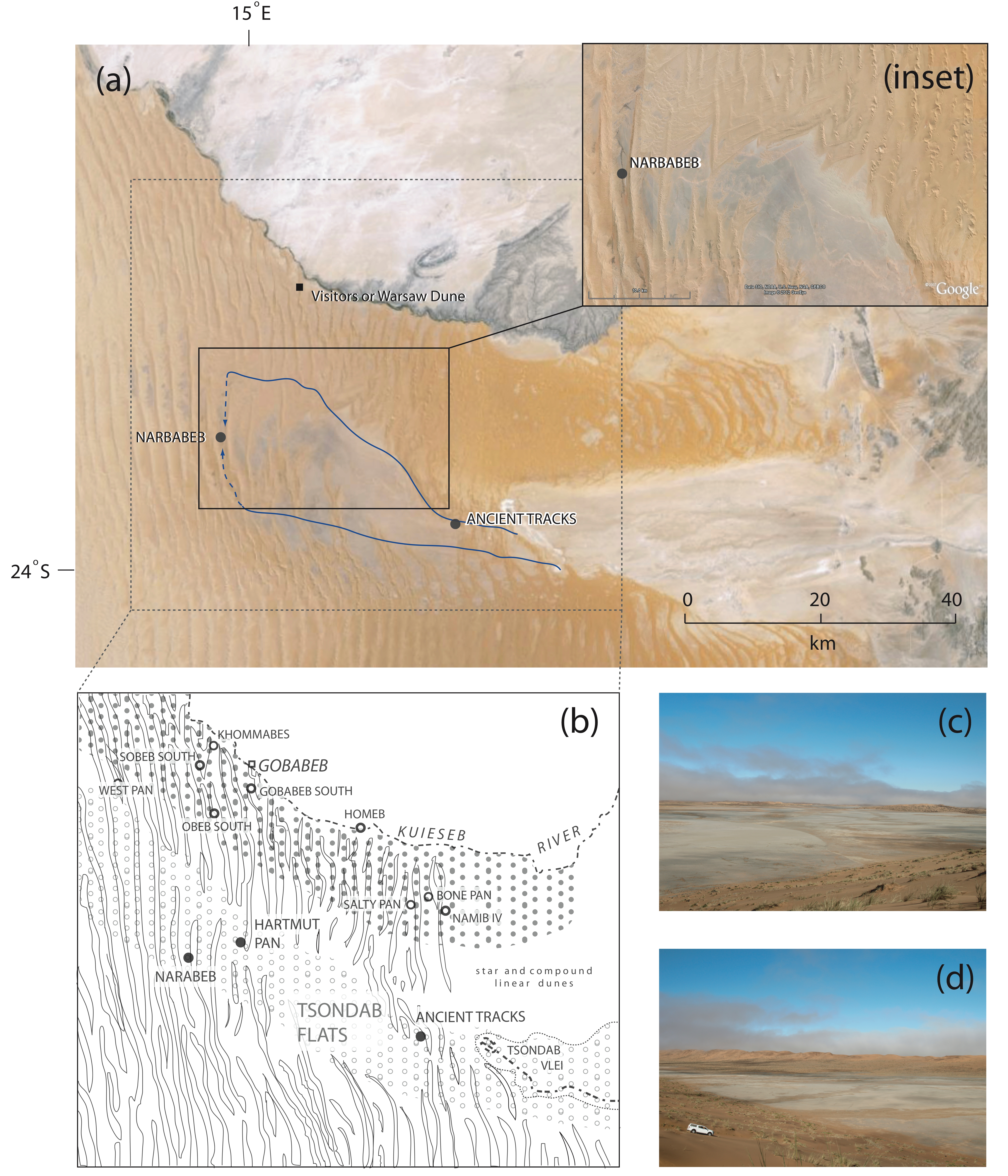
Photo 4: Evidence for a much mightier former Tsondab River… (peruse doi:10.1016/j.jafrearsci.2013.02.003 for the full figure caption)
So. We set off. A party of four in two vehicles, from the Gobabeb Research Station, to go and dig some deep holes into spots in the sand sea where water from the former Tsondab River had formerly ponded up. The aim was to recover samples of sand-rich material to take back to the laboratory in Oxford in order to establish how long those samples had been buried underground (or when they were last exposed to light) using a technique called ‘luminescence dating’. This is applicable to sediments containing quartz and feldspar, and is a relatively new technique compared to other methods such as radiocarbon dating, and hence was not available to my research predecessors. By dating the quartz-rich sand units (deposited by the wind) either side of (or inter-bedding) the water-lain finer-grained sediment, we would be able to bracket the time at which the Tsondab River has been at these sites…
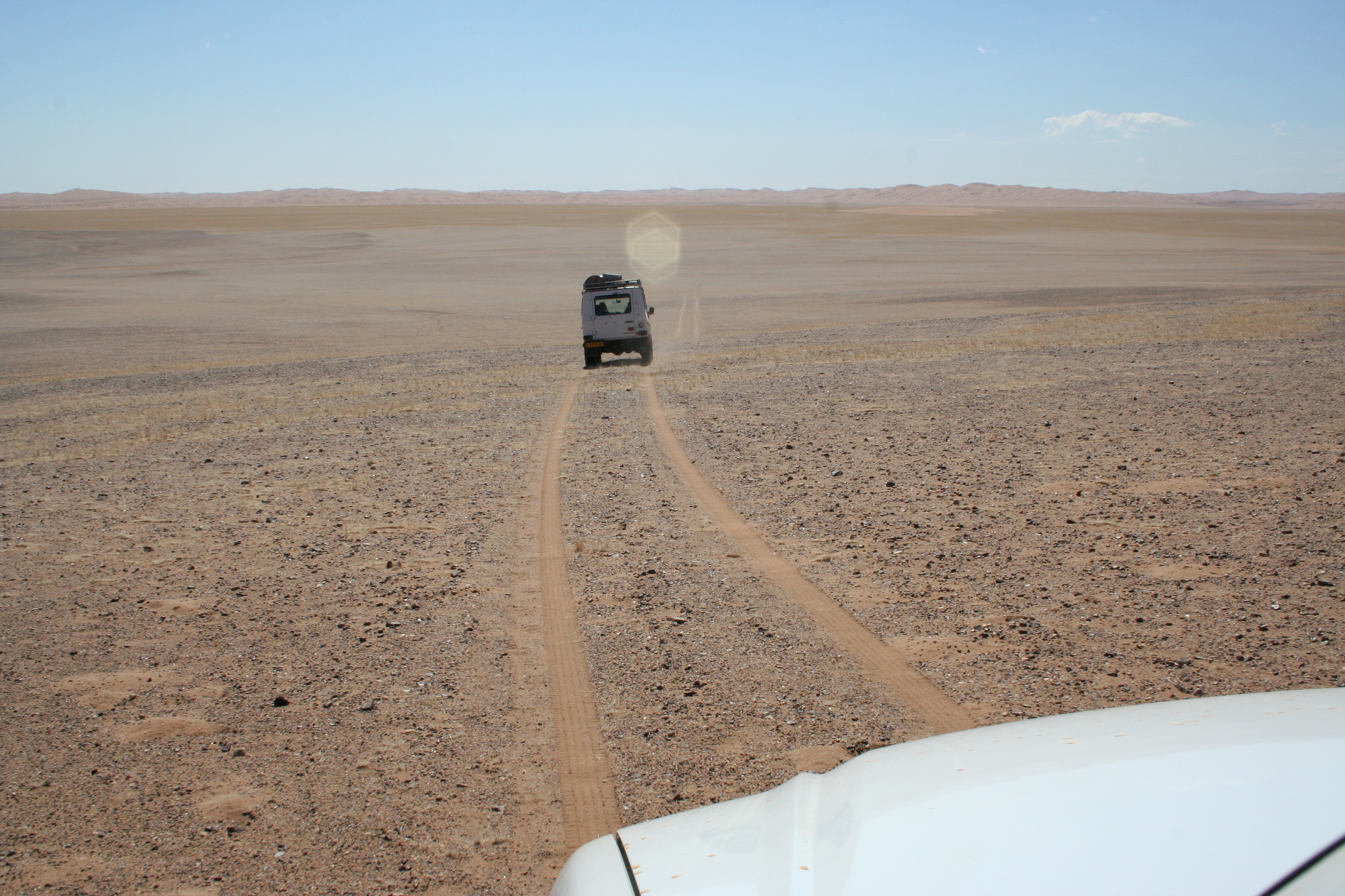
Photo 5: Follow the orange gravel road (and Hartmut).
The most important part of the expedition logistics was having an expert Namib Sand Sea guide, Hartmut Kolb, to help us decipher which corridor between which dune to head down, from the natural crossroads of the open gravelly-sandy-surface (Tsondab Flats in Photo 4) around 20 km south of the Gobabeb Research Station. Luckily for us there is a strict ‘stick to the former track if there is one’ rule in this important conservation area, so much of the first part of the journey followed tracks (of decreasing freshness and disappearing completely when you needed to cross over a dune). We reached a former weather station at Narabeb (the former raingauge and wind vein no longer stand here) that rarely collected many drops of water! The second vital part of logistics, was carrying lots and lots and lots of water, in containers of all shapes and sizes on the roof and in the vehicles…
Narabeb was our first site, and perhaps the most impressive. It contains a 36 m thick section of calcareous mudstone and sand units (look at the stripes in photo 6) nestled below 80 m or so of softer linear sand dune, from which the view from the (trudge to the) top was well worth it!
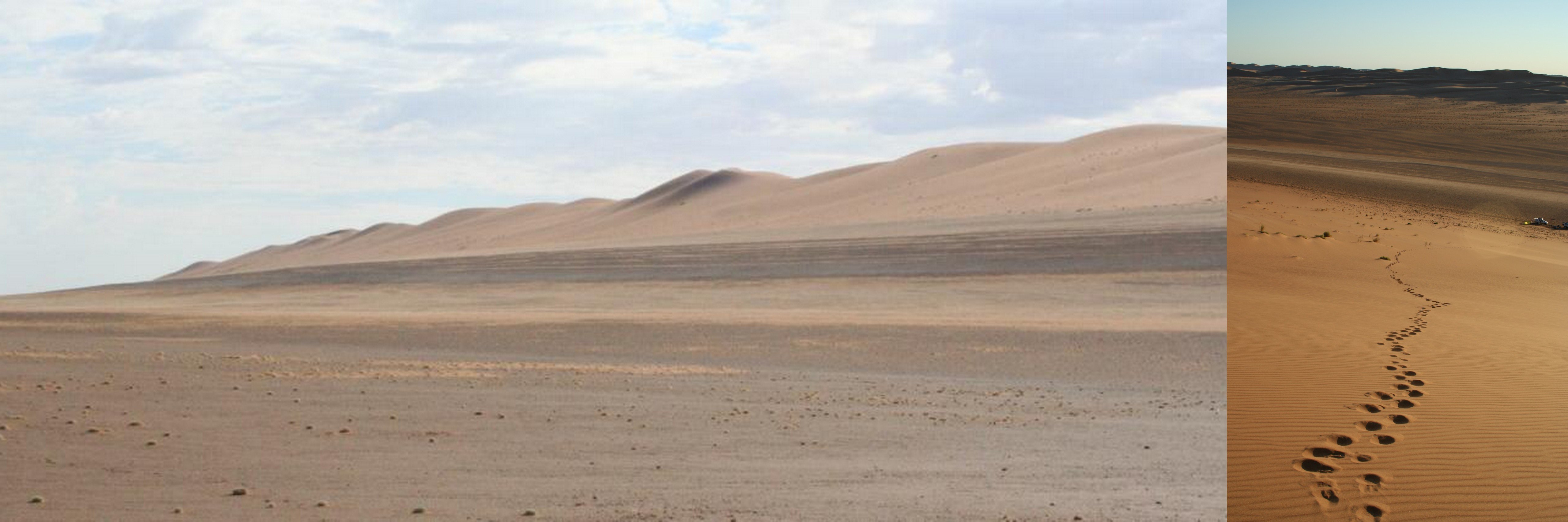
Photo 6: (LH) Stripy layers of mud and sand (bliss). (RH) View from the top well worth it!
This site had the most extensive river-laid deposits of the three we sampled, and is exposed for about 1 km along the eastern side of the north-south dune corridor. It represents ponding of water, perhaps as a former end point of the river, and Jim Teller and Nick Lancaster had previously found freshwater diatom species (silica-rich unicellular algae), characteristic of a eutrophic (nutrient-rich) lake environment at this site.
Whilst the diatoms have all since departed, we were greeted by some unexpected camp-site neighbours – gerbils. To give them their scientific name Tatera leucogaster, and possessing an unexpected love of pasta tubes with tomato sauce. I suppose I was naïve to be surprised by their presence 100 km out into the sand sea, as there is enough in the way of seeds and sparse grass matter for this species to thrive even outside years of exceptional rainfall. Well, the gerbils were one thing, friendly yet nibble-y, but later in the trip the scorpions were another thing. Seeing them saw me retreating to the roof of the vehicle to take my rest balanced across the slats of the roof-rack in my sleeping bag.
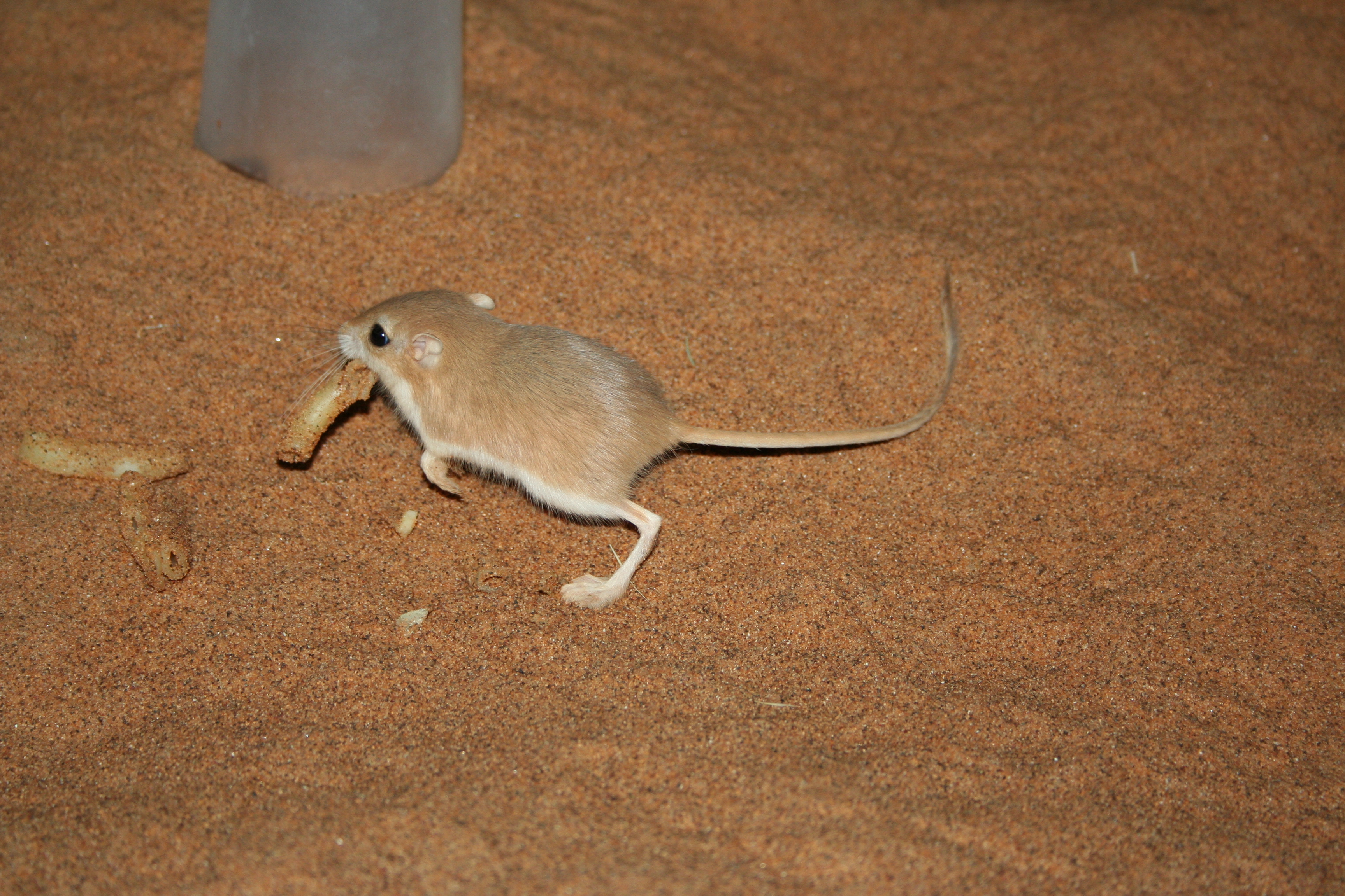
Photo 7: One of our gerbil campsite neighbours. Also partial to nibbling head torches!
After a few days of digging holes at Narabeb, aided by pouring some of our coveted water onto the sand to help hold the sediment together in the compression sampling head, we were back on the desert track (and lack thereof) heading east making tracks for a site named ‘Ancient Tracks’ by Beatrice Sandelowsky. More on that naming in a second. If you look back at the map in photo 4 you will see that this involved navigating the crossing of some of the linear dunes (even up towards the Tsondab Flats). My co-researcher, then PhD supervisor, and at that moment driver, kept the engine revs up, the tyre pressure low and the steering light to follow Hartmut up and over the dunes (see photo 8). Sometimes with me walking the route up front to check the solidity, or otherwise, of our undulating sandy highway.
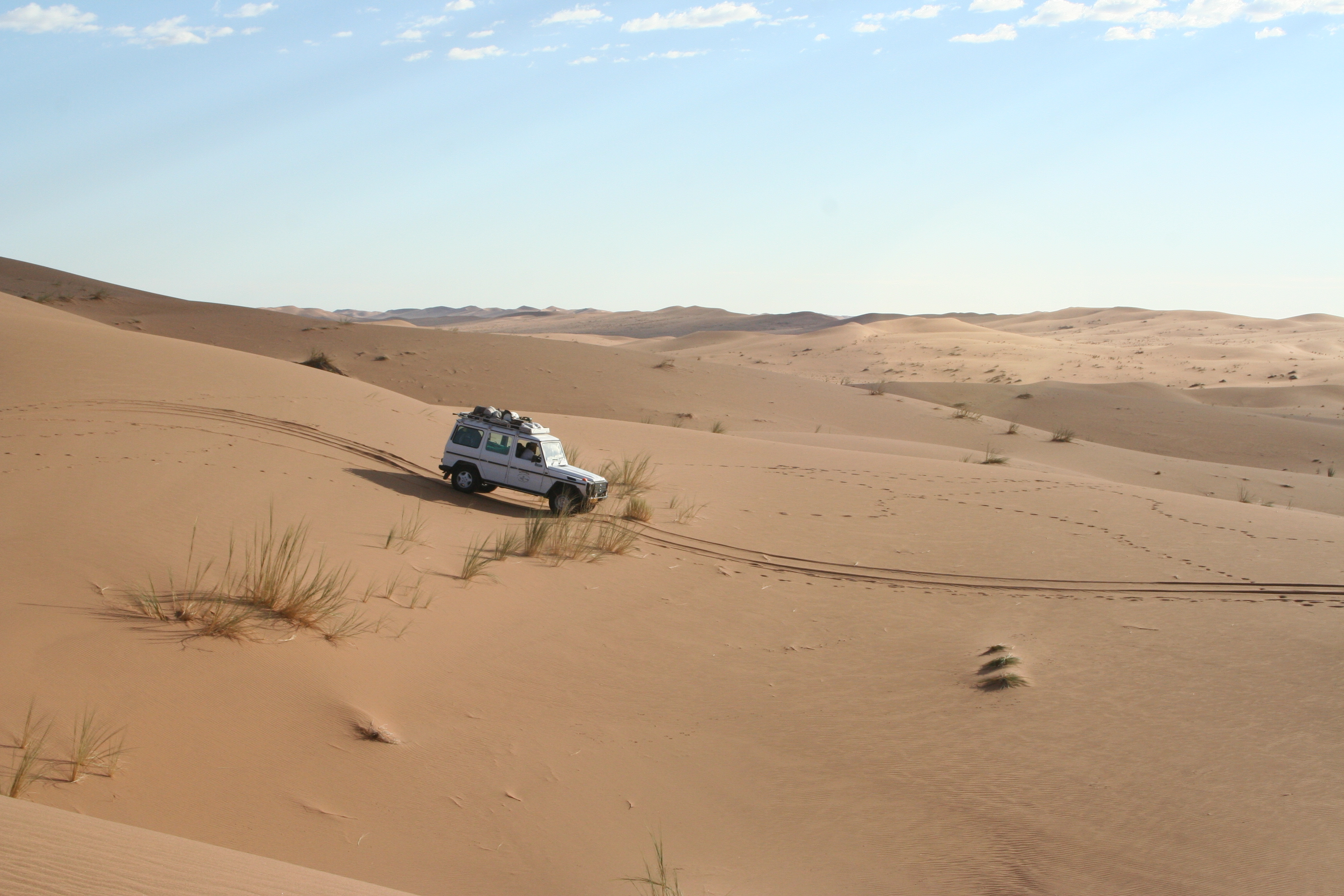
Photo 8: Navigating the gentler terrain of some of the smaller dunes.
Site 2 was a fortuitous find on the way to Ancient Tracks, and came to be called ‘Hartmut’s Pan’. It contained three units of water-lain silt, and samples of the sands between these were dated. This photo also provides an opportunity to show some of the results of the dating exercise.
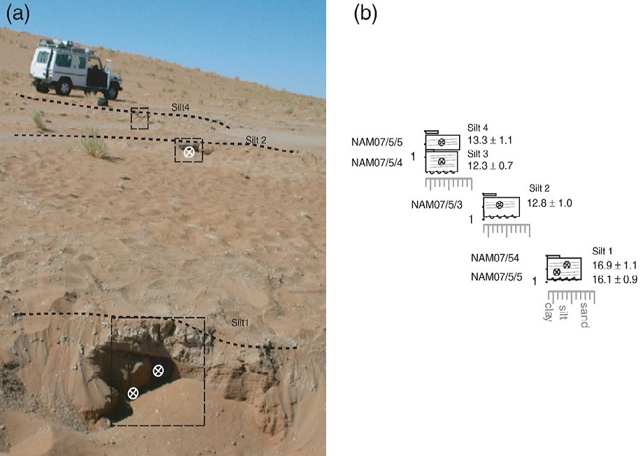
Photo 9: The three silty units at Hartmut pan, showing where we took samples and the results from the luminescence dating exercise (ages are in thousands of years (ka) so that 13.3 = 13,300 years).
See doi:10.1016/j.palaeo.2010.01.032 for full details.
The fabled ‘Ancient’ tracks, was now our third site, and whilst us British researchers tried to take some shade beneath the vehicle and take on more water in the heat of the midday sun, our desert-expert friend Hartmut took at heat-scorched stroll around an area of a few square kilometres squared to seek out a metal plate which he believed might still be in place to protect the, you guessed right, footprints/tracks Beatrice had uncovered in the 1970s. He returned a few hours later a little downhearted not to have found them, but was cheered up, or at least amused, by the sight of the temporary desert office I had set up at the sample site. The laptop was connected to a field gamma spectrometer, which was attached to some rope and placed down a shallow hole. A gamma spectrometer is a metal tube with a germanium crystal at the end, which records pulses that occur when the crystal is hit with a gamma ray (a tiny burst of high frequency electromagnetic waves emitted by the nuclei of isotopes of elements such as uranium, thorium and potassium, naturally occurring in the sediment).

Photo 10: Field desk
And why? Well, establishing the ‘dose rate’ or rate at which the sediment is hit by these gamma rays and beta radiation (and cosmic rays from the sun) is the denominator in the luminescence ‘age equation’.
Photo 11: Deceptively simple equation behind which lurks months of dark-lab sample preparation, sizeable bits of fairly dangerous machinery and some more-complicated mathematical sums.
After sampling between each of the water-lain units at this site we drove and then walked up onto a plateau surface of the Tsondab Sandstone (the lower tier of the desert cake) to get a view back onto the Tsondab Flats. Like all good fieldwork vistas this was not only breath-taking but a good reminder of how small and insignificant we and our vehicles are against the backdrop of the scale of the natural world. Whilst you contemplate this vista it is also a nice chance for me to reflect back on our couple 100 km drive through the northern Namib Sand Sea and offer you a couple of sentences about the results of our river tracing exercise. It seems that around 110, 000 years ago, during the last interglacial (MIS 5), the Tsondab River flowed another 60 km further into the sand sea and culminated in a substantial freshwater pond/lake. Since then the river has progressively dried up (appearing to retreat eastwards) with thinner sections of river silts found in the Tsondab flats at Hartumt’s pan and Ancient Tracks during the end of the deglaciation that followed the last glacial maximum and into the start of the Holocene. As to where the rain fell to feed the greater river flow in the past, that was probably to the east of the ancient Namib Sand Sea in the hills of the Great Escarpment, where tufa carbonates abound in the now-ephemeral rivers (more on those another time).
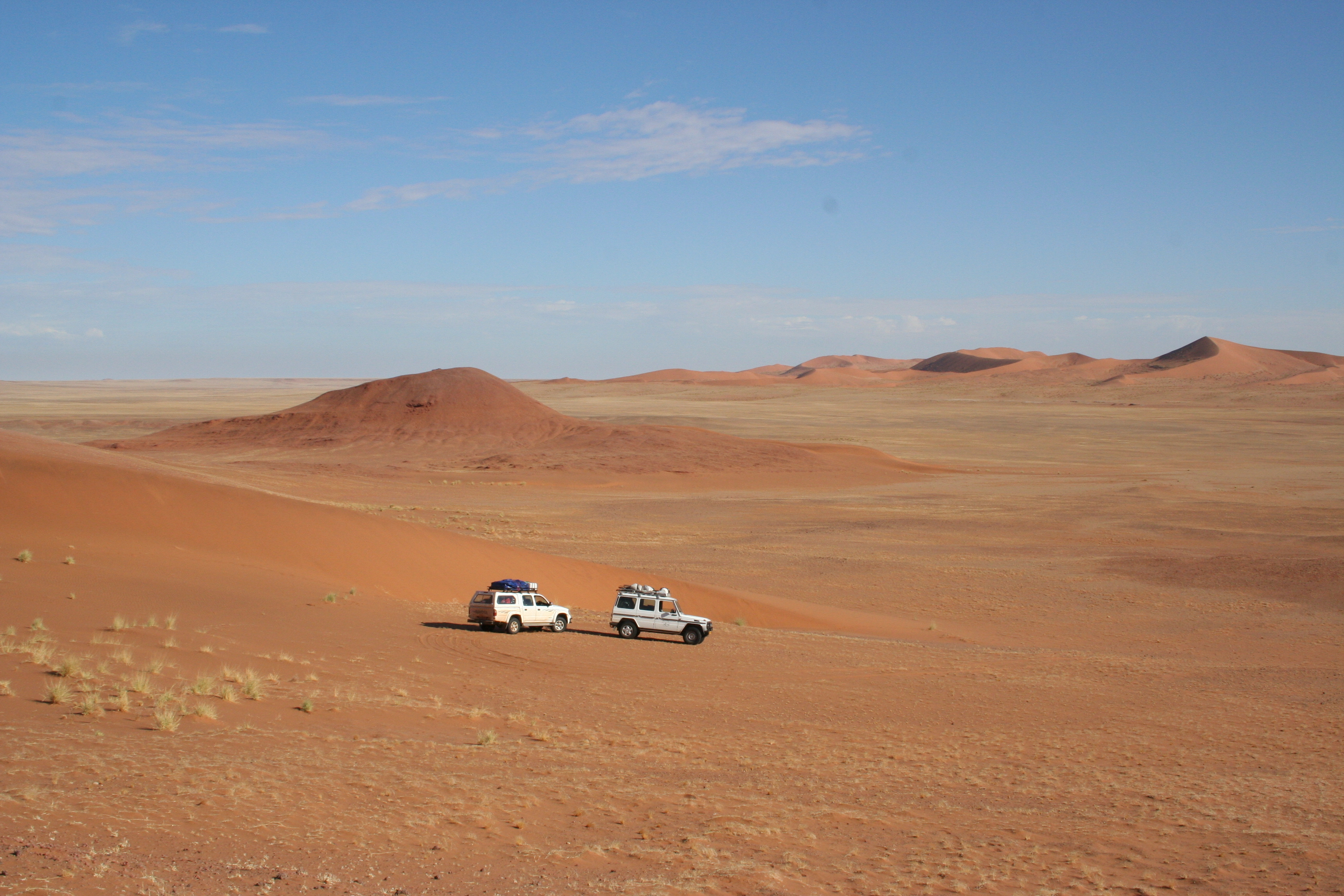
Photo 12: We’re small in the grand geomorphological scheme of things.
There are plenty more sites of former water courses across the northern Namib Sand Sea to be visited, sampled and dated. It must be time for another trip… Dust off the toilet brush (if you were still wondering, it is the best tool for cleaning the sampling head on our auger).
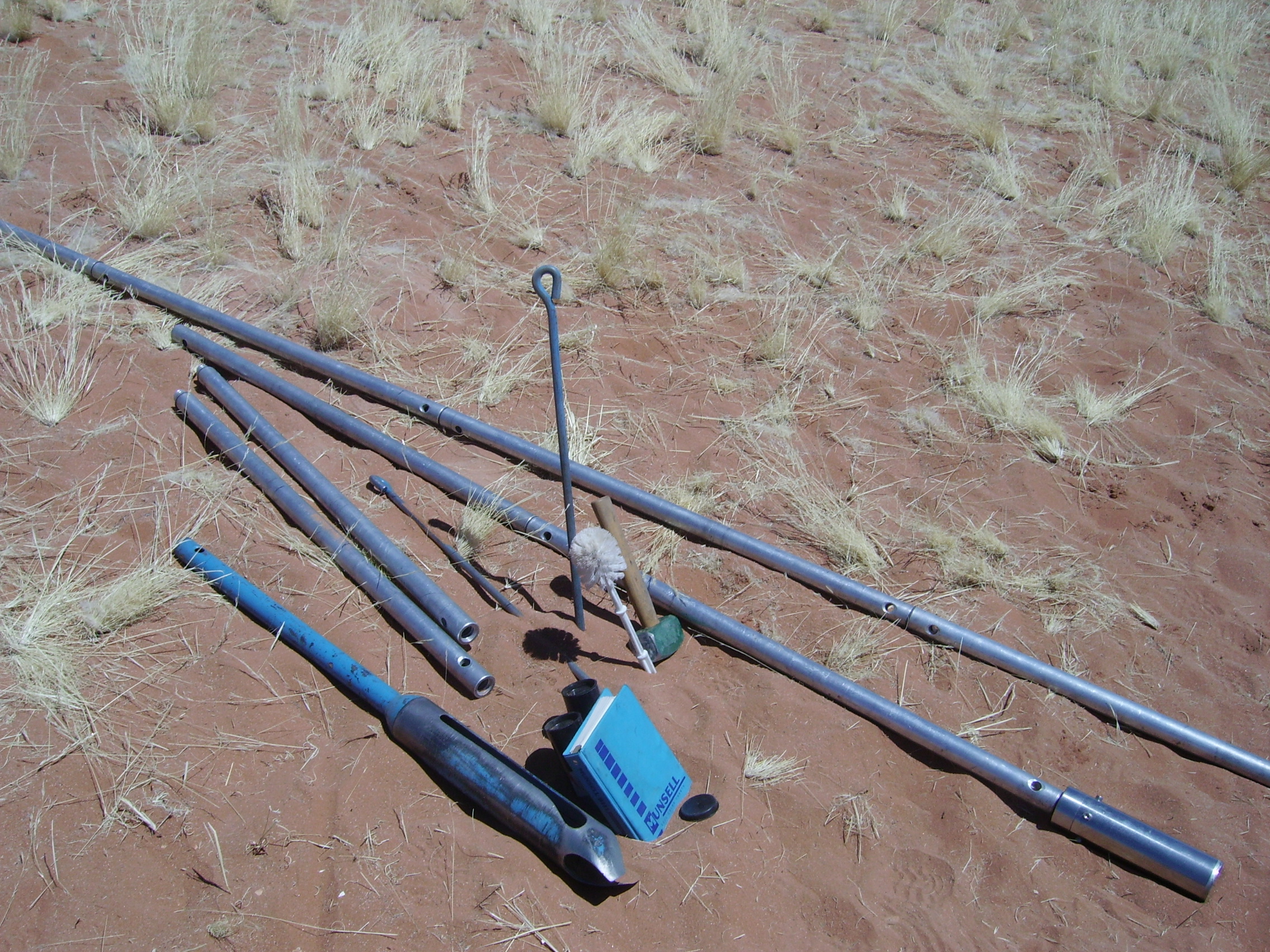
Photo 13: Augering kit, complete with accompanying hammer, Munsell colour chart and the infamous toilet-brush.
With warm thanks to David Thomas and Heather Viles who supervised my doctoral research and were willing field-trip companions, excellent company and irreplaceable co-authors. I look forward to future potential Namib Sand Sea adventures with Mark, Charlie, Rob, Giles, Jo, Ian, Dave and Kevin.
Read about this research in:
Stone, A. E. C., Thomas, D. S. G., Viles, H. A. (2010). Late Quaternary palaeohydrological changes in the northern Namib Sand Sea: New chronologies using OSL dating of interdigitated aeolian and water-lain interdune deposits. Palaeogeography, Palaeoclimatology, Palaeoecology 288, 35-53.
And about the Namib Sand Sea more generally:
Stone, A. E. C. (2013) Age and dynamics of the Namib Sand Sea: a review of chronological evidence and possible landscape development models. Journal of African Earth Sciences 82, 70-87.
Stone, A. E. C., and Thomas, D. S. G. (2013 – online view since 2011) Casting new light on late Quaternary environmental and palaeohydrological change in the Namib Desert: A review of the application of optically stimulated luminescence in the region. Journal of Arid Environments 93, 40-58.
![]() This work is licensed under a Creative Commons Attribution-NonCommercial-ShareAlike 4.0 International License.
This work is licensed under a Creative Commons Attribution-NonCommercial-ShareAlike 4.0 International License.