Professor Melanie Leng is the Director of the Centre of Environmental Geochemistry (a collaboration between the BGS and the University of Nottingham) and a Science Director at the British Geological Survey where she manages the Stable Isotope Facility. You can read more about her research here.
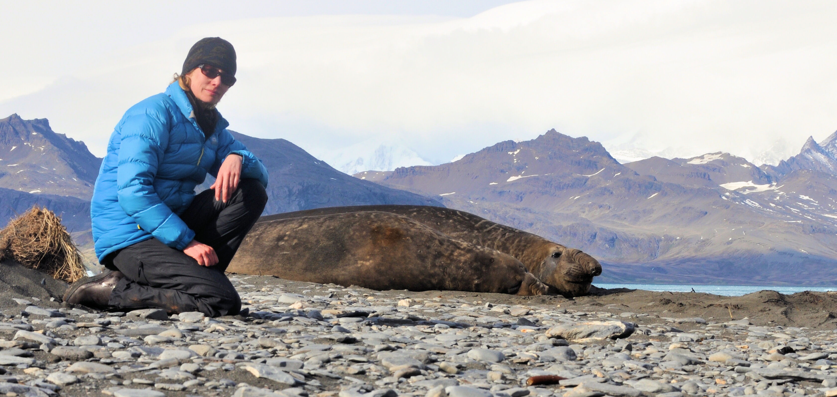
Mel & Elephant Seal on South Georgia
The Travelling Geologist asked me to write a blog on the most spectacular fieldwork I have ever done. It set me thinking, as a geologist I have been fortunate enough to visit some of the most amazing places on the planet, from the equator to (close) to the poles – East Africa, South America, Greenland, Japan, Australia, and the subAntarctic ….but which was the most spectacular?
The places I have visited have all been amazing in different ways, so I decided to write about the most challenging and share some of my images. About three years ago while taking lake sediment cores in the Mediterranean (not the most challenging!), my German colleagues asked if I’d like a place on an expedition to the island of South Georgia in the South Atlantic. None of us really believed it would happen, being largely fair weather geologists (and our field area of choice at that time was the Mediterranean after all), but it did happen and last spring me and the team were dropped off on the island by the German research ship the RV Polarstern. We spent about a month on a very remote part of South Georgia in Cumberland Bay, we were wet pretty much the whole time, our only shelter being tents and a leaky tin hut from the whaling days of the island.
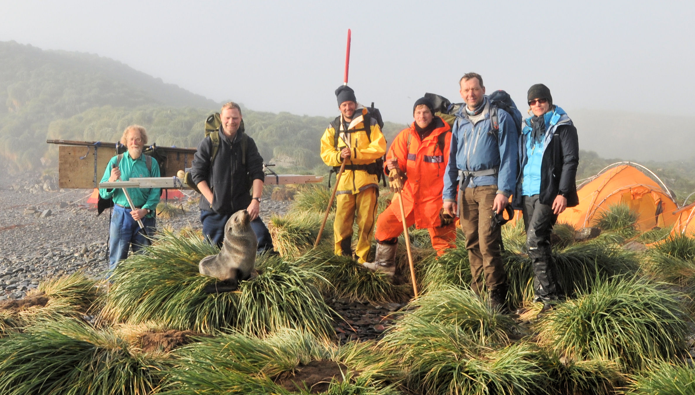
The international team of researchers from Germany, Denmark and UK (I am on the far right).
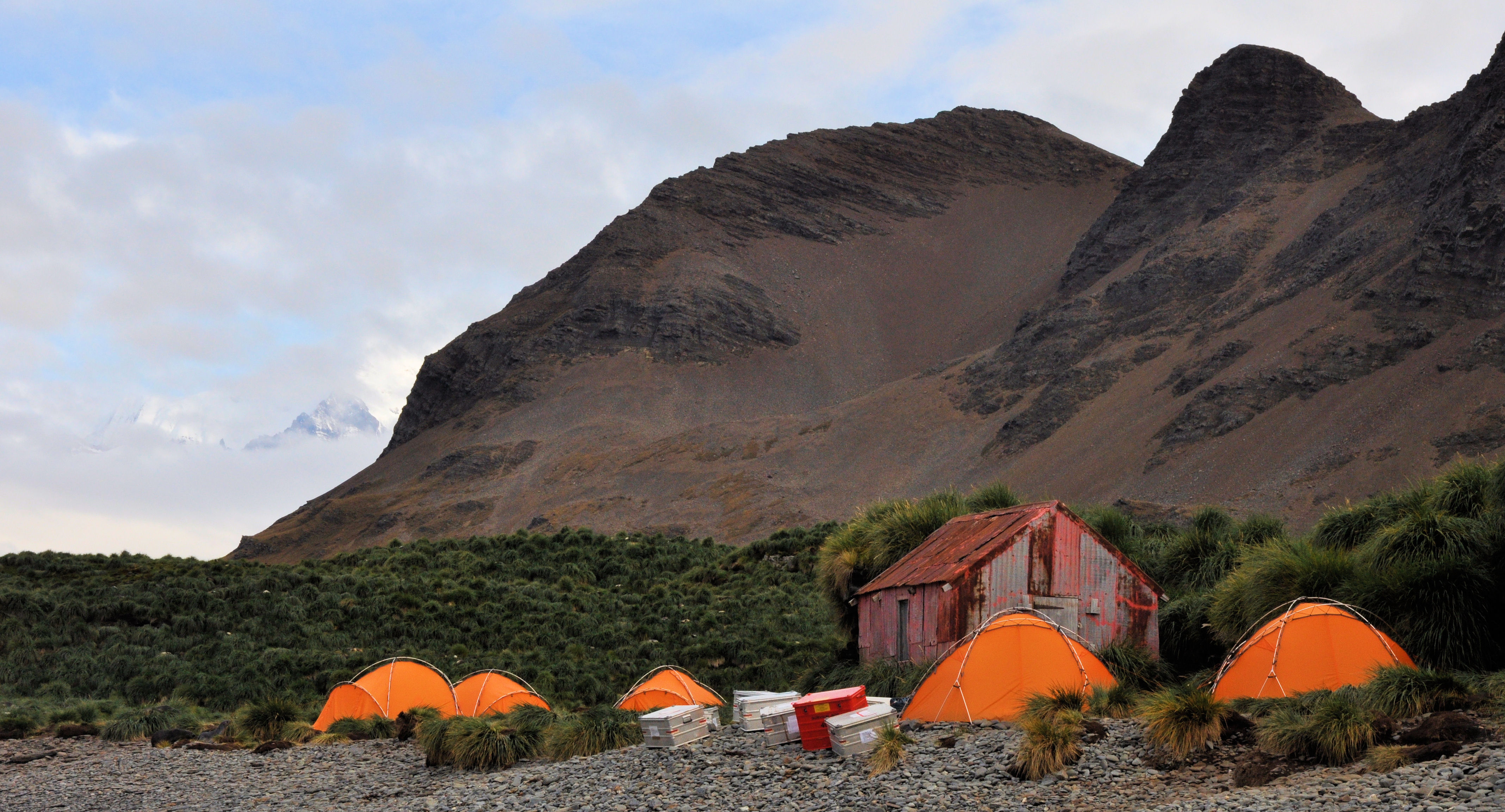
Our camp ground on the gravelly coast (the hut is a relic from the whaling days of South Georgia).
The Task
Our research proposal was to collect sediment cores from lagoons and lakes on the northern shore of Cumberland Bay on the eastern side of the island. The sediments in the lagoons and lakes are dark grey muds which contain plants and animals through time which we will be using to reconstruct the environmental history of the island since the glaciers retreated from the coastal margin around 10,000 years ago. This work is ongoing research and being partly undertaken by PhD student Rowan Dejardin…
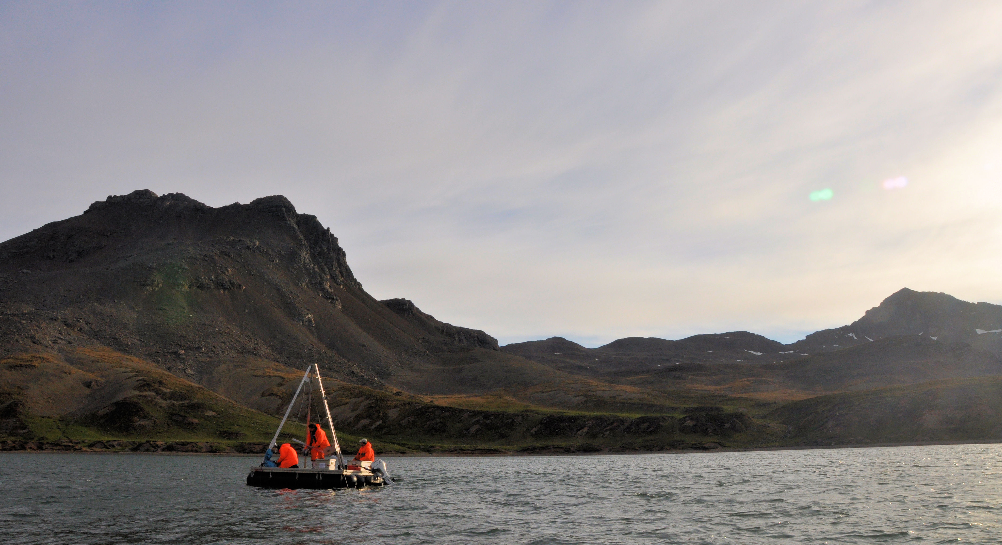
Collecting a lagoon sediment core from a floating platform.
Scenery
South Georgia is pretty spectacular. The thin shingle and sandy beaches that line the coast soon give way to thick peat bogs with extremely hummocky tussock grassland. The bog and mire merge into herb fields on the low slopes and then gravelly, poorly vegetated, glacial moraines left by the retreating glaciers. As the slopes steepen away from the coast, the scree slopes are covered with lichens, mosses and liverworts. The screes lead to ice-capped mountains which form the spine down the centre of the island. The severe topography of South Georgia has been mostly sculptured by ice caps and glaciers waxing and waning over millions of years. In the current interglacial the island has about 50% ice coverage. The permanent snowline is at about 300m above sea level today. The scenery is a function of both the continual battering of the island by the westerly storms and the geology. The geology is the reason why the central spine of mountains rise more or less straight out of the sea with no other land for hundreds of miles in any direction…
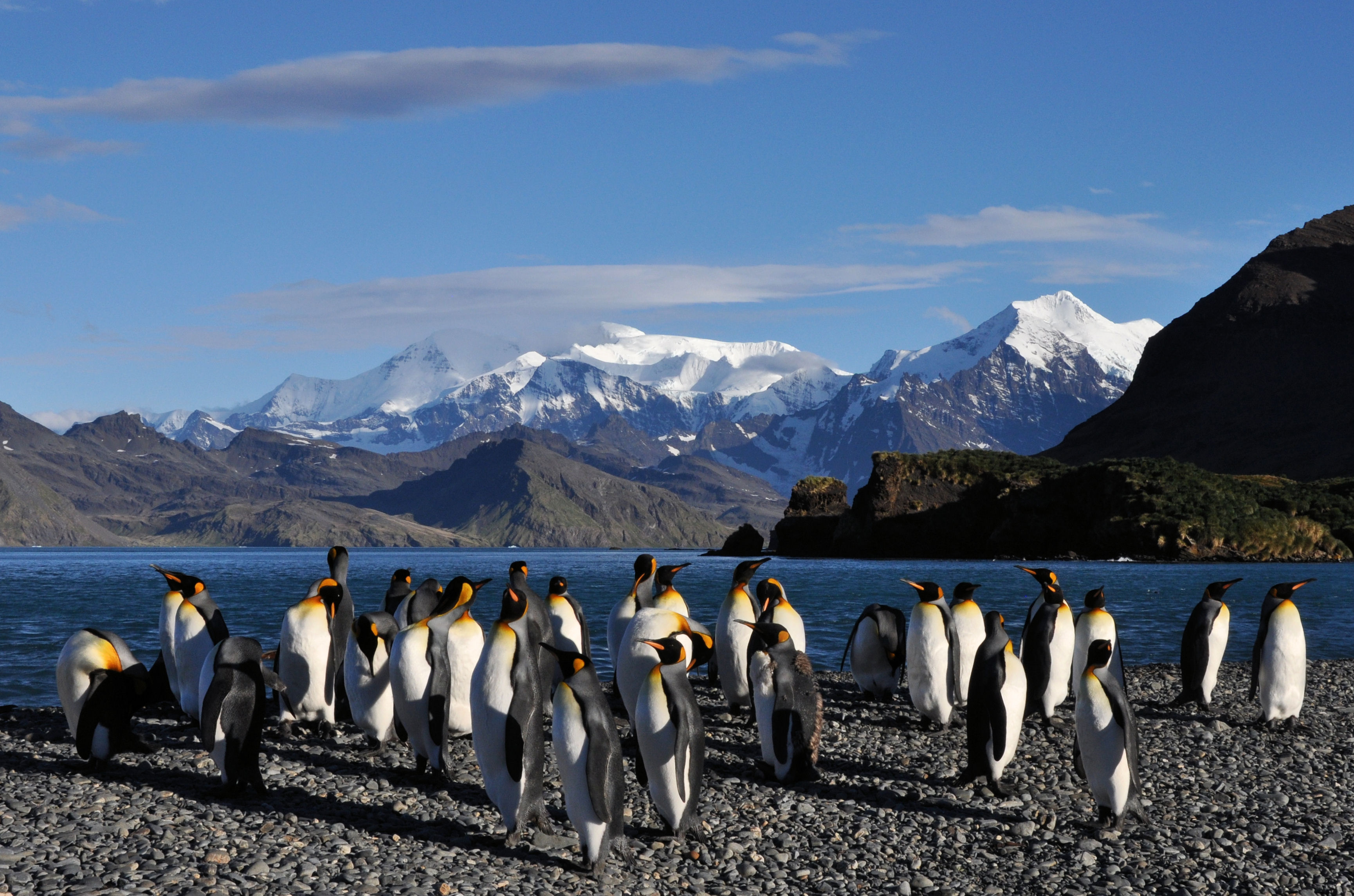
Emperor Penguins on South Georgia!
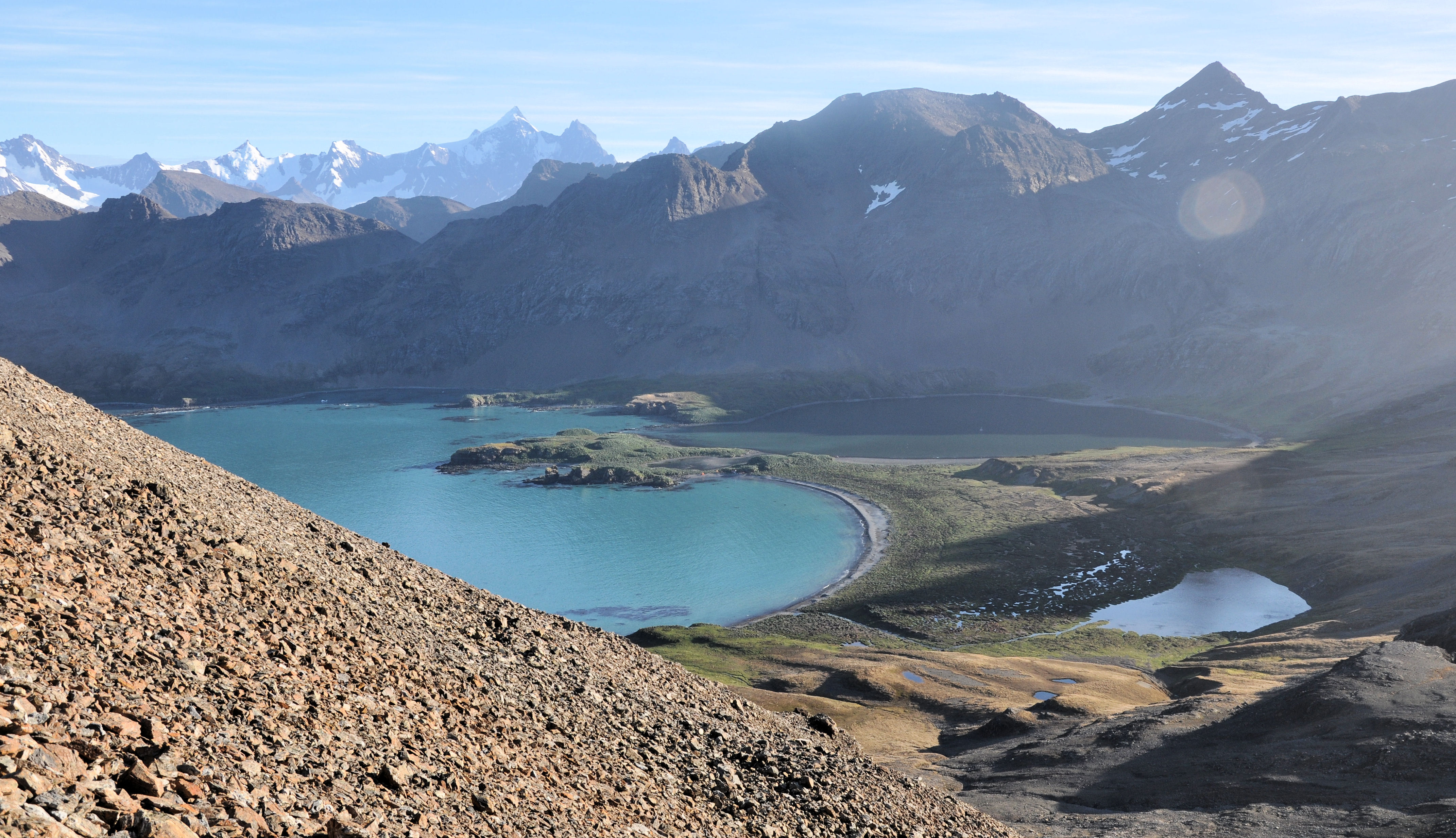
Cumberland Bay on the eastern side of South Georgia.
The Geology
It’s complicated! It seems that the reason for the small rocky outpost of South Georgia in the middle of a vast ocean is due to tectonics. As the Atlantic ocean has opened over the last 200 million years, the Pacific ocean plate has dived beneath South America. Amongst the geological maelstrom fragments of southern South America have broken off forming geological “jetsam”. The island comprises basement (very old) granites and gneisses, mixed with much younger volcanic and marine sediments which were subsequently metamorphosed. Volcanoclastic sediments are widespread and most easily seen in the pebbles on the beaches and as scree on the steep slopes.
OK back to the Question
South Georgia is definitely one of the most dramatic places I have ever visited. Going in the austral autumn meant the weather was quite challenging (think winter in Scotland), wet, windy with the added excitement of daily katabatic winds from the glaciers. Most days were spent on a small raft pushing coring equipment through the muds within the lagoons and lakes. We will use this material to investigate how the landscape developed and how the plants and animals colonised the island over the last 10,000 years. We are particularly interested to see how the island is responding to this period of the Anthropocene. Are glaciers retreating faster than ever due to global warming? What is happening to the plants and animals as they try to adapt to the most rapid period of global warming the world has ever experienced? I feel honoured to be able to join the debate…
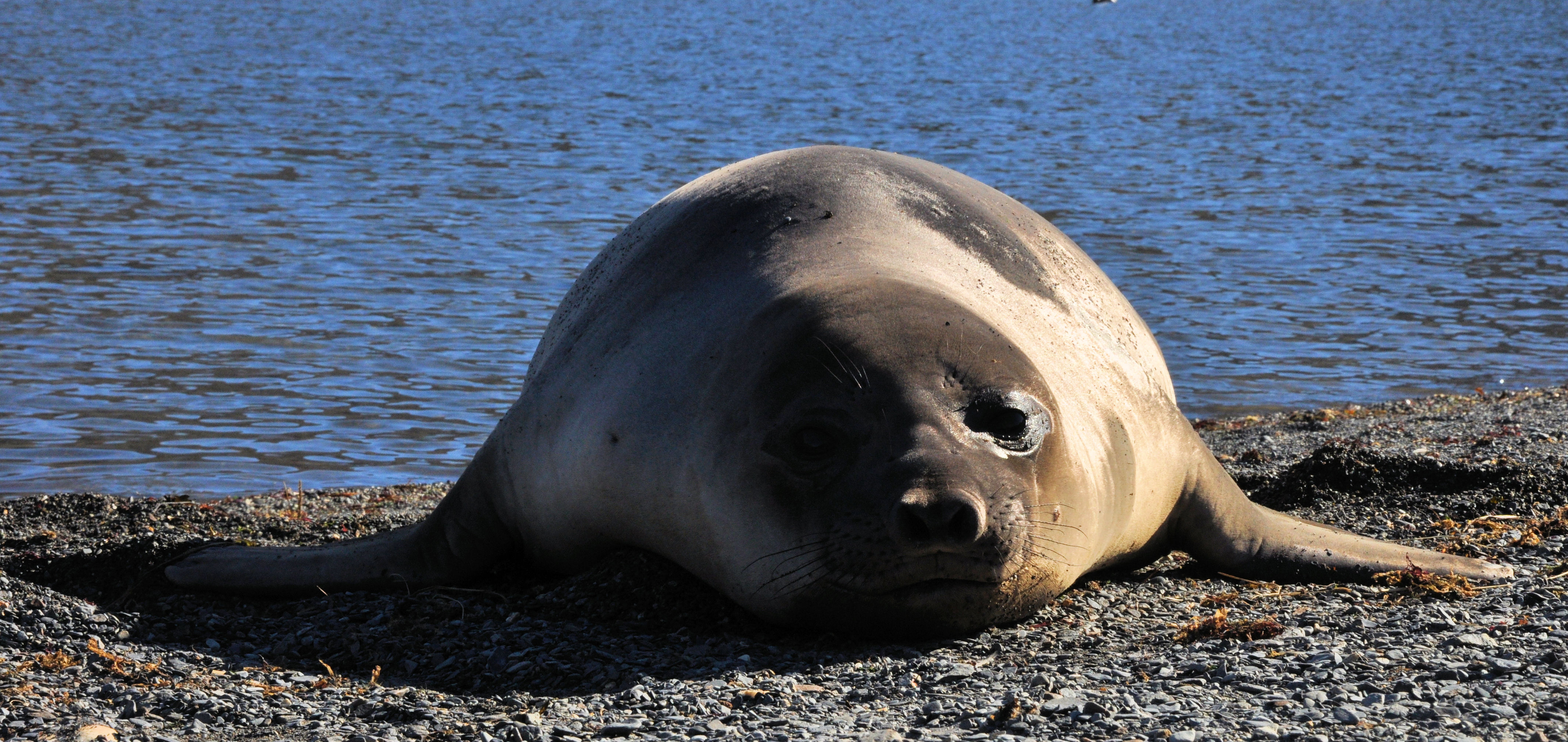
Finally I didn’t mention the big animals! We shared the island with colonies of penguins and seals. The animals, largely unused to human contact, were amazing: curious, friendly, playful but protective of their young at times. More on the expedition can be found in on my blog page (here).
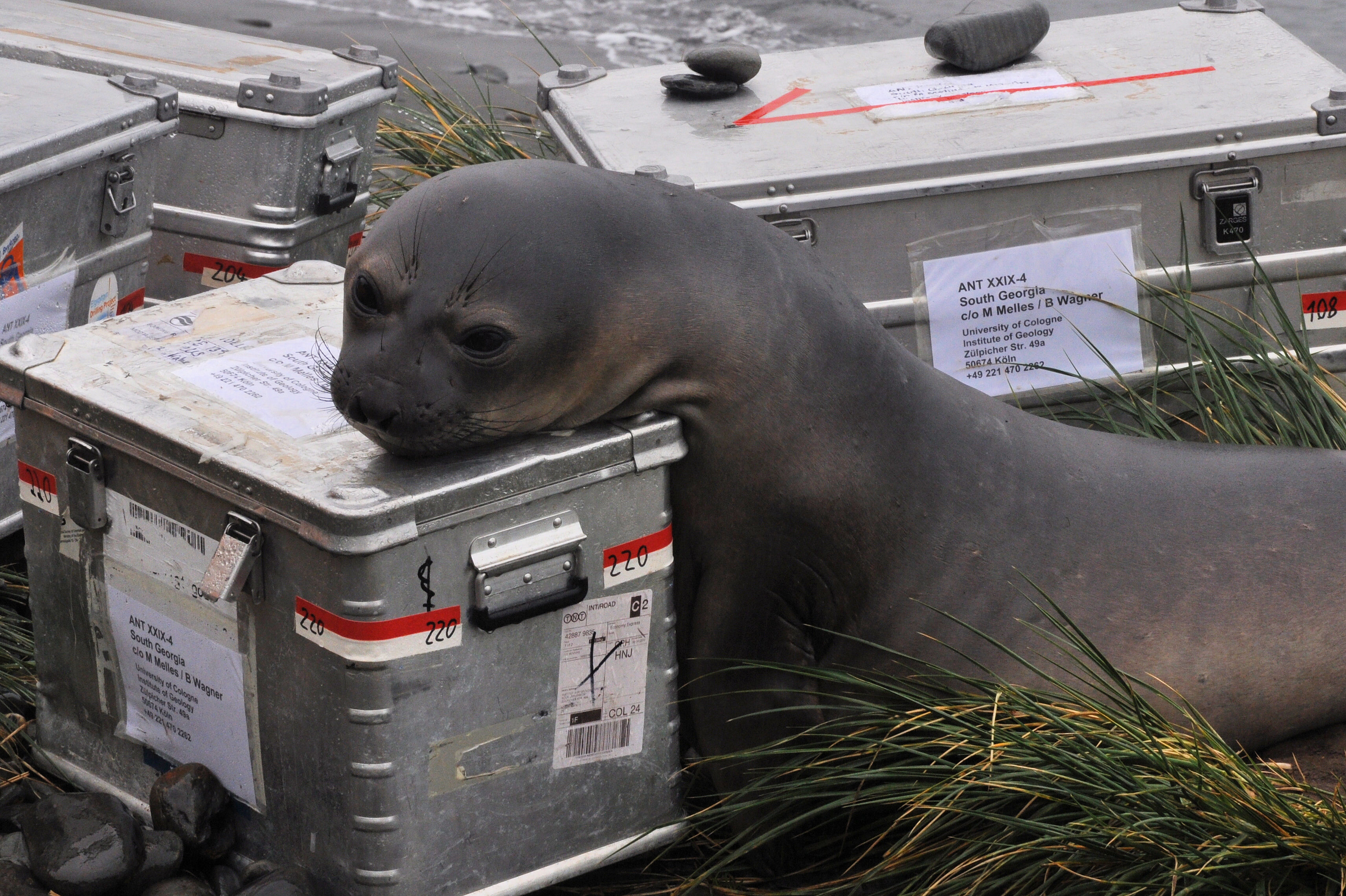
Curious companions

Calling Home
![]() This work is licensed under a Creative Commons Attribution-NonCommercial-ShareAlike 4.0 International License.
This work is licensed under a Creative Commons Attribution-NonCommercial-ShareAlike 4.0 International License.