by Kellen Gunderson
The Ridge and Valley province of the Appalachians is a fold and thrust belt that formed during the Alleghanian orogeny (260-325 Million years ago). The remnants of that ancient mountain belt consist of a series of linear ridges and valleys that can be followed for hundreds of kilometers. There are a series of particularly nice exposures or Ridge and Valley structures on a transect that follow the Potomac river in Western Maryland.
The Ridge and Valley province of the Appalachians is a fold and thrust belt that formed during the Alleghanian orogeny (260-325 Million years ago). The remnants of that ancient mountain belt consist of a series of linear ridges and valleys that can be followed for hundreds of kilometers. There are a series of particularly nice exposures or Ridge and Valley structures on a transect that follow the Potomac river in Western Maryland.
 |
|
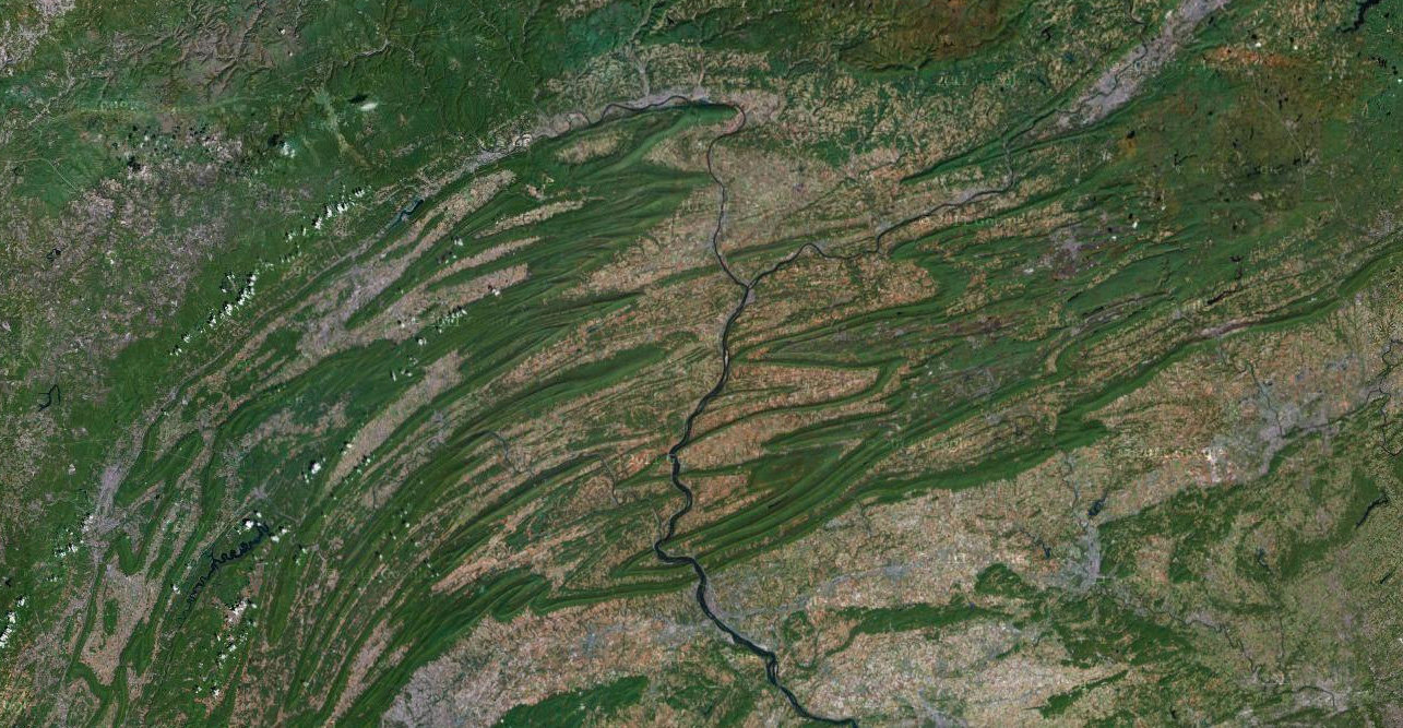
Satellite photograph of the Ridge and Valley province in Northern Maryland and and Southern Pennsylvania.
|
 |
|
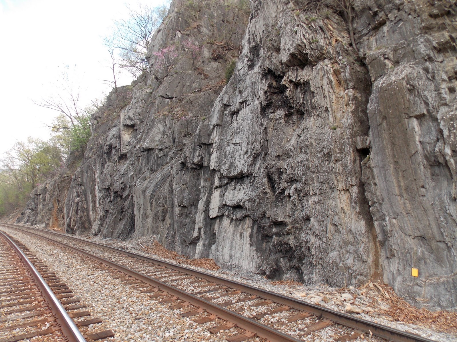
Steep forelimb of the Wills Mountain anticline near the town of Pinto, Maryland.
Many of the best exposures follow the railroad tracks.
|
 |
|
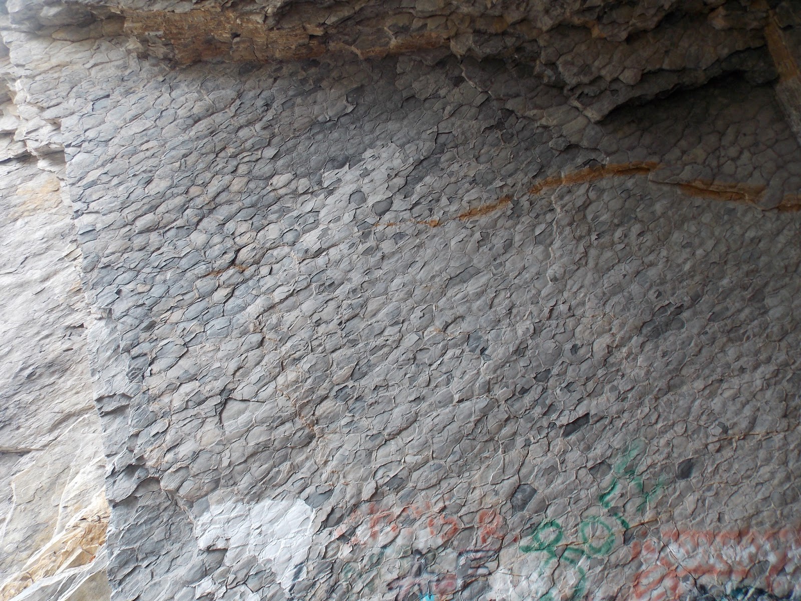
Deformed mudcracks near Pinto, Maryland. When these mudcracks formed they were
equant but were later stretched by the deformation that formed the Ridge and Valley.
|
 |
|
The Martin’s Mountain anticline is a good place for undergraduate
structural geology students to sort out the kinematics of deformation.
|
 |
|
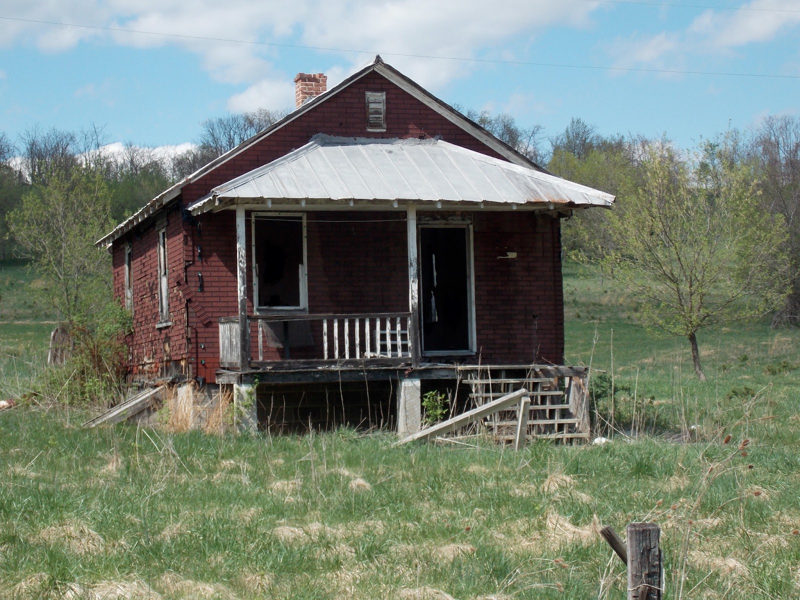
You don’t have to go far to find reminders that you are in Appalachia,
traditionally one of the most impoverished regions in the United States.
|
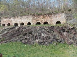 |
| 19th century kilns positioned on top of this fold at Round Top were used to make cement that was shipped down the Potomac River to Washington, D.C.The cement produced here helped build the famous Washington monument. |
 |
|
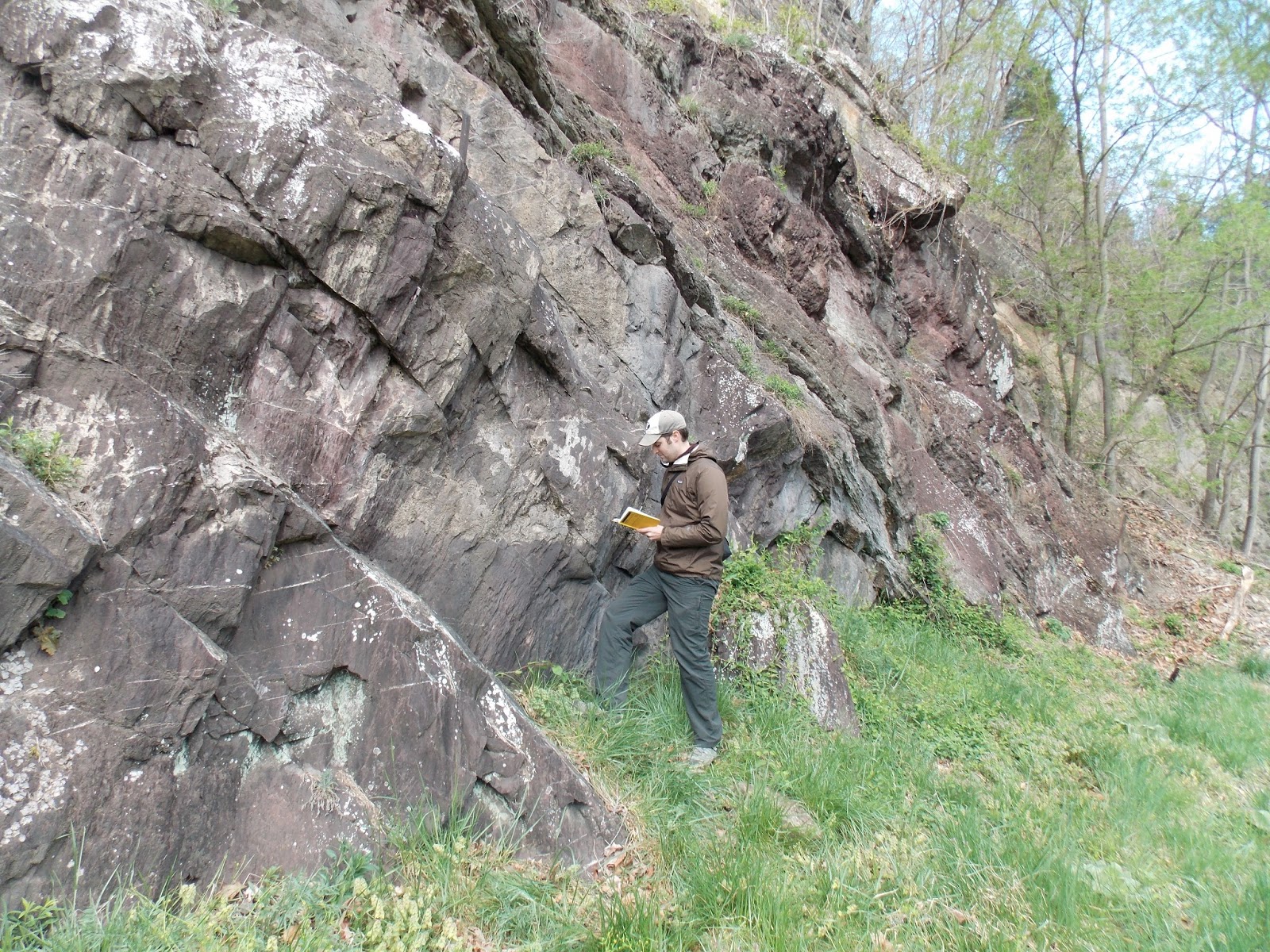
Kellen Gunderson working the outcrop at Round Top, Maryland.
|
![]() This work is licensed under a Creative Commons Attribution-NonCommercial-ShareAlike 4.0 International License.
This work is licensed under a Creative Commons Attribution-NonCommercial-ShareAlike 4.0 International License.